 Today, Harpers Ferry National Historical Park gets the honored distinction of being the first historical park added to this site – eight new maps!
 I actually have another eight for the park coming down the pipeline, but sometimes real life gets in the way and I run out of time to do as much work as originally planned. So those will just have to wait. Edit: scratch that – I added the eight trail maps so now it’s up to sixteen.
I should clarify: there are other pages up featuring parks with a historical bent to them (Kennesaw Mountain, Statue of Liberty/Ellis Island, Bandelier…). It’s just that Harpers Ferry is the first of the designated “historical parks” I have up. A subtle distinction possibly only cared about by national park dorks? Absolutely!
That puts NPMaps at 85 map pages and 904 total maps now, after passing 800 not too long ago. Can I keep this momentum going?
Edit: thanks to backpackers.com for publishing a really nice interview with me about the site last week! I always enjoy getting a chance to talk about my project.
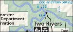 Well, I had no Missouri parks nor any riverways, so I thought that was a logical next step. So, here’s
 Honestly I’m wondering if creating the new
  The
The  Maybe the most underrated park in the country is Dinosaur National Monument. So enjoy the 14