If you’re looking for a Zion map, you’ve come to the right place; currently I’ve collected 15 free Zion National Park maps to view and download. (PDF files and external links will open in a new window.) Here you’ll find maps of trails, shuttles, wilderness, and the official brochure map you receive at the park entrance. You can also browse the best-selling Zion maps and guidebooks on Amazon.
Zion map from the park brochures
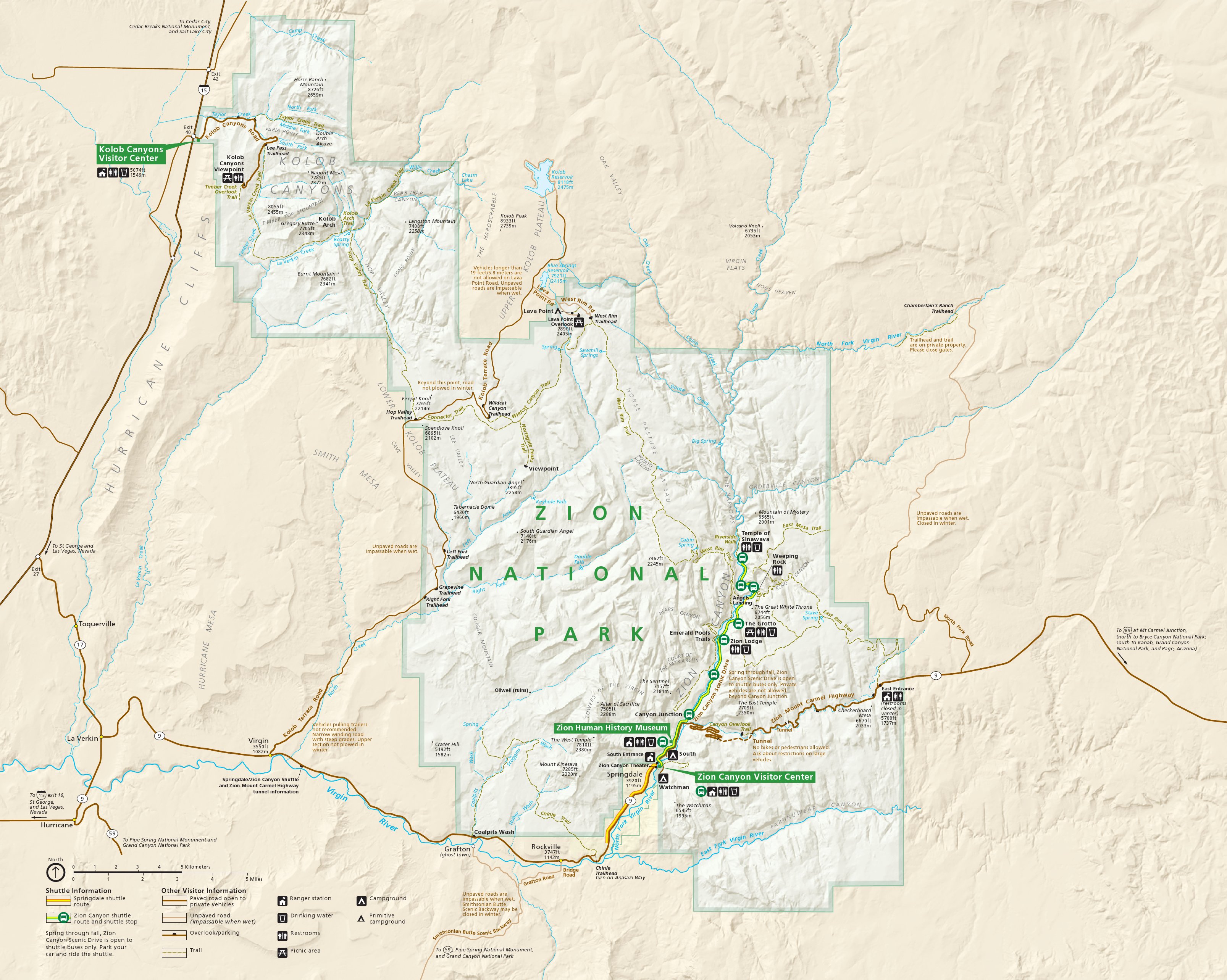 This is the main Zion National Park map, showing both Zion Canyon and the Kolob Canyons section of the park. Click the image to view a full size JPG (1.2 mb) or download the PDF (3.9 mb).
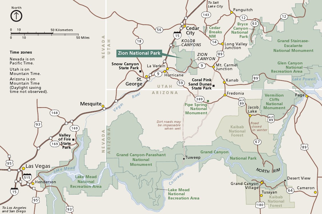 This is a Zion regional map, showing Zion National Park in relation to Bryce Canyon, Grand Canyon, Las Vegas, and other attractions. Click the image to view a full size JPG (150 kb) or download the PDF (150 kb).
Zion trail maps
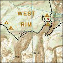 The free maps below are probably fine if you’re mostly visiting Zion by car and bus. However, if you’re planning to do some considerable hiking or are going backpacking, then a National Geographic Trails Illustrated map is helpful (it shows backcountry campsites and topographic lines). I always prefer seeing topo lines when planning out my trip; it’s easier to figure out how much I can handle each day.
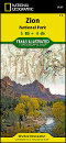
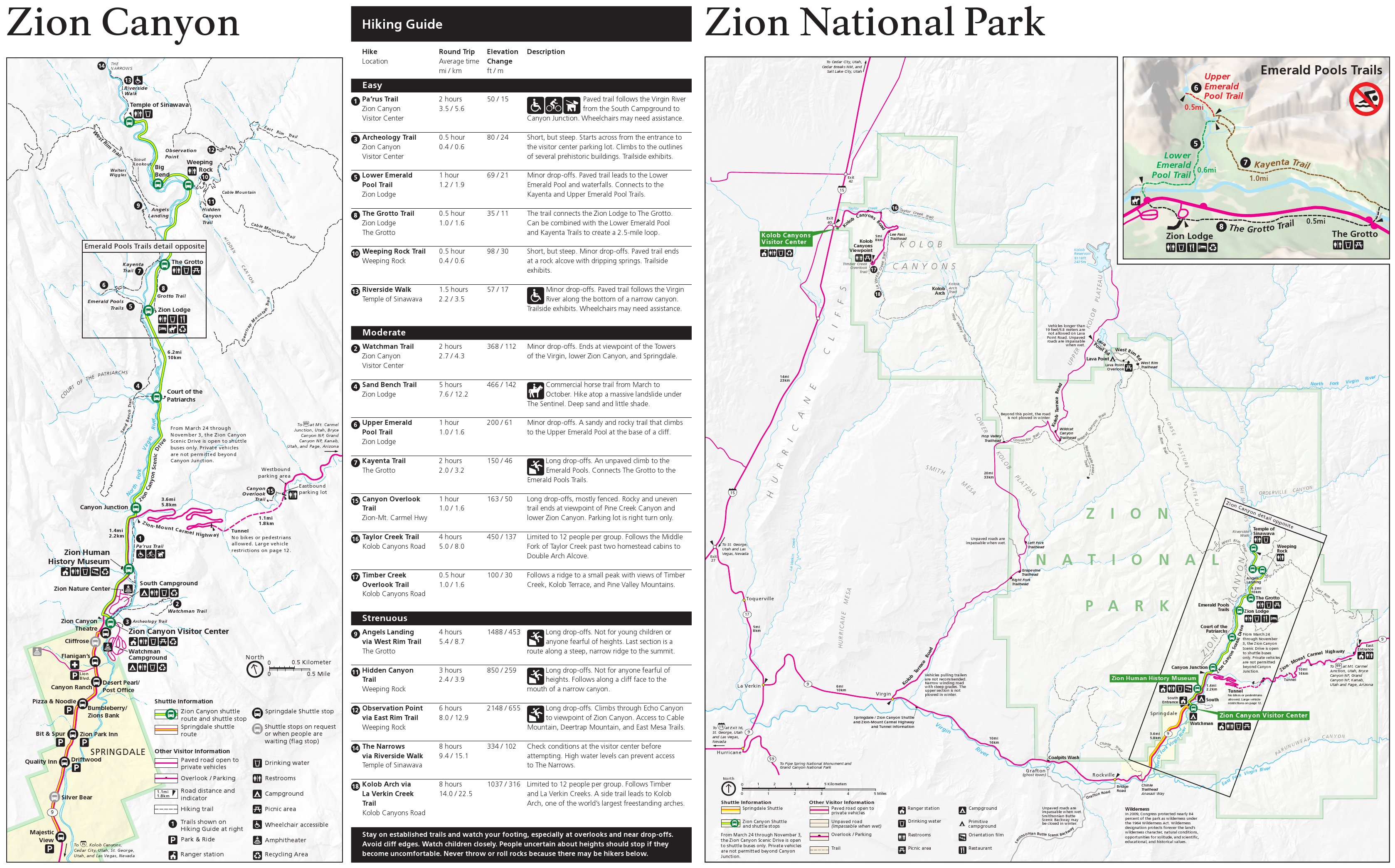 This set of three Zion trail maps shows trails and has written descriptions about hikes in three separate areas of the park. Click the image to view a full size JPG (1.2 mb) or download the PDF (2.7 mb).
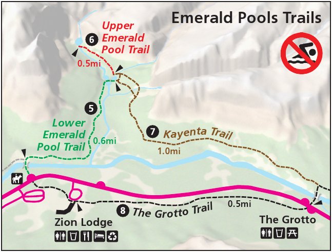 This is the Emerald Pools trail map (70 kb) inset from the previous file. I posted this separately so you don’t need to download the entire file if all you needed was the hiking trails to Emerald Pools.
Zion Canyon detail and shuttle bus maps
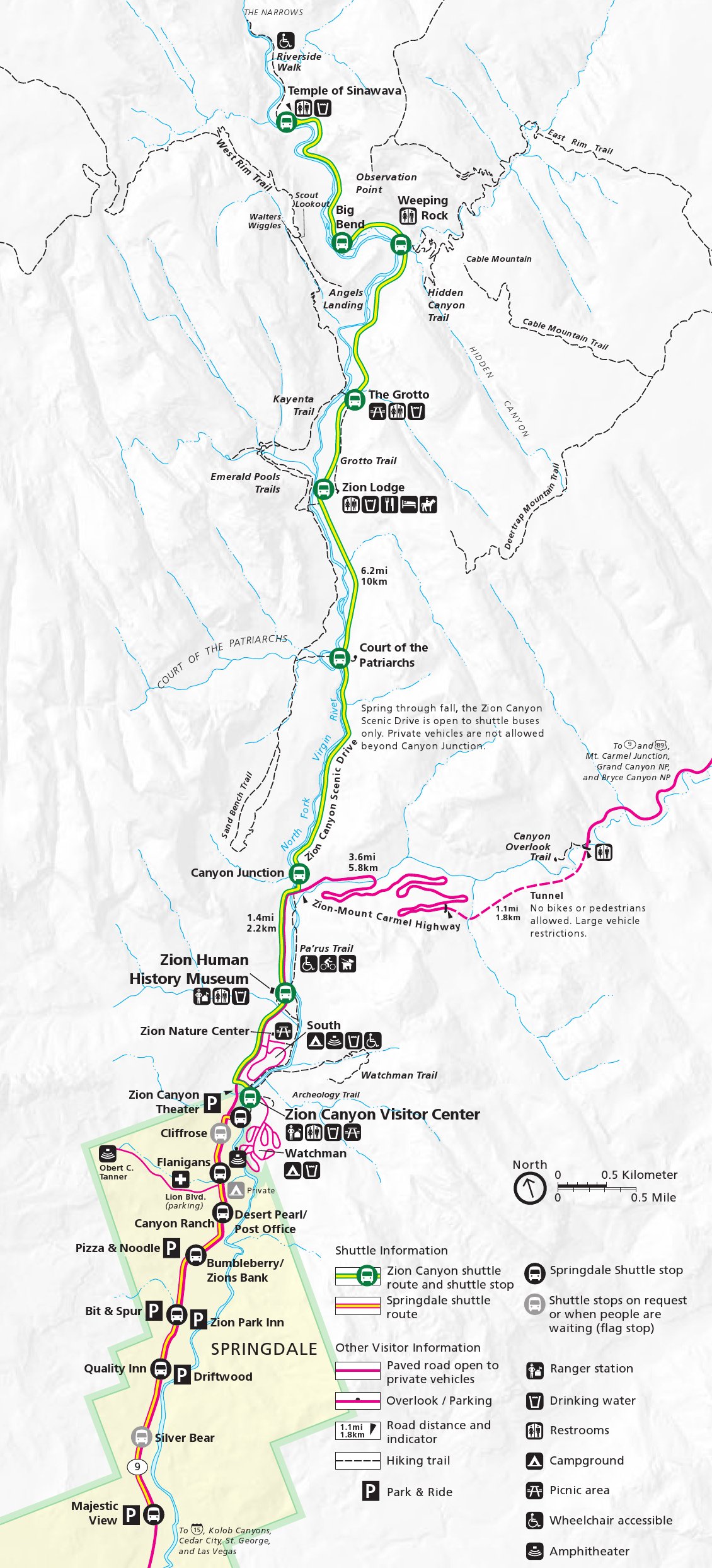 This map shows a detailed, zoomed-in view of Zion Canyon and its shuttle bus route. Click the image to view a full size JPG (500 kb) or download the PDF (600 kb).
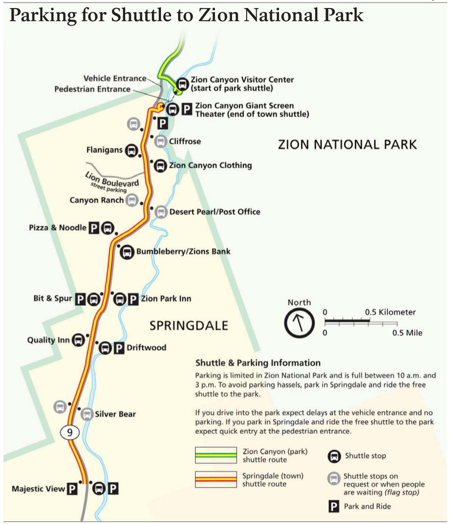 Here’s a Springdale shuttle map (100 kb), showing the free route through the town of Springdale, just outside Zion Canyon. Don’t bother trying to drive into Zion, especially if you’re staying in Springdale!
Zion campground maps
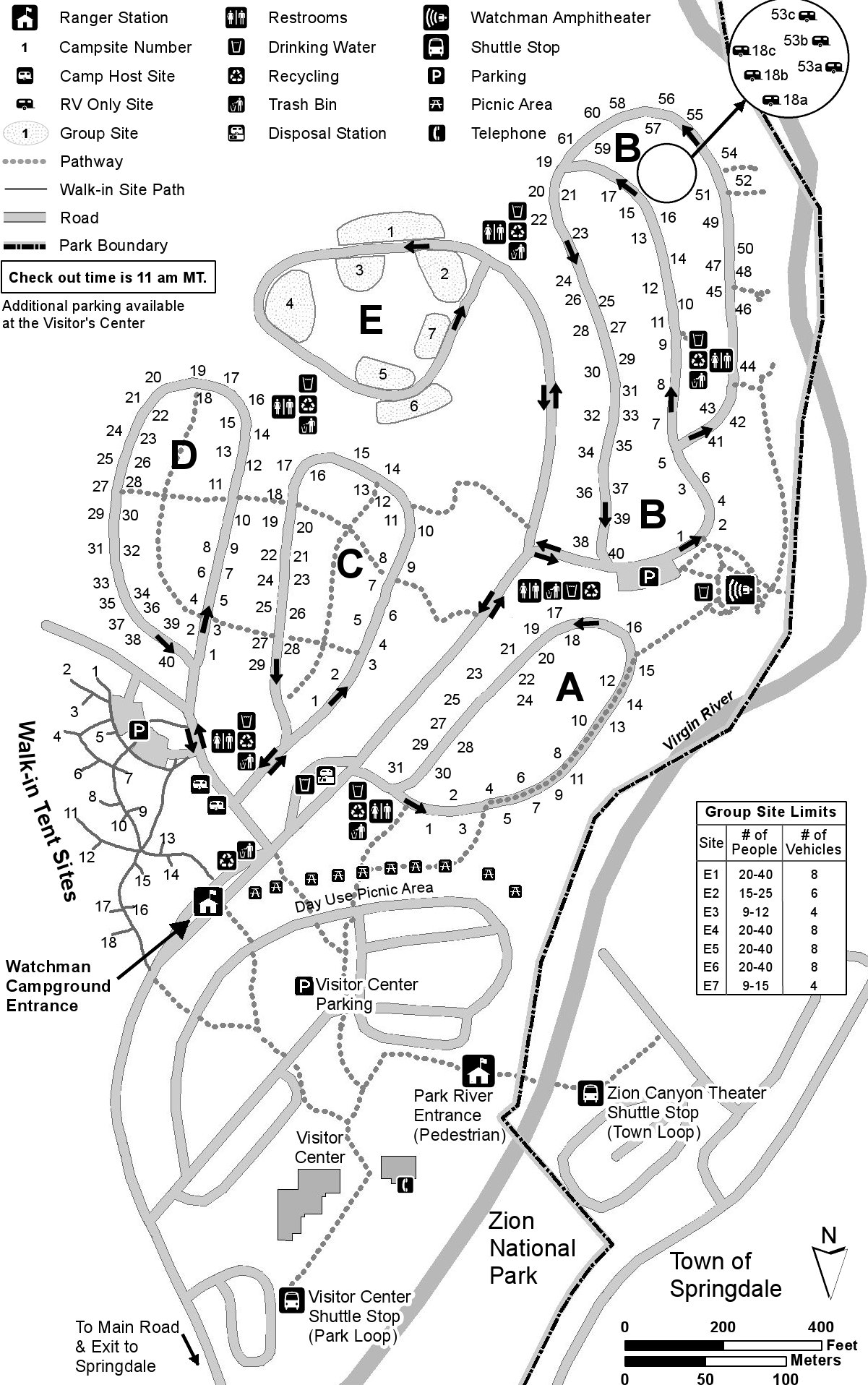 This is a map of Watchman Campground (400 kb), located on the east side of the Virgin River and north of the Zion Canyon Visitor Center. This is the most popular of the two Zion National Park campgrounds.
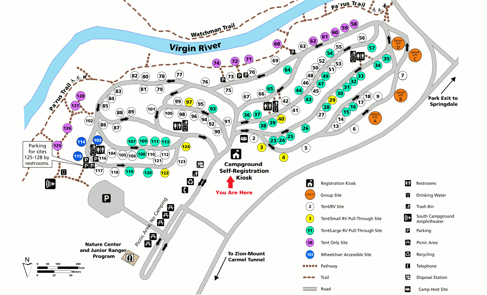 This is a map of South Campground (300 kb), located on the west side of the Virgin River and south of the Zion Canyon Visitor Center. Although less popular, it’s still in an incredibly scenic area.
Zion lodging map
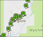 Most Zion visitors choose to stay in Springdale, UT, just outside the park entrance. To the right, you can view a Hotels.com interactive Zion lodging map, showing the huge number of options there. Staying in Springdale will put you right on the shuttle bus line. Also consider browsing the Hotels.com top-rated Zion lodging where you can compare prices, photos, location, reviews, and more.
Zion topographic maps
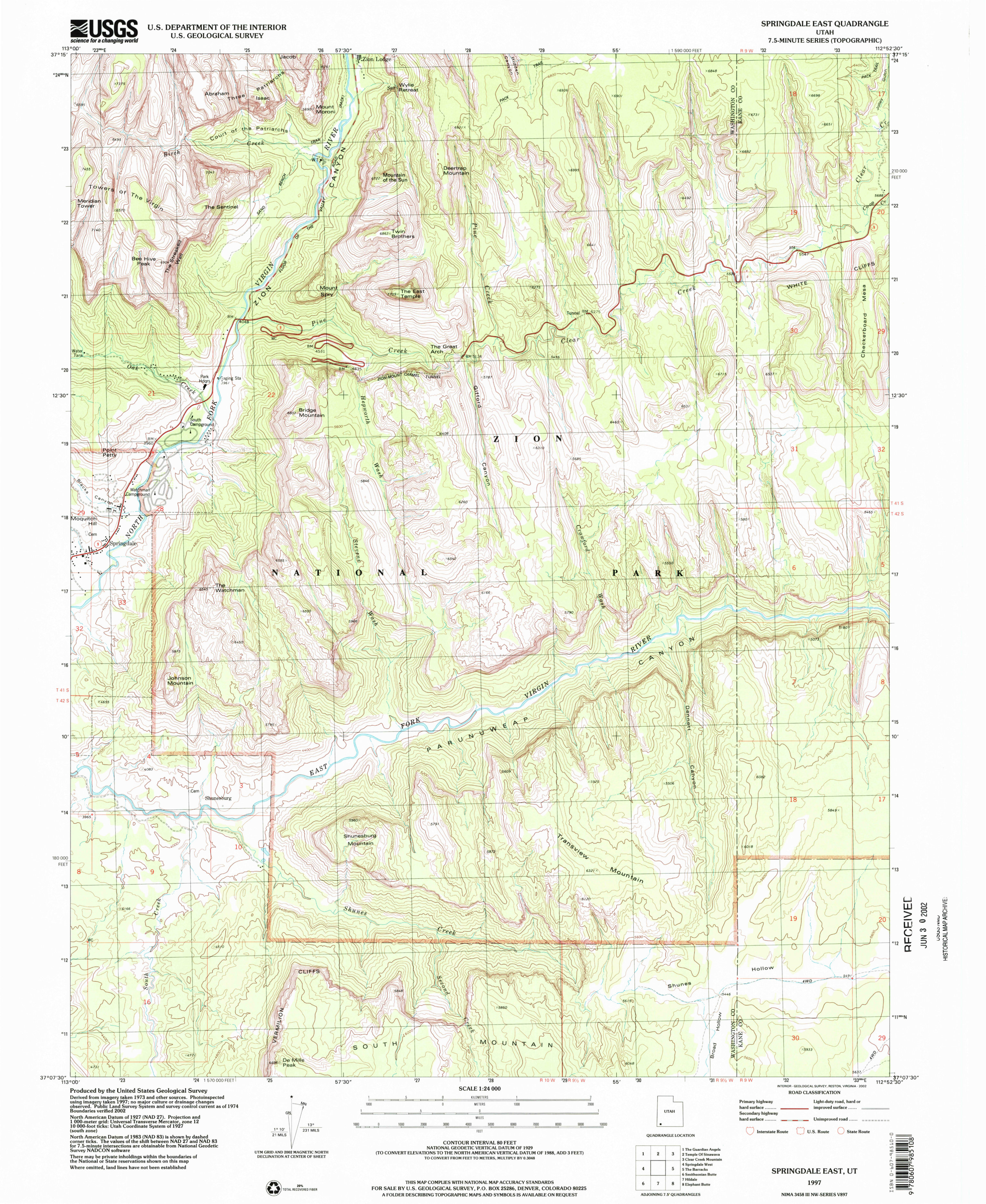 This Zion Canyon (south) topo map, focusing on the southern part of Zion Canyon as well as the east entrance road. Click the image to view a full size JPG (3.0 mb) or download the PDF (12.5 mb).
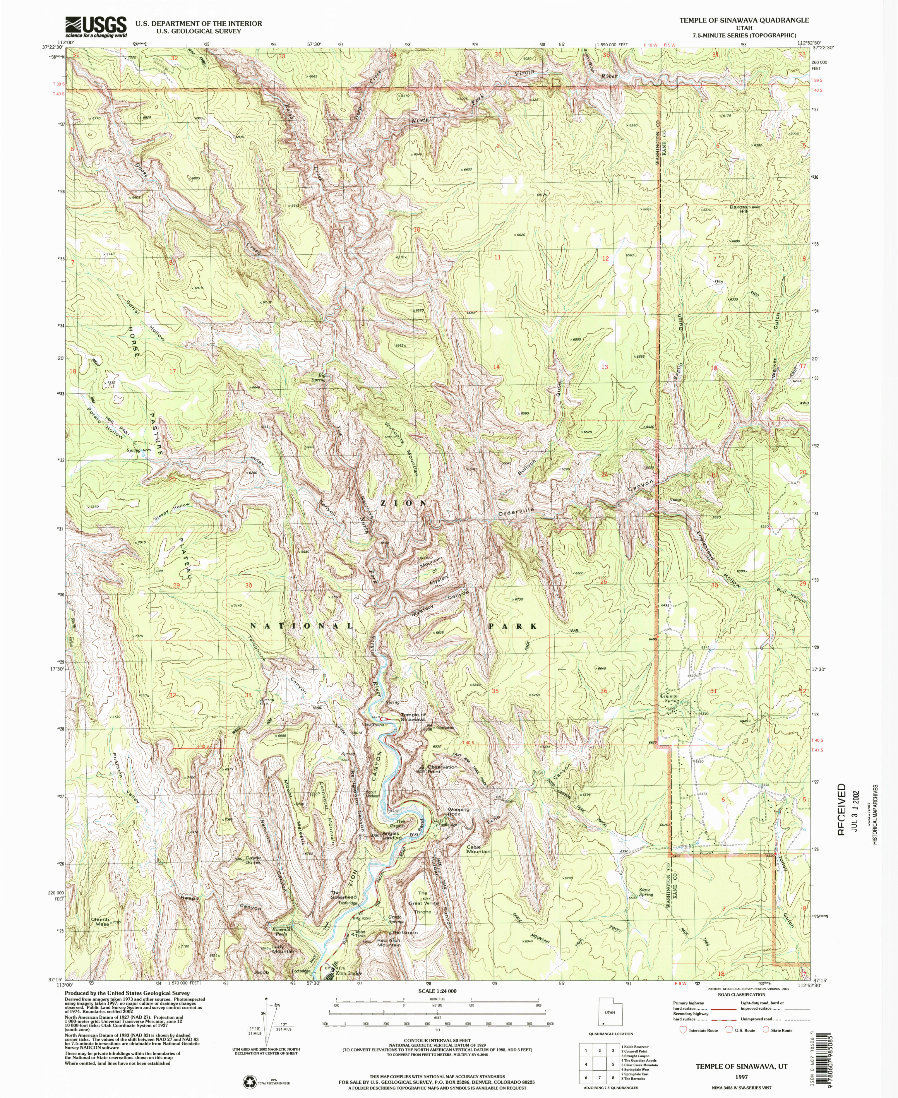 Here’s a Zion Canyon (north) topo map, which shows Angels Landing, the Narrows, and other popular trails. Click the image to view a full size JPG (3.2 mb) or download the PDF (13.8 mb).
Zion geologic map
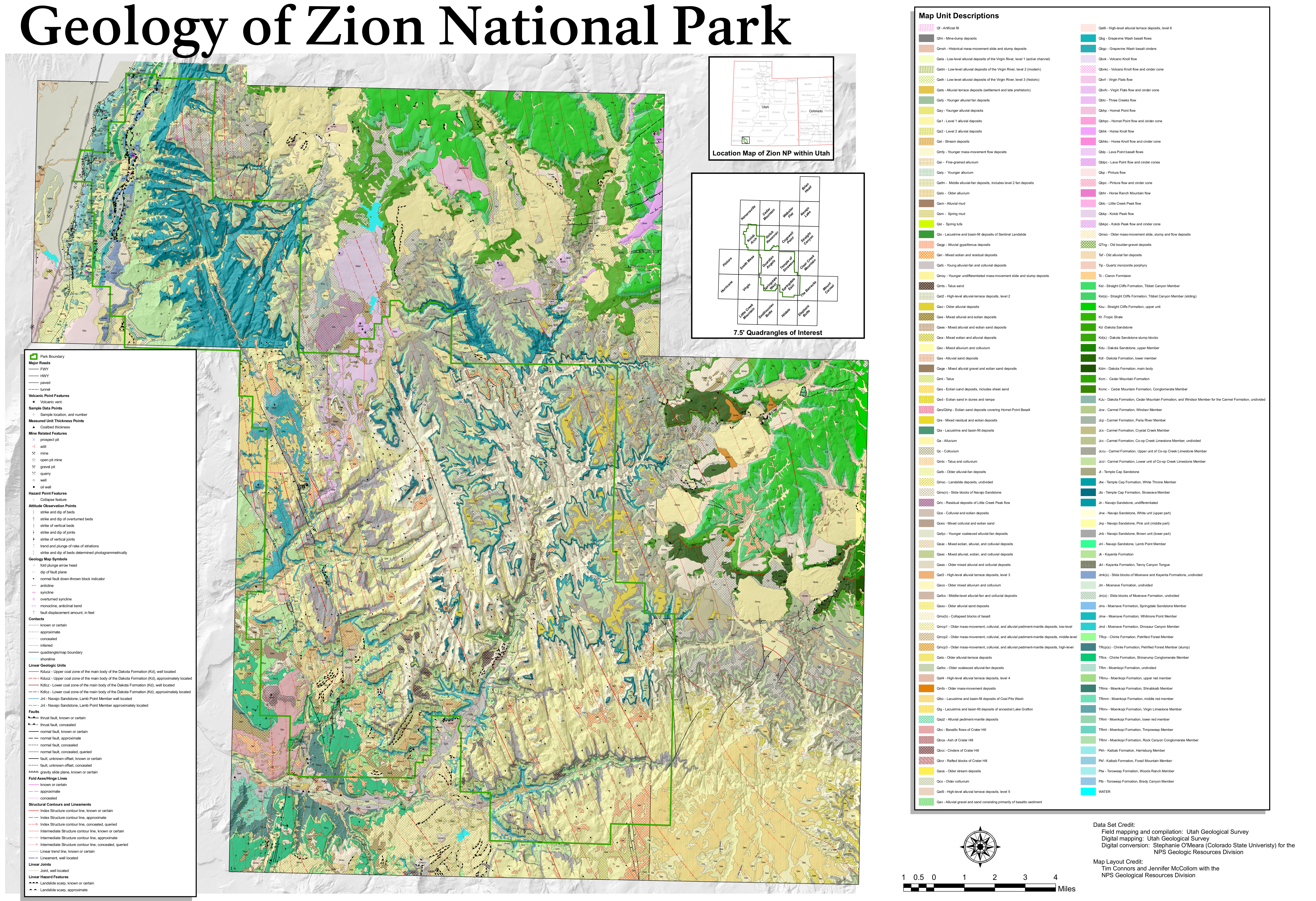 The geologic map of Zion (11.2 mb) has a large file size, but its incredible detail about the various rock types that make up Zion National Park is great to learn about the geology of Zion.
Zion backcountry wilderness map
 This map shows the Zion wilderness trails and backcountry campsites (1.0 mb), including trail mileages and water sources in both Zion and Kolob canyons. Great for planning a backpacking trip!
Although the above map is good for planning, it’s not suitable for navigation since it doesn’t show topgraphic lines and will be useless if you’re lost. Like many other parks, the best map for general trail travel is the National Geographic Trails Illustrated map. If you’re doing in-depth canyoneering, however, not even Nat Geo is going to be sufficient; you need USGS topographic maps and specialized canyoneering guidebooks.
Zion vegetation map
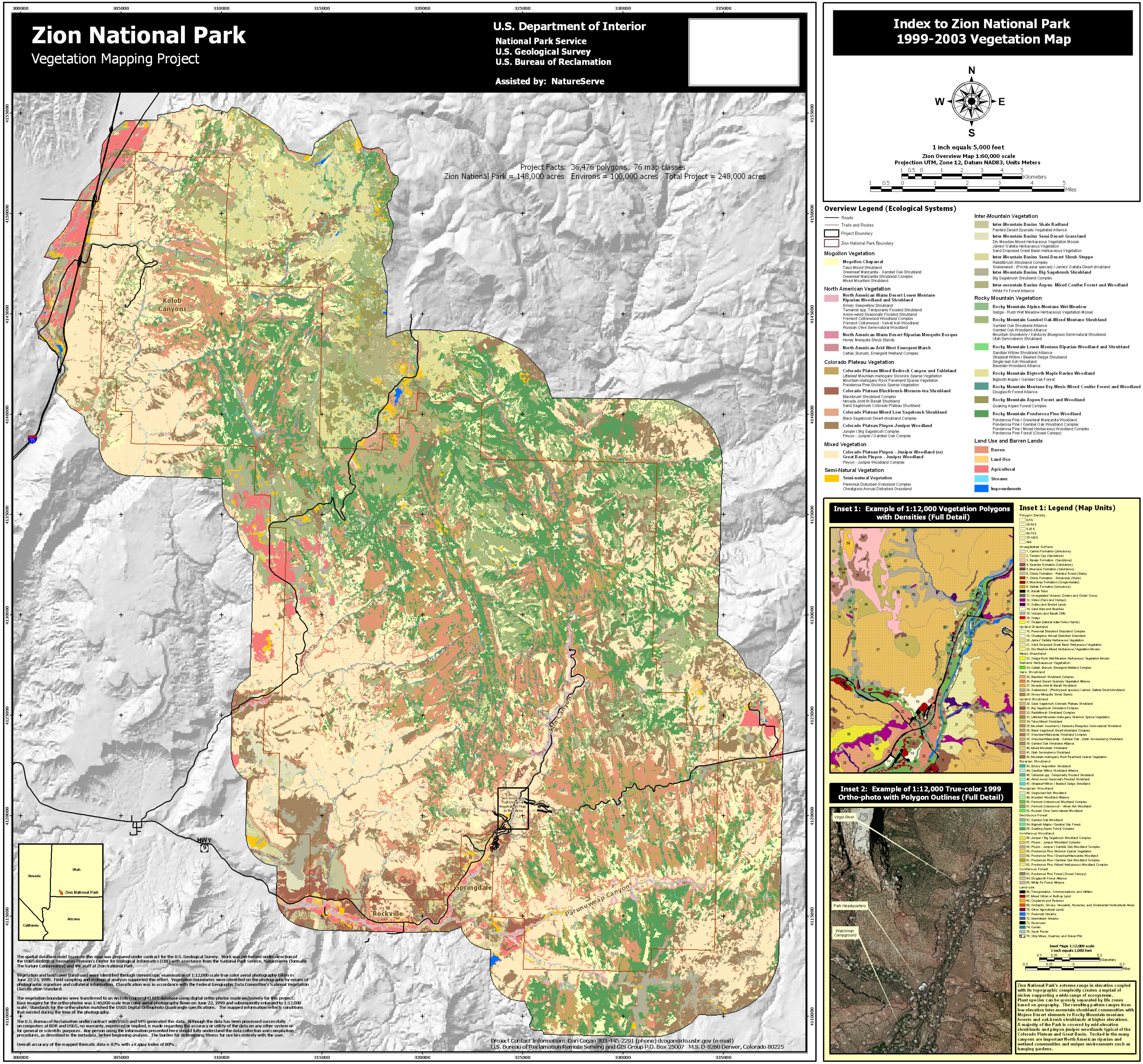 This is a vegetation map of Zion National Park (5.1 mb), showing the different types of forests and brushland found within the park boundaries. It makes a good companion to the geologic map to learn about Zion.
…and more!
< Return to National Park Maps home
< Return to Park List
< Return to List by State
Need more trip-planning help? Browse Amazon’s best-selling Zion maps and guidebooks.