Hot Springs maps from the park brochure
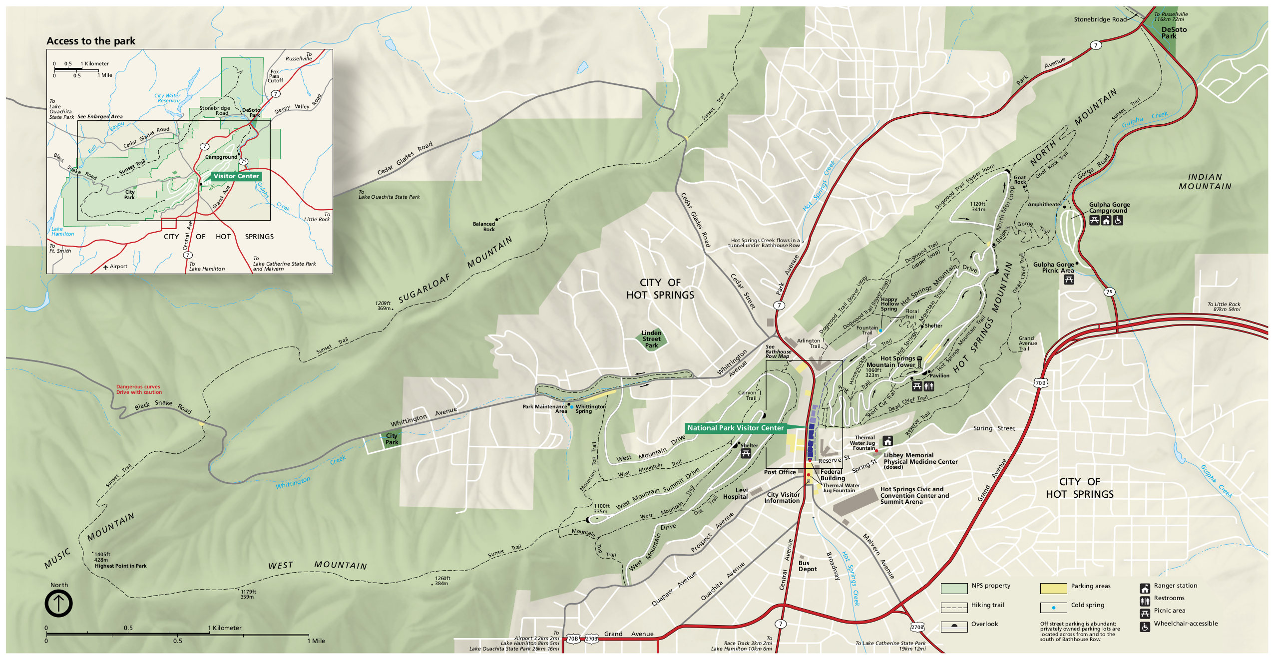
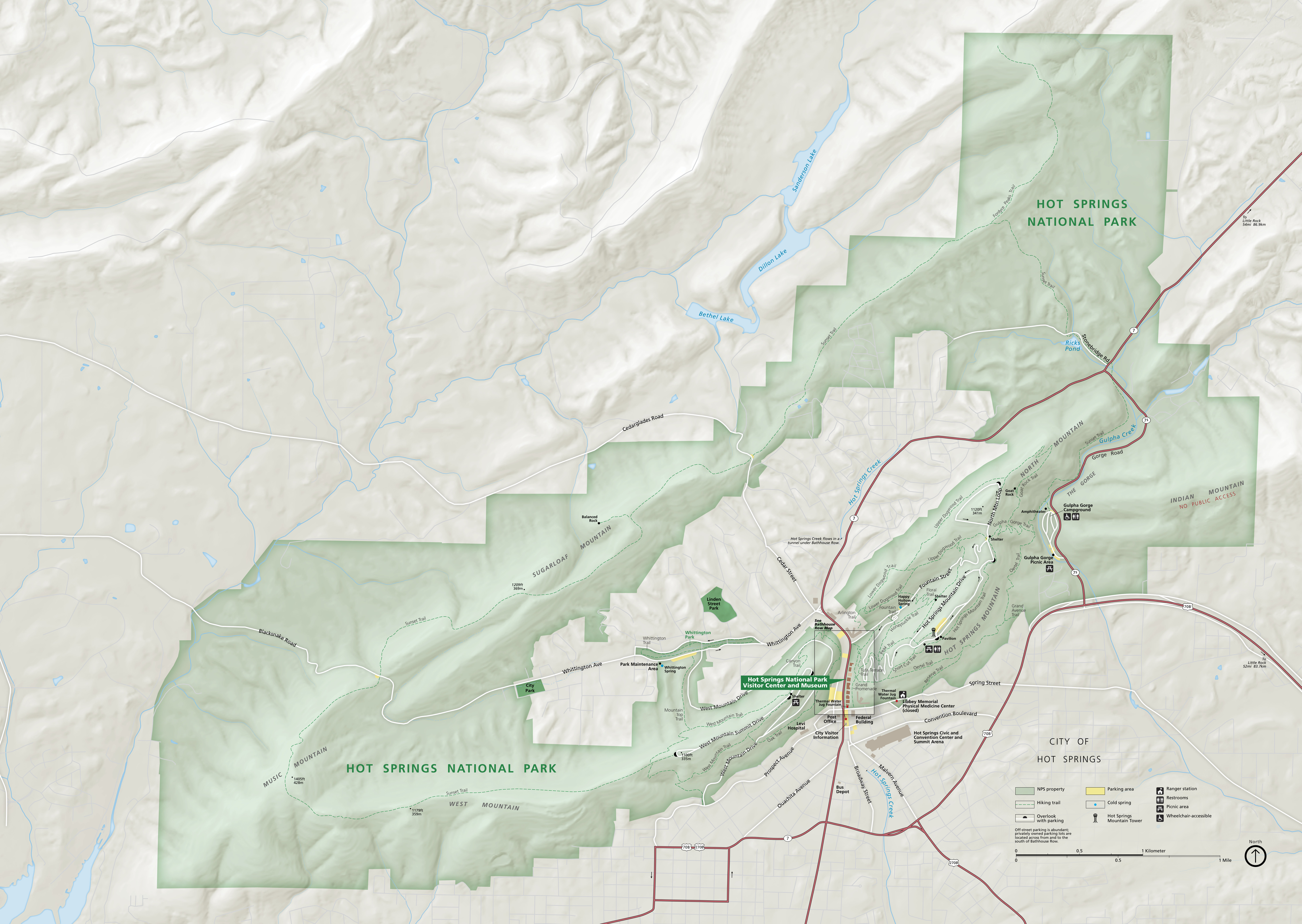 This is the official Hot Springs National Park map from the NPS brochure, last updated in 2021. Note that the park is much more than just bathhouses, including mountain trails, lookouts, and a campground.
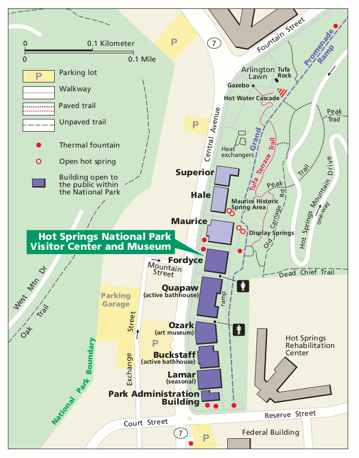
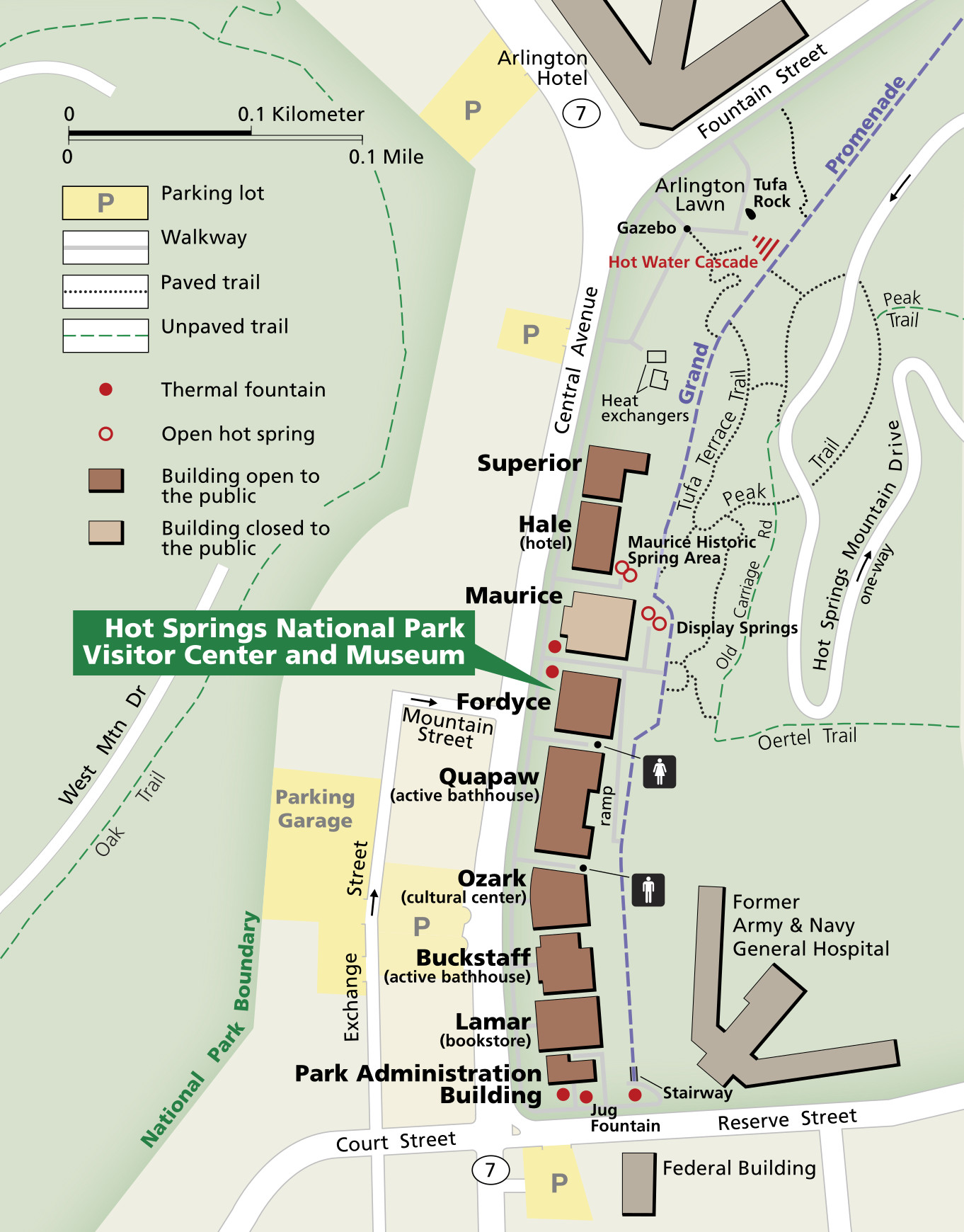 Here’s a Bathhouse Row map. These bathhouse buildings were constructed between 1892 and 1923, and collectively make up the heart of the park. Click the image to view a full size map or download the PDF.
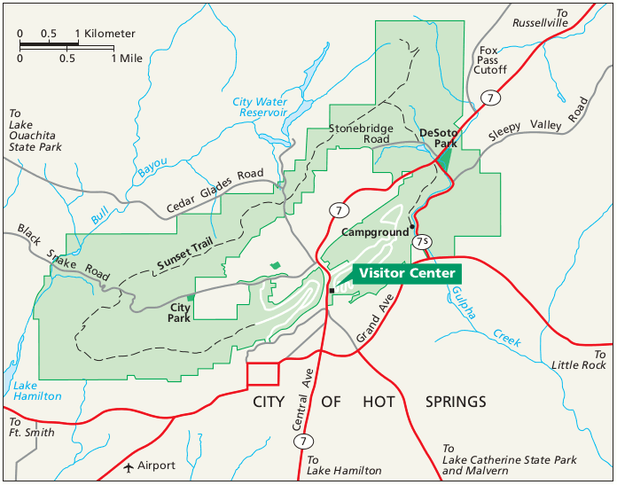 This is a regional map of Hot Springs that shows the roads and highways leading into and around the park from surrounding Arkansas. Click the image to view a full size map or download the PDF.
Hot Springs lodging map
 If you’re visiting Hot Springs National Park, you’ll likely want to stay in (shocker!) Hot Springs, AR. To the right you can open an Expedia interactive lodging map of Hot Springs, making it easy to see where your choices are in reference to the park. I’d also recommend browsing the top-rated Hot Springs lodging in order to read reviews, compare prices, and see photos and amenities of each place you’re considering.
Hot Springs trail maps
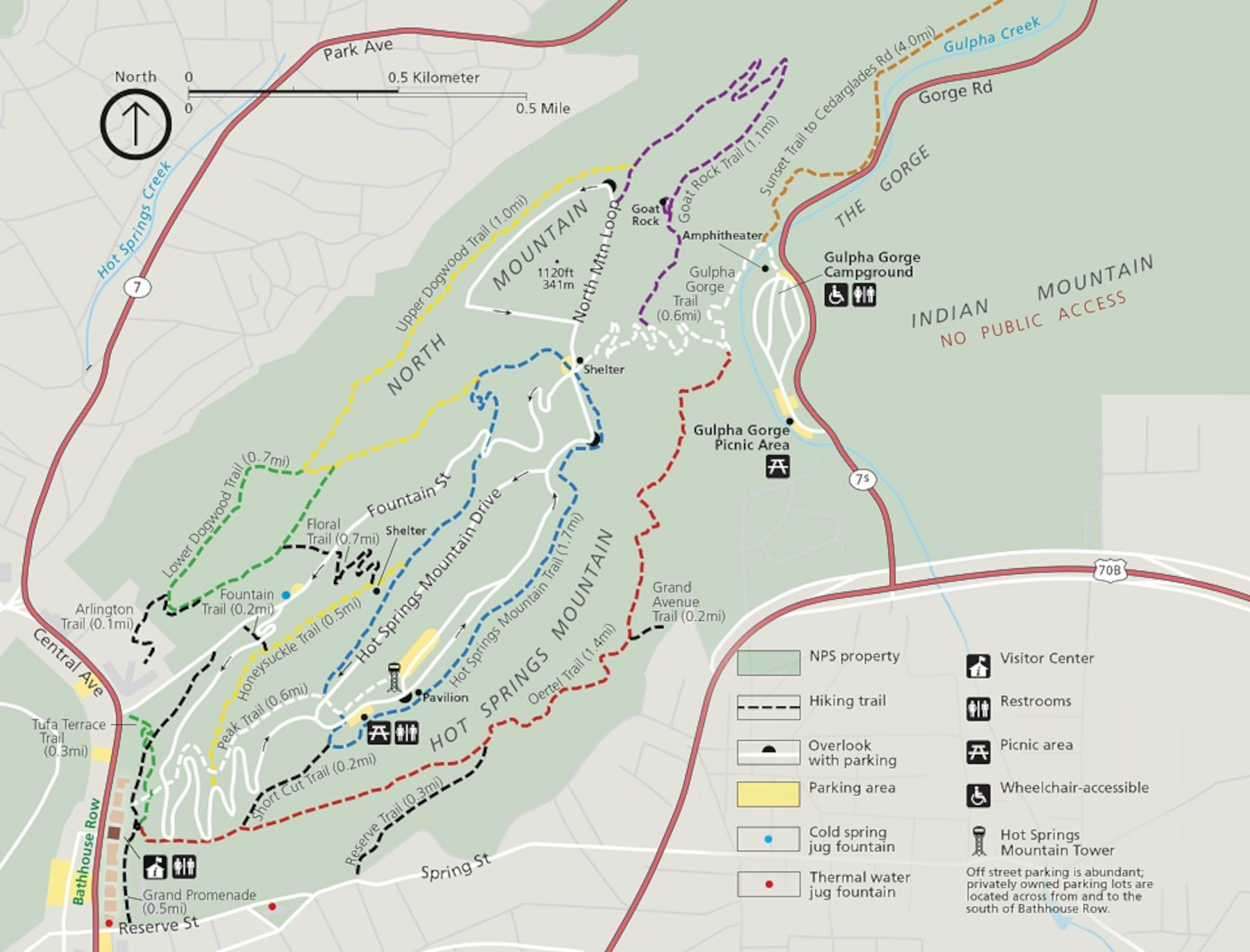 This Hot Springs National Park trail map focuses on the trails of Hot Springs Mountain and North Mountain, immediately east of the bathhouses. These are the park’s most popular and include scenic views.
 Here’s a West Mountain trail map, which conversely shows trails west of Bathhouse Row. These hiking trails are a bit less traveled than those to the east, giving you a better chance at seeing wildlife.
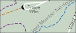
 The Sunset Trail map shows the longest trail in Hot Springs National Park, clocking in at about 10 miles one-way. You can combine it with other hikes on North Mountain to make an even longer loop.
Assorted Hot Springs maps
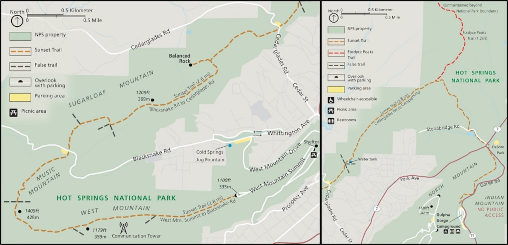
 This is a Gulpha Gorge Campground map, which is Hot Springs National Park’s only campground. 40 sites are available for reservation, and all sites have hookups for electricity and water.
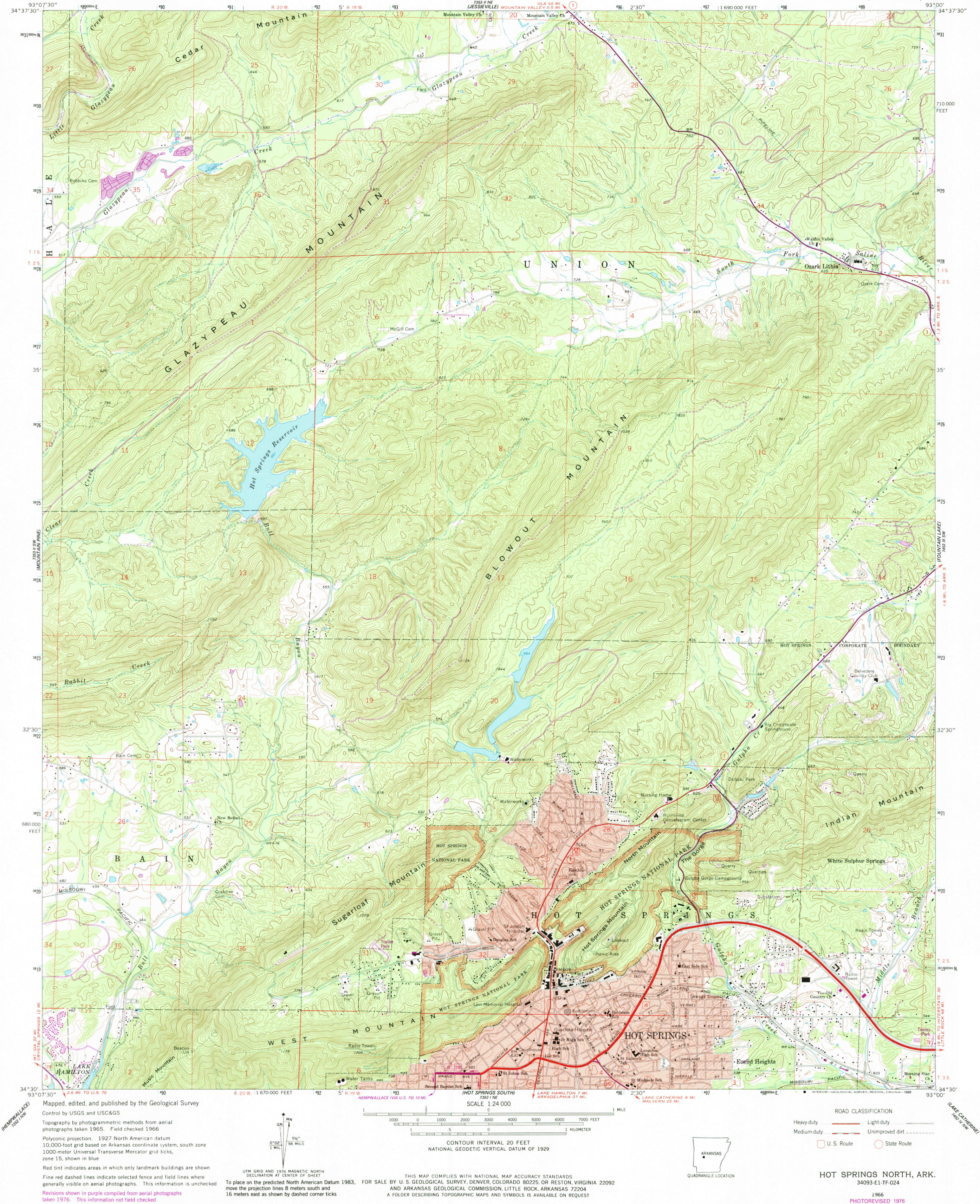 Here’s a Hot Springs topographic map, which includes a large section of park lands as well as the town of Hot Springs, Arkansas and the surrounding hills of Sugarloaf Mountain and Hot Springs Mountain.
Hot Springs science maps
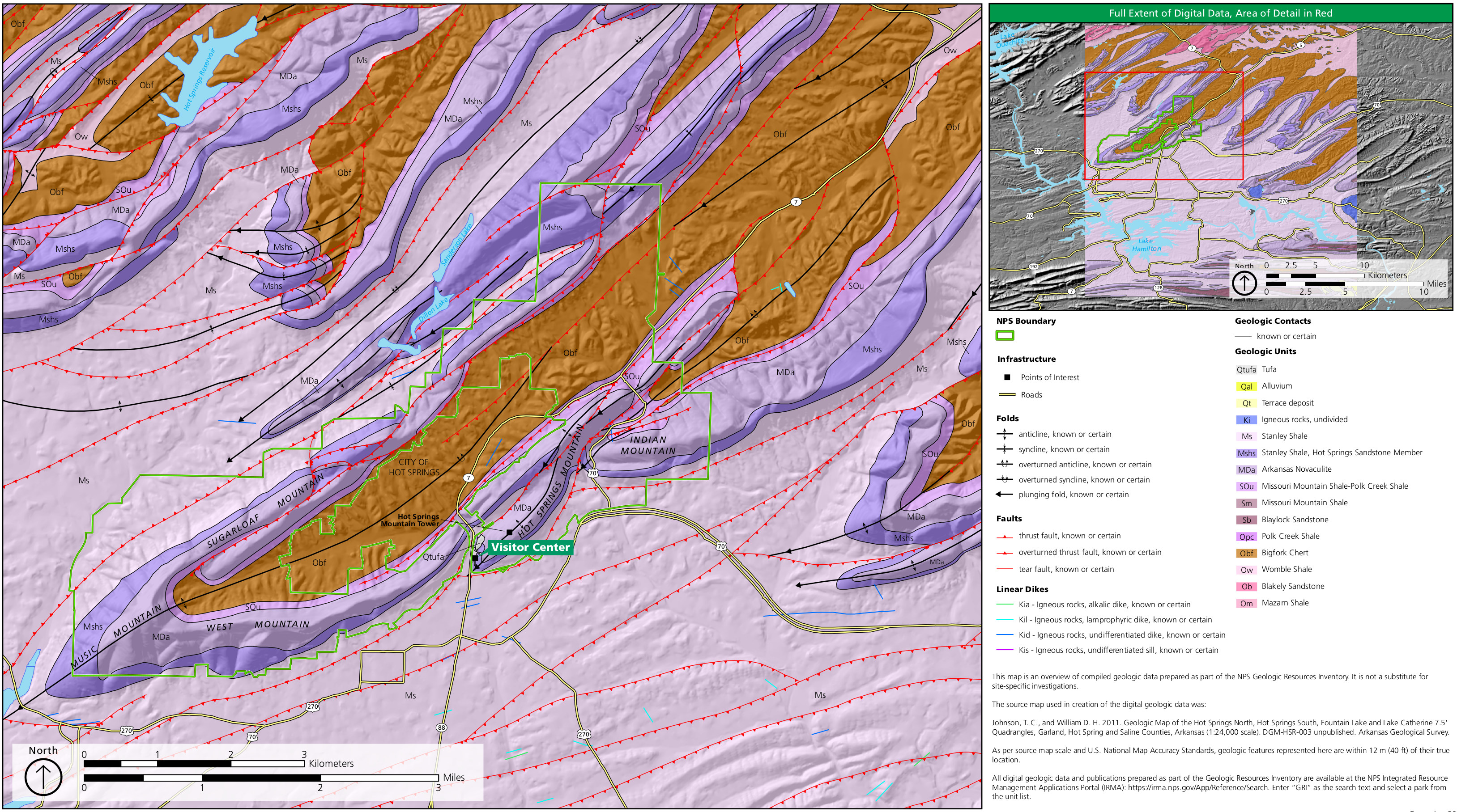 The geologic map of Hot Springs National Park zooms in on the national park lands while also showing the bedrock, folds, faults, and dikes in the surrounding region in Arkansas.
 Here’s a Hot Springs recharge zone map, which shows where the water in the springs comes from. Rain and snowmelt become groundwater and get heated underground before emerging from a fault in Hot Springs Mountain.
Archived Hot Springs maps
The National Park Service often releases new maps and updates old ones; I do my best to include new Hot Springs maps here. Rather than deleting old ones, I move them to this section, so users can see how national parks like Hot Springs change over time.
 This is the old complete Hot Springs National Park map from the mid-2010s brochure, showing the park, hiking trails, and city of Hot Springs. Click the image to view a full size map or download the PDF.
 This is an old Hot Springs visitor center area map from the mid-2010s, zoomed in on the most visited part of Hot Springs National Park including the bathhouses, springs, roads, parking, trails, and visitor center.
…and more!
< Return to National Park Maps home
< Return to Park List
< Return to List by State