American Samoa maps from the park brochure
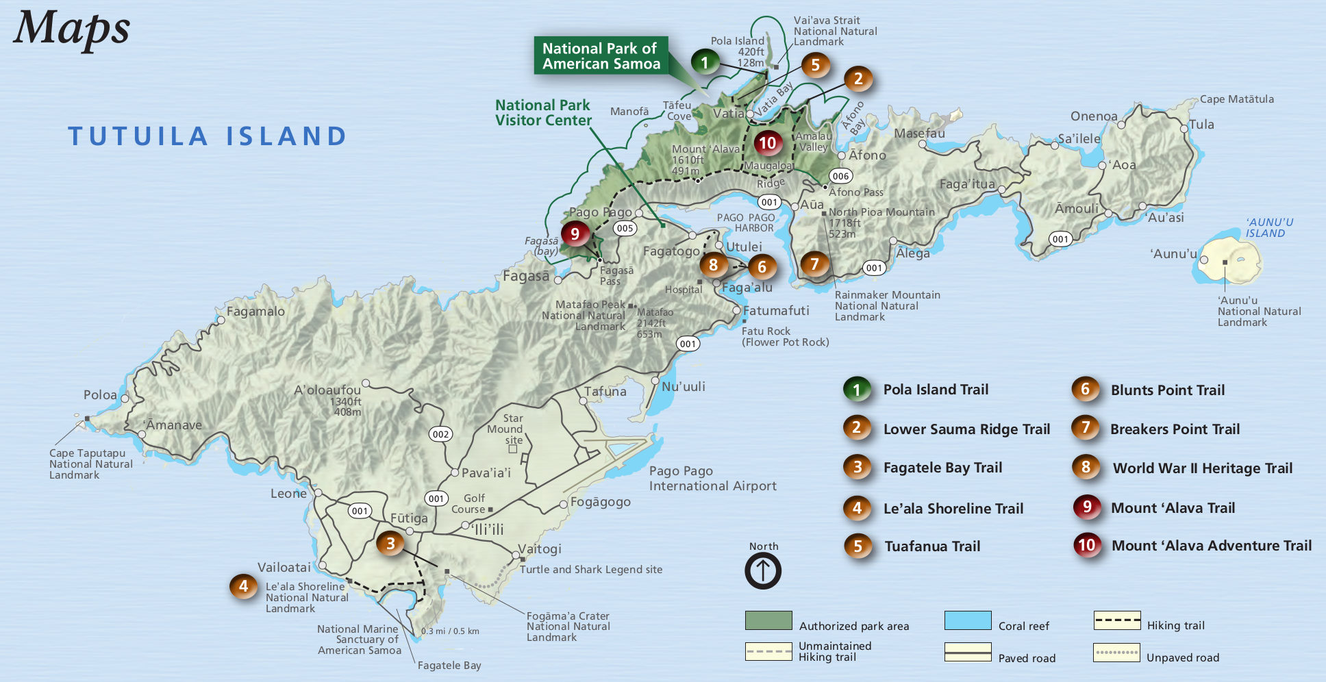
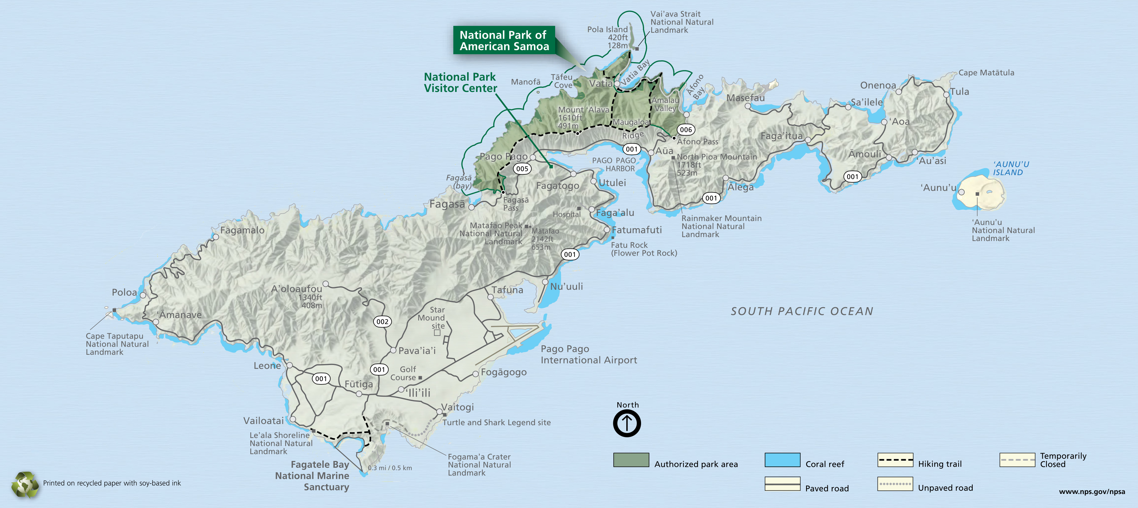 This is the official National Park of American Samoa map from the NPS brochure. It zooms in on park lands on Tutuila Island, home to Pago Pago and the most visited areas of the national park.
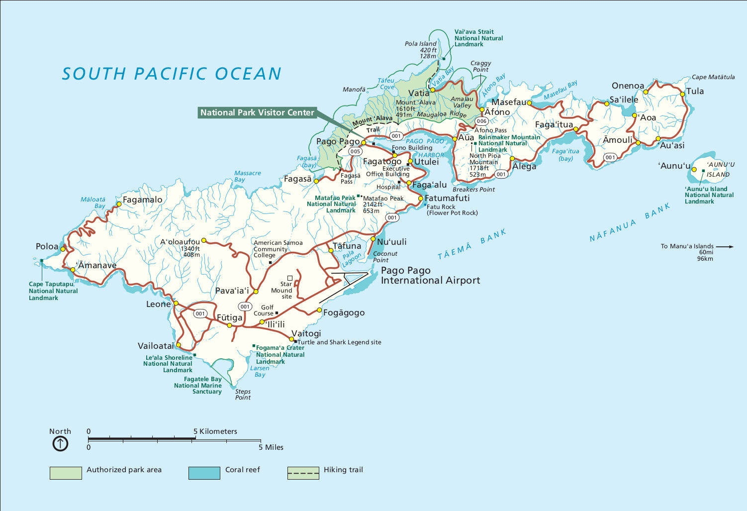 Here is an alternate American Samoa National Park map. This map does not include topographic shading like the map above, so it’s easier to quickly interpret. Click the image to view a full size map or download the PDF.
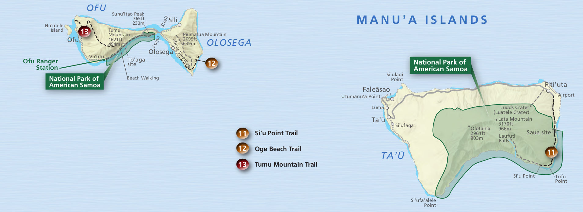
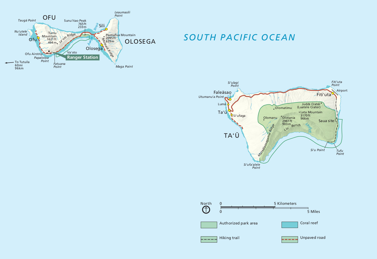 This is a map of American Samoa lands on Manu’a Islands, including facilities on both Ofu and Ta’u. Click the image to view a full size map or download the PDF.
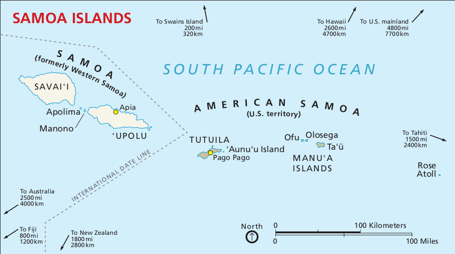 This is the regional map, showing the islands of American Samoa in relation to Western Samoa and other points of interest. Click the image to view a full size map or download the PDF.
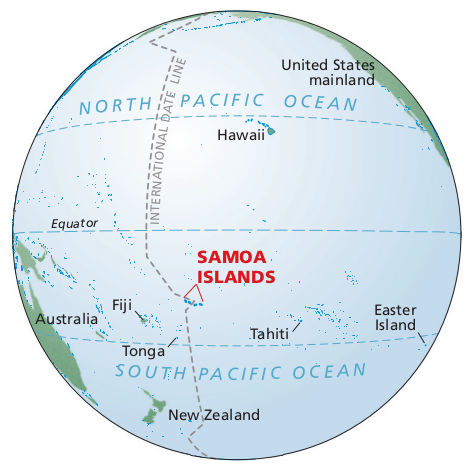 Here’s a Pacific ocean map showing where American Samoa is in relation to the Equator, Fiji, Tahiti, Tonga, Hawaii, and the U.S. mainland. Yep, it’s waaaaay out there in the Pacific Ocean.
American Samoa trail maps
 This Tutuila Island trail map from the American Samoa National Park newspaper labels hiking trails near Pago Pago on Tutuila Island. A few trails outside the park are also included.
 Here’s the Manu’a Islands map from the newspaper, labeling three trails (both beach and mountain trails) and showing points of interest on Ofu Island and Ta’u Island.
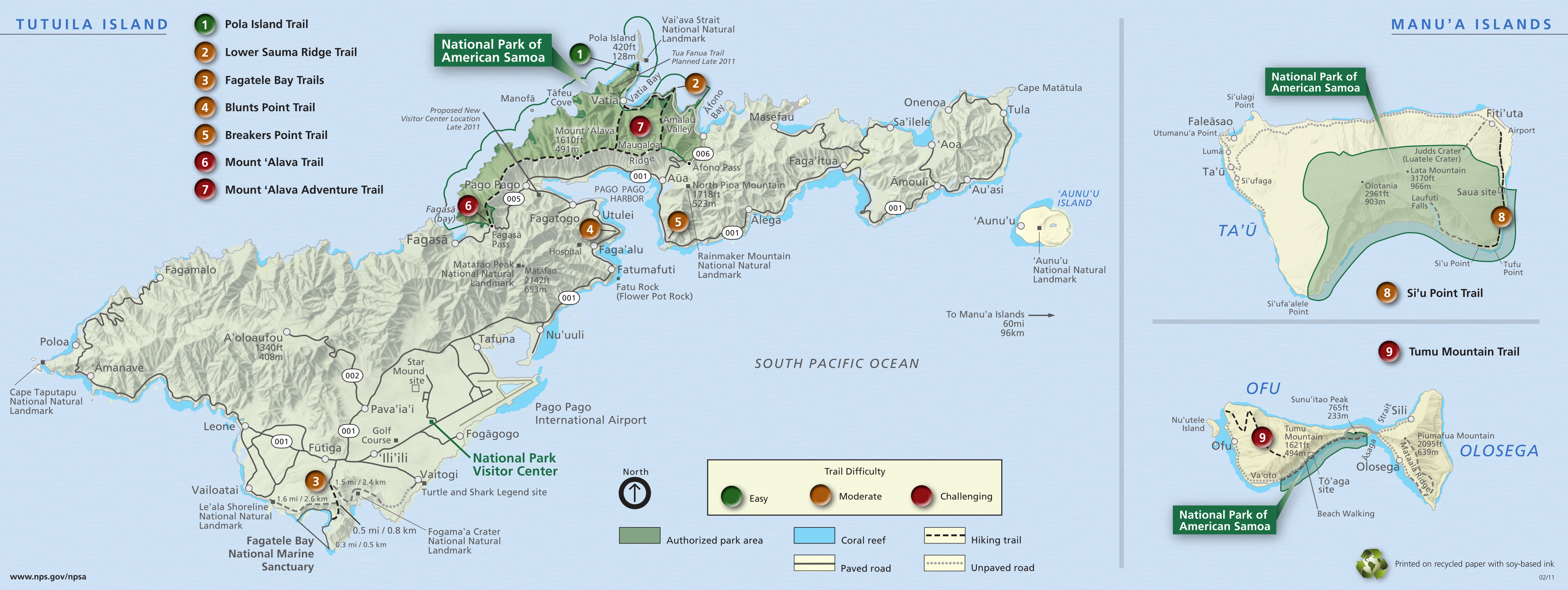 This older American Samoa trail map shows many major trails across three islands on a single map. The map comes with an associated NPS American Samoa hiking guide PDF, which includes trail descriptions.
Assorted American Samoa maps
 This is a Tutuila Island map. This map labels many things to do, both within the national park and outside the boundaries: snorkeling sites, hiking trails, and other points of interest.
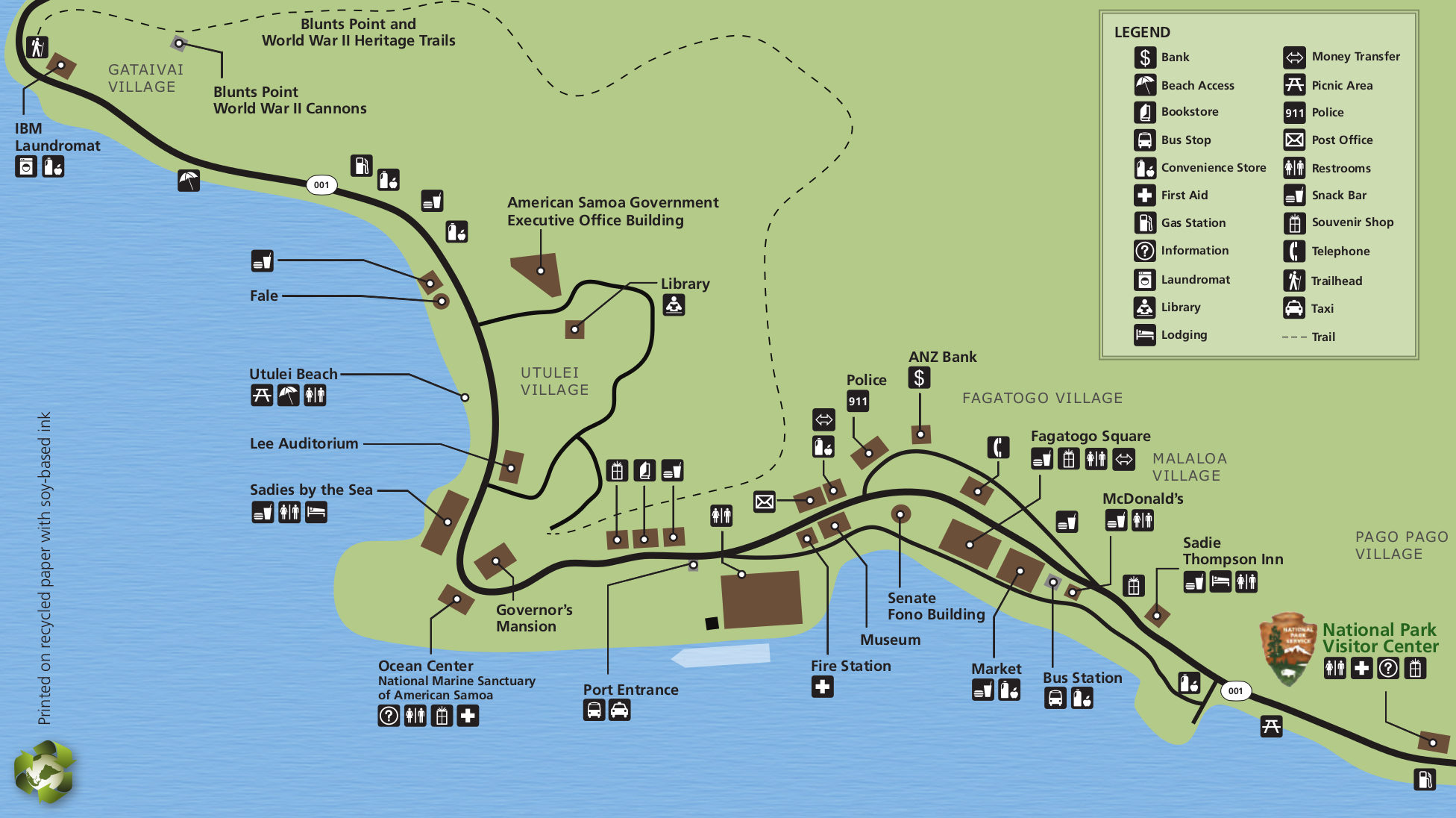 Here’s an American Samoa detail map zooming in to show the location of the park visitor center in relation to Utulei, Fagatogo, and Pago Pago villages on Tutuila Island. Note that on this map, north is down.
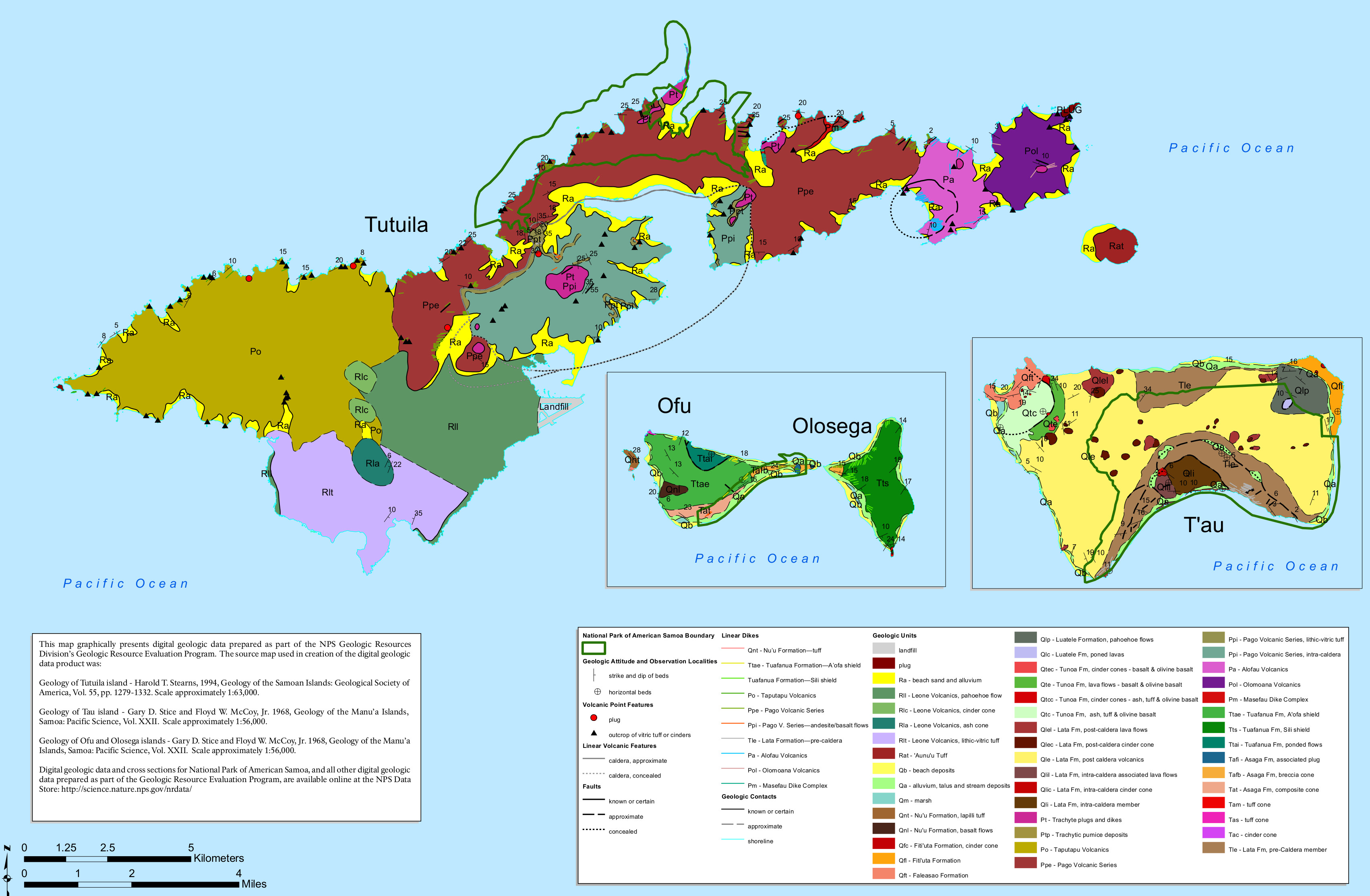 The American Samoa geologic map shows the bedrock geology of the terrain both inside and outside of the National Park of American Samoa, on all three islands that have park lands.
…and more!
< Return to National Park Maps home
< Return to Park List
< Return to List by State