Denali maps from the park brochure
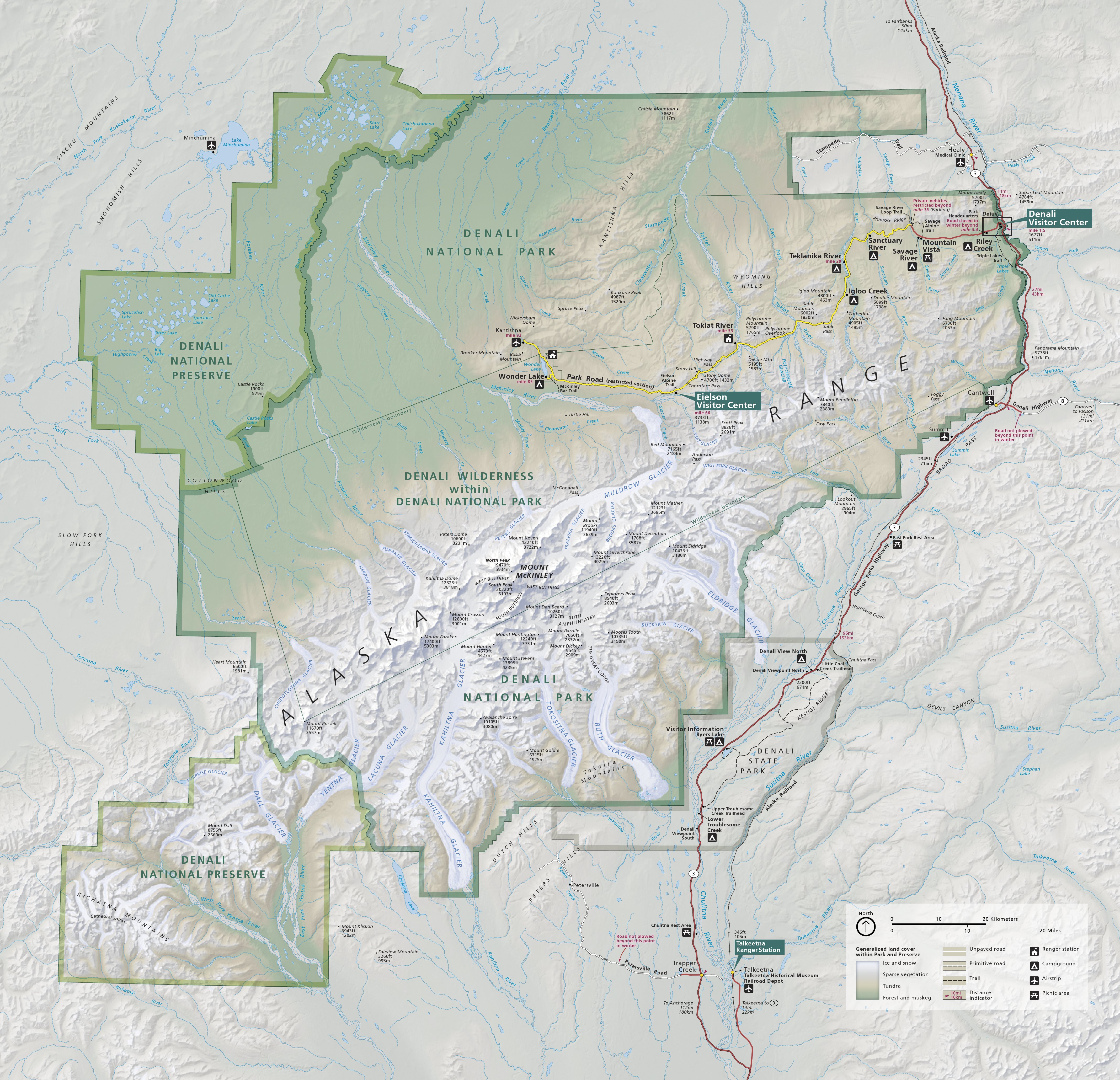
 This is the official Denali National Park map from the NPS brochure, last updated in 2025. Note that through 2026, the Eielson Visitor Center and Wonder Lake are inaccessible due to a road closure at Mile 43.
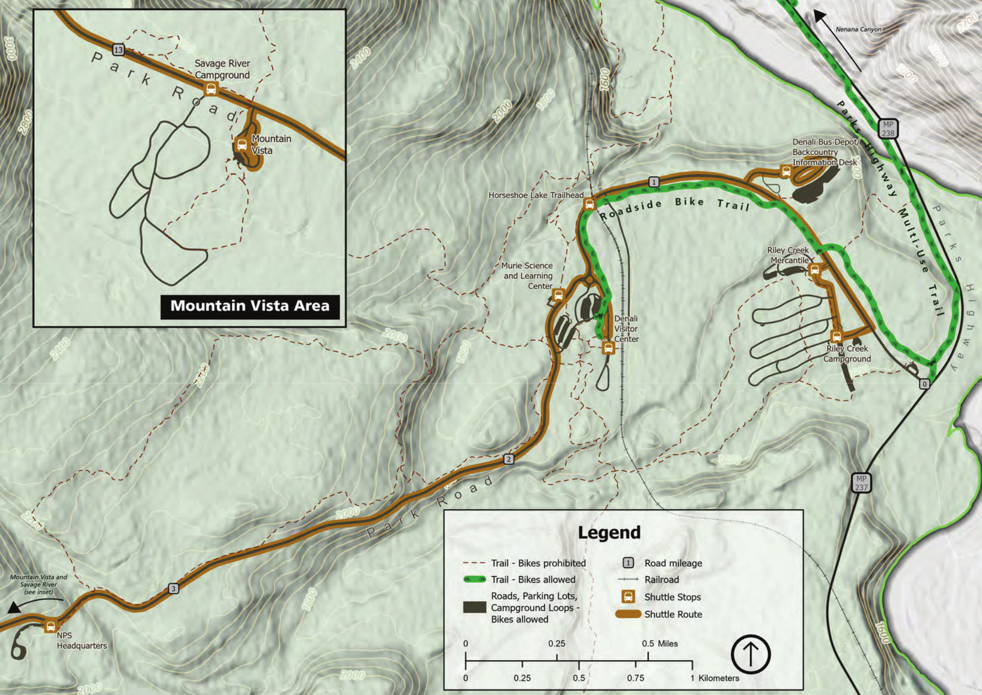
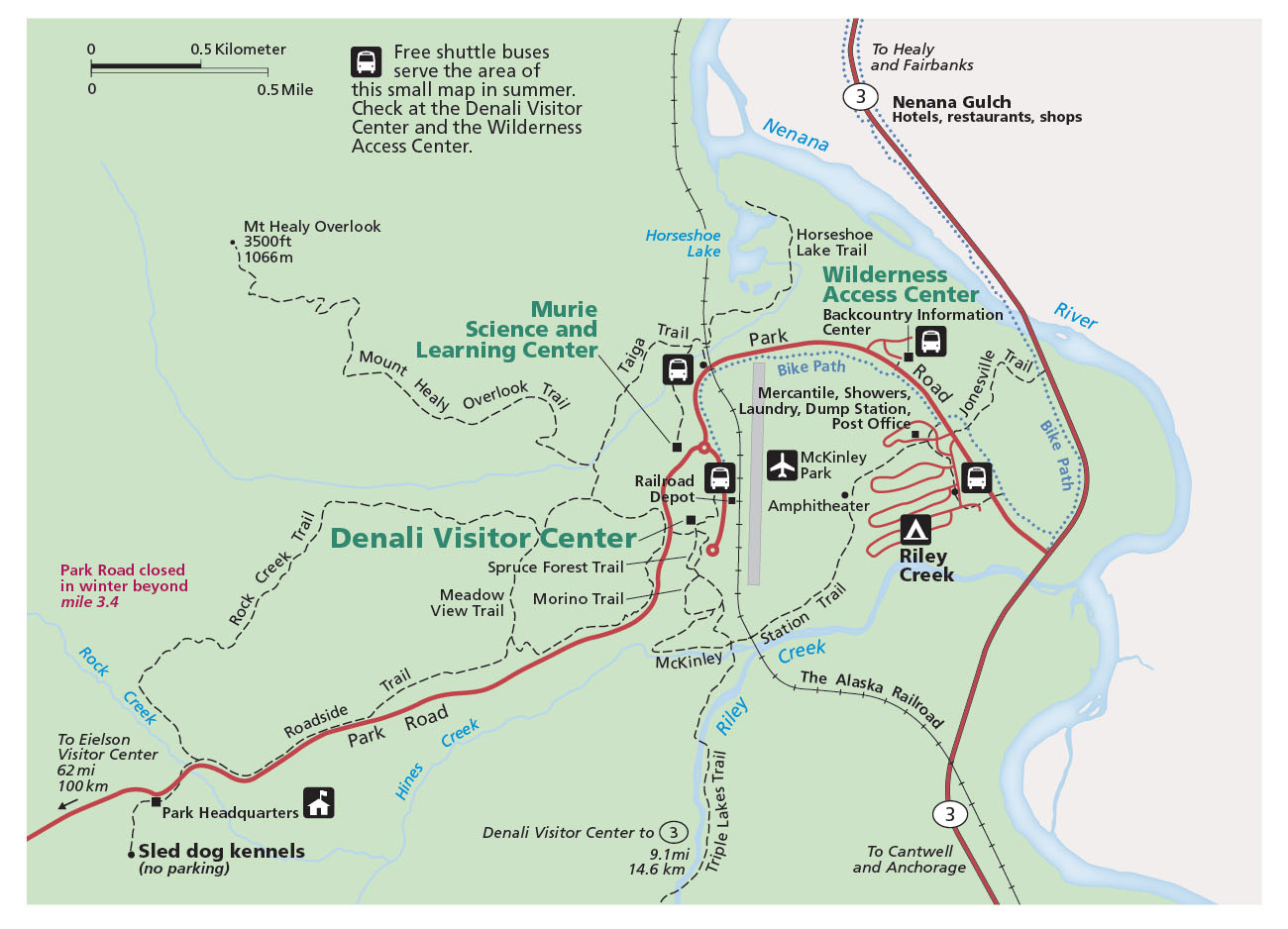
 The Denali Visitor Center map shows the facilities located near the main visitor center and railroad and Denali Bus Depot just off the main George Parks Highway. Click the image to view a full size map or download the PDF.
Denali trail maps
 There’s not much in the way of good free parkwide trail maps of Denali that I’ve found, but the National Geographic Trails Illustrated map is definitely the best one that covers the entire park. It shows the various points of interest along the Wonder Lake Road and throughout the rest of the park. That said, it’s not sufficiently detailed for climbing or off-trail travel; since it shows the entire park, it has to sacrifice detail in order to cover everything.
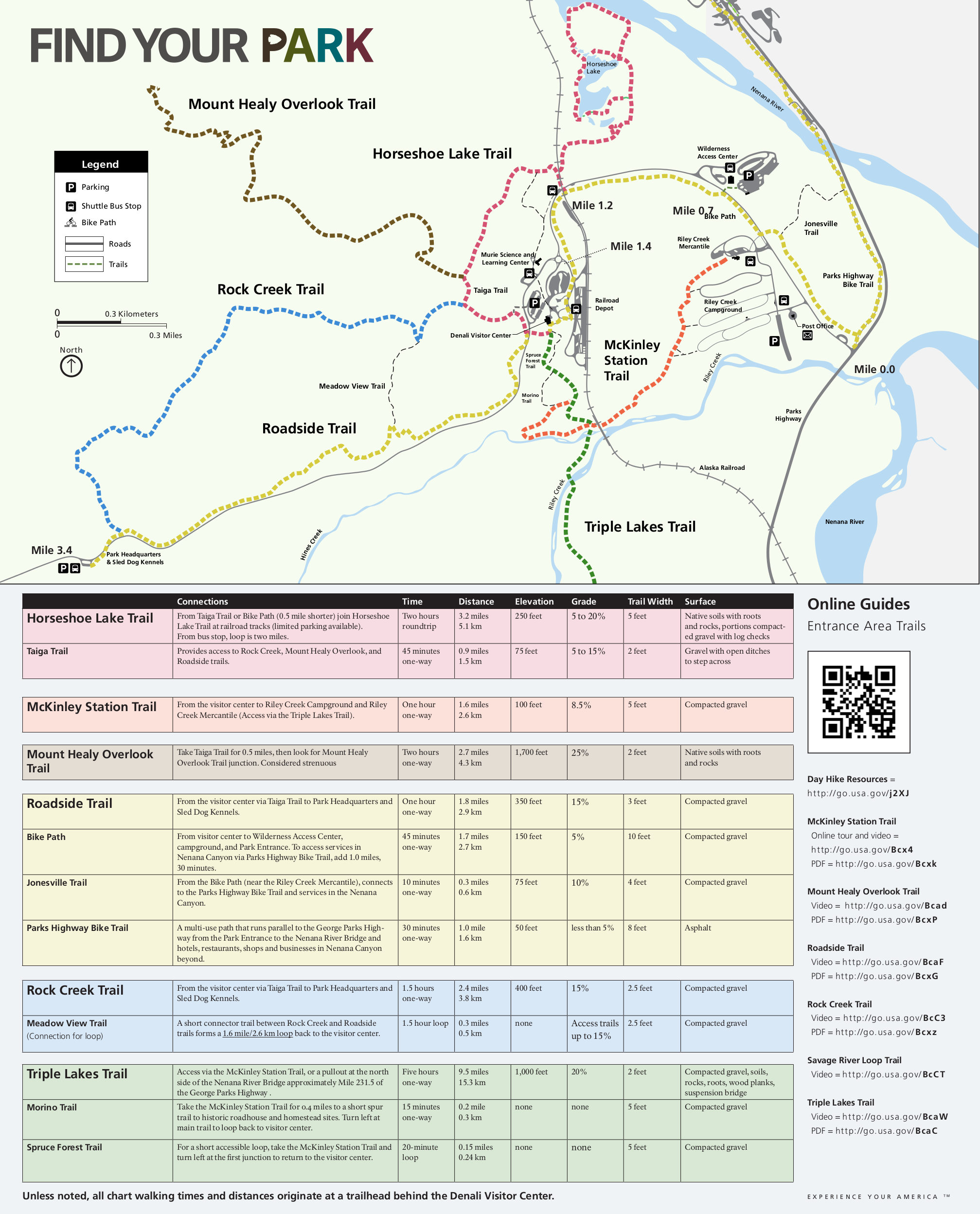
 The Denali trail map shows trails in the entrance station area as well as Savage River. You can also download the NPS trail handout that includes a table with information about elevation change and distance.
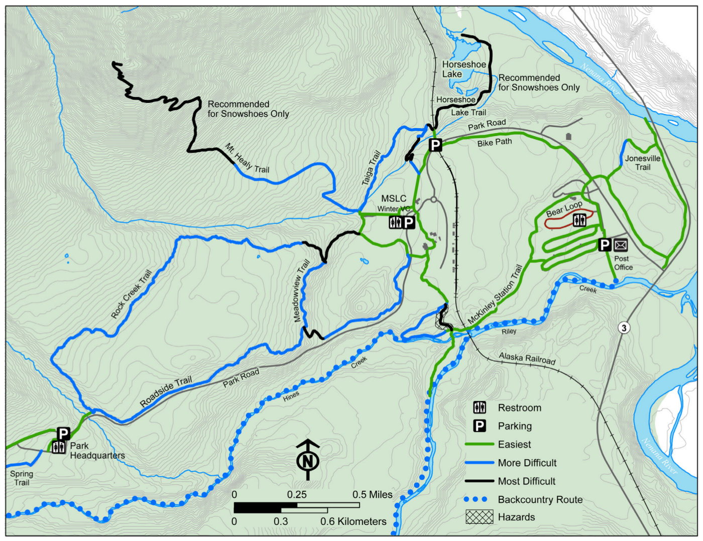 This is a Denali entrance area winter map, showing the ski and snowshoe routes at the park entrance. They’re color-coded by difficulty level, allowing you to choose easy, intermediate, or difficult ones.
Denali campground maps
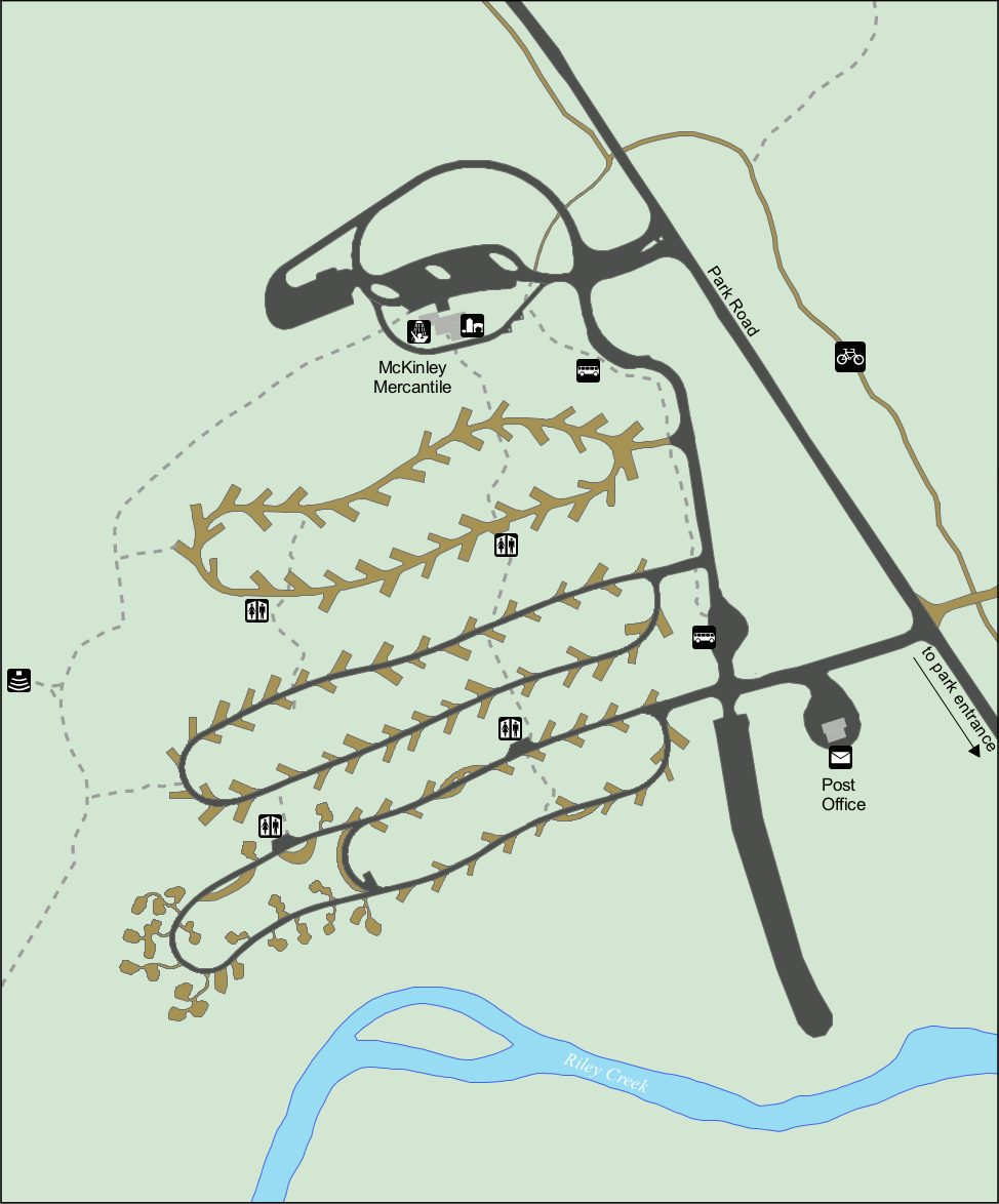 This is a Riley Creek Campground map. Riley Creek is the largest campground in the park and is located near the park entrance and Denali Visitor Center. Here you’ll see each campsite and the restrooms.
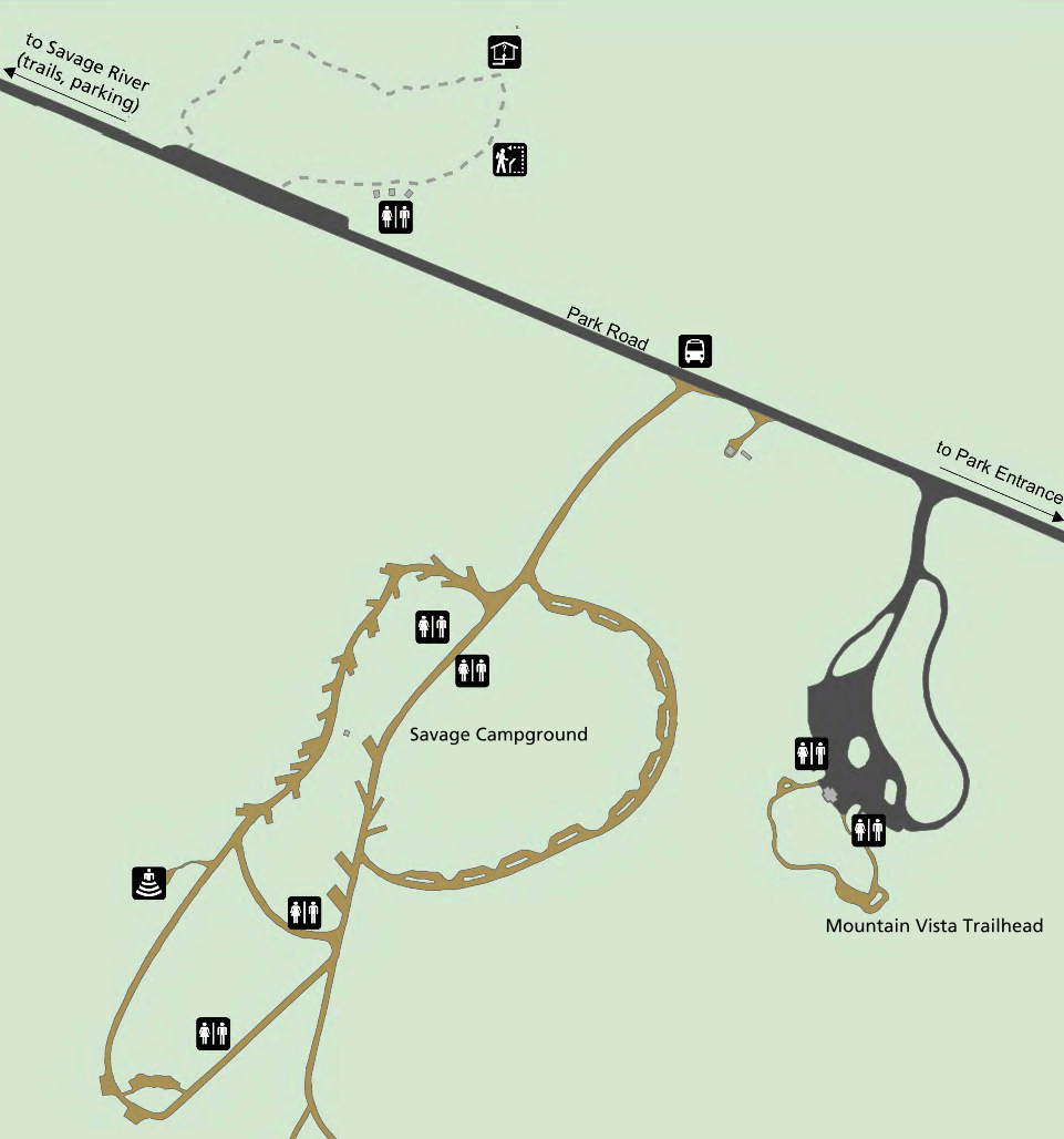 This is a Savage River Campground map. This campground is located 13 miles west along the Park Road and has 33 campsites. This map also shows nearby trails and viewpoints.
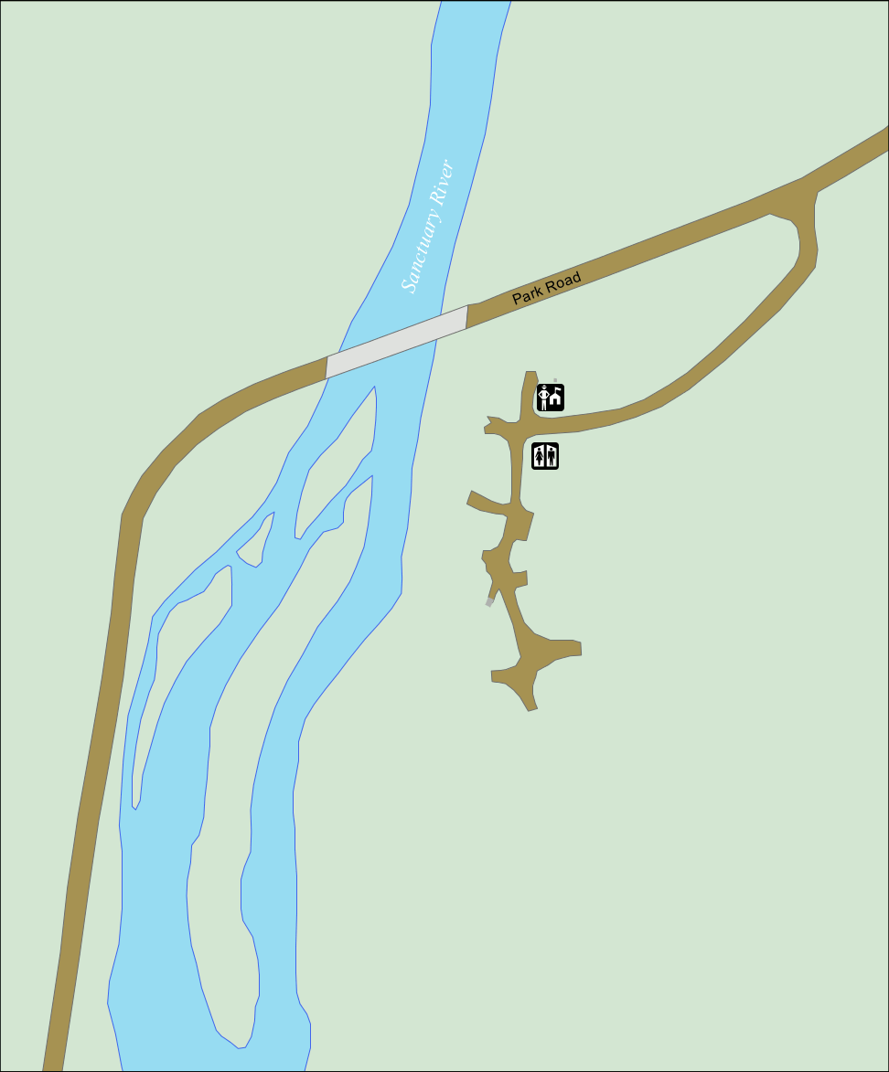 This is a Sanctuary Campground map. Sanctuary is a small tent-only campground along the Sanctuary River, featuring only seven campsites. This is about as rustic and quiet as you can get!
 This is a Teklanika River campground map. “Tek” River Campground is the second largest in the park and is located 29 miles west along the Park Road. This map shows the two loops and restrooms.
Denali lodging map
 Most visitors who want to stay nearby Denali end up in Healy, which has a number of lodging options. To the right you can view an Expedia interactive lodging map of Healy, which is the nearest town to Denali National Park’s entrance. Or you may want to start out by browsing Expedia’s best-rated Denali lodging in order to compare prices, read reviews, and view photos of the various options.
Denali landscape maps
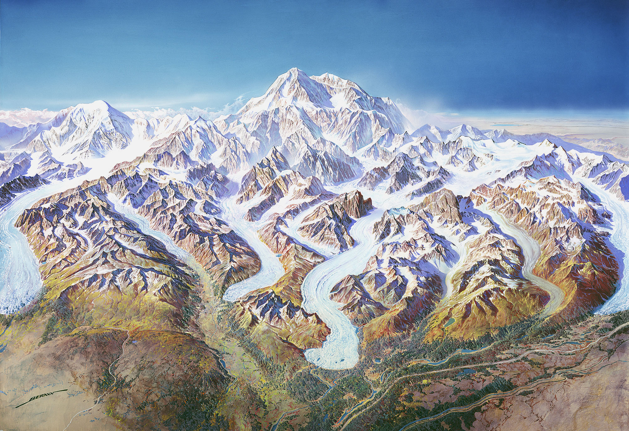
 This amazing Denali landscape map was originally painted for the National Park Service by Austrian painter Heinrich Berann. Enjoy dreaming about the incredible Alaskan mountains while viewing this!
 This unlabeled Denali landscape map is pretty much the same as the map above, but removes all the labels for a more natural perspective. Save them both and quiz yourself; you’ll be an expert in no time.
Assorted Denali maps
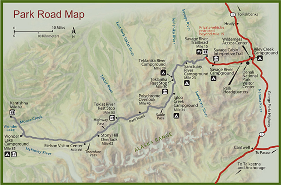
 The Denali road map focuses on the main road to Wonder Lake. In a typical year, shuttle buses traverse the entire road to Wonder Lake, but through at least 2026, shuttles only run to Mile 43 due to the Pretty Rocks landslide.
 The Denali National Park bike map highlights the Roadside Bike Trail, which is a paved multiuse path a bit under 2 miles in length. You can also ride on the main park road.
 The overnight parking map shows the three locations visitors can leave their vehicles overnight when on overnight cycling trips: Riley Creek, the Backcountry Information Center, and the Denali Visitor Center.
Denali geologic maps
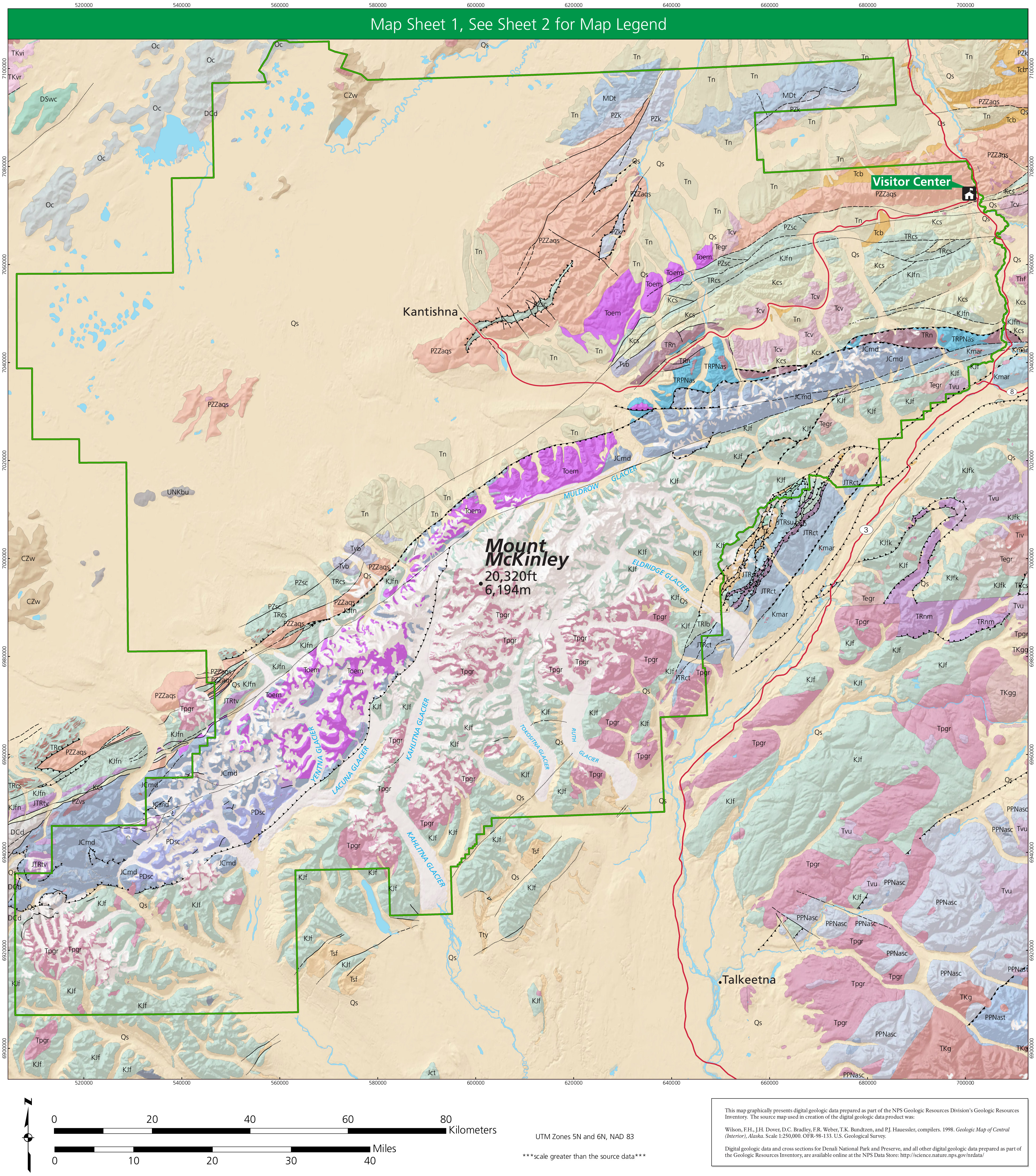 Here’s a Denali geologic map, showing all the rock layers within the national park boundary. This map labels the rock types, but you’ll need to download the map below for a legend identifying each one.
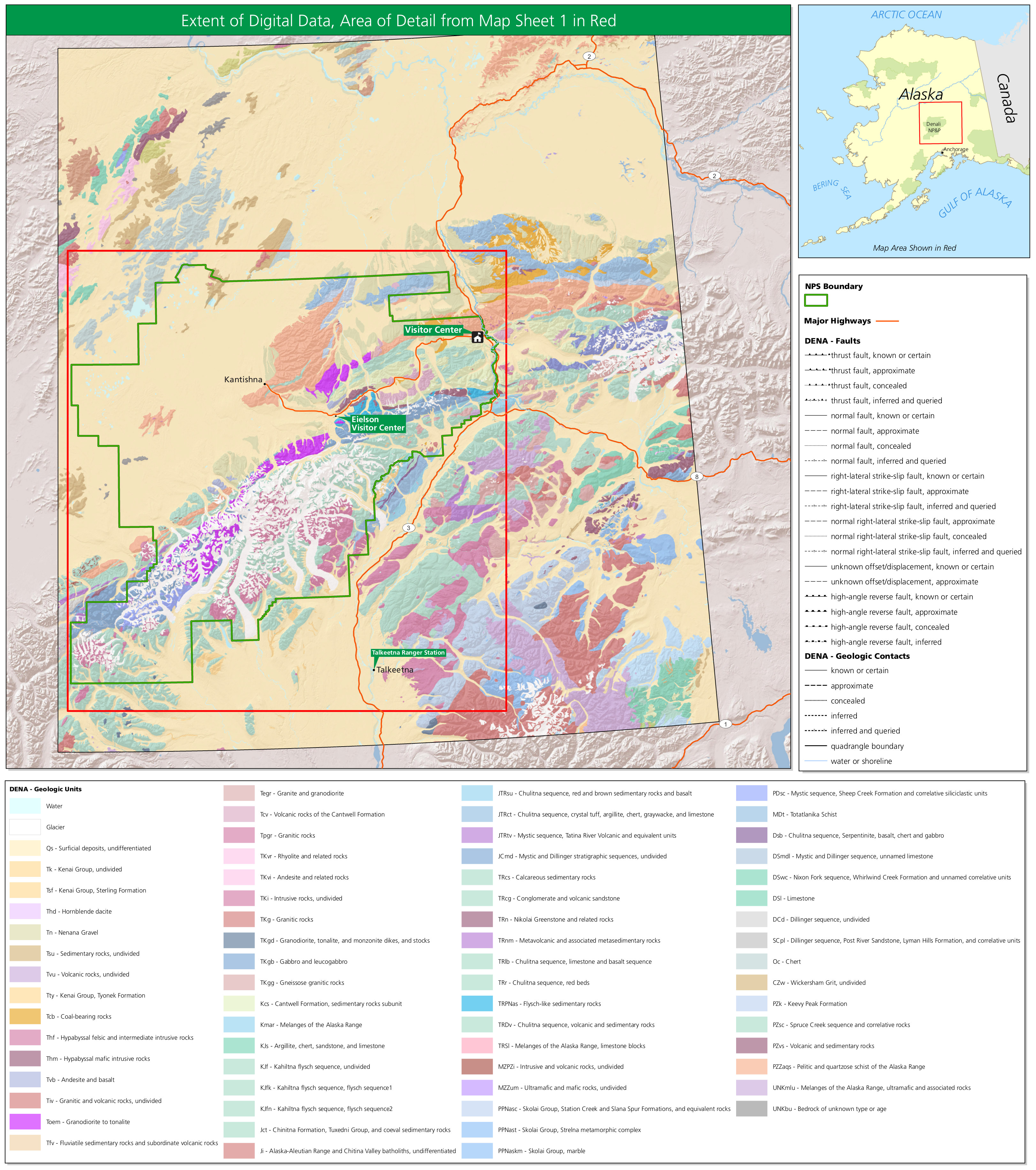 This geologic map of Denali zooms out from the one above and shows much of surrounding Alaska. It also includes a legend, identifying all the rock layers found on these two maps.
Archived Denali maps
 This is the old official Denali map from the mid-2010s park brochure, showing roads, mountains, campgrounds, and points of interest. Click the image to view a full size map or download the PDF.
 This is a detail map of Denali park entrance area from the mid-2010s, including the Riley Creek Campground and Denali Visitor Center. Click the image to view a full size map or download the PDF.
 Here’s an old Denali entrance area trail map from the mid-2010s, focusing on the trails near the beginning of the Wonder Lake Road. You’ll also find here a table of trail distances and descriptions of each route.
 This is an old Denali Park Road map, showing campgrounds and points of interest along the 89 miles to Wonder Lake and Kantishna. It also shows which parts you can drive and which are shuttle bus only.
Denali map prints and gifts

 Printed high-resolution Denali map posters and other products are available at the Denali National Park Maps store. For art prints, gift ideas, and souvenirs featuring other national parks, support this site and visit the National Park Maps store; you’ll find items to bring on vacation, keep at home for the memories, or give to your park-enthusiast friends and loved ones.
…and more!
< Return to National Park Maps home
< Return to Park List
< Return to List by State