Kings Canyon maps from the park brochure
 Here is the Kings Canyon National Park map from the official brochure, last updated by the National Park Service in 2025. It is zoomed in on the road-accessible areas only and includes Sequoia National Park.
 This full Kings Canyon and Sequoia National Parks map zooms out to show all lands in the two parks. It doesn’t have a ton of detail but is focused instead on showing the diverse ecosystems from the foothills to Mt. Whitney.
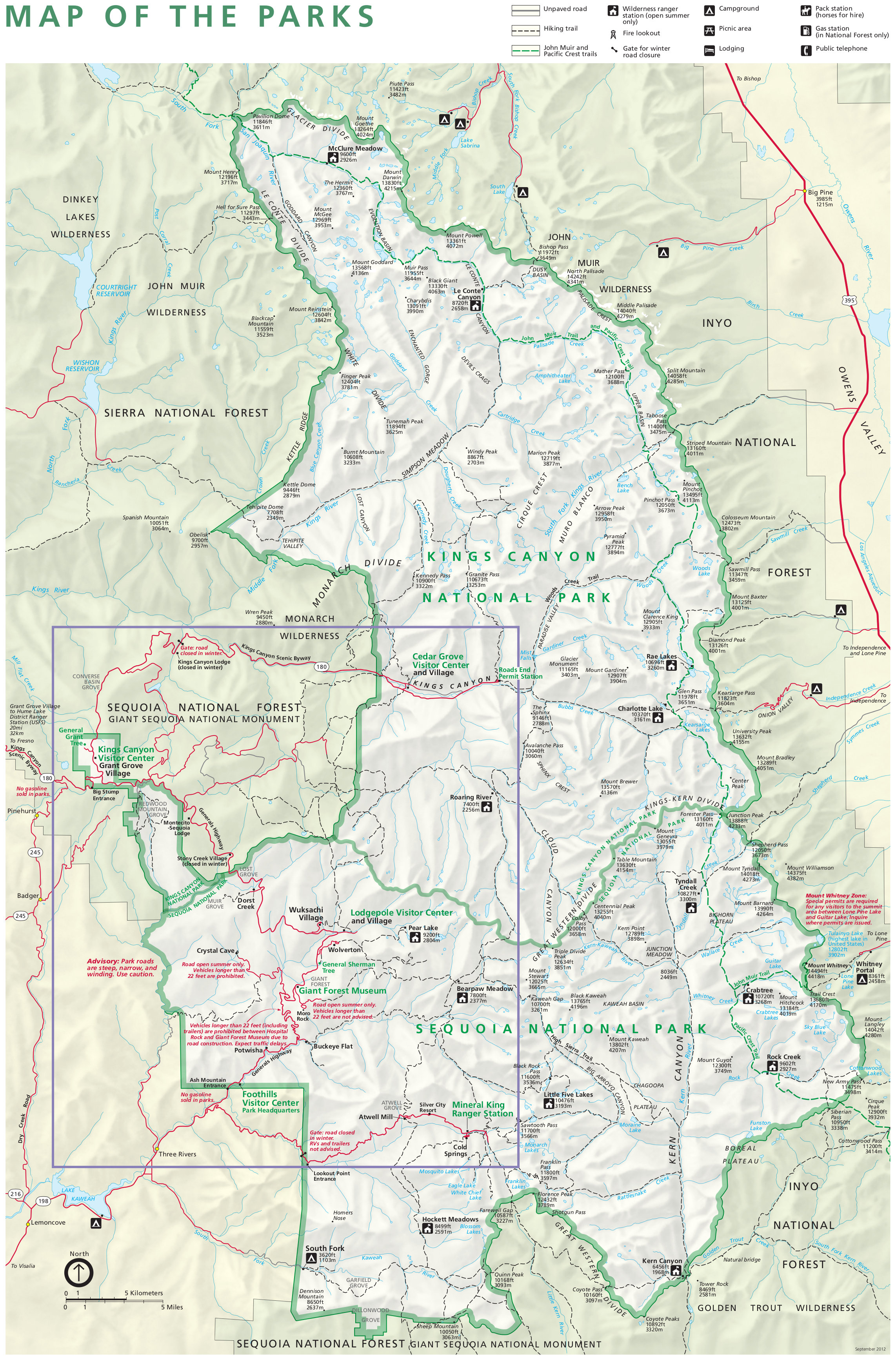 This is the old official Kings Canyon and Sequoia map. It’s no longer in print as of 2025, but I like this older one because of its backcountry detail. Click the image to view a full size map or download the PDF.
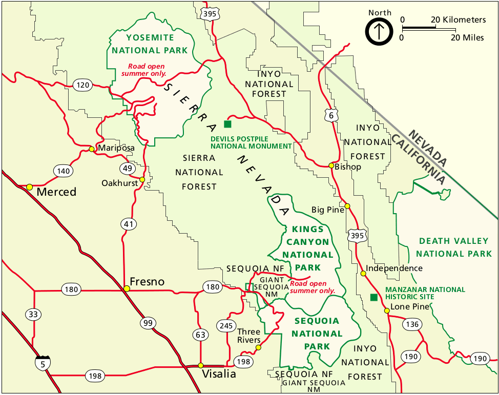
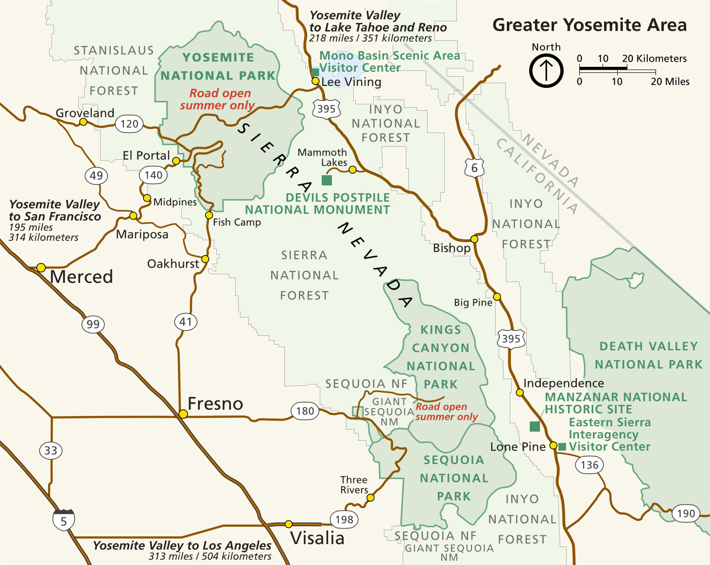 This Kings Canyon regional map zooms way out to show these two parks in relation to Yosemite National Park, nearby cities, and parks and monuments located on the east side of the Sierra Nevada.
Kings Canyon and Sequoia trail maps
 If you’re planning on doing any long day hikes or overnight backpacking trips, you’ll want a detailed trail map like the National Geographic Trails Illustrated map. One Trails Illustrated map will cover all of Sequoia and Kings Canyon’s wilderness area. The Tom Harrison maps I love and used to recommend here are now out-of-print, but I’ve found that the NatGeo maps really do make a worthy successor, and I personally own this map as well.
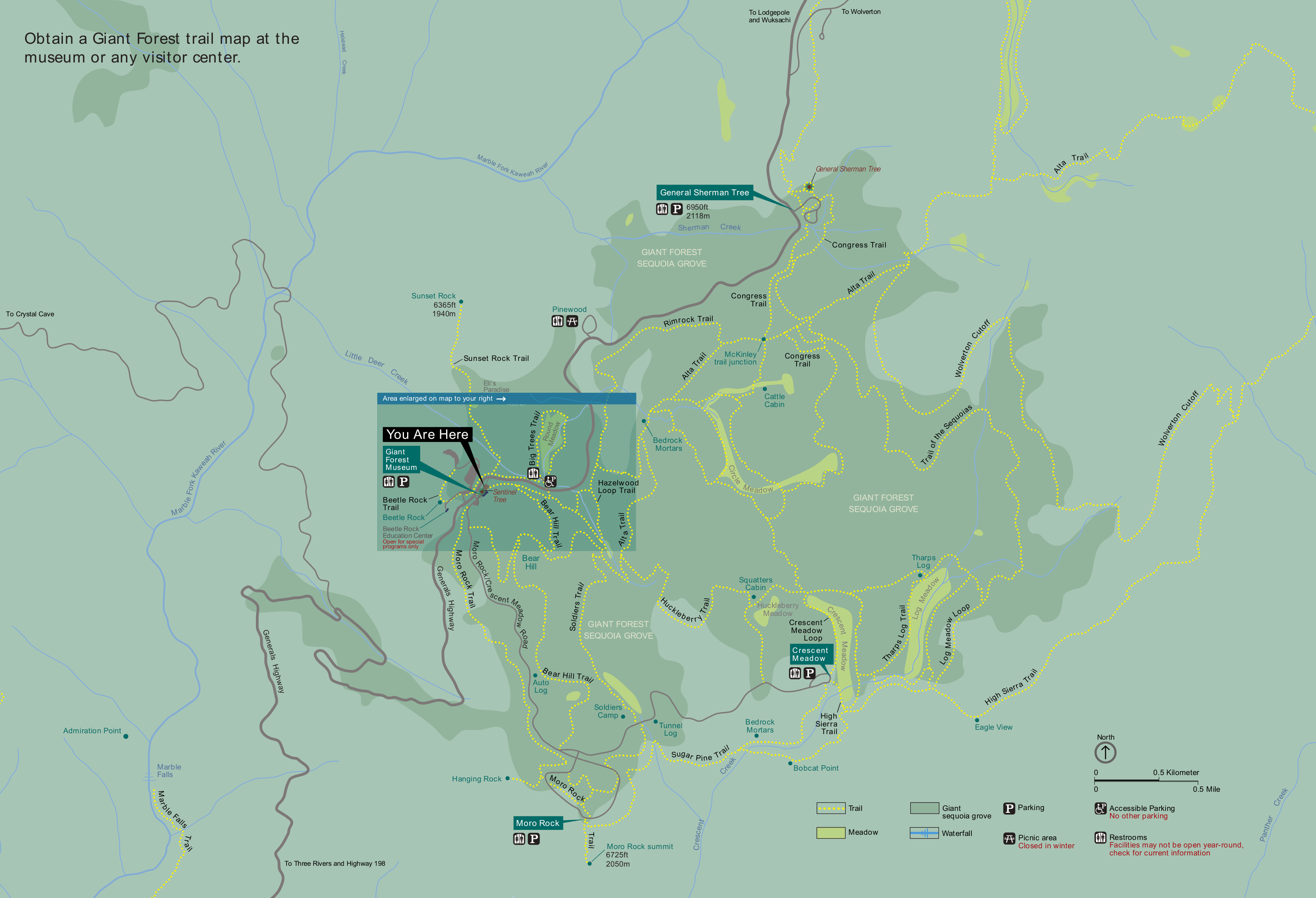 This Giant Forest trail map is on the wayside sign in front of the Giant Forest Museum in Sequoia. It shows the extensive network of trails through the Giant Forest, including the General Sherman Tree.
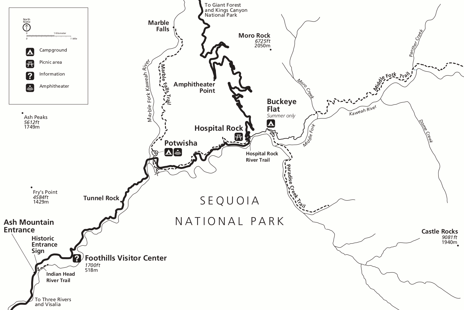 This is a Foothills trail map of Sequoia National Park. It shows the popular trails in the Foothills district, which is not ideal for hiking during the summer because it is very, very hot.
Kings Canyon attractions maps
 Here’s the summer map of Kings Canyon and Sequoia National Parks. This edition is from the 2025 visitor guide and highlights ranger recommendations for places to visit in all areas of both parks.
 The Kings Canyon and Sequoia winter map is another visitor guide like the one above, but focused on the places accessible during the winter season when most of the parks are under snow.
Kings Canyon and Sequoia shuttle maps
 Here’s the summer Sequoia National Park shuttle map from 2025, which shows the three free daily routes (Giant Forest, Sherman Tree, Lodgepole), one free weekend route (Wuksachi), and the paid shuttle from Visalia.
 This is the winter shuttle map, last updated in 2024. These shuttles run during winter holidays (Christmas break, MLK Day weekend, Presidents’ Day weekend), but the Wuksachi/Lodgepole route ends after the new year.
Kings Canyon lodging map
 Like Sequoia National Park, Kings Canyon doesn’t have much nearby in terms of hotels. If you’re visiting both Sequoia and Kings Canyon, the Three Rivers is a convenient home base; to the right in an Expedia interactive Three Rivers lodging map. Otherwise, you’ll almost certainly drive through Fresno on your way to or from the park, so it’s worth comparing Expedia’s top Fresno lodging where you’ll find plenty of selection to compare.
Giant Forest maps
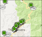
 Although not exactly a map, I believe this General Sherman Tree infographic is interesting enough to warrant inclusion on this page. You know I’m right! Look for it on a wayside when you visit the park.
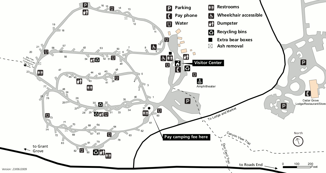
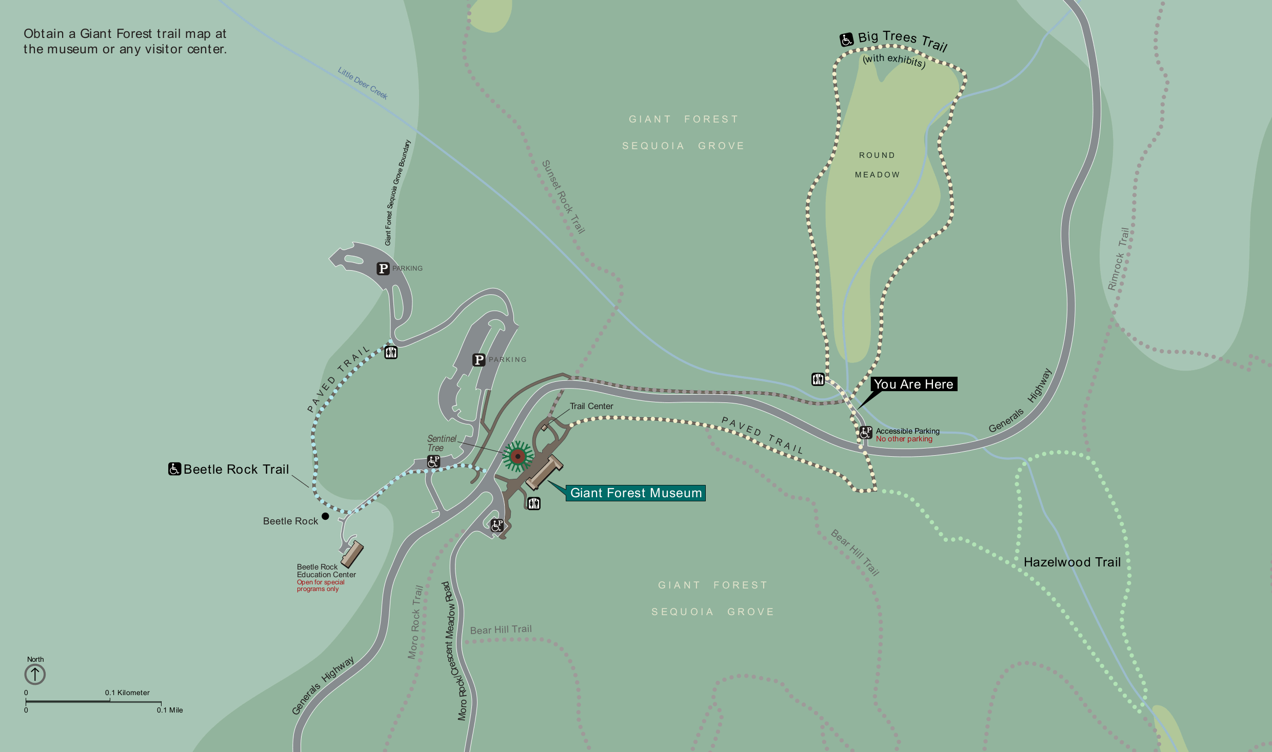 Here’s a Giant Forest Museum map, zooming in on the area immediately surrounding the museum. This map can be found on a wayside sign at the start of the Big Trees Trail at Round Meadow.
Kings Canyon and Sequoia campground maps
The following is a listing of campgrounds located in both Sequoia and Kings Canyon; they are listed here from north to south, starting at Roads End in Kings Canyon.
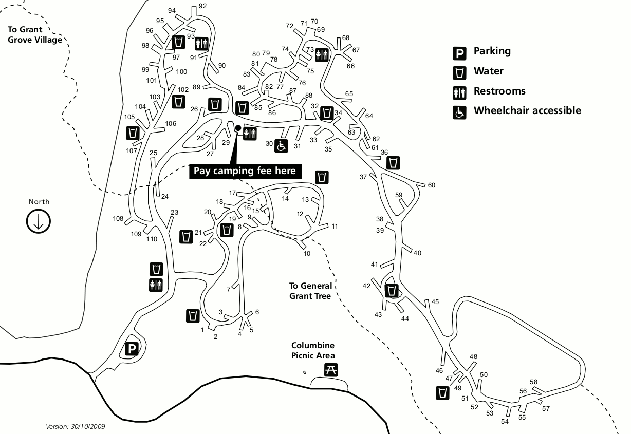
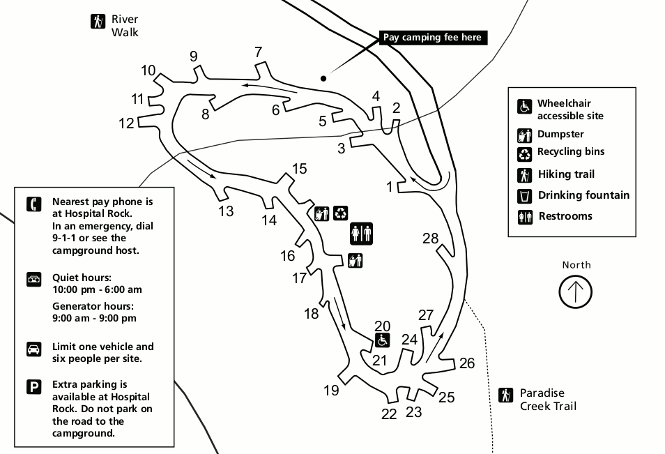
 This is a Moraine Campground map, located furthest east of all the Cedar Grove area campgrounds in Kings Canyon National Park, nearest to Road’s End and furthest from the village and visitor center.
 This is a Canyon View Campground map, located near Cedar Grove in Kings Canyon. This is a group campground only. (Personally I find it nice to separate out the larger groups from family campers.)
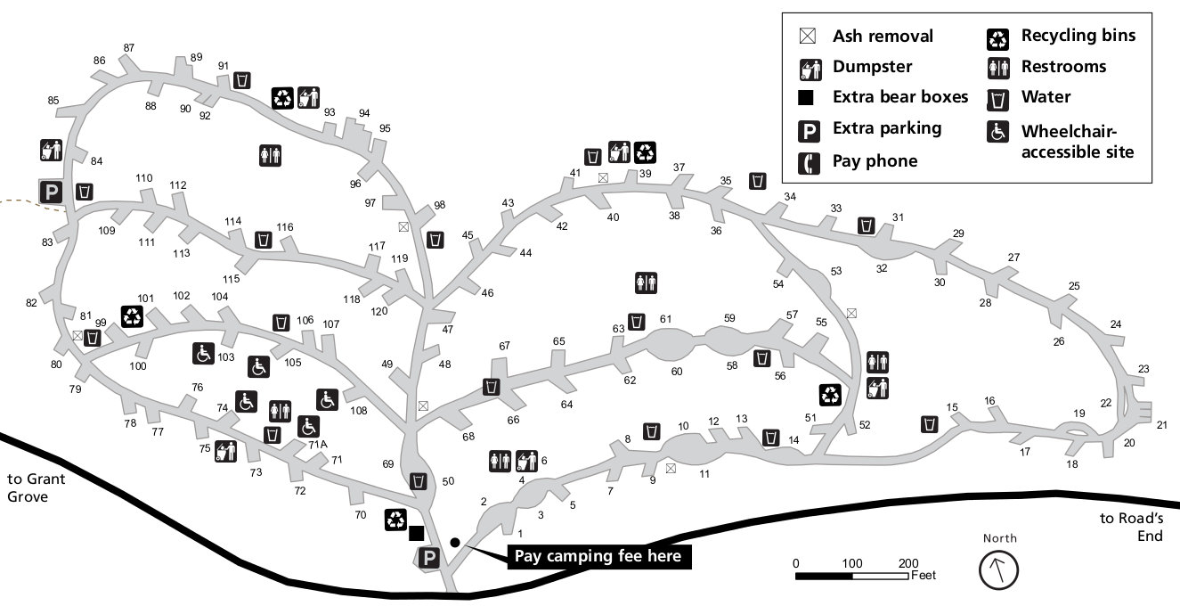
 This is a Sentinel Campground map, located at Cedar Grove in Kings Canyon National Park. You’ll find warmer temperatures here than the Grant Grove campgrounds listed further below.
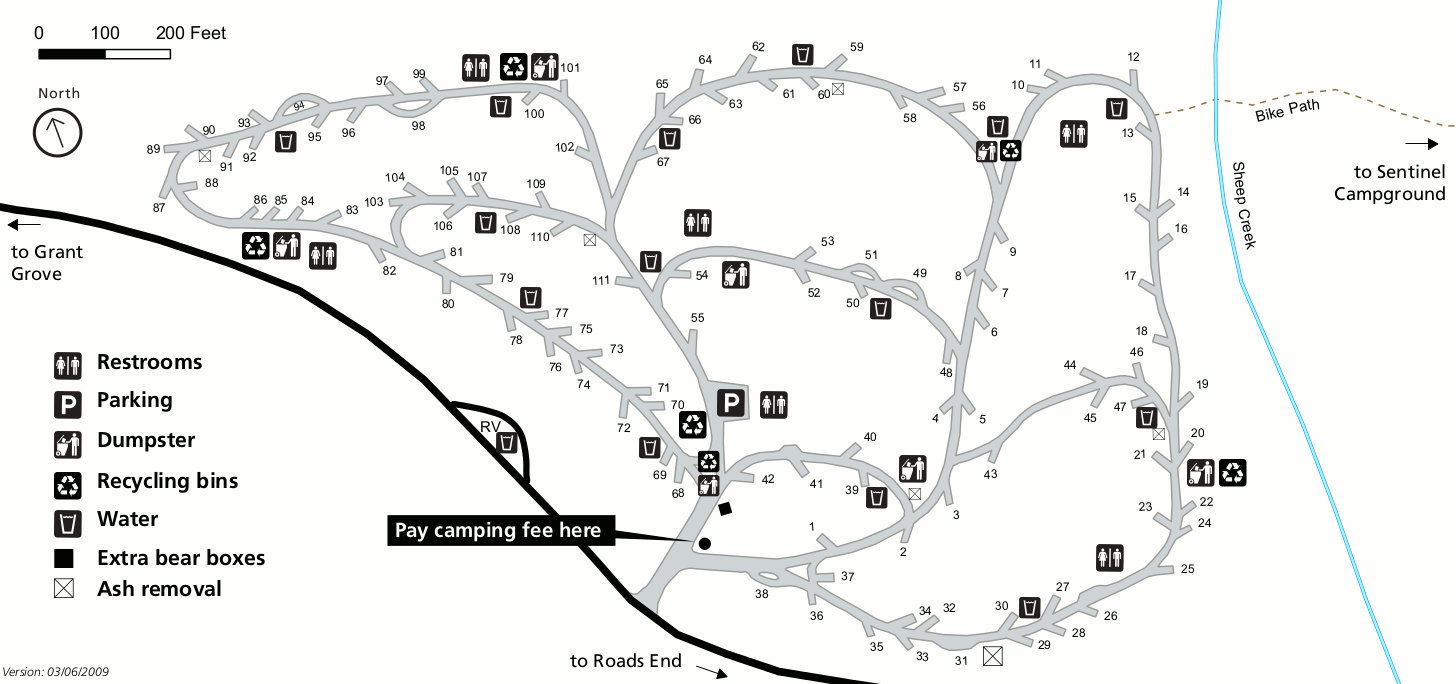 This is a Sheep Creek Campground map, located near Cedar Grove in Kings Canyon National Park. This and the previous campgrounds are lower elevation campgrounds in Kings Canyon proper.
 This is a Crystal Springs Campground map, open summers and also located near Grant Grove in Kings Canyon National Park. These next few campgrounds are high elevation with cooler temperatures.
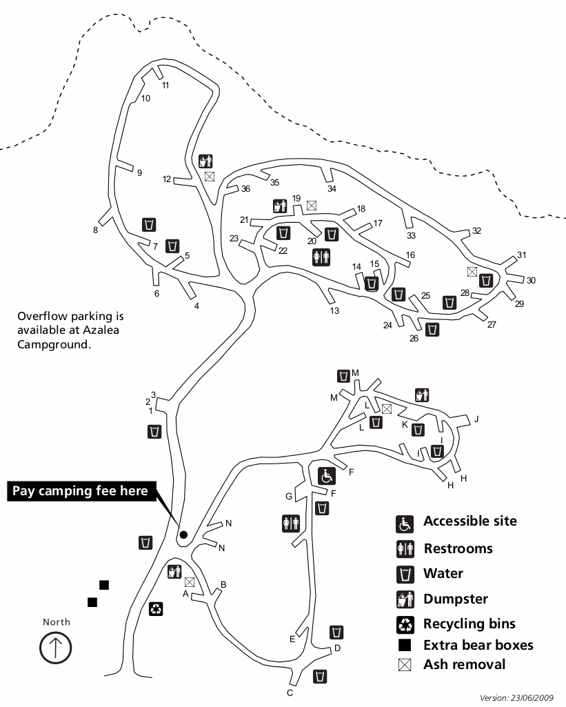
 This is an Azalea Campground map, located near Grant Grove in Kings Canyon National Park. It is Kings Canyon’s only all-year campground, with pleasant temperatures in summer (snow in winter).
 This is a Sunset Campground map, open summers with over 100 sites and located near Grant Grove in Kings Canyon National Park. This is another high-elevation forested campground.
 This is a Dorst Creek campground map, located on the way to Lodgepole along the Generals Highway. This high-elevation campground stays cool during summer months like Grant Grove.
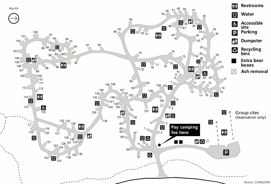
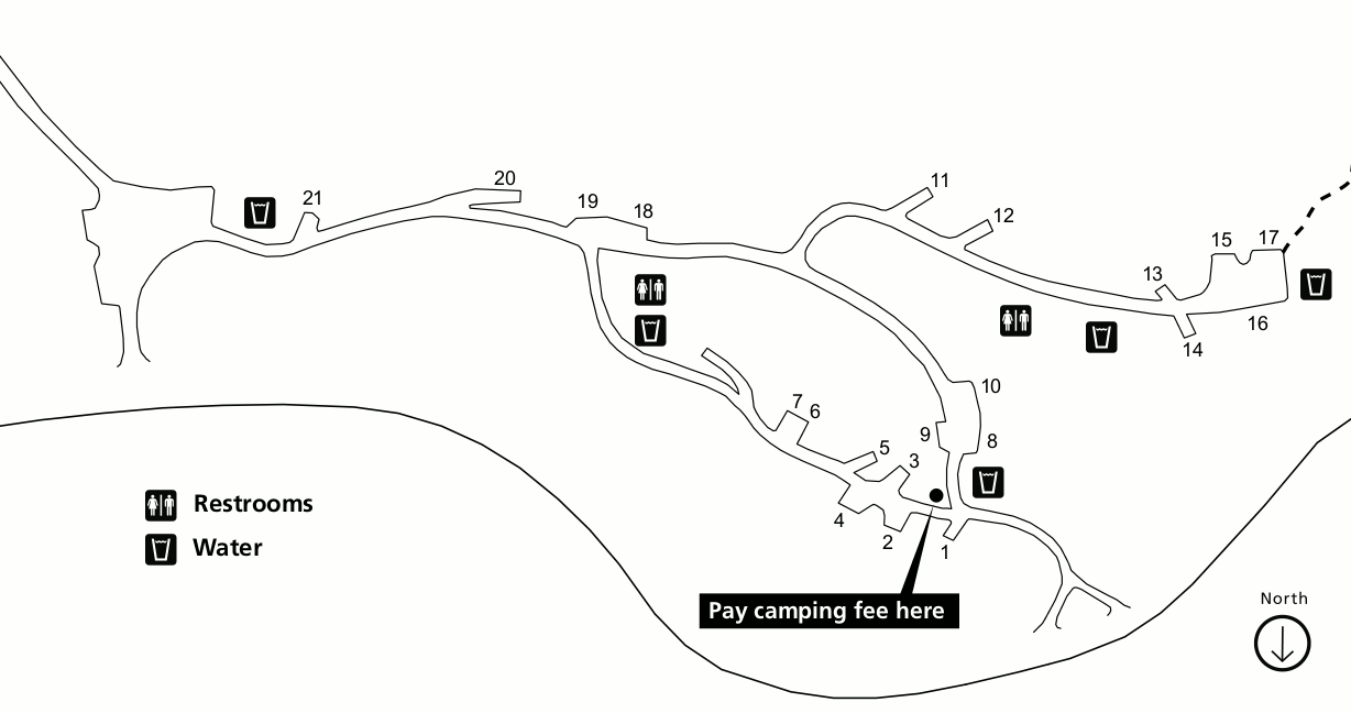
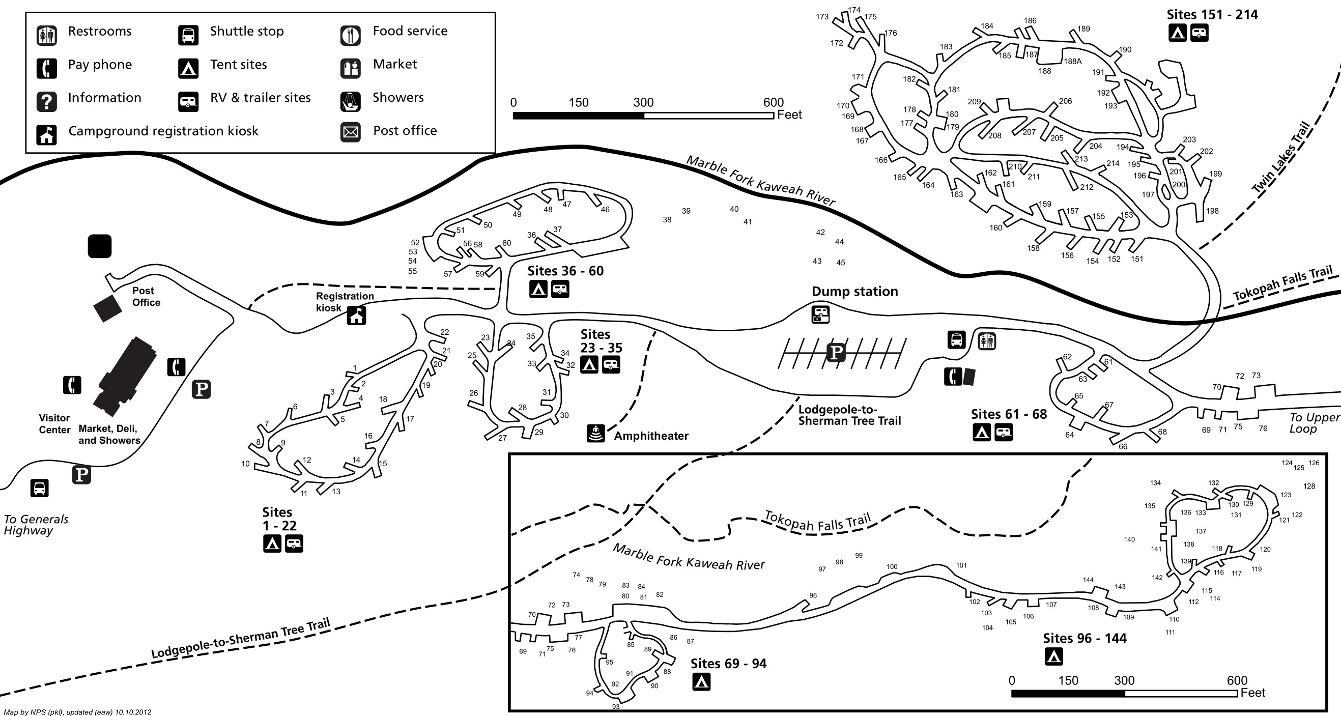 This is a Lodgepole campground map. Lodgepole is the centerpiece campground in Sequoia, located nearest Giant Forest and the Lodgepole area. Its location along the Marble Fork of the Kaweah River doesn’t hurt!
 This is a Buckeye Flat campground map, open seasonally (summers) along the Generals Highway in the low elevation Foothills district in Sequoia National Park.
 This is a Potwisha campground map, open all year and located along the Generals Highway in the low elevation Foothills district in Sequoia National Park. It’ll be hot during the summer!
 This is an Atwell Mill campground map, open during the summer months along the Mineral King Road in Sequoia National Park. This is a very isolated part of Sequoia National Park down a rough road.
 This is a Cold Springs campground map, open during the summer months in Mineral King (very remote!) in Sequoia National Park. You probably won’t be going here unless you’re a hardcore visitor!
Kings Canyon backpacking maps
The National Park Service does not have any good free backpacking map showing all the wilderness trails. If you’re planning on a wilderness trip, you need a trail map with topo lines like this National Geographic Trails Illustrated map. Not only is it practically a requirement for safety when on the trail, but it’s pretty much necessary to plan your routes in the first place so you can view distances and elevation gain across trail segments.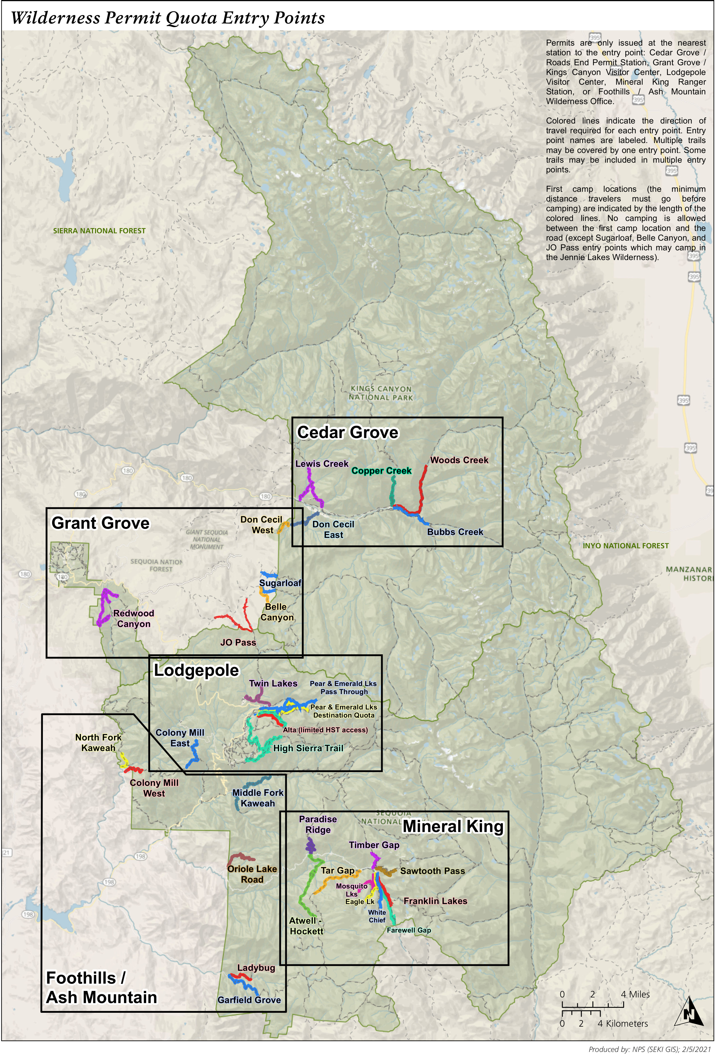 Here’s a backpacking map of Kings Canyon and Sequoia. This map is designed to show the trailheads that backpackers can reserve wilderness permits for. Each trailhead has a quota for how many per day can start a trip.
 This is a Kings Canyon and Sequoia bear box map, showing the locations of all food storage lockers in the wilderness, at least as of 2015 when the National Park Service created this map.
 The Kings Canyon stock use map shows all of Kings Canyon’s wilderness and where stock is allowed and what the grazing regulations are. Click the image to view a full size map or download a PDF.
 The Sequoia stock use map color codes regions of the Sequoia wilderness based upon stock travel and grazing regulations for horses, burros, and llamas. Click the image to view a full size map or download a PDF.
Assorted Sequoia and Kings Canyon maps
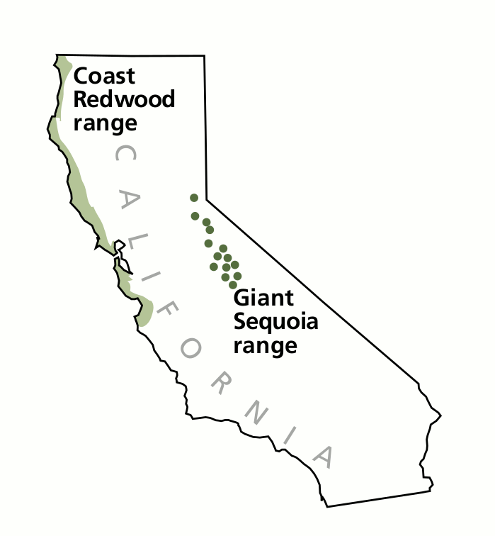 Here’s a sequoia range map, showing the only places on Earth where giant sequoia trees grow naturally. You can see how the range differs from redwoods, which grow only on the Pacific coast.
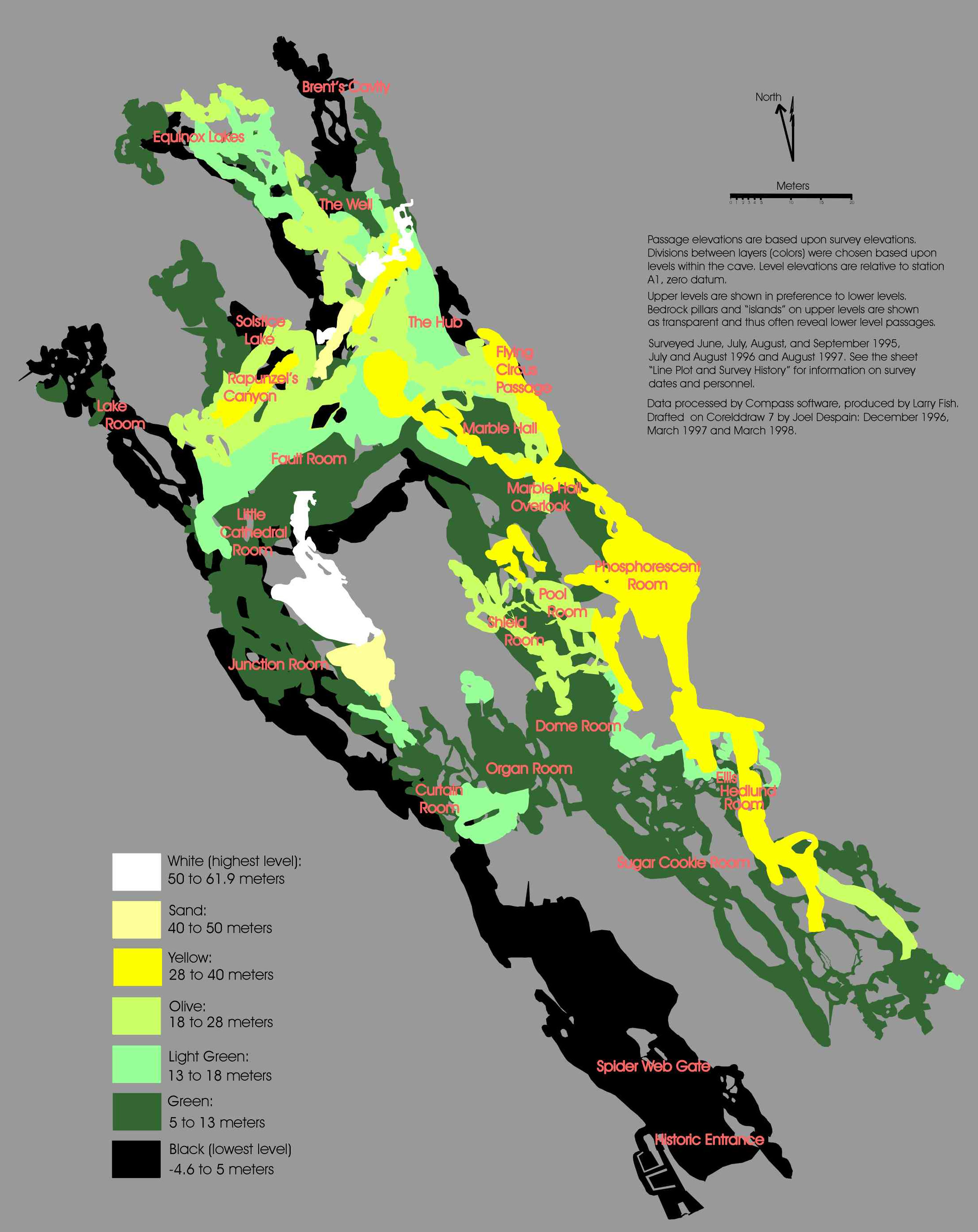 This Crystal Cave map shows the layout of Crystal Cave, which is located near Giant Forest. This cave is only accessible on guided tours through the Sequoia Parks Conservancy.
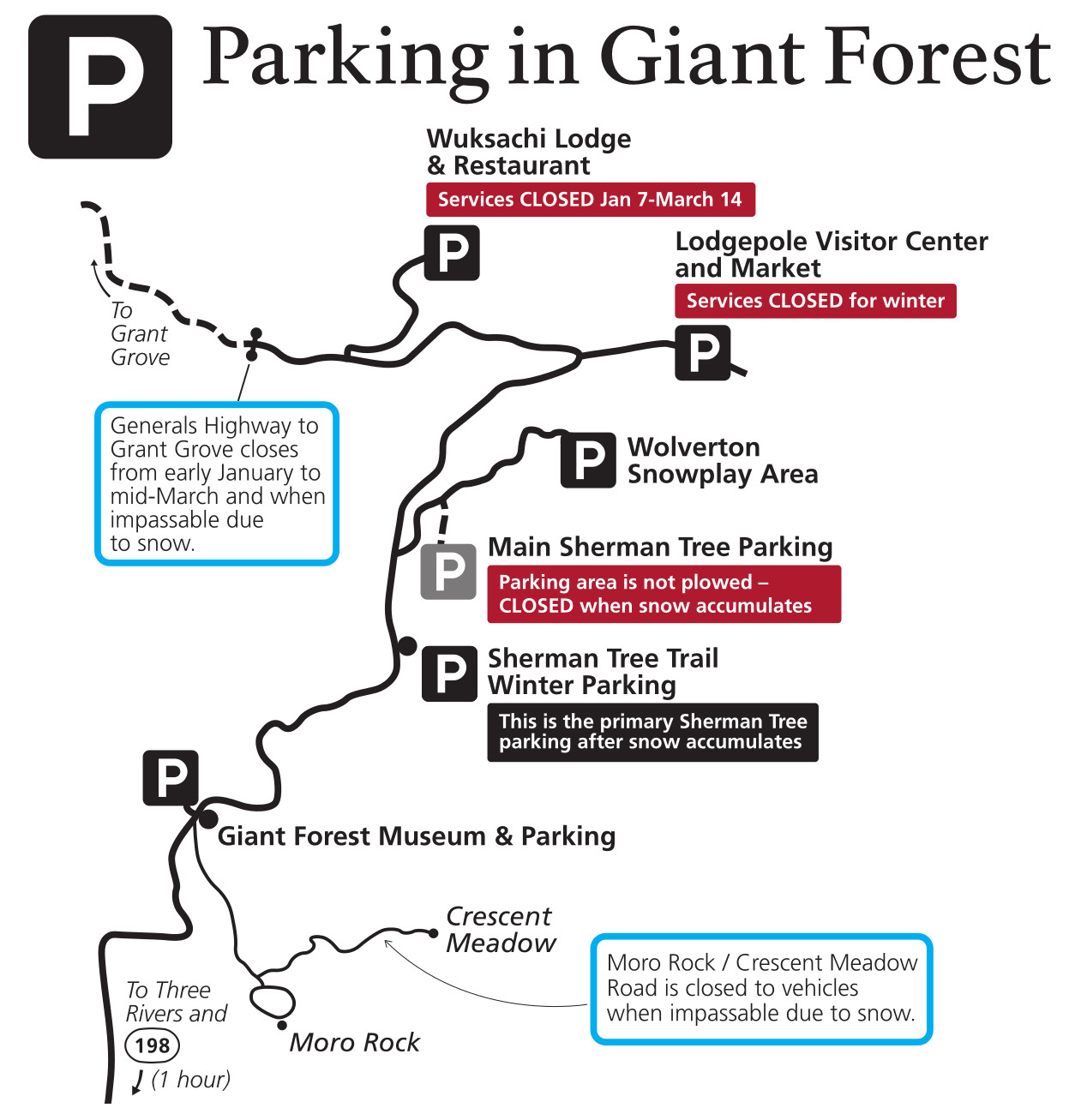 This Giant Forest winter parking map focuses on the locations visitors can park in the winter. Note that Lodgepole and Giant Forest are only accessible from Three Rivers and Visalia at this time of year.
Archived Kings Canyon maps
The National Park Service is constantly updating maps and putting out new ones; I do my best to update this page accordingly. The maps below have since been superseded by new maps higher on this page, but I’ve preserved them here for archival purposes so users can see how things change in parks over time.
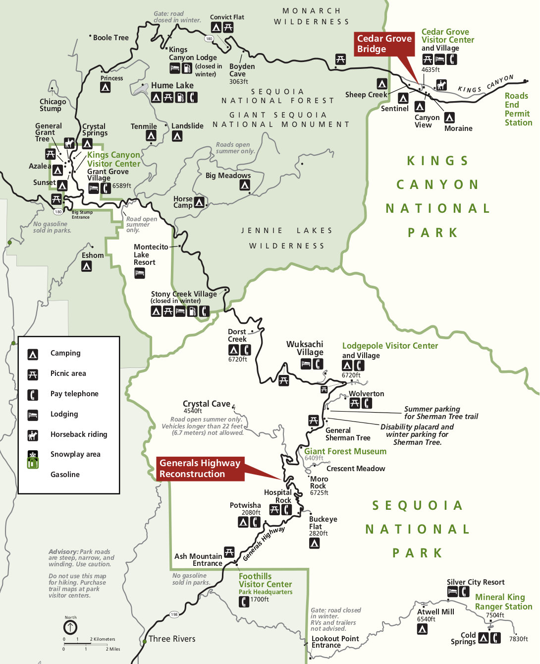
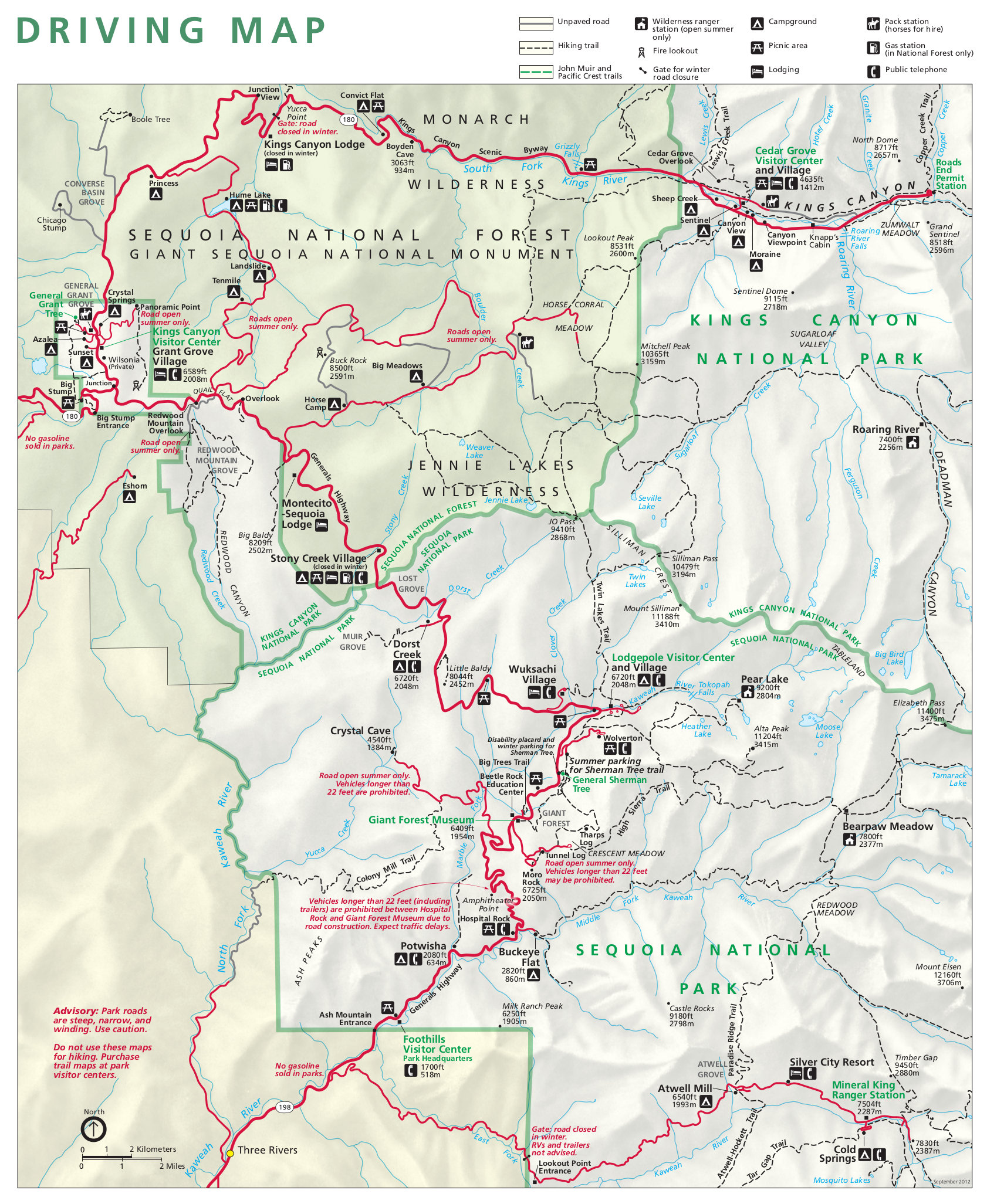 This is an old detail map of Sequoia and Kings Canyon from the mid-2010s, zooming in on the roads and frontcountry to show major points of interest. Click the image to view a full size map or download the PDF.
 This is an older regional map of Sequoia and Kings Canyon. I’ve archived it here although it was superseded by a new one in 2024, located on top of this page. Click the image to view a full size map or download the PDF.
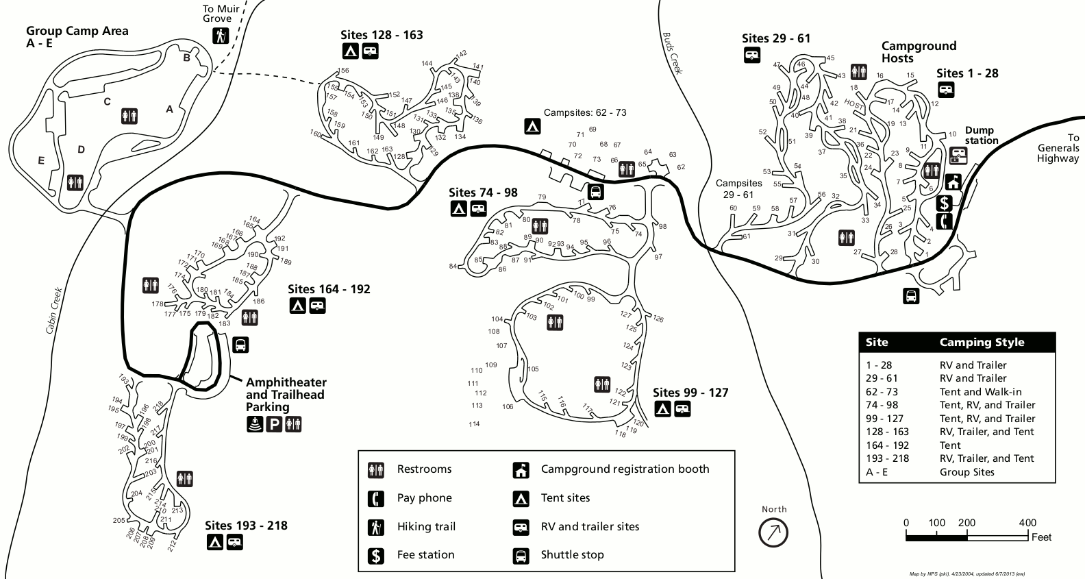
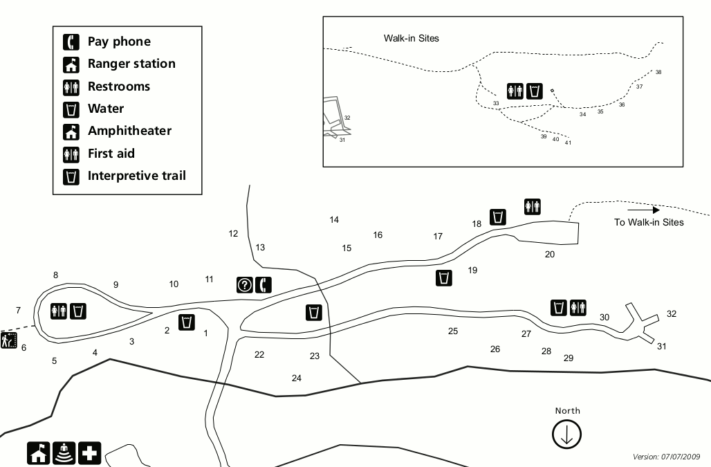
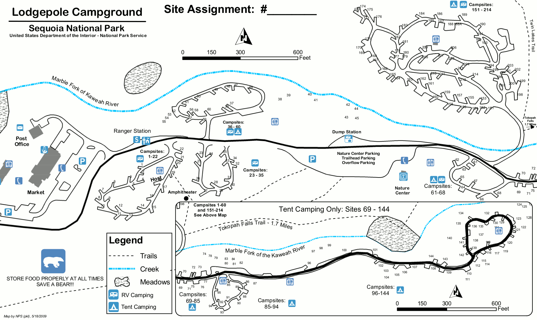 This is an old Lodgepole campground map from 2009. Lodgepole is the closest campground to Giant Forest in Sequoia National Park. Click the image to view a full size map or download the PDF.
 This is an old simple road map of Sequoia and Kings Canyon. This map is more suitable for printing than the full-park maps since it doesn’t have terrain shading and works well in grayscale ink.
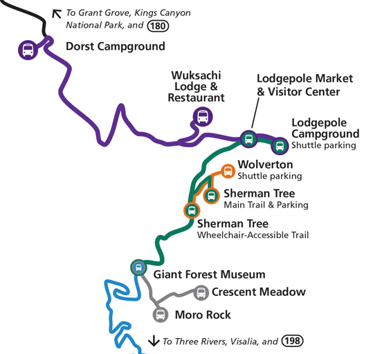 This is a late-2010s bus map of Sequoia and Kings Canyon shuttles, which operate during the summer months. It shows all bus stops including the General Sherman Tree, Moro Rock, Lodgepole, and the Wuksachi Lodge.
…and more!
< Return to National Park Maps home
< Return to Park List
< Return to List by State