Great Sand Dunes maps from the park brochure
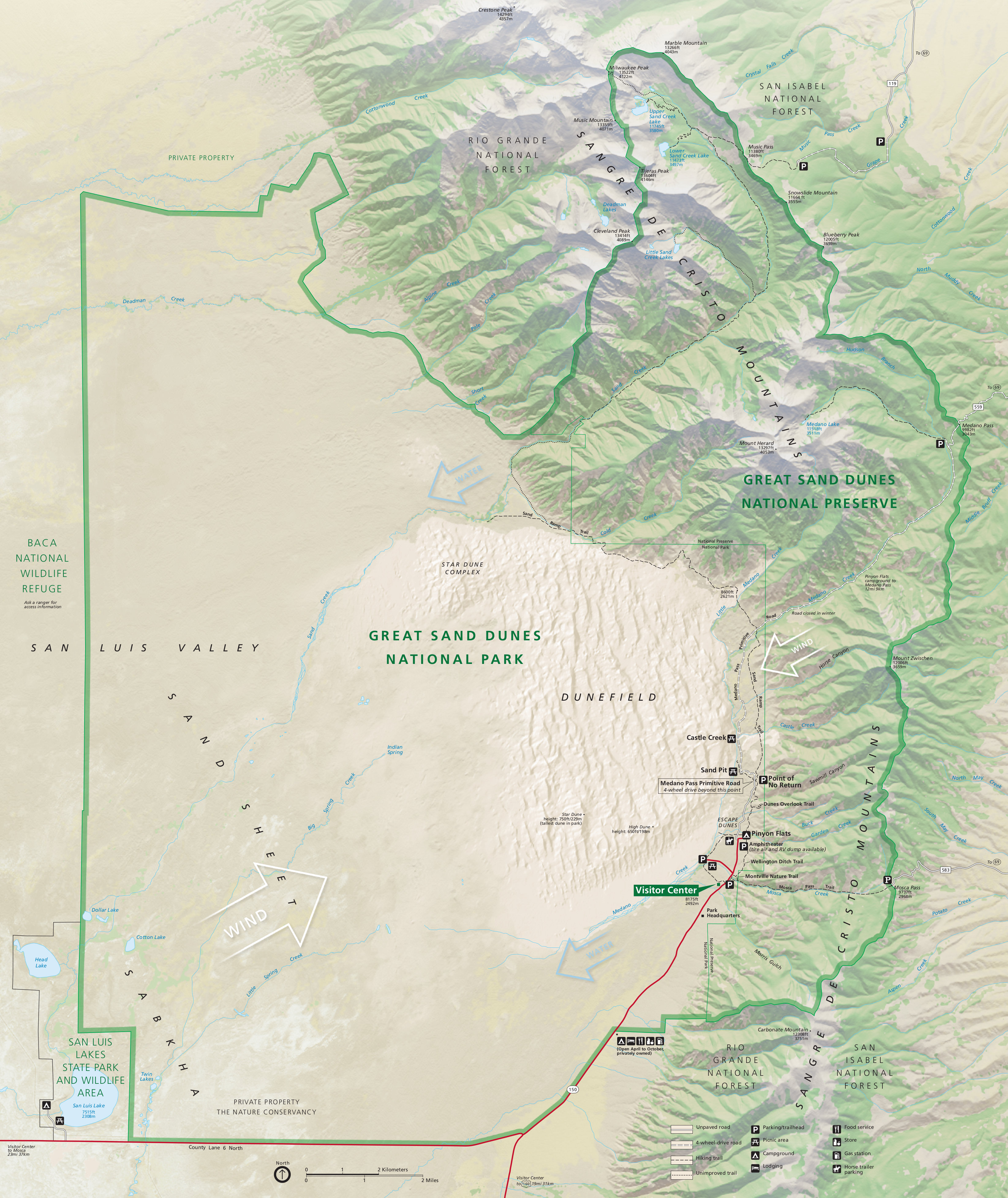
 Here’s the official Great Sand Dunes National Park map from the NPS brochure, identical to the one you receive when you visit. It was last updated in October 2022 and shows both the national park and the preserve.
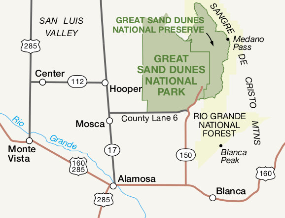 This is a regional map of Great Sand Dunes that shows roads and towns that surround the park and preserve. Click the image to view a full size map or download the PDF.
Great Sand Dunes backcountry maps
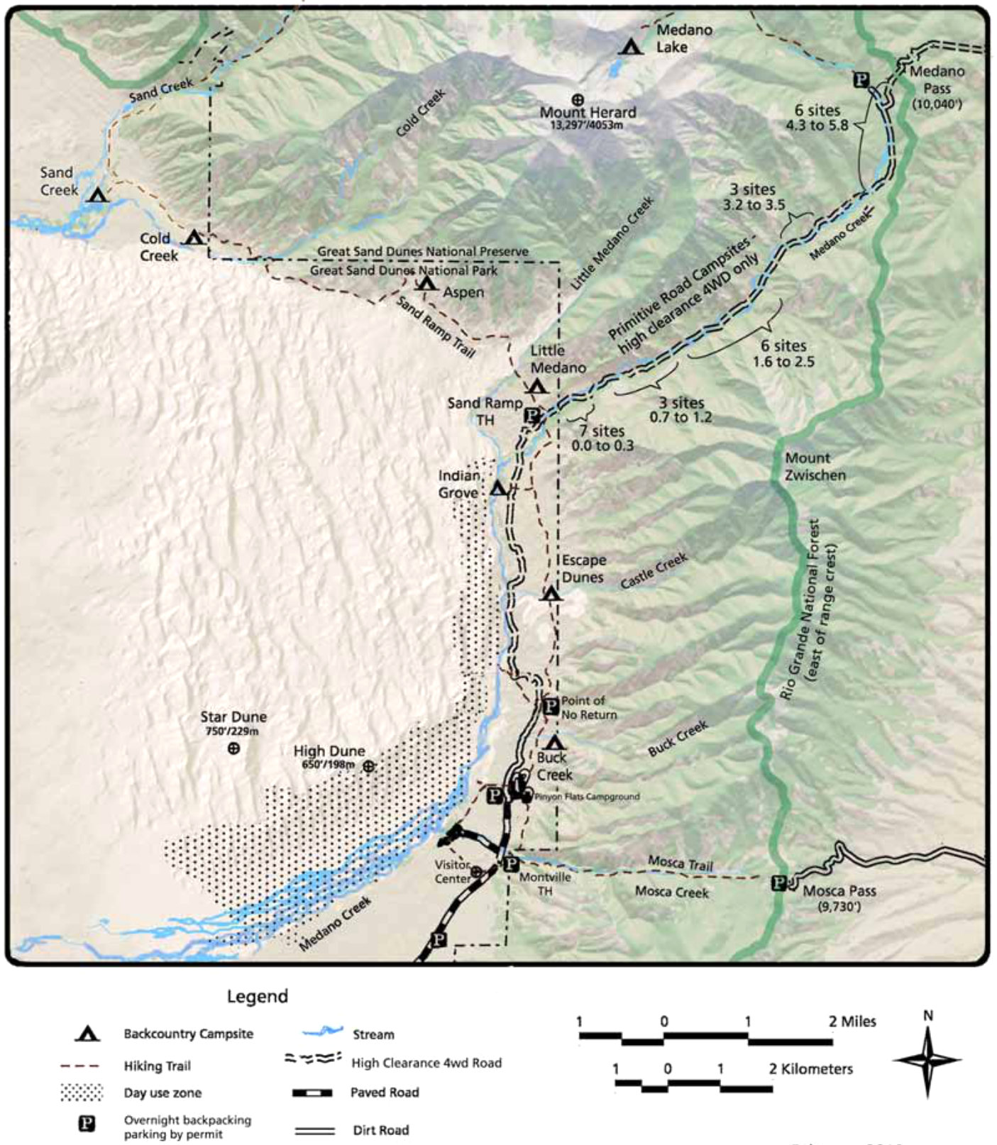
 The Great Sand Dunes backpacking map is useful to those planning overnight hiking trips on trails or into the dunefield. Take note of the shaded day use area; you must hike over the ridgeline before setting up camp.
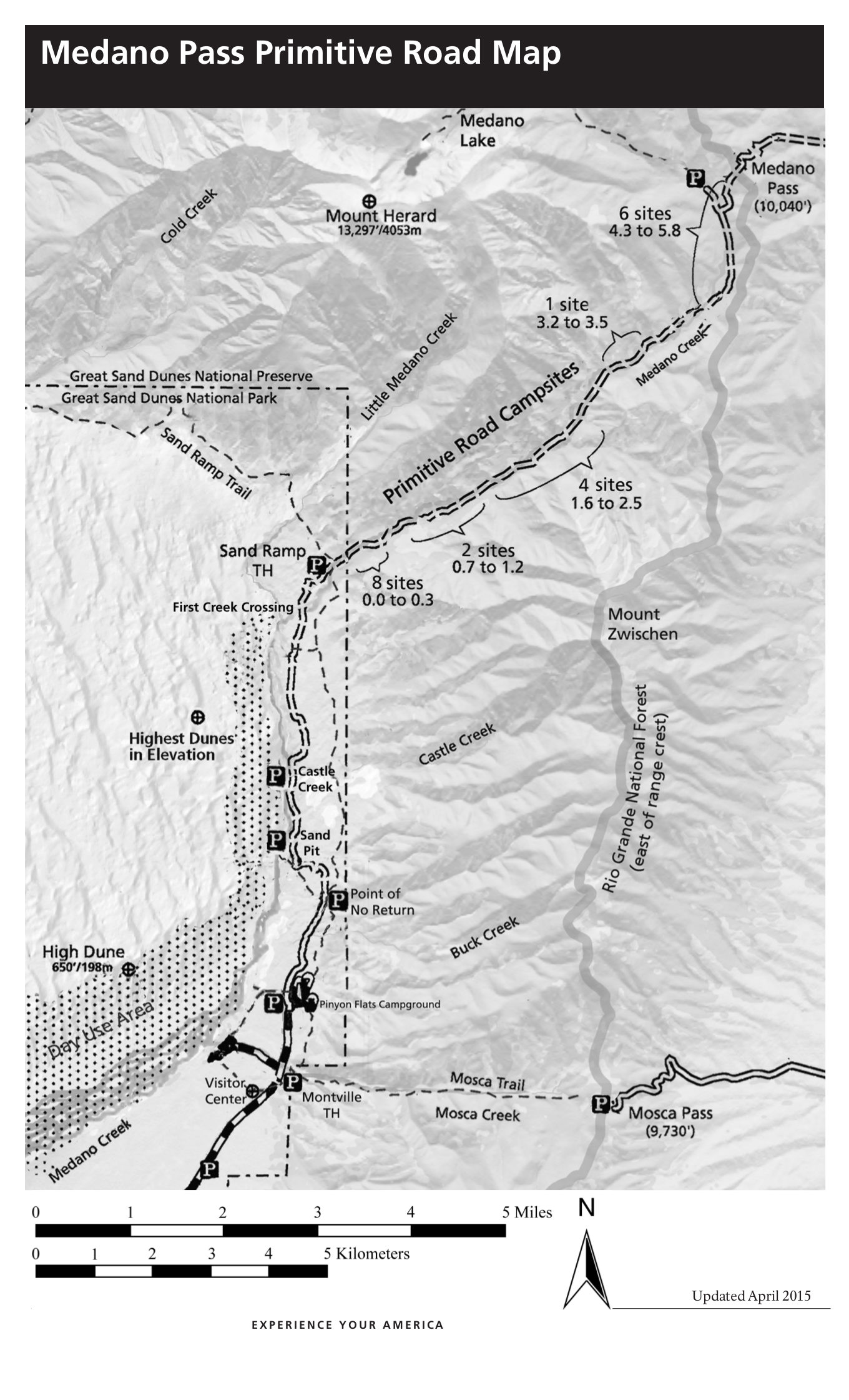 This is a Medano Pass primitive road map, showing the four-wheel-drive road up to Medano Pass and the campsites along the way with their approximate locations in mileage from the road start.
 While the maps above are great for a general overview and trip planning, they shouldn’t be used for navigation and route-finding. Instead, take a look at getting the National Geographic Trails Illustrated map, which includes topographic lines and much more detail about water sources, trail routes, trailhead access roads, etc. It covers the dune field as well as the Sangre de Cristo mountains. An absolute must if you’re doing any backpacking!
Great Sand Dunes campground map
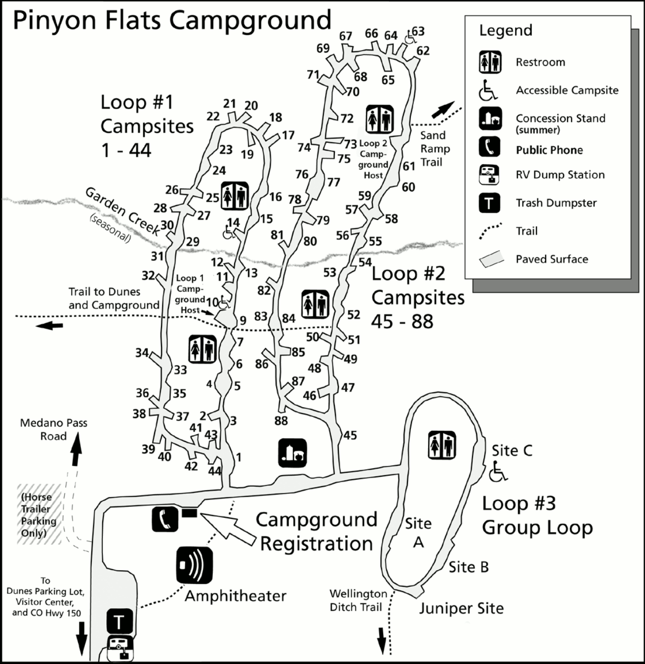
 This Pinon Flats campground map was last updated in 2024. This is the only campground located within the park, and is very popular especially on summer and holiday weekends.
Assorted Great Sand Dunes maps
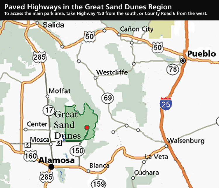 Here’s a Great Sand Dunes paved road map. It is not unusual for visitors’ GPS apps to try sending them down primitive four-wheel-drive roads or hiking trails. Refer to this map to ensure you’re staying on pavement!
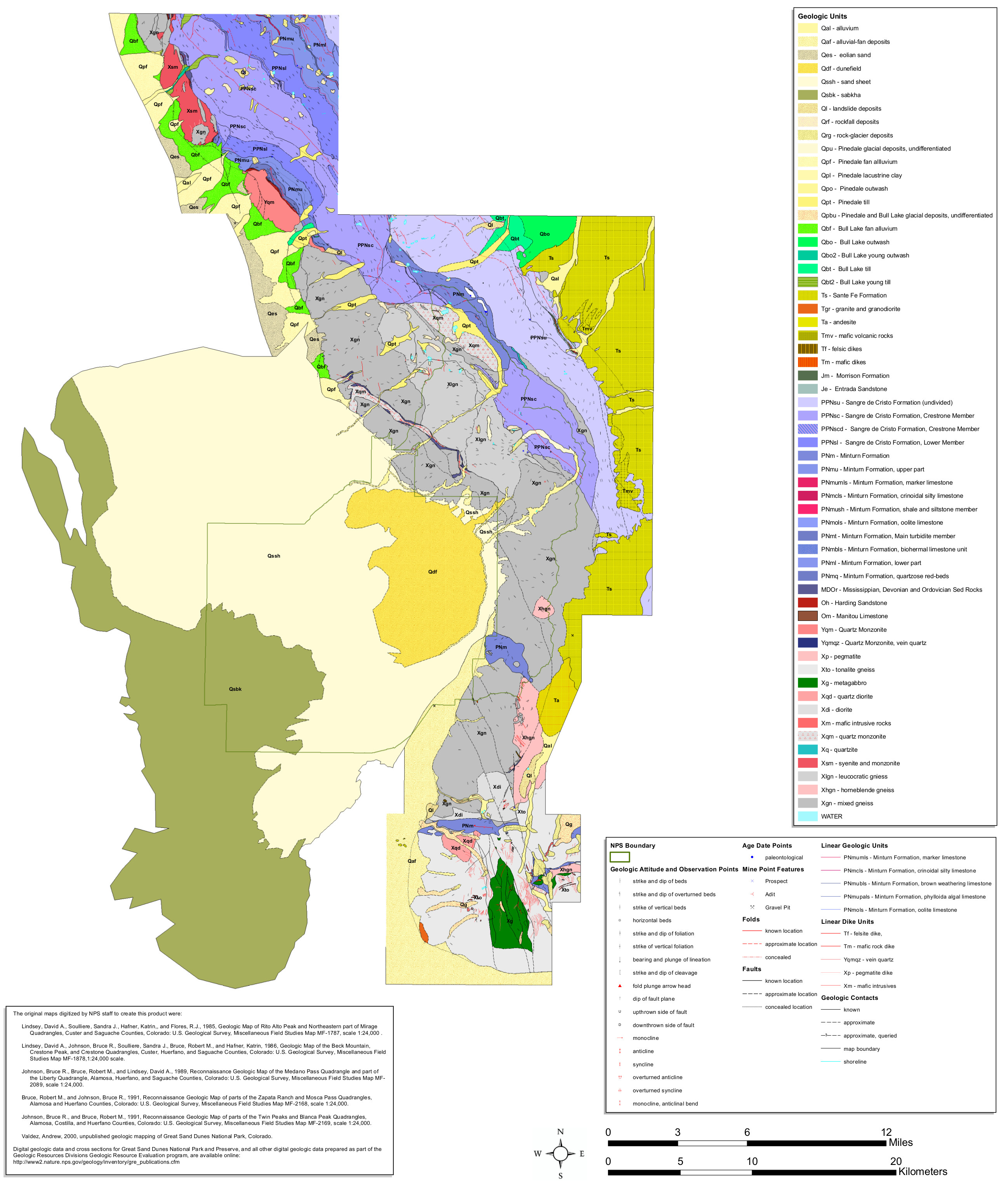 The Great Sand Dunes geologic map includes the dune field as well as the surrounding mountains in the Sangre de Cristo Mountains, leading to some huge geological variety that you don’t find in every park.
 This is a Great Sand Dunes hunting map. Hunting is permitted within the boundaries of the National Preserve, a trait shared by many other park-adjacent preserves managed by the National Park Service.
Great Sand Dunes lodging map
 If you want to stay near Great Sand Dunes, there’s really just one game in town: Alamosa, CO. To the right you can open an Expedia interactive lodging map that will show each option. I’d also recommend comparing prices, photos, reviews, and distance from the park on Expedia’s best-rated Great Sand Dunes lodging where you’ll find a mix of hotels, cabins, lodges, and guesthouses.
Great Sand Dunes pet maps
 This Great Sand Dunes pet map shows where pets are allowed within the park and preserve. Note that while most of the dune field is off limits, they are permitted in the main day use area near the parking lot.
 This zoomed-in pet map focuses on the front-country parts of Great Sand Dunes. On this map, the blue shading shows where dogs are not permitted, meaning dogs and other pets are free to enjoy the dunes day use area.
Archived Great Sand Dunes maps
The National Park Service is always releasing new and updated maps, and I try my best to share new ones on this page as I find them. The ones below are no longer the most up-to-date, but I’ve provided them for archival purposes so external links to these files won’t break, and so that users can see how their national parks change over time.
 This is the old complete Great Sand Dunes map from the official brochure in the mid-2010s, showing the dune field as well as the Sangre de Cristo Mountains. Click the image to view a full size map or download the PDF.
 The old Great Sand Dunes backcountry map from the mid-2010s shows backcountry campsites and trails into the Sangre de Cristo Mountains as well as those that follow the boundaries of the dune field.
 This is an old Pinon Flats Campground map. This is the only developed Great Sand Dunes drive-in campground and is located past the visitor center. You’ll find three loops, restrooms, and an amphitheater.
…and more!
< Return to National Park Maps home
< Return to Park List
< Return to List by State