Joshua Tree map from the park brochure
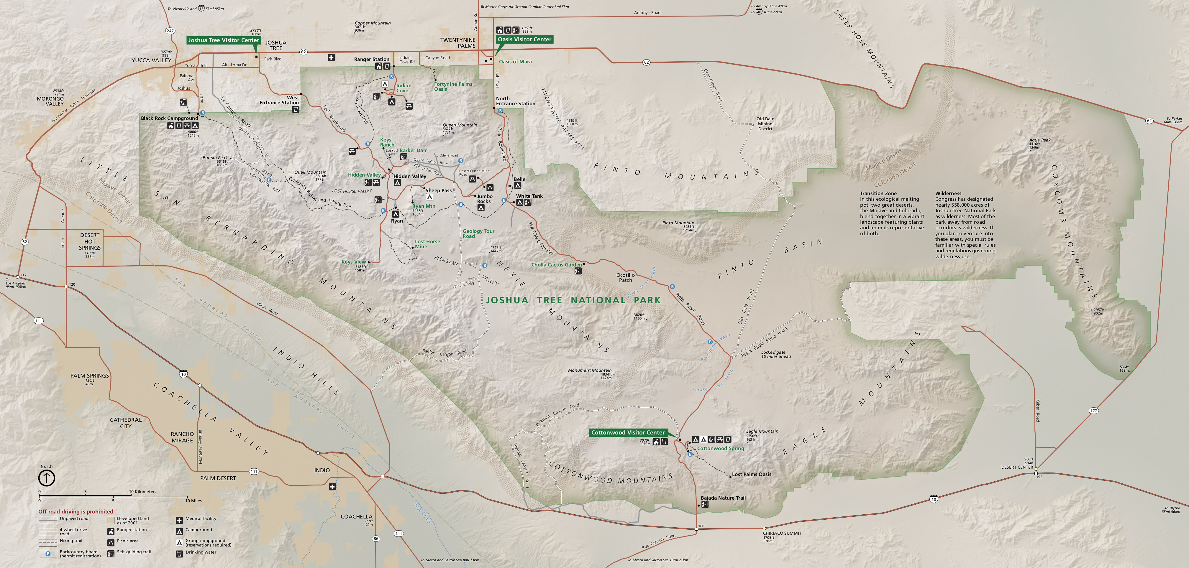
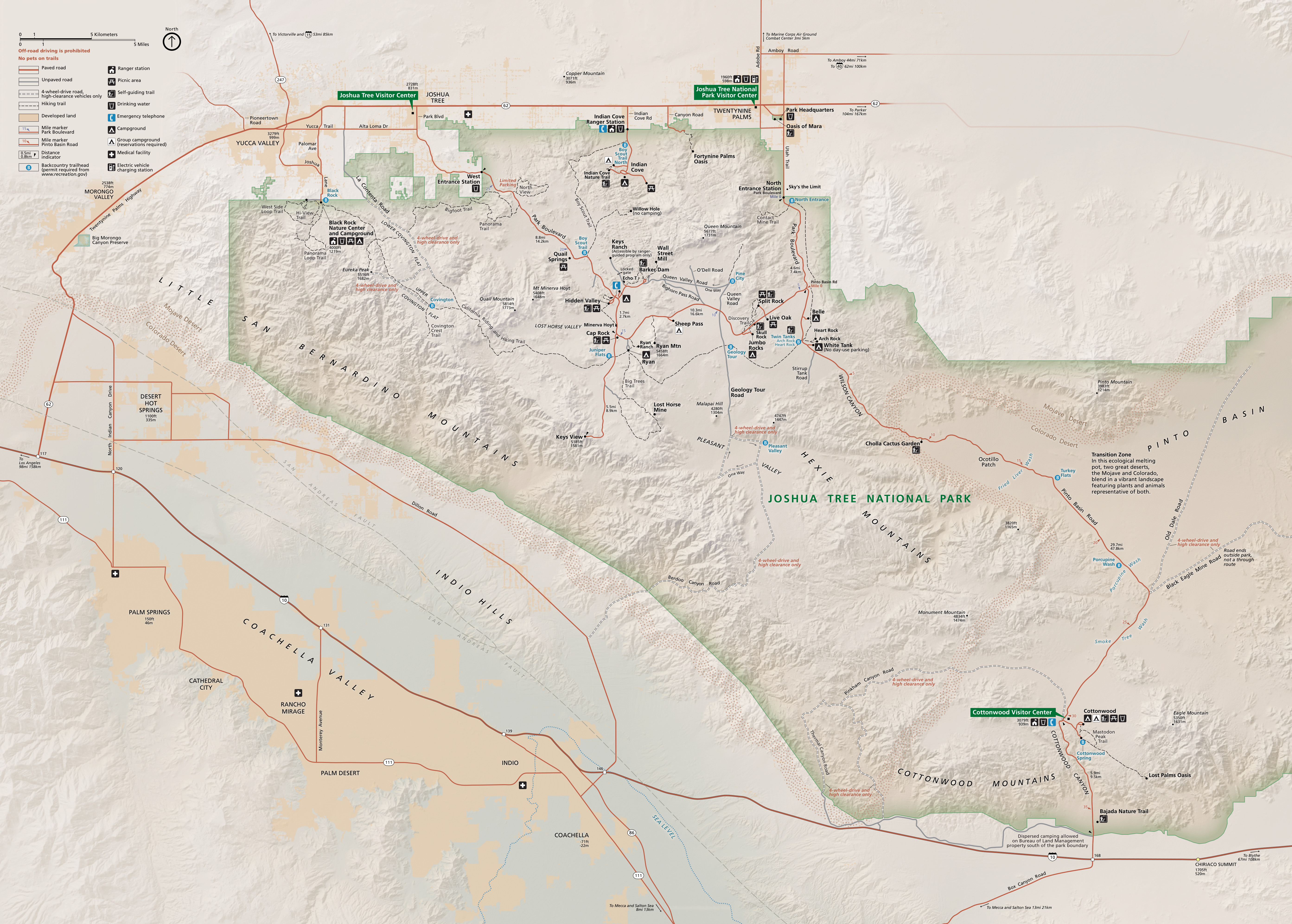 This is the official Joshua Tree National Park map from the NPS brochure, handed out at park entrance stations. It was last updated in 2023 and includes roads in the surrounding Coachella Valley and in Twentynine Palms.
Joshua Tree trail maps
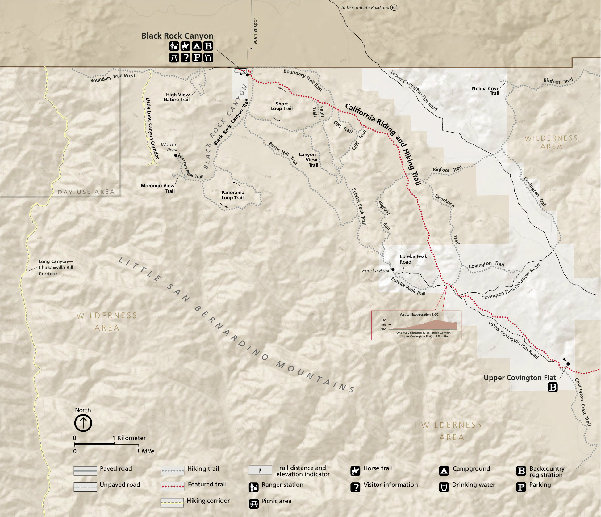
 This Black Rock trail map zooms in to show all the hiking trails located in the Black Rock area of Joshua Tree, which has its own separate entrance located in the northwest corner of the park, outside of Yucca Valley.
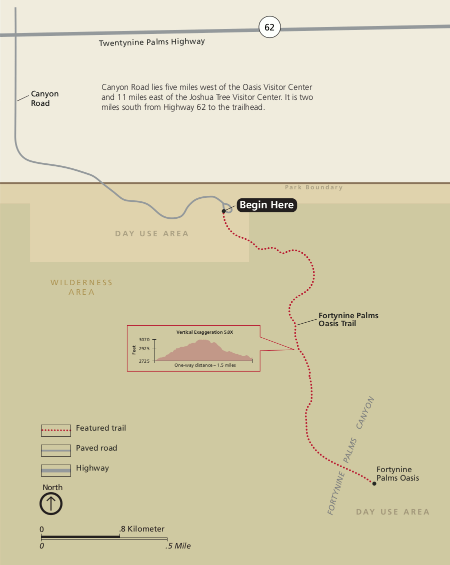 This is a Fourtynine Palms Oasis trail map, showing the short route to Fortynine Palms Oasis from the parking area off of Canyon Road — a separate entrance to Joshua Tree National Park.
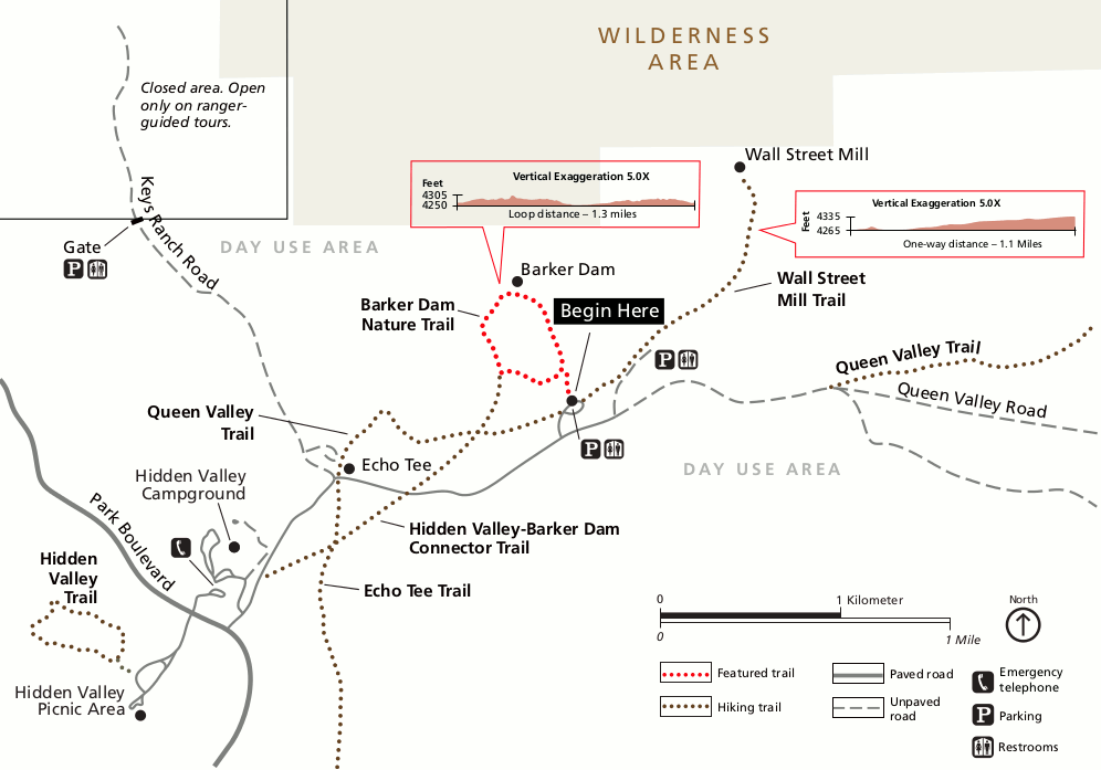 This map shows the Barker Dam Nature Trail and Wall Street Mill trail. It also shows a few other trails near Hidden Valley Campground, such as the Queen Valley Trail and Echo Tee Trail.
 This is a map of the Hidden Valley Nature Trail, located near the Hidden Valley Campground and picnic area off of Park Boulevard. This is a straightforward one-mile loop hike.
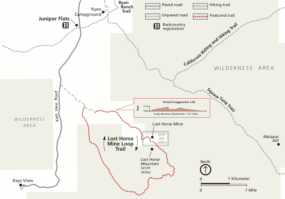 This is a Lost Horse Mine loop trail map, which accesses Lost Horse Mine and Lost Horse Mountain off of Keys View Road (which dead-ends at Keys View). This makes a solid 6+ mile loop hike.
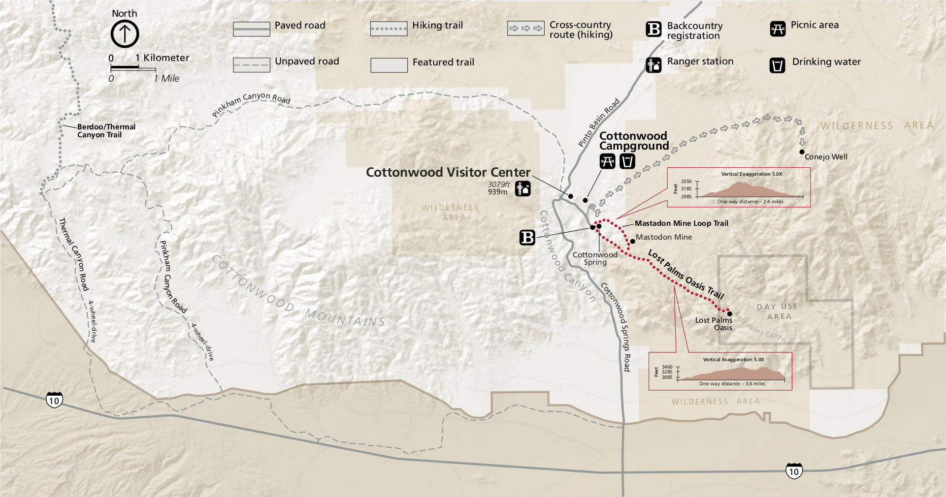
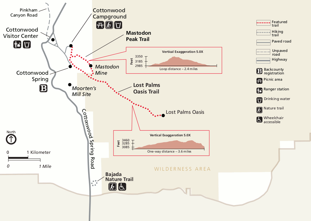 This is a Lost Palms Oasis trail map, also showing the Mastodon Peak trail to Mastodon Mine from Cottonwood Spring. You can get to these from the Cottonwood Visitor Center area in the southern part of the park.
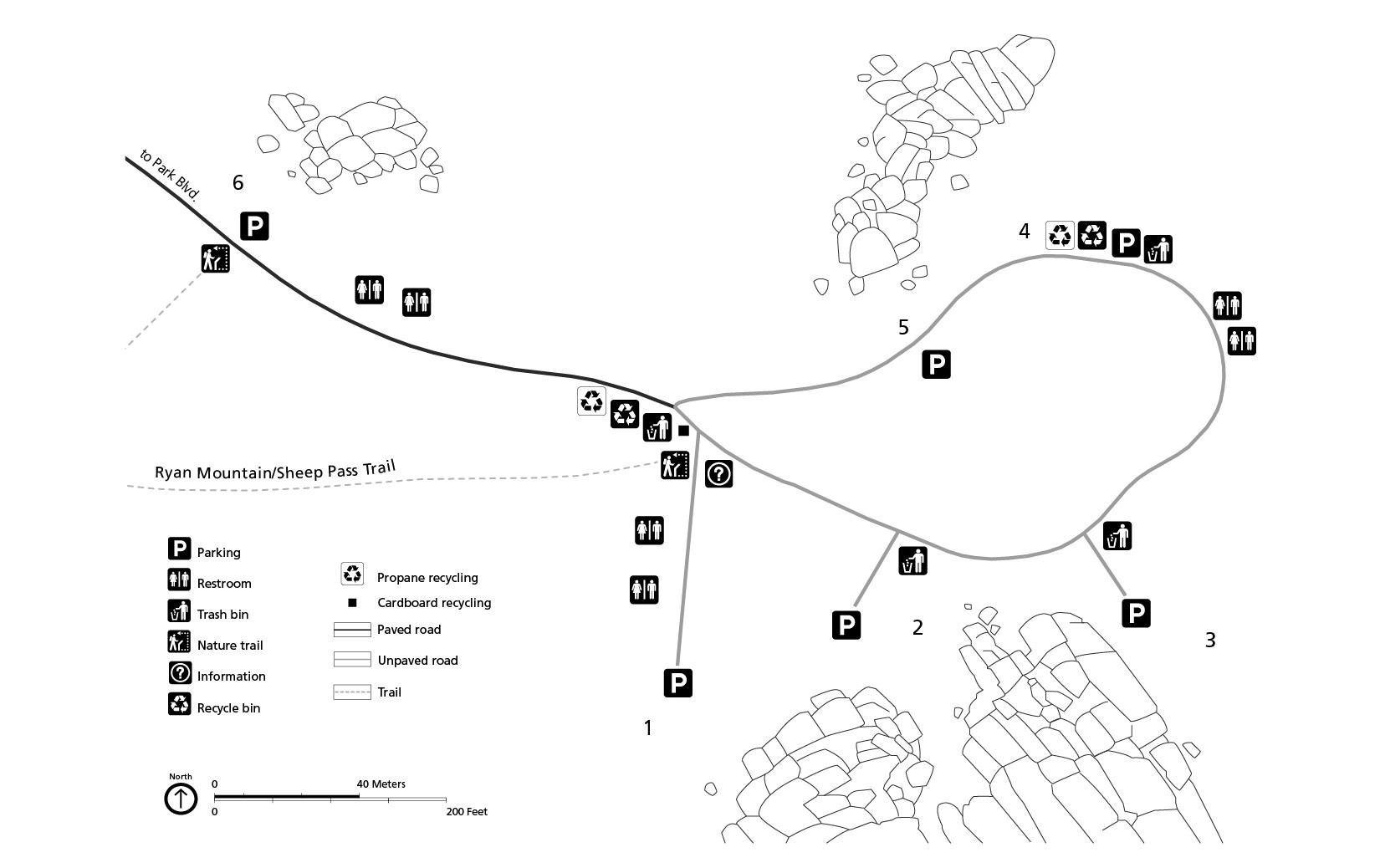
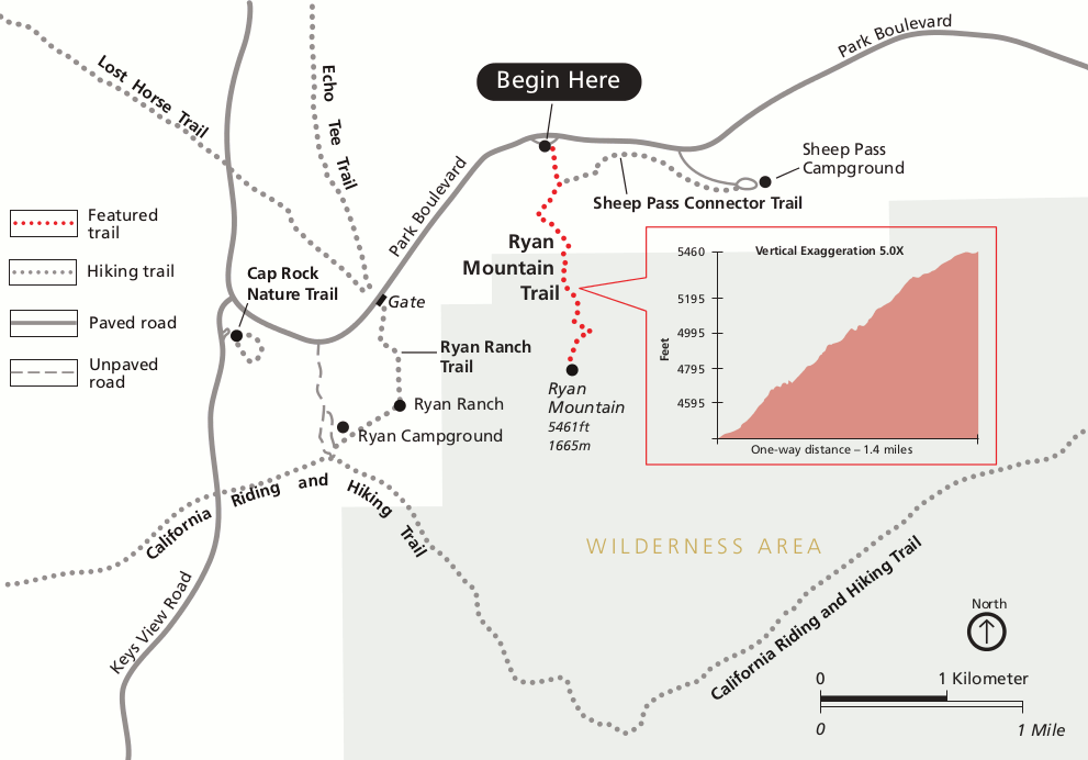 This is a map of the Ryan Mountain trail, which leads to the summit of Ryan Mountain. This map also shows a few other trails in the area near Sheep Pass and Ryan Campground.
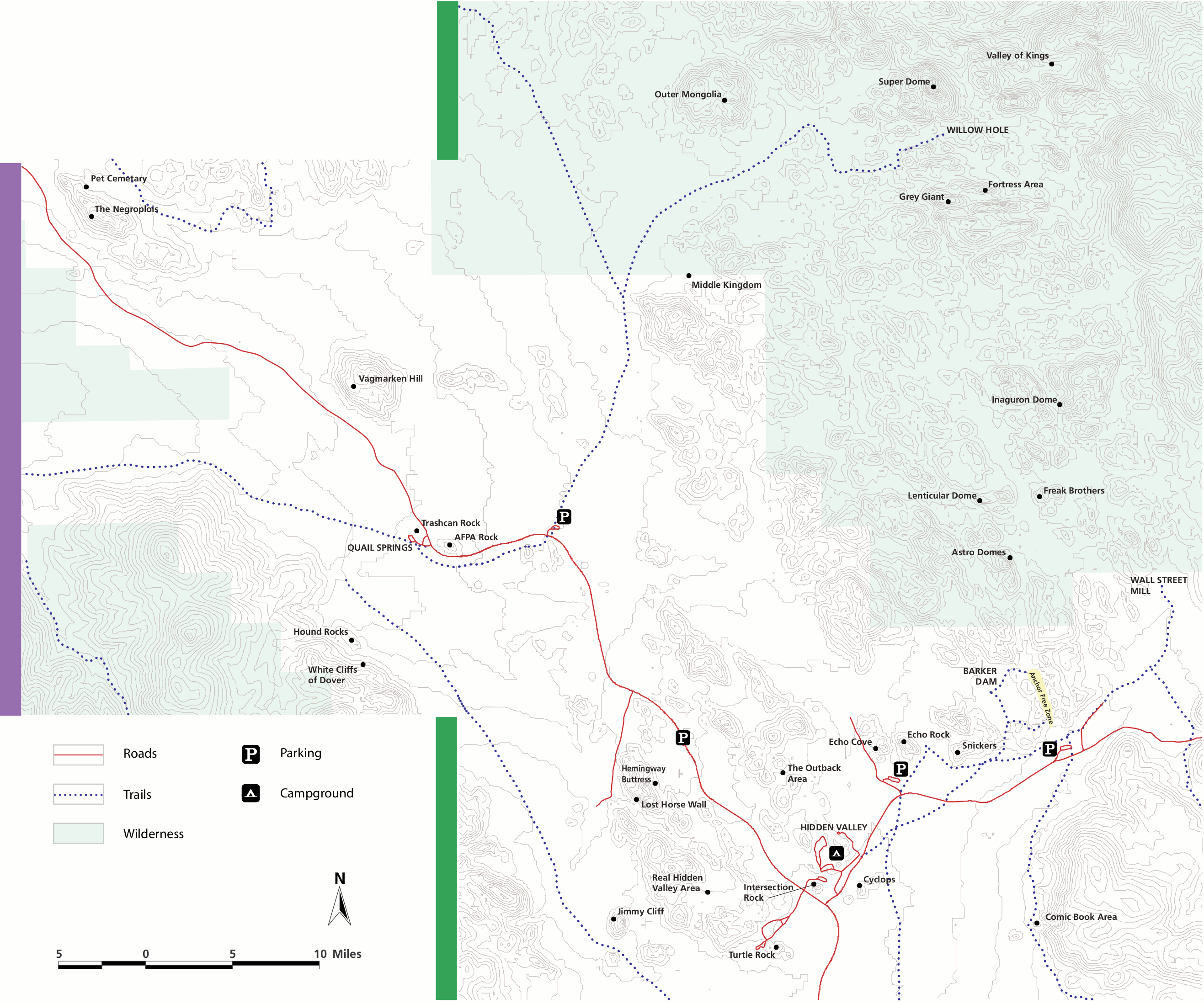
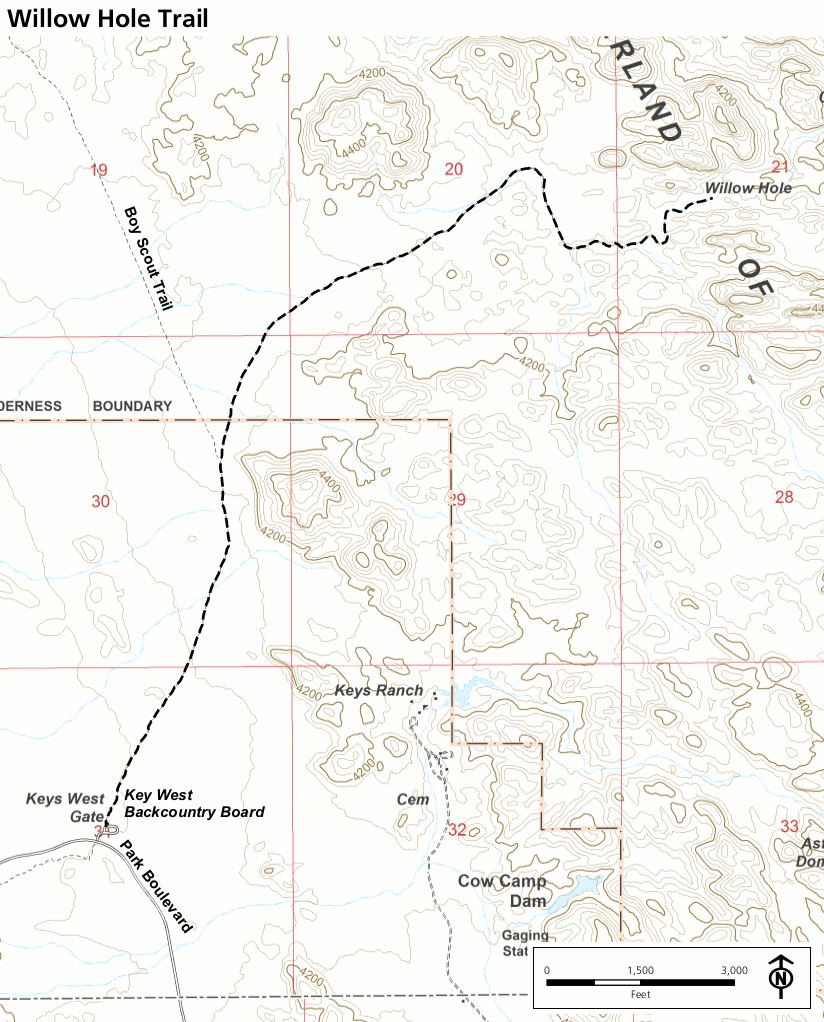 This is a Willow Hole trail map. The trail departs from the Keys West backcountry board on Park Boulevard and connects with Boy Scout Trail, leading to the Indian Cove area.
 The free maps above show some of the popular hiking trails in Joshua Tree, although they don’t have much detail in terms of mileages or topographic lines. For a more detailed map suitable for long hikes and overnight wilderness trips, you’ll want a National Geographic Trails Illustrated map of Joshua Tree. Please do not venture off-trail or do any long hikes with the simple free maps posted above. The Mojave Desert is unforgiving.
Joshua Tree rock climbing maps
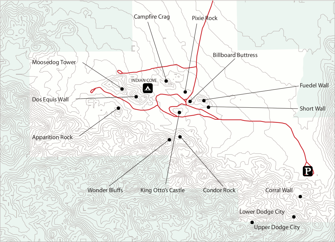 This is the Indian Cove rock climbing map, showing the various towers and rock formations surrounding the Indian Cove campground. Click the image to view a full size map or download the PDF.
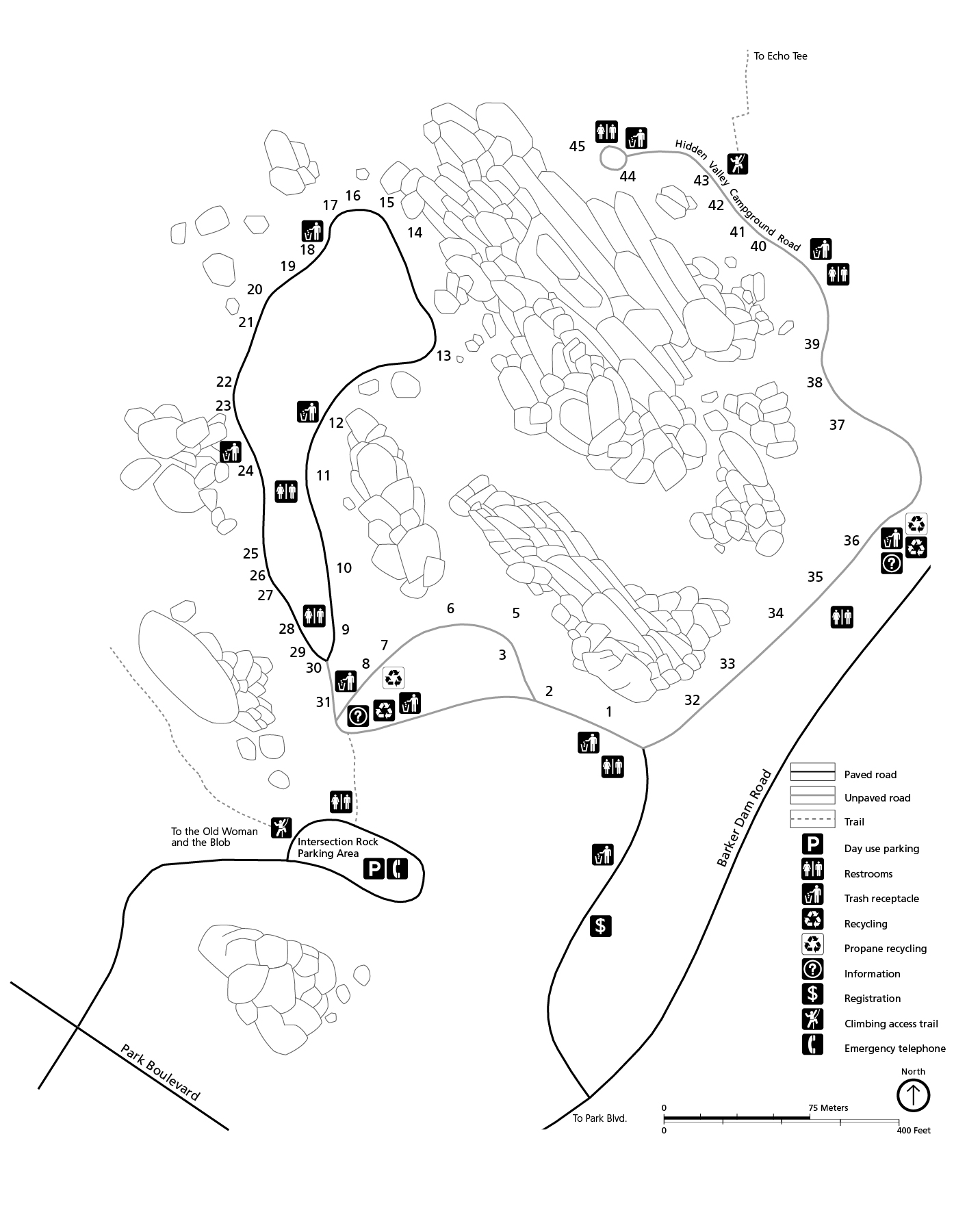
 This is the Hidden Valley rock climbing map, showing the rocks and walls surrounding the Hidden Valley campground and Quail Springs. Click the image to view a full size map or download the PDF.
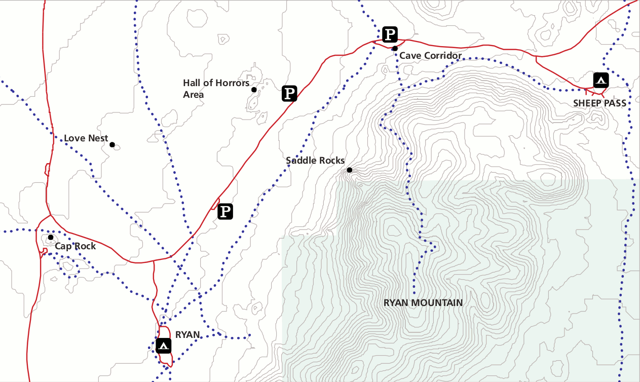 This is the Sheep Pass rock climbing map, featuring climbing features near Ryan Mountain at Sheep Pass and Ryan campgrounds. Click the image to view a full size map or download the PDF.
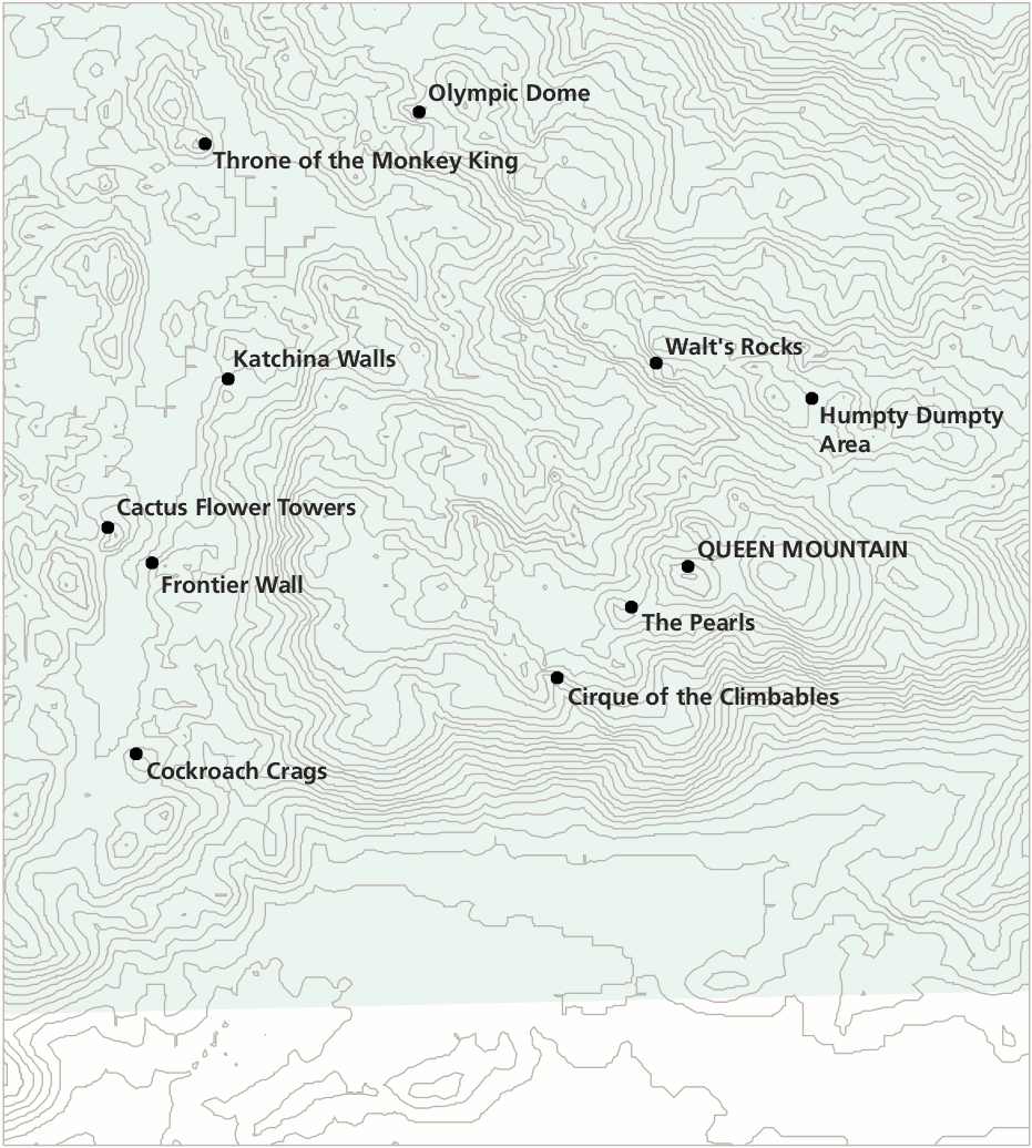 This is the Queen Valley rock climbing map, showing features around Queen Mountain in this remote area of Joshua Tree. Click the image to view a full size map or download the PDF.
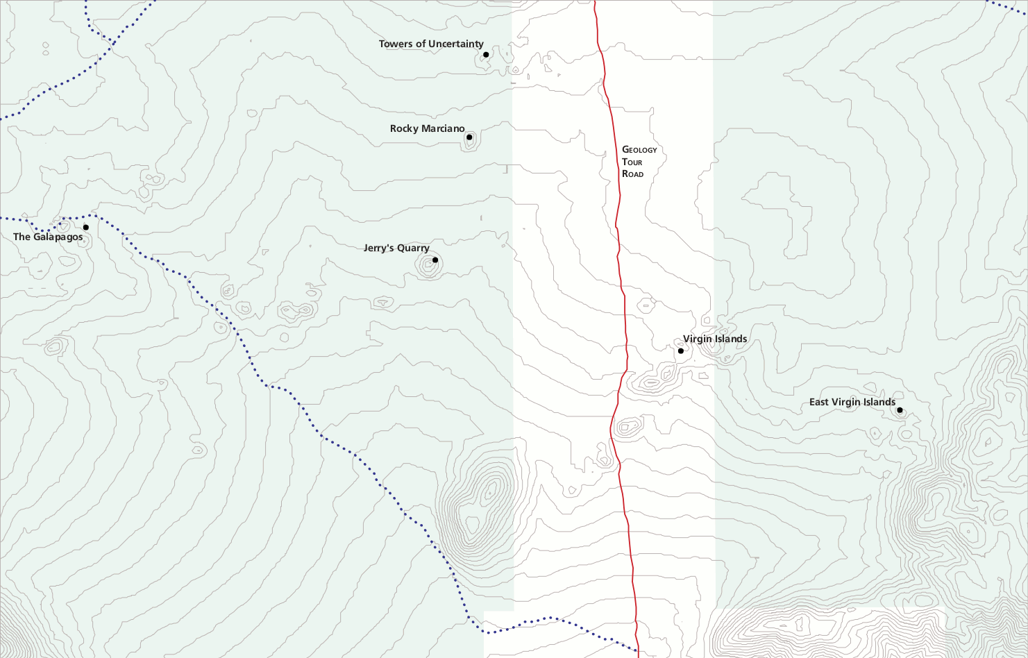 This is the Geology Tour rock climbing map, showing features east and west of Geology Tour Road, such as the Towers of Uncertainty. Click the image to view a full size map or download the PDF.
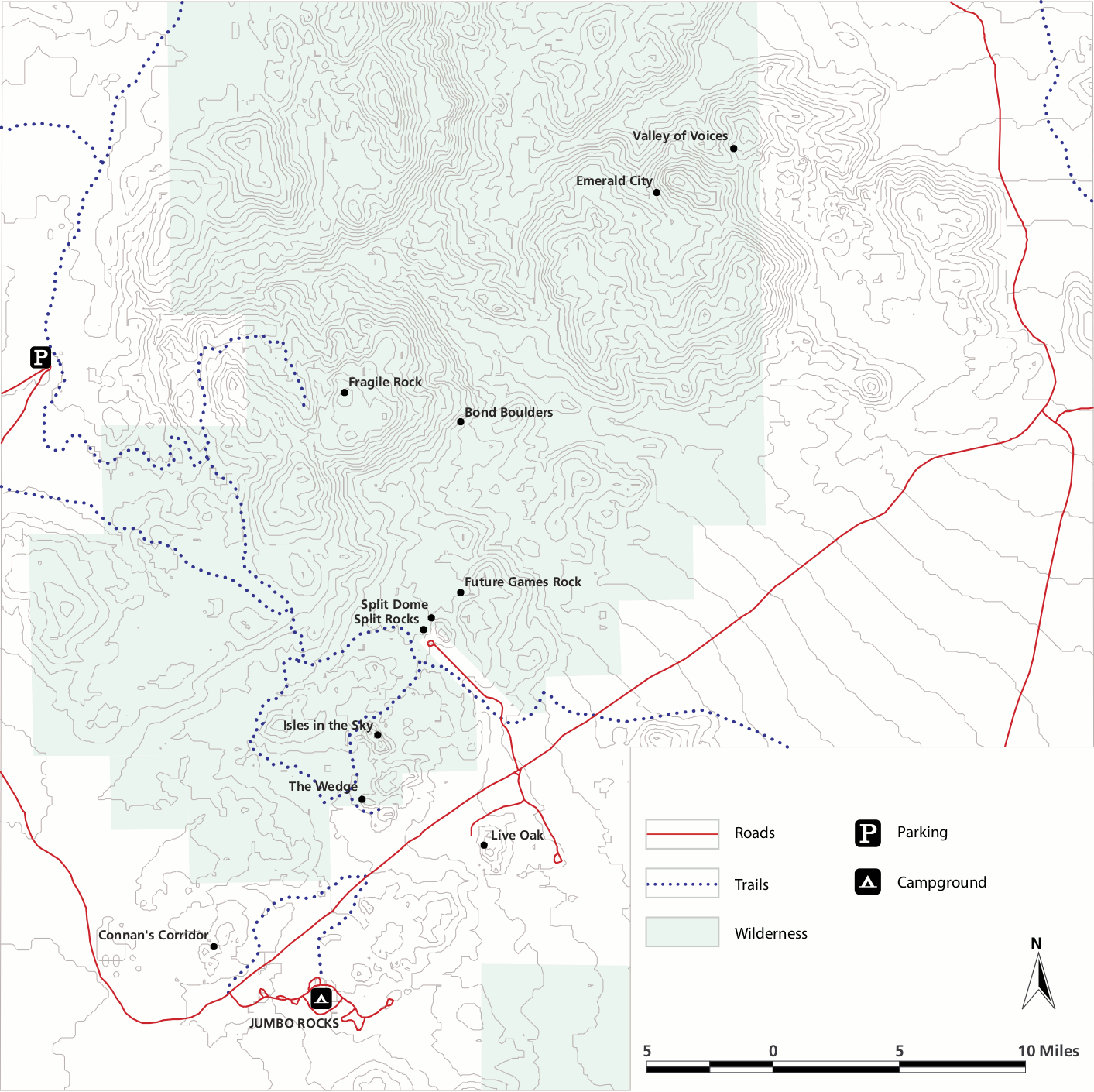 This is the Split Rock rock climbing map, showing climbing features near Jumbo Rocks campground. Click the image to view a full size map or download the PDF.
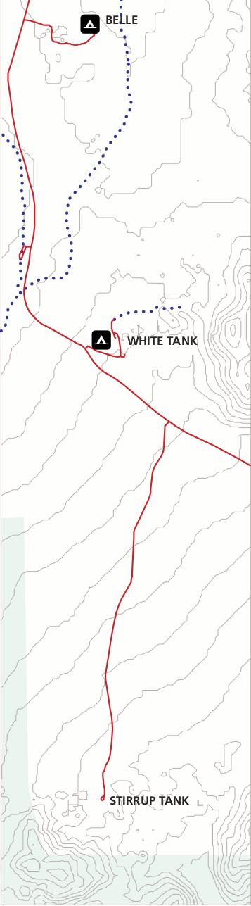 This is the Belle and White Tank rock climbing map, showing the Belle and White Tank camping areas and road to Stirrup Tank. Click the image to view a full size map or download the PDF.
Joshua Tree lodging map
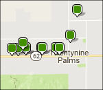 If you want to be as close as possible to popular Joshua Tree sights, stay in Twentynine Palms; to the right is an Expedia interactive lodging map centered there. You can zoom out and scroll the map to see that there are way more options if you’re OK with staying further, like in Palm Springs. Probably the best way to start is by browsing the top-rated Joshua Tree lodging to compare prices, reviews, locations, and photos.
Joshua Tree backpacking maps
 Here’s a Joshua Tree backpacking map that shows the various backcountry camping zones. You must obtain a permit from the park to camp in the zone of your choice. All zones except Boy Scout have no capacity limit.
 The backcountry campsite map zooms in on the Boy Scout Trail zone. This is the one backcountry zone that has capacity limitations, and you must camp in one of the fifteen designated sites shown on this map.
Joshua Tree backcountry maps
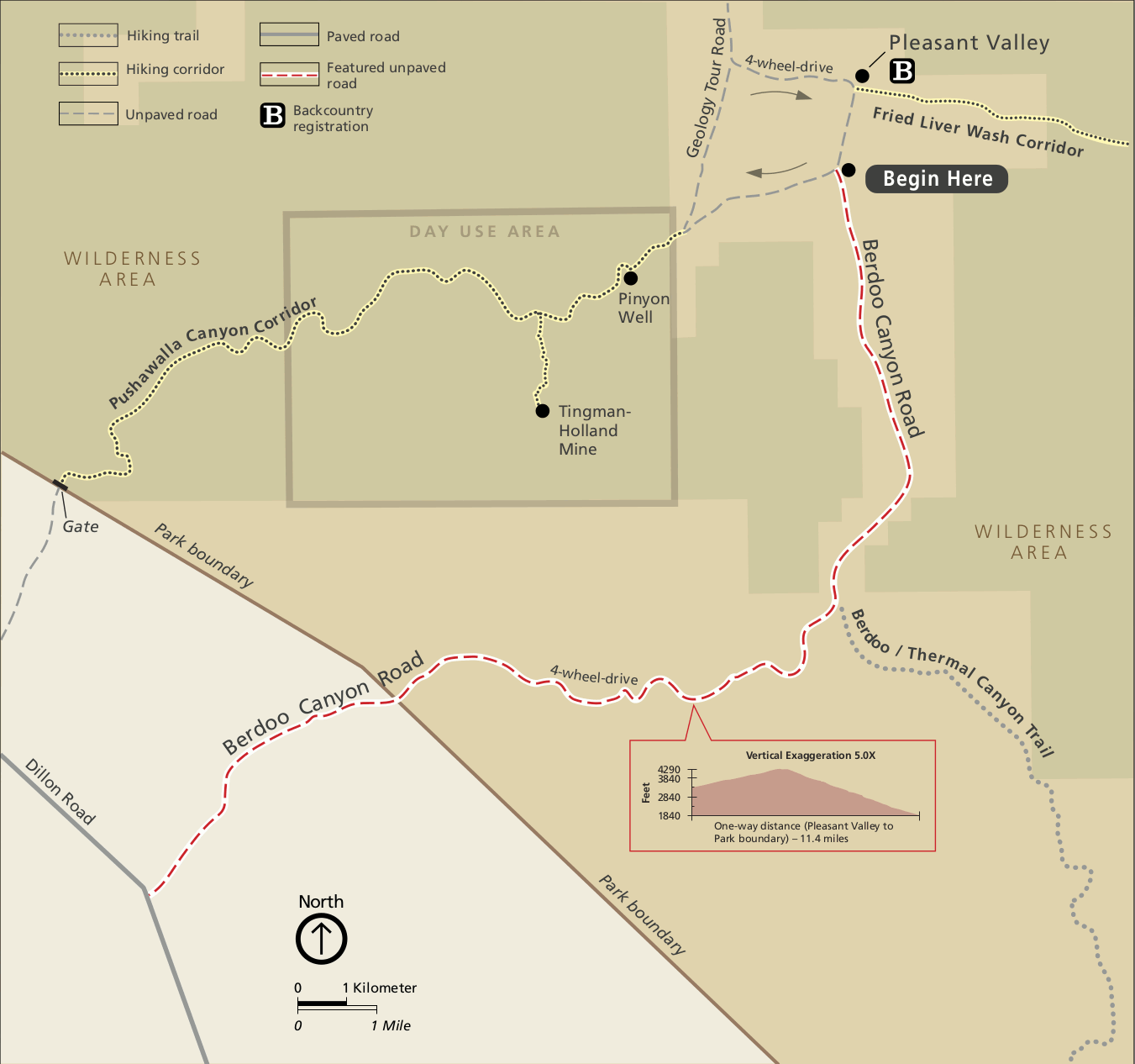 This is the Berdoo Canyon Road map, showing the 4-wheel drive road and surrounding wilderness area. Click the image to view a full size map or download the PDF.
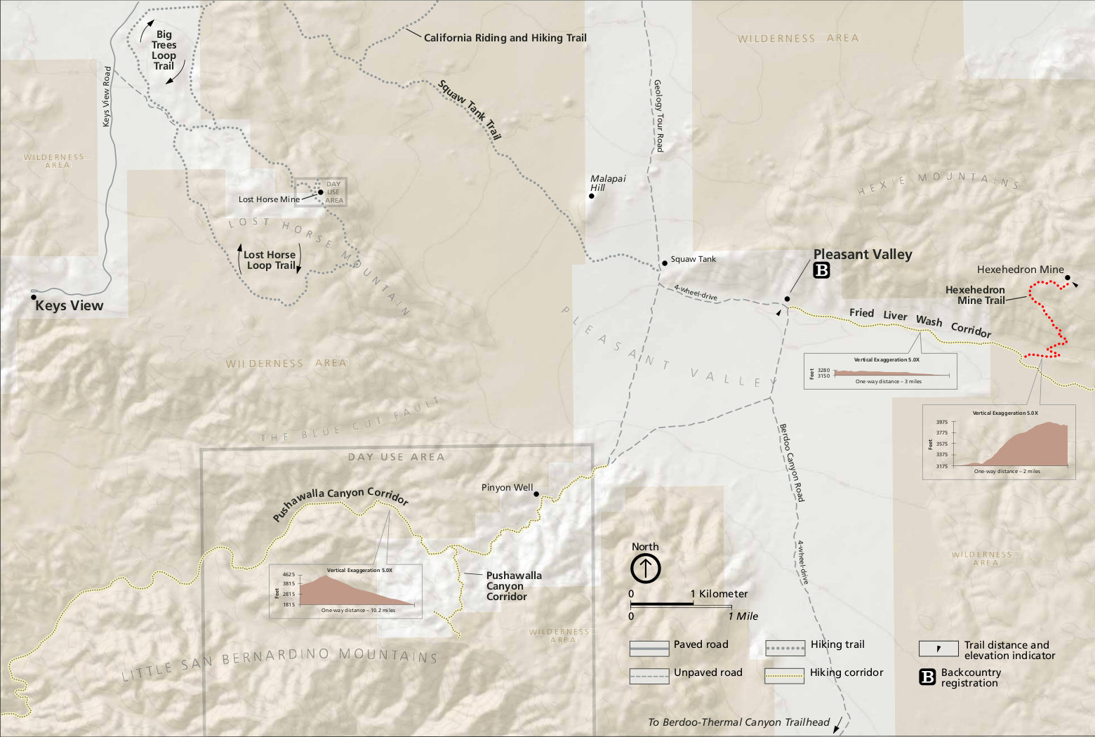
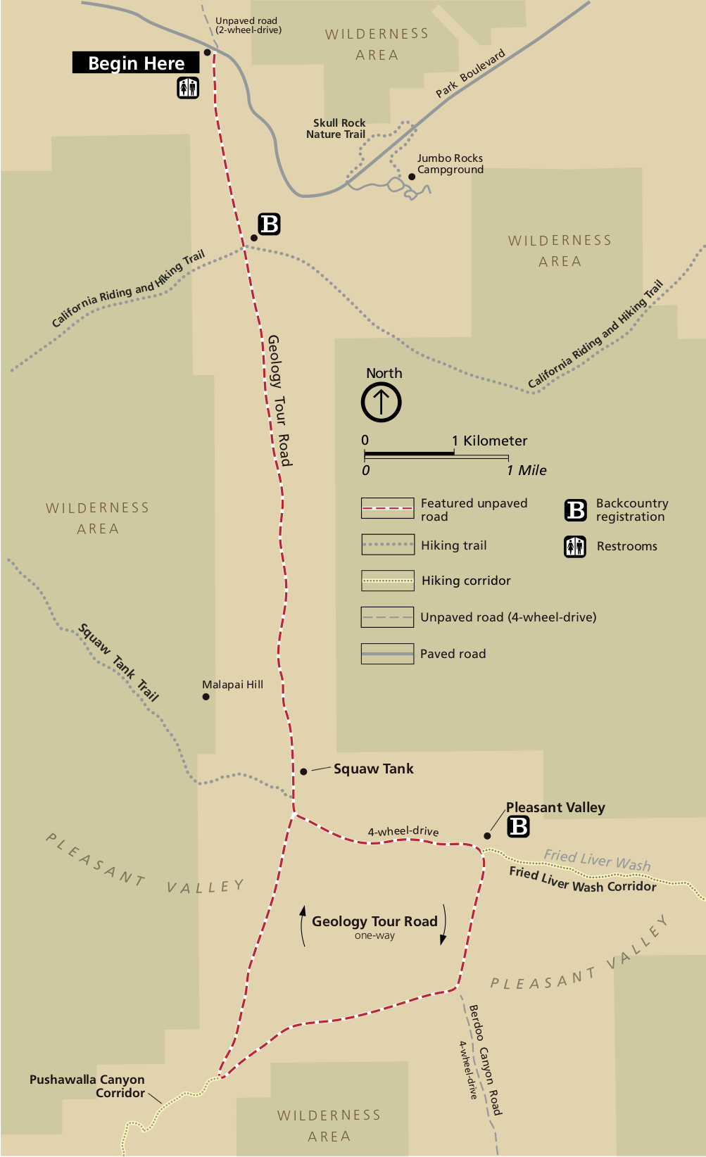 This is the Geology Tour Road map, showing Pleasant Valley, Squaw Tank, and other points of interest. Click the image to view a full size map or download the PDF.
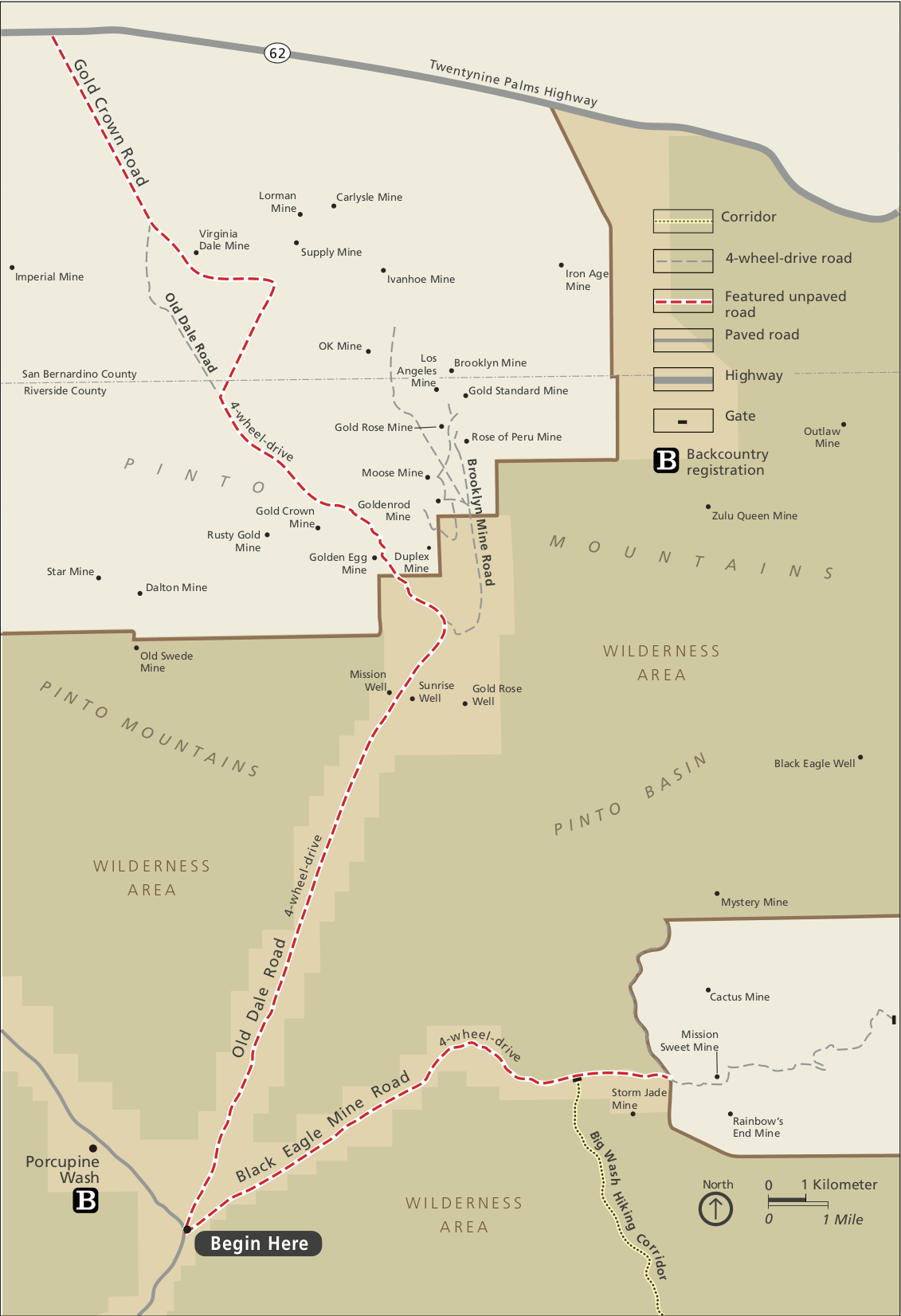 This is the Old Dale/Black Eagle Mine Road map, showing the locations of many old mines located in the Pinto Mountains. Click the image to view a full size map or download the PDF.
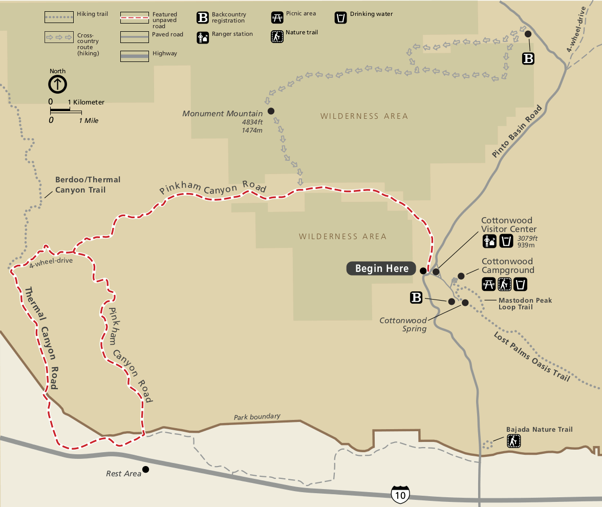 This is the Pinkham Canyon Road map, connecting the Cottonwood Campground and visitor center with the Thermal Canyon Road. Click the image to view a full size map or download the PDF.
Joshua Tree backcountry registration board maps
Following are the maps posted at Joshua Tree National Park backcountry registration boards. These boards are where you park and register for backcountry travel. Each link will open a full-size map file:
- Blackrock Canyon
- Cottonwood Spring
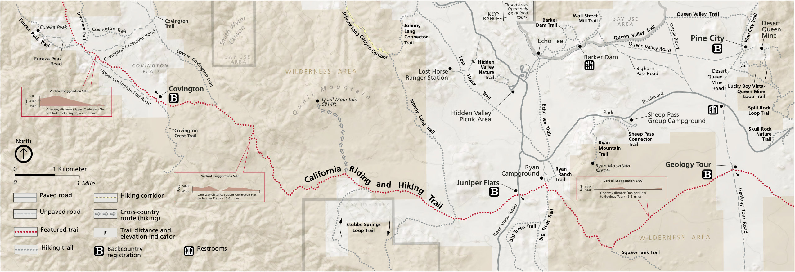
- Covington
- Geology
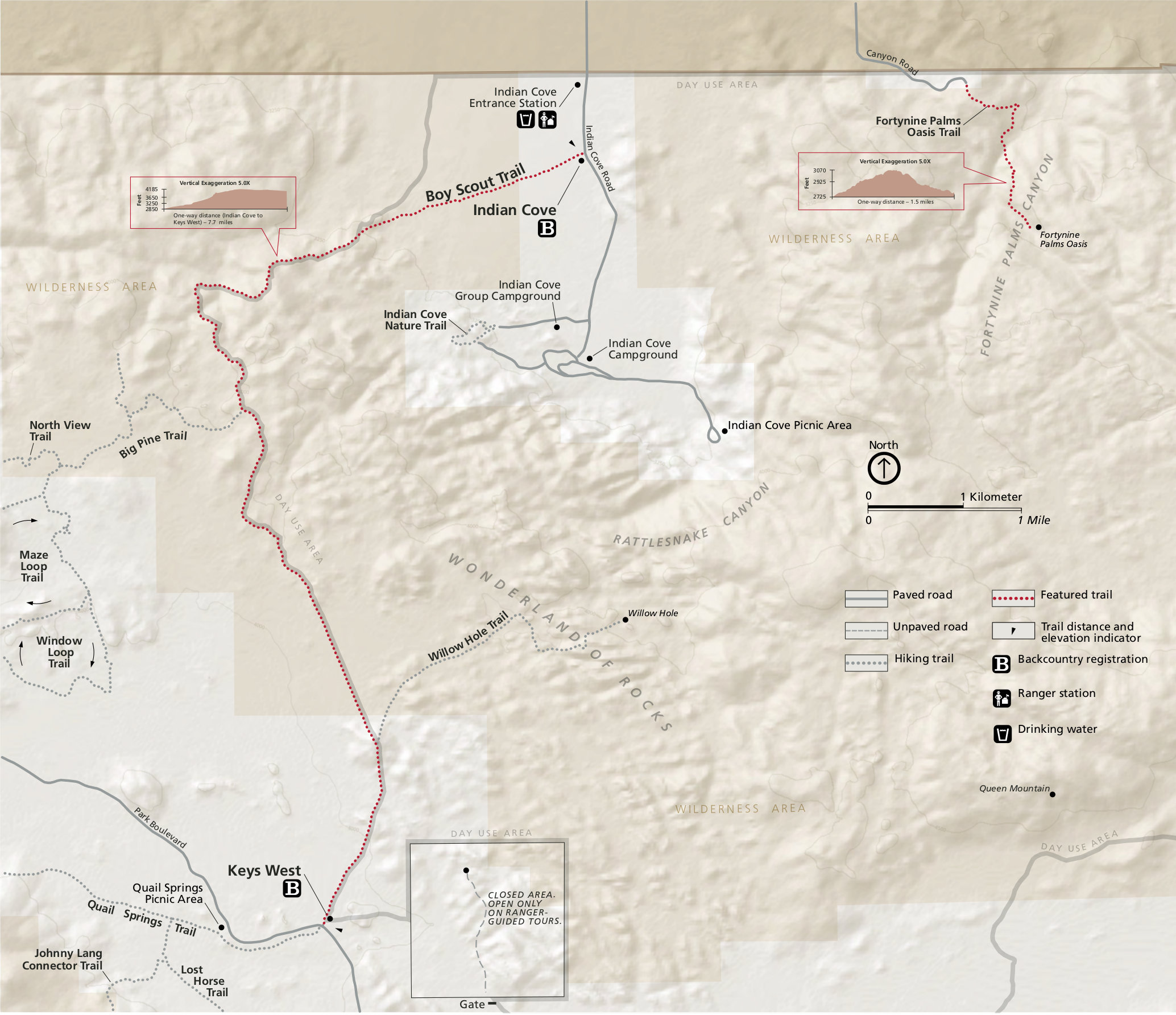
- Indian Cove
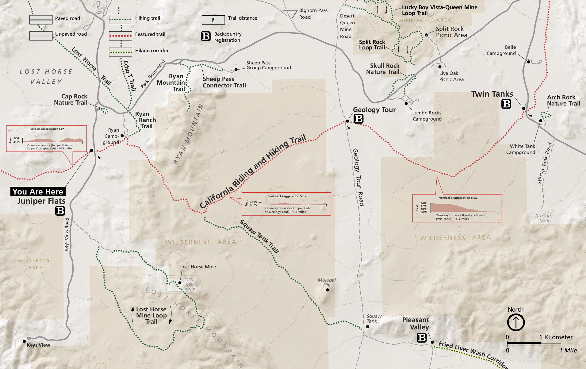
- Juniper Flats
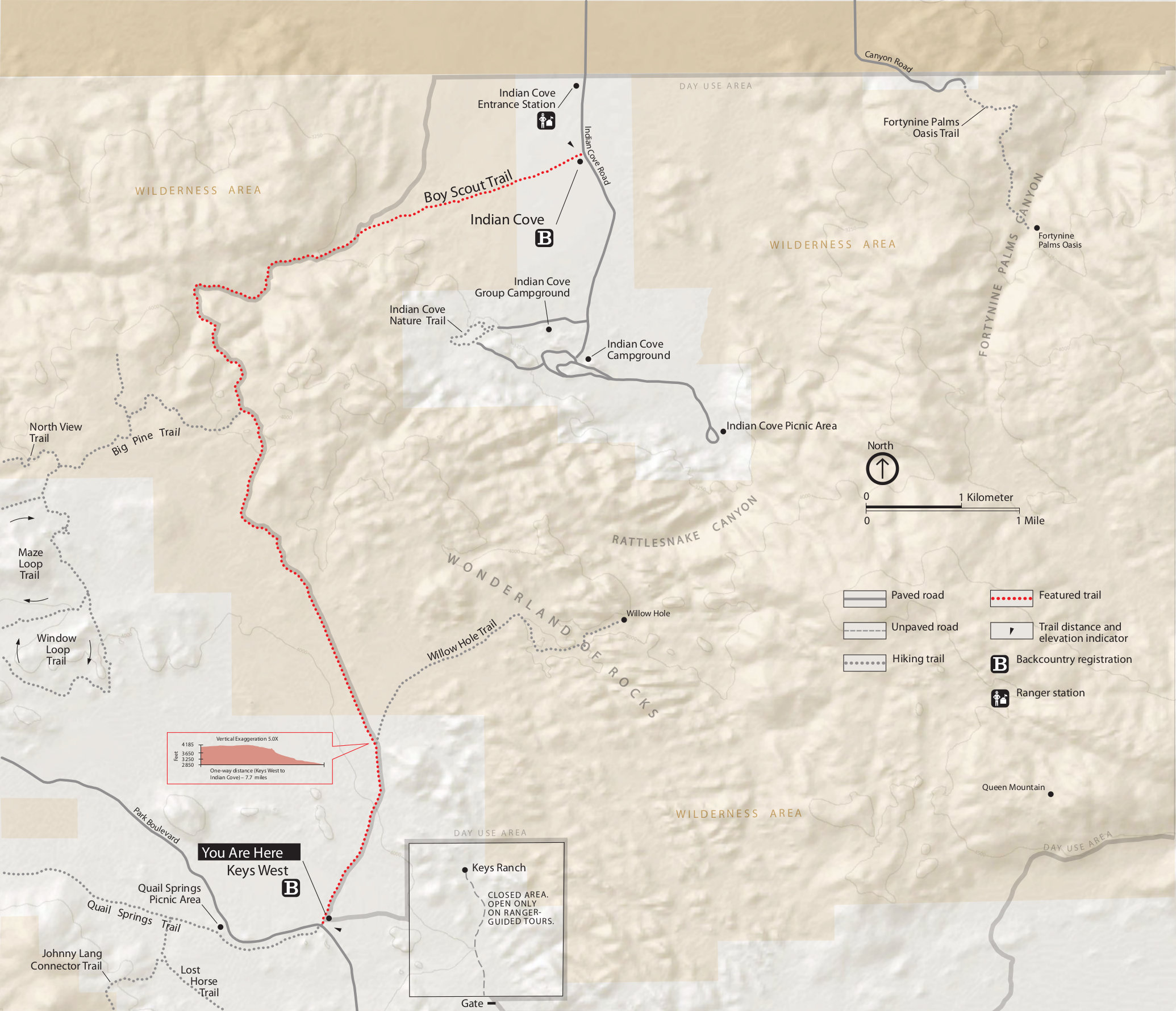
- Keys West
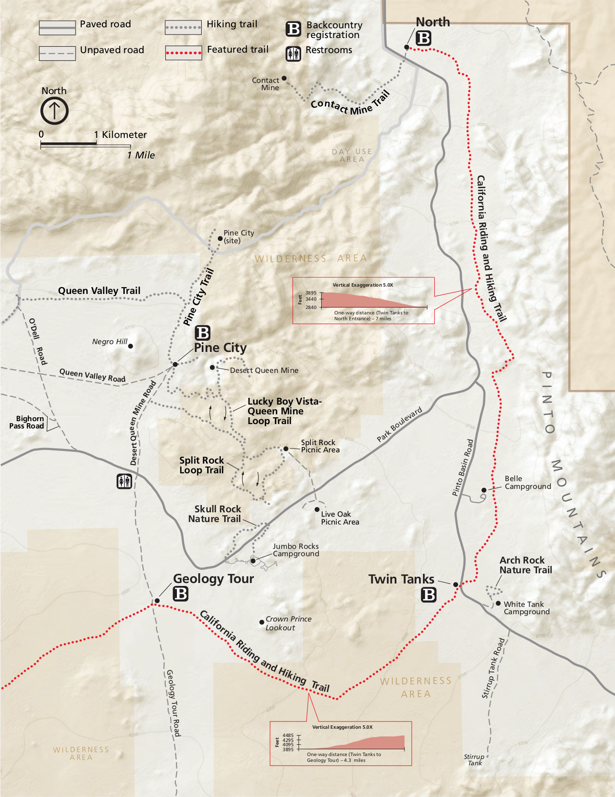
- North Entrance
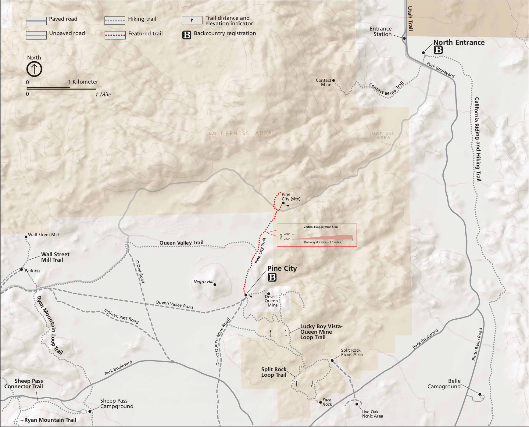
- Pine City
- Pleasant Valley
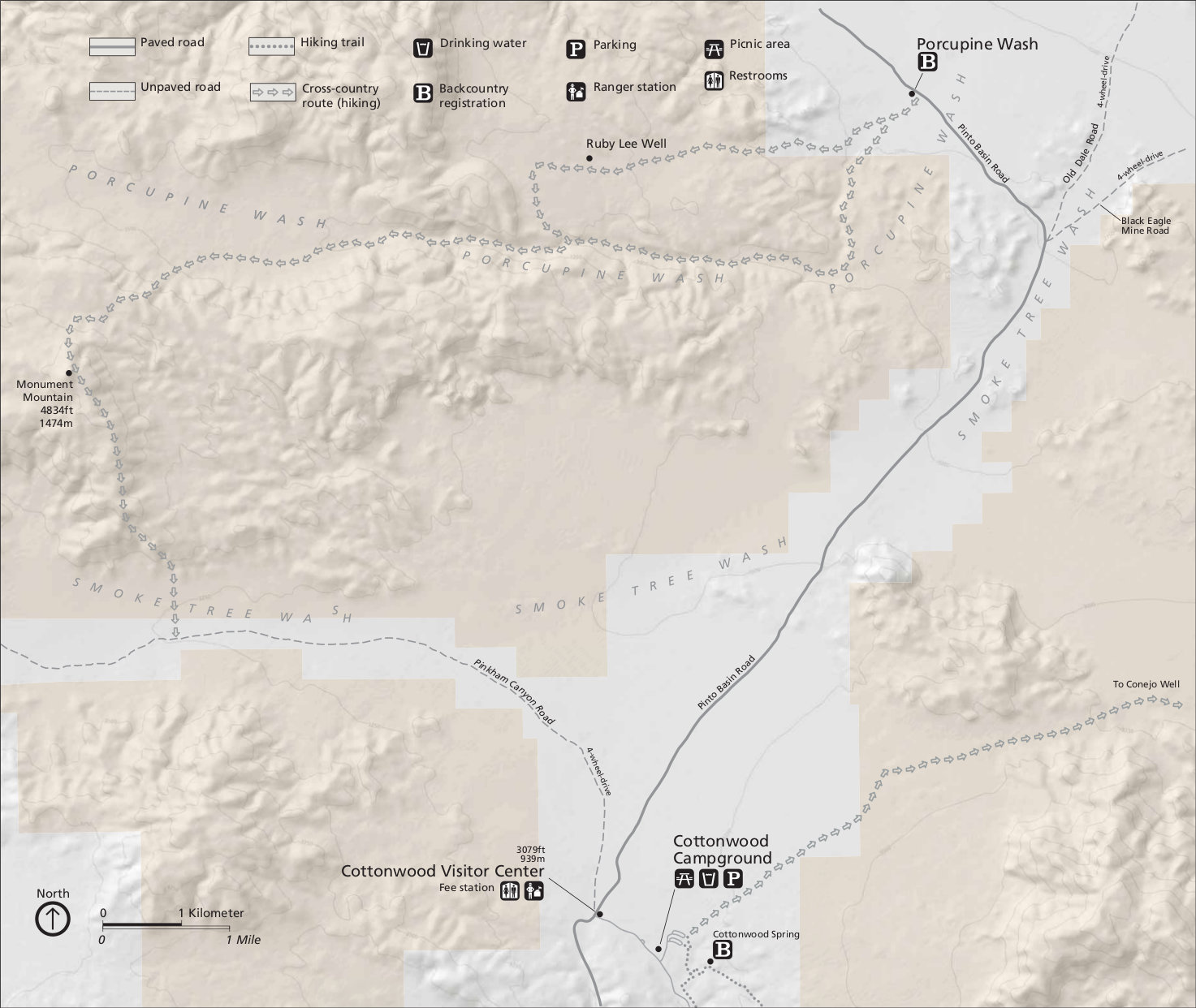
- Porcupine Wash
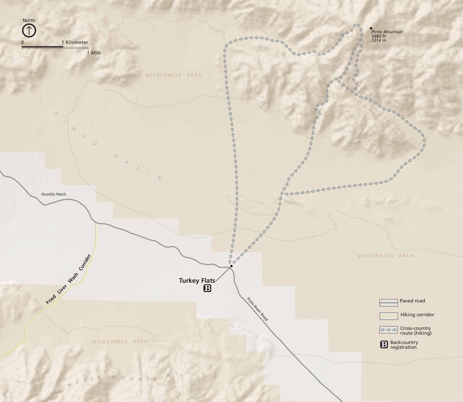
- Turkey Flats
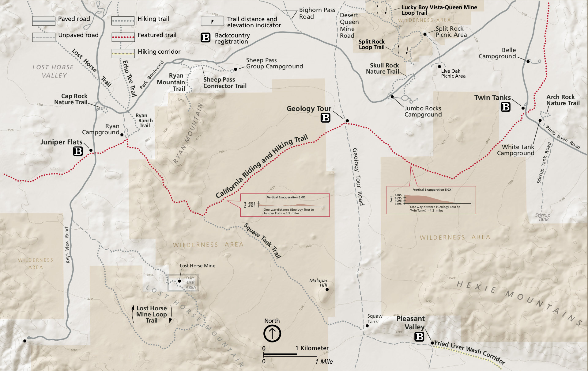
- Twin Tanks
 Those maps above give a good overview of what to expect in different backcountry areas, but aren’t suitable for navigation or overnight travel. Joshua Tree National Park is located in the Mojave Desert. Do not take this lightly; it’s one of the most extreme environments in the U.S. Detailed trail maps like the National Geographic Trails Illustrated map will come in handy, along with a map, compass, and GPS. Do not underestimate the desert!
Joshua Tree campground maps
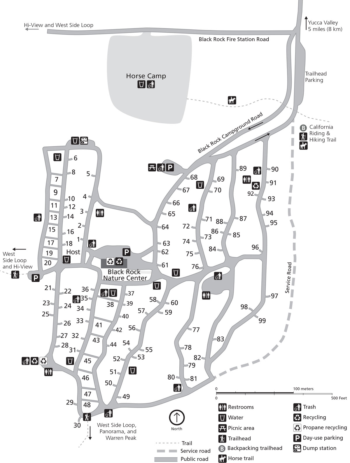 Here’s a Black Rock Campground map. This campground is located off a separate entrance road from Yucca Valley that does not connect to the rest of the park. But you’ll find the highest density of Joshua tree here.
 This Indian Cove Campground map shows this dry campground located off a separate entrance road between Yucca Valley and Twentynine Palms. This road does not connect to the main Park Boulevard.
 This is a Hidden Valley Campground map. This is one of the park’s three first-come first-served campgrounds, accepting no advance reservations. Get there early for a spot at this very popular campground.
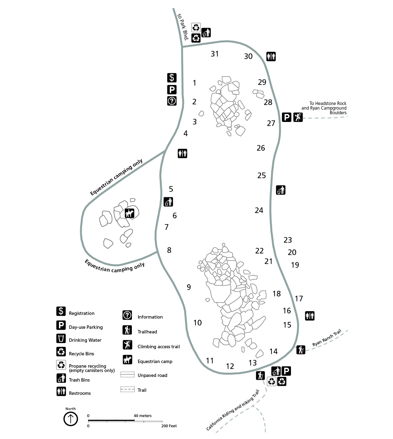 This Ryan Campground map shows this quieter, small, reservation-only campground. It’s located a bit southeast of Hidden Valley and is very centrally located, nearby the popular Ryan Mountain hike.
 Here’s a Jumbo Rocks Campground map, showing this large, centrally-located campground that is only available for advance reservation. It’s a bit east of Ryan Campground.
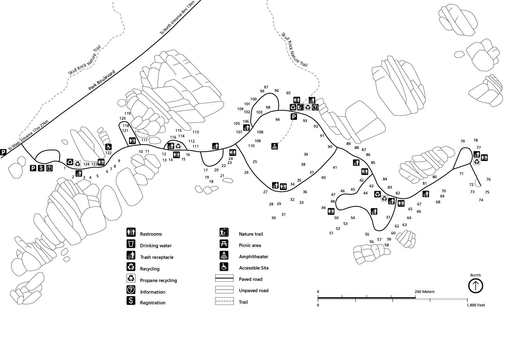
 This is a Belle Campground map. With only 18 campsites, this small dry campground feels more remote and isolated than some of the larger, busier ones. It’s first-come first-served, like White Tank and Hidden Valley.
 The White Tank Campground map shows this even smaller campground: 15 sites! It’s a little south of Belle and is similarly first-come, first-served. Like many others, you’ll need to pack in your own water.
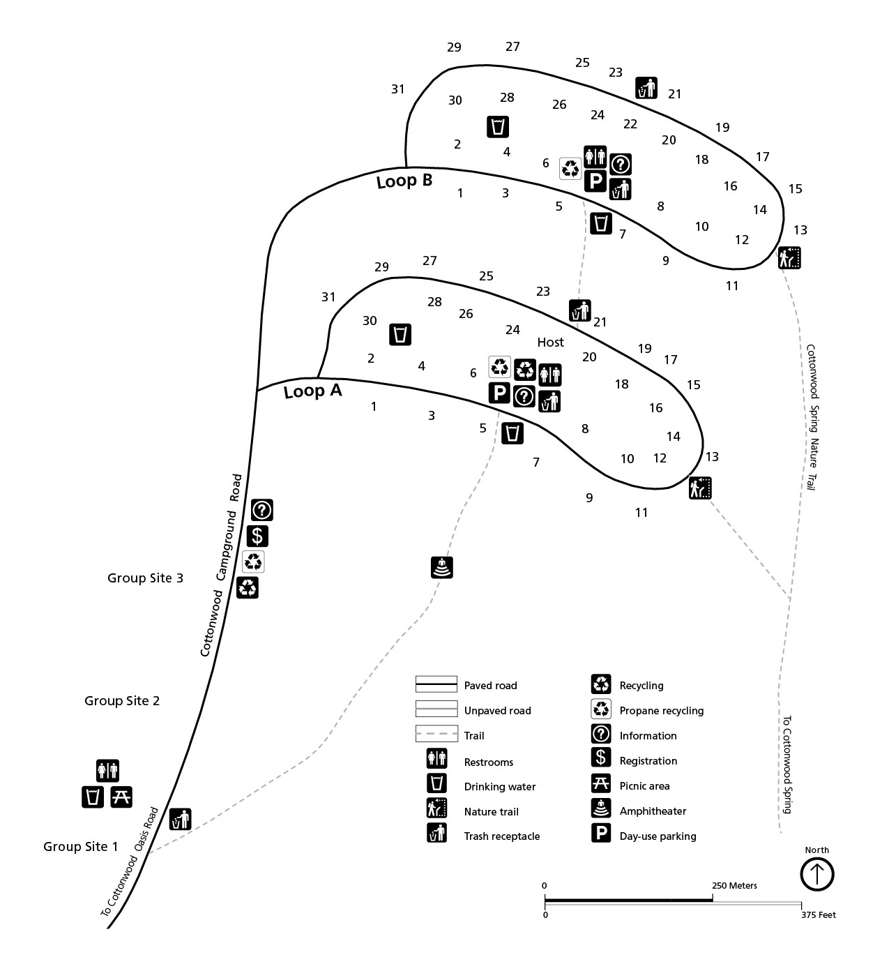
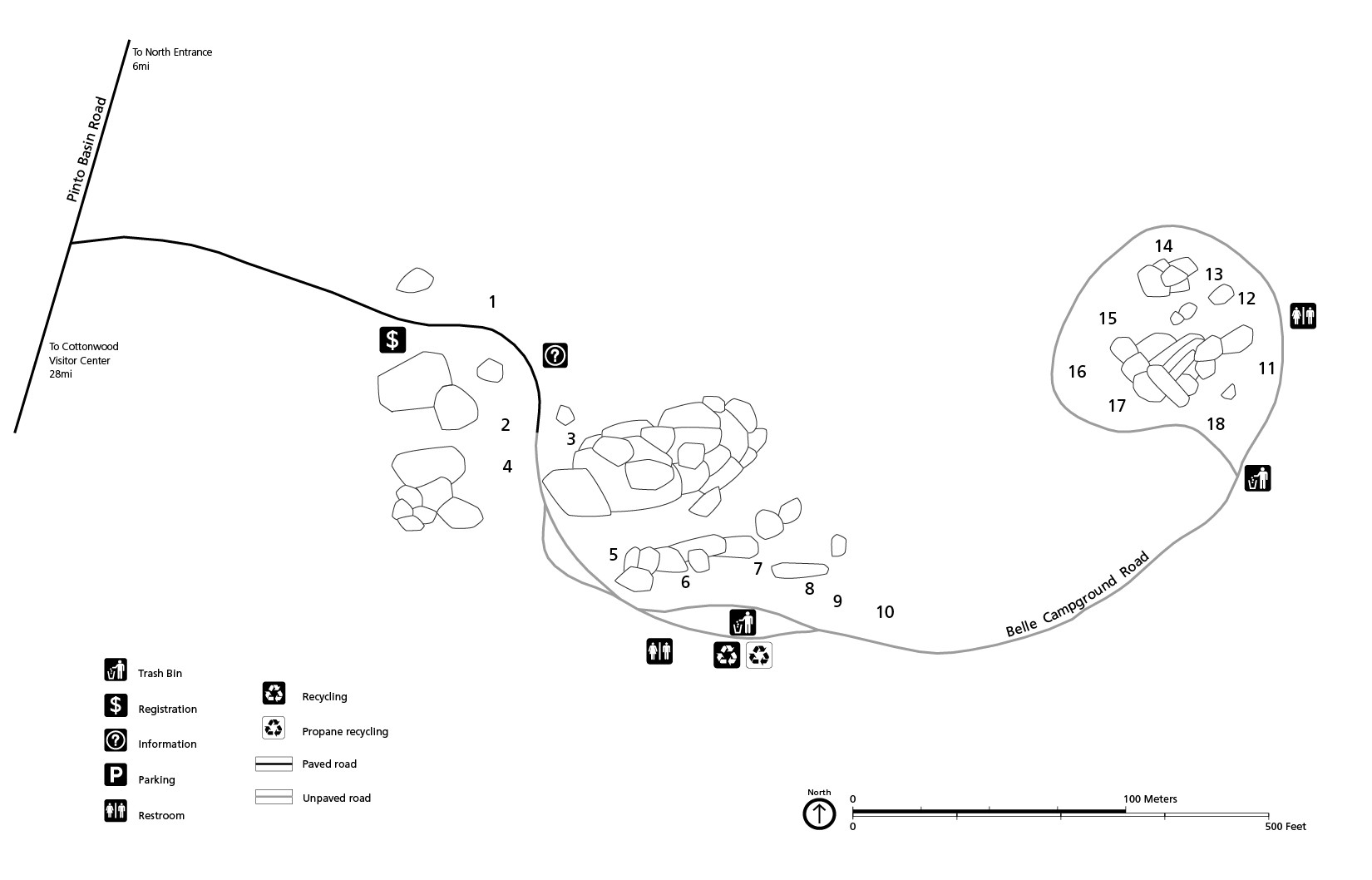
This Cottonwood Campground map shows the reservation-only campground located in the southern part of the park, further away from most attractions. But there are flush toilets and sinks and very dark night skies.
 Here’s a Sheep Pass Group Campground map. This centrally-located campground is only for large groups. Sites here are much larger and spaced further apart than the rest of Joshua Tree’s campgrounds.
 This Joshua Tree dispersed camping map (north) is for those who arrive late and have nowhere to camp. It shows a Bureau of Land Management (BLM) dispersed camping zone to the north outside of the park.
 The Joshua Tree dispersed camping map (south) shows the patchwork of BLM lands outside the park’s southern entrance. For these dispersed camping areas, you must be entirely self-sufficient.
Assorted Joshua Tree maps
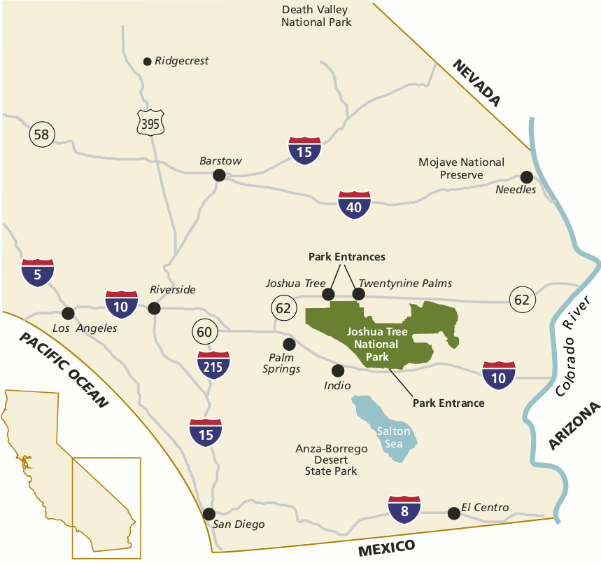 This regional map of Joshua Tree shows the surrounding highways, cities, and park entrances off I-10 and Highway 62. Click the image to view a full size map or download the PDF.
 This is a Joshua Tree wilderness map. 84% of Joshua Tree’s 1,200 square miles is managed as wilderness, including the designated Joshua Tree Wilderness and other lands classified as potential and proposed wilderness.
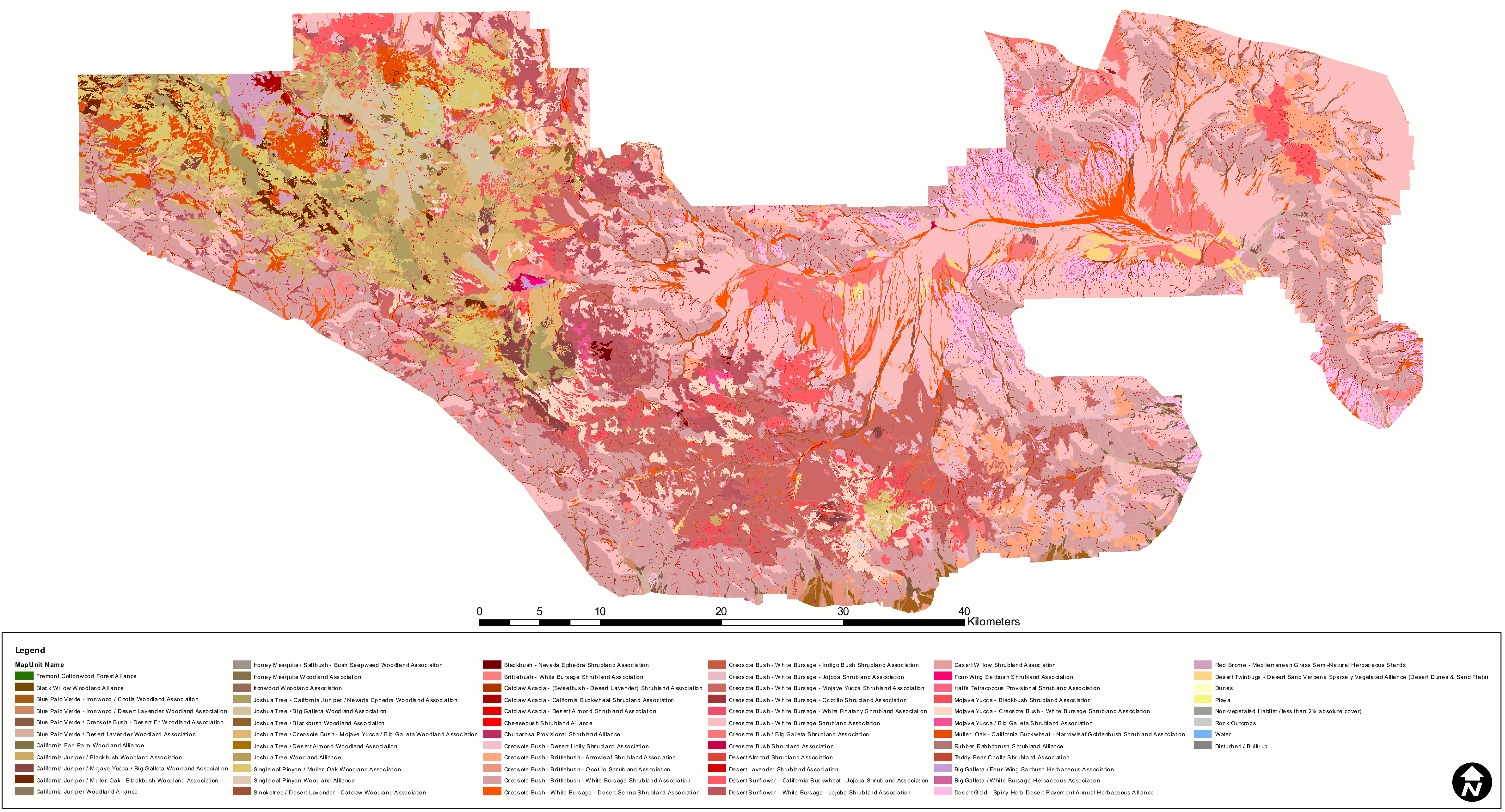 This Joshua Tree vegetation map shows what plant communities grow everywhere in Joshua Tree National Park — or where nothing grows, in the case of bare rock and sand dunes.
Joshua Tree horse trail maps
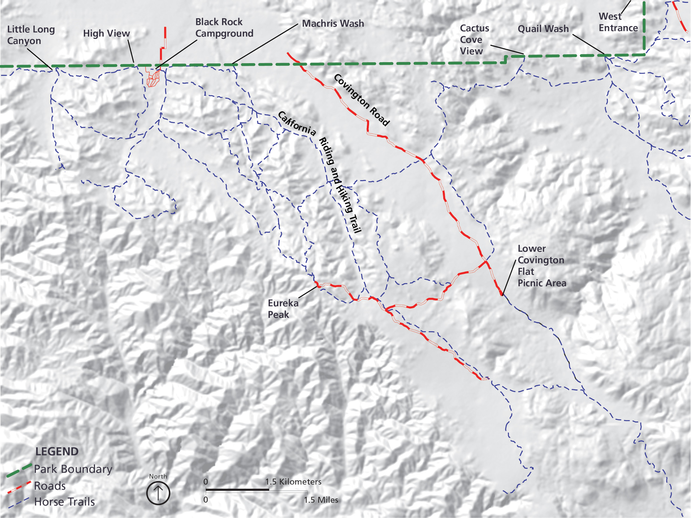 Here’s a Black Rock horse trail map that shows the various designated equestrian trails that depart from the Black Rock area. The Black Rock campground also has designated areas for stock and horses.
 The West Entrance horse trail map shows the network of trails for stock and horses. Note that the map labels Ryan Campground, which is the other Joshua Tree campground with room for stock animals.
Archived Joshua Tree maps
The National Park Service is always releasing new maps and I do my best to include new ones here. As older maps get updated, I move them down to this section. I never delete maps off this site, as I believe it’s important to be able to trace the evolution of parks over time. But these here have been superseded by newer ones above.
 This is the map of Joshua Tree National Park from the official brochure given at the park entrance, dating from the mid-2010s. Click the image to view a full size map or download the PDF.
 This is the older Joshua Tree park map, similar to the one above but is slightly less detailed and looks better when printing. Click the image to view a full size map or download the PDF.
…and more!
< Return to National Park Maps home
< Return to Park List
< Return to List by State