Indiana Dunes brochure maps
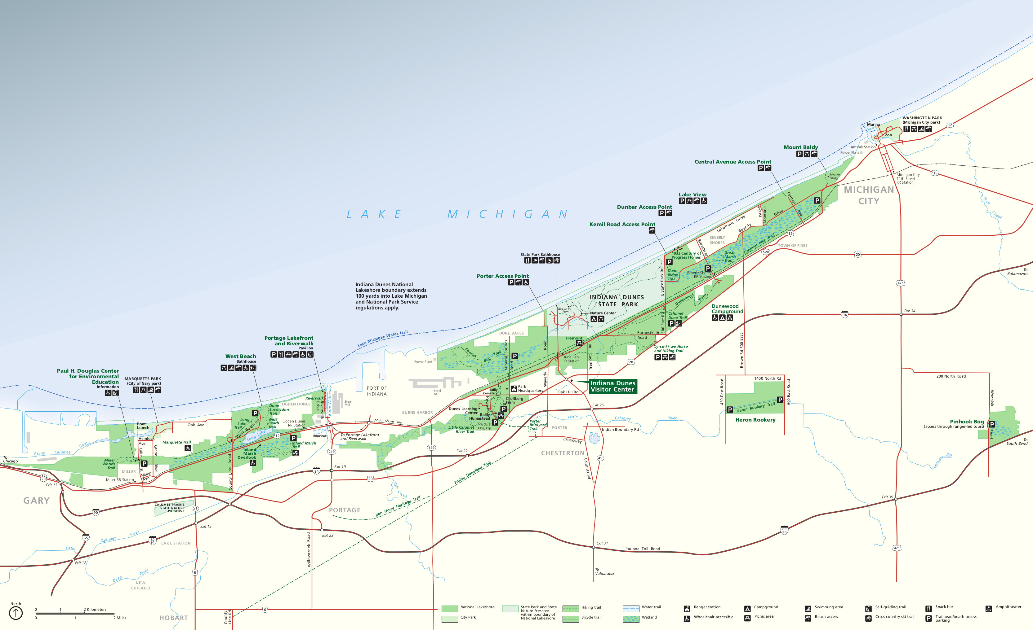
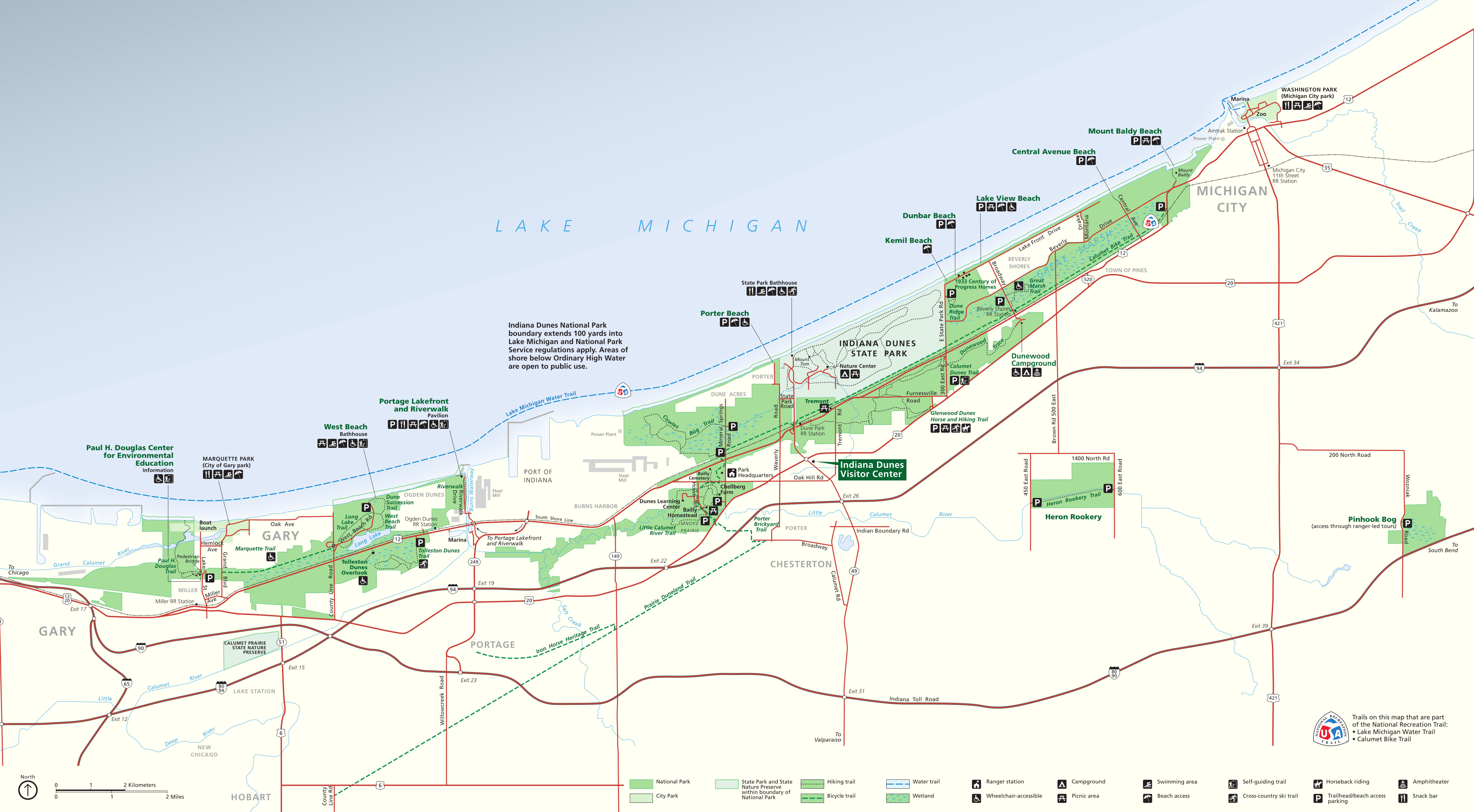 Here is the official Indiana Dunes National Park map. It was last updated by the National Park Service in 2020 and labels all the beaches and visitor services. Click the image to view a full size map or download the PDF.
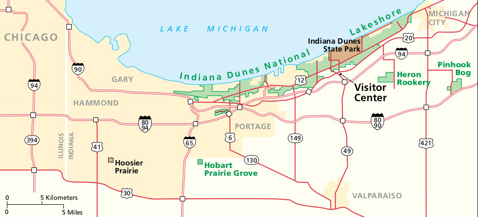 This is a regional map of Indiana Dunes, showing the park in relation to Chicago and the various interstate highways. Click the image to view a full size map or download the PDF.
Indiana Dunes trail maps
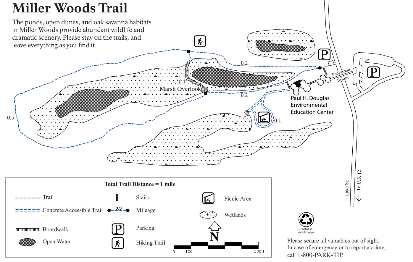
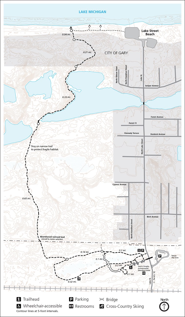 Here’s a Miller Woods trail map, which shows the Paul H. Douglas Trail and the network of trails surrounding the Paul H. Douglas Environmental Education Center.
 The West Beach trail map focuses on this very popular area of Indiana Dunes National Park. There are several loops, including the Dune Succession Trail and Long Lake Trail.
 This Tolleston Dunes trail map shows the couple miles of trails that wind through the Tolleston Dunes system. The Tolleston Dunes Overlook is also shown, which is accessed from further west on Highway 12.
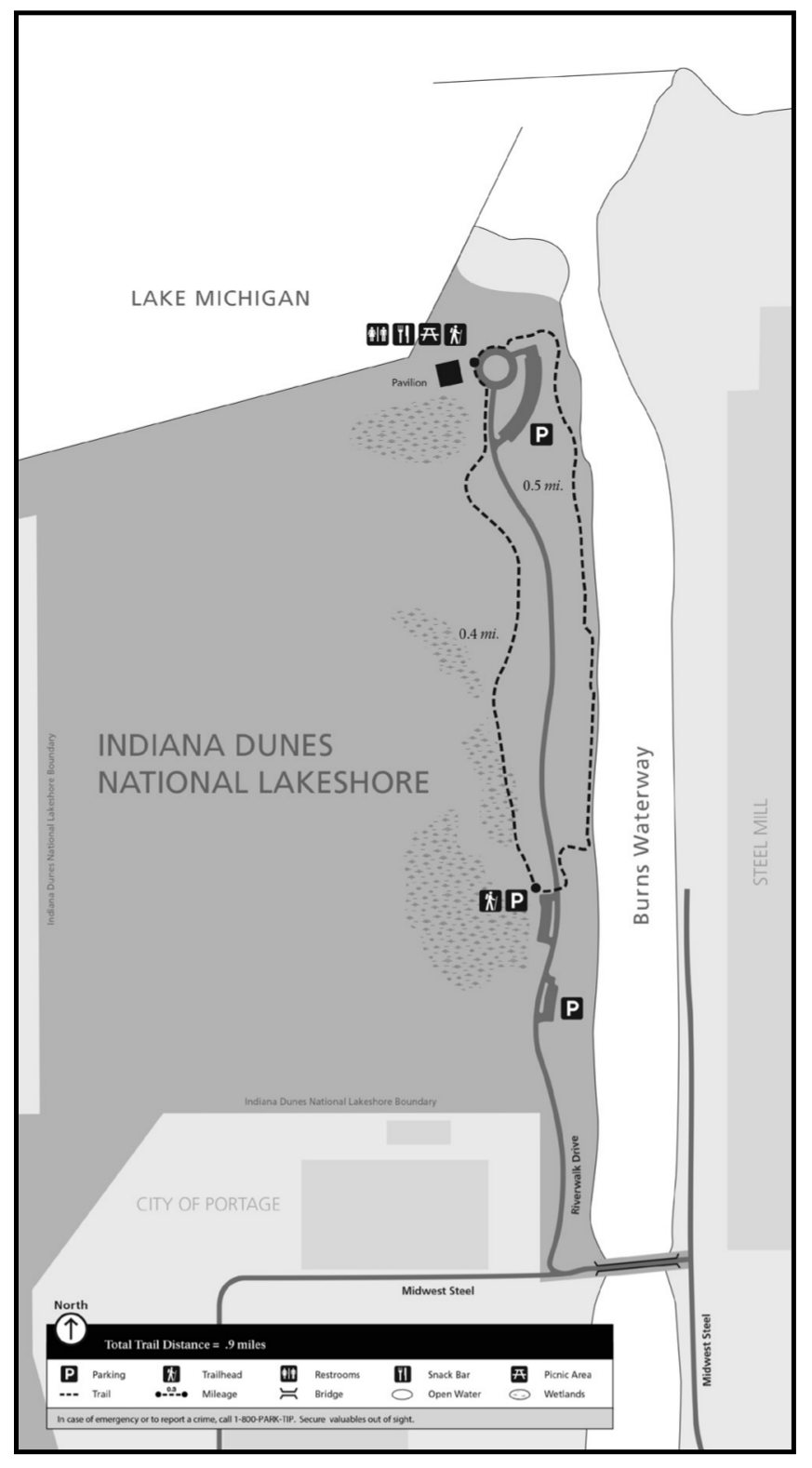
 This Portage Riverwalk trail map shows this popular route along the Burns Waterway. Note that as of 2025, the center segment of the trail is closed due to erosion and only the north and south ends can be accessed.
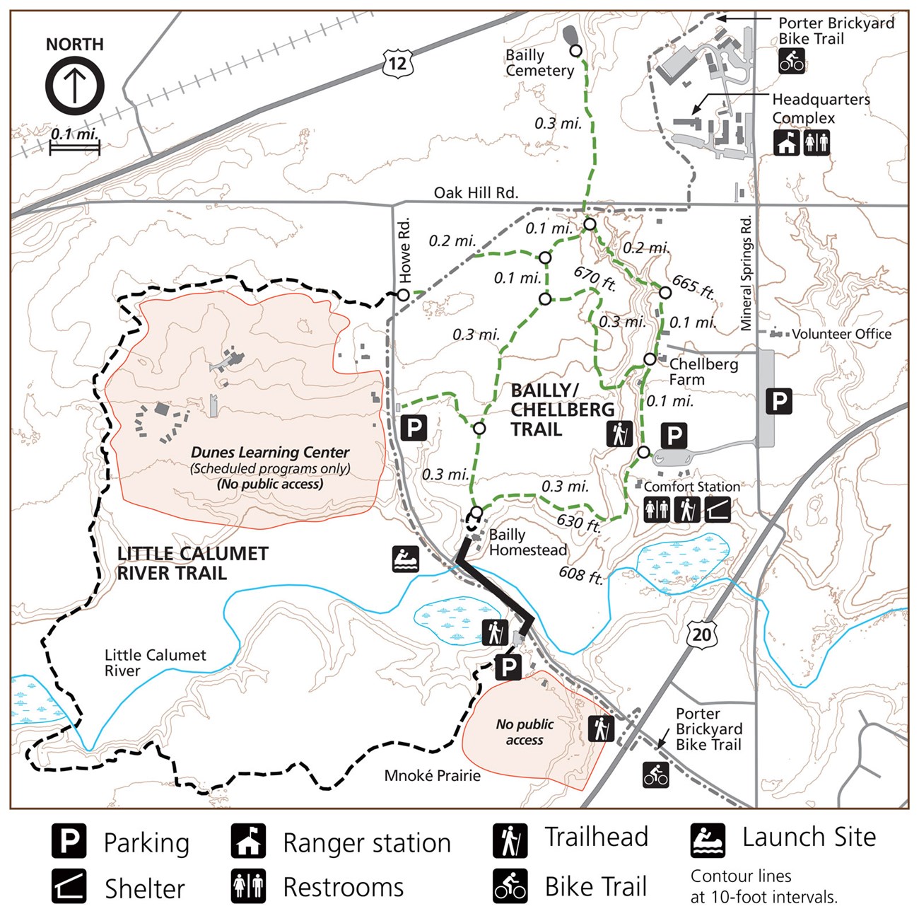 I call this the Bailly Homestead trail map, but it also includes many other hiking trails around Chellberg Farm and the Little Calumet River, as well as the Porter Brickyard Bike Trail.
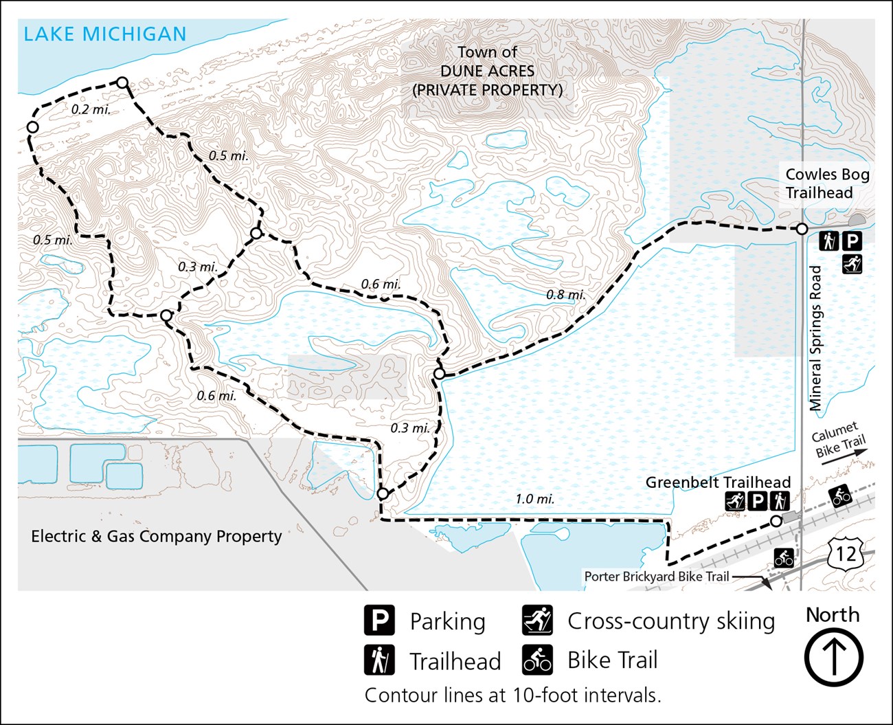 The Cowles Bog trail map includes both the Cowles Bog Trailhead and Greenbelt Trailhead. These routes connect together in a loop system that ventures out to Lake Michigan.
 This is a Glenwood Dunes trail map, which shows a few different loops. This extensive trail system connects to Dunewood Campground in the east and the Dune Park South Shore Railroad Station to the west.
 The Calumet Dunes trail map shows a short loop that includes paved trail and boardwalk. It’s accessed from the USGS Lake Michigan Ecological Research Station (which is actually Indiana Dunes’ old visitor center).
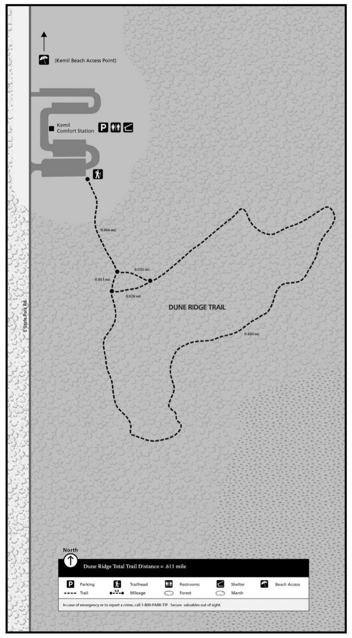
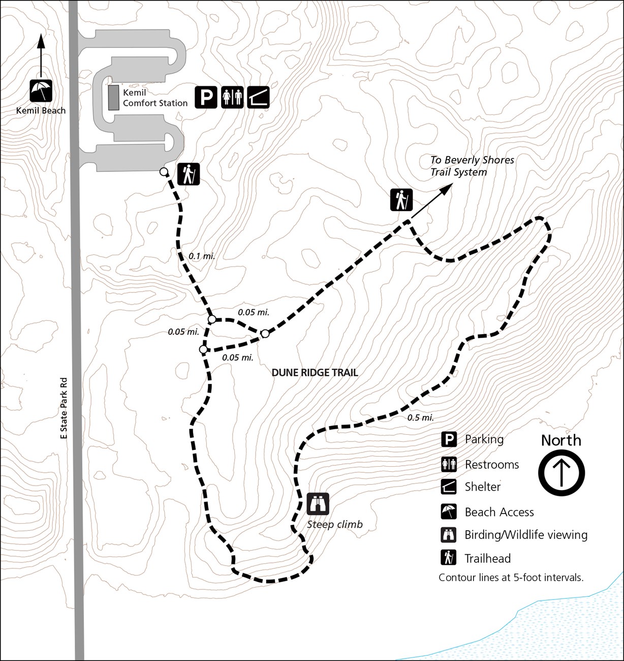 This is a Dune Ridge trail map, showing the short loop hike with a steep climb and views of forest and wetlands from above. You can reach it from E State Park Road en route to Kemil and Dunbar beaches.
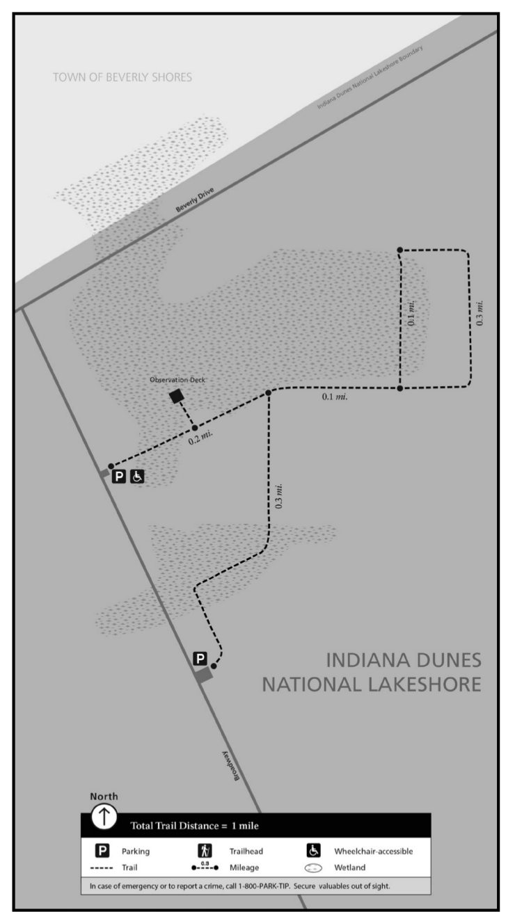
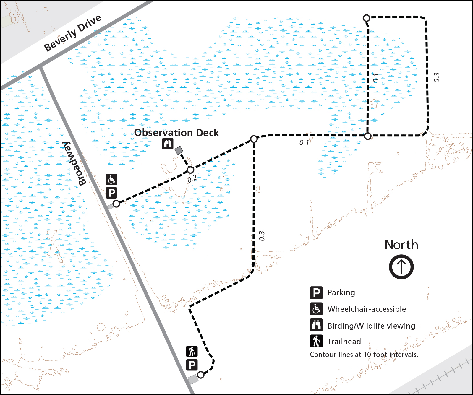 Here’s a Great Marsh trail map, which explores Lake Michigan’s largest wetland. It’s very popular among birders and features a short loop and an observation deck for waterbird, wader, and songbird viewing.
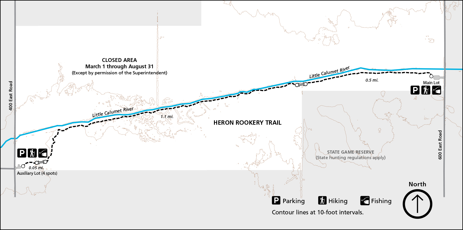 The Heron Rookery trail map focuses on a small area along the Little Calumet River. The trail connects two parking lots and can be done as an out-and-back or shuttle, but note that herons no longer nest in this area.
 The Pinhook Bog trail map includes the Upland Trail, which winds through beech and maple trees, and the out-and-back Pinhook Bog trail. It’s located southeast of the main park in a small detached parcel.
 Here’s a Mount Baldy trail map, which shows the Mount Baldy Beach Trail hike. Mount Baldy and the Summit Trail are closed for public access, but periodic ranger-led hikes provide access to the summit.
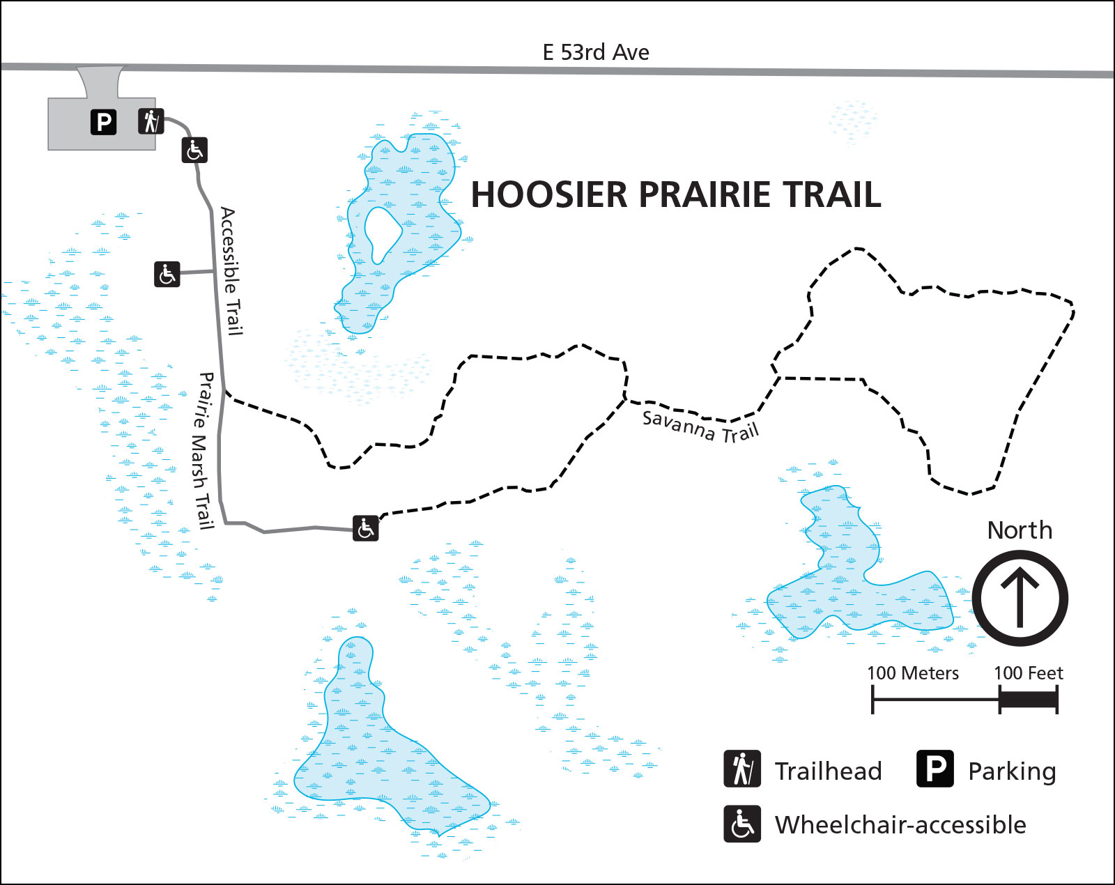 The Hoosier Prairie trail map shows this State Nature Reserve located southwest of the main Indiana Dunes park. It includes an accessible trail as well as a Savanna Trail loop and the Prairie Marsh Trail.
 This Hobart Prairie trail map shows a detached unit of Indiana Dunes, located southwest. The Oak Savannah trail is open for cycling, and a footpath spurs off to an overlook of Lake George.
Indiana Dunes campground maps
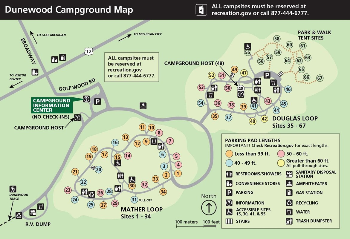 This is a Dunewood campground map, showing both drive-in and walk-in campsites. The map is color-coded to show the size of parking pads so you’ll know which ones will fit your RV or vehicle.
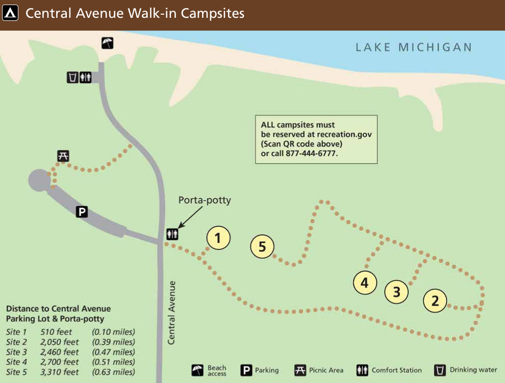 Here’s a Central Avenue campsite map. These five primitive walk-in campsites are located near Central Avenue Beach. The map indicates the distance you’ll need to walk to reach each site from the parking lot and vault toilet.
Indiana Dunes picnic map
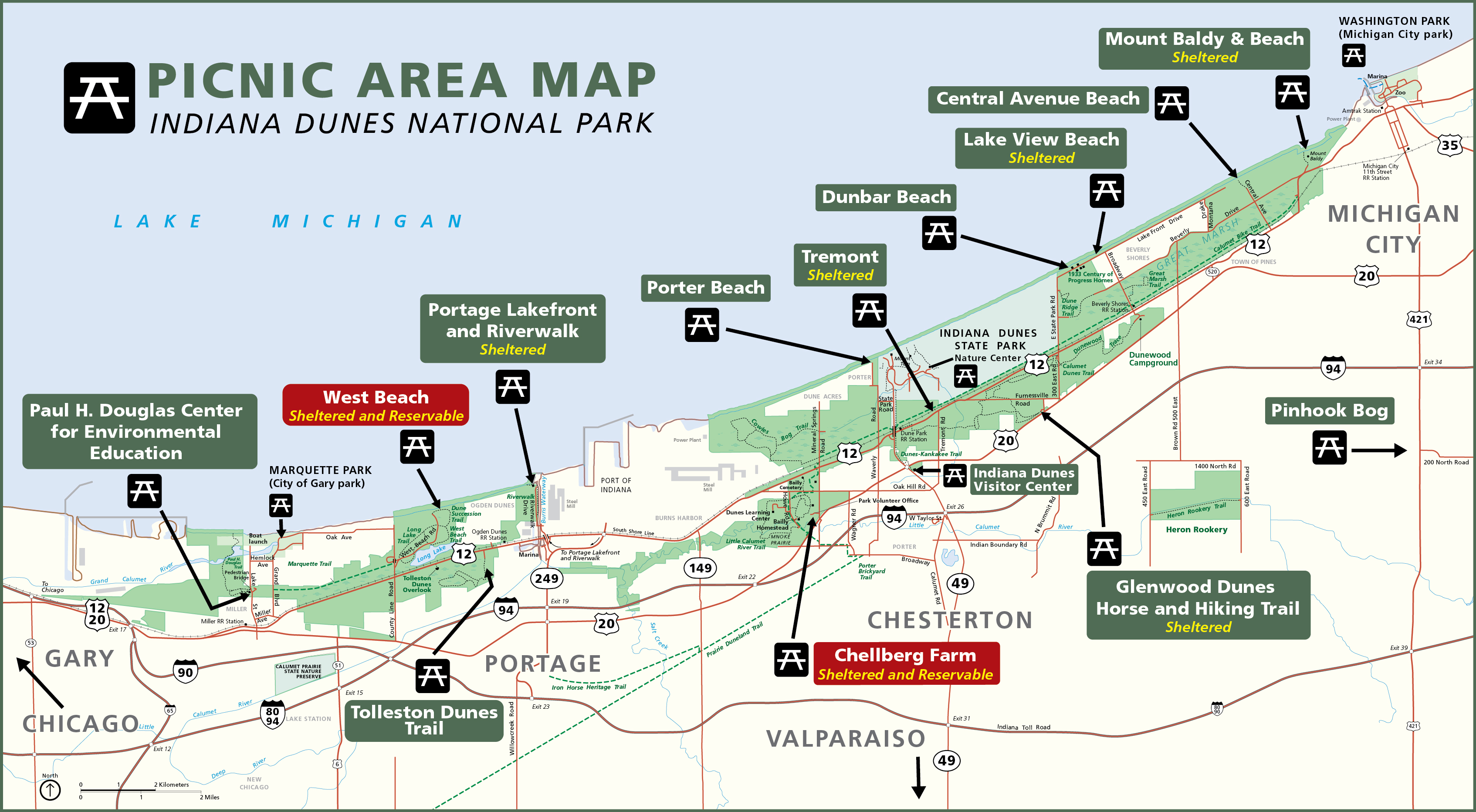 Here’s an Indiana Dunes picnic map, which labels all Indiana Dunes National Park picnic areas. Each is labeled to show if it’s reservable (Bailly Chellberg and West Beach) and whether it has a shelter.
Archived Indiana Dunes maps
Below are several maps that are no longer current; they have since been replaced by newer maps above. I have preserved them here for archival purposes and so users can track changes over time.
 Here is the old official Indiana Dunes map, showing each section of the park along Lake Michigan from Gary to Michigan City. Click the image to view a full size map or download the PDF.
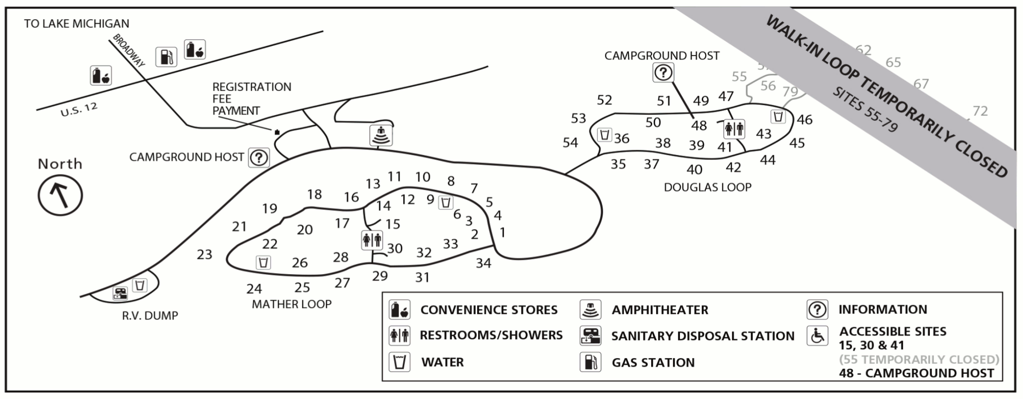 This is an old Dunewood campground map, showing both the Douglas and Mather loops in this 66-site campground near Great Marsh. Also labeled are restrooms, showers, and nearby convenience stores.
 This is an old Dune Ridge trail map, located just east of Indiana Dunes State Park on the way to Kemil Beach and other beach access points. You can make this hike a short loop.
 Here’s an old Miller Woods trail map, located in the far western part of the park adjacent to the Paul H. Douglas Center for Environmental Education. It has a loop trail, boardwalk, and picnic area.
 This old Portage Lakefront and Riverwalk trail map, located in Portage west of the Port of Indiana along the Burns Waterway. This short trail is less than one mile and runs directly north/south.
 Here’s the old Great Marsh trail map, located east of the state park near the Calumet bike trail and the town of Beverly Shores. You’ll find an observation tower and two parking lots to access this trail.
…and more!
< Return to National Park Maps home
< Return to Park List
< Return to List by State