Yosemite maps from the park brochures
 This is the main Yosemite park map from the National Park Service brochure, showing Yosemite trails, roads, campgrounds, and visitor services. Click the image to view a full size map or download the PDF.
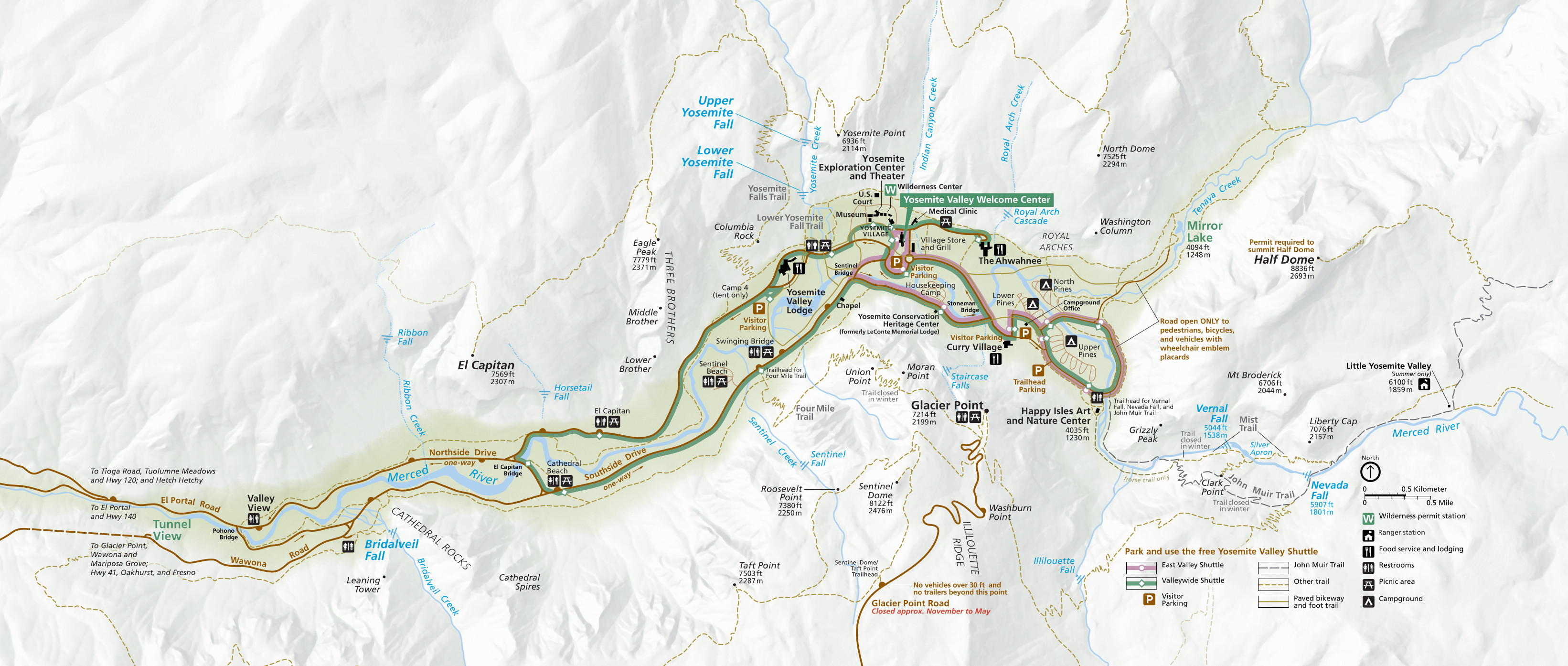 Here’s a Yosemite Valley map that zooms in on Yosemite Valley, which is by far the most visited area of the park. It includes Yosemite Falls, Half Dome, El Capitan, Bridalveil Falls, the Mist Trail, and all the major hits.
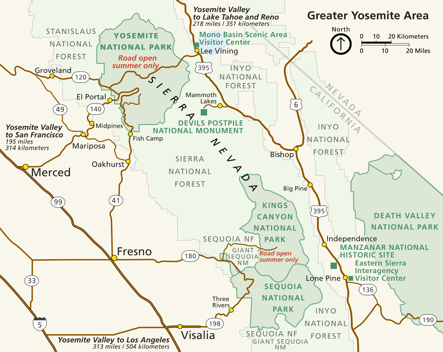 This Yosemite regional map zooms way out to show the park in relation to Sequoia and Kings Canyon National Parks, as well as Mono Lake and Highway 395 on the east side of the Sierra Nevada.
Yosemite trail maps
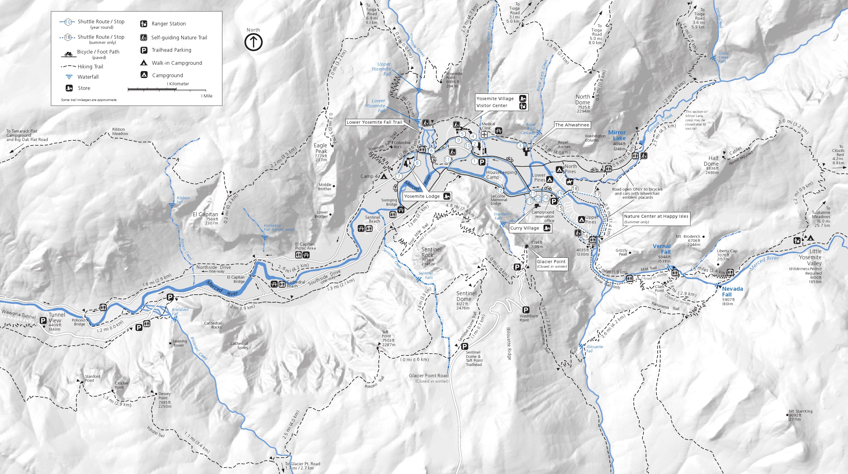 This is the Yosemite Valley trail map, showing the popular Yosemite Valley hikes including Yosemite Falls, Half Dome, Vernal Fall, Nevada Fall, Mirror Lake, Valley Loop, and Bridalveil Fall.
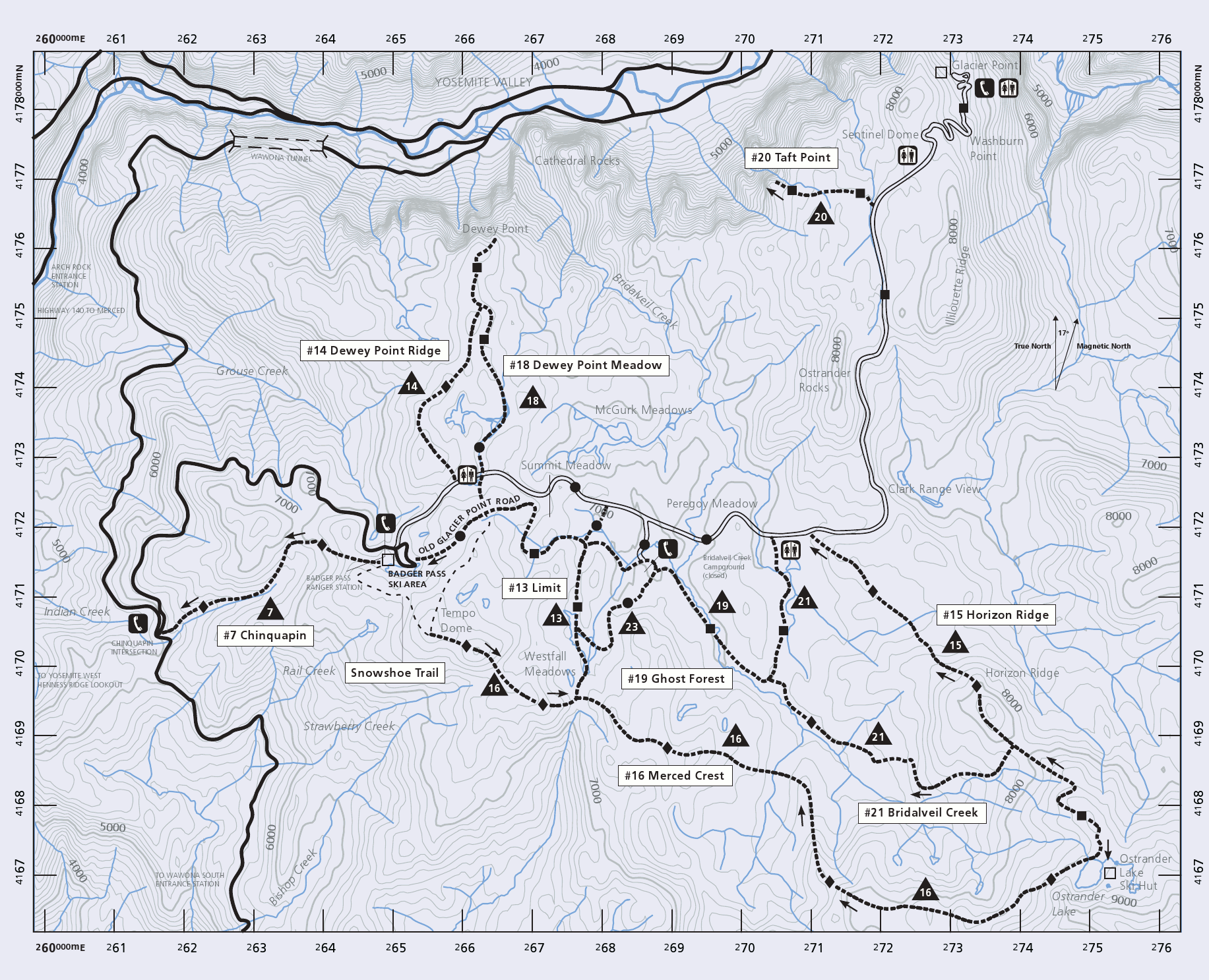
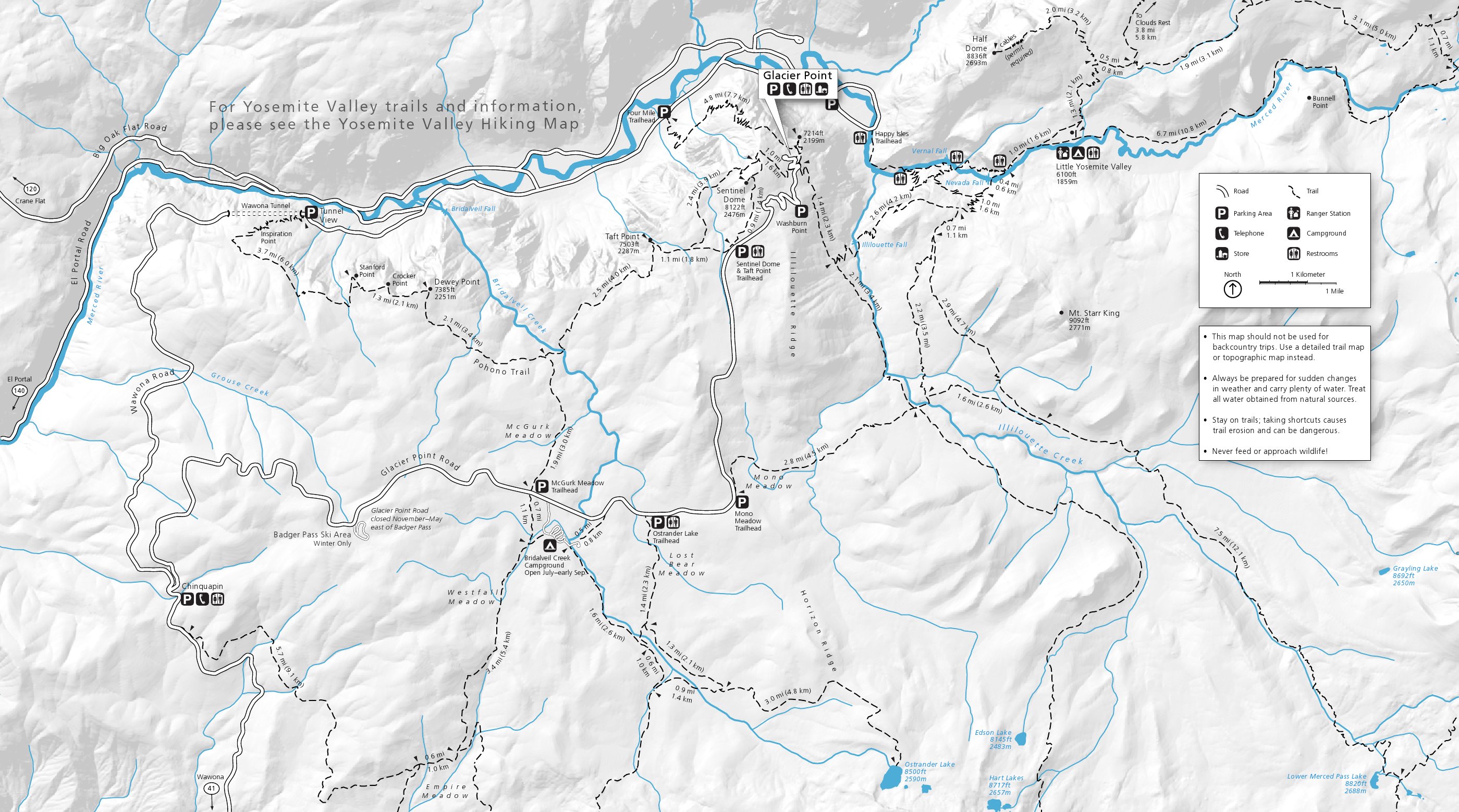 This is the Glacier Point area trail map, showing Glacier Point Road area hiking trails including Sentinel Dome, Taft Point, Dewey Point, and Ostrander Lake. (Sentinel Dome and Taft Point are my favorites.)
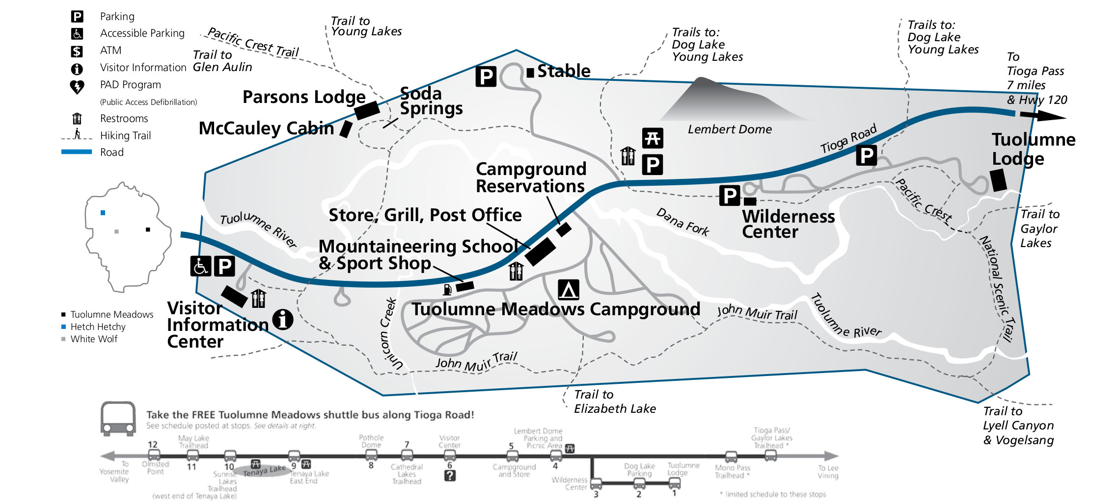
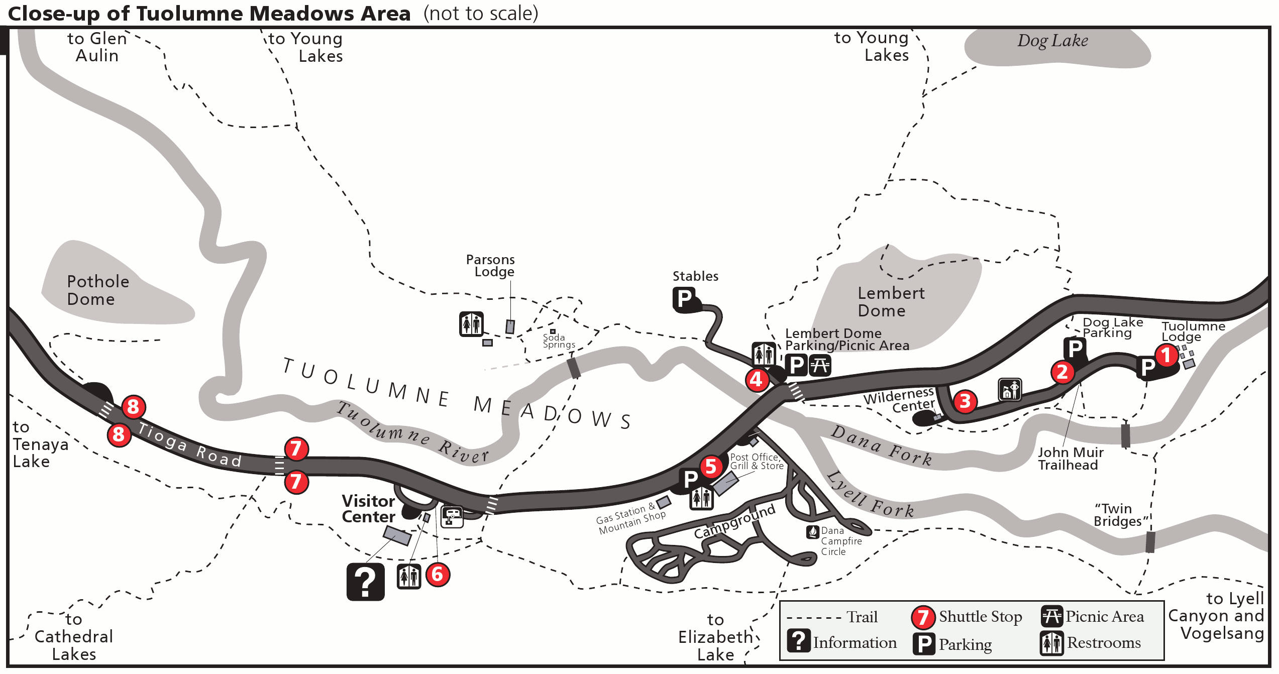
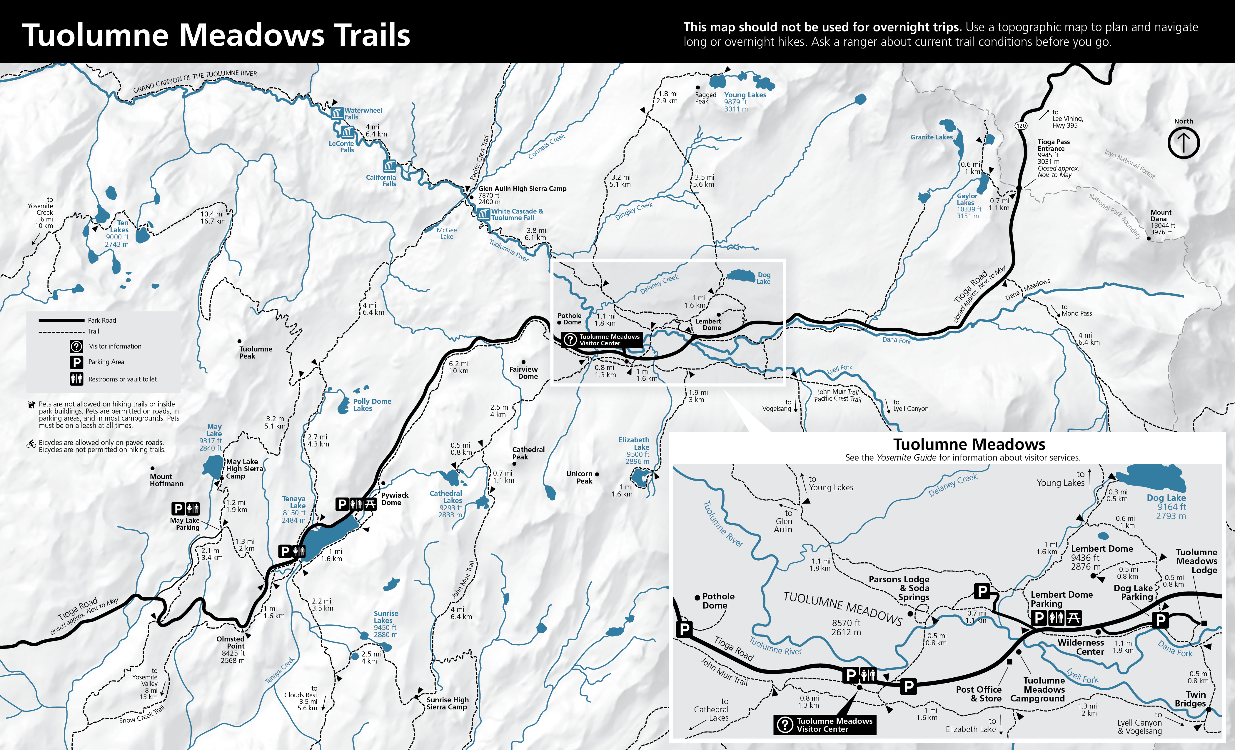 This is a Tuolumne Meadows trail map that shows Tioga Road from May Lake to Tioga Pass, including the John Muir Trail, Pacific Crest Trail, Tenaya Lake, Cathedral Lakes, Elizabeth Lake, Glen Aulin, and more.
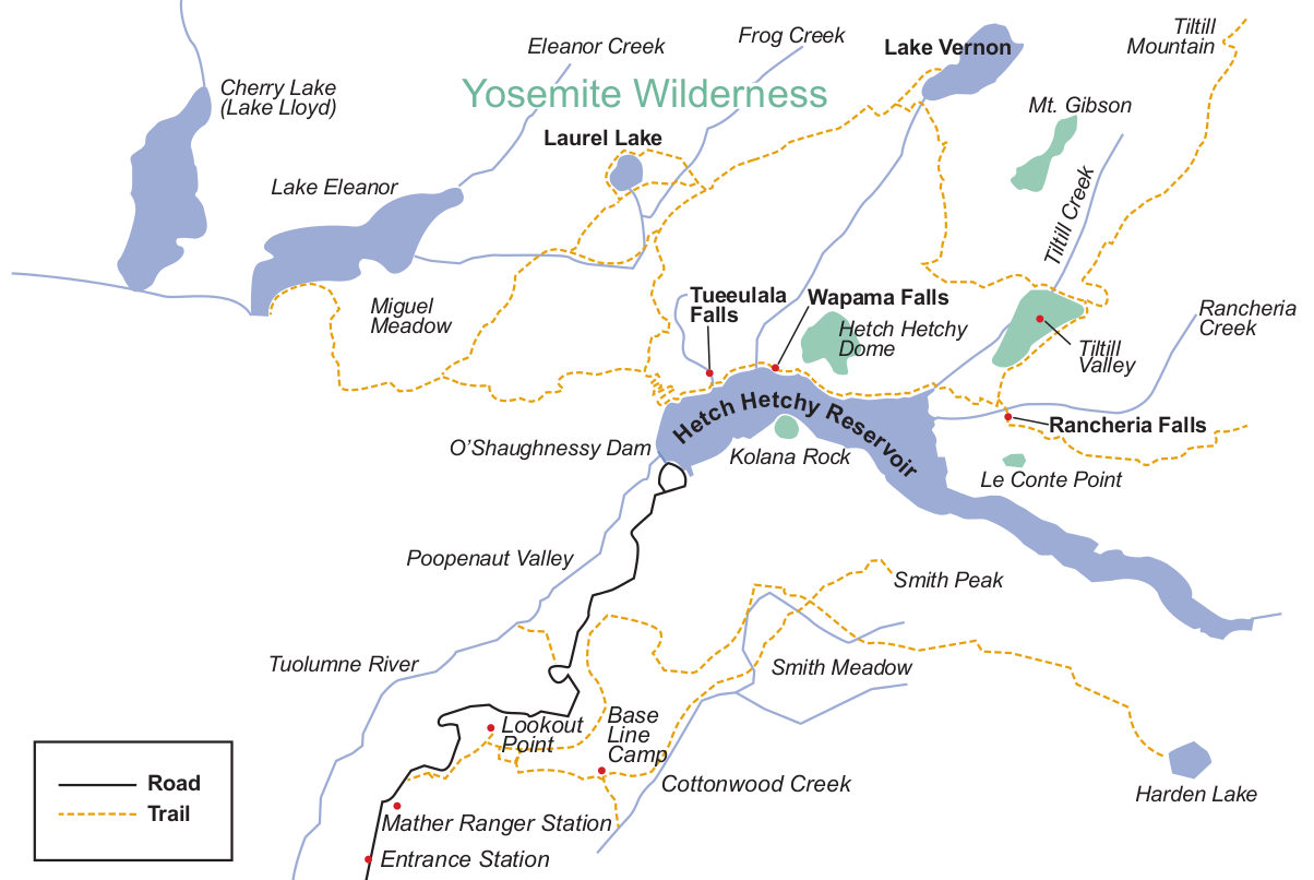
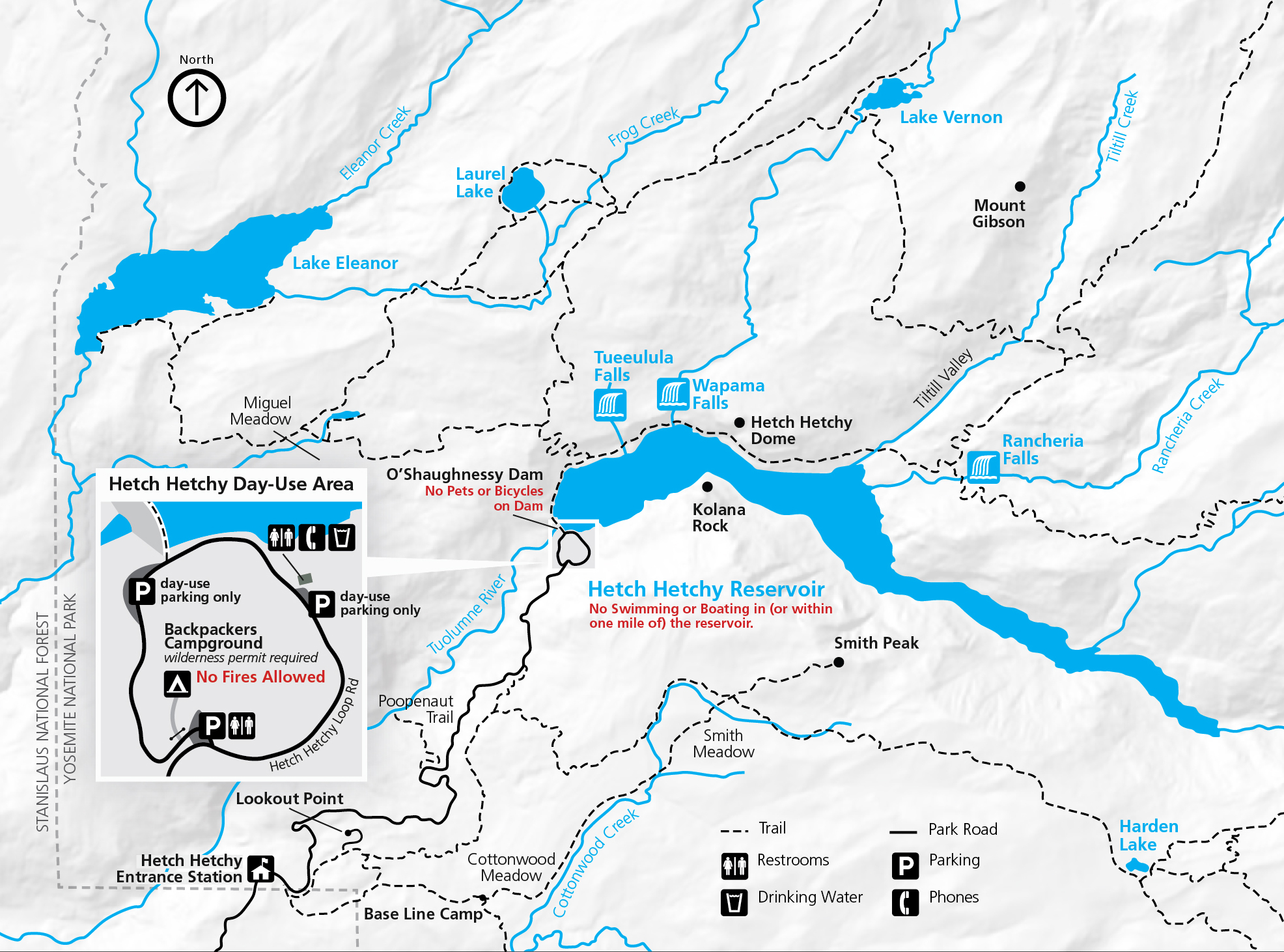 Here’s a Hetch Hetchy trail map last updated in 2023. An inset shows the day use area, and the main map includes all the trails to popular locations like Wapama Falls, Rancheria Falls, Lake Vernon, and Smith Peak.
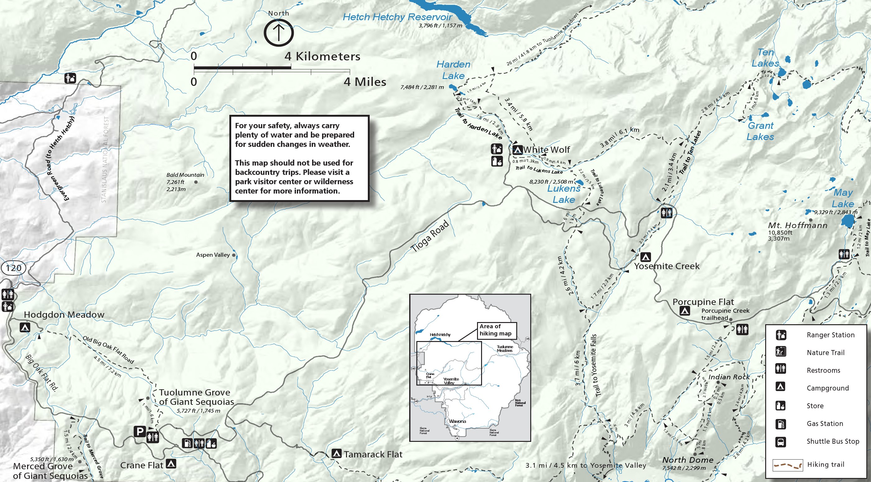 This Crane Flat/White Wolf trail map features hikes off western Tioga Road including North Dome, Tuolumne Grove, Harden Lake, May Lake, and Lukens Lake. Of these, North Dome is my favorite.
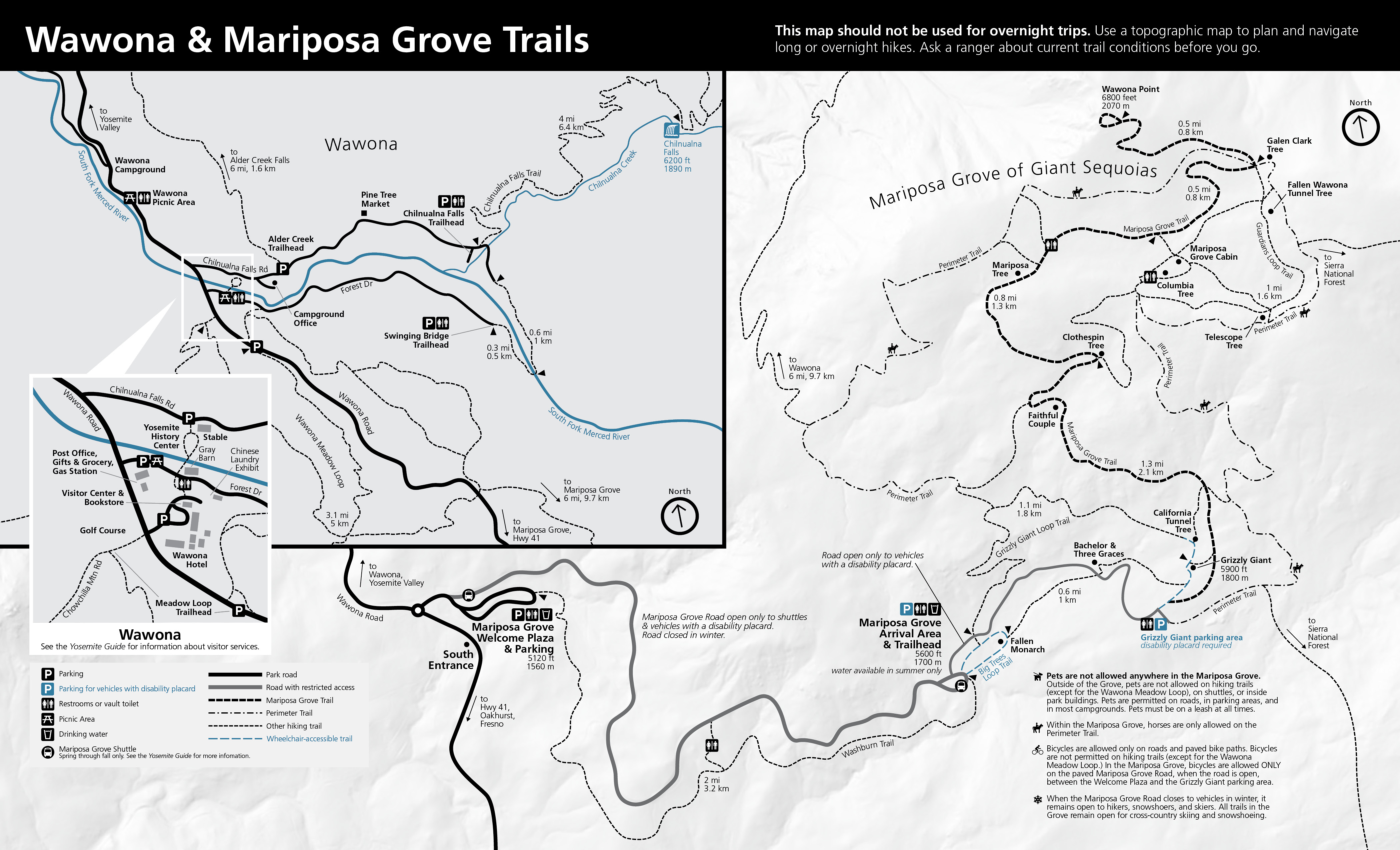 Here’s a Wawona and Mariposa Grove trail map from 2024, which focuses on the Mariposa Grove but also includes trail in the Wawona area such as Chilnualna Falls and the Meadow Loop.
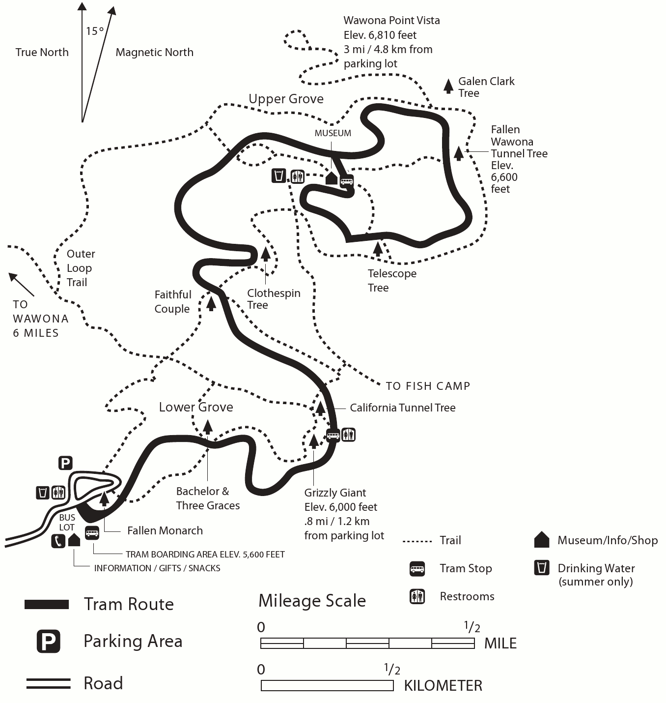
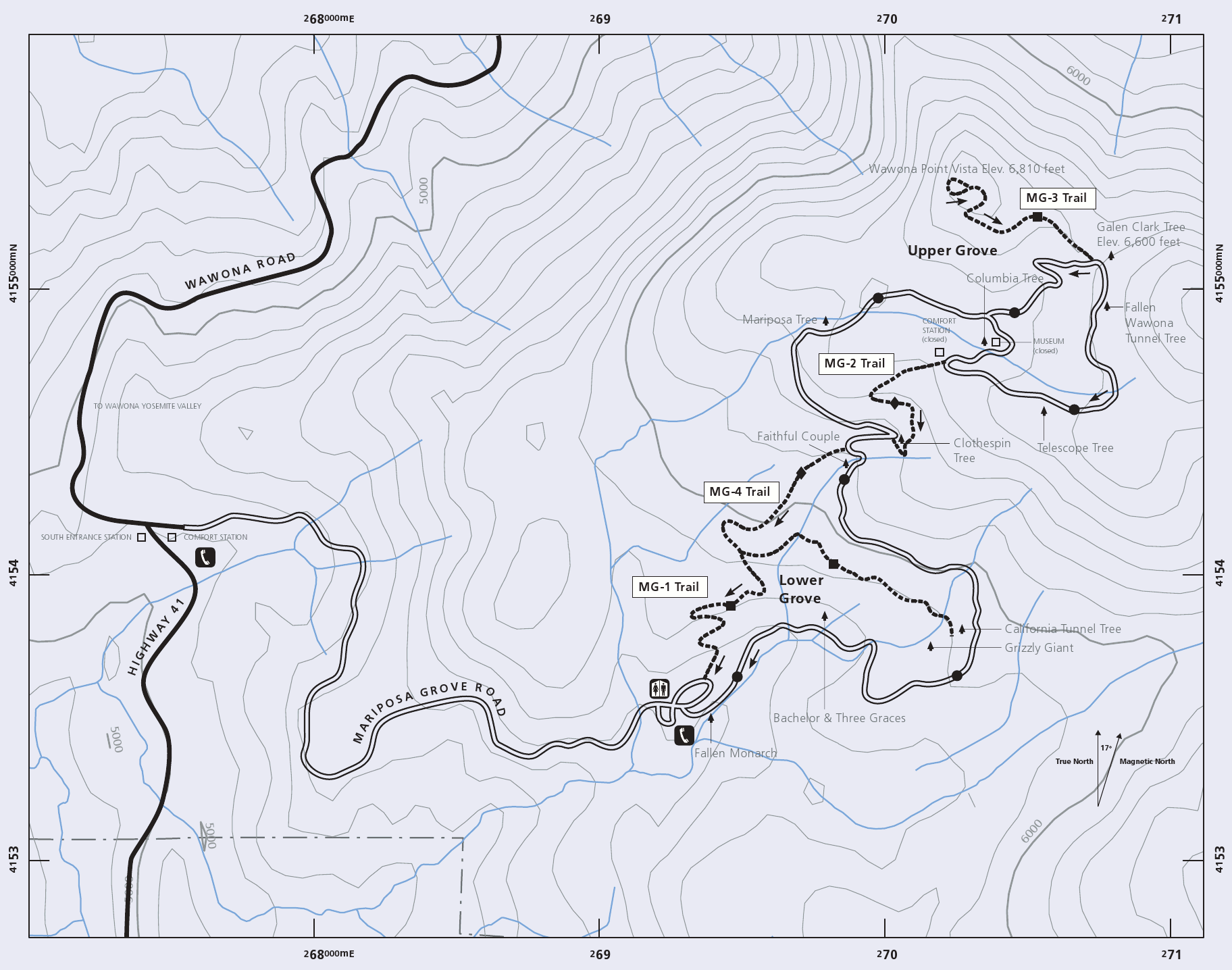
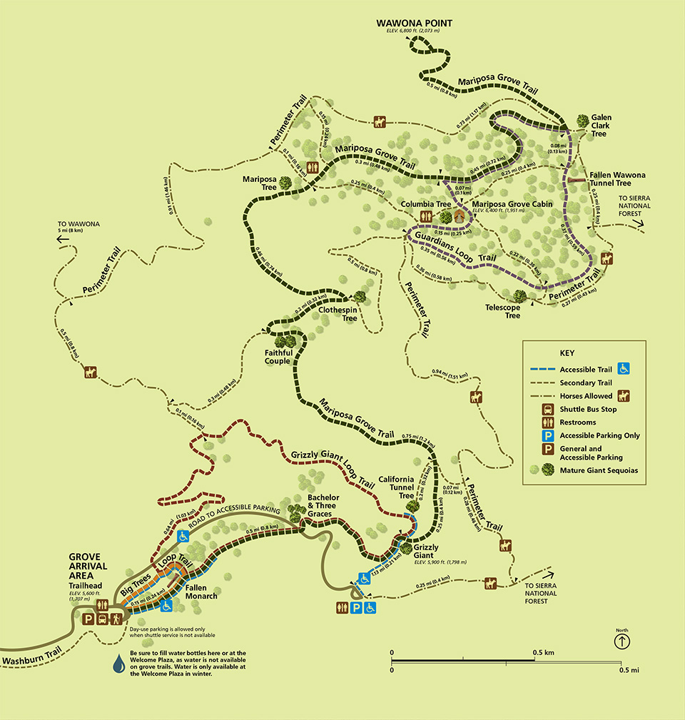 Here’s a Mariposa Grove trail map, showing trails to the Grizzly Giant, California Tunnel Tree, and more. You can see the various hiking options from the main parking lot and shuttle bus arrival area.
 If you’re mostly doing day hikes in Yosemite, the free maps above should be sufficient, though they won’t include elevation contours. If you’re doing a lot of hiking or an overnight trip, you’ll definitely want to purchase a detailed trail map, such as the National Geographic Trails Illustrated map. Also consider the larger-scale Trails Illustrated four-pack bundle if you’re planning to hike in lots of different parts of the park, or returning for more than one visit.
Yosemite shuttle maps
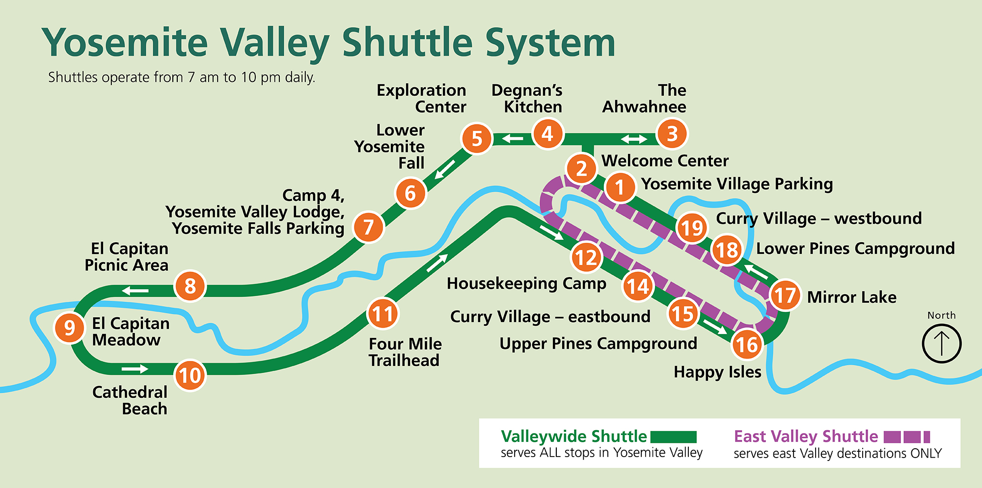 The simple Yosemite Valley shuttle map is the easiest to read of the options provided here. Geographic accuracy is sacrificed for legibility, making it the easiest to discern the East Valley Shuttle from the Valleywide Shuttle.
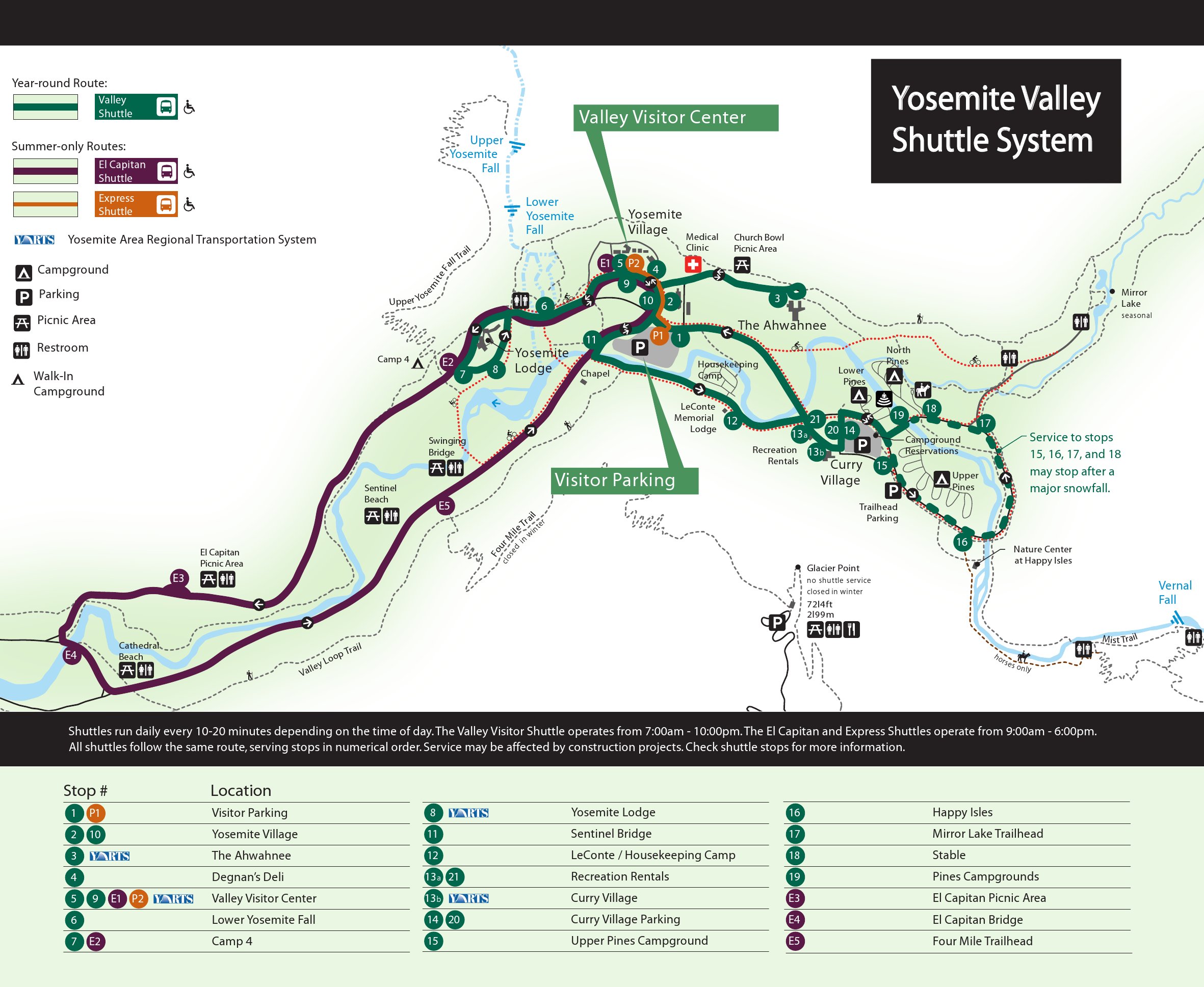
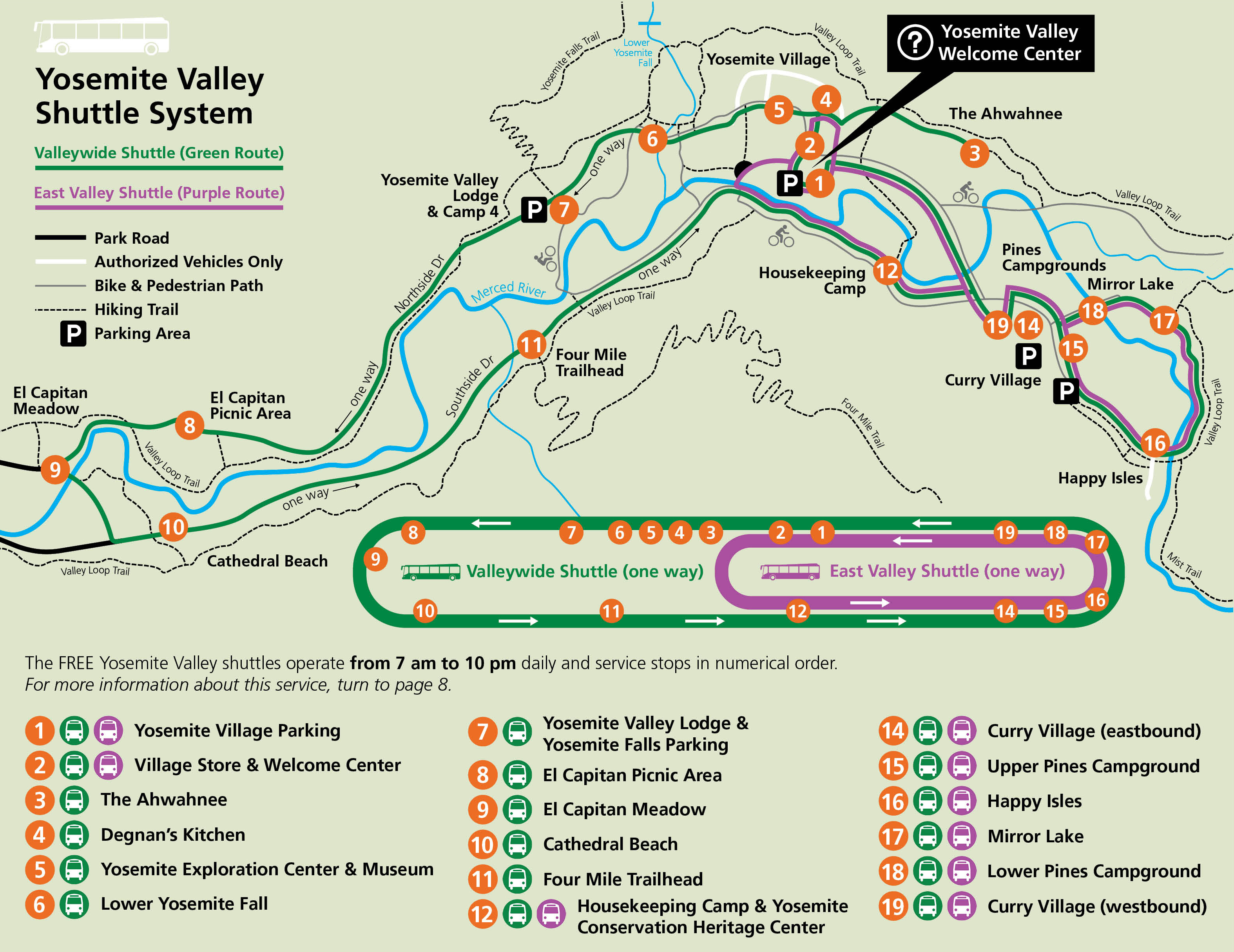 Here’s the Yosemite Valley shuttle map, plotting the routes on a Yosemite Valley map that shows trails, roads, and parking. A handy key labels each stop with a brief explanation of what’s found there.
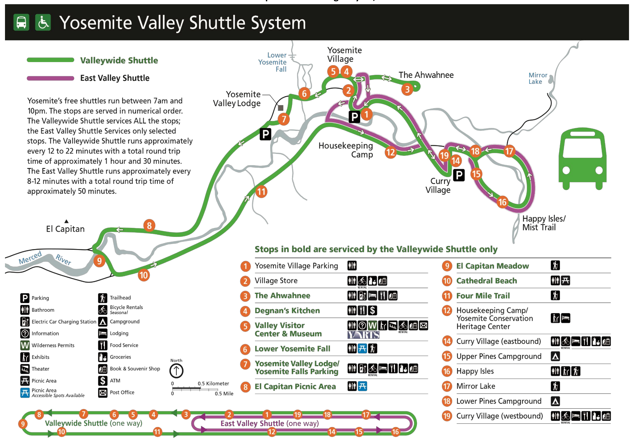 This printable Yosemite shuttle map is similar to the one above but is in simpler colors and makes for easier printing. It also does a better job at showing the various amenities at each shuttle stop.
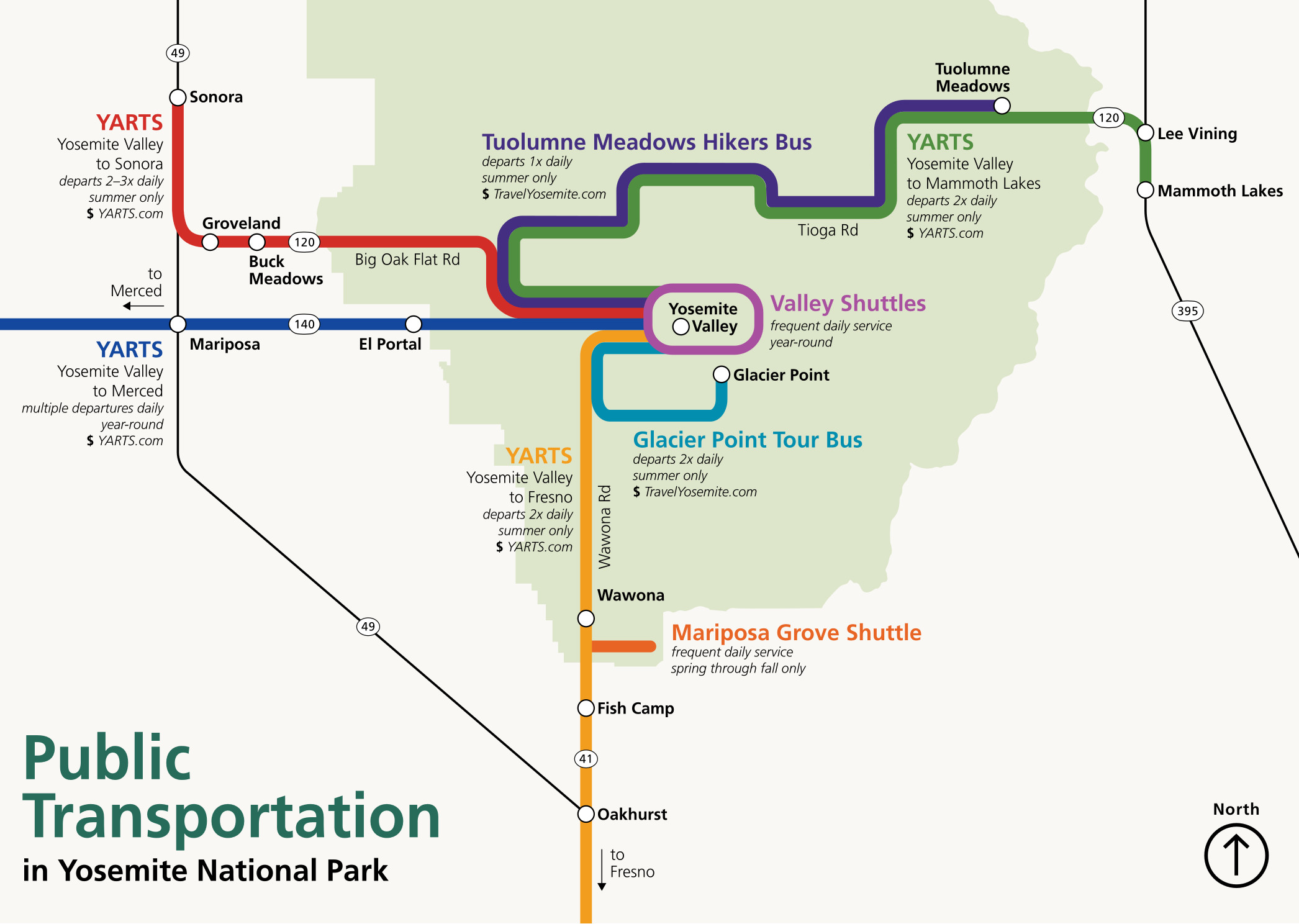 This Yosemite public transportation map shows different ways of getting to and around the park without a car, including from Mammoth Lakes, Merced, and Fresno. Note that many of these routes are summer only.
Various Yosemite Valley maps
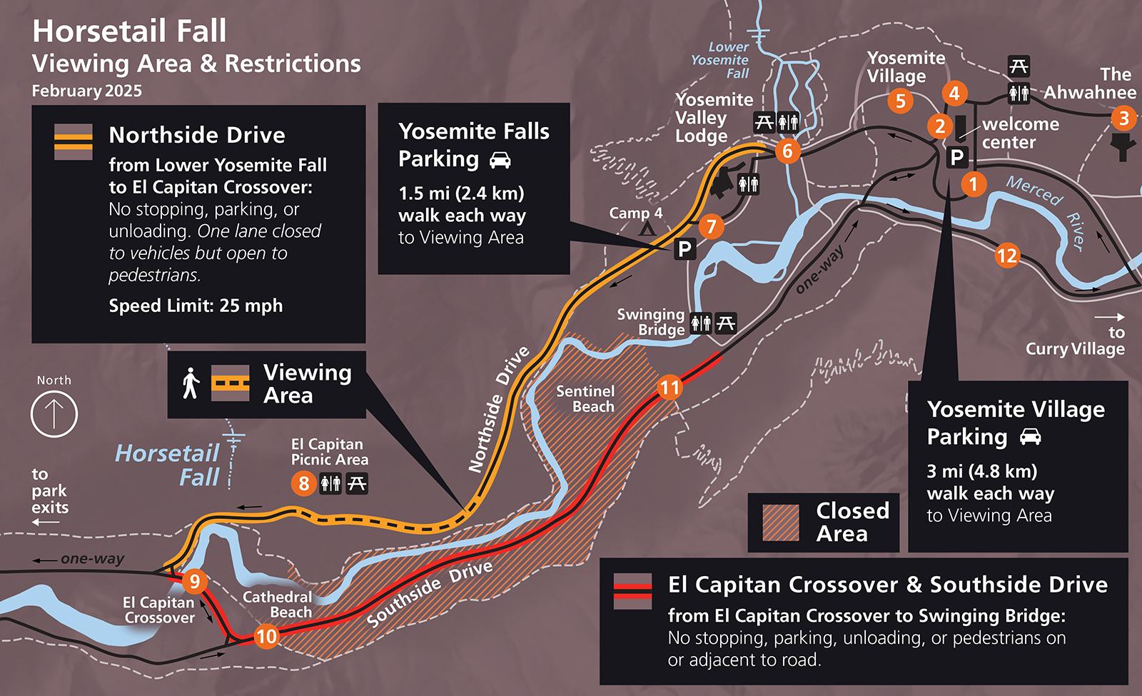 This is a Horsetail Fall map. Every year in late February, the “firefall” appears and Yosemite Valley gets crowded with those trying to view the falls. This map shows the closures and parking for viewing for 2025.
 Here’s a Yosemite Valley parking map, showing the various parking areas in Yosemite Valley. Expect traffic if you’re visiting in the summer or on a weekend, so arrive early and use the free shuttle bus!
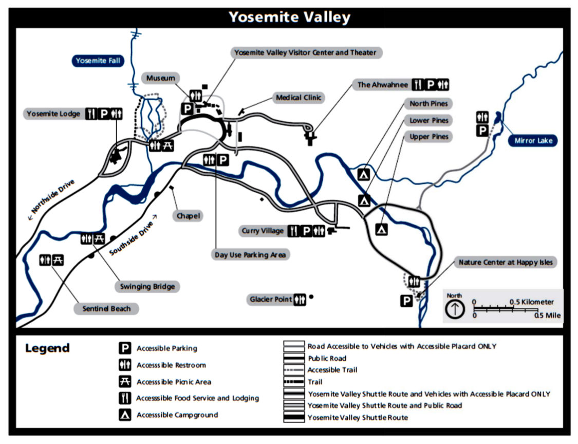
 This is a Yosemite Valley accessibility map, last updated in 2022. It shows the accessible parking areas and trails within Yosemite Valley that require a blue placard to park your car.
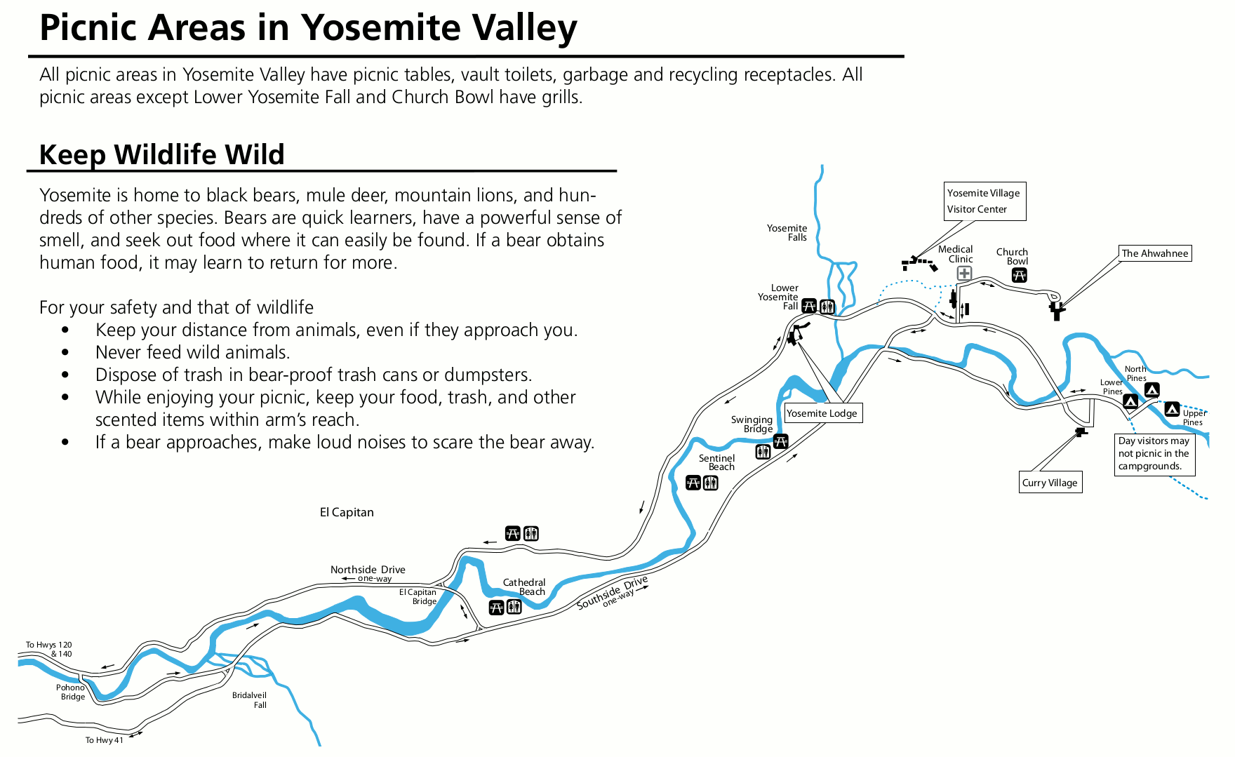 Here’s a Yosemite Valley picnic areas map, zooming in Yosemite Valley to show the several picnic areas located in this part of the park. Arrive early to get your spot!
 This Yosemite Valley cross-section isn’t really a map, but it’s so cool that I had to include it; it shows the width vs. height of Yosemite Valley with north/south cross-sections in three locations.
Beyond Yosemite Valley maps
 Here’s a Tuolumne Meadows simple map that shows the main points of interest along Tioga Road. Note that this map shows a free shuttle bus route that is sadly not generally in operation anymore.
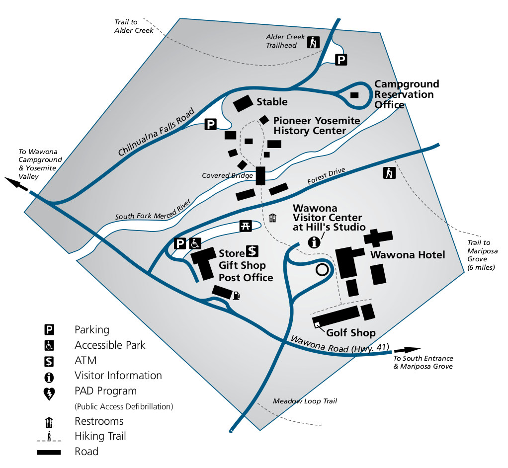 I pulled this Wawona map from the Yosemite park newspaper and is therefore designed to be simple and easy to read, even if it isn’t quite to scale. It’s perfect for easy orientation in the Wawona area.
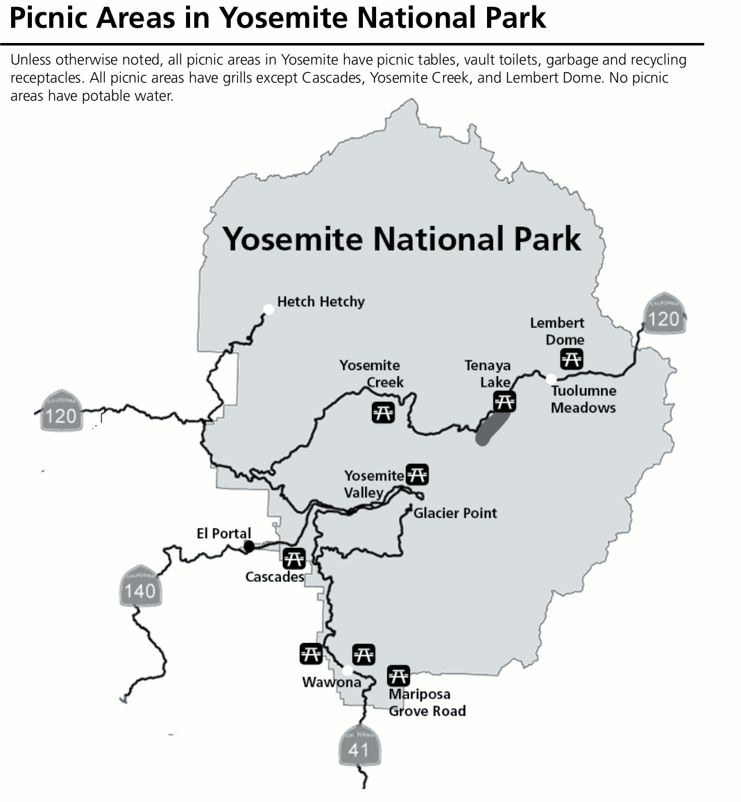 This Yosemite picnic areas map shows all the picnic areas in Yosemite National Park that are not located in Yosemite Valley. (Yosemite Valley has a separate picnic map in the Yosemite Valley section above.)
Yosemite lodging maps
Yosemite is a huge park, with hundreds of lodging options in nearby towns depending on which way you enter the park. Below I’ll summarize the advantages and disadvantages of staying in each area, including links to Expedia’s interactive lodging maps on the right.
 From the northwest, you enter on Highway 120 through the Big Oak Flat entrance. This area gives you good access to the Hetch Hetchy part of Yosemite and decent access to Tioga Road, although it’ll make for a long drive to see the Mariposa Grove of giant sequoias (check out the smaller Tuolumne Grove instead). Here’s Expedia’s top-rated Big Oak Flat entrance lodging to compare reviews and photos.
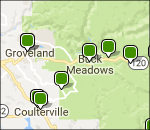
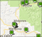 From the west, you enter on Highway 140 through the towns of Mariposa, Midpines, and El Portal. While Mariposa has by far the most options, El Portal is quite a bit closer, though lodging is more limited (and El Portal isn’t a “real” town, so services will all be at your hotel only. Here’s Expedia’s top west entrance lodging, where you’ll see a couple El Portal hotels and a bunch in Mariposa.
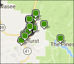 From the south, Highway 41 brings you into Yosemite. The largest concentration of hotels is in Oakhurst, but if you look north on the map you’ll also find options in Fish Camp. This area is great for visiting the Mariposa Grove of giant sequoias, but makes for a particularly poor choice to visit Tuolumne Meadows and Tioga Road. Here are Expedia’s top south entrance lodging to find the best fit for you.
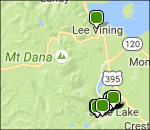 From the east, Highway 120 via 395 brings you to Tioga Pass — Yosemite’s east entrance. From near to far, your towns are Lee Vining, June Lake, and Mammoth Lakes. If you scroll down you’ll find Mammoth Lakes, which is the largest town but furthest of the three. These are great places to stay to see Tuolumne Meadows, but are quite far from Yosemite Valley. Browse Expedia’s east entrance lodging to find your best fit.
Yosemite wilderness maps
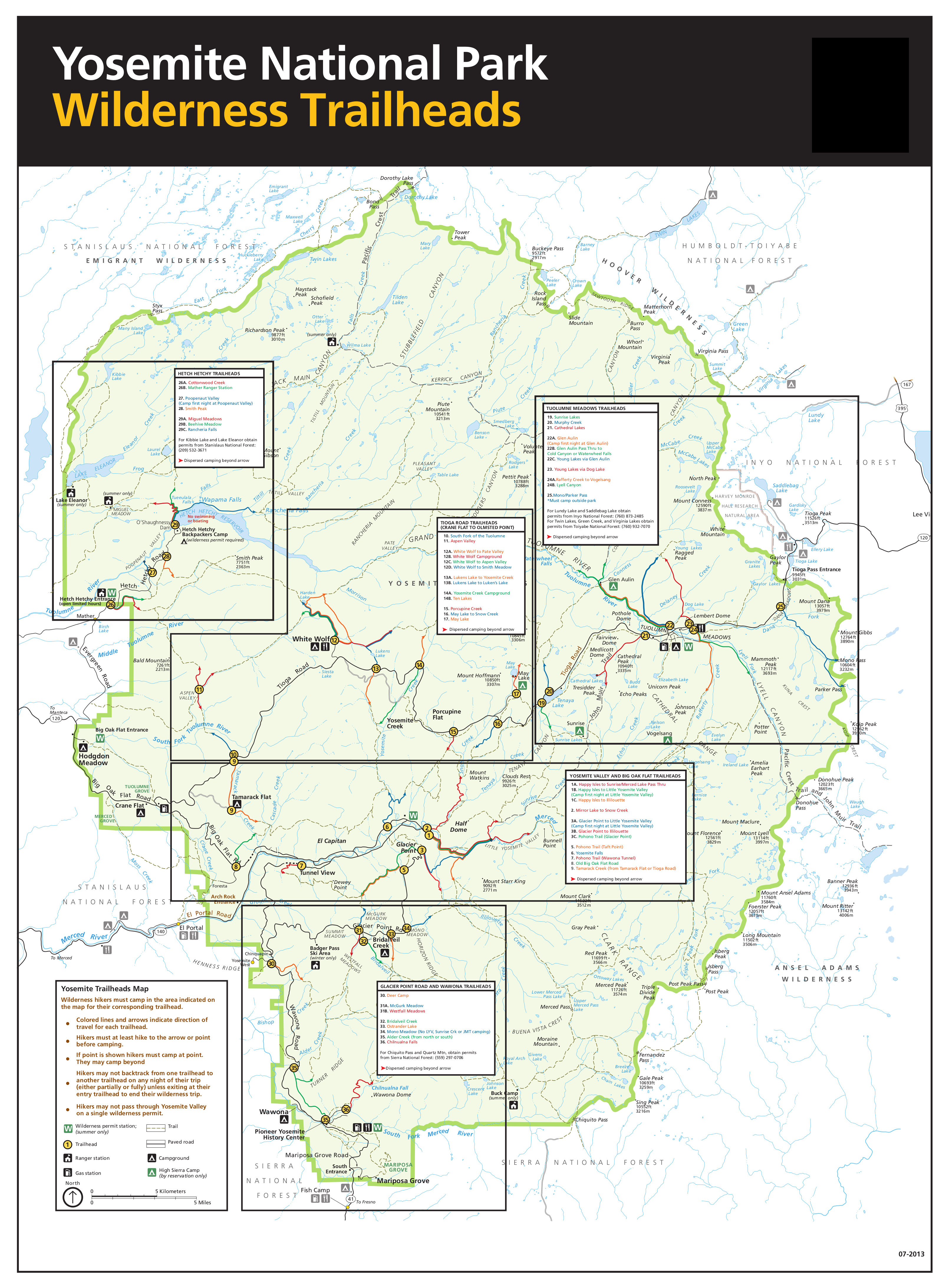
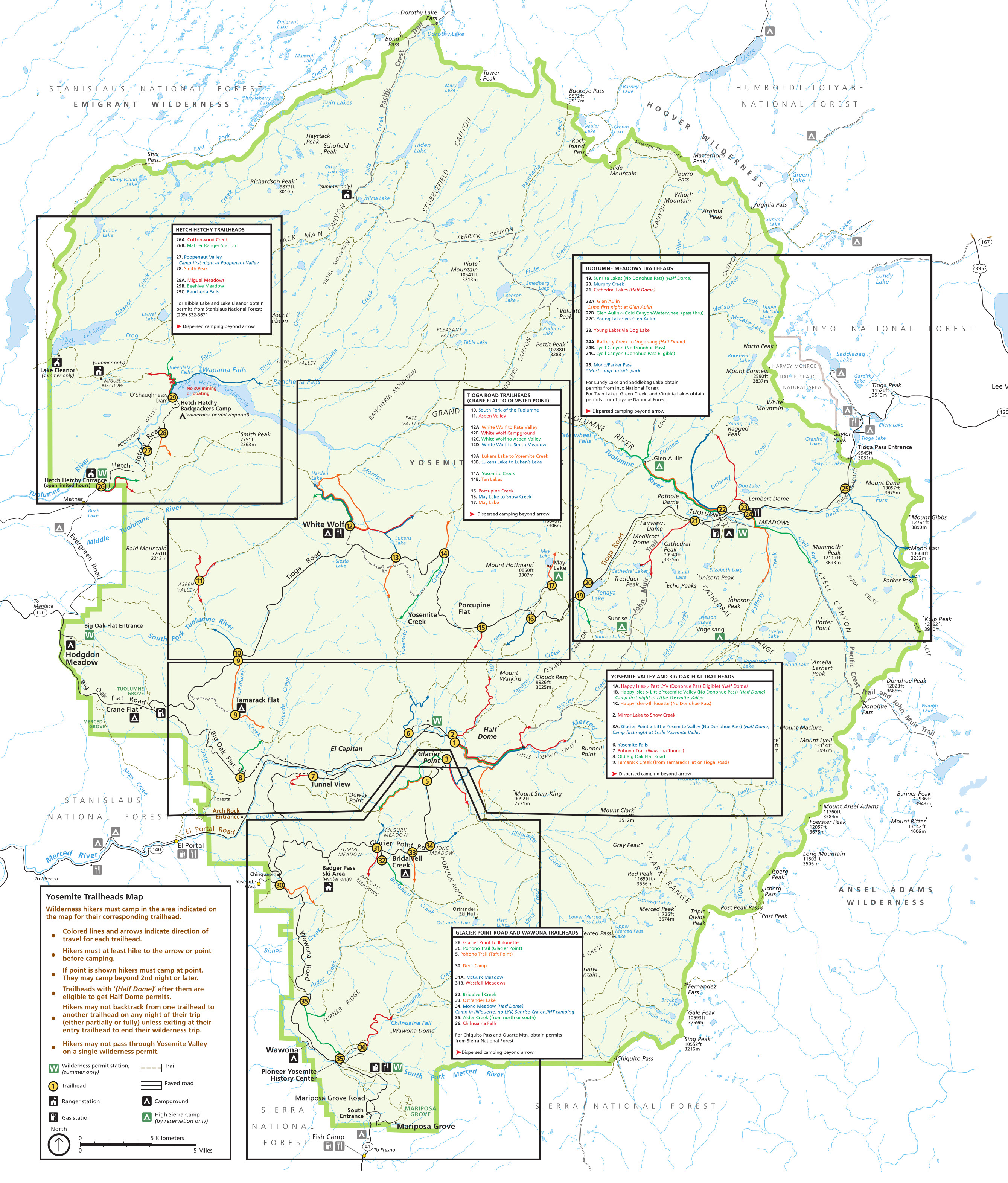 This is the Yosemite wilderness trailheads map. Permits for backpacking are allocated based on trailhead quotas. This map shows all the trailheads, as well as how far you need to hike before dispersed camping.
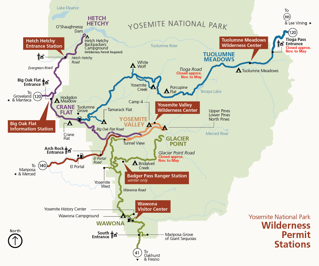 Here’s a wilderness permit center map to show you where to pick up those aforementioned wilderness permits. This map shows the general location of the permit stations, and the maps below show the exact building locations.
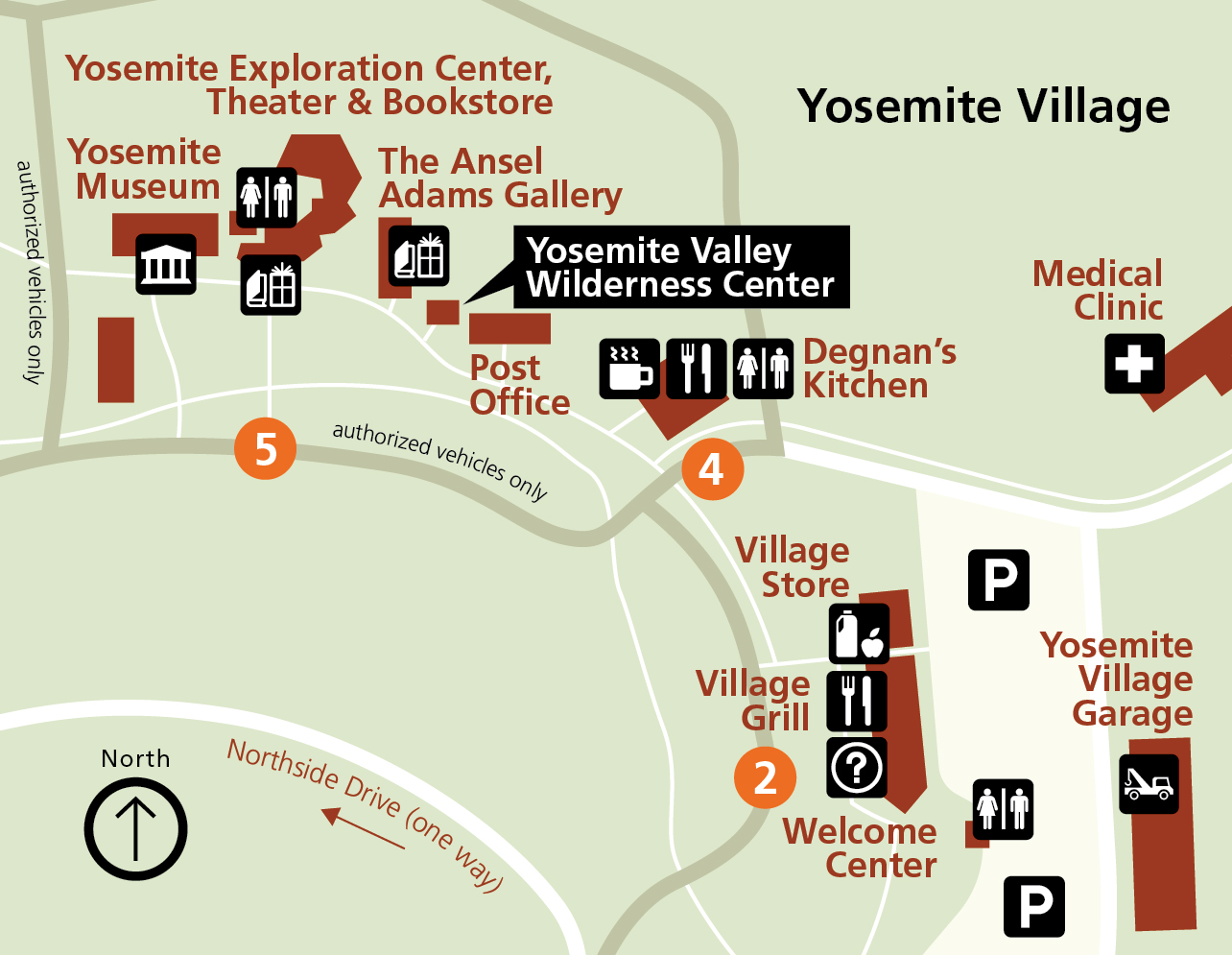 The Yosemite Valley Wilderness Center map focuses in on the central hub of wilderness permit activity in Yosemite. You’ll want to park in the main Yosemite Valley visitor lot and walk to Yosemite Village.
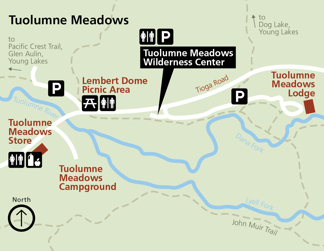 The Tuolumne Meadows Wilderness Center map shows this alternate location to pick up permits during the summer months. It makes the most sense for hikes originating from Highway 120 and Tuolumne Meadows.
 Here’s a Wawona Visitor Center map, showing another location to pick up permits during the summer, in Hill’s Studio. This is a convenient location if you’re entering the park from the south on Highway 41.
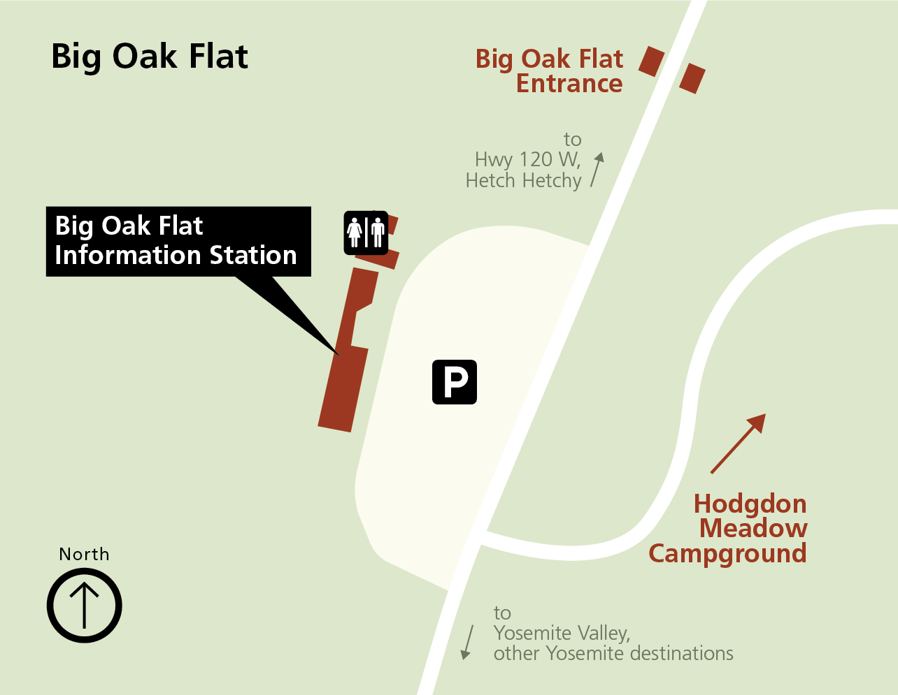 The Big Oak Flat Information Station map shows another place to pick up your wilderness permits. This summer-only facility is just inside the entrance on Highway 120, coming from the northwest.
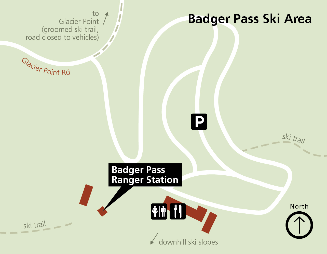 This Badger Pass Ranger Station map shows this winter-only facility, open when the Badger Pass Ski Area is open. It’s used for those venturing into the wilderness overnight on skis and snowshoes.
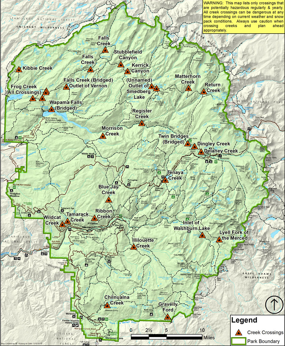 Here’s a map of wilderness creek crossings that can be potentially hazardous, generally early in the summer season during peak snow melt. Most of these are unbridged, and those with bridges are labeled.
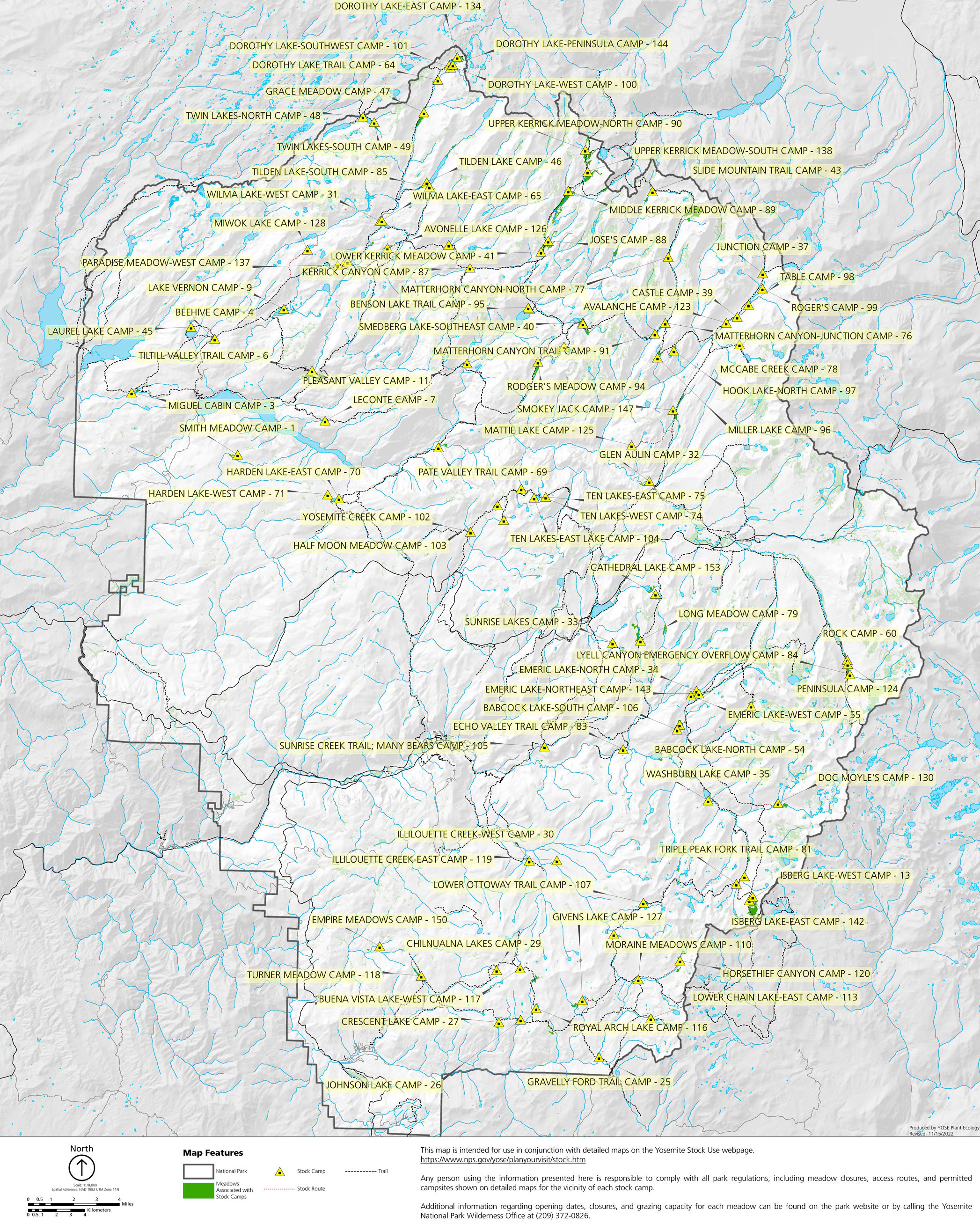 This Yosemite stock camp map shows the dozens of backcountry sites for stock camping. Stock are allowed on most wilderness trails though additional regulations apply.
Yosemite campground maps
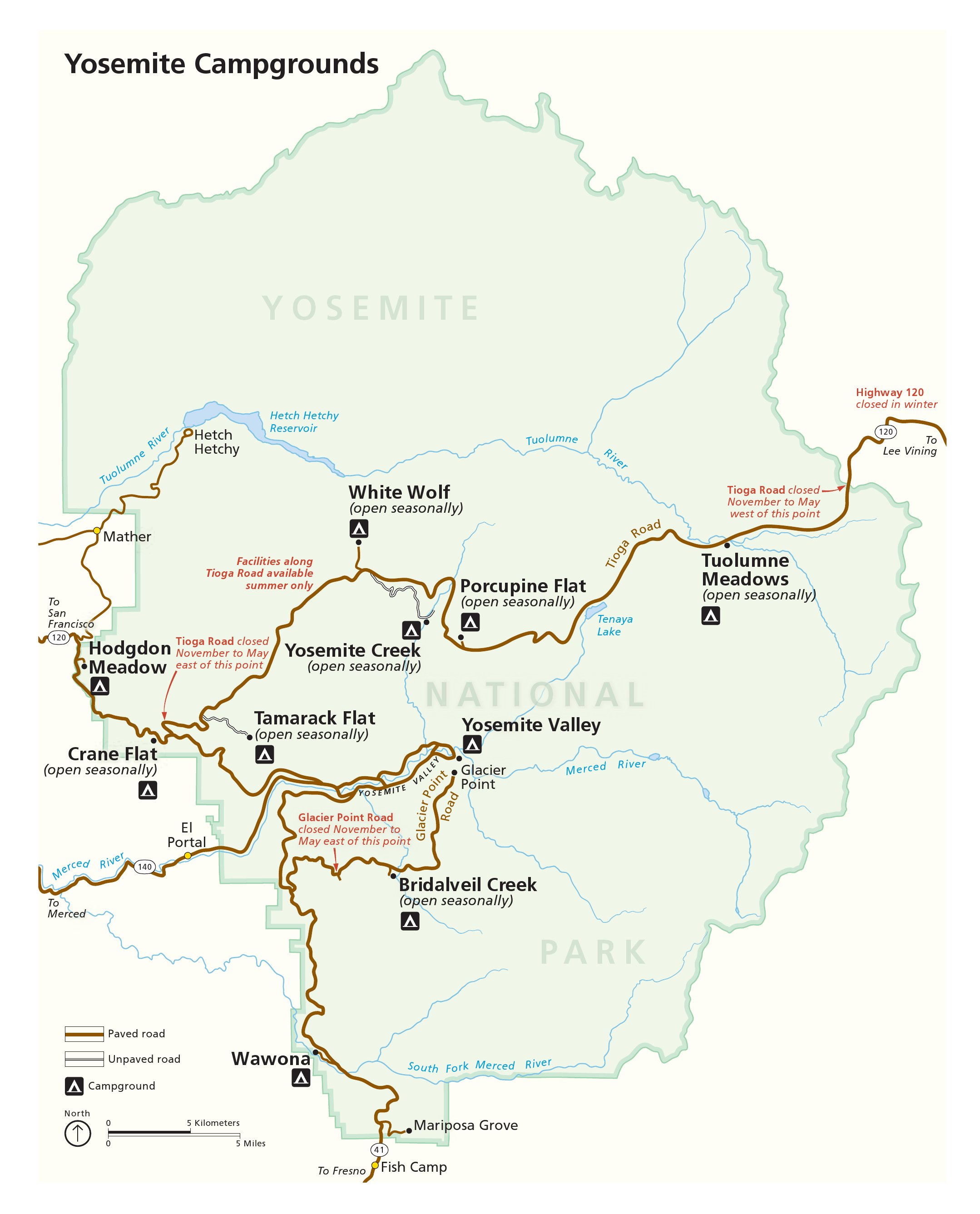 This is a Yosemite campgrounds map that shows locations of all campgrounds in Yosemite National Park. It’s helpful for referencing the campgrounds below. Click the image to view a full size map or download the PDF.
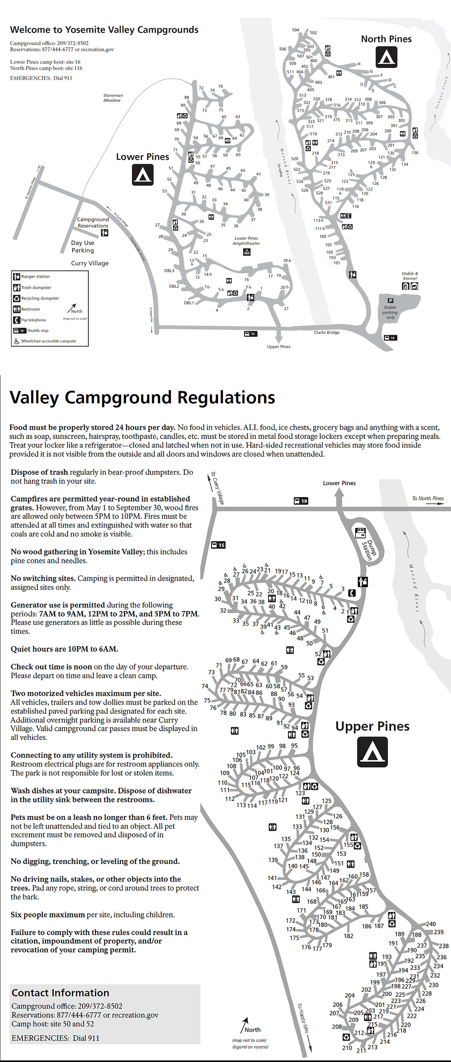 Here’s a Yosemite Valley Campgrounds map that shows Upper Pines, North Pines, and Lower Pines campgrounds. These are the main camping areas in the Valley save for Camp 4, the walk-in campground below.
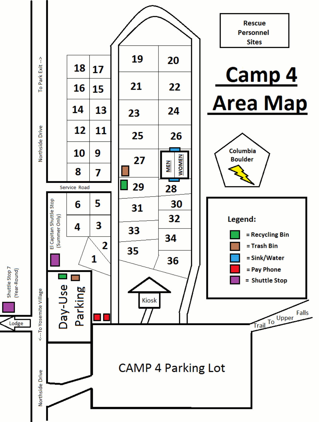 The Camp 4 map shows this year-round walk-in campground in Yosemite Valley with shared campsites, especially popular with climbers. Are you ready to get in line by 6am?
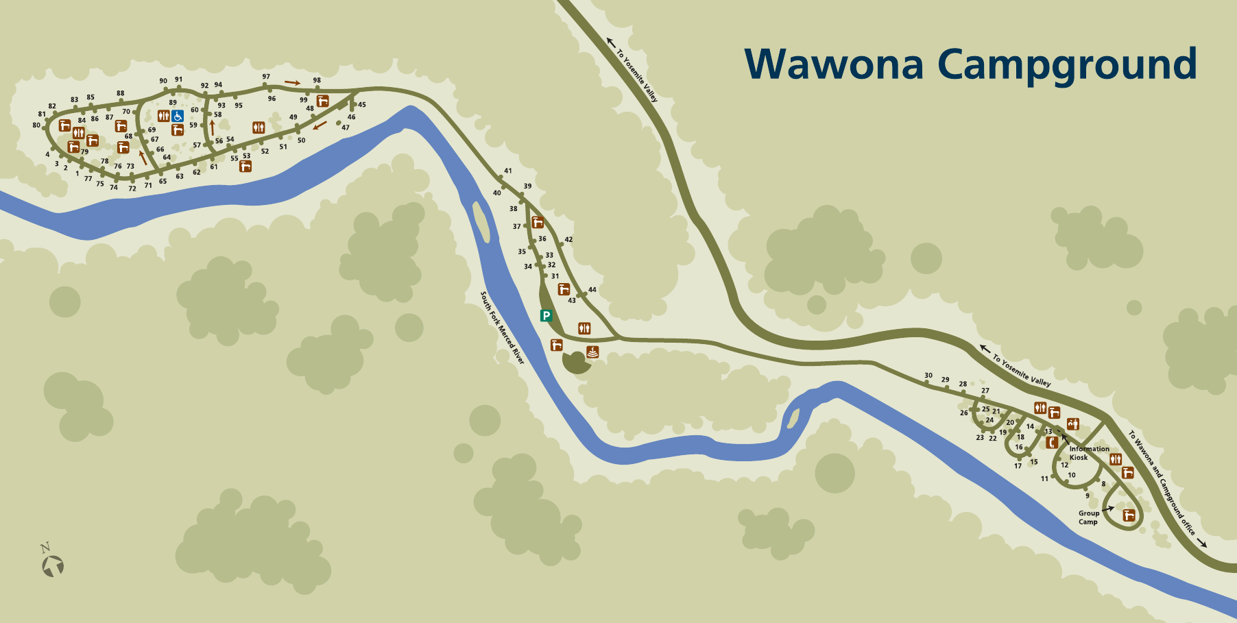 Here’s the Wawona Campground map, showing the year-round campground located in Wawona near the south entrance of Yosemite. This is your nearest campground to the Mariposa Grove.
 The Hodgdon Meadow Campground map shows the year-round campground located inside the northwest entrance where visitors arrive from Highway 120 (the most direct route from San Francisco).
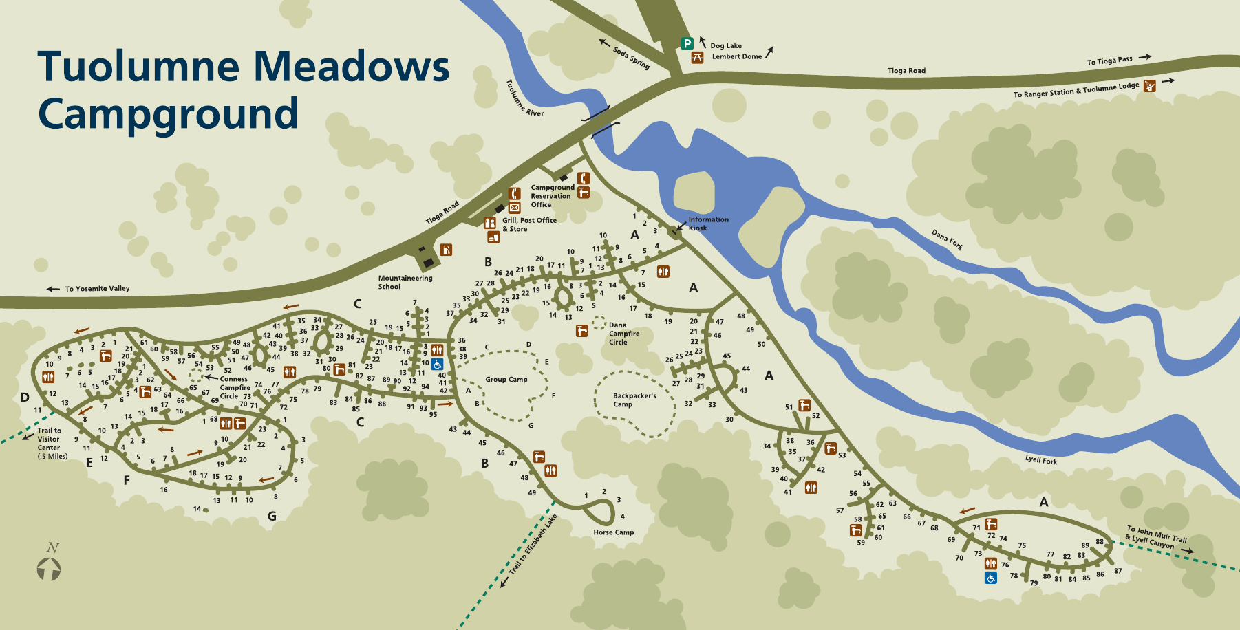 The Tuolumne Meadows Campground map shows the enormous campground located near the Tuolumne River and many trailheads along Tioga Road. This beautiful campground is very popular!
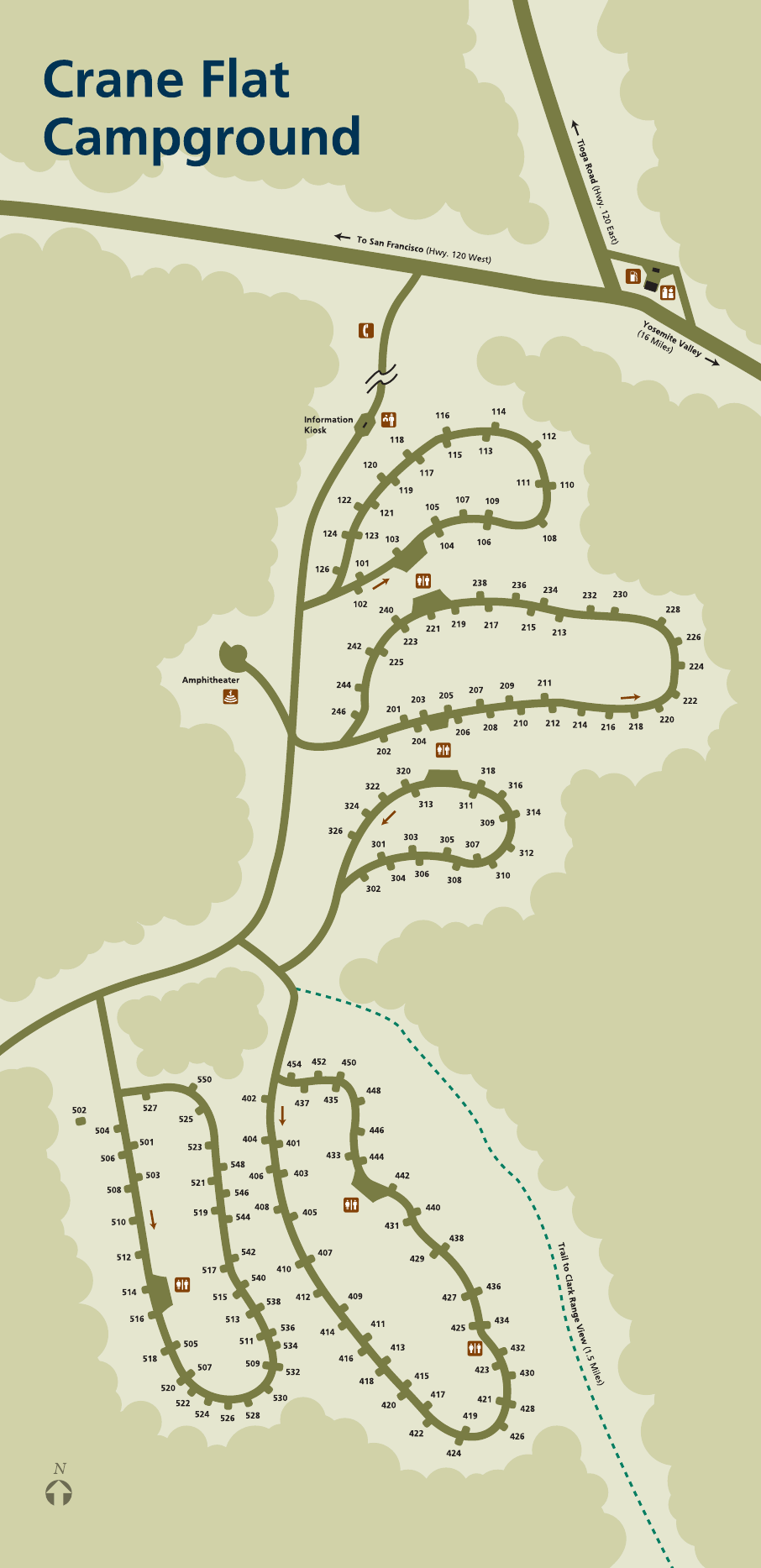
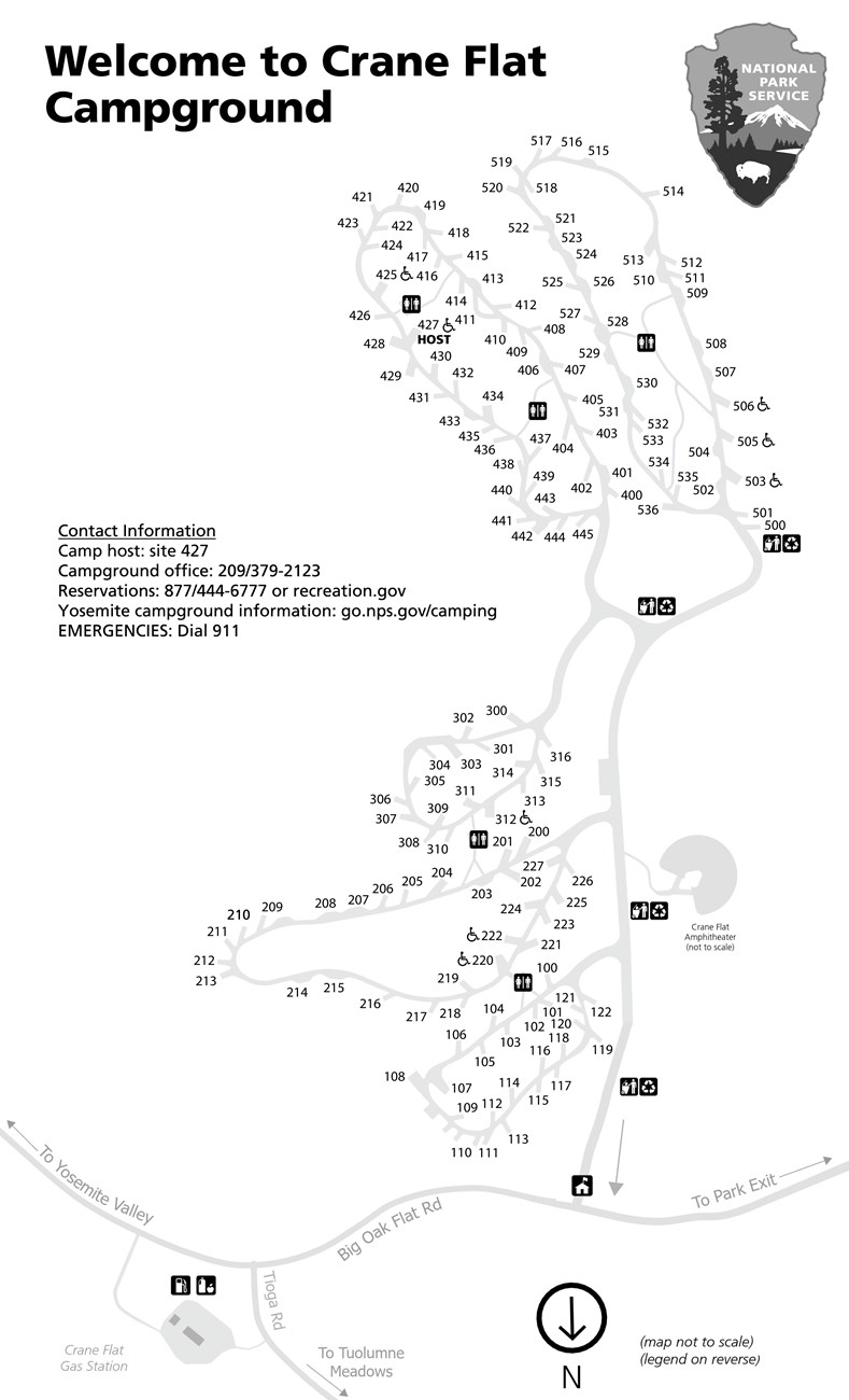 The Crane Flat Campground map shows this centrally-located campground that provides reasonable access to both Yosemite Valley and Tuolumne Meadows. It accepts reservations during the summer.
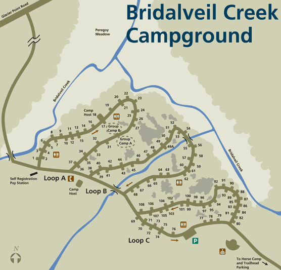 The Bridalveil Creek Campground map focuses on the only campground located along the Glacier Point Road, where it’s cooler and quieter than Yosemite Valley with easy access to Glacier Point.
 The Tamarack Flat Campground map shows Tioga Road’s nearest first-come first-served campground to Yosemite Valley. It’s also the lowest elevation Tioga Road campground.
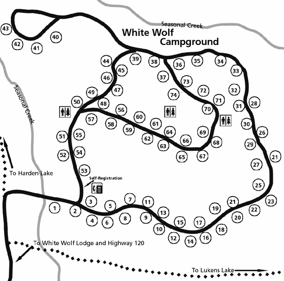
 The White Wolf Campground map shows this forested campground located nearby the White Wolf Lodge. It’s located off Tioga Road between Tuolumne Meadows and Yosemite Valley.
 Here’s a Yosemite Creek Campground map, showing this campground located at the end of an unpaved road that provides a quiet, relaxed camping experience. Be prepared for a drive to Yosemite Valley!
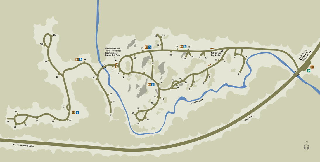
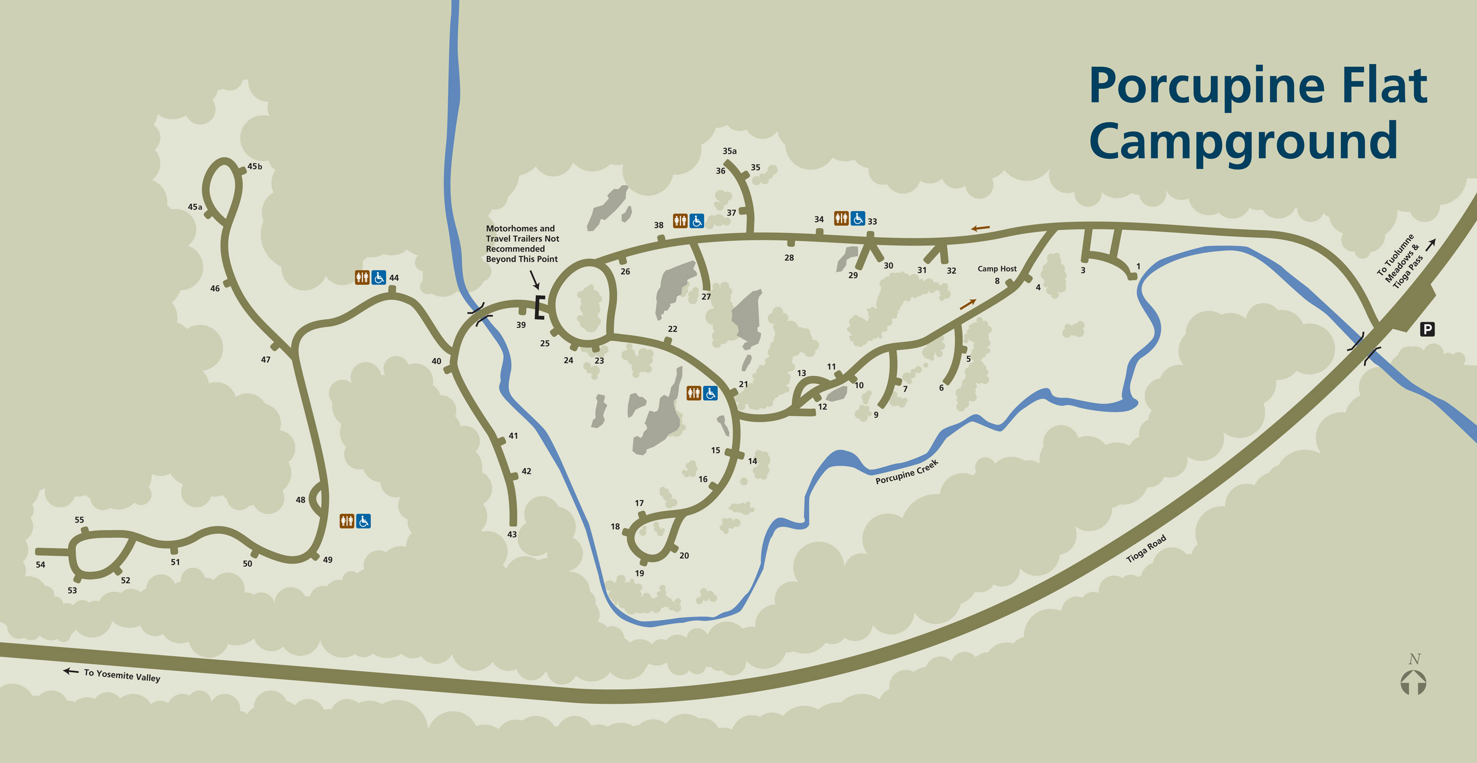 This Porcupine Flat Campground map shows the basic self-service campground located right alongside Tioga Road near Tuolumne Meadows. This is much closer to Tuolumne than Yosemite Valley.
Yosemite scenic maps
 This incredible Yosemite landscape painting shows an artistic representation of Yosemite National Park with a focus on Yosemite Valley. It was originally created for the NPS by Austrian painter Heinrich Berann.
 The unlabeled Yosemite landscape painting is similar to the map above, but with all the labels removed, giving a more natural perspective on how this area of the Sierra Nevada fits together.
Yosemite winter maps
 The Mist Trail winter route map shows the only way to reach the top of Vernal Fall and Nevada Fall during winter, via a portion of the John Muir Trail, when the Mist Trail staircase is closed due to snow and ice.
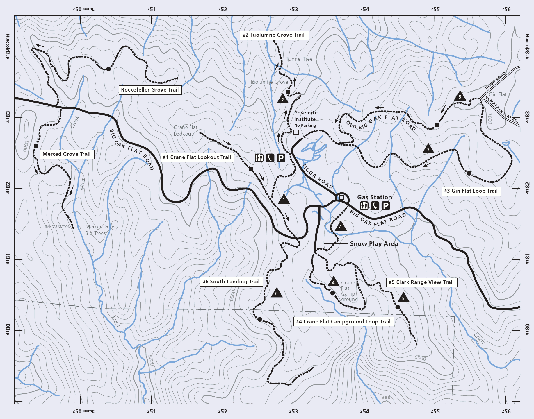 This Crane Flat winter trails map shows the ski and snowshoe trails near Crane Flat on the Big Oak Flat Road. Check out the Tuolumne Grove to see sequoias surrounded by snow, without the summer crowds.
 The Mariposa Grove winter trails map was recently updated to reflect the removal of the old road that used to wind through the sequoias. Trees of interest are labeled, such as the Grizzly Giant and California Tunnel Tree.
 This is the Badger Pass winter trails map, showing the ski and snowshoe trails along the Glacier Point Road accessible from Badger Pass. Check out Dewey Point for views, or stick to the groomed road to learn.
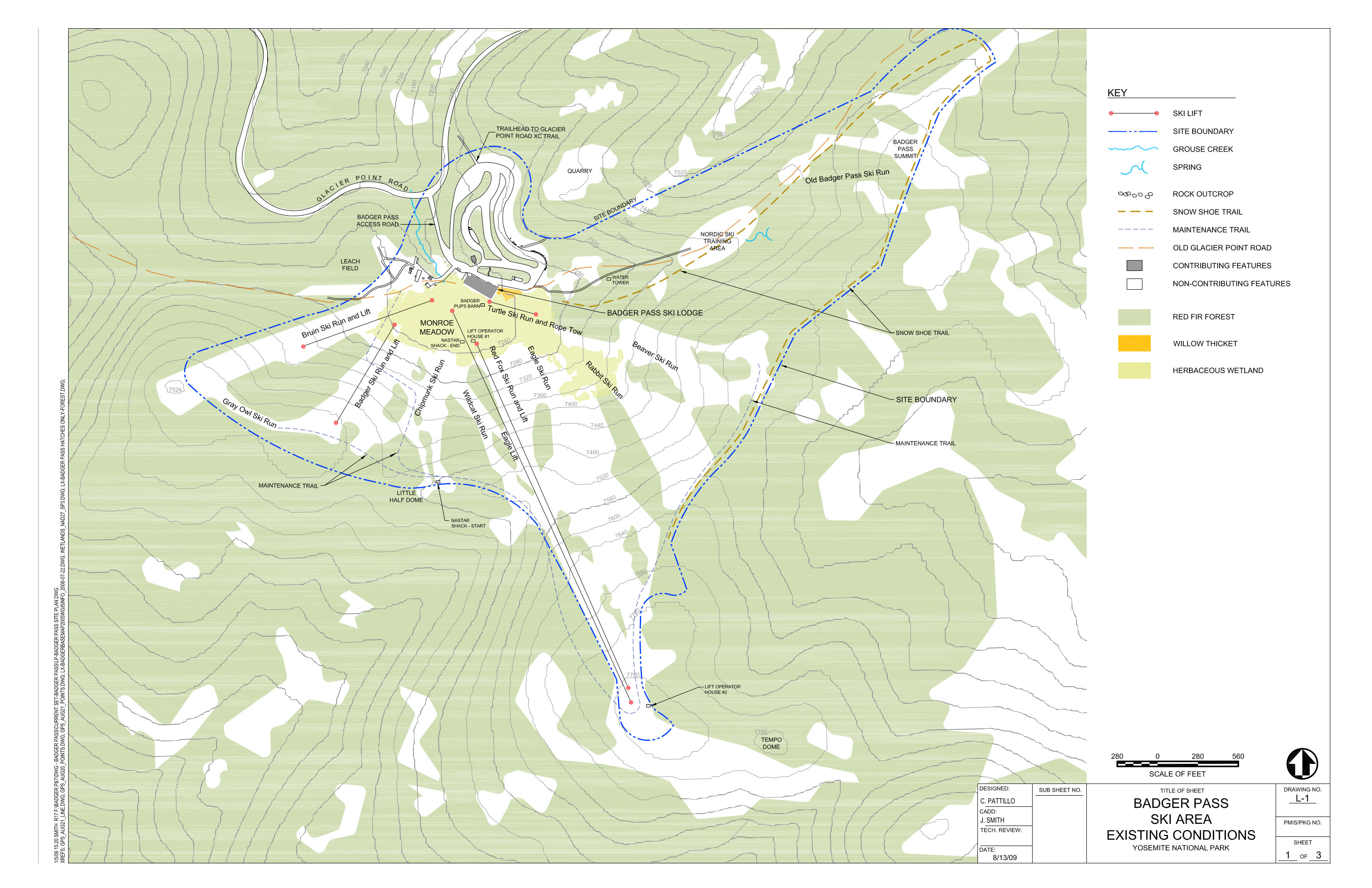 This Badger Pass ski map shows the chairlifts, ski runs, lodge, and infrastructure at Badger Pass for cross-country & downhill skiing, including topographic lines to show elevation.
Yosemite geologic maps
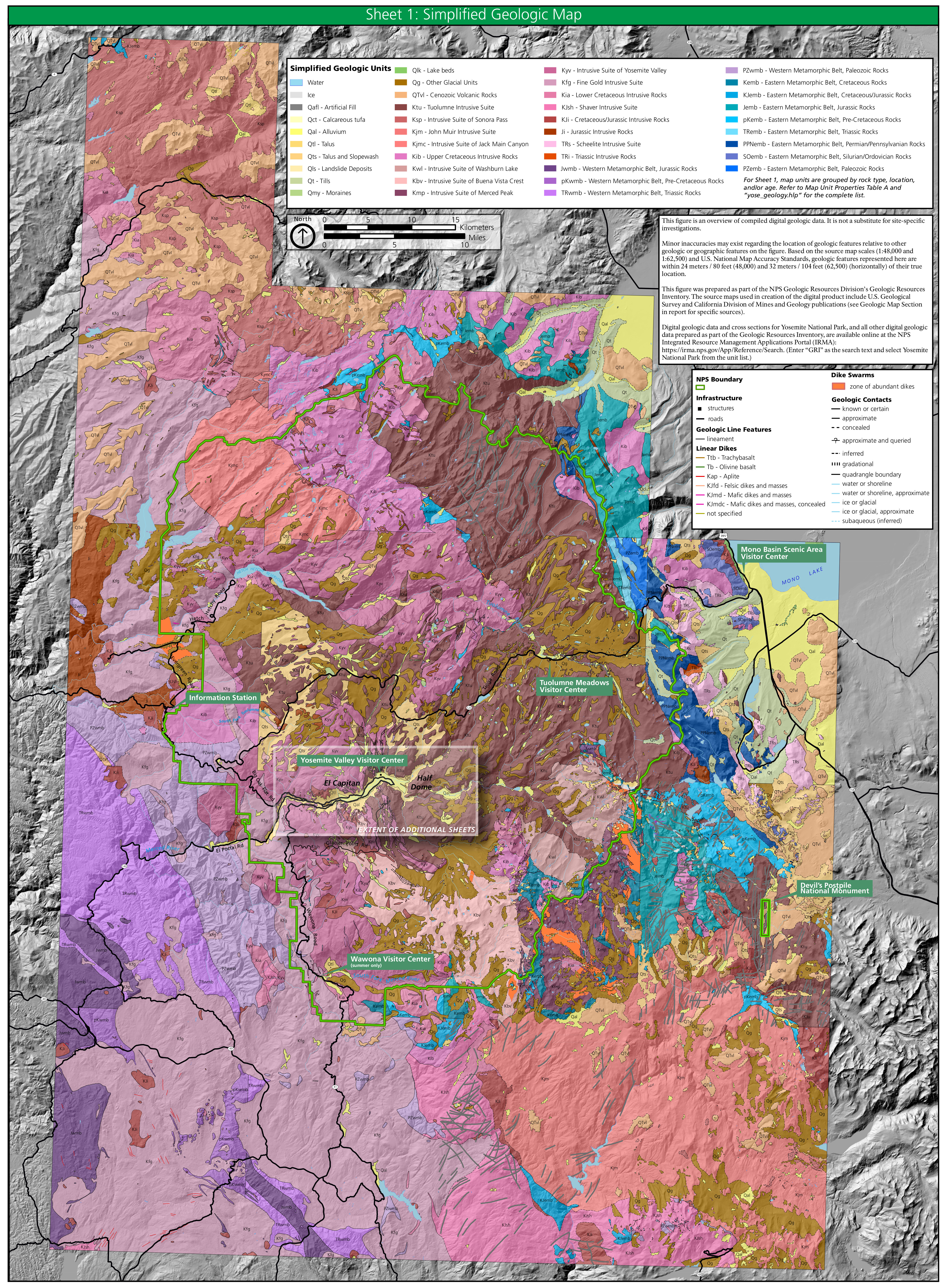 This Yosemite geologic map covers the entire national park, displaying different granites and rock types underlying Tuolumne Meadows, Yosemite Valley, and this whole section of the Sierra Nevada.
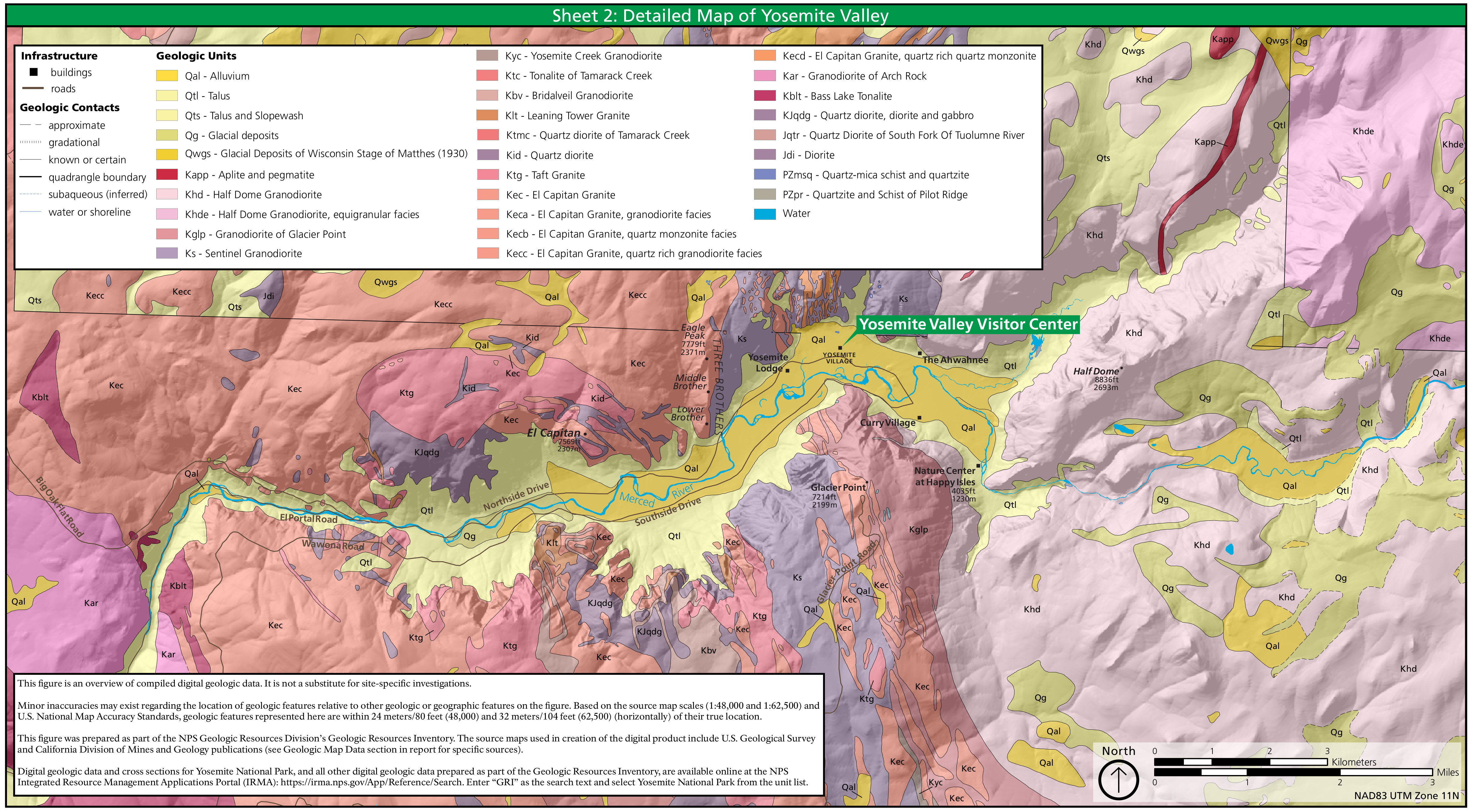 Here’s a Yosemite Valley geologic map, zooming in on the incredibly dramatic, in-your-face geology of formations such as Half Dome, El Capitan, Cathedral Rocks, and Glacier Point.
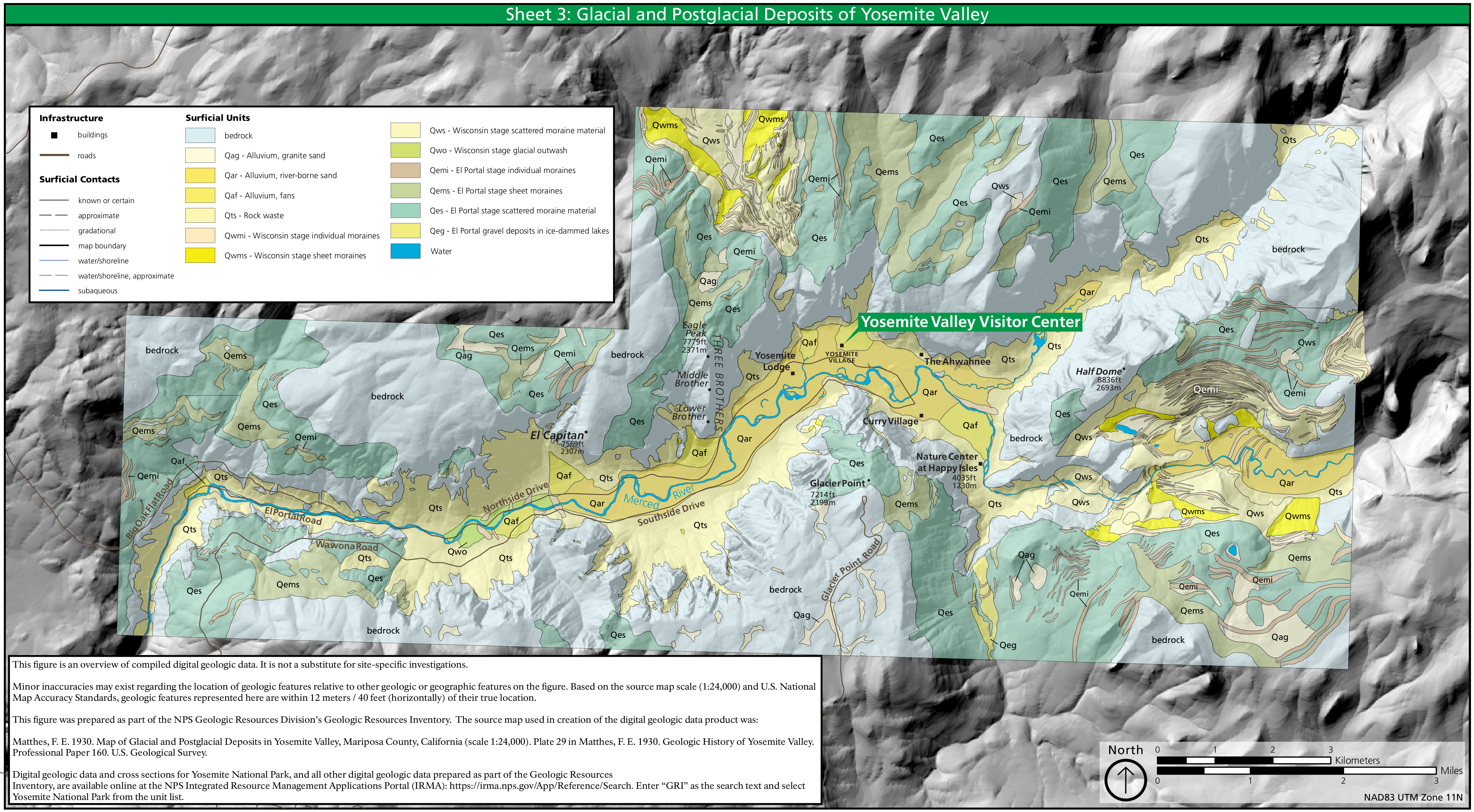 This is a post-glacial geologic map of Yosemite Valley, featuring the more recent surficial deposits (not bedrock) that make up much of Yosemite Valley’s surface. If you want bedrock, see the previous map.
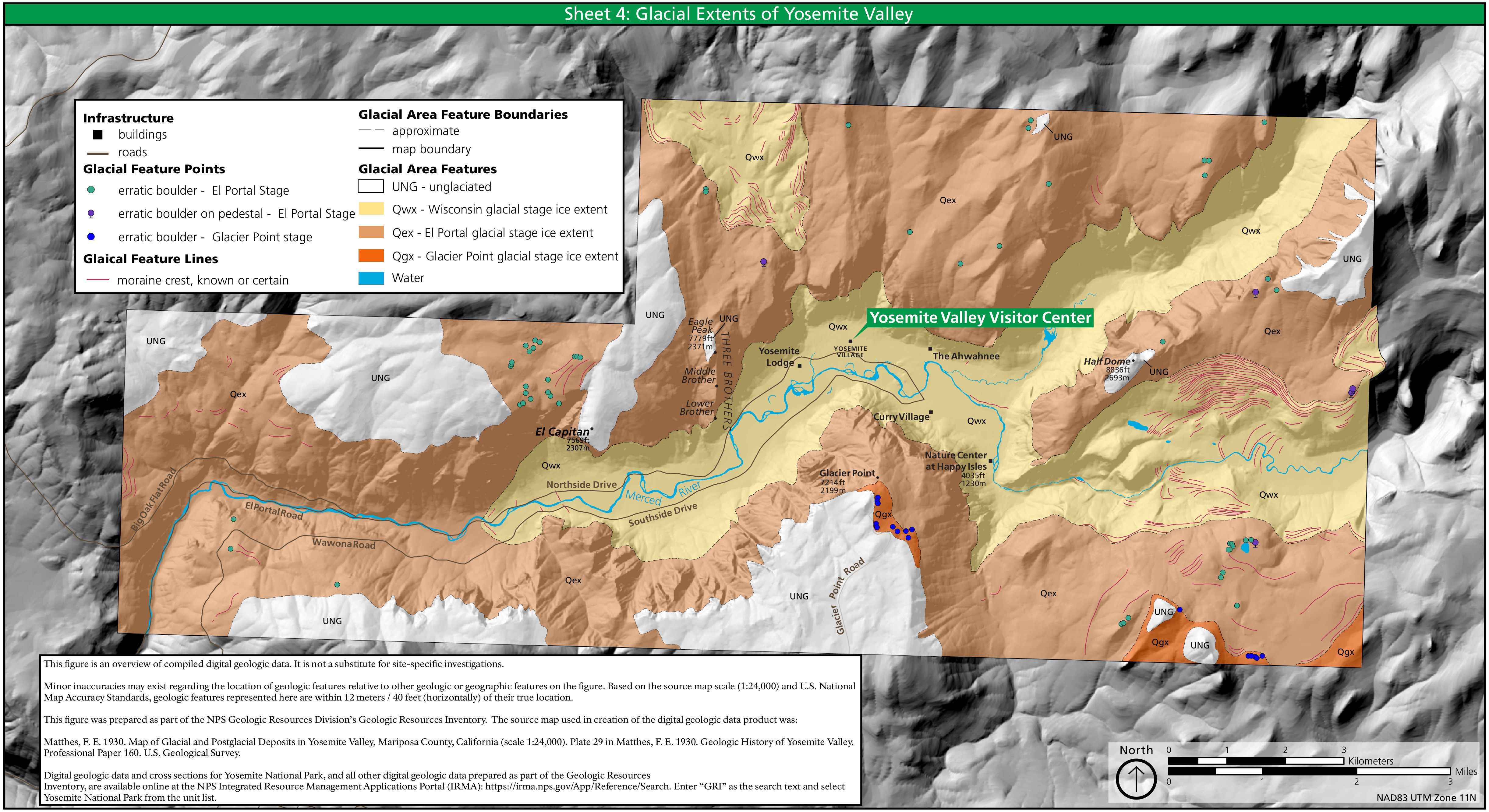 The glacial extent of Yosemite Valley map focuses on the most recent glaciations and shows the features and evidence they left behind, such as glacial erratics and moraines.
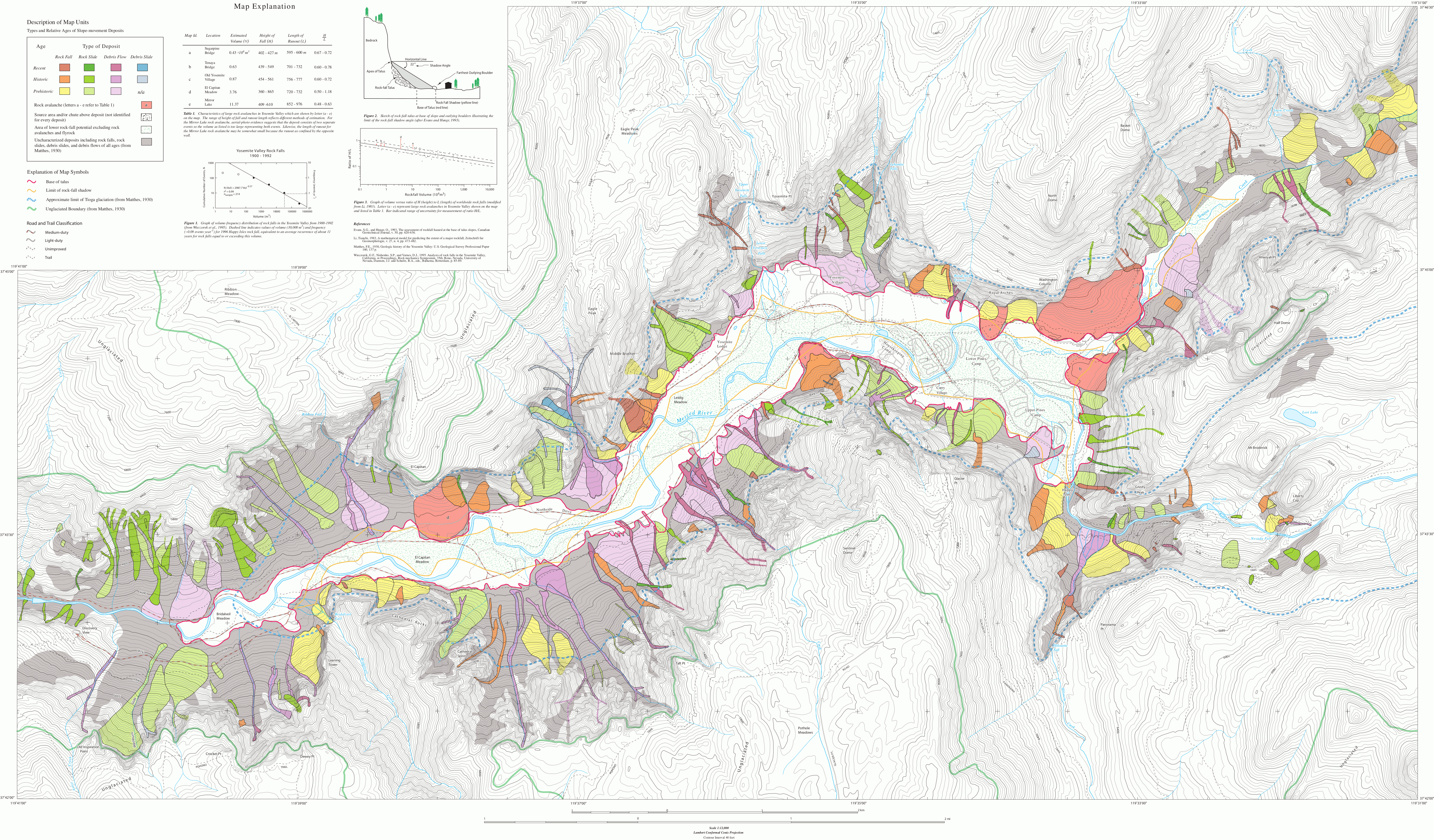 Here’s a (large!) Yosemite Valley rockfall map, indicating the type of rockfall as well as location and known date of each one in Yosemite Valley. Rockfalls tend to be common in spring and winter.
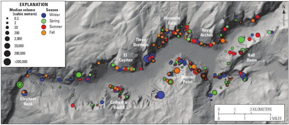 This recent Yosemite rockfall map, showing the location and approximate size of each rockfall in Yosemite Valley from 1857 to 2011. If you’re lucky (or unlucky), you’ll see one on your visit!
Yosemite landscape design maps
The following maps are from A Sense of Place: Design Guidelines for Yosemite National Park, published by the National Park Service in 2012. The book is an excellent resource for learning about how the NPS works to harmonize the built environment with the natural landscape. If you’re interested in learning more, I’ve provided a free PDF download of the book here.
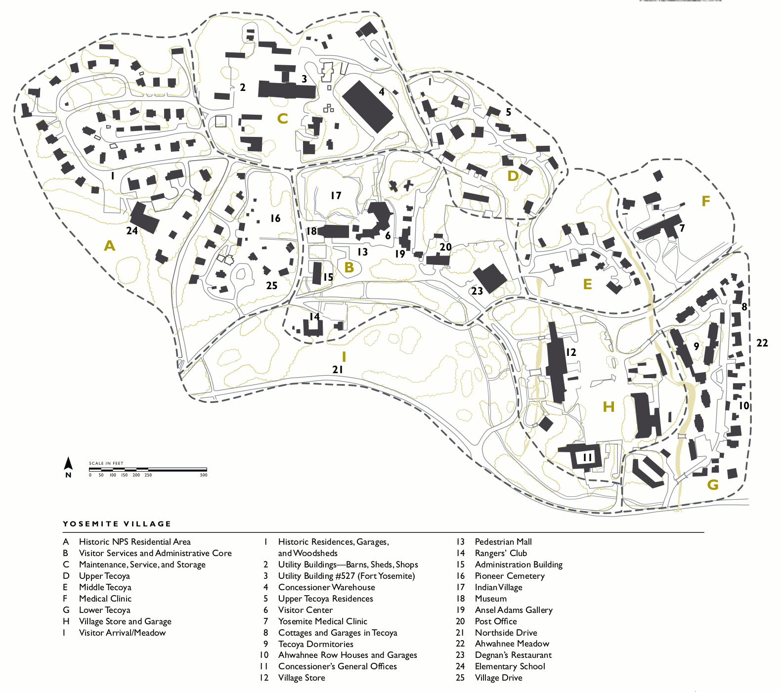 Here’s a Yosemite Village map, showing the main developed area of Yosemite Valley that includes the former visitor center, post office, wilderness center, Ansel Adams Gallery, village store, and housing.
 The simple Ahwahnee map labels the main features of the Ahwahnee Hotel and the surrounding grounds including trails, roads, parking, and the meandering Merced River.
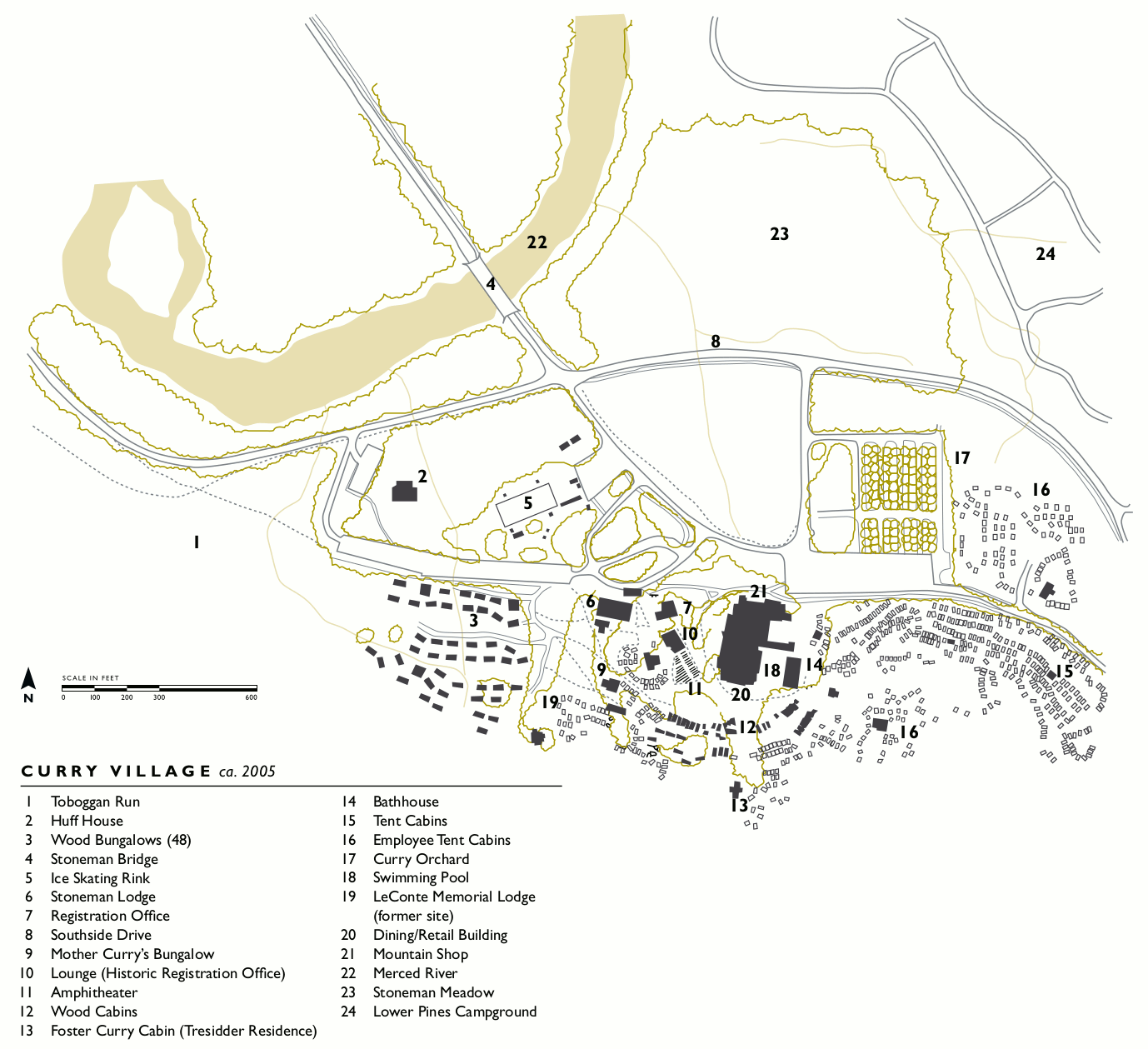 This Curry Village map reveals the complex, chaotic nature of the Curry Village area. Everything from tent cabins, to bungalows, to a swimming pool, to a winter ice skating rink is included.
 The Yosemite Lodge map shows the mid-range lodging option in Yosemite Valley – a step up from Curry Village but not the luxury prices of the Ahwahnee. This is your closest lodging option to Yosemite Falls.
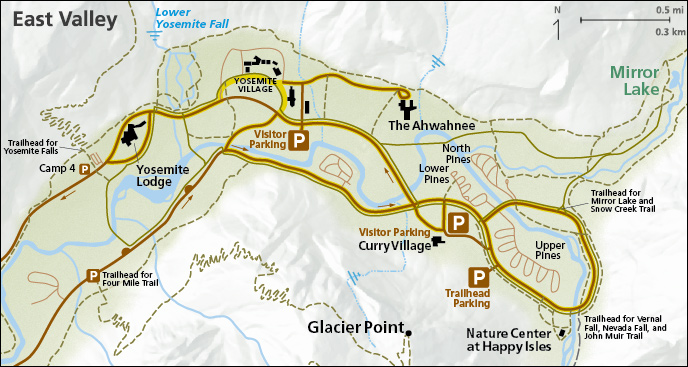
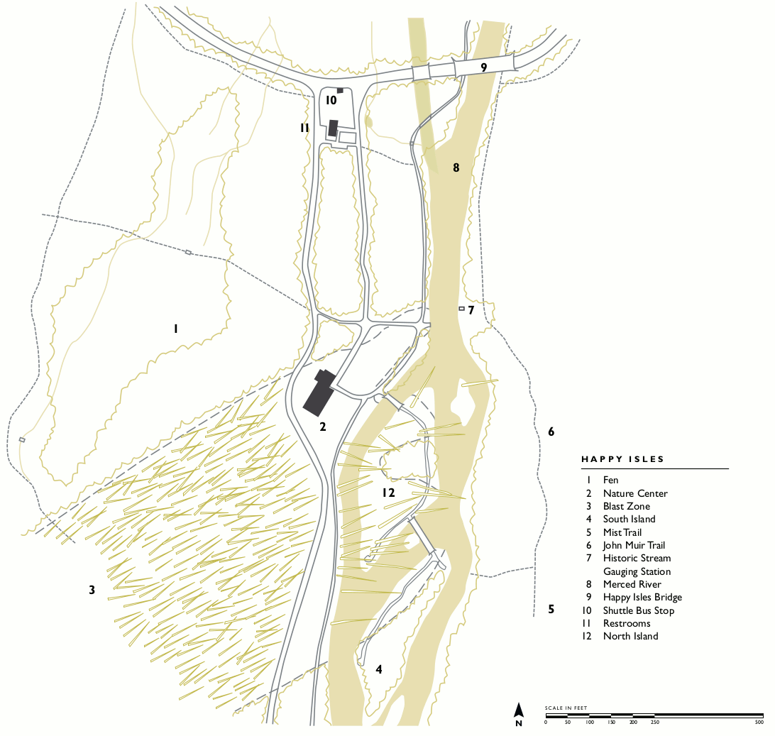 This Happy Isles map includes the Happy Isles Nature Center and the main trails along the Merced River, including the beginning of the Mist Trail and John Muir Trail. Enjoy the lack of cars here!
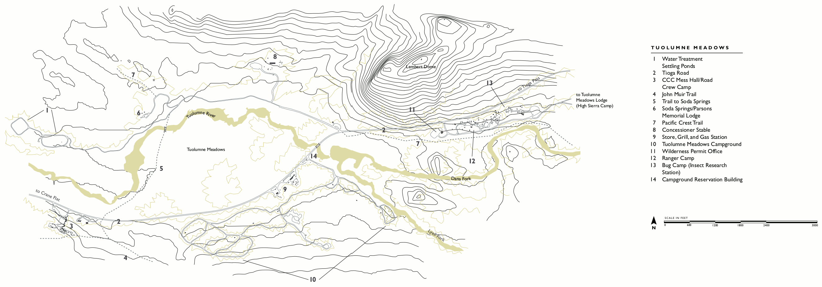 This Tuolumne Meadows map includes topographic lines and is zoomed out to include the Tuolumne Meadows Campground, Tuolumne Meadows Lodge, general store, gas station and trailheads.
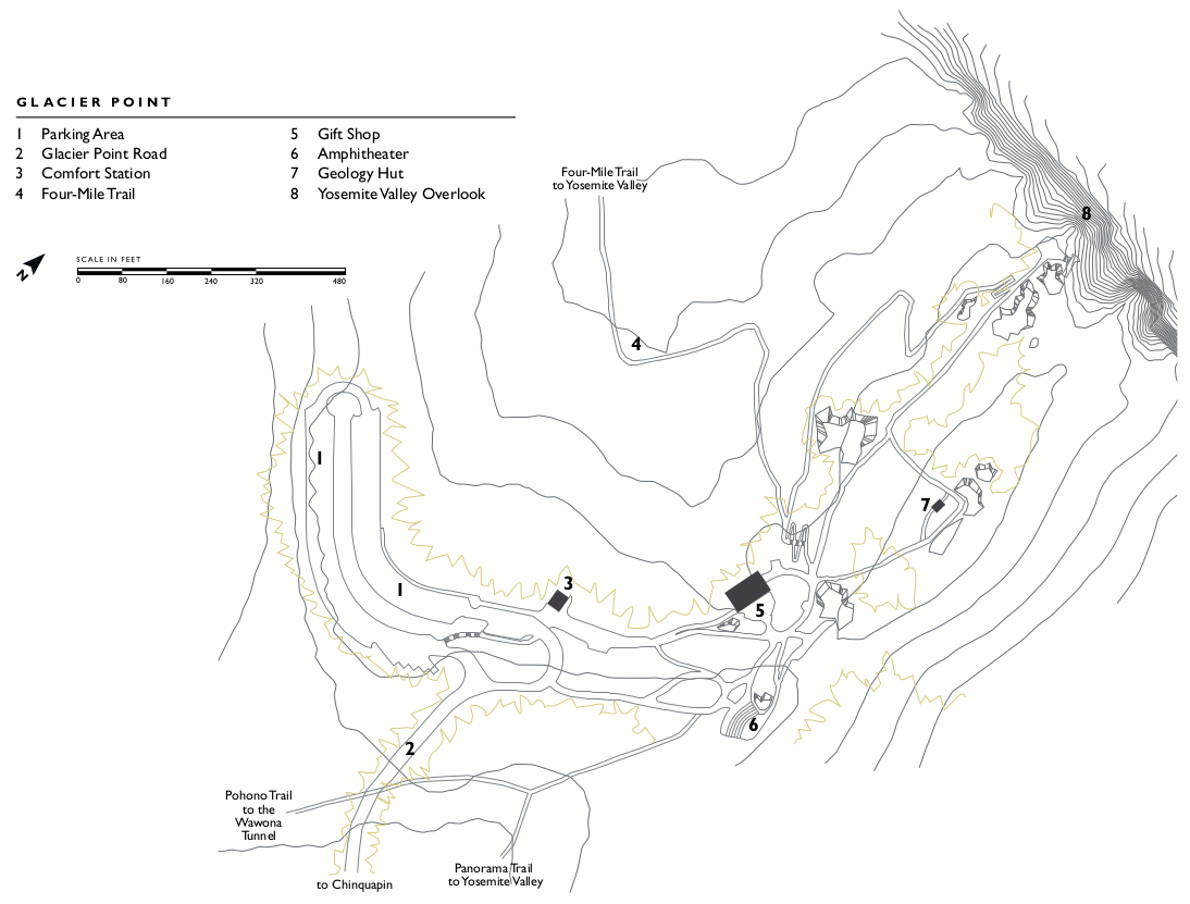 This Glacier Point map overlays the parking, gift shop, amphitheater, viewpoints, and trails at Glacier Point on topographic lines showing the area’s elevation change.
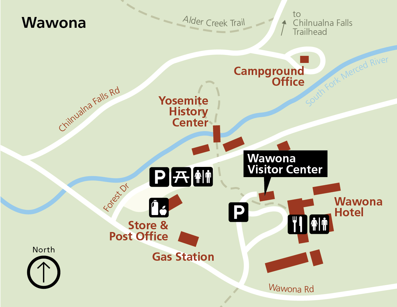
 The simple Wawona map shows the entire Wawona area, nestled along the South Fork of the Merced River. You’ll find NPS facilities and structures labeled that I bet you had no idea even existed!
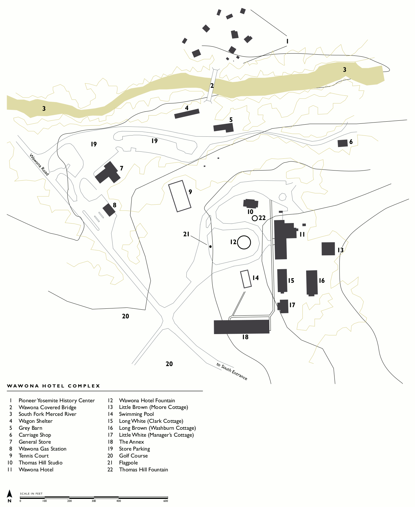 The simple Wawona Hotel map zooms in to provide a nice easy-to-read overview of the Wawona Hotel grounds and includes the Pioneer Yosemite History Center and covered bridge over the Merced.
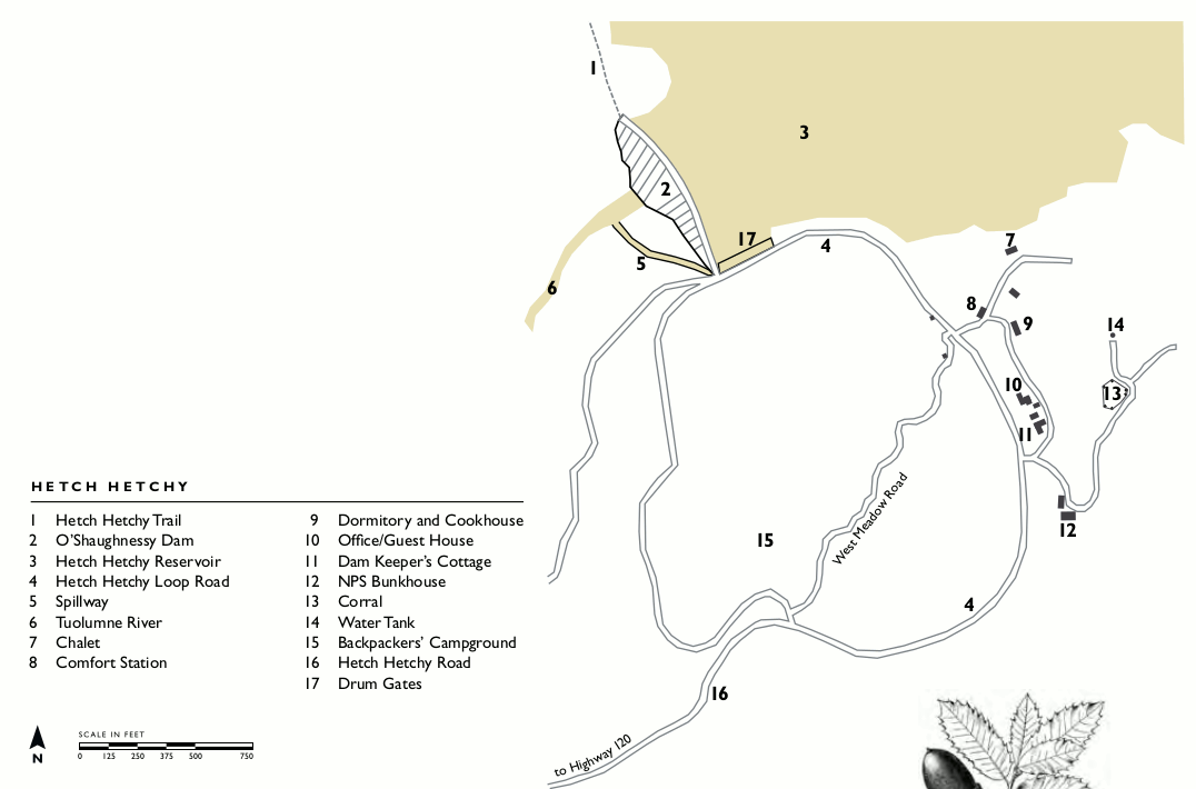 Here’s a Hetch Hetchy map that focuses on the end of the Hetch Hetchy Road: O’Shaughnessy Dam, reservoir, backpackers’ campground, and various buildings and infrastructure.
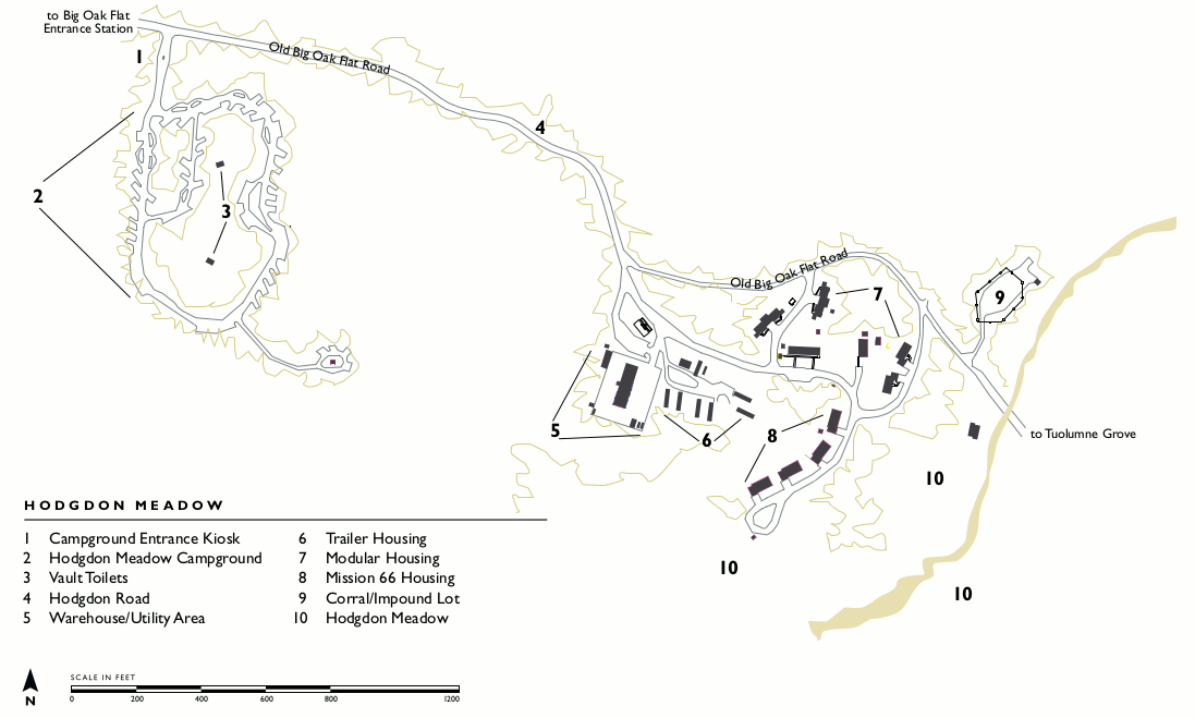 The Hodgdon Meadow map zooms in on the Old Big Oak Flat Road, showing the Hodgdon Meadow Campground and ranger housing near the Big Oak Flat entrance station.
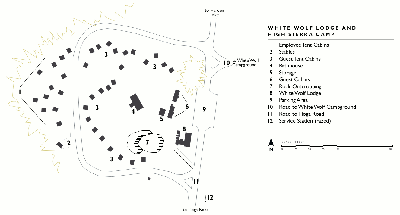 This White Wolf Lodge map shows the developed area at the end of the White Wolf road (north off Tioga Road), including guest cabins and the main lodge and dining hall.
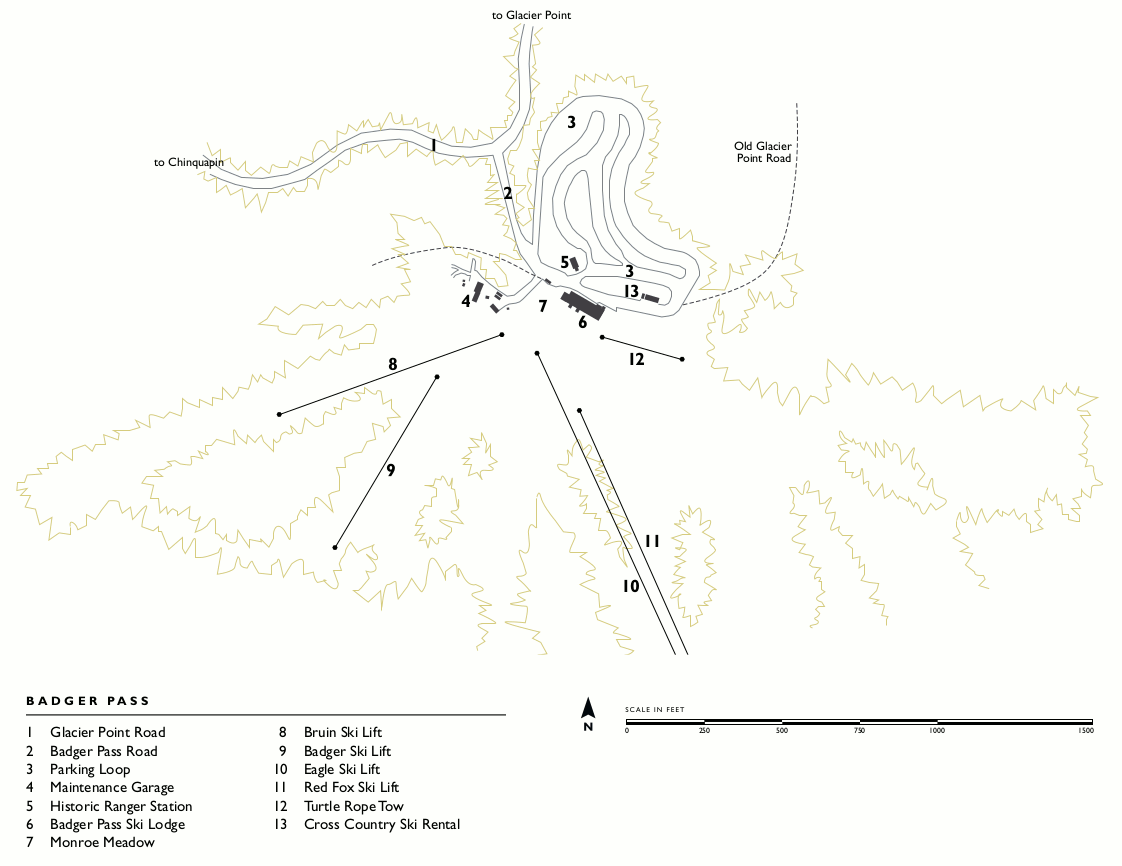 The Badger Pass map shows a very general outline of the Badger Pass ski area, including lifts, lodge, and parking. If you’ve only ever visited in summer, you’ve never been here, so check out the map!
High Sierra Camp maps
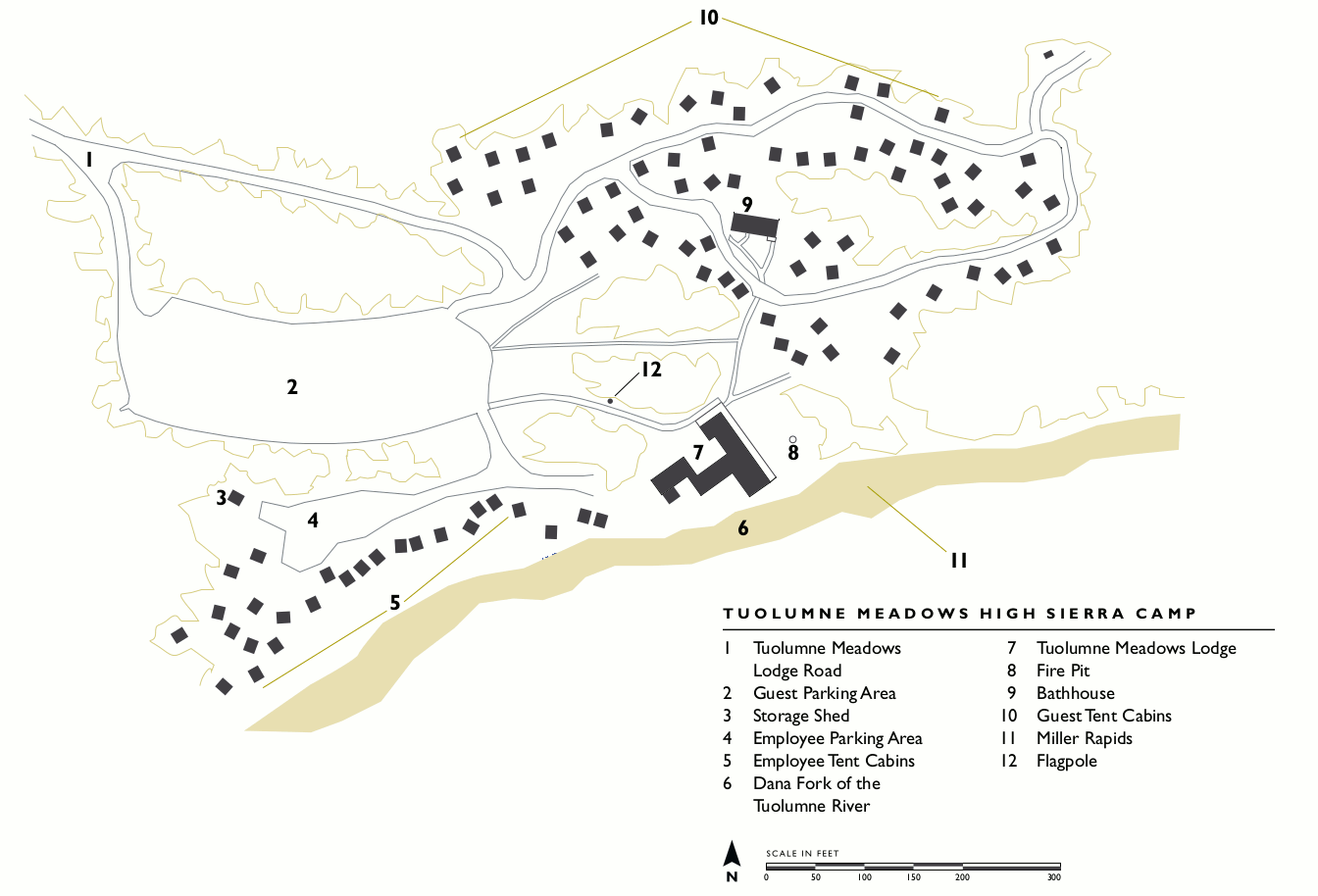 Here’s a Tuolumne Meadows Lodge map – the lodge doubles as both a High Sierra Camp as well as a lodge, so you’ll see it’s a bit bigger than the other High Sierra Camps below.
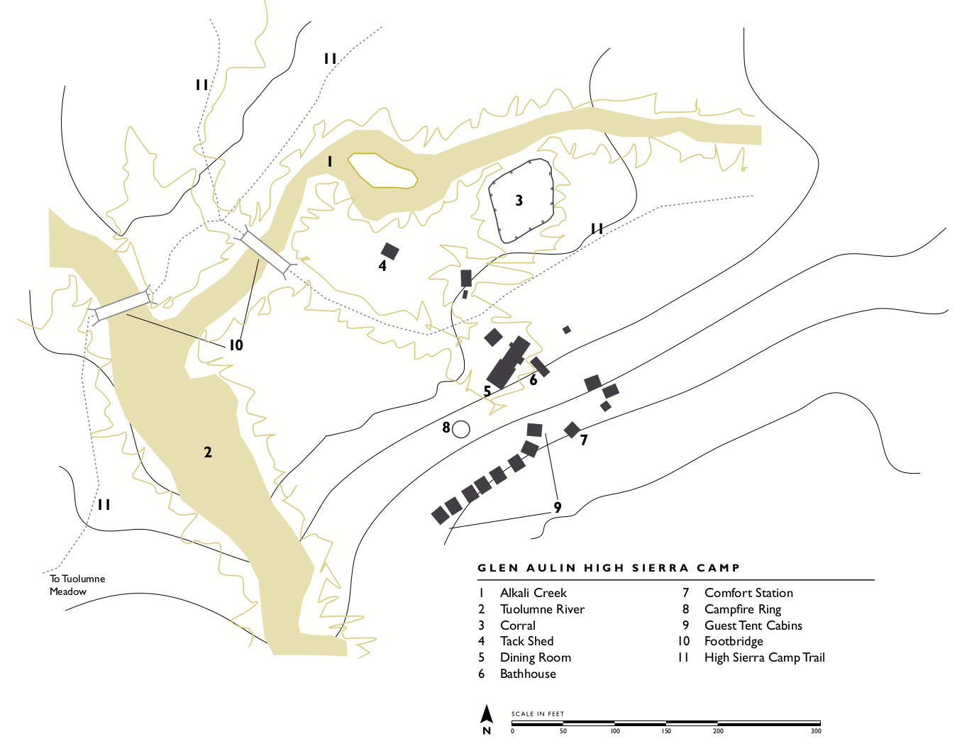 This Glen Aulin High Sierra Camp map shows the northernmost camp, nestled along the Tuolumne River just before it enters the Grand Canyon of the Tuolumne. A beautiful setting!
 The May Lake High Sierra Camp map shows the easily-accessible camp right along the shores of May Lake – just a short walk from the parking area. This makes for a great place to explore Mount Hoffmann.
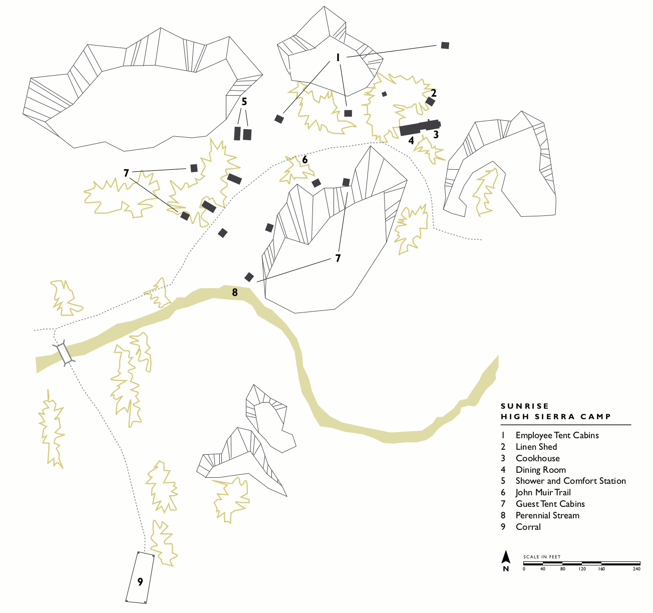 Here’s a Sunrise High Sierra Camp map, showing the camp located midway between May Lake and Merced Lake camps. Sunrise Lakes and some meadows are both close by.
 This Merced Lake High Sierra Camp map lays out the camp lowest in elevation and nearest to Yosemite Valley (and furthest from Tioga Road). This will be snow-free sooner than the other ones.
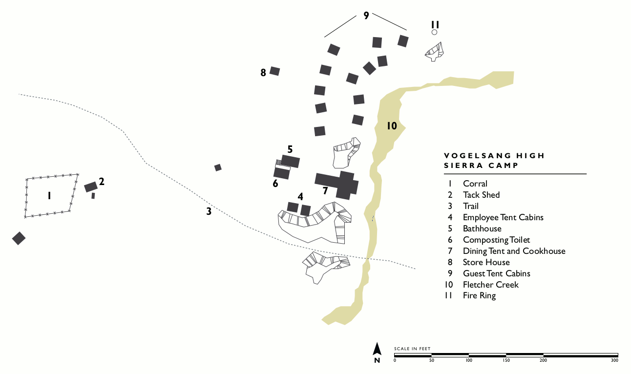 The Vogelsang High Sierra Camp map shows the highest of the camps, located along Fletcher Creek nearby beautiful alpine meadows and mountains such as Vogelsang Peak.
Yosemite architectural and design maps
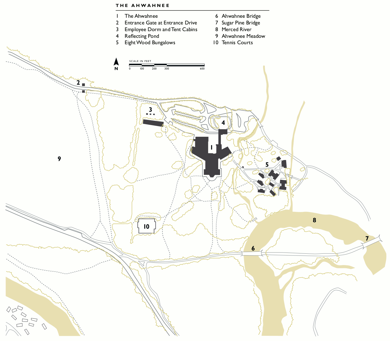
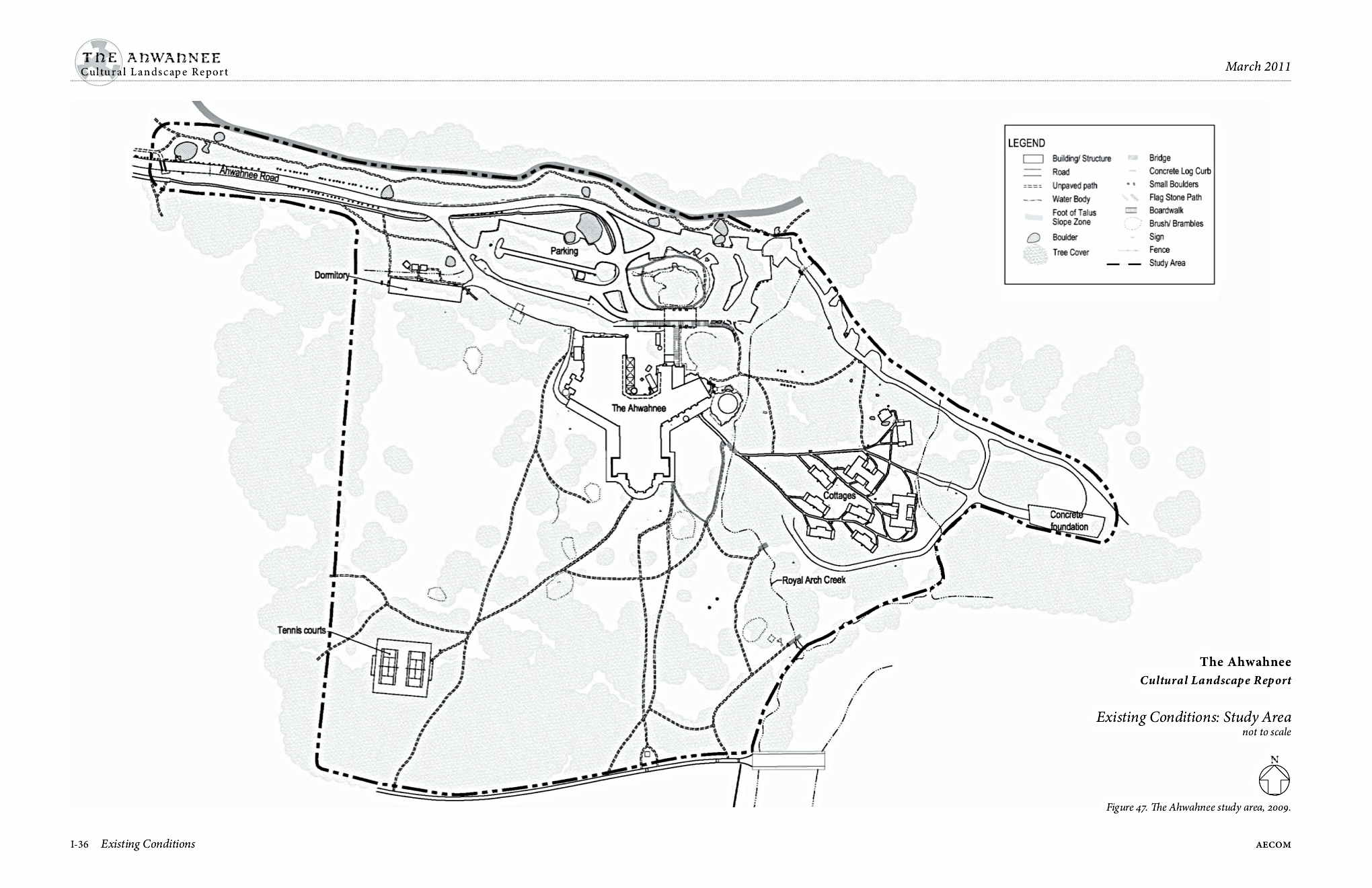 Here’s an Ahwahnee Hotel map, showing the grounds and buildings of the complex. This can help you navigate the network of trails that winds through the Ahwahnee area.
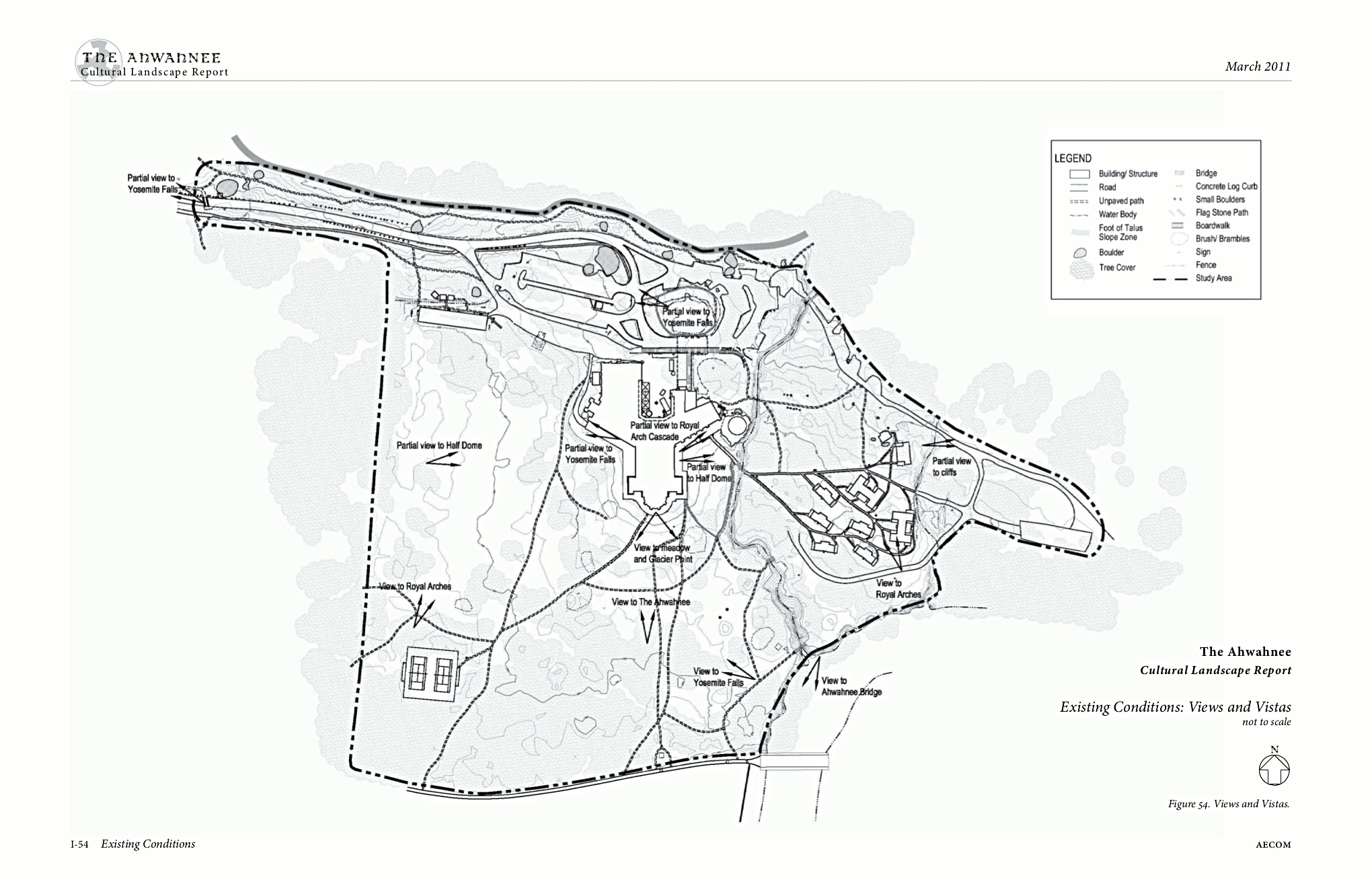 Here’s a vista map of the Ahwahnee, showing locations of various viewpoints toward famous Yosemite features such as Half Dome, Yosemite Falls, Glacier Point, and Royal Arch Cascade.
 Here’s a Wawona Hotel map, showing a site plan of the Wawona Hotel grounds with a focus on the historic Yosemite National Park features, including buildings no longer standing.
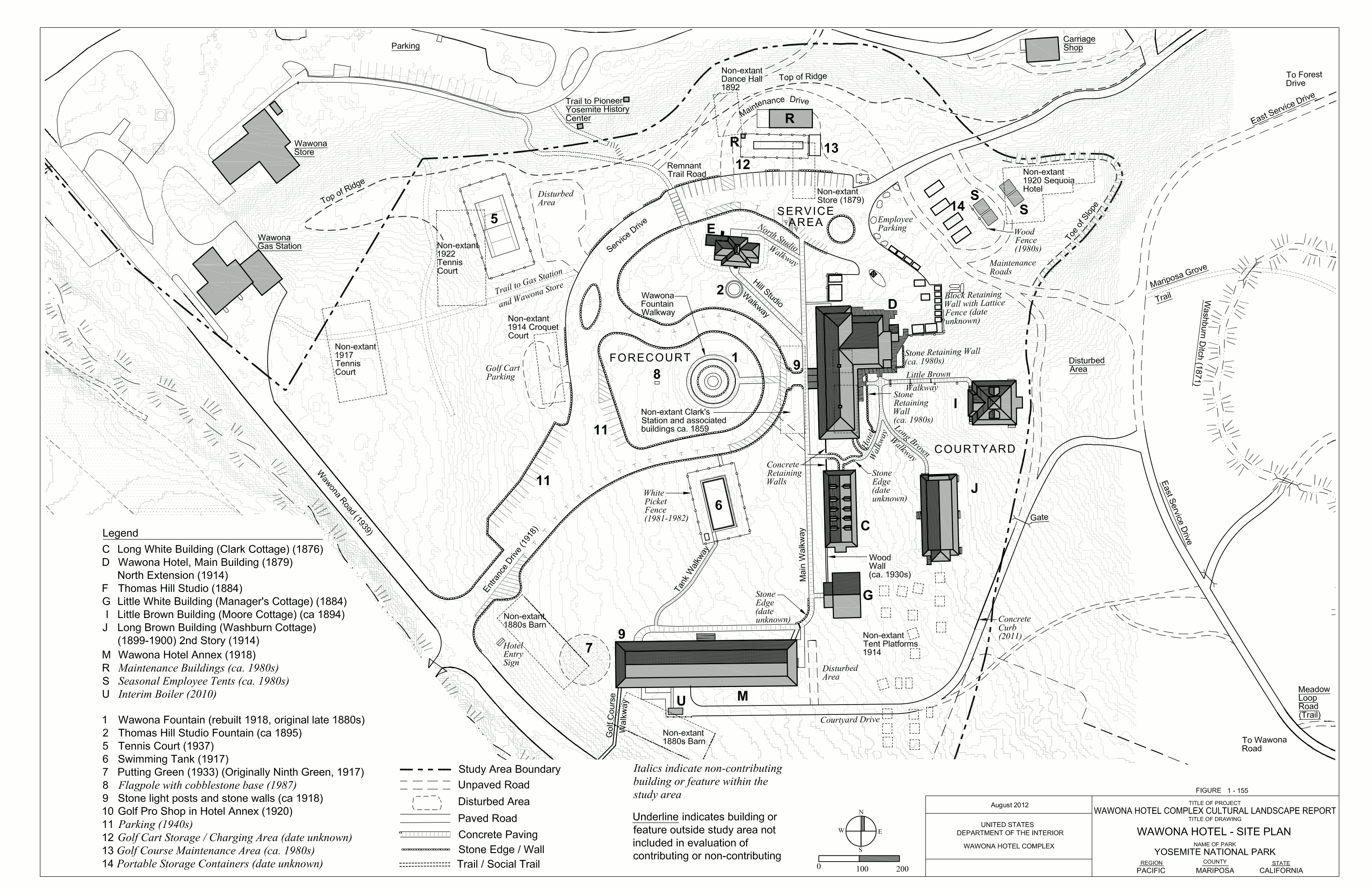
 This is a Wawona area map, including the Wawona Hotel, golf course, and other historic features along with the dates they were built. This highly-detailed map is to scale and very accurate.
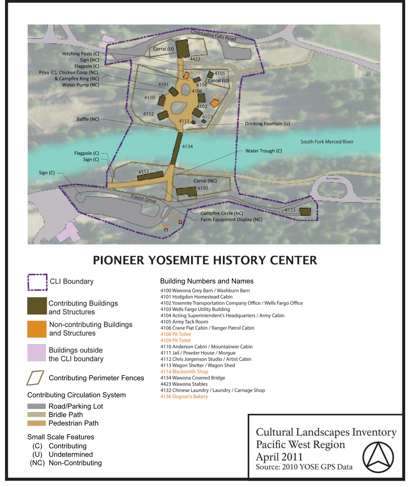 This is a Pioneer Yosemite History Center map, showing the pedestrian walkways and historic structures of the village in the Wawona area along the South Fork of the Merced River.
Historical Yosemite lodging maps
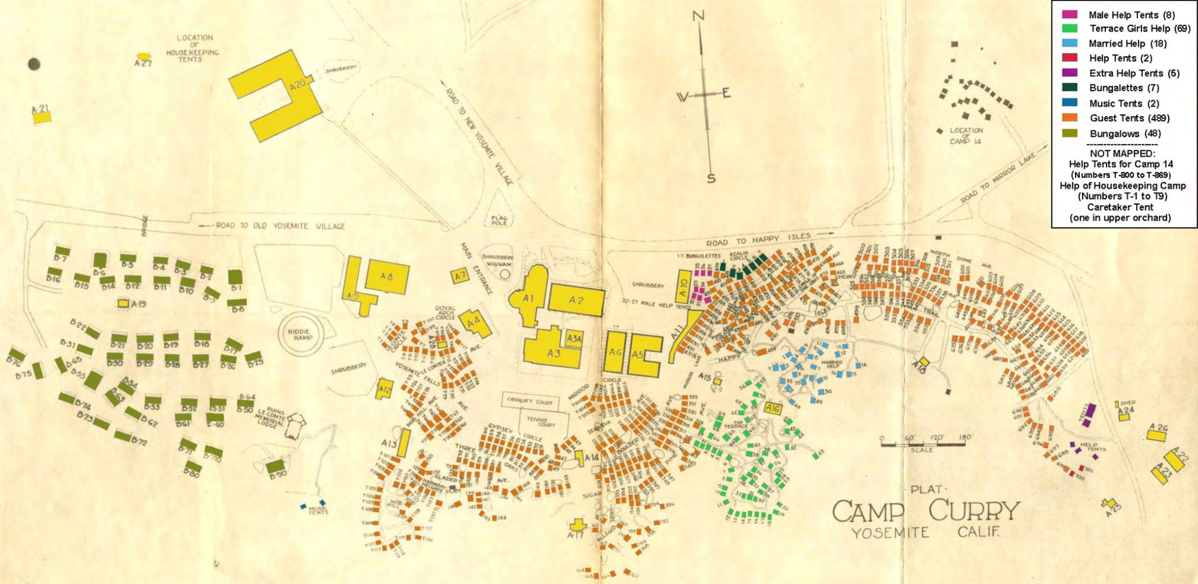 This historic Curry Village map shows the haphazard layout of Curry Village – then known as Camp Curry – as it was in 1925. Check out the croquet and tennis courts!
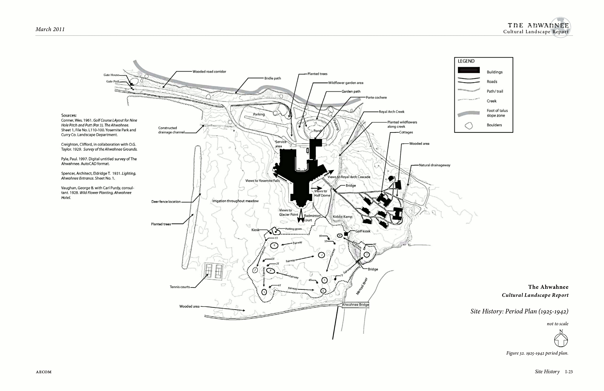 This 1925-1942 Ahwahnee map shows the hotel’s early days, back when it still included a 9-hole golf course, putting green, and badminton court on its grounds.
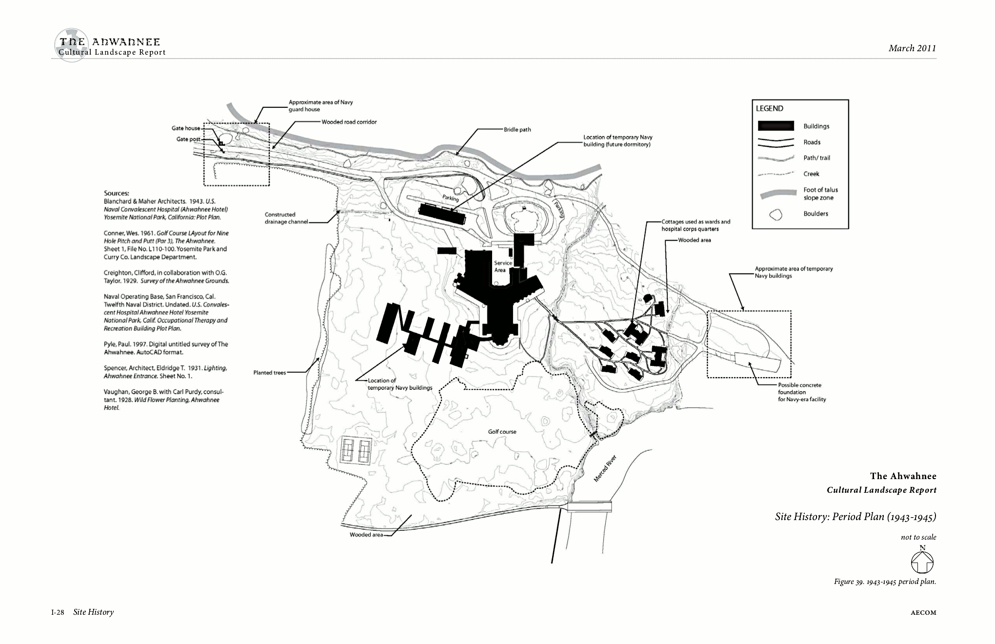 The 1943-1945 Ahwahnee map includes the additions built by the United States Navy when they took it over during World War II for recovering troops to get some R&R.
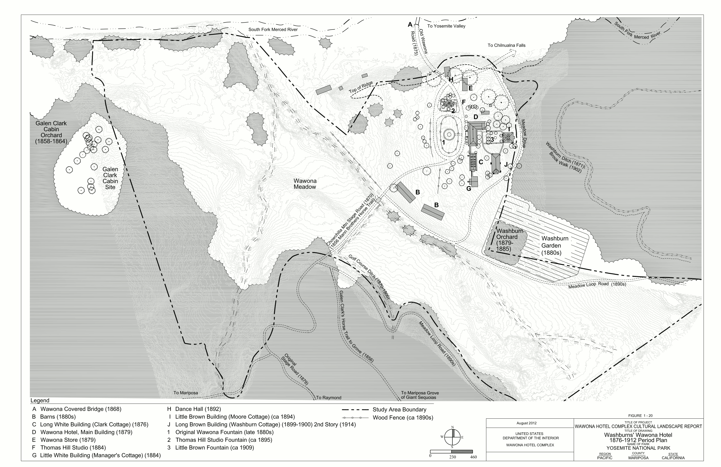 The 1876-1912 Wawona map shows the earliest days of the Wawona area, from even before it was a part of Yosemite National Park. Can you imagine stopping in here on your multi-day wagon journey?
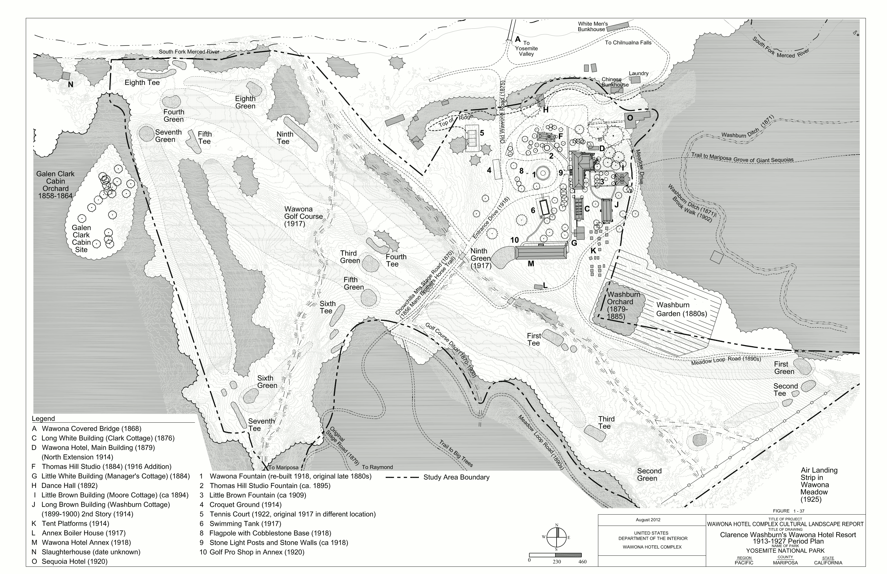 This 1913-1927 Wawona map shows some new features that weren’t present on the earlier map, including the Wawona golf course, which still remains to this very day.
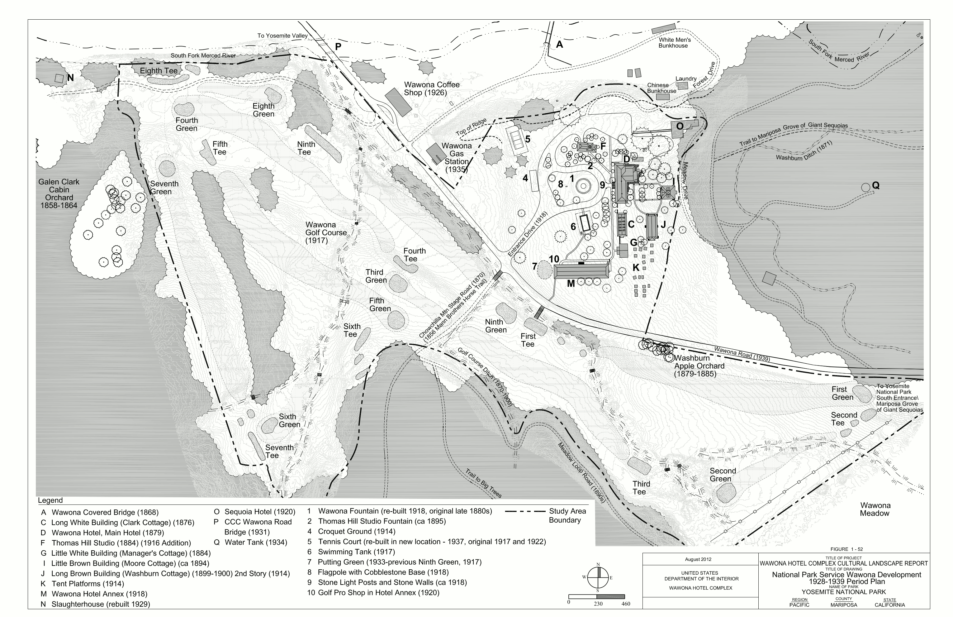 Here’s a 1928-1939 Wawona map, where the Wawona grounds really start gaining a resemblance to the layout of the location today. Can you find the differences? Amazingly, there aren’t a lot.
Archived Yosemite maps
Below are several maps that are no longer current, and have since been replaced by newer maps above. I’m providing them here for archival purposes and to ensure any links to them from throughout the web can remain active and unbroken.
 This is an old Yosemite Valley shuttle bus map. This map shows a previous layout of shuttle stops before the Yosemite Valley Welcome Center was created. Click the image to view a full size map or download the PDF.
 This is the old Tuolumne Meadows trail map, which includes shuttle bus stops for a free Tioga Road service that is defunct most years. Use this map to mourn what’s been lost! (And to dream about its eventual return.)
 Here’s the old Mariposa Grove trail map. This is how the Mariposa Grove used to be laid out before it reopened in June 2018 with the roads removed, protecting the giant sequoias from human impact.
 This is the old Yosemite Valley map, which shows the layout of the valley roads and parking before much of the mid 2010s construction. Click the image to view a full size map or download the PDF.
 This is an old Yosemite wilderness trailheads map, labeling all the trails that are reservable for an overnight wilderness permit (limited walk-in permits are also available). Get your permit early.
 Here’s an old Hetch Hetchy trail map, which shows the main trails to the various waterfalls (Wapama, Rancheria), lakes, and peaks. The trail along the reservoir is mostly flat – the others involve more elevation.
 Here’s a Wawona trail map, which isn’t nearly as nicely done as the newer map shared near the top of this page. This shows the Wawona area but doesn’t have much detail on the Mariposa Grove.
 This is the old Mariposa Grove winter trails map, showing the ski and snowshoe trails in the Mariposa Grove back when it still had a road driving through the middle of the sequoias.
 If you compare this old Crane Flat Campground map with the current one higher up on this page, you can see how the site numbering and campsite layout has changed over time.
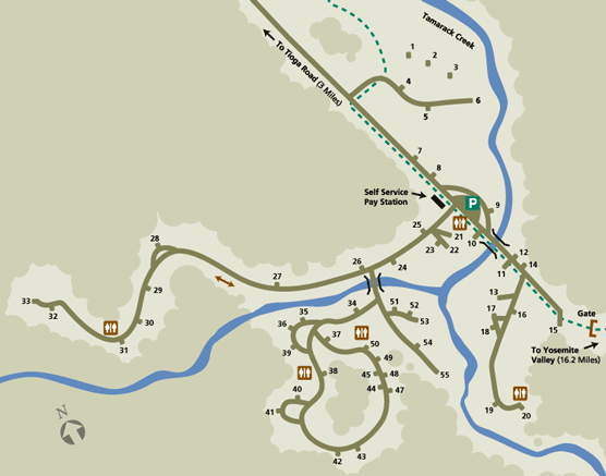
 This old Porcupine Flat Campground map shows the layout and numbering of this campground prior to 2023. The post-2023 version can be found higher on this page in the campground maps section.
 The old White Wolf Campground map doesn’t have as many key details as the more modern one higher on this page, missing things like the location of the camp host, campfire circle, and more.
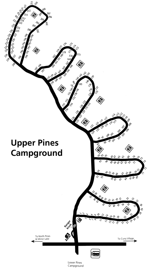 Here’s an old Upper Pines Campground map, showing the largest campground in Yosemite Valley and the only Valley campground besides Camp 4 open all year. (It’ll be very chilly in the winter, however!)
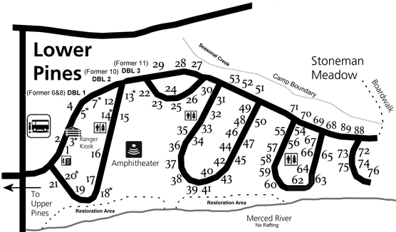 This is an old Lower Pines Campground map, showing the campground located along the Merced River just north of Curry Village. This campground closes in the winter months.
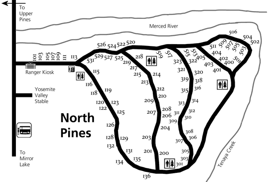 The old North Pines Campground map shows my favorite campground in Yosemite Valley, smaller and quieter than the others and with a bit more privacy, located along the Merced River.
 This is an old Yosemite Valley accessibility map from before 2022, showing accessible parking areas and trails within Yosemite Valley that are suitable for wheelchairs.
Yosemite map prints and gifts

 Printed high-resolution Yosemite map posters and other products are available at the Yosemite Maps store. For prints, gift ideas, and souvenirs featuring other national parks, support this site and visit the National Park Maps store; you’ll find items to bring on vacation, keep at home for the memories, or give to your park-enthusiast friends and loved ones.
…and more!
< Return to National Park Maps home
< Return to Park List
< Return to List by State