Lassen map from the park brochure
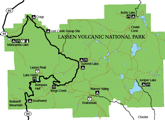
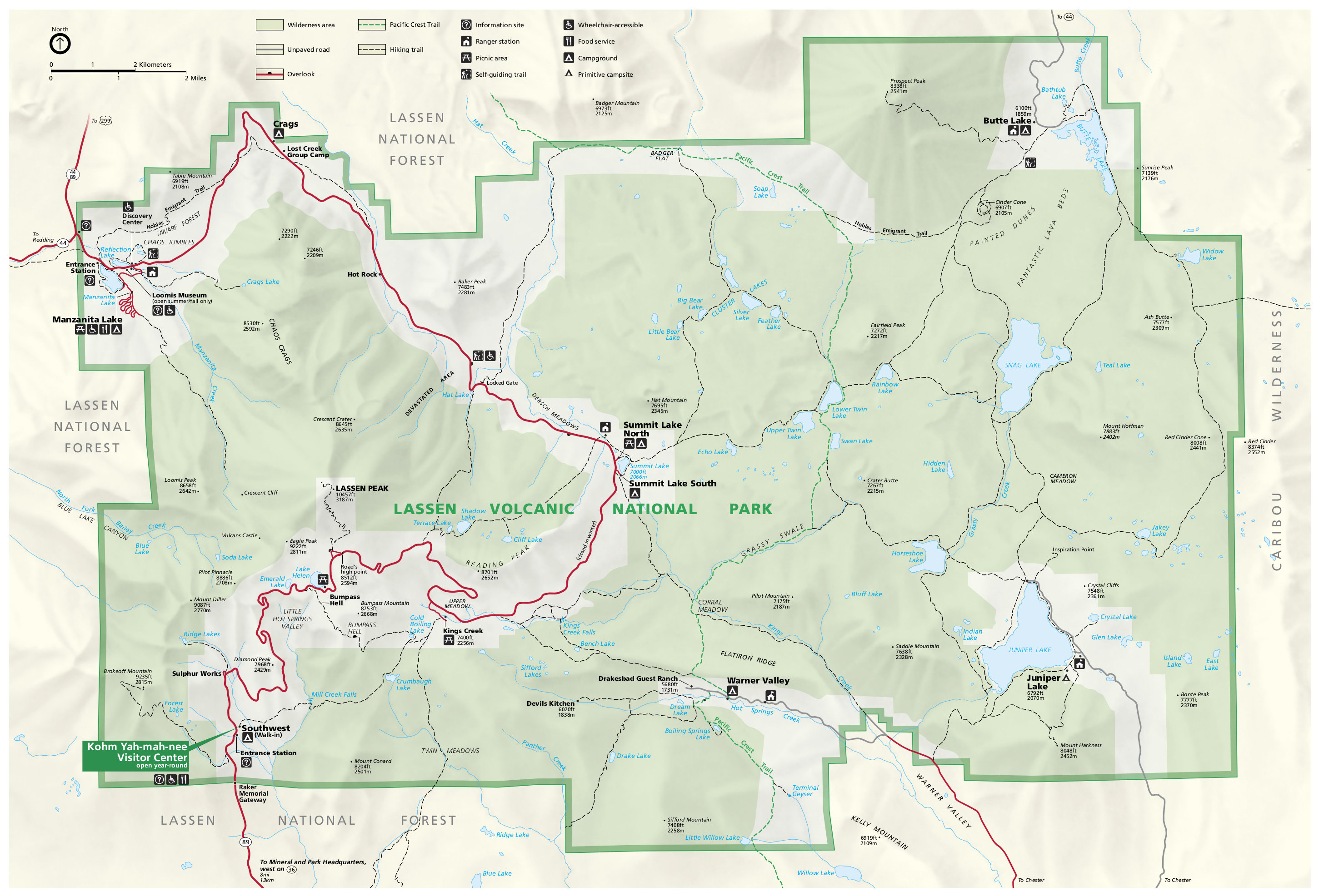
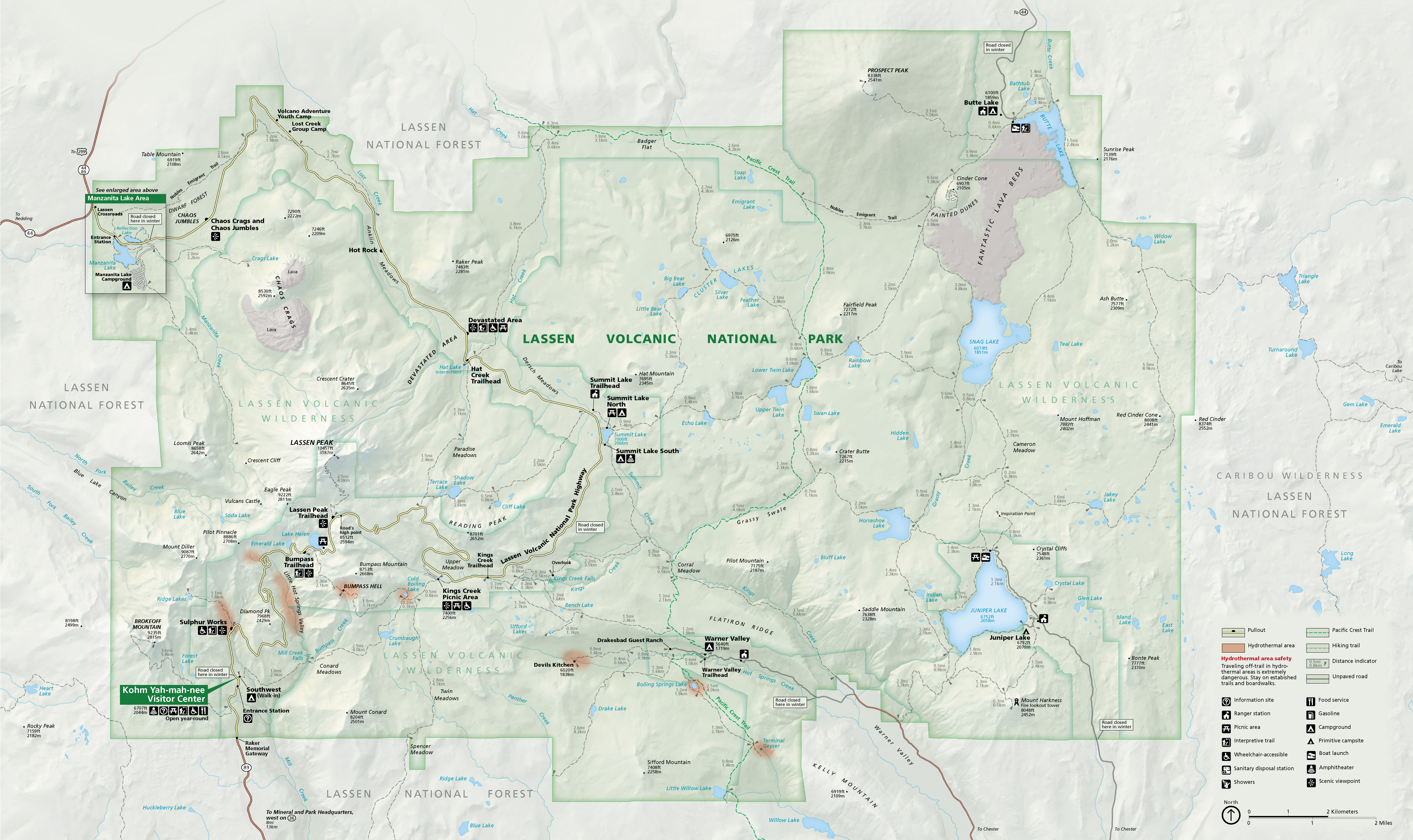 Here’s the official Lassen Volcanic National Park map, identical to the one you receive at the park. This version was updated in 2019 to include nicer graphics that show topography, volcanic areas, trails, and points of interest.
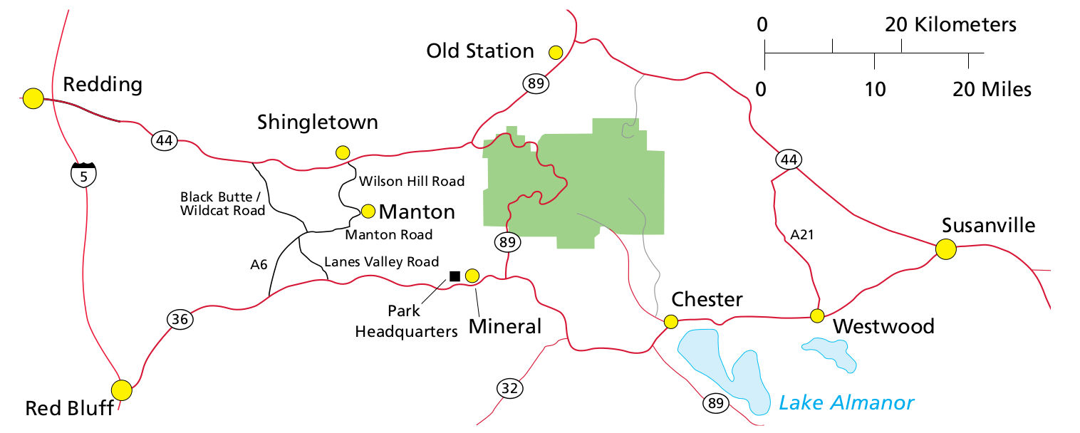
 Here’s a Lassen road map, which shows the small towns near the park and the access roads to reach Lassen. My guess is you’ll be coming from I-5 to the west. Click the image to view a full size map or download the PDF.
Lassen trail maps
 The maps below work great for short hikes when you don’t have to worry about navigation. However, if you’re doing anything longer than just a couple miles and want a trail map to cover the entire park, you should probably grab a National Geographic Trails Illustrated map, which includes trail mileages between each junction and topographic lines. Much better for peace of mind while hiking!
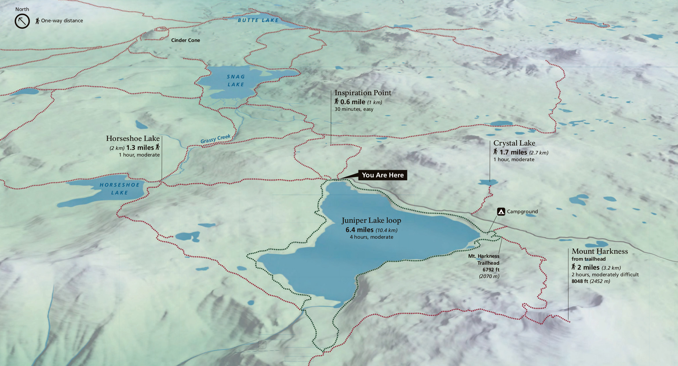 The Juniper Lake area trail map features the map located on a wayside exhibit sign at the Juniper Lake trailhead, with routes to Mount Harkness, Horseshoe Lake, Snag Lake, and other locations.
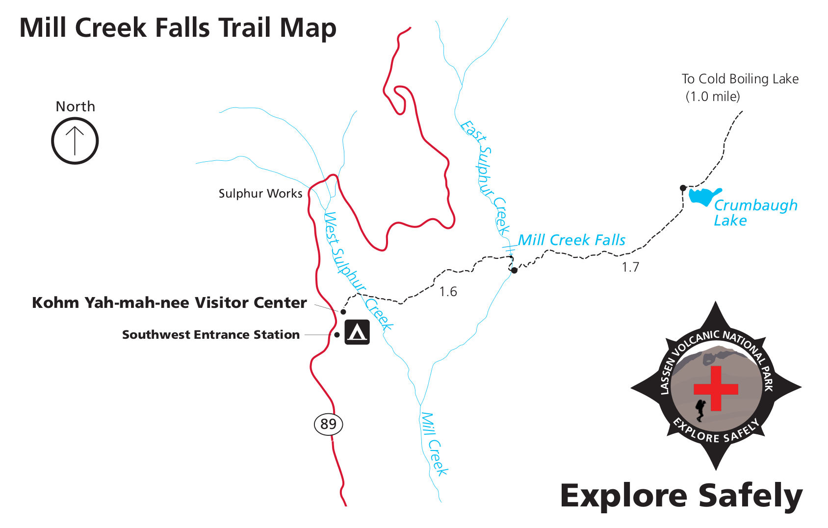 This is a Mill Creek Falls trail map, leading from the Kohm Yah-mah-nee Visitor Center and southwest entrance station to Crumbaugh Lake and Cold Boiling Lake via Mill Creek Falls.
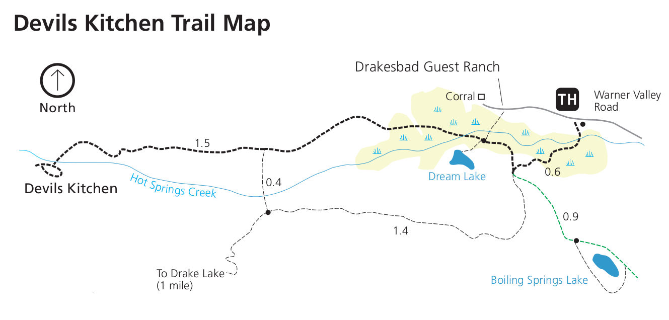 This is a Devils Kitchen trail map, showing the hike near Hot Springs Creek and Drakesbad Guest Ranch off the Warner Valley Road, which comes through a separate entrance to the southern part of Lassen.
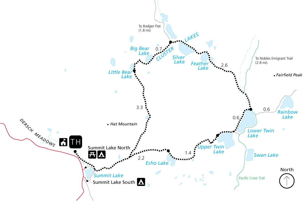 Here’s a Cluster Lakes trail map. This loop hike departs from Summit Lake. At 10.8 miles (with lots of up and down), it makes for a strenuous day hike, but is particularly nice as an overnight backpacking trip.
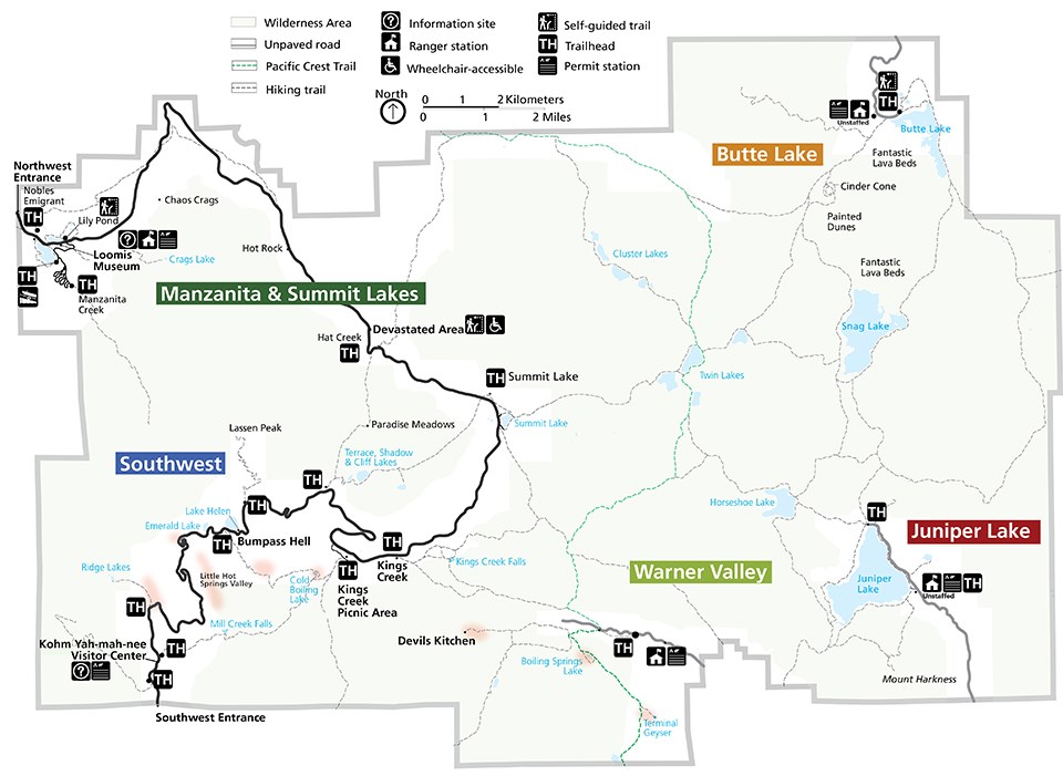 The Lassen trailhead map simplifies the park map to call out hiking trailheads, where you’ll enter the backcountry. The map is color coded into five hiking zones, which is an easy way to mentally organize the park.
 This is a Lassen backpacking map. At Lassen you can set up camp almost anywhere in the backcountry. This map shows the no camping zones, so you know the only places not to camp.
Assorted Lassen maps
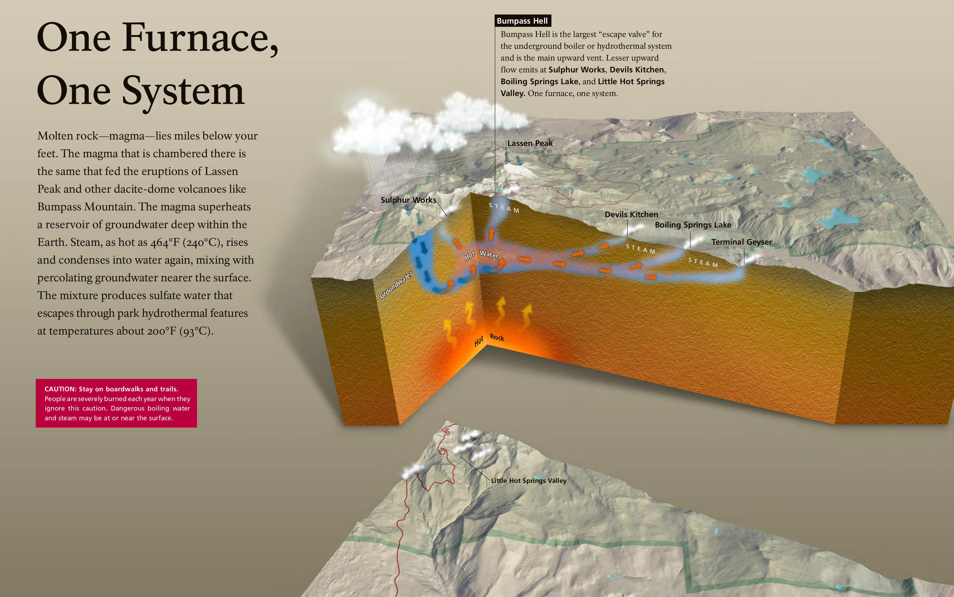 The Bumpass Hell cutaway map helps explain the geologic processes that result in Bumpass Hell, Lassen Peak, Devils Kitchen, Boiling Springs Lake, and other points of interest in the park.
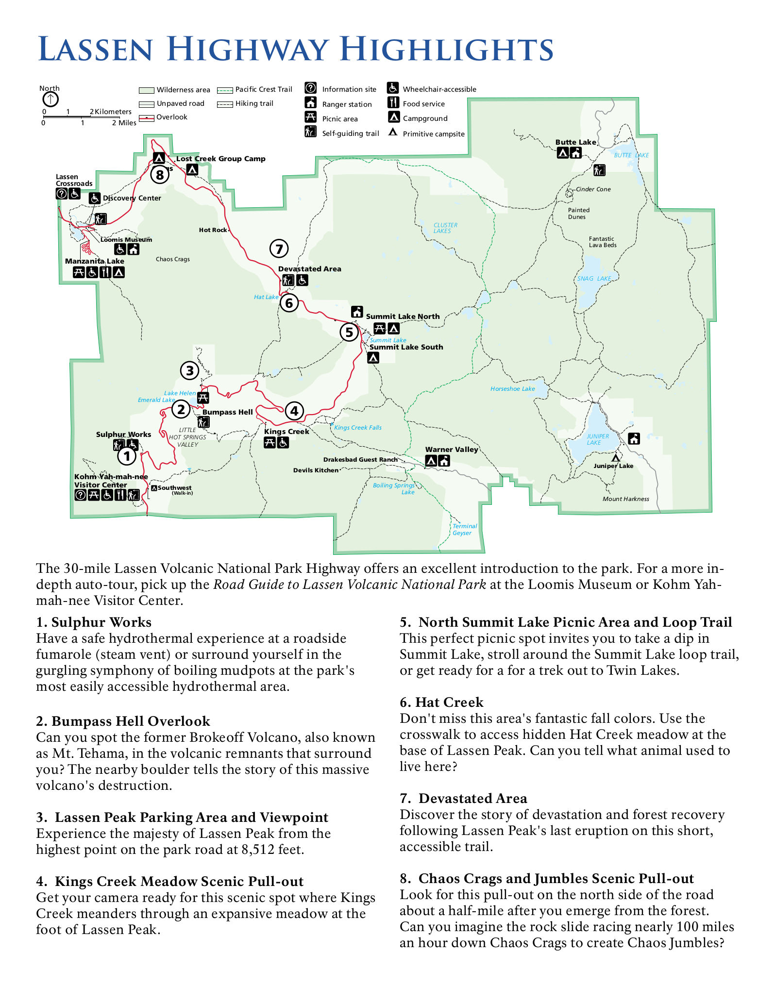 This is a Lassen auto tour map, showing highlights and points of interest in a self-guided auto tour along the main park road. The tour follows the road from the southwest to northwest entrance.
 Here’s a Lassen area map that zooms out beyond the park boundaries to show the roads and highways used to access the park. Gas stations are indicated, which is especially relevant for driving in remote places!
 This is a Lassen region map, zooming out to show the various National Park units nearby: Redwood, Whiskeytown, Lava Beds, Crater Lake, and Oregon Caves. Combine them all into one trip!
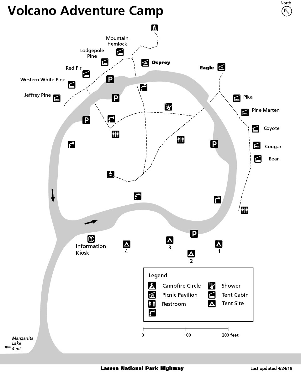 This is a Volcano Adventure Camp map, which is a youth camping facility opened in 2016 for youth organizations and groups. This map shows the campus, including the named tent cabins.
Lassen lodging map
 Like many western parks, Lassen Volcanic doesn’t have a ton of lodging inside the park or nearby. Many visitors choose to stay in Redding, CA, the nearest major town along I-5 to the west. To the right you can open up the Expedia interactive Redding lodging map to compare options. You might also want to browse the list of Expedia’s top-rated Redding lodging to compare prices, photos, amenities, and reviews.
Lassen winter maps
 Here’s a Lassen winter map, showing where the road ends near the southwest entrance station at the Kohm-Yah-mah-nee Visitor Center. Ski and snowshoe routes are marked to show options on the park road and on trails.
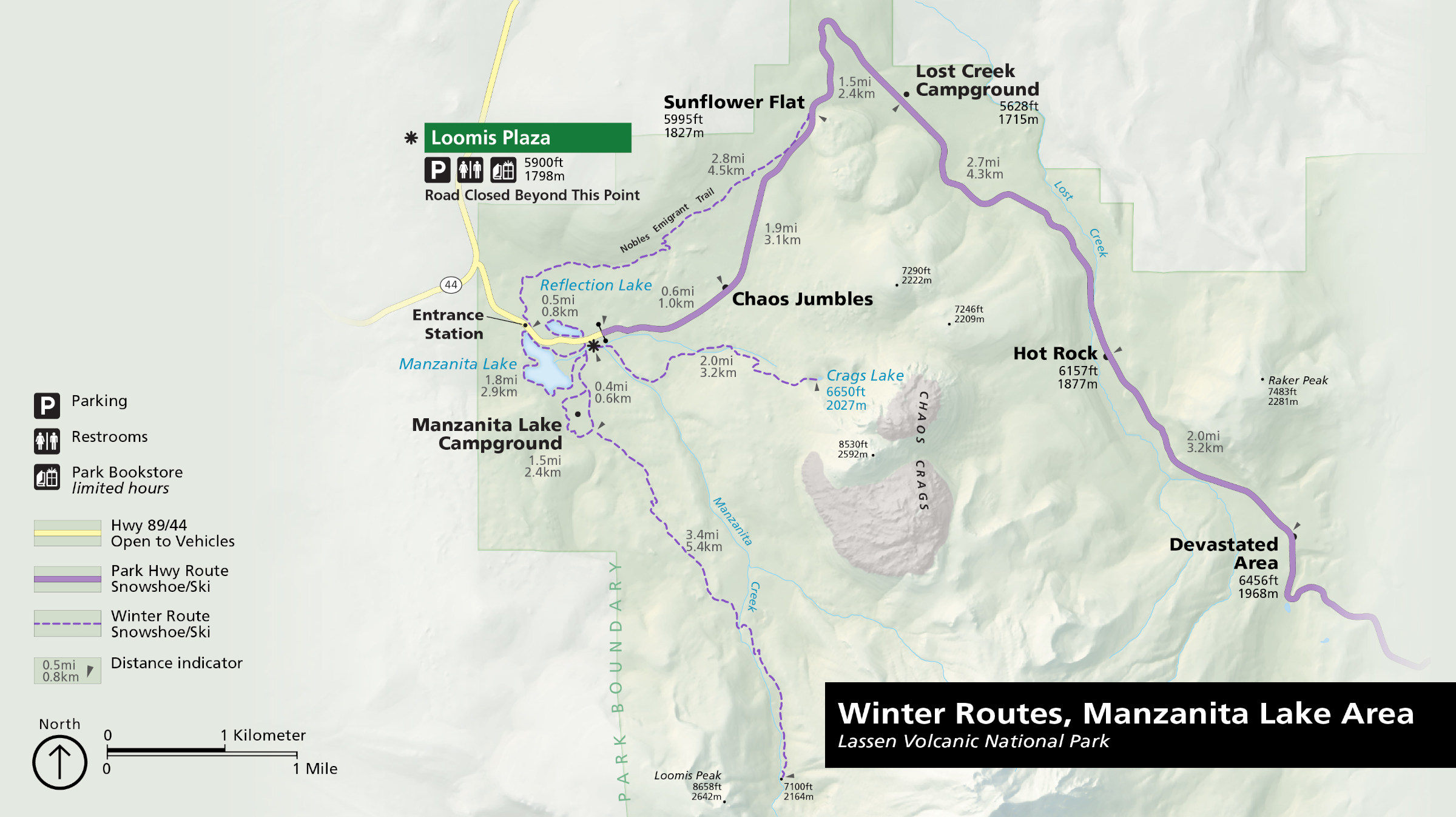 The Manzanita Lake winter map shows where the road ends just beyond the northwest entrance station. Routes are color coded to show snowshoe/ski roads and snowshoe/ski trails.
 This is a winter trail map of Manzanita Lake, zooming in to Loomis Plaza to show trails around the lake and the Campground Loop, Nobles Emigrant Trail, Crags Lake Trail, and Manzanita Creek Trail.
Lassen campground maps
 Here is a map of all Lassen campgrounds. The maps below are arranged south-to-north along the main highway and clockwise throughout the rest of the park, accessed from different roads.
 The Southwest Walk-in Campground map shows the walk-in tent sites located adjacent to the Kohm Yah-mah-nee Visitor Center, just inside the southwest entrance station.
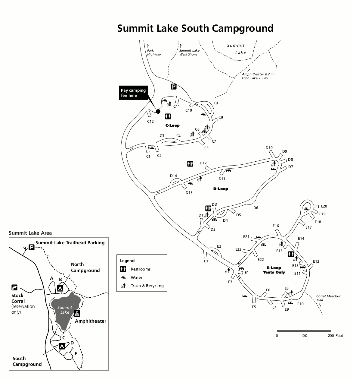 The south Summit Lake Campground map shows the southern part of Summit Lake Campground, featuring both reservation and first-come first-serve sites. Trails from the campground loops are shown.
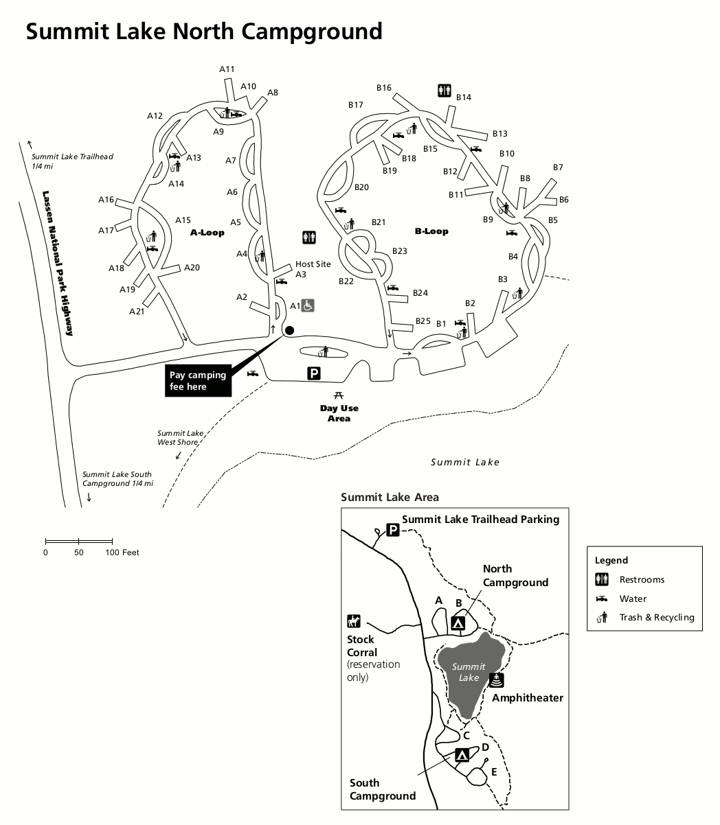 Here the north Summit Lake Campground map shows the reservable B loop, the first-come first-served A loop, and the trail to Echo Lake. You’ll also see an inset map showing the south campground.
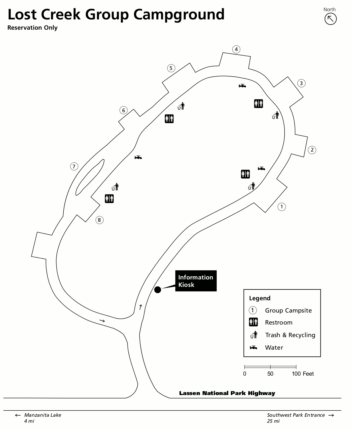 The Lost Creek Group Campground has eight campsites for groups of 10-25 campers and is located near the Devastated Area. Reservations are necessary to camp in Lost Creek.
 Here’s the Manzanita Lake Campground map, the northernmost campground on the main highway and largest in the park. This map shows each of the loops with restrooms, water, and camper services.
 The Butte Lake Campground map is in the northeast corner of the park and has 100 campsites accessed by a remote gravel road (RVs up to 35 feet). Water and restrooms are available here.
 The Juniper Lake Campground map has 18 sites located in the remote southeast corner of the park. There’s no potable water available here, so make sure to bring your own.
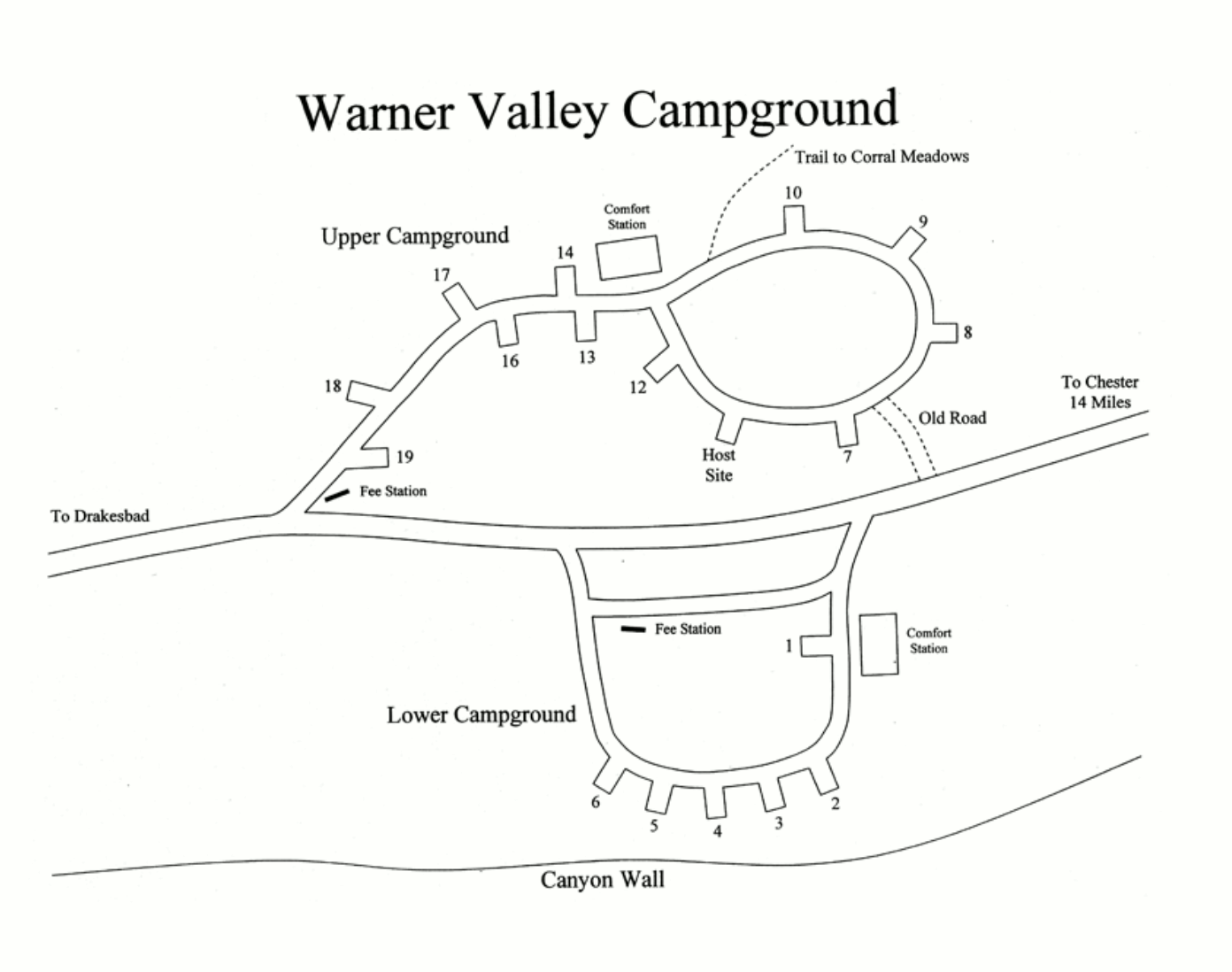
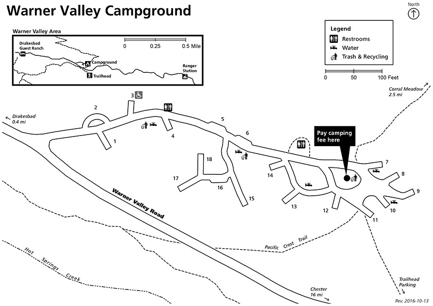 This is a Warner Valley Campground map. This campground is in a pretty quiet, remote area of the national park, with only a dead-end gravel road to get you here.
Dixie Fire maps
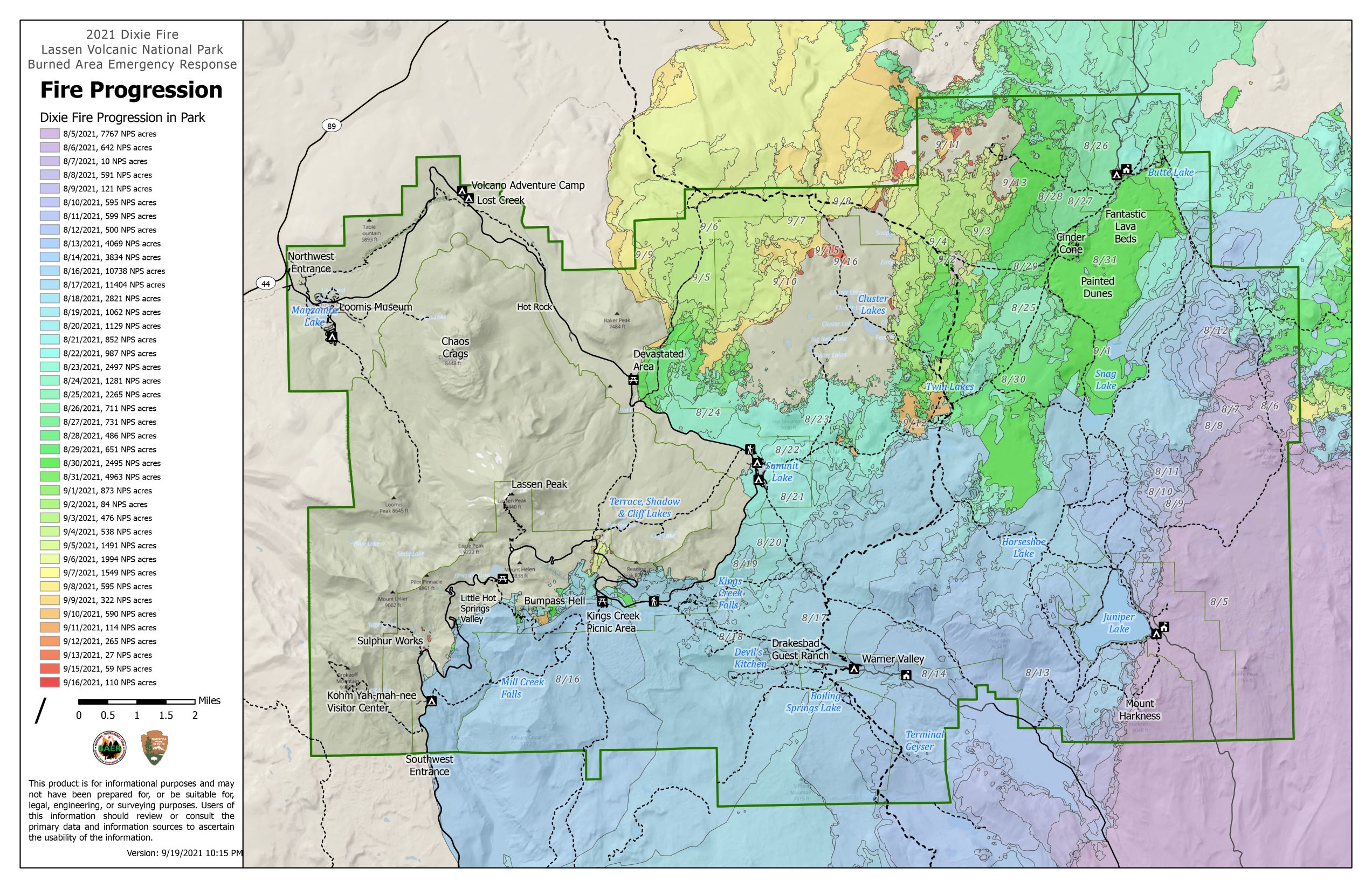 The Dixie Fire map shows the progression of the Dixie Fire in 2021, a catastrophic blaze that burned nearly 70% of the park. But like Yellowstone after 1988, we now get to enjoy watching an ecosystem return to life.
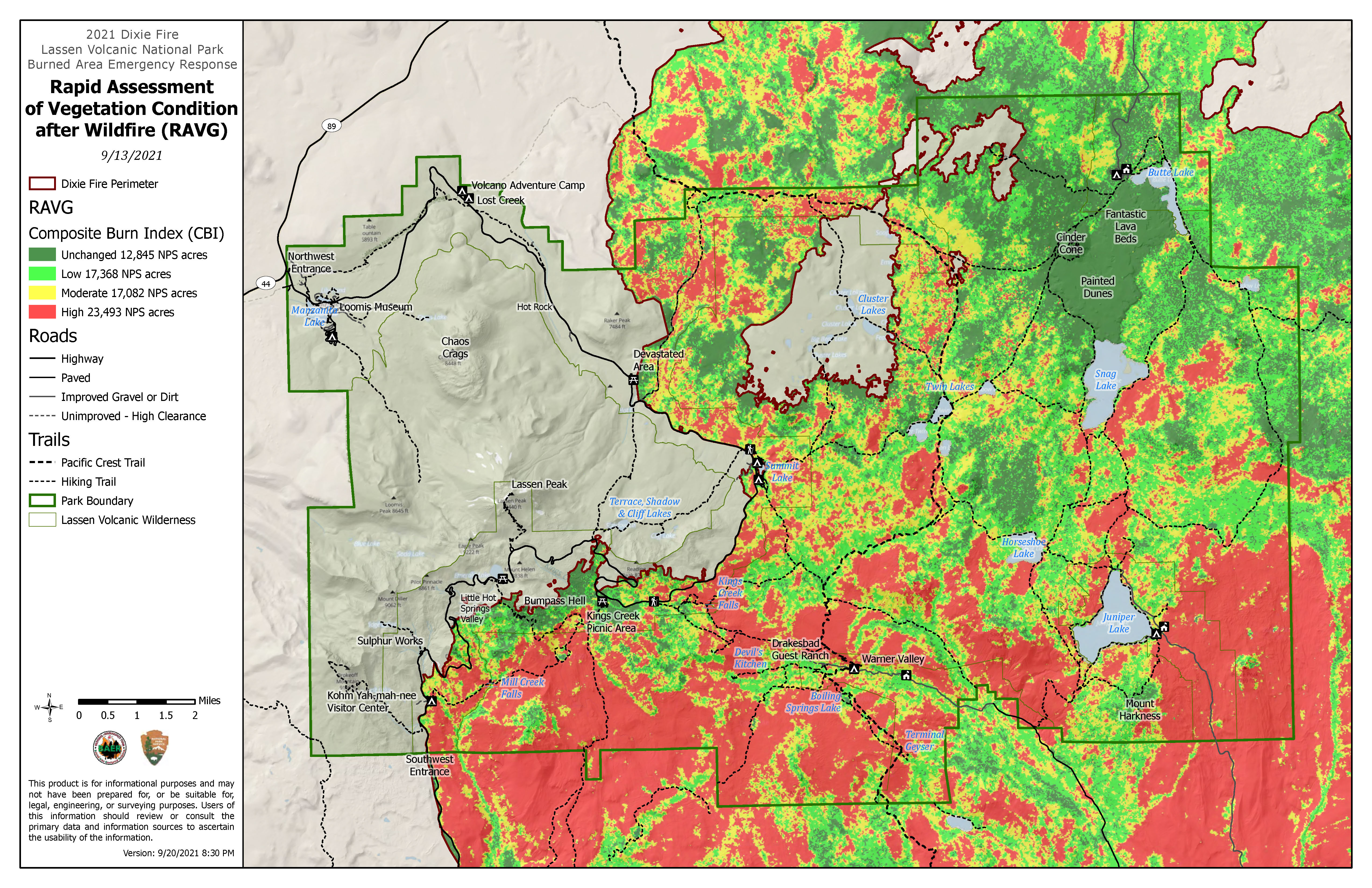 This Dixie Fire intensity map reveals that despite the huge acreage of the fire, not all of the forest burned intensely, and much of the landscape within the fire perimeter remains unchanged.
Lassen science maps
 This Lassen watershed map zooms way out to show the various watersheds that Lassen lakes and rivers flow into: North Fork Feather River, Pit River, Battle Creek, and Mill Creek.
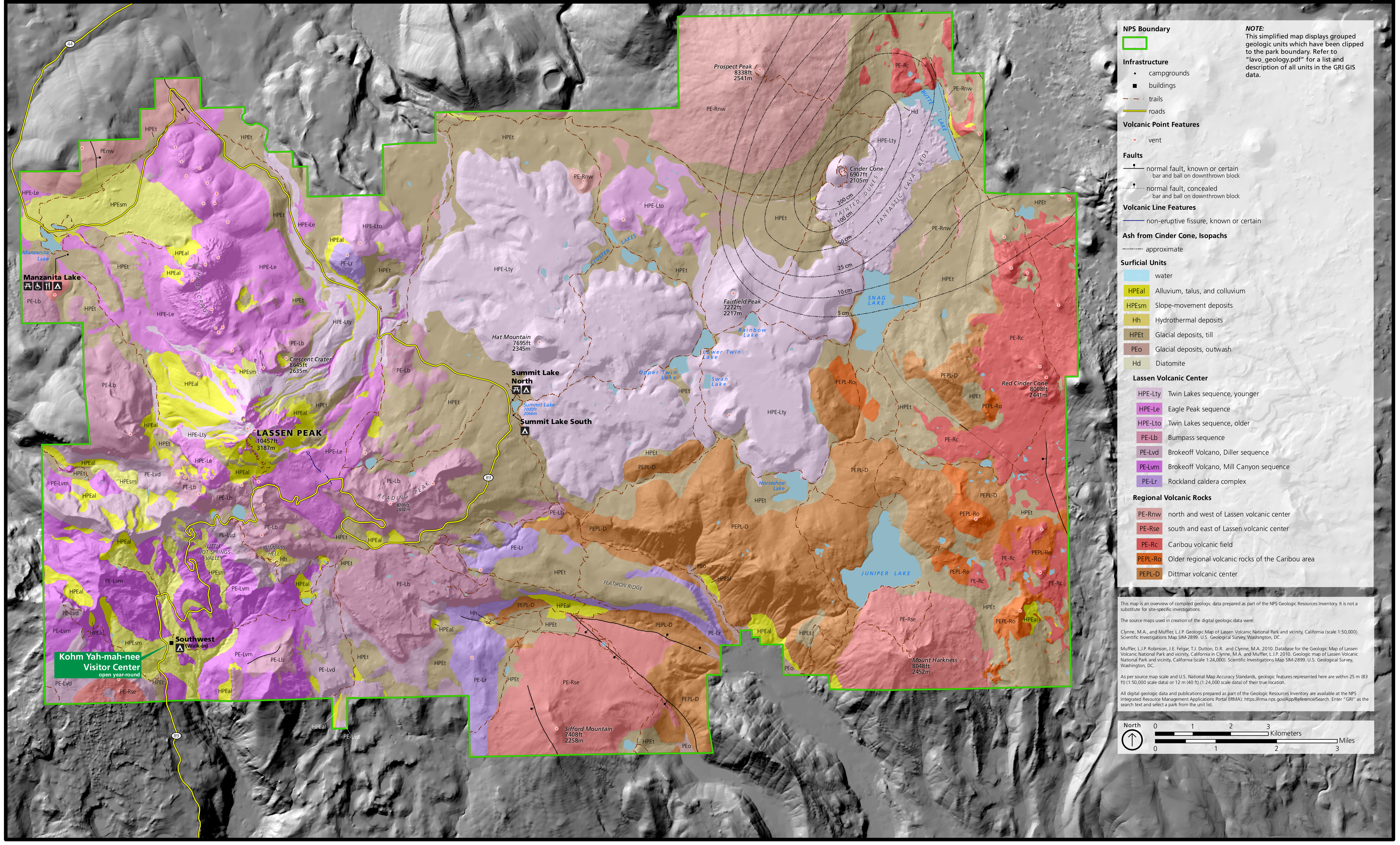 Here’s a Lassen geologic map, showing both the recent volcanic surficial deposits as well as some of the older bedrock near Lassen Peak, overlaid on a shaded terrain view of the national park.
Archived Lassen maps
The National Park Service often updates maps and creates new ones, and I try to share them on this page as I find them. But I try to avoid removing old maps, as I believe it’s important to tell the story of how national parks like Lassen Volcanic change over time. In this section, you’ll find some older maps that have since been superseded by ones above.
 This is the old brochure map of Lassen Volcanic from the mid-2010s, which is still accurate but has since been updated to have more eye-catching graphics. Click the image to view a full size map or download the PDF.
 Here is an old Lassen regional road map from the mid-2010s, showing access to the park from I-5 via Redding and Red Bluff from the west. Highways from the north, east, and south are also shown on this map.
 Here’s a Warner Valley Campground map from the mid-2010s. It’s located down a rough gravel road in the southern part of the park (trailers are not recommended). This map includes restrooms and trailheads.
…and more!
< Return to National Park Maps home
< Return to Park List
< Return to List by State