Mammoth Cave maps from the park brochure
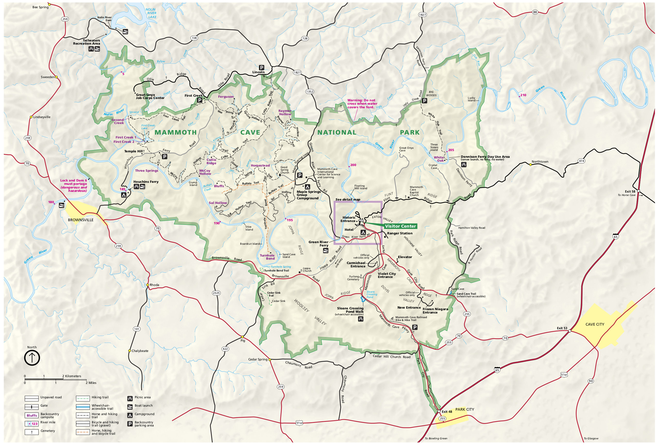
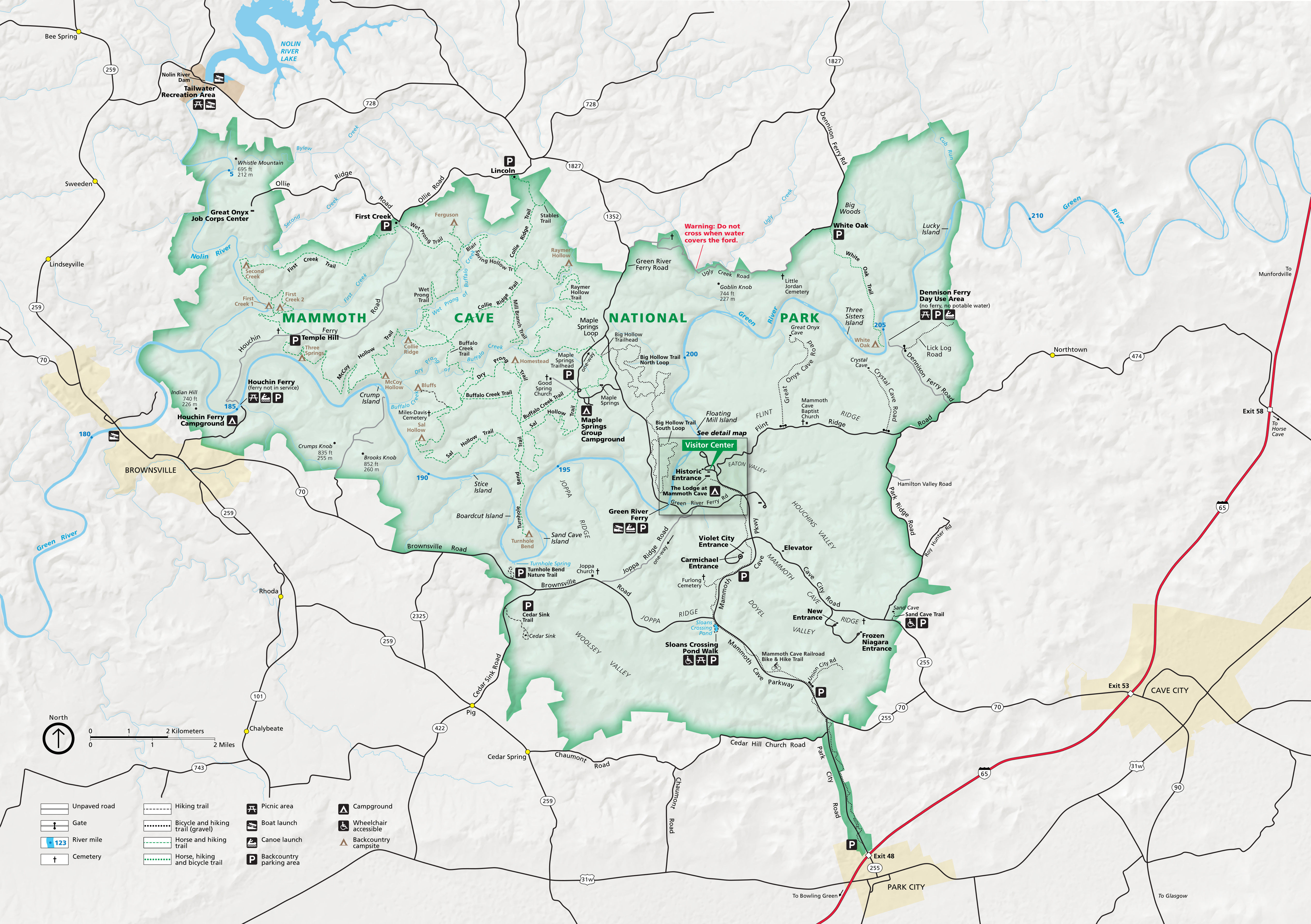 This is the official NPS Mammoth Cave National Park map, identical to the one you receive when you visit. This map shows that there’s much more to the park than the cave itself, including trails and backcountry campsites.
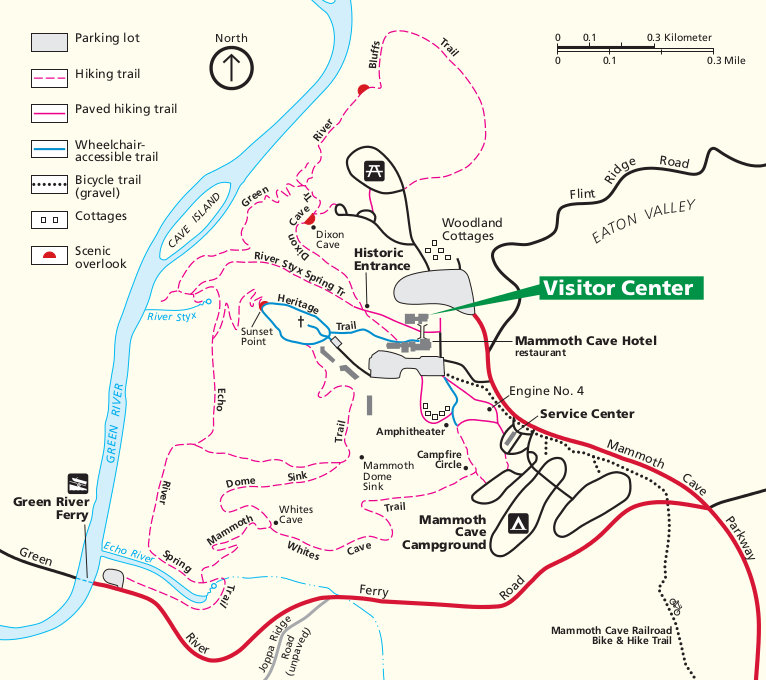
 Here’s a Mammoth Cave Visitor Center area map, which zooms in on the visitor center, Mammoth Cave Campground, and numerous hiking trails. Click the image to view a full size map or download the PDF.
Mammoth Cave trail maps
 The free maps below show trails and mileages in more detail than the park map above. However, they don’t show topographic lines, so I wouldn’t want to use them for long hiking or backpacking trips since they won’t be as useful for navigation. Instead, you’ll want the National Geographic Trails Illustrated map, which has enough detail and information to be suitable for overnight travel and backpacking.
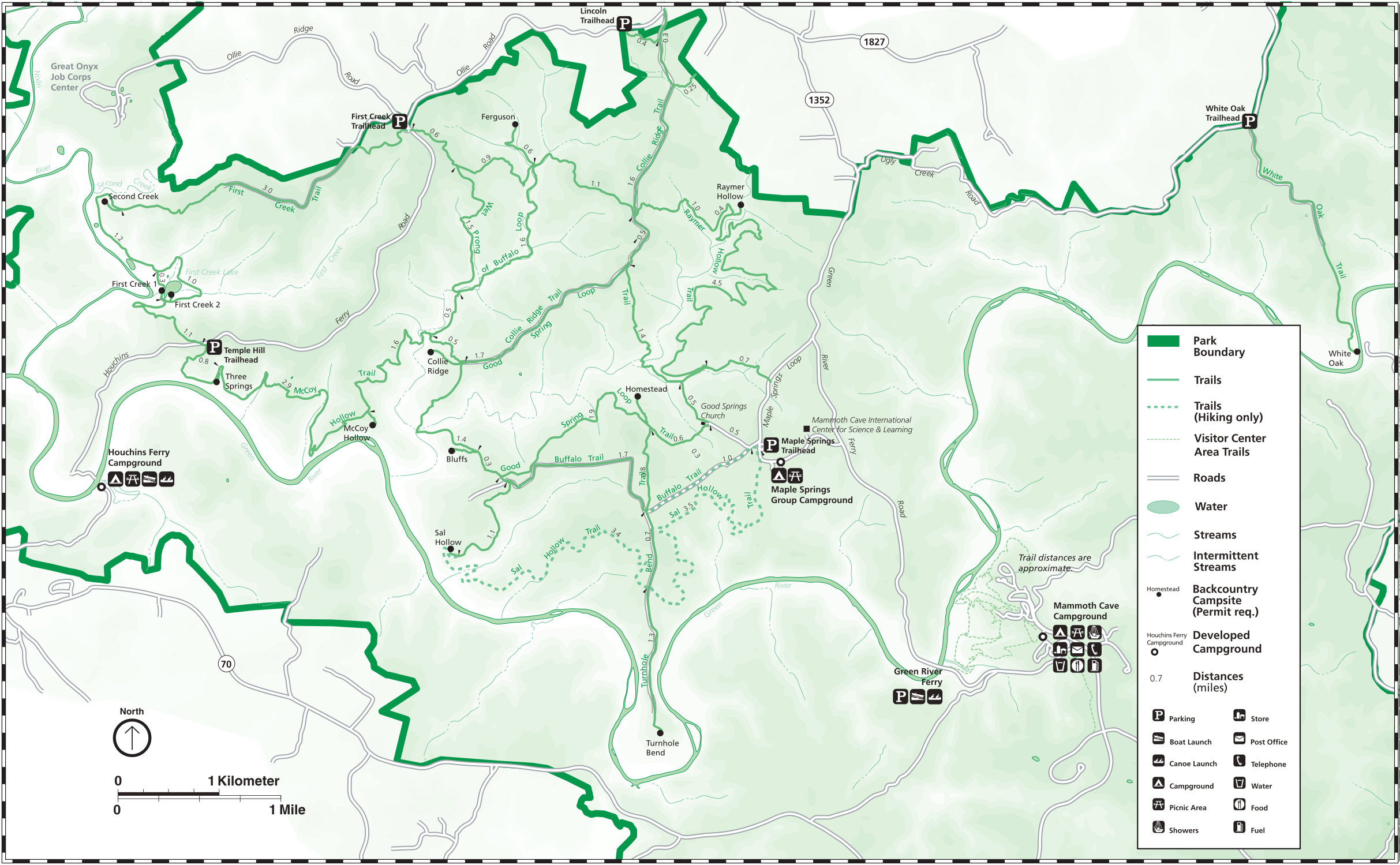
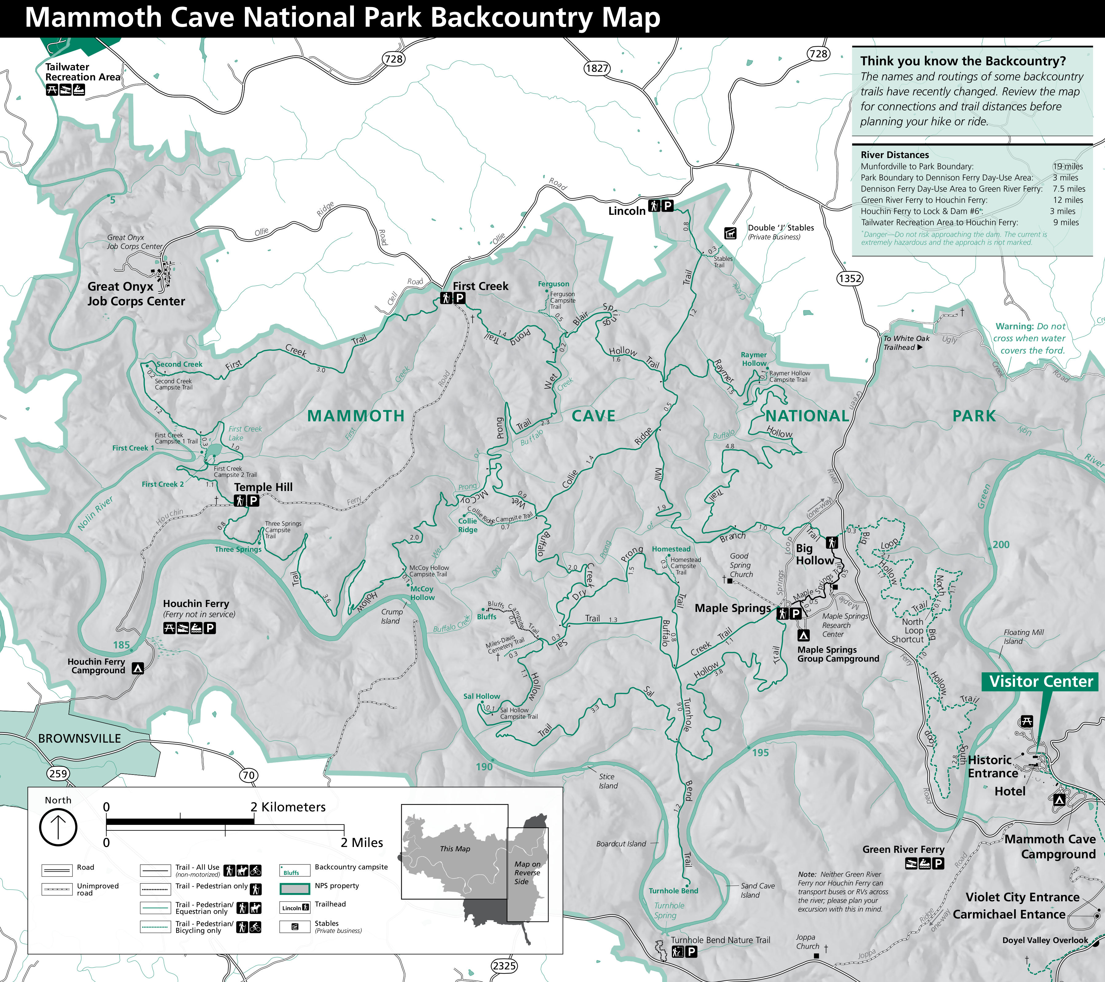 The Mammoth Cave trail map shows the park’s extensive network of backcountry trails, along with mileages between junctions, backcountry campsites, and other points of interest.
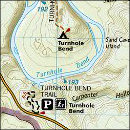
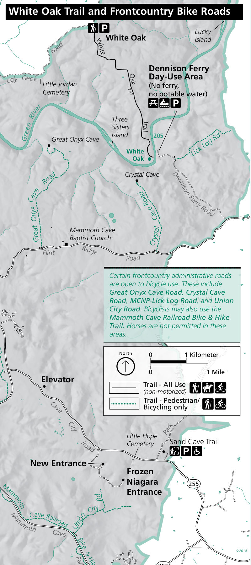 This east Mammoth Cave trail map shows the remainder of the park not included on the previous map. This is the section labeled “map on reverse side” on the previous map key.
 This is the older Mammoth Cave backcountry map, replaced by the ones above. This one is easier to read but has outdated trail routes that are no longer accurate, so do not use this map to navigate.
Mammoth Cave campground map
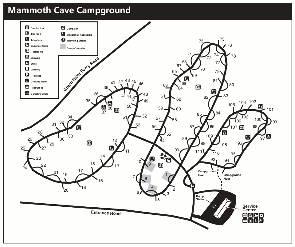
 The Mammoth Cave Campground map was last updated in 2020 and includes campsites and the locations of services like water spigots and restrooms. Click the image to view a full size map or download the PDF.
Mammoth Cave lodging map
 Click the image to the right to view an Expedia interactive Mammoth Cave lodging map in a new window, centered on Cave City. Although Cave City is the most popular place to stay outside the park, if you zoom out and scroll the map you can find more options if you drive a bit further. Also consider viewing top-rated Mammoth Cave lodging on Expedia to compare reviews, photos, locations, and prices.
Mammoth Cave layout map
 This is a complete Mammoth Cave system map, showing the entire extent of the world’s largest known cave system. Note how the full cave size extends well beyond the boundaries of Mammoth Cave National Park.
Mammoth Cave geologic maps
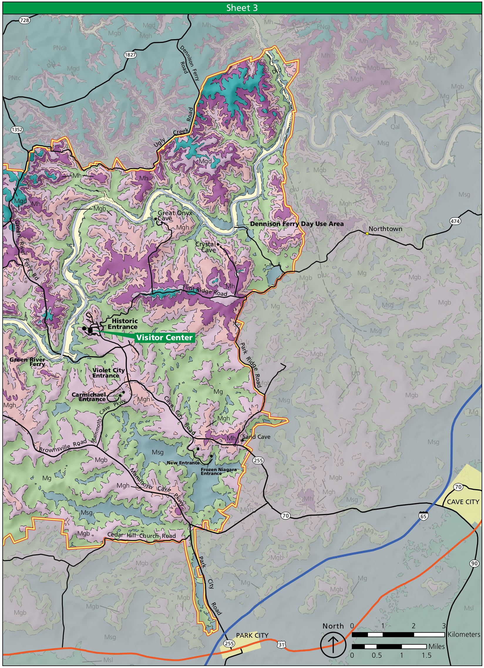
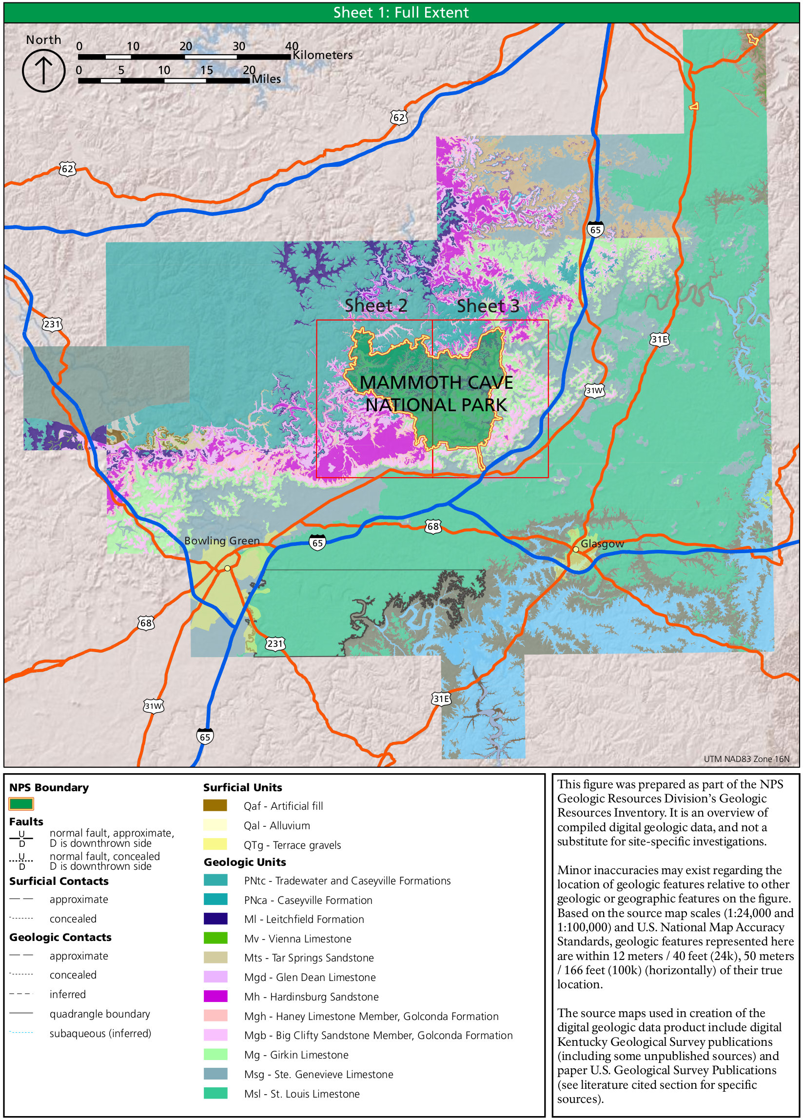 This Mammoth Cave geologic map provides an overview of the entire Mammoth Cave region and includes a legend to identify the rocks you’ll find on the maps below.
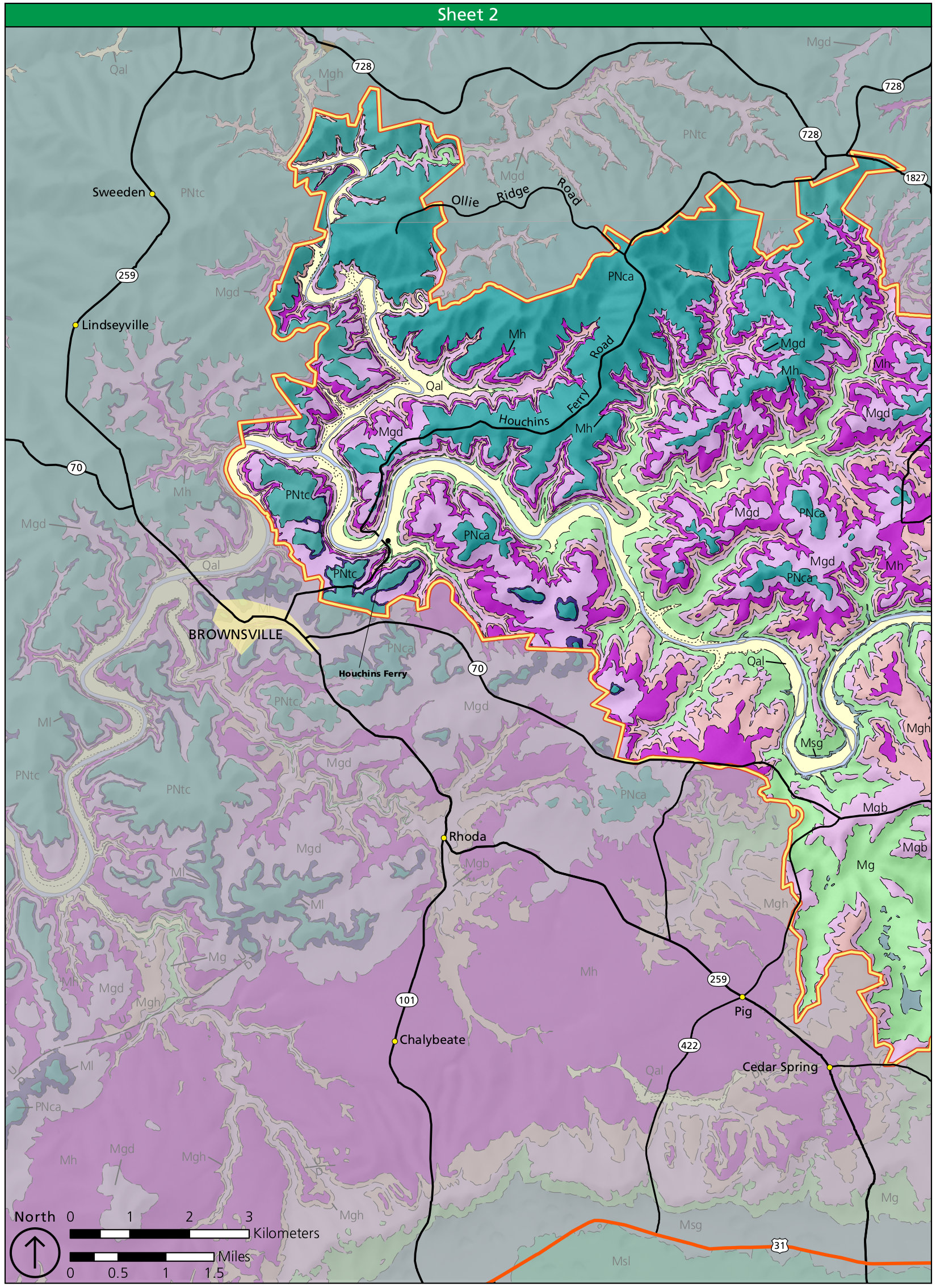 Here’s a west Mammoth Cave geologic map, showing the rock types on the western side of the park, nearest the town of Brownsville. You’ll find a legend in the map above.
 This is an east Mammoth Cave geologic map, including the area around the visitor center and entrances to Mammoth Cave. Again, you’ll get a legend in the first geologic map listed above.
Archived Mammoth Cave maps
The National Park Service releases new and updated maps with regularity and I do my best to capture those maps and host them here as I find them. Maps that are older and have since been replaced are featured below. I still include them on this site because I believe it’s important to have an archival record of how national parks change over time.
 This is the official Mammoth Cave National Park map from the mid-2010s, showing the main roads, trails, and points of interest. Click the image to view a full size map or download the PDF.
 This is a detail map of Mammoth Cave from the mid-2010s, zoomed in on the visitor center, cave entrance, campground and Mammoth Cave Hotel. Click the image to view a full size map or download the PDF.
 This is a mid-2010s map of Mammoth Cave Campground, located near the visitor center and Mammoth Cave Hotel. Click the image to view a full size map or download the PDF.
…and more!
< Return to National Park Maps home
< Return to Park List
< Return to List by State