Big Bend maps from the park brochure
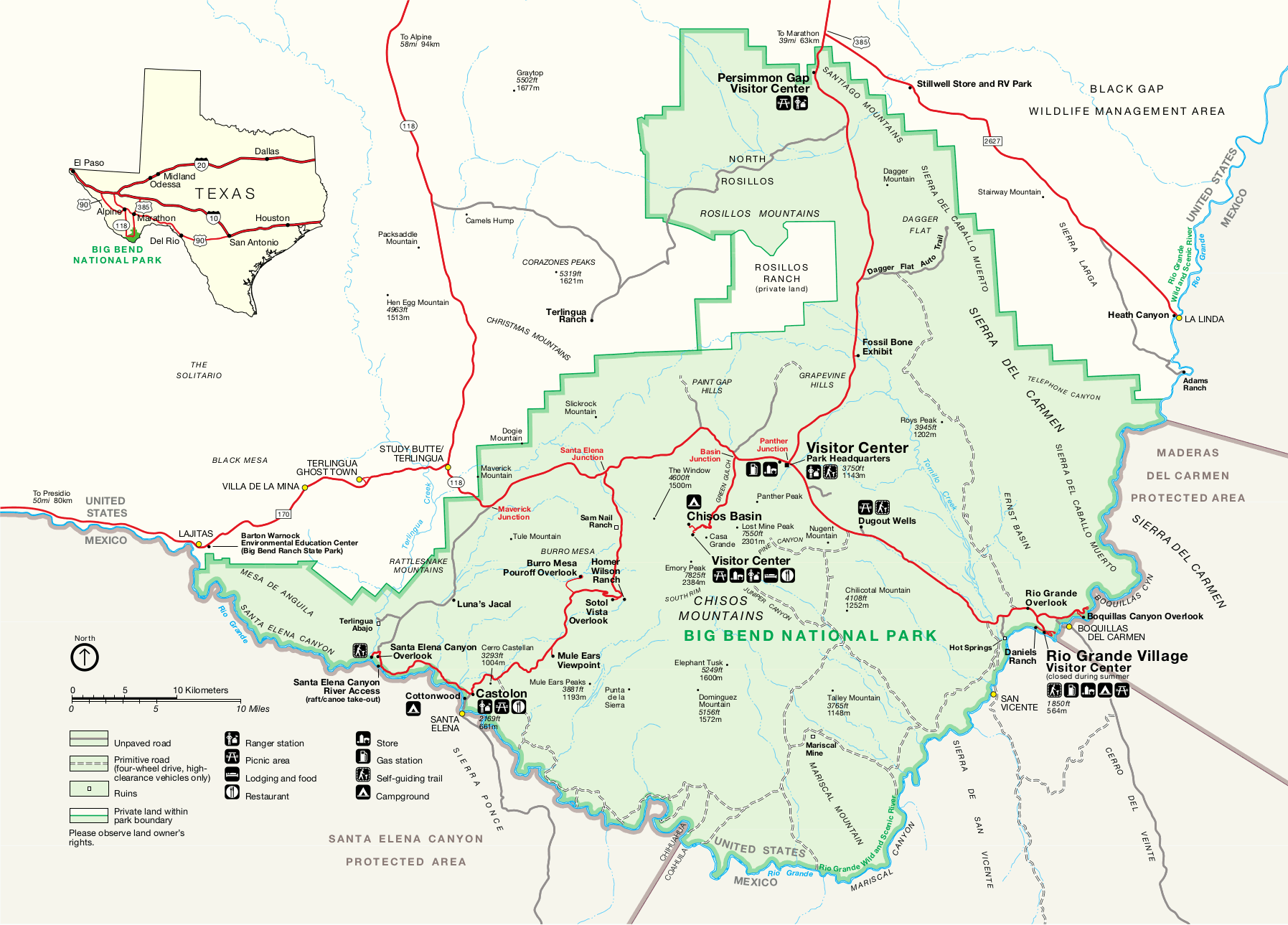
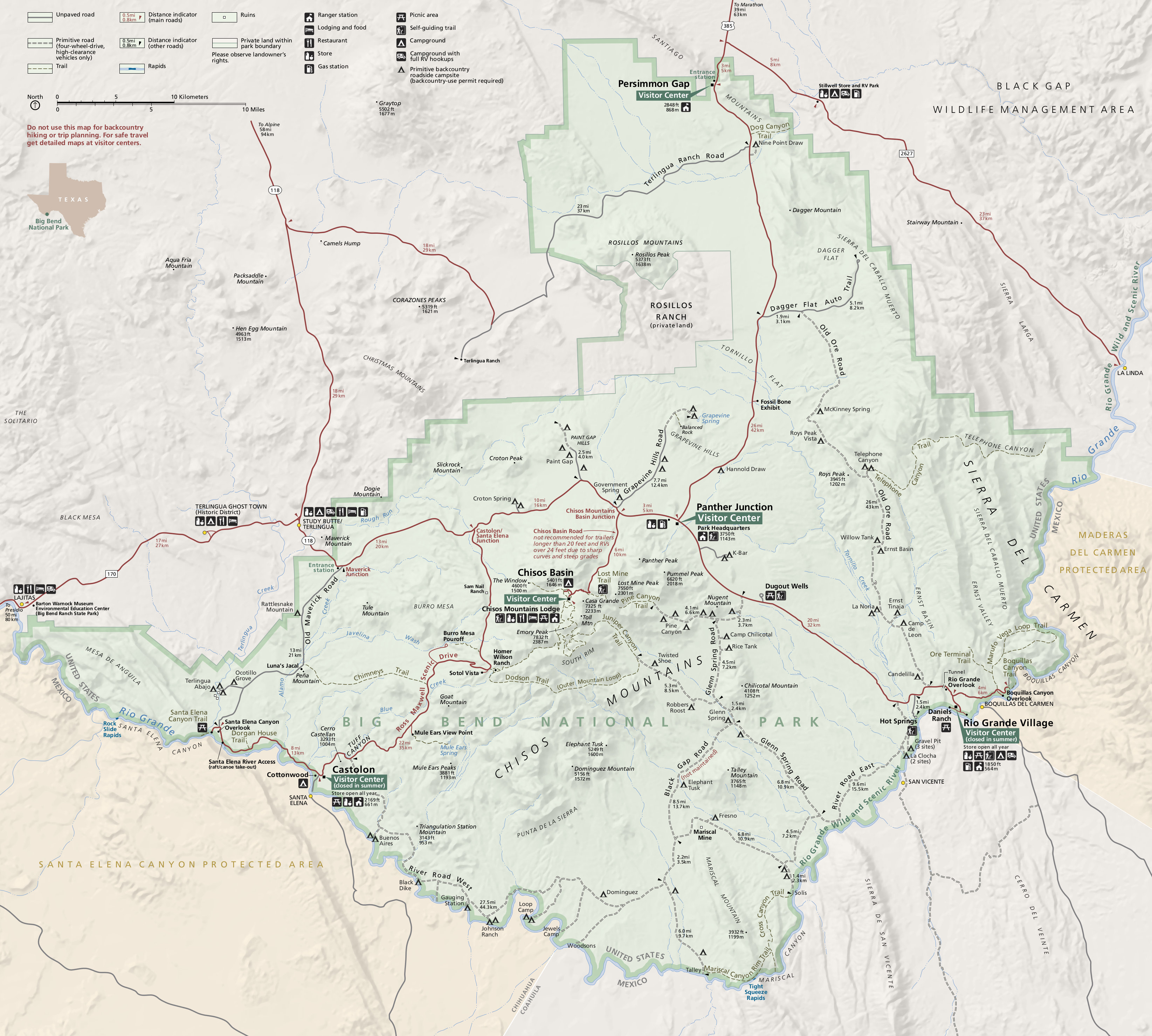
 Here is the official Big Bend National Park map from the NPS brochure, last updated in 2021. It includes an inset map of the busy Chisos Basin area, which I’ve split off separately into the map below.
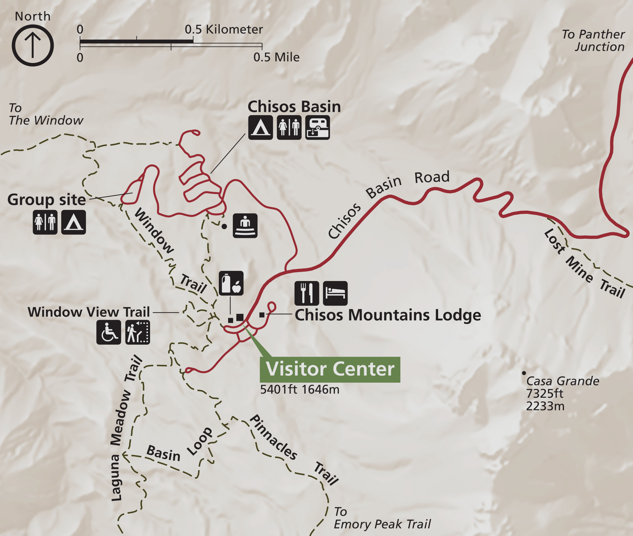 Here’s the Chisos Basin map, which zooms in on this popular area that includes the Chisos Basin Campground, Chisos Basin Visitor Center, and Chisos Mountains Lodge. (Sense a pattern in the naming here?)
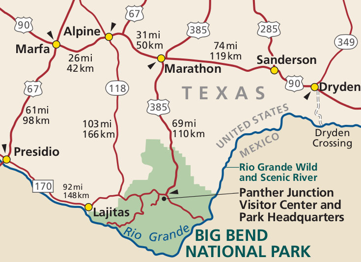 This is a regional map of Big Bend, showing driving directions and routes to Big Bend from the north in this rural part of Texas. Click the image to view a full size map or download the PDF.
 This Big Bend area map zooms out even further than the map above to include I-10 and I-20, and cities such as El Paso, Midland, and Chihuahua, Mexico. Click the image to view a full size map or download the PDF.
Big Bend trail maps
 The two maps below show backcountry campsites and trails in Big Bend’s Chisos Mountains, and will be super useful for trip planning. However, the maps don’t include the rest of the park, and just aren’t quite high-res enough for navigating on the trail. For that, you’ll want a detailed topographic map like the National Geographic Trails Illustrated map of Big Bend; this is the best single map showing every trail in all of Big Bend National Park.
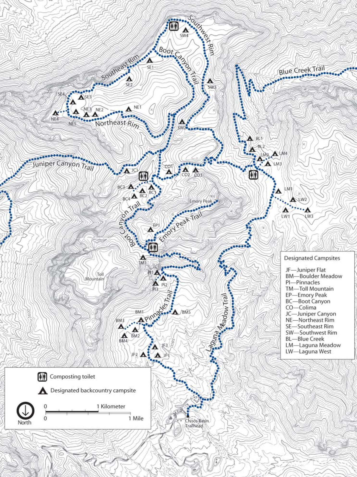
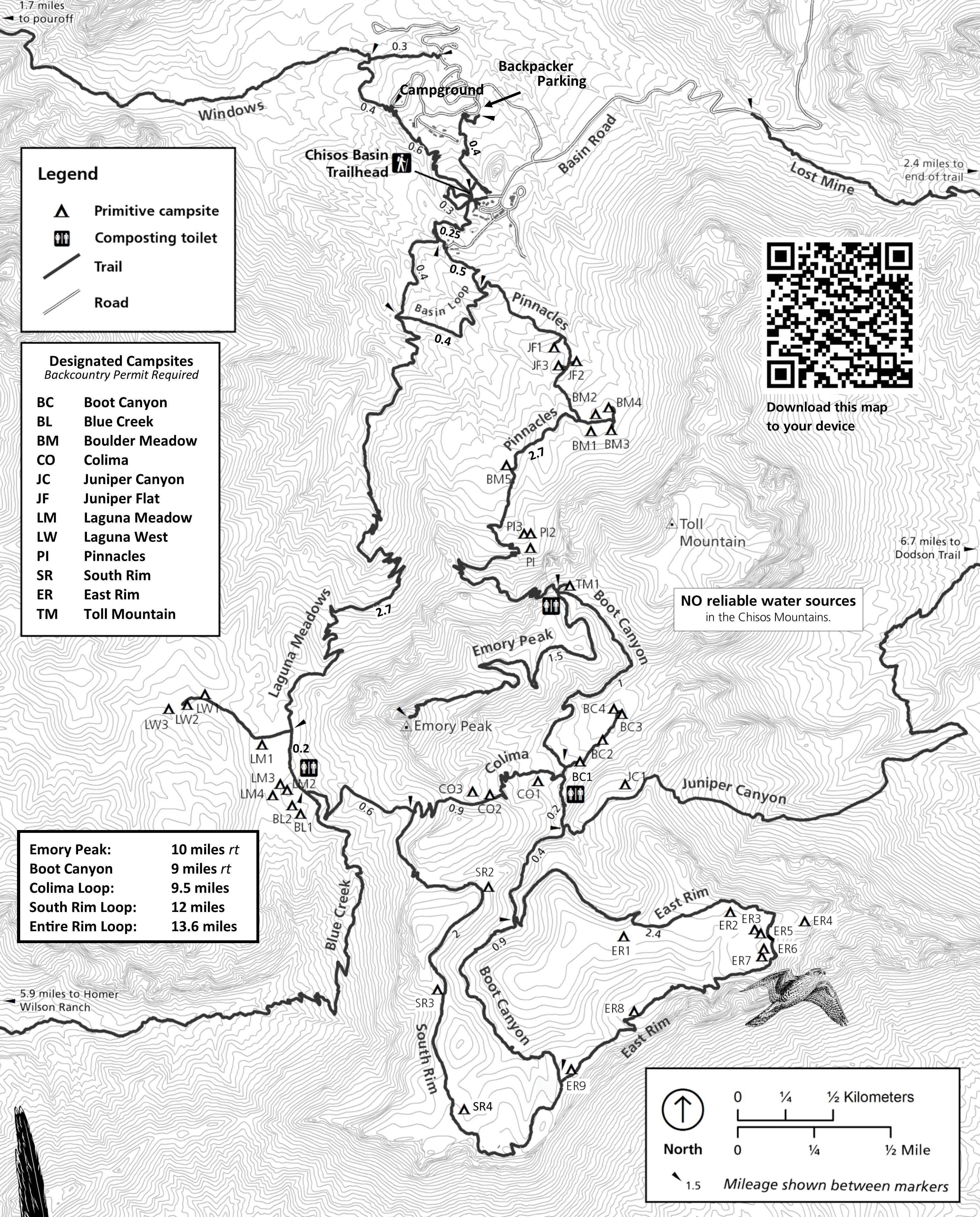 This Chisos Mountains trail map was last updated in 2024 and highlights the trails in the Chisos Mountains. The topo lines and mileages are especially helpful for planning out your hiking trip.
 The Chisos Mountains backpacking map more prominently shows designated backcountry campsites. It comes from the NPS Chisos Mountains Backcountry Campsites guide, which I’ve provided here as a PDF download.
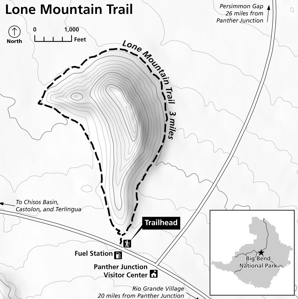 The Lone Mountain Trail map shows the newest trail in the park! This three-mile loop was opened in 2022 and is located near the Panther Junction Visitor Center. It’s a welcome addition to this part of the park.
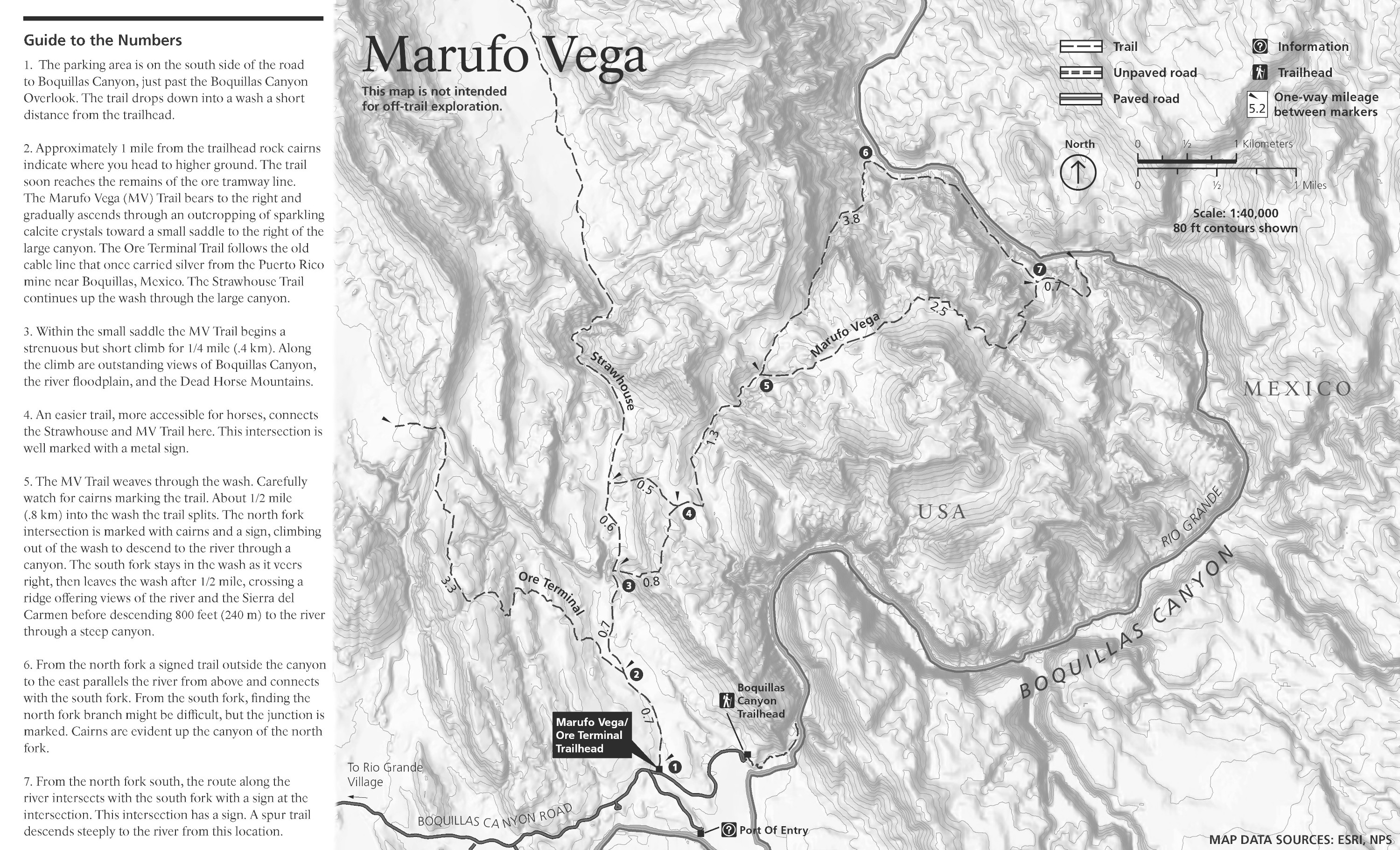 The Marufo Vega trail map shows this very strenuous 14-mile loop trail through the Deadhorse Mountains with amazing views. Travel during the summer months is strongly discouraged due to extreme heat and no shade.
Big Bend campground maps
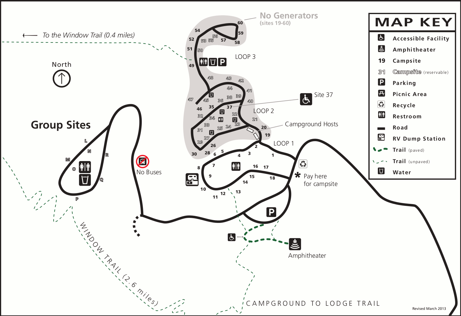 This is a Chisos Basin Campground map, showing the three campsite loops and visitor facilities in this high elevation campground located in the Chisos Mountains in Big Bend.
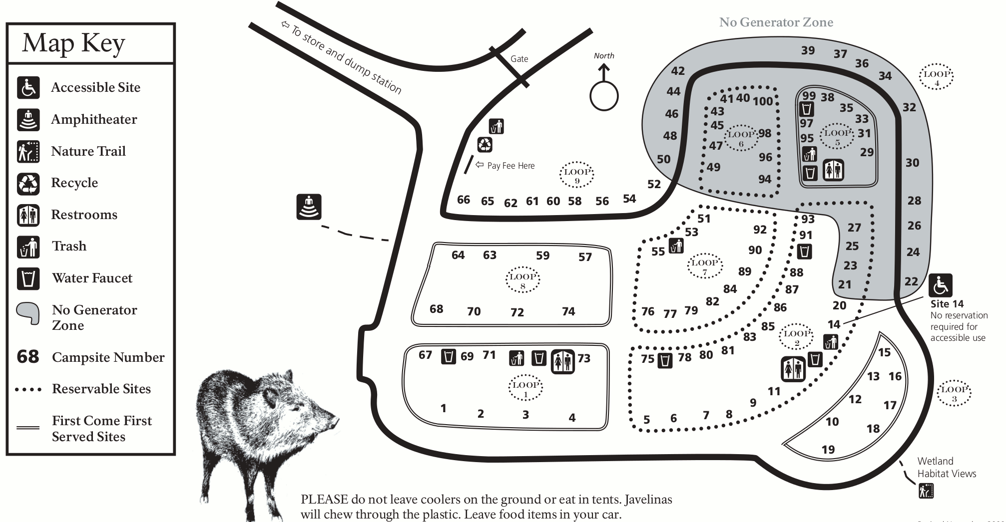 Here’s a Rio Grande Village Campground map. This is Big Bend’s low-elevation campground located along the Rio Grande River and includes loops of reservation campsites as well as first-come first-served.
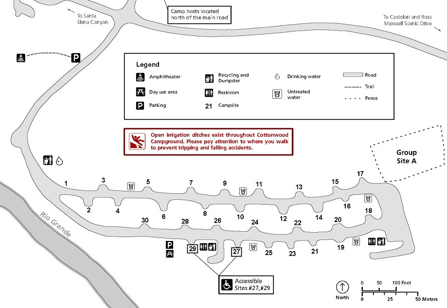 The Cottonwood Campground map shows this small, quiet campground located near the Castolon Historic District and Santa Elena Canyon in the remote western part of Big Bend National Park. It’s closed during summer.
Big Bend lodging map
 To the right, you can open an Expedia interactive Big Bend lodging map – there’s not a lot in this wild, desolate area of Texas! (Which is part of the fun of visiting.) If you zoom out and scroll, you can see the town of Alpine to the north, which is the closest thing to an actual city in the area. Here you can also browse Expedia’s top-rated Big Bend lodging to compare photos, reviews, location, prices, and more.
Big Bend detail maps
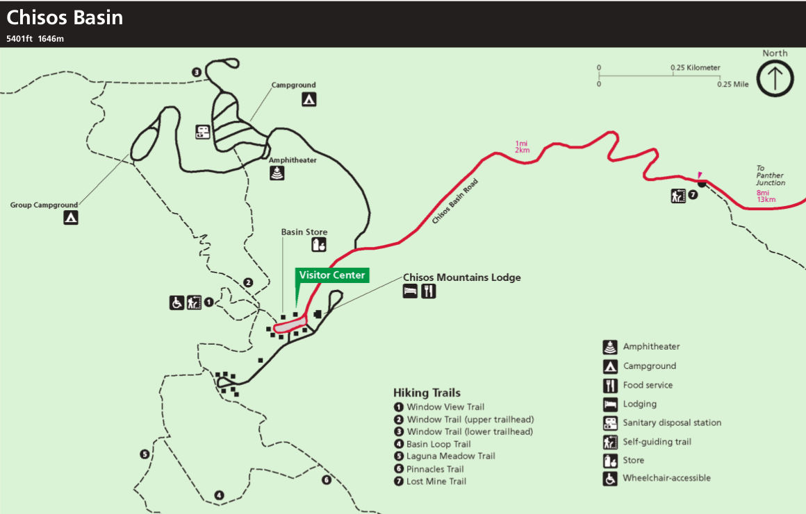
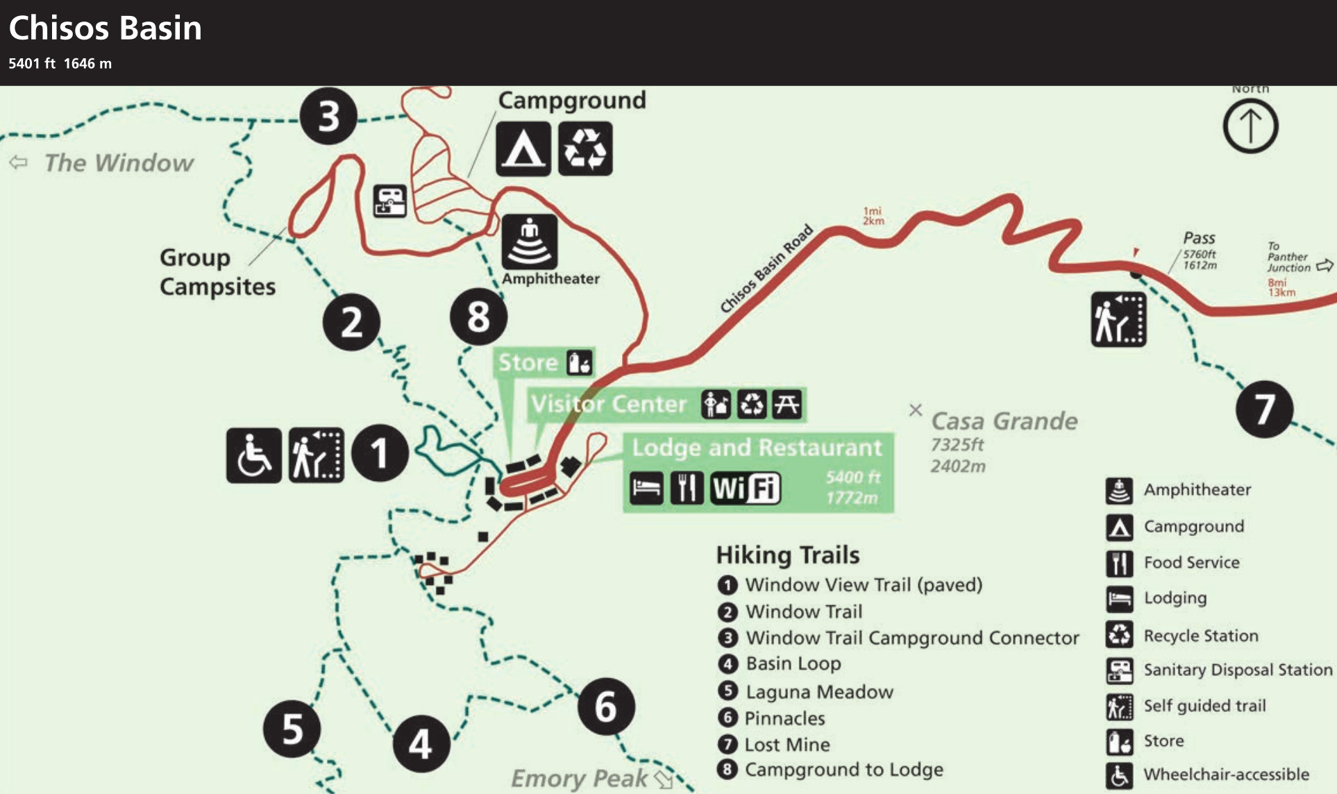 Here’s a Chisos Basin detail map from the 2025 edition of Big Bend National Park’s newspaper. It includes information about visitor services (such as Wi-Fi availability) and labels eight different hiking trails.
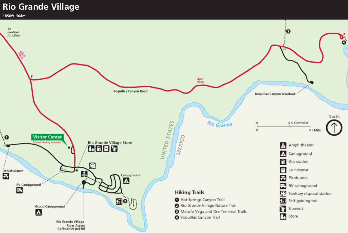
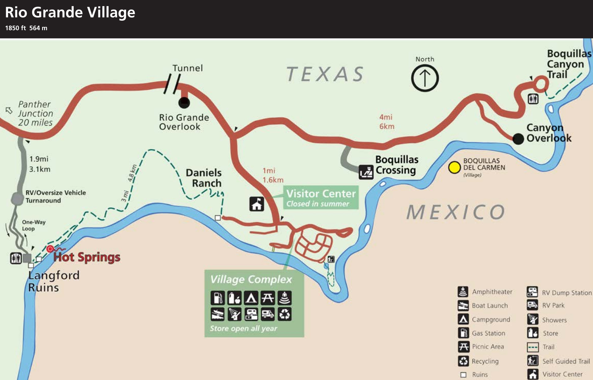 This is a Rio Grande Village detail map, also from the 2025 park newspaper. Here you get some great overlooks of the Rio Grande River and a number of visitor services, some of which are closed in summer due to heat.
Big Bend primitive road maps
Big Bend National Park has 67 primitive campsites along backcountry roads. All are reservable in advance, either online or in-person at Panther Junction. Practically all sites require high-clearance 4WD vehicles to access. Maps here show just a selection of the 67 primitive campsites in Big Bend.
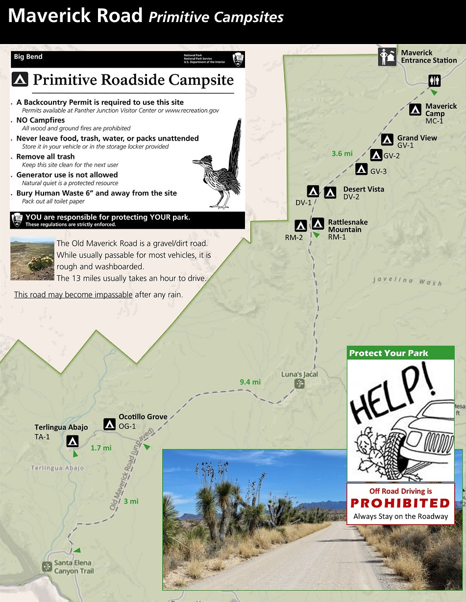 The Old Maverick Road primitive campsite map shows this 14-mile road in western Big Bend. This dirt road is better maintained than other backcountry roads, so you might not need a 4WD vehicle if conditions are good.
 This River Road primitive campsite map shows the 51 miles that traverse the southern portion of Big Bend National Park. For this road, you absolutely need a high-clearance 4WD vehicle.
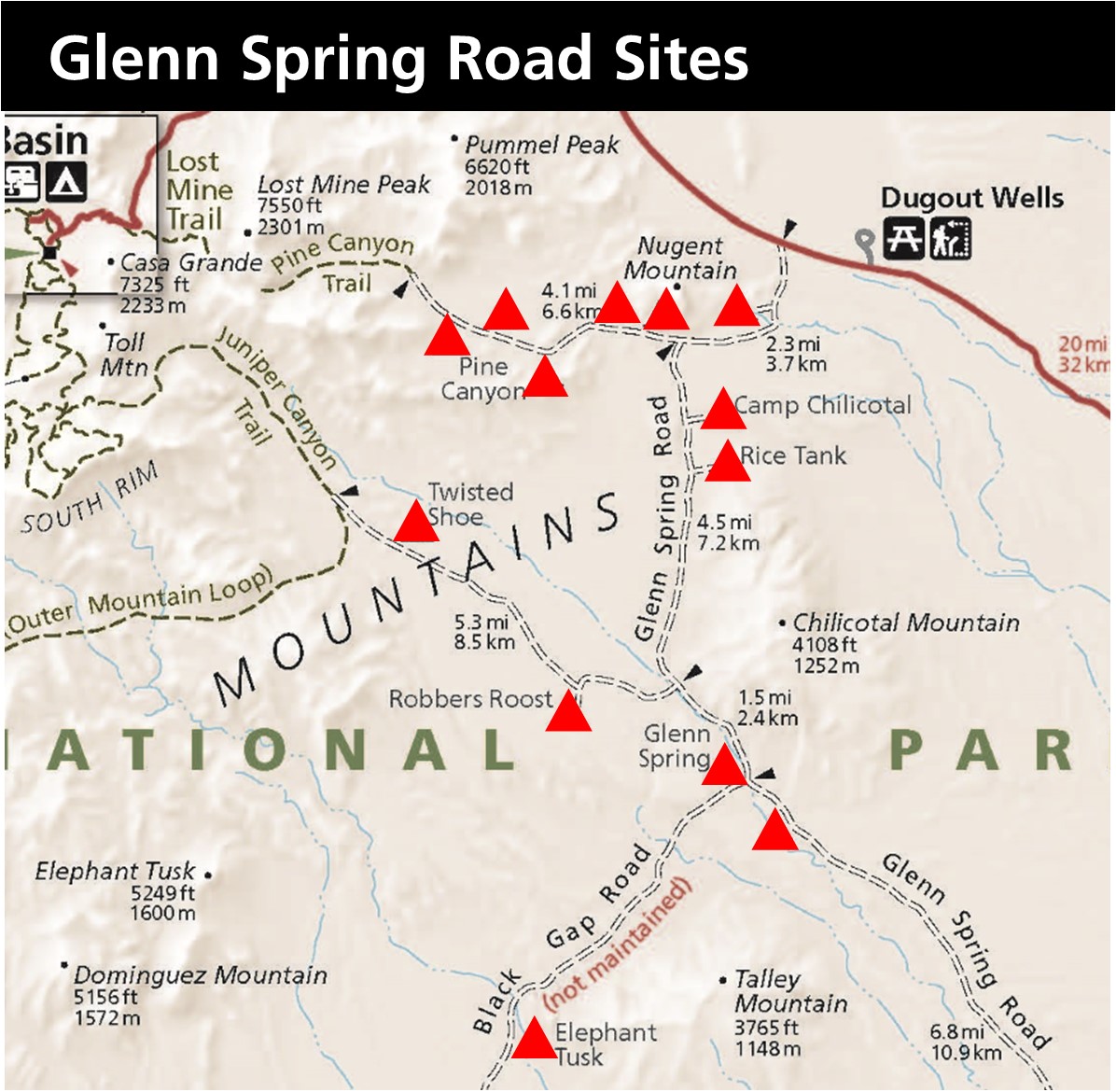 Here’s a Glenn Spring Road primitive campsite map. This road runs along the eastern edge of the Chisos Mountains, and is used to access Pine Canyon Road, Black Gap Road, and Juniper Canyon Road.
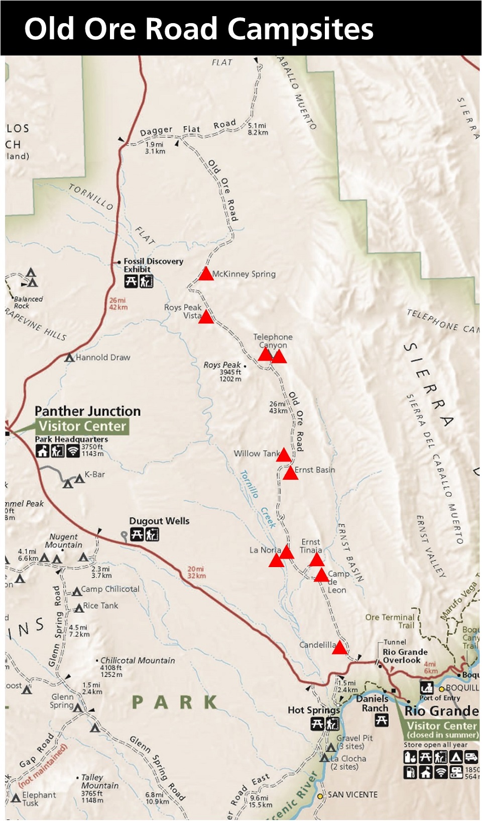 This is an Old Ore Road primitive campsite map, which highlights this 26-mile long road that you definitely need a high-clearance 4WD vehicle for. The northern half is rougher than the southern stretch.
Assorted Big Bend maps
 This is a simple map of Big Bend from the park newspaper. It’s easier to read and print than the official map above. Click the image to view a full size map or download the PDF.
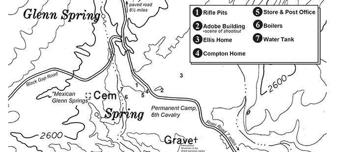 The Glenn Springs map labels old structures and features of the ghost town of Glenn Springs. It’s located today at the junction of the Glenn Spring Road and Black Gap Road, accessible only to high-clearance 4WD vehicles.
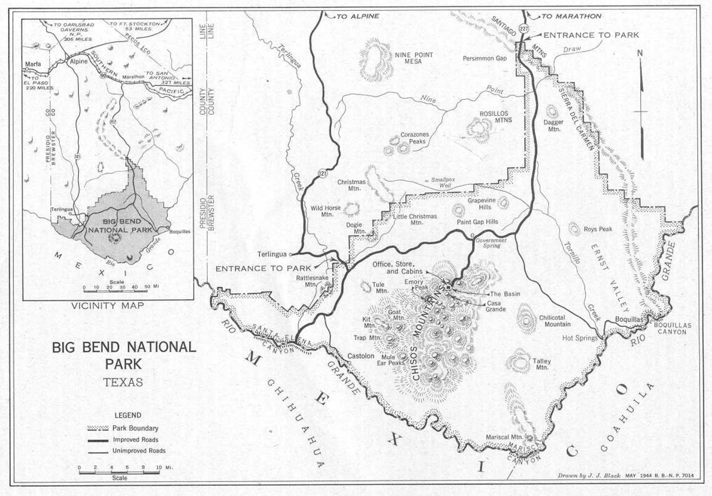 Here’s a 1944 historical map of Big Bend. While it’s probably not useful for current trip planning, it’s fun to see how the park infrastructure has changed today compared to then.
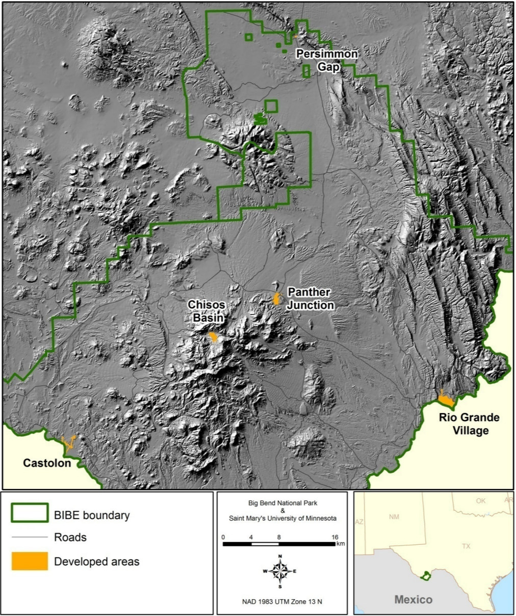 The Big Bend relief map shows a three-dimensional view of Big Bend National Park, making it easy to see the varied elevation at a quick glance in relation to the developed visitor destinations.
Big Bend science maps
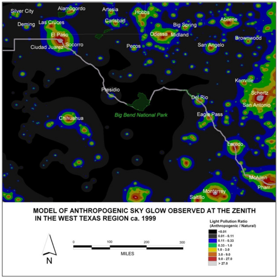 This Big Bend night sky map shows how incredibly dark the night skies are at Big Bend compared to nearby areas in Texas and Mexico. This also explains why it seems like such a long drive from everywhere!
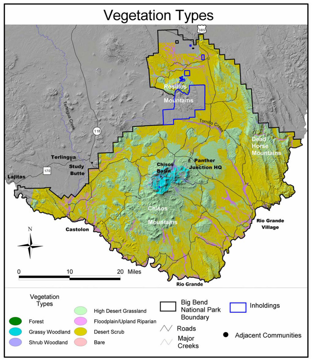 Here is a vegetation map of Big Bend, showing desert scrub, woodlands, and grasslands mostly, with only a tiny bit of forest. (The next map below has some more interesting vegetation!)
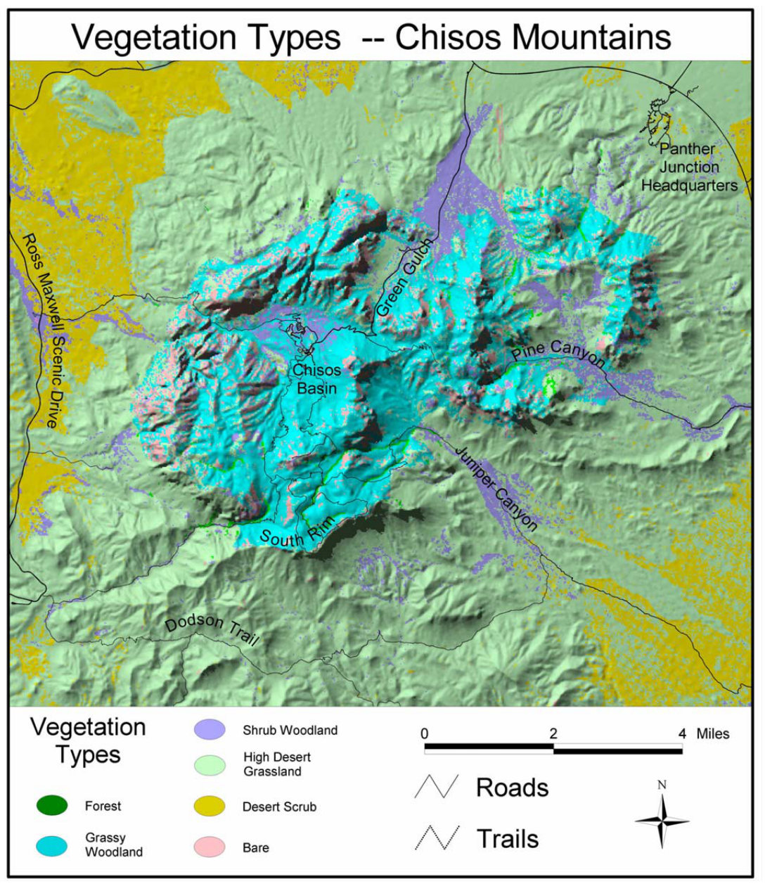 This is a vegetation map of the Chisos Mountains, showing the complex combination of vegetation types, including forests, woodlands, and grasslands. You’ll find more trees here than elsewhere in Big Bend.
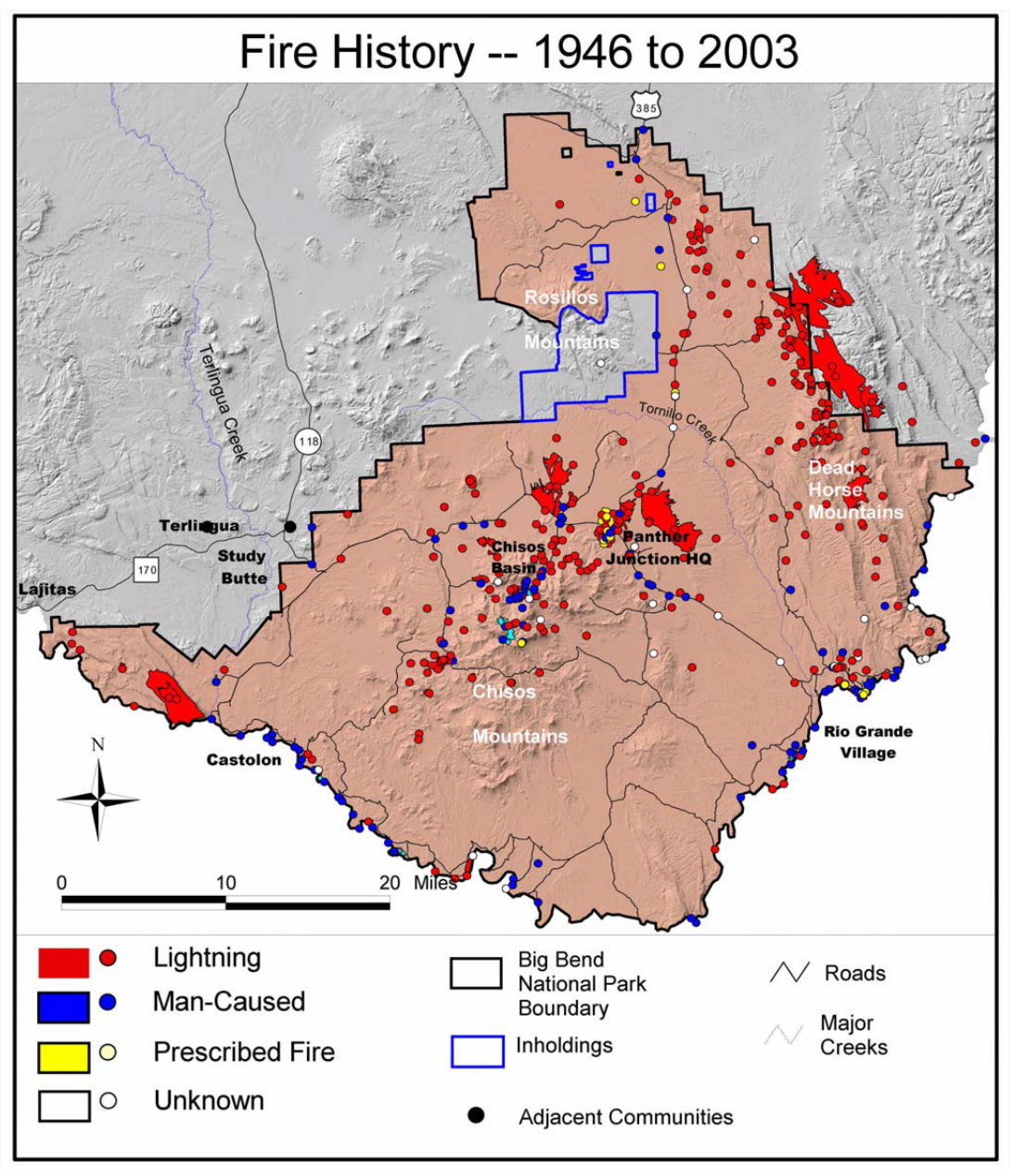 This is a Big Bend fire history map, displaying all the fires that have taken place in the park from 1946 to 2003, including lightning, human-caused, and prescribed fires.
Archived Big Bend maps
I try to continually update this page as the National Park Service releases new and updated maps. As old maps get updated, I move them down to this section here. Anything below has a newer version posted above. These are provided for archival purposes so you can see how Big Bend National Park has changed over time.
 Here is the official Big Bend National Park map from the 2015 national park brochure, showing the park roads and many trails. Click the image to view a full size map or download the PDF.
 This is the previous Big Bend map from the 2013 park brochure, showing roads, trails, and campsites, and points of interest. Click the image to view full size map or download the PDF.
 This is an old trails map of the Chisos Mountains from the mid-2010s, showing Big Bend’s popular hiking trails and backcountry campsites around Emory Peak. The map includes topo lines to show elevation changes.
 This is an old detail map of Chisos Basin from the mid-2010s, showing the lodge, visitor center, and many Chisos Mountains trails. Click the image to view a full size map or download the PDF.
 This is an old detail map of Rio Grande Village from the mid-2010s, showing river access, camping, the visitor center, and various services. Click the image to view a full size map or download the PDF.
…and more!
< Return to National Park Maps home
< Return to Park List
< Return to List by State