Wrangell-St Elias maps from the park brochure
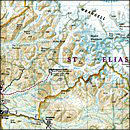
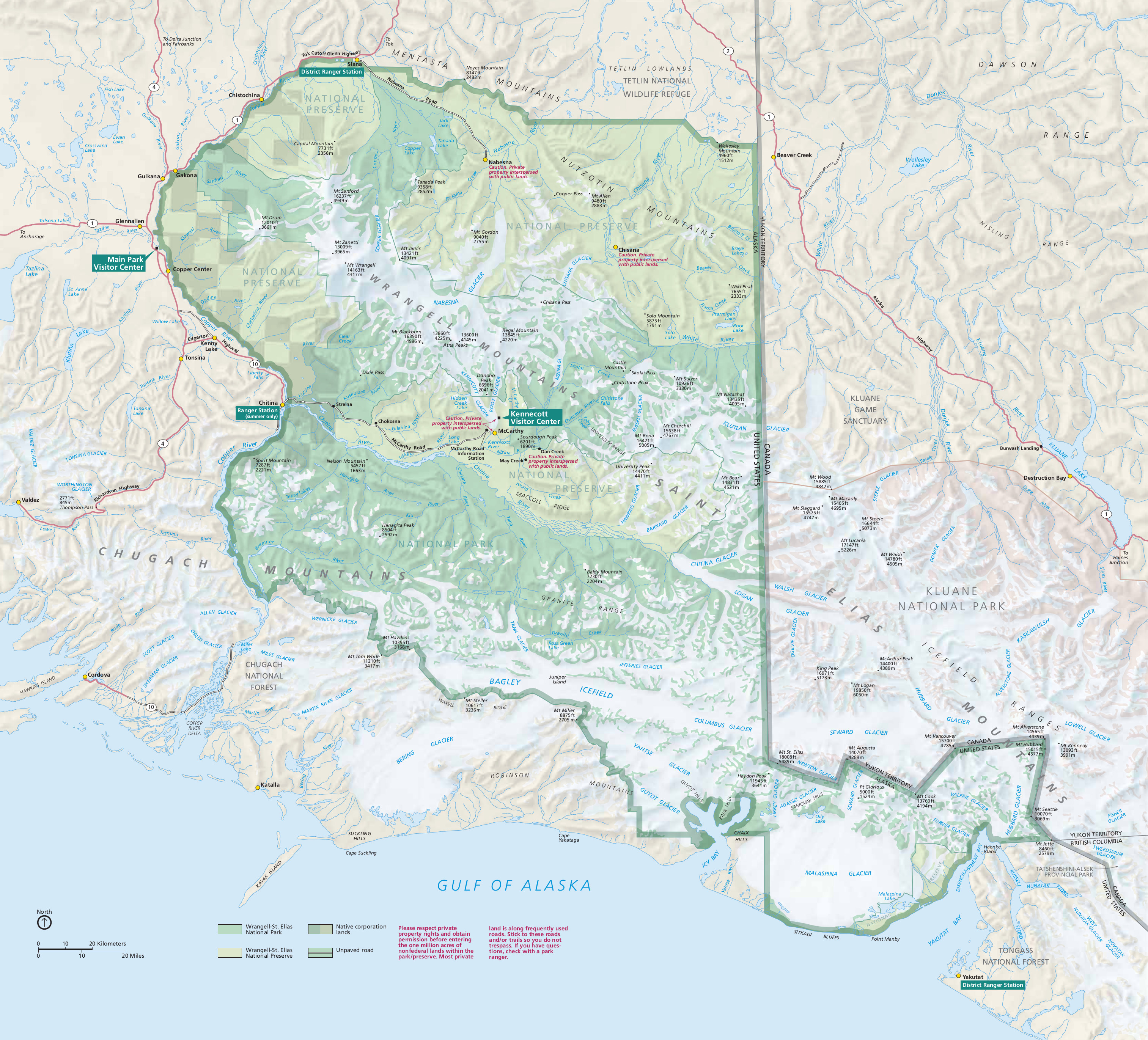
 Here’s the official Wrangell-St Elias National Park map from the NPS brochure, last updated in 2019. It includes the road-accessible areas near the Wrangell Mountains and the vast wilderness near Mt. St. Elias.
 I love this one! Enjoy this oblique 3D map of Wrangell-St Elias that emphasizes the dramatic topography of the Wrangell Mountains. It doesn’t show the entire park but focuses on the Nabesna and McCarthy roads.
Wrangell-St Elias trail map
 Wrangell-St Elias is a huuuuuuuuge park, and is actually the largest national park in the United States. The maps on this page do a good job of providing a general overview of the park. However, if you’re looking for a map that has more detail, you may want to check out the waterproof National Geographic Trails Illustrated map of Wrangell-St Elias. In particular, I love how it really highlights the topographic features compared to the free maps.
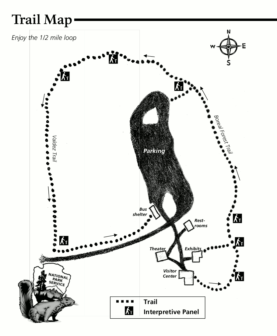 Here’s the Boreal Trail map, focusing on the short 1/2-mile loop that departs from the main park visitor center south of Glennallen. This map shows the location of each wayside exhibit that’s a part of the loop.
Kennecott maps
 This Kennecott map zooms in on Kennecott Mines National Historic Landmark. This area is located five miles beyond the end of the McCarthy Road and features the remnants of the historic mining town of Kennecott.
 The Kennecott Mines walking tour map provides a hand-drawn overview of the historic landscape. You can also download the National Park Service’s self-guided Kennecott walking tour handout PDF for detailed info.
Wrangell-St Elias road maps
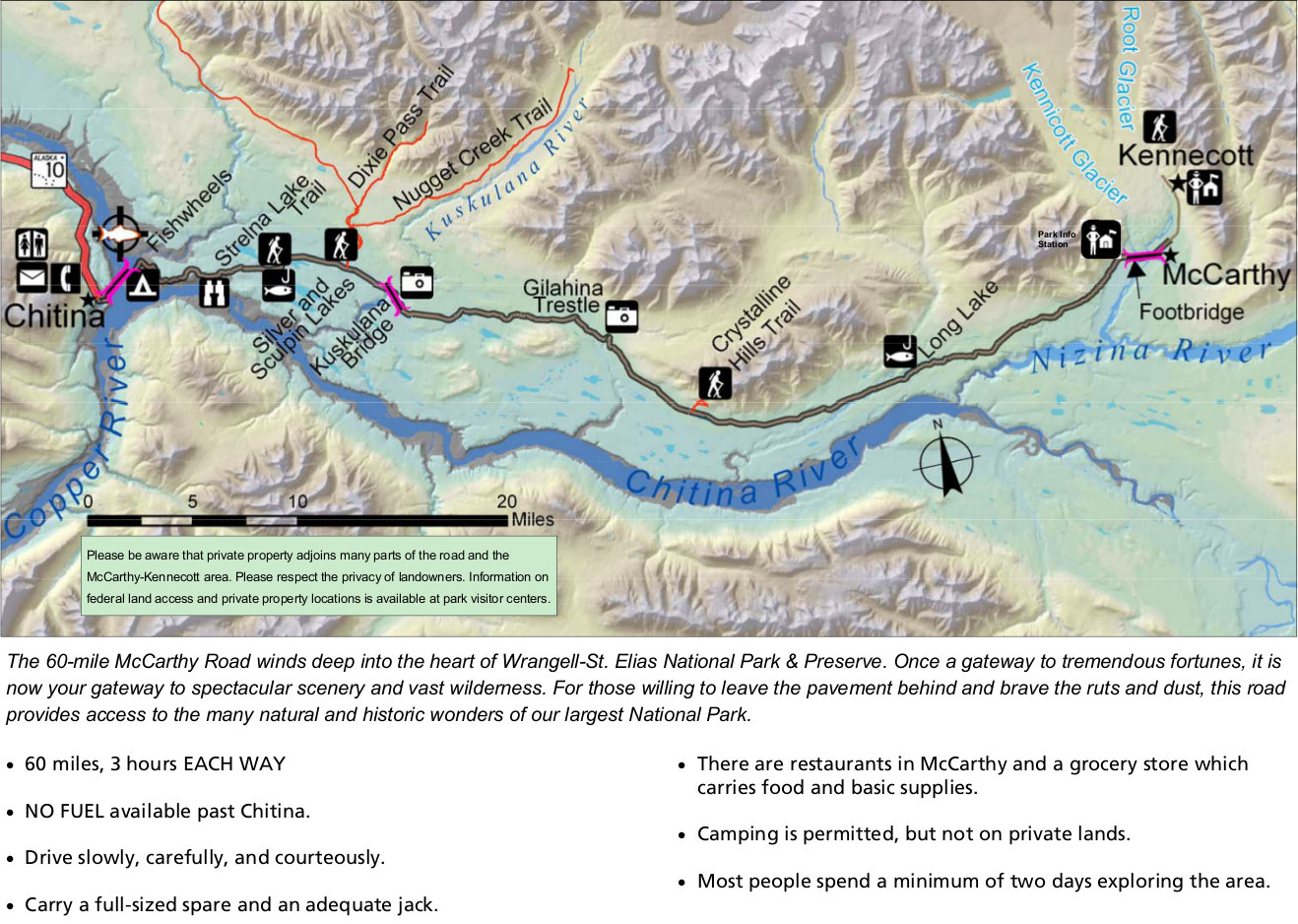 This is a McCarthy Road map from the park newspaper, zooming in on this most-visited part of the park that leads to McCarthy and Kennecott, south of the Wrangell Mountains. Expect 3 hours of driving each way.
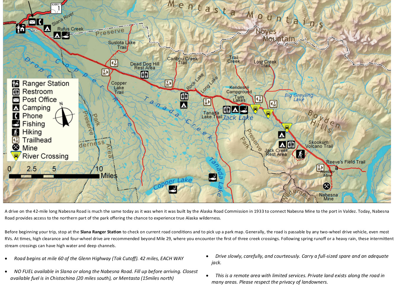 The Nabesna Road map from the newspaper shows the other maintained road inside the park, allowing you to access the northern part of the park. Labeled are ranger stations, restrooms, camping, and more.
Wrangell-St Elias camping map
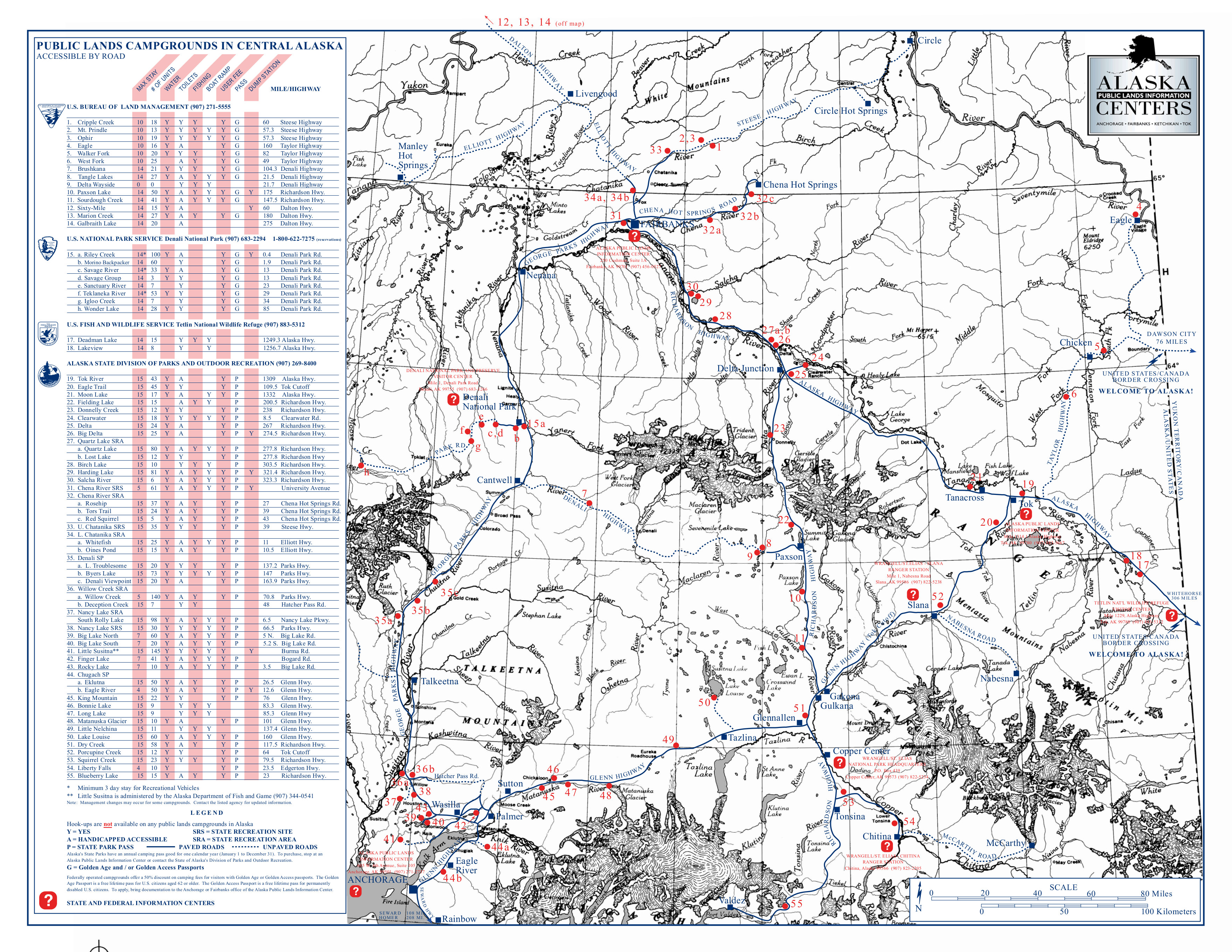 This Wrangell-St Elias campground map shows all the campgrounds in the entire central Alaska region, including Anchorage and Fairbanks. Click the image to view a full size map or download the PDF.
Assorted Wrangell-St Elias maps
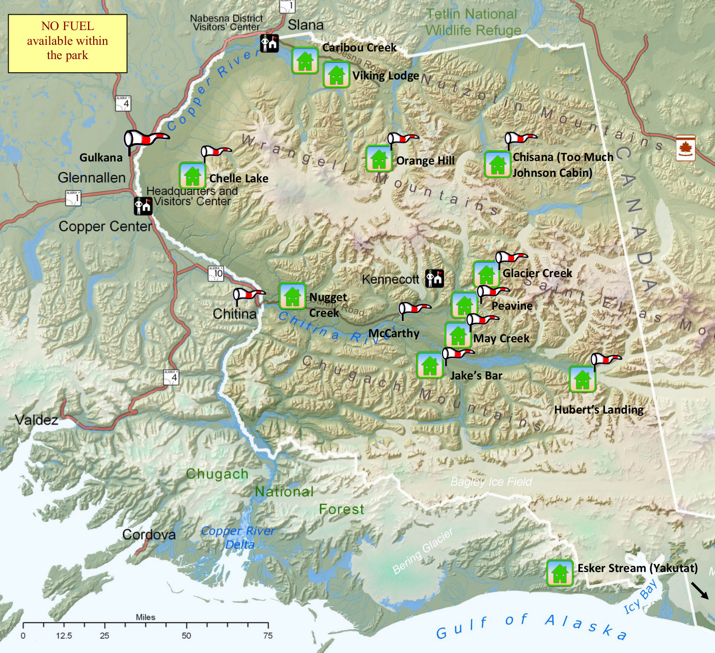 This is a Wrangell-St Elias airstrip and cabin map, showing the general locations of each of the park’s airstrips and cabins. This should prove useful if you’re flying into the park.
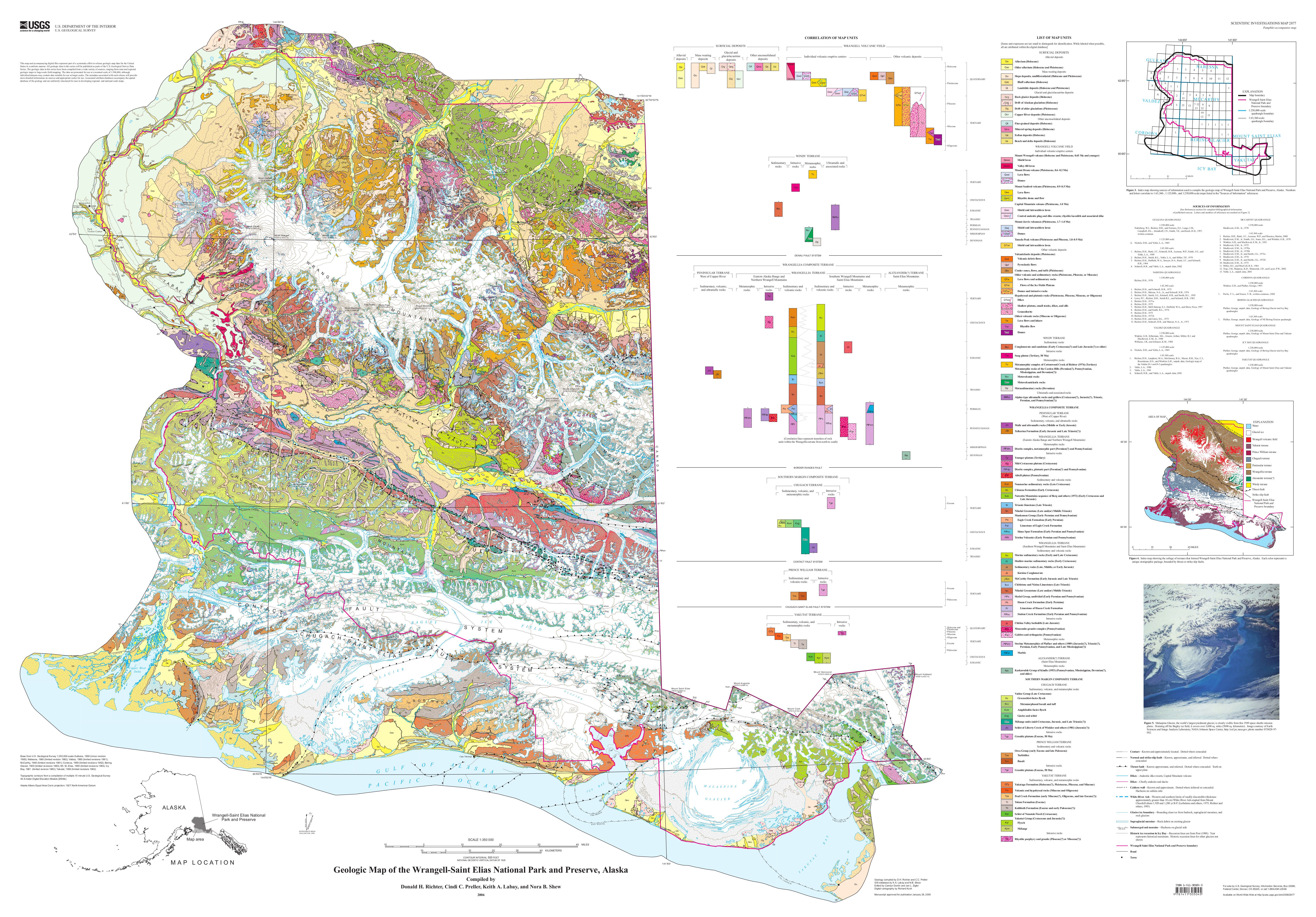 Here’s a Wrangell-St Elias geologic map, which has got to be one of the most complicated geologic maps in the nation! Click the image to view a full size map or download the PDF.
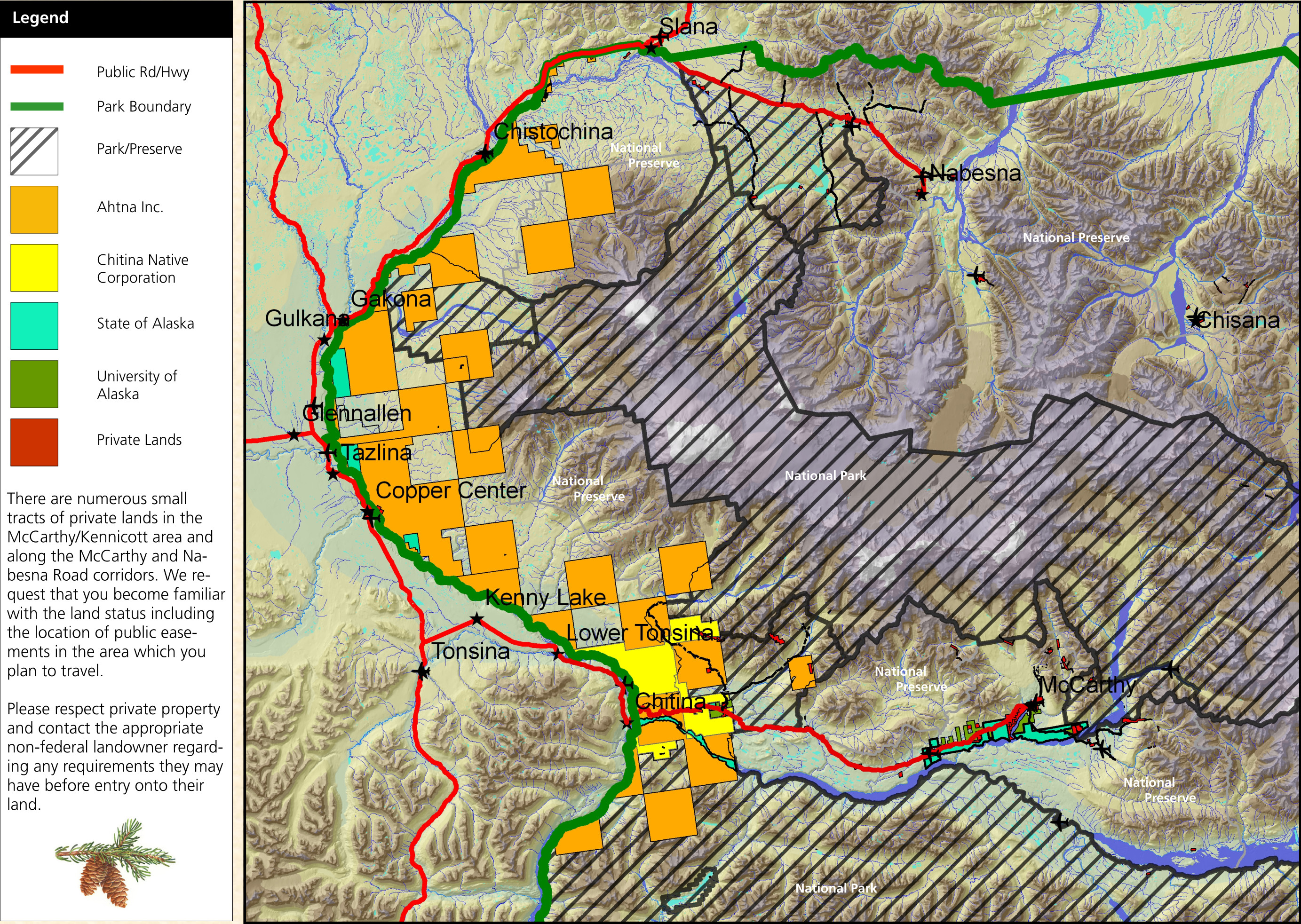 Here’s a Wrangell-St Elias land status map, which helpfully shows the complicated patchwork of land ownership in the area: National Park Service, State of Alaska, University of Alaska, and more.
 Here’s an old official Wrangell-St Elias map from the mid-2010s. This map shows out-of-date sizes for glaciers, which are now smaller than when this map was made. Click the image to view a full size map or download the PDF.
…and more!
< Return to National Park Maps home
< Return to Park List
< Return to List by State