White Sands maps from the official brochure
 Here is the official White Sands National Park map from the National Park Service brochure. Just a beautiful map with vivid color, showing the San Andres Mountains and the prevailing wind and water flow patterns.
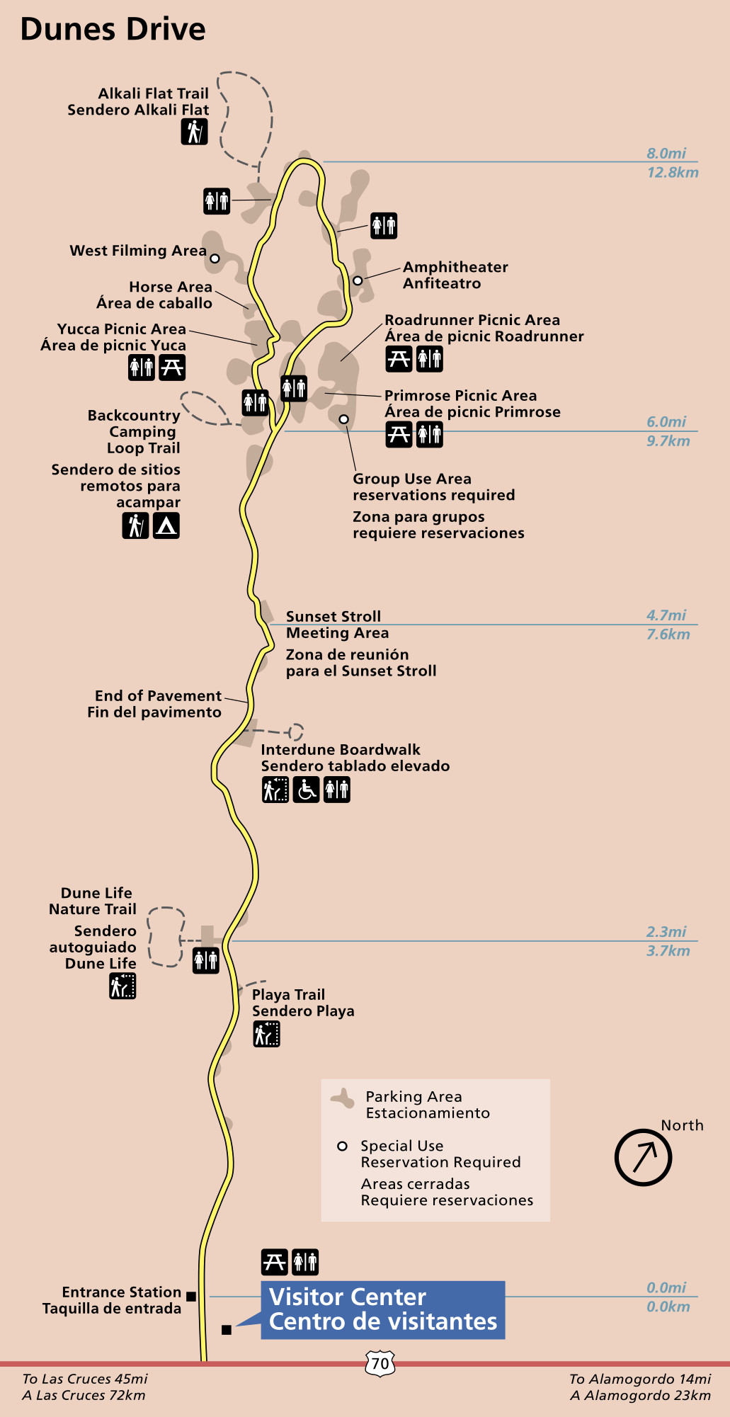 This is a Dunes Drive map, which zooms in on the main park road to show additional details. Note the Alkali Flat Trail near the end of the loop road; this is the park’s most popular and iconic trail, taking you into the dunefield.
White Sands lodging map
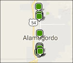 For visiting White Sands, you pretty much need to stay in Alamogordo if you want to be anywhere nearby. To the right is an Expedia interactive lodging map of Alamogordo, showing you the various options (all lined up!). You can filter by price on the map, but you might want to start by browsing the top-rated White Sands lodging to compare guest reviews, photos, amenities, and prices.
White Sands aerial maps
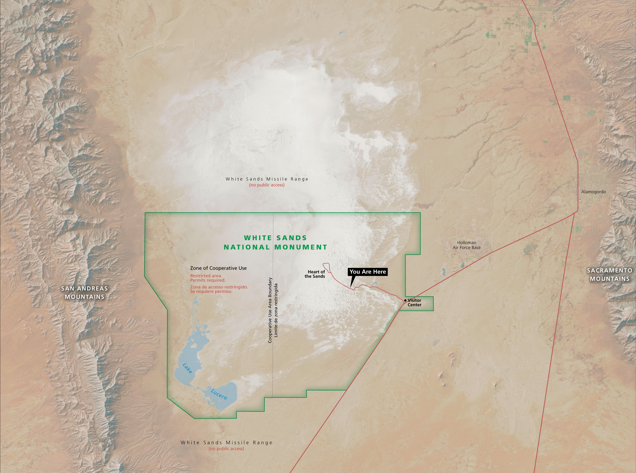 This White Sands National Park map draws the park boundaries on a beautiful overhead landscape view to emphasize the extent of the dunes. Click the image to view a full size map or download the PDF.
 Here’s a White Sands water flow map, taken from a park exhibit. It shows the Sacramento and San Andres Mountains (which are misspelled as “San Andreas” on this exhibit sign). You can also download this map as a PDF.
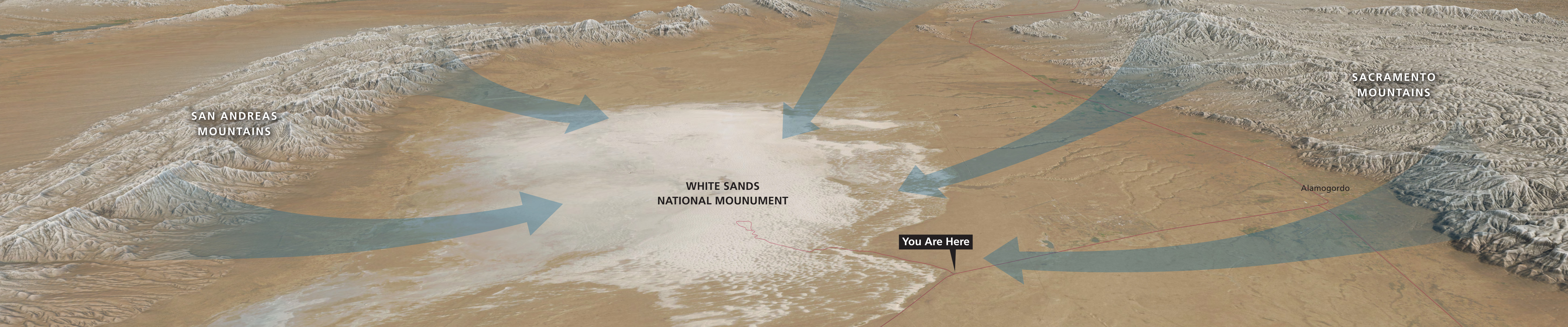
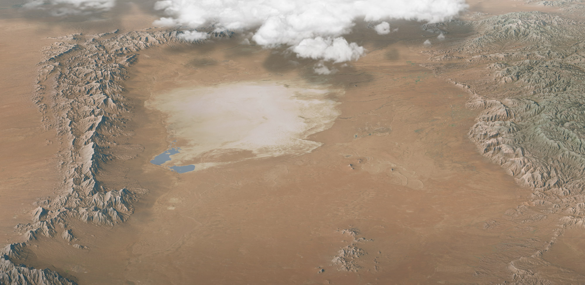 This White Sands oblique map has no labels! Instead it shows the area in its natural setting, nestled between two mountain ranges. Click the image to view a full size map or download the PDF.
White Sands regional maps
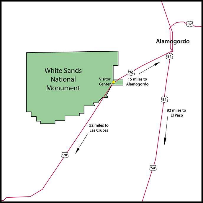 Here’s a White Sands regional map that shows the various highways you can take to arrive at White Sands from Alamogordo or Las Cruces in New Mexico or El Paso in Texas.
 This New Mexico national parks map shows all national park sites in New Mexico as well as the major highways and cities that are located nearby. Who knew New Mexico had so many?
White Sands camping maps
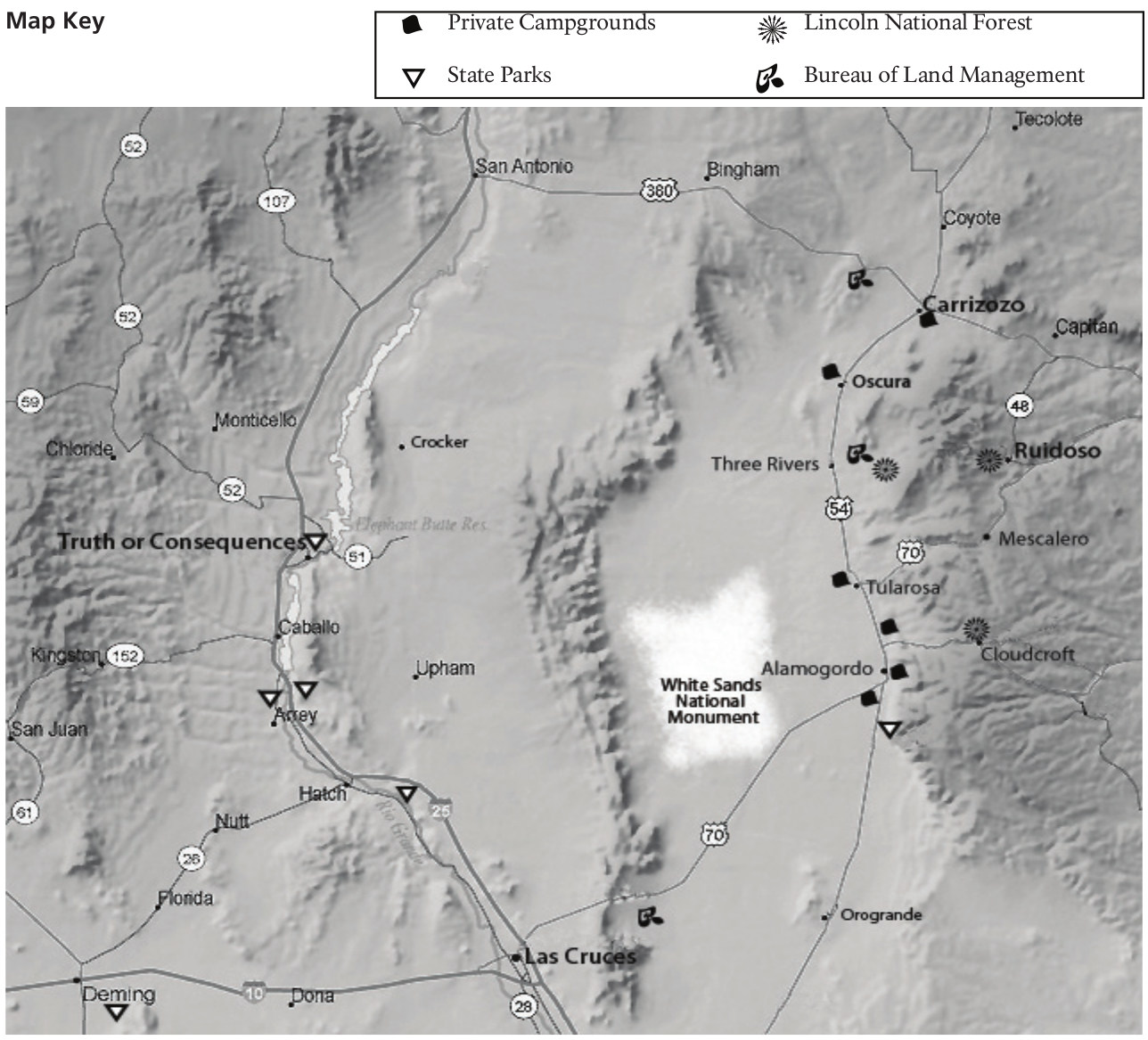 This is a regional camping map showing the nearby campgrounds located outside the park. You’ll find these to be a mix of private campgrounds, state parks, national forests, and BLM land.
 The White Sands backcountry camping map shows the ten backcountry campsites you can stay in if you want to sleep out in the sand under the stars. It’s definitely an experience to remember!
White Sands science maps
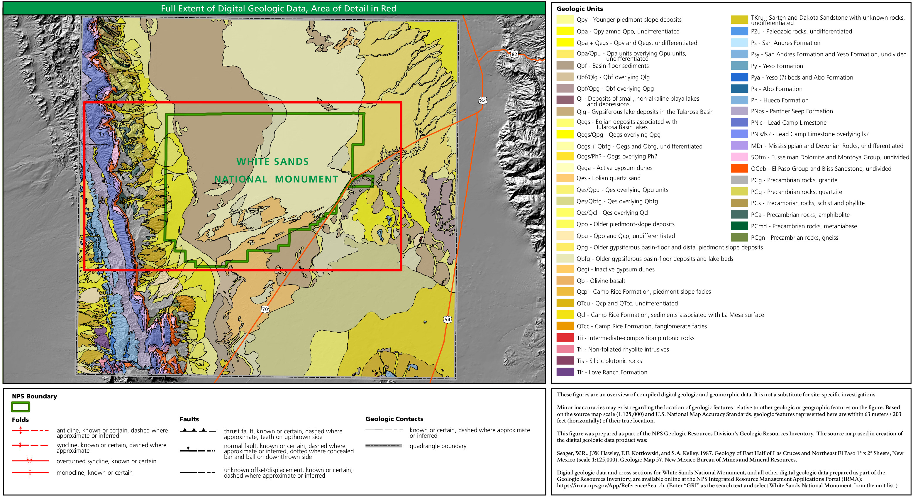 Here’s a White Sands regional geologic map, showing a general overview of the White Sands region and San Andres Mountains; see the map below to view the individual units labeled.
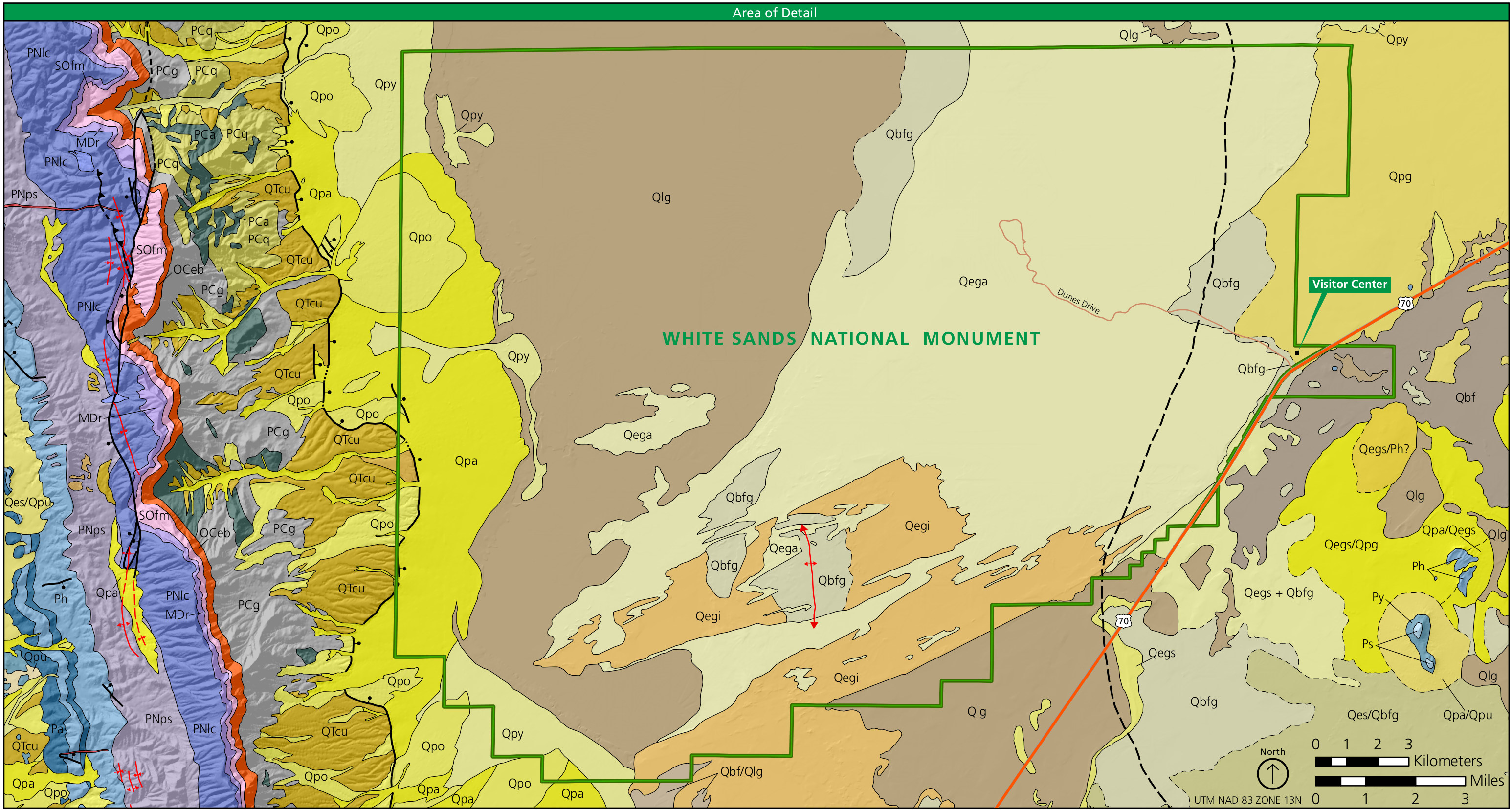 This White Sands detail geologic map zooms in on the park area itself with text labels for the units. You’ll need to view the map above, however, to see the legend that explains what each rock layer is.
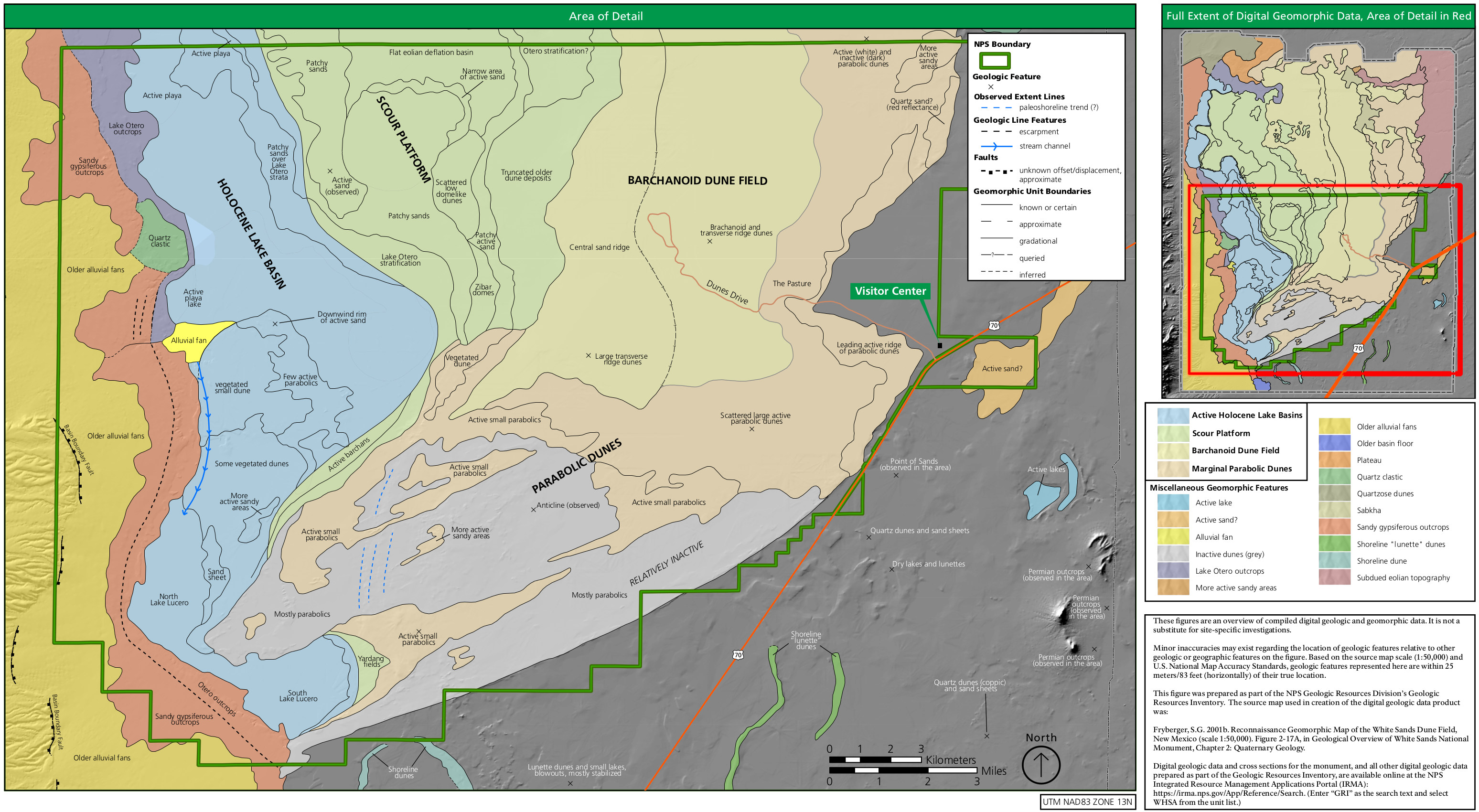 The White Sands dune map labels the sand dune types and plots them in relation to the roads and national park visitor center. Did you know there were so many types of dunes?
Chihuahuan Desert maps
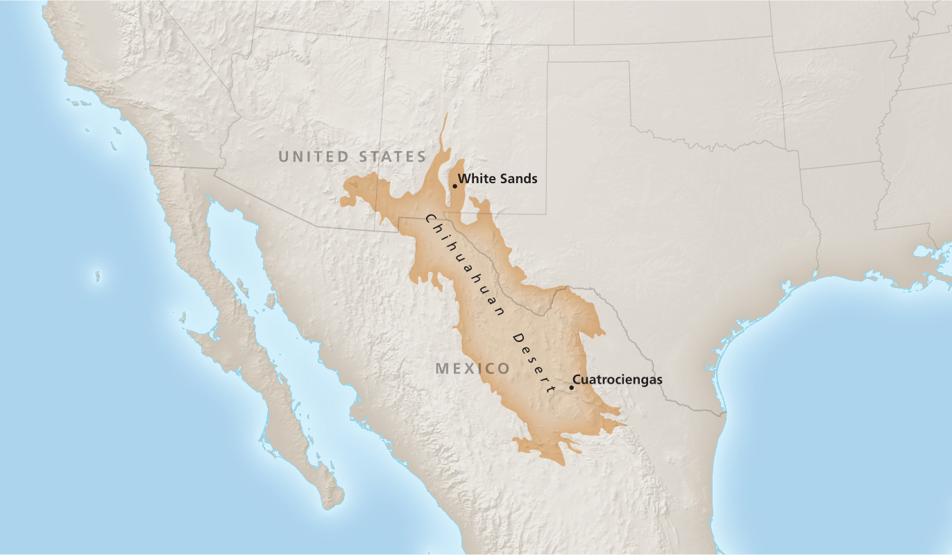 This is a Chihuahuan Desert map, showing how White Sands National Park is at the very northern edge of the Chihuahuan Desert. Did you know that this desert is the largest in North America?
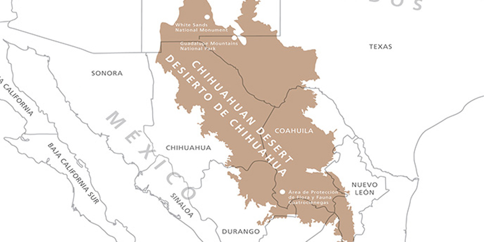 The Chihuahuan Desert detail map isn’t as high resolution as the one above, but it labels other protected areas as well as the various states in Mexico the desert reaches into.
Archived White Sands maps
As the National Park Service updates maps and releases new ones, I do my best to capture and upload them here. But rather than deleting old White Sands maps, I move them down to this section, as the maps are a matter of historical record and I believe it’s important to preserve how the park has changed over time. So the maps in this section aren’t the most up-to-date and have newer versions shared above.
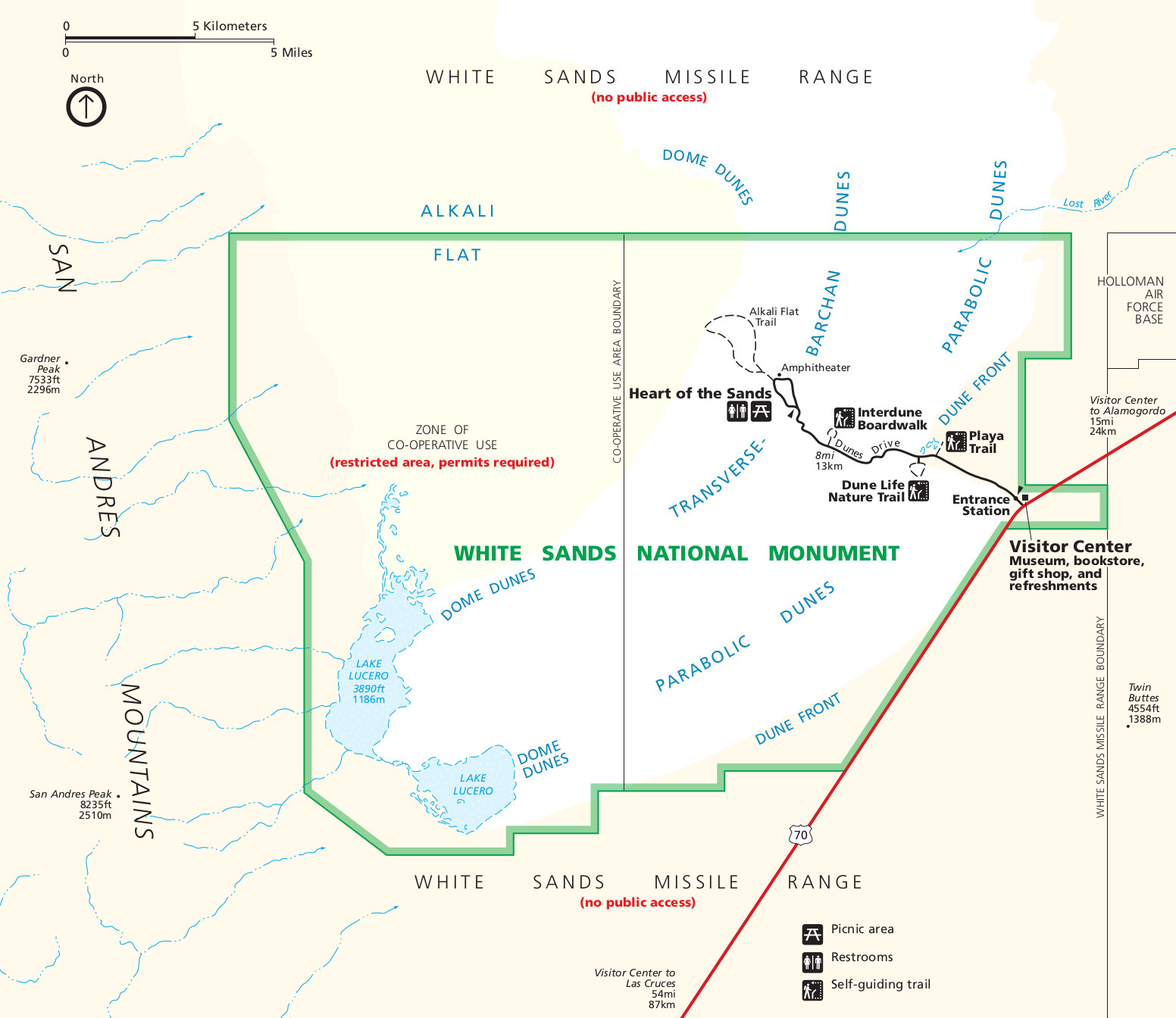 This is an old White Sands brochure map, back from when it was still called White Sands National Monument. It was designated a national park in 2019. Click the image to view a full size map or download the PDF.
 This old Dunes Drive map shows the main road of White Sands National Park and the various points of interest and parking areas. Click the image to view a full size map or download the PDF.
…and more!
< Return to National Park Maps home
< Return to Park List
< Return to List by State