If you’re looking for a Shenandoah map, you’ve come to the right place; currently I’ve collected 26 free Shenandoah National Park maps to view and download. (PDF files and external links will open in a new window.) Here you’ll find some trail maps, campground maps, and full park maps that I hope you find helpful for planning your trip. You can also browse the best-selling Shenandoah maps and guidebooks on Amazon.
Shenandoah map from the park brochures
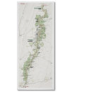
 This is the official Shenandoah map from the park brochure. Inset maps of each Shenandoah National Park location are posted below. Click the image to view a full size JPG (1.2 mb) or download the PDF (12.4 mb).
 This is the older official Shenandoah National Park map (pre-2013). I’ve provided it because I think it’s easier to read than the new version. Click the image to view a full size JPG (1 mb) or download the PDF (500 kb).
 This is a detail map of Mathews Arm and Elkwallow showing the campground, viewpoints, trails, and picnic areas. Click the image to view a full size JPG (50 kb) or download the PDF (600 kb).
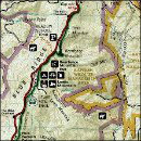
 This is a detail map of Skyland, showing overlooks, hiking trails (including Stony Man), and lodging. Click the image to view a full size JPG (50 kb) or download the PDF (600 kb).
 This is a detail map of Big Meadows, showing the campground, lodge, visitor center, and hiking trails (including the Appalachian Trail). Click the image to view a full size JPG (50 kb) or download a PDF (650 kb).
 This is a detail map of Lewis Mountain, showing the campground, picnic area, cabins, and nearby Appalachian Trail. Click the image to view a full size JPG (30 kb) download the PDF (500 kb).
 This is a detail map of Loft Mountain, showing the campground, trails, overlooks, visitor services, and Skyline Drive. Click the image to view a full size JPG (40 kb) or download the PDF (500 kb).
Shenandoah trail maps

 If you’re looking for one Shenandoah trail map to cover the entire national park, then you might want to get the National Geographic Trails Illustrated map from Amazon. It probably isn’t necessary for a quick day-hike, but it certainly comes in handy when doing overnight backpacking trips. Otherwise, the free maps below should be sufficient, although they aren’t in color and don’t have topographic lines.
 This is a Dickey Ridge trail map (50 kb), showing trails originating from the Dickey Ridge Visitor Center area. Trails include Fox Hollow, Snead Farm Loop, and Dickey Ridge.
 This is a Mathews Arm and Elkwallow trail map (100 kb), showing several trails both east and west of Skyline Drive, including the Appalachian Trail and a number of overlooks and waysides.
 This is a Panorama trail map (100 kb). Most of these hiking trails are east of Skyline Drive, such as Buck Hollow and Pass Mountain. Also included are some text descriptions of the popular routes.
 This is a Skyland trail map (150 kb), showing trails to Stony Man Summit, Little Stony Man, Millers Head Lookout, Limberlost, Corbin Mountain, and many others on fire roads and foot paths.
 This is an Old Rag trail map (150 kb). It shows trails to Old Rag Mountain, Upper and Lower Whiteoak Falls, and others in the area. Trailheads from Skyline Drive and other nearby Virginia roads are included.
 This is a Hawksbill trail map (150 kb), showing hiking trails to Hawksbill Mountain, Rose River Falls, and a few others accessed from Skyline Drive. You’ll also see the Rock Springs hut o the Appalachian Trail.
 This is a Big Meadows trail map (150 kb), showing trails near the Byrd Visitor Center to waterfalls such as Dark Hollow Falls, Rose River Falls, and Lewis Falls. You’ll also find the Big Meadows Lodge and campground.
 This is a Rapidan Camp trail map (150 kb), showing trails to access Rapidan Camp (Mill Prong and Laurel Prong), south of the Byrd Visitor Center and east of Skyline Drive.
 This is a Lewis Mountain trail map (150 kb), showing trails to Bearfence Mountain (including the Appalachian Trail hut), Lewis Mountain, South River Falls, Upper Pocosin Mission, and others.
 This is a Loft Mountain trail map (150 kb), featuring hiking trails to Jones Run Falls, Doyles River Falls, and mountains and ridges such as Rockytop, Austin Mountain, and Patterson Ridge.
 This is a Riprap trail map (150 kb), the southernmost hiking trail map for Shenandoah. Blackrock, Chimney Rock, Trayfoot Mountain, Wildcat Ridge, Calvary Rocks, and other areas are all accessible from here.
Shenandoah lodging map
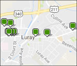
 Shenandoah is a big park, so it may be hard to decide where to stay. To the right, I’ve linked to a Hotels.com interactive lodging map centered on Luray, which is located near park headquarters and the Skyland area. You can also browse Hotels.com’s top-rated Shenandoah lodging to compare all nearby towns. Otherwise, consider Waynesboro if arriving from the south and Front Royal if coming from the north.
Shenandoah campground maps
 This is a Mathews Arm Campground map. (200 kb). Mathews Arm is the northernmost campground on Skyline Drive in Shenandoah and has a mix of reservable and first-come first-serve campsites.
 This is a Big Meadows Campground map (300 kb). Big Meadows is near the Byrd Visitor Center and the popular Dark Hollow Falls hiking trail. You’ll find sites for RVs and also walk-in tent-only sites.
 This is a Lewis Mountain Campground map (80 kb). Lewis Mountain is smaller and quieter than the other campgrounds, and reservations are not accepted. There are also cabins and a picnic area here.
 This is a Loft Mountain Campground map (200 kb). Loft Mountain is the largest campground in Shenandoah National Park and has both reservable and first-come first-served campsites.
Various Shenandoah maps
 This is a simple map of Shenandoah National Park (250 kb), showing just Skyline Drive and the major developed areas along its route. This is the simplest map for printing that shows the major park facilities.
 Here’s a Shenandoah geologic map (5.5 mb), which helpfully includes Skyline Drive and visitor centers to help orient you to the exposed rock layers labeled on this map.
 This Shenandoah surficial geology map (6.7 mb) better shows the topographical relief in the park and identifies young rock deposits. You really get an good picture of the park’s mountainous landscape.
Shenandoah map prints and gifts

 Printed high-resolution Shenandoah map posters and other products are available at the Shenandoah Maps store. For prints, gift ideas, and souvenirs featuring other national parks, support this site and visit the National Park Maps store; you’ll find items to bring on vacation, keep at home for the memories, or give to your park-enthusiast friends and loved ones.
…and more!
< Return to National Park Maps home
< Return to Park List
< Return to List by State
Need more planning help? Browse Amazon’s best-selling Shenandoah maps and guidebooks.