C&O Canal brochure maps
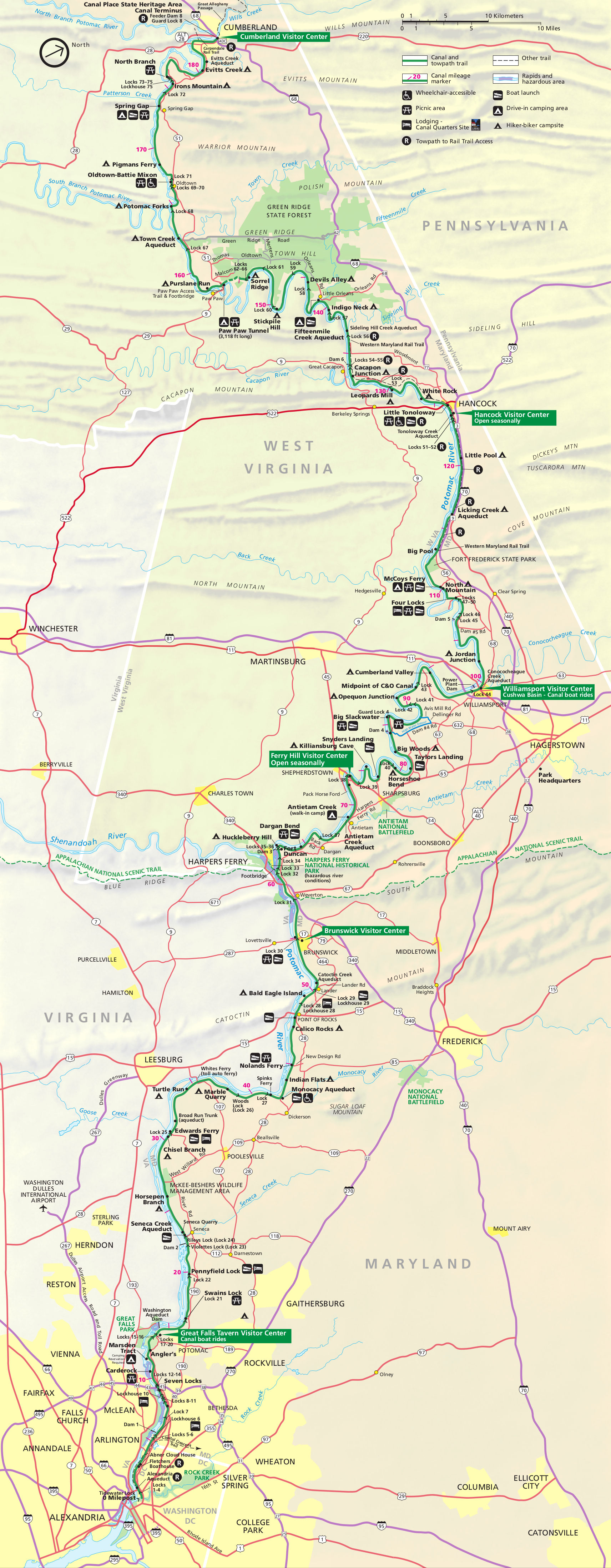
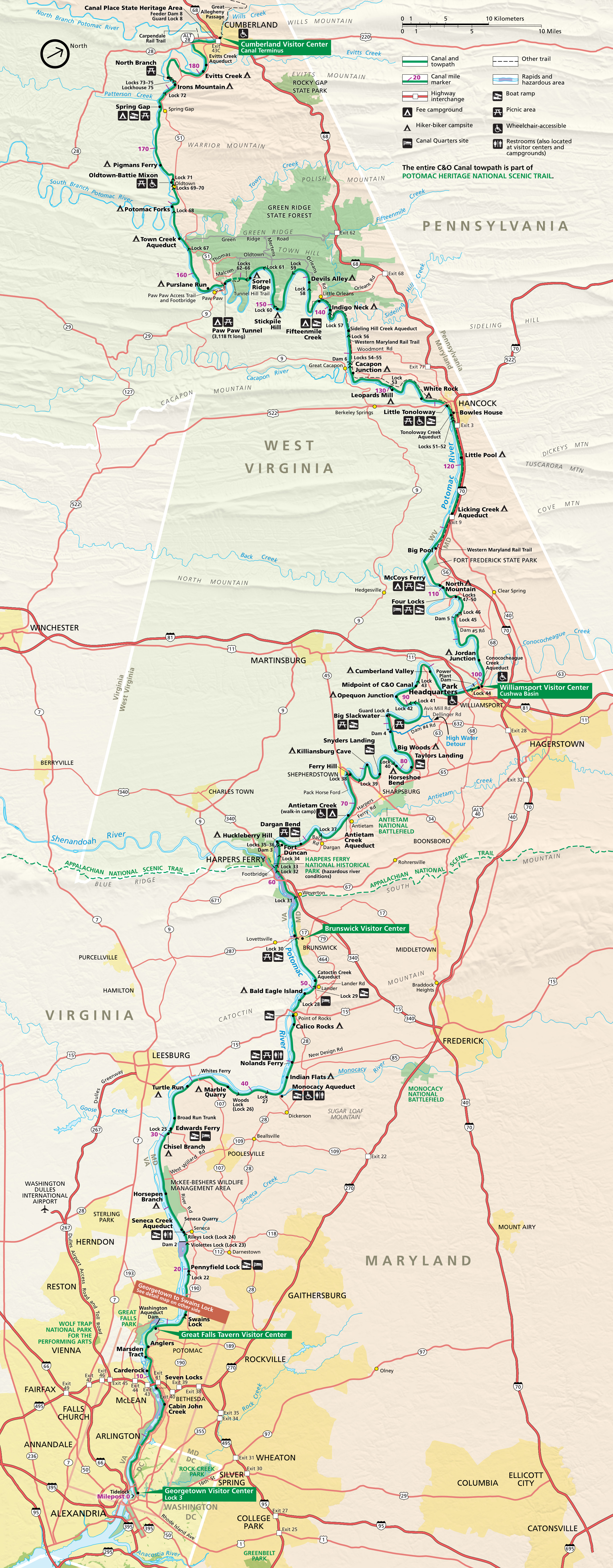 Here’s the official Chesapeake and Ohio Canal map from the NPS brochure, last updated in 2024. It shows the entire length of the park from Cumberland, MD to Washington, D.C.
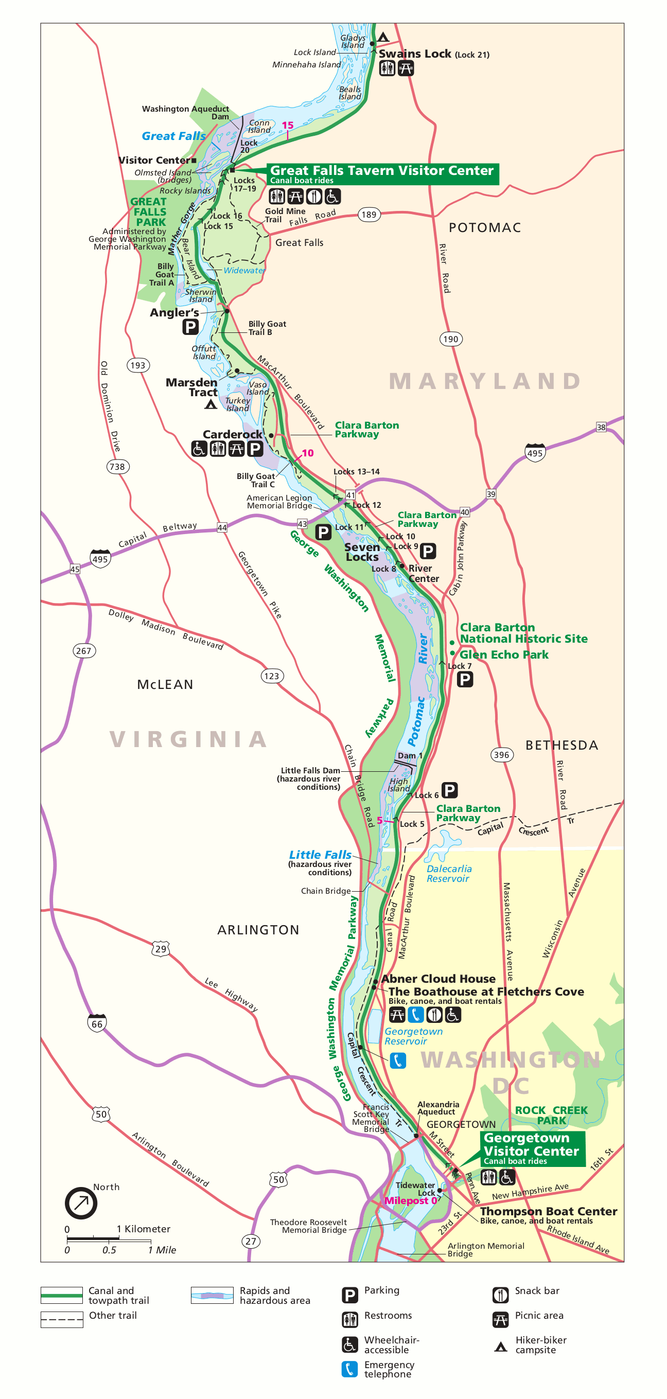
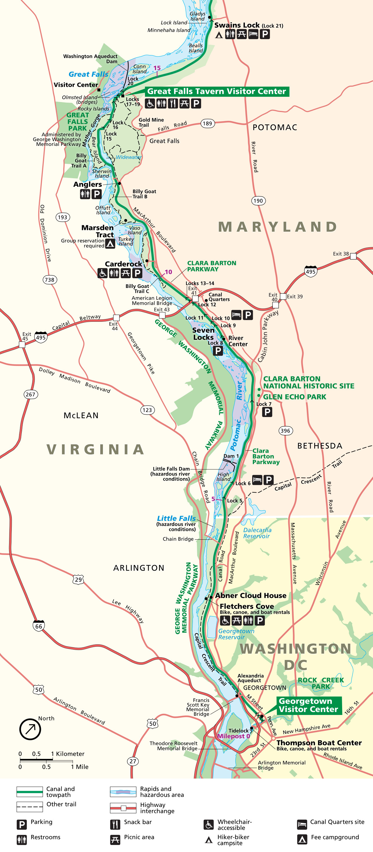 This C&O Canal detail map, also updated in 2024, zooms in on the lower Potomac River from Great Falls to the Georgetown Visitor Center in D.C. Click the image to view a full size map or download the PDF.
Simple C&O Canal maps
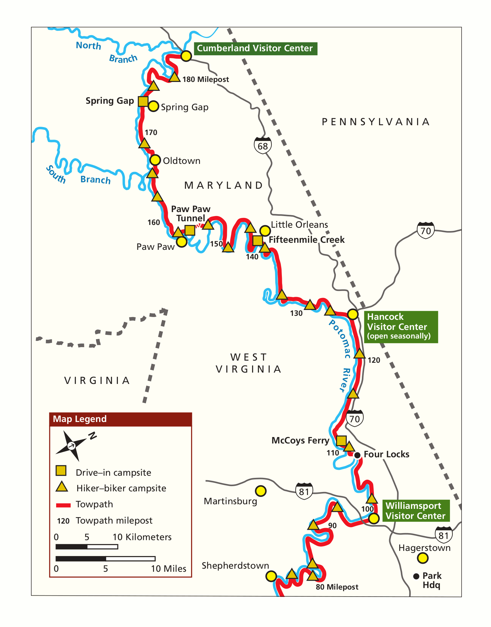 This is a C&O Canal simple map (north), focusing on the northern (and western) segment of the historic towpath in less detail than the one above. Click the image to view a full size map or download the PDF.
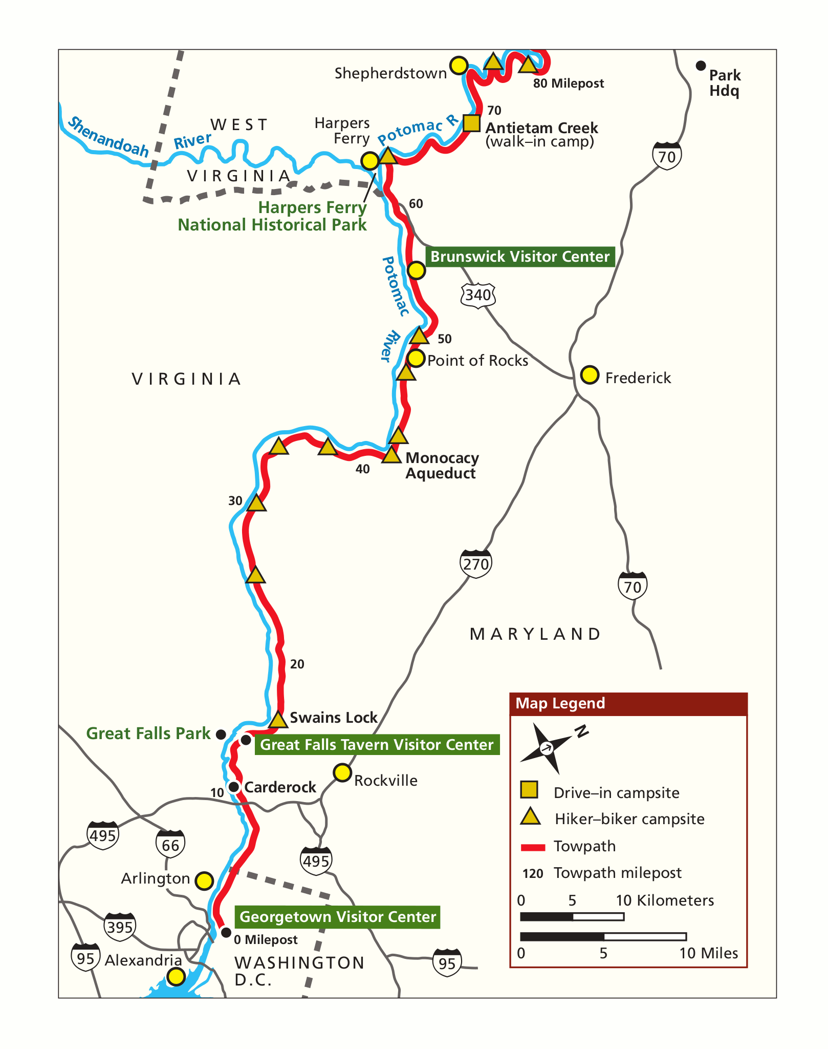 The C&O Canal simple map (south) focuses on the southern (and eastern) segment closest to Washington, D.C. Click the image to view a full size map or download the PDF.
Great Falls area maps
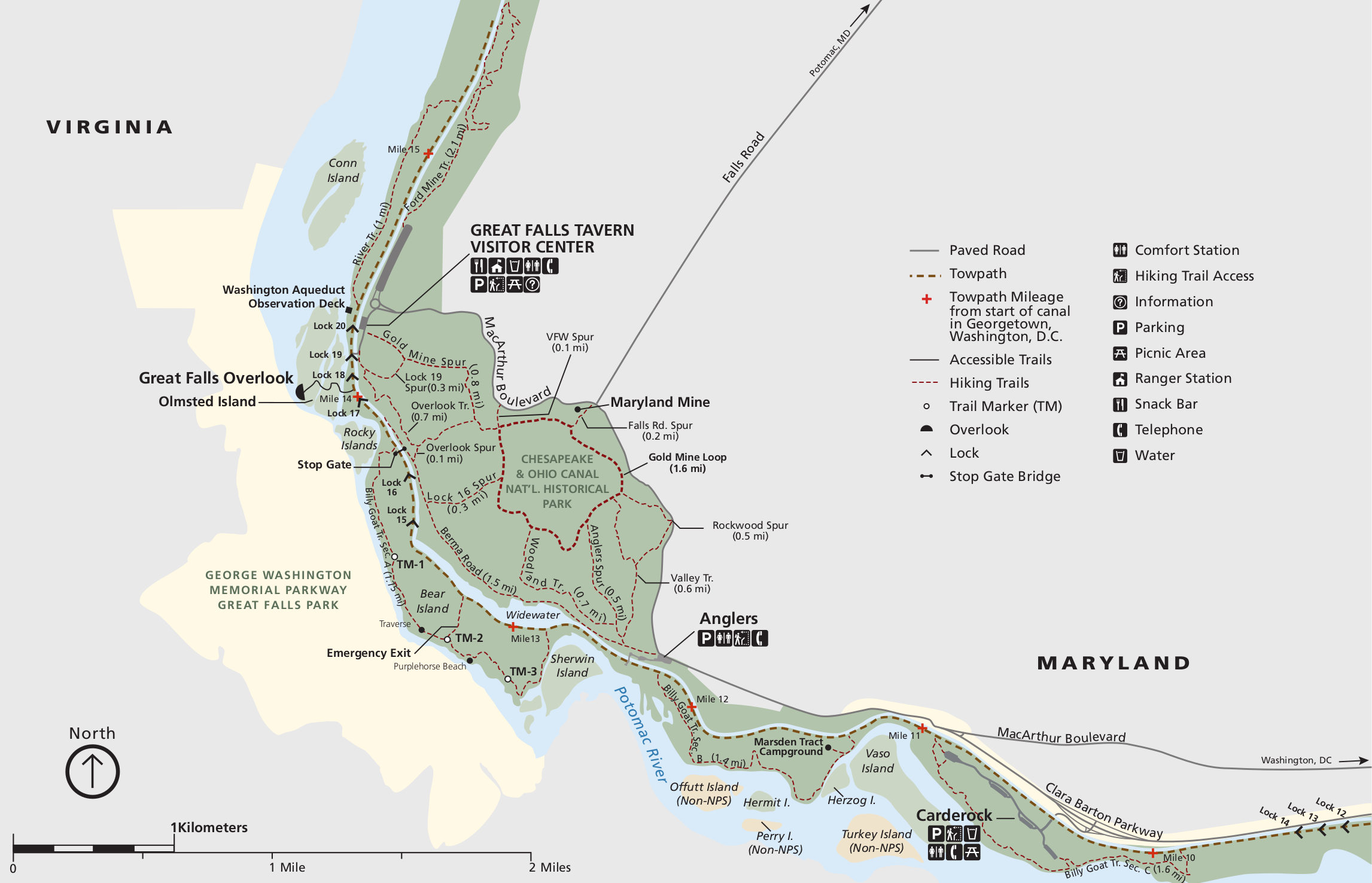 This C&O Canal trail map focuses on the trails around Great Falls and the Great Falls Tavern Visitor Center, including the Billy Goat Trail. It includes trail mileages between junctions and points of interest.
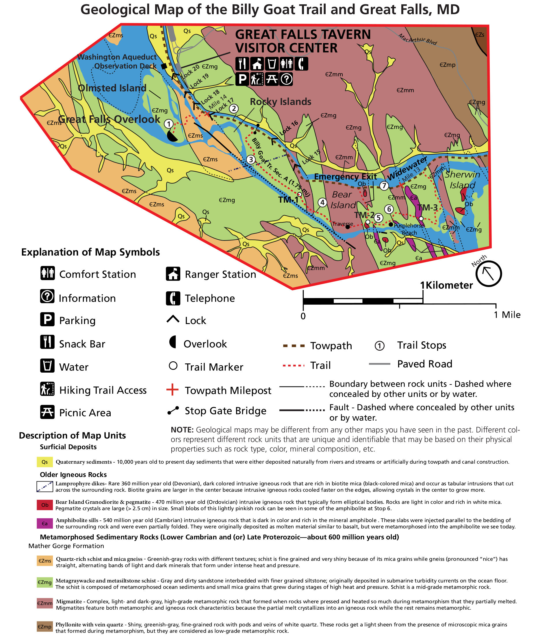 Here’s a geologic map of the Great Falls area, focusing on the park lands in and around Great Falls, MD. This area has the most interesting geology of the Potomac; these are some very old rocks!
Assorted C&O Canal maps
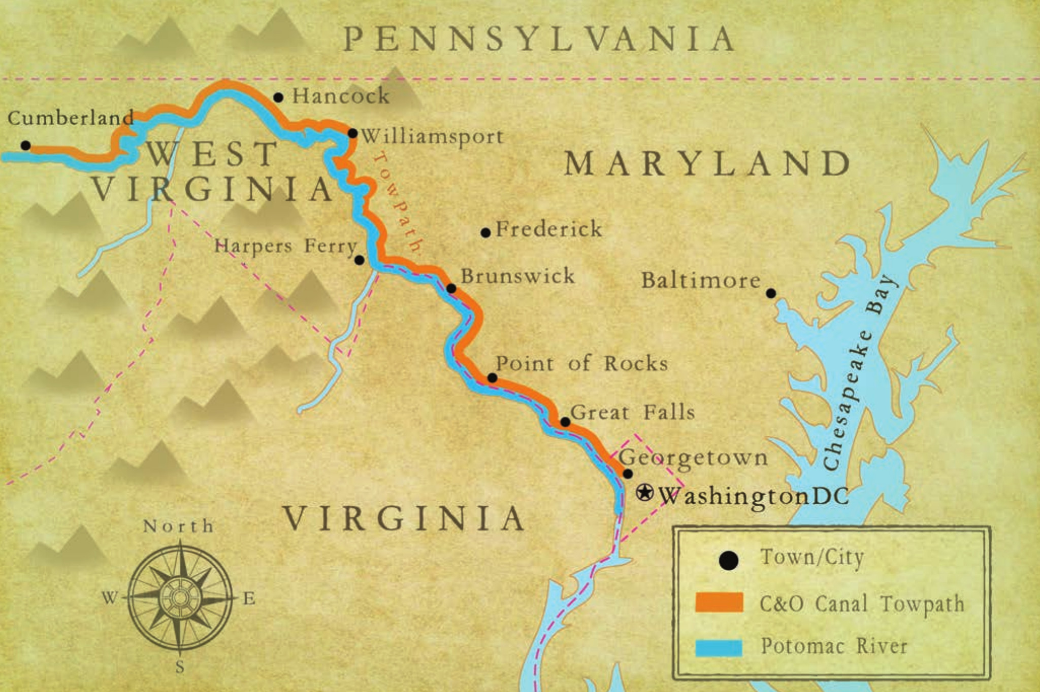 The C&O Canal illustrated map is the simplest and most easily-interpretable map on this page. It has few details and simply focuses on showing the towns connected by the canal and towpath along its length.
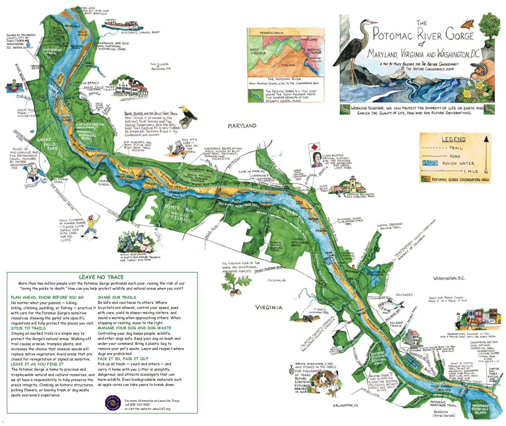 Here’s an illustrated Potomac River Gorge map from the Nature Conservancy, focusing on the eastern portion of the C&O Canal and Potomac River between Great Falls and Georgetown.
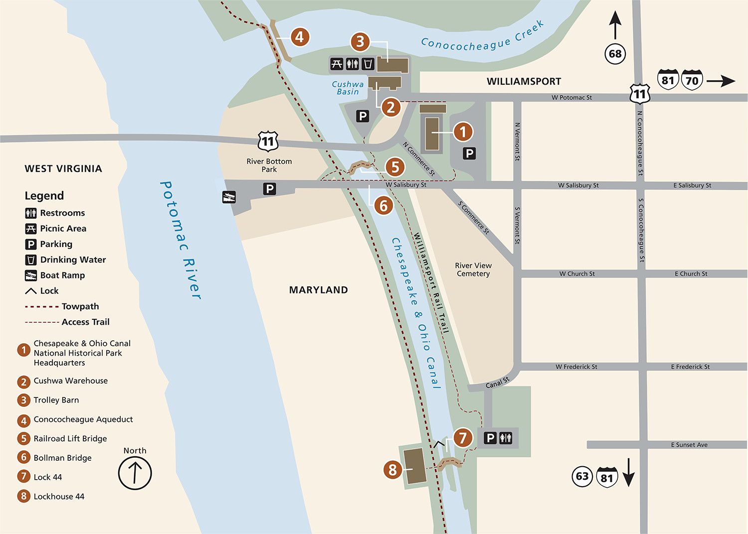 This is a Williamsport, MD map. This historic town along the Maryland-West Virginia border has several historic structures worth visiting. They’re labeled on this map, along with the park headquarters.
Archived C&O Canal maps
The National Park Service is continually releasing new maps and updating old ones. I do my best to share the newest versions on this page. But rather than deleting old ones, I simply move the out-of-date C&O Canal maps down to this section. I believe it’s important to trace how national parks change over time so I never want to erase traces of the past.
 Here’s the old official Chesapeake and Ohio Canal map, which was superseded by the one on top of this page in 2024. Click the image to view a full size map or download the PDF.
 This old C&O Canal detail map was also updated and replaced in 2024 by the detail map in the top section of this page. Click the image to view a full size map or download the PDF.
…and more!
< Return to National Park Maps home
< Return to Park List
< Return to List by State