Kenai Fjords map from the park brochure
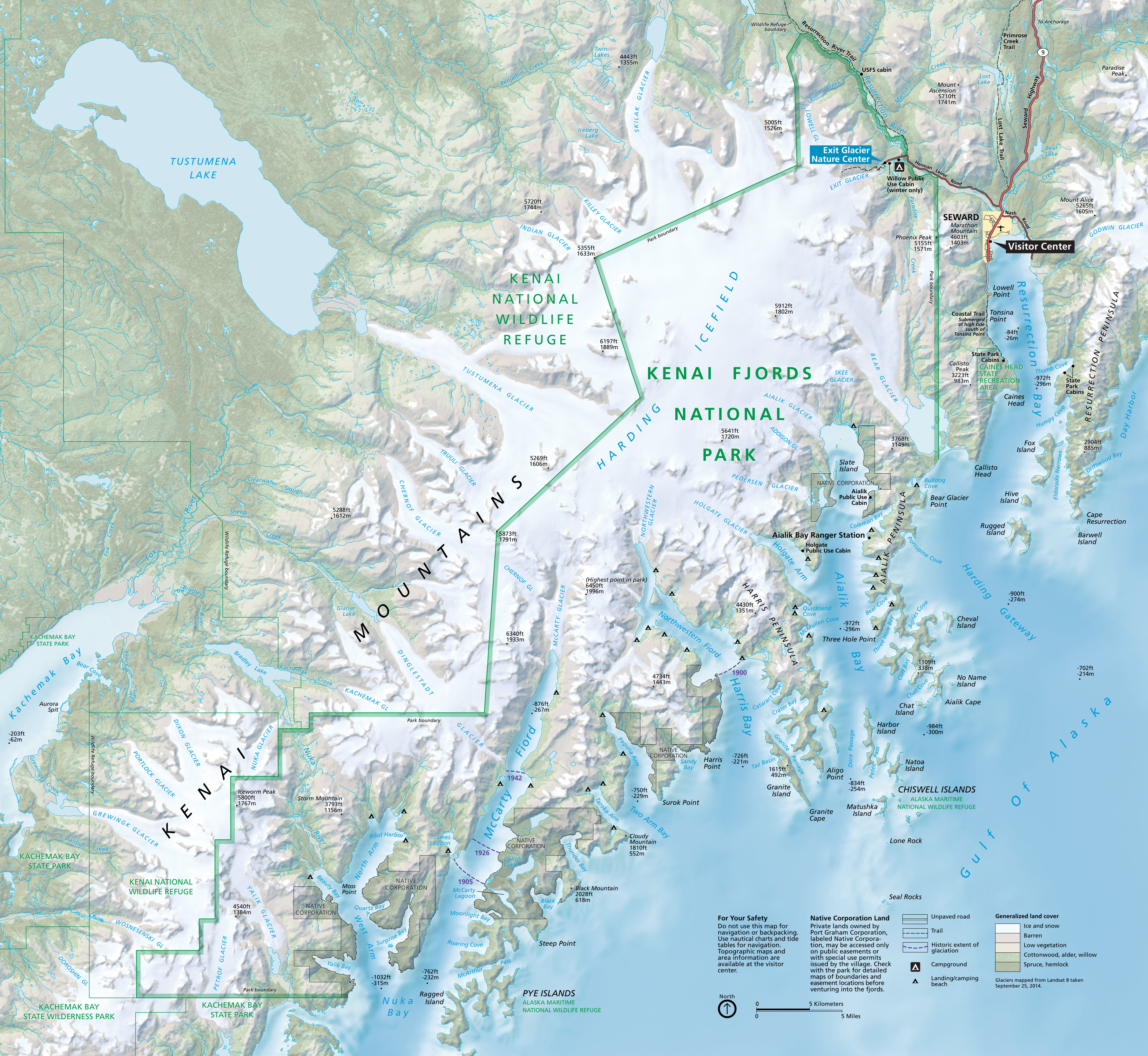 This is the official Kenai Fjords National Park map, showing the Exit Glacier area as well as the fjords and islands southwest of Seward. Click the image to view a full size map or download the PDF.
Kenai Fjords trail maps
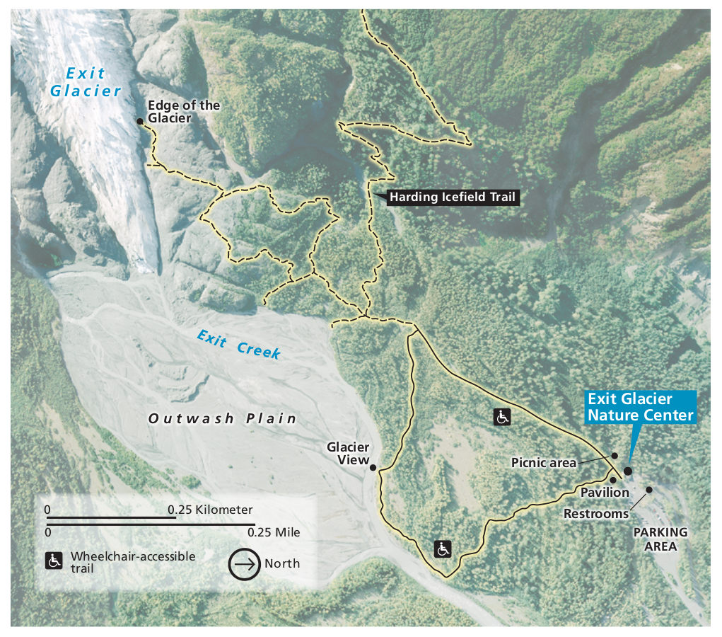
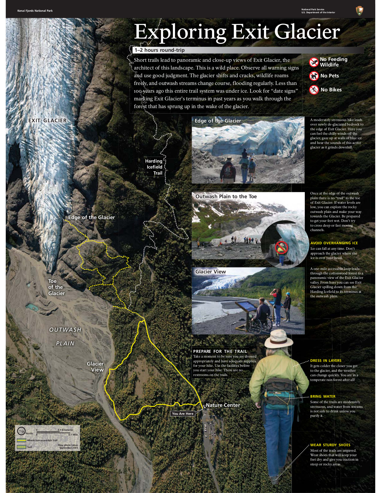
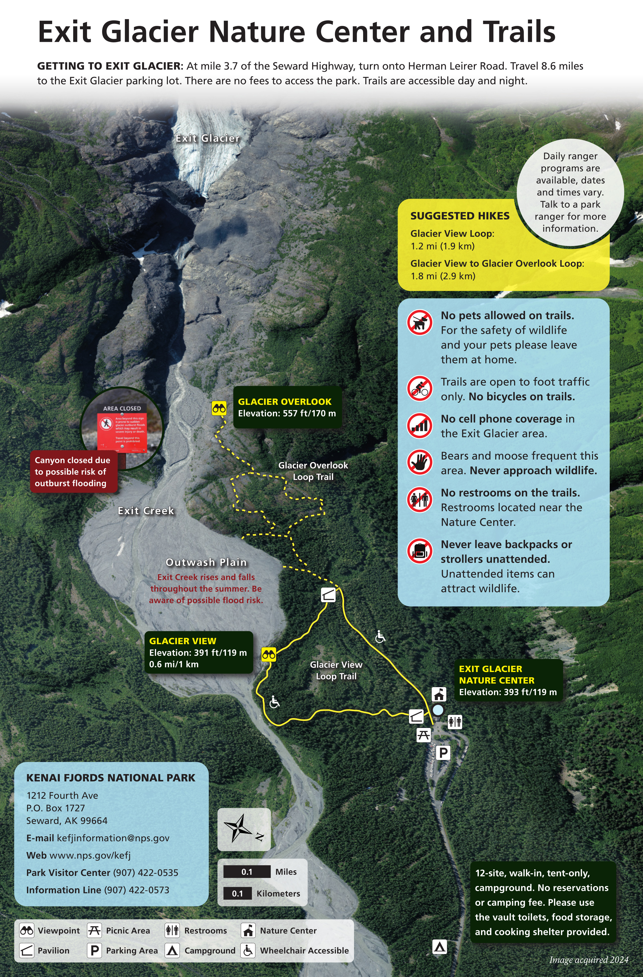 This Exit Glacier trail map was last updated in 2025. It zooms in on the two main loops from the Exit Glacier Nature Center, showing the Glacier View Loop Trail and Glacier Overlook Loop Trail.
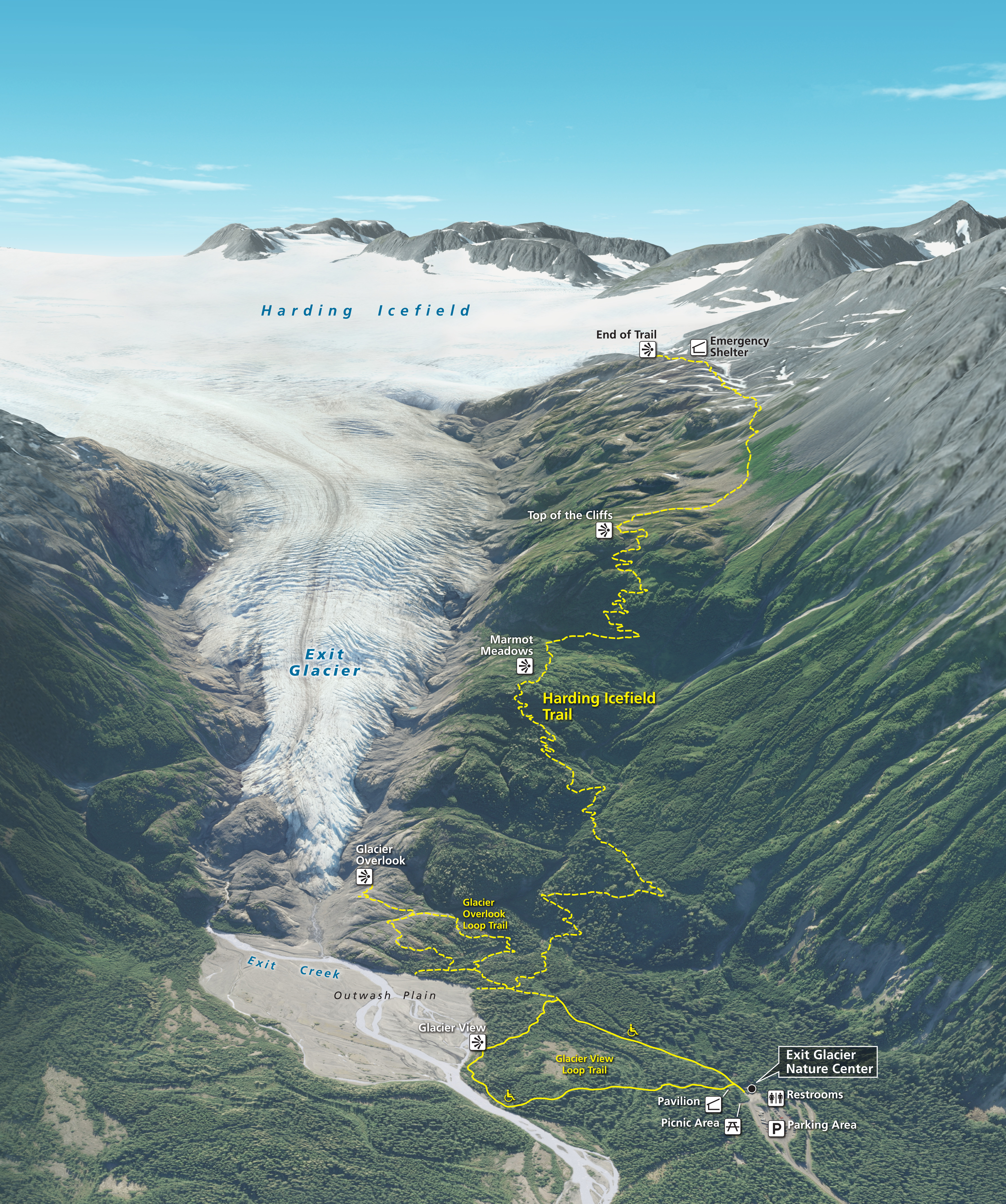
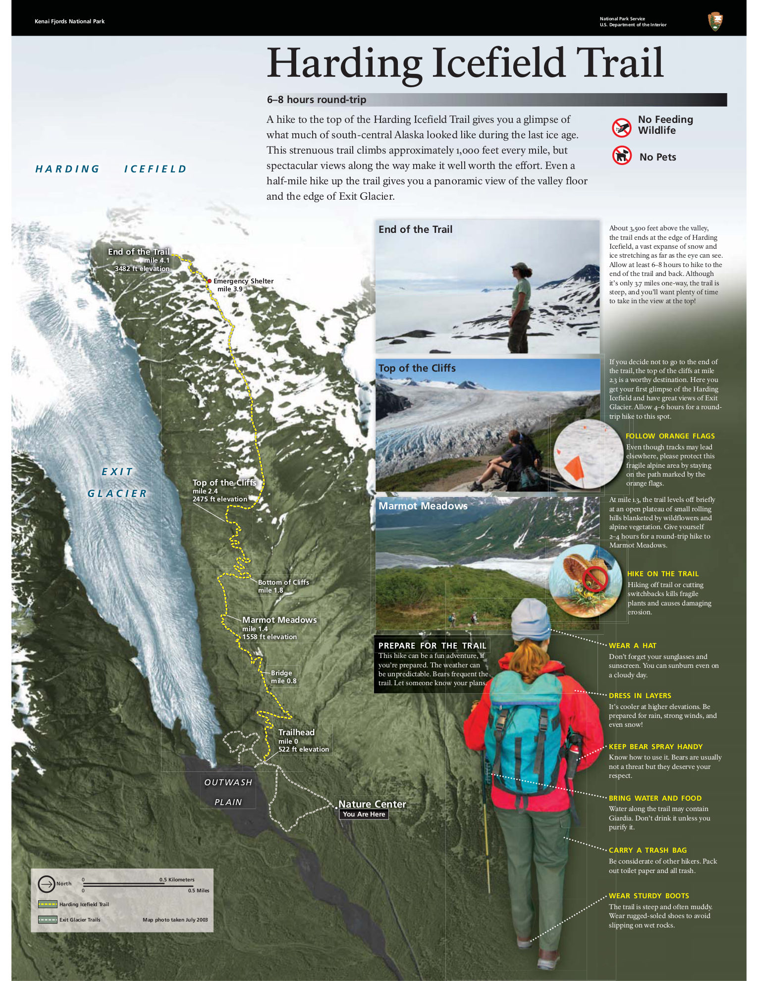
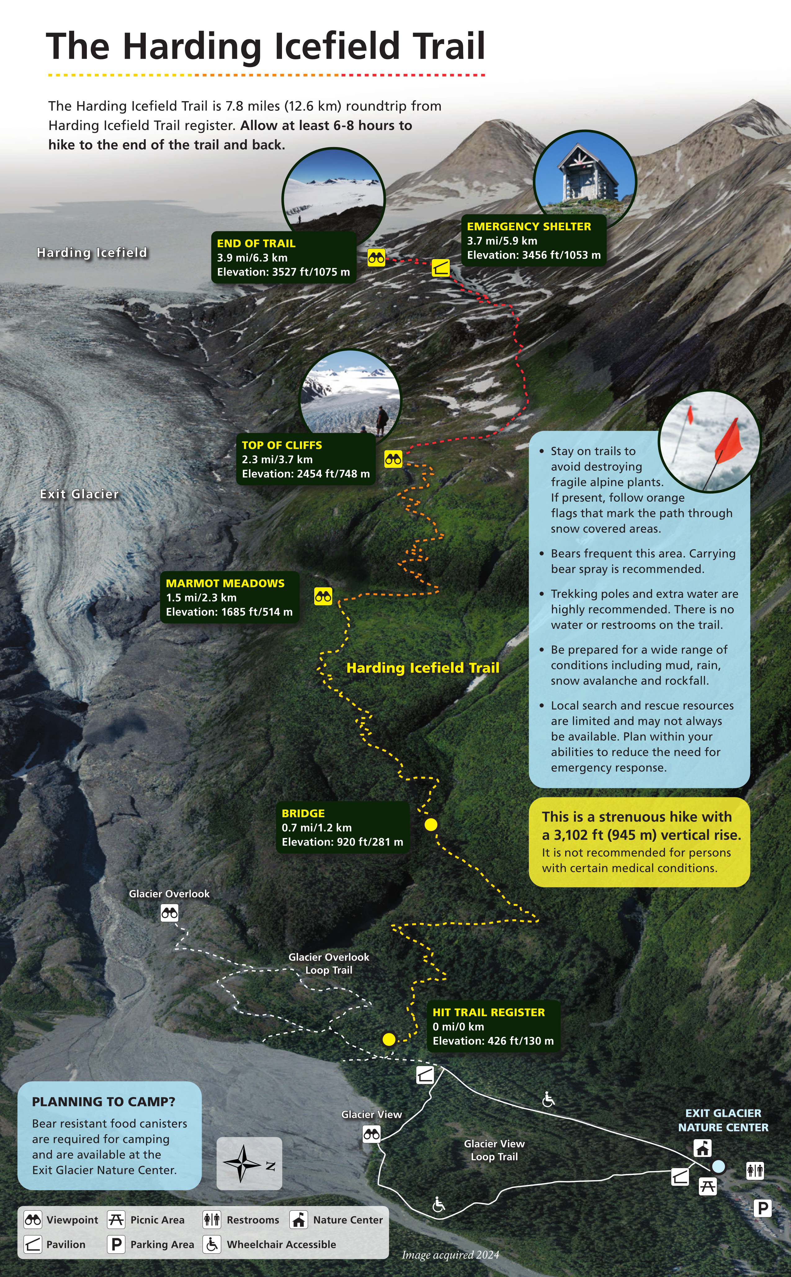 The Harding Icefield trail map was last updated in 2025. It focuses on the strenuous trail that will take several hours but leave you with a spectacular overlook of the enormous Harding Icefield.
 The maps above are great if you’re hiking around the Exit Glacier; you won’t need a more detailed map since the trails are well signed and maintained. But if you want a map to cover the rest of Kenai Fjords and include topo lines and much more detail, you may want to check out the National Geographic Trails Illustrated map here. It’s especially nice to have if you’re on a boat tour to help you identify peaks and trace out your tour route.
Kenai Fjords backcountry maps
 This Kenai Fjords backcountry map shows the various campsites and cabins available for use by kayakers, boaters, and other adventurers. It also shows harbor seal habitat and campsite regulations.
 This map of Kenai Fjords food storage lockers shows the food lockers available for the public to use to store food from bears. I wouldn’t want to camp out unless I was at one of the bear-locker campsites.
Assorted Kenai Fjords maps
 Here’s a gorgeous aerial map of Kenai Fjords and the Kenai Peninsula, which shows the incredible extent of the Harding Icefield and how Exit Glacier, Bear Glacier, and others are simply small pieces of a huge ice sheet.
 The Exit Glacier retreat map is from a trailside exhibit showing effects of climate change on Exit Glacier. This map stops at 2007, but the glacier’s retreat up its valley has continued substantially since then.
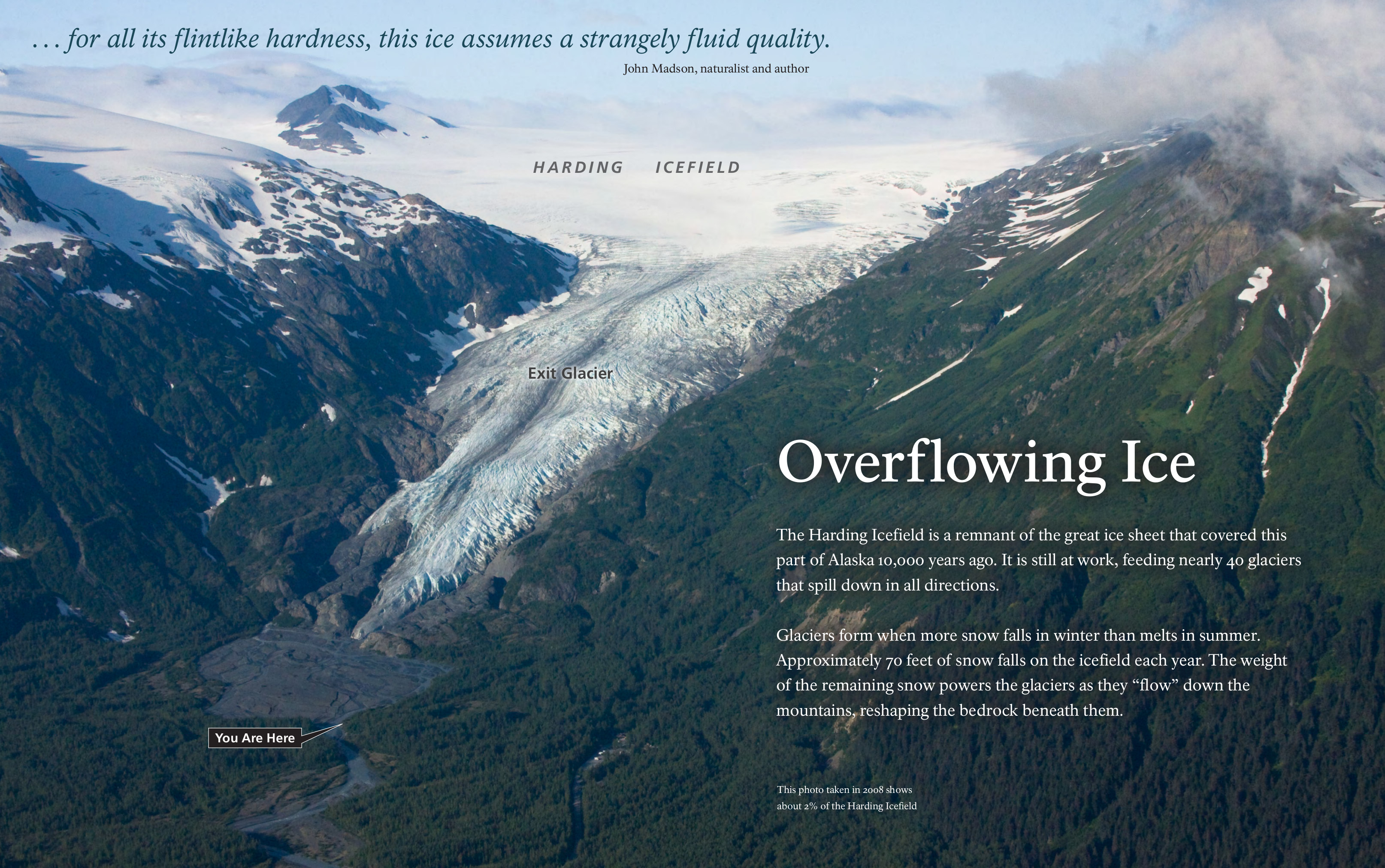 The Exit Glacier aerial map from 2008 comes from a wayside exhibit near the Exit Glacier Nature Center. Note the size of the Harding Icefield in relation to the Exit Glacier; the scale of the ice sheet is mind-boggling.
 This Kenai Fjords National Park regional map zooms out to show the surrounding region, including Lake Clark National Park and Preserve as well as Katmai National Park.
Kenai Fjords lodging map
 Lucky you! If you’re visiting Kenai Fjords National Park, you get to hang out in the great port town of Seward. To the right is an Expedia interactive Seward lodging map, where you can see you have a couple clusters of options. You’re probably best off starting your research by comparing Expedia’s top-rated Seward lodging so you can see differences in price, amenities, locations, and guest reviews.
Archived Kenai Fjords maps
On most pages on this website, I provide older maps for archival purposes simply so users can see how NPS maps change over time. For Kenai Fjords, the older maps in this section are of key importance, as they trace the extent of Exit Glacier’s retreat in very recent history.
 The Exit Glacier map from 2018 focuses on the iconic Harding Icefield trail and the trail network near the Exit Glacier Nature Center. Note how the Edge of the Glacier view from earlier maps was renamed Glacier Overlook.
 This is an Exit Glacier map from the mid-2010s, showing the trails and Exit Glacier Visitor Center located at the end of the Exit Glacier road. Click the image to view the full size map or download the PDF.
 This is an Exit Glacier trail map from the mid-2010s, showing the trails with text descriptions on a satellite view of the Exit Glacier area. Click the image to view a full size map or download the PDF.
 This is a Harding Icefield Trail map from the mid-2010s, showing the route up to the Harding Icefield from the Exit Glacier area and visitor center. Click the image to view a full size map or download the PDF.
 This is the old Kenai Fjords map from the mid 2010s, which is similar to the current one but does not include the Exit Glacier Nature Center. Click the image to view a full size map or download the PDF.
…and more!
< Return to National Park Maps home
< Return to Park List
< Return to List by State