Bryce Canyon maps from the park brochure
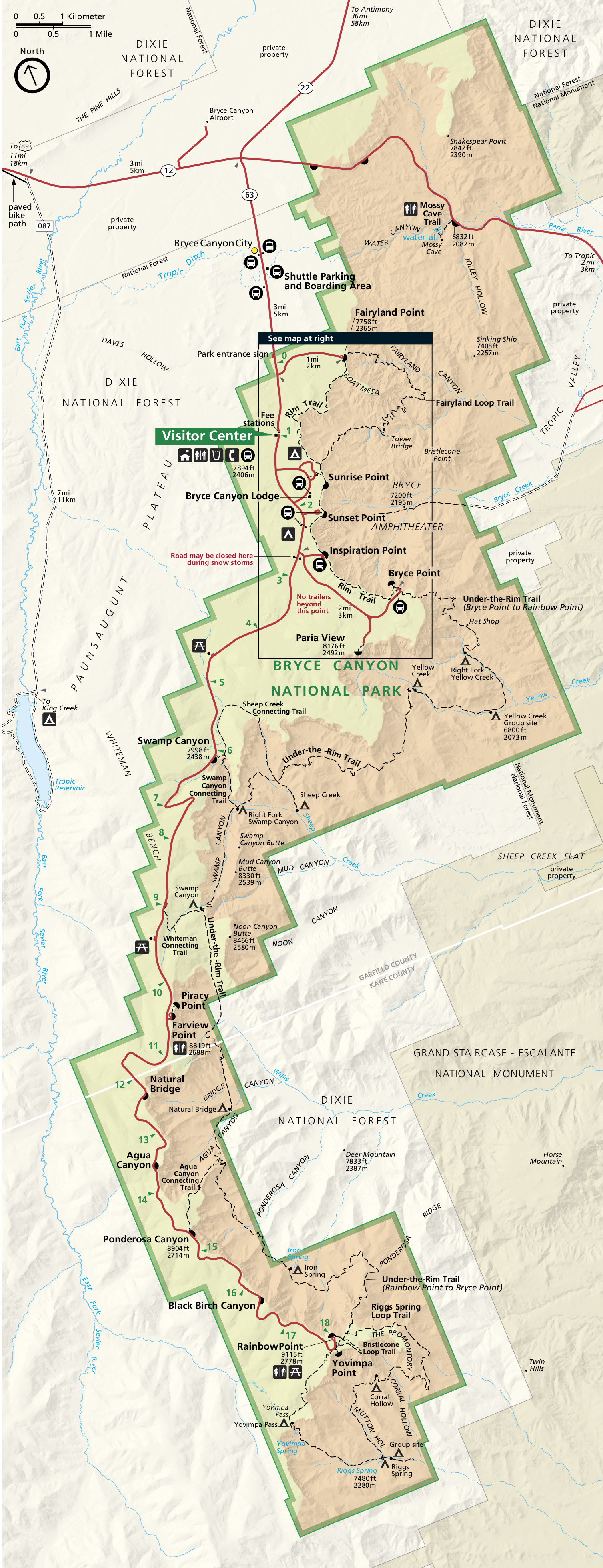
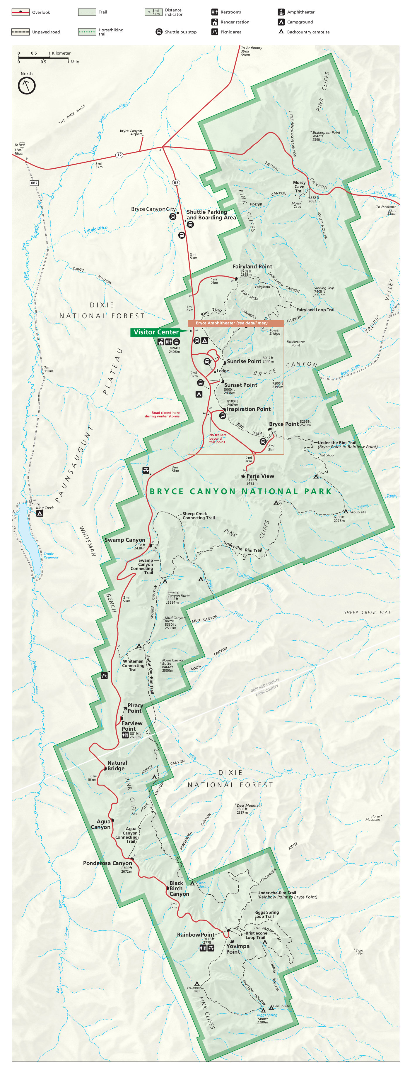
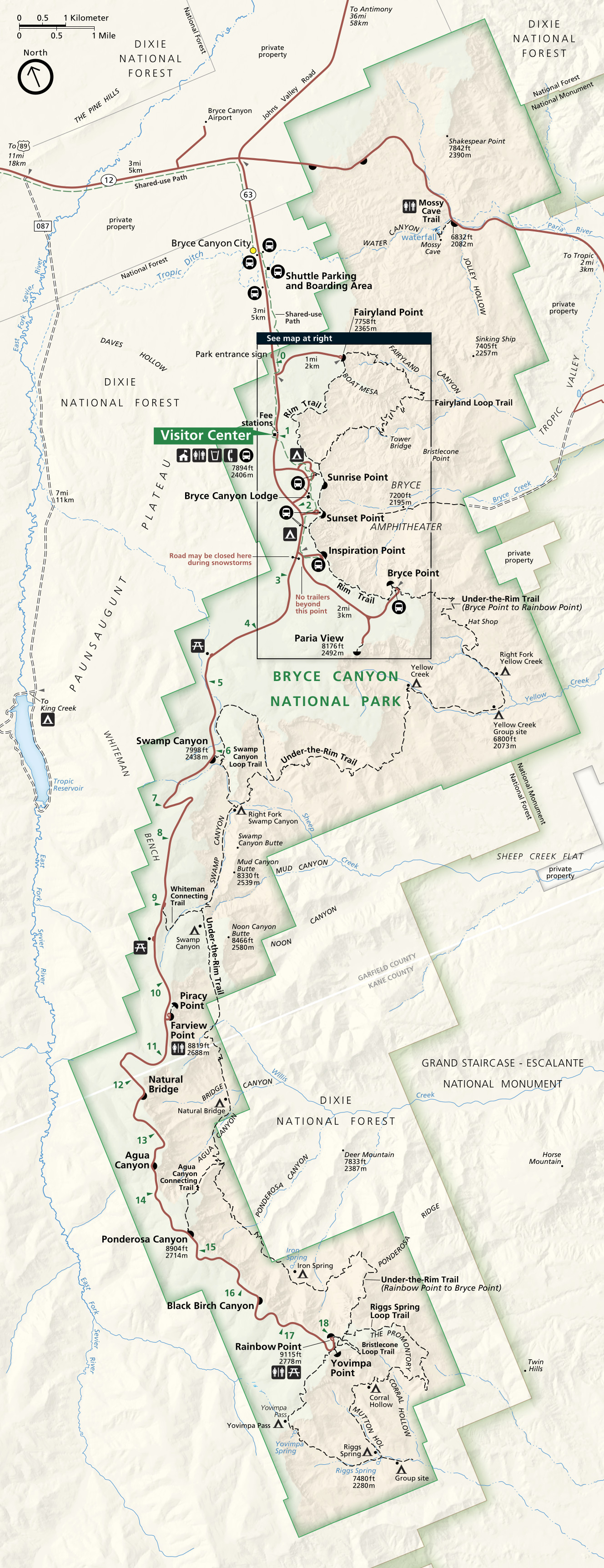 This is the official Bryce Canyon National Park map from the NPS brochure, revised in 2024. It includes all the trails located outside the main Amphitheater. Click the image to view a full size map or download the PDF.
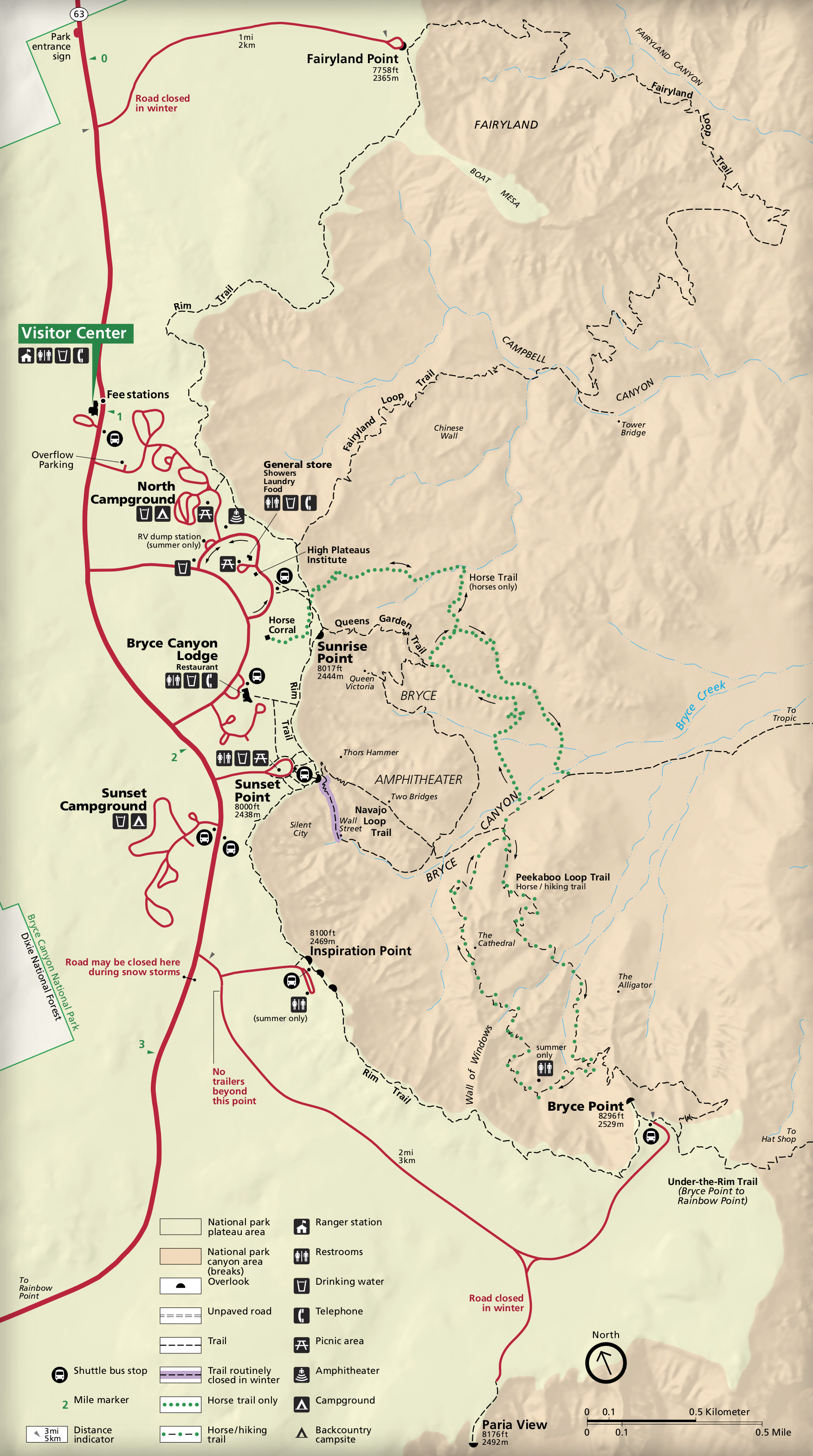
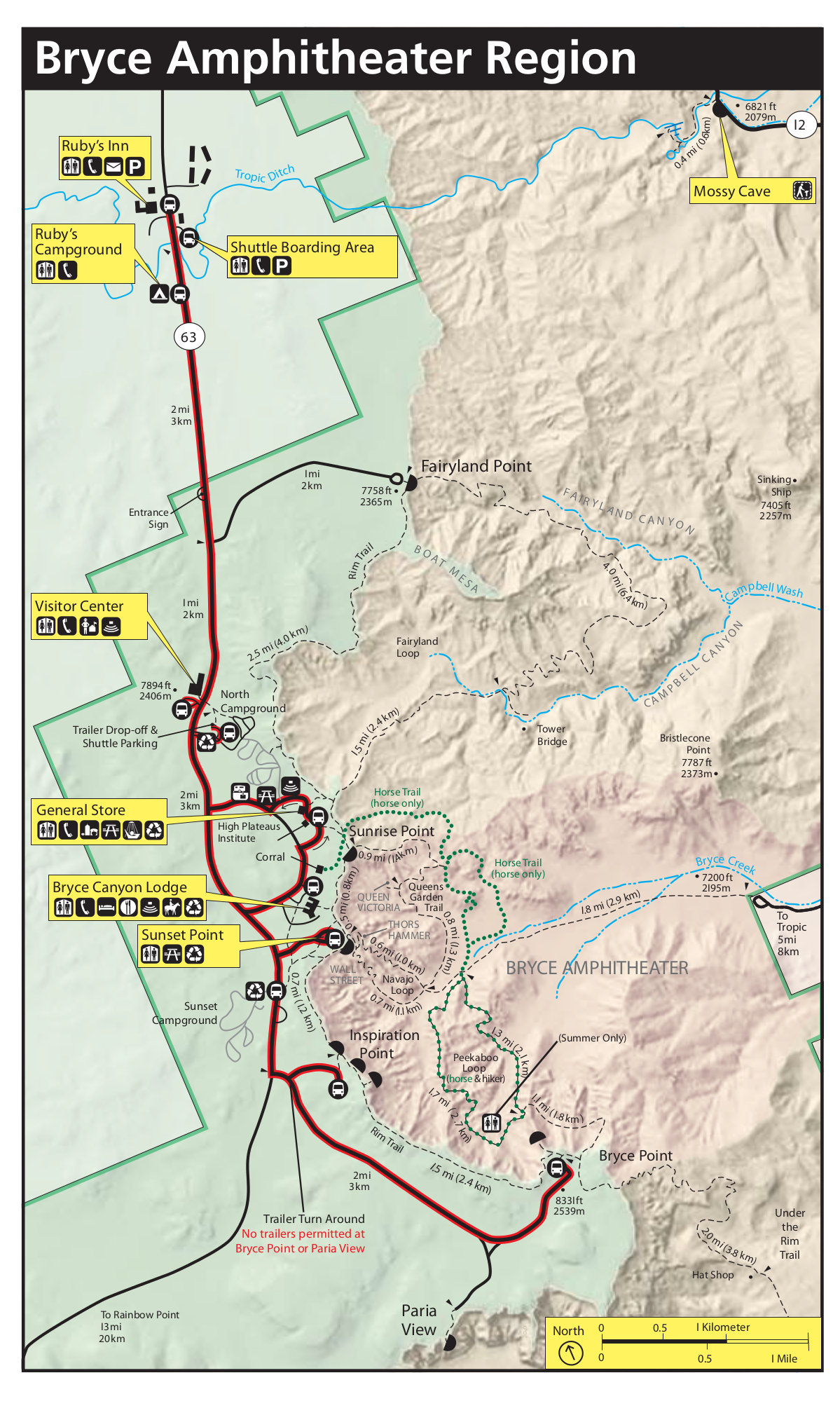
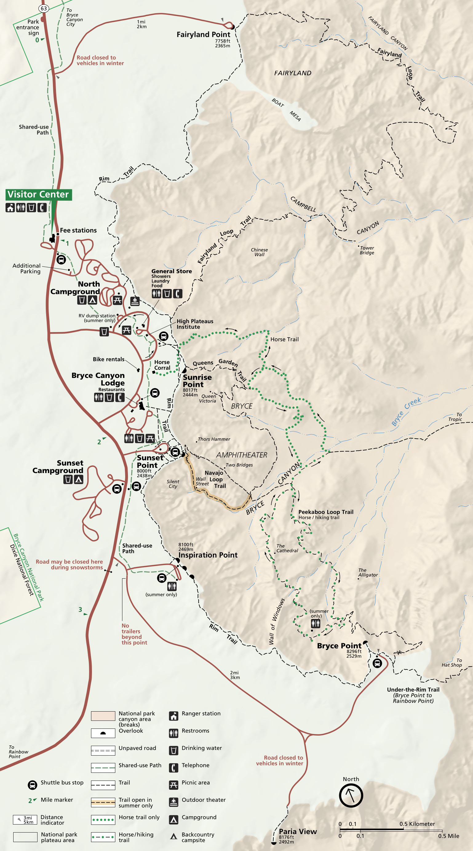 This is a detail map of Bryce Canyon Amphitheater, also revised in 2024. It zooms in to show all the trails in the most popular area of the park. Click the image to view a full size map or download the PDF.
 I prefer this alternate Bryce Canyon Amphitheater map, which comes from the 2025 park newspaper. The landscape orientation works better with my brain, though take note that north is not pointed up in this map.
Bryce Canyon trail maps
 While the below maps are good for trip planning and day hikes, you’ll probably want a more detailed map with topographic lines and mile markers if you decide to do any backpacking. The National Geographic Trails Illustrated map is therefore perfect for overnight trips. I admit that even though I’ve never backpacked in Bryce Canyon, I do have a copy of this map just because I like having as much info and detail as possible when planning even my day hikes.
 The Bryce Canyon trail map doesn’t have a ton of trail detail, but it does provide a handy reference table that provides descriptions, distance, and difficulty of all hiking trails in Bryce Canyon National Park.
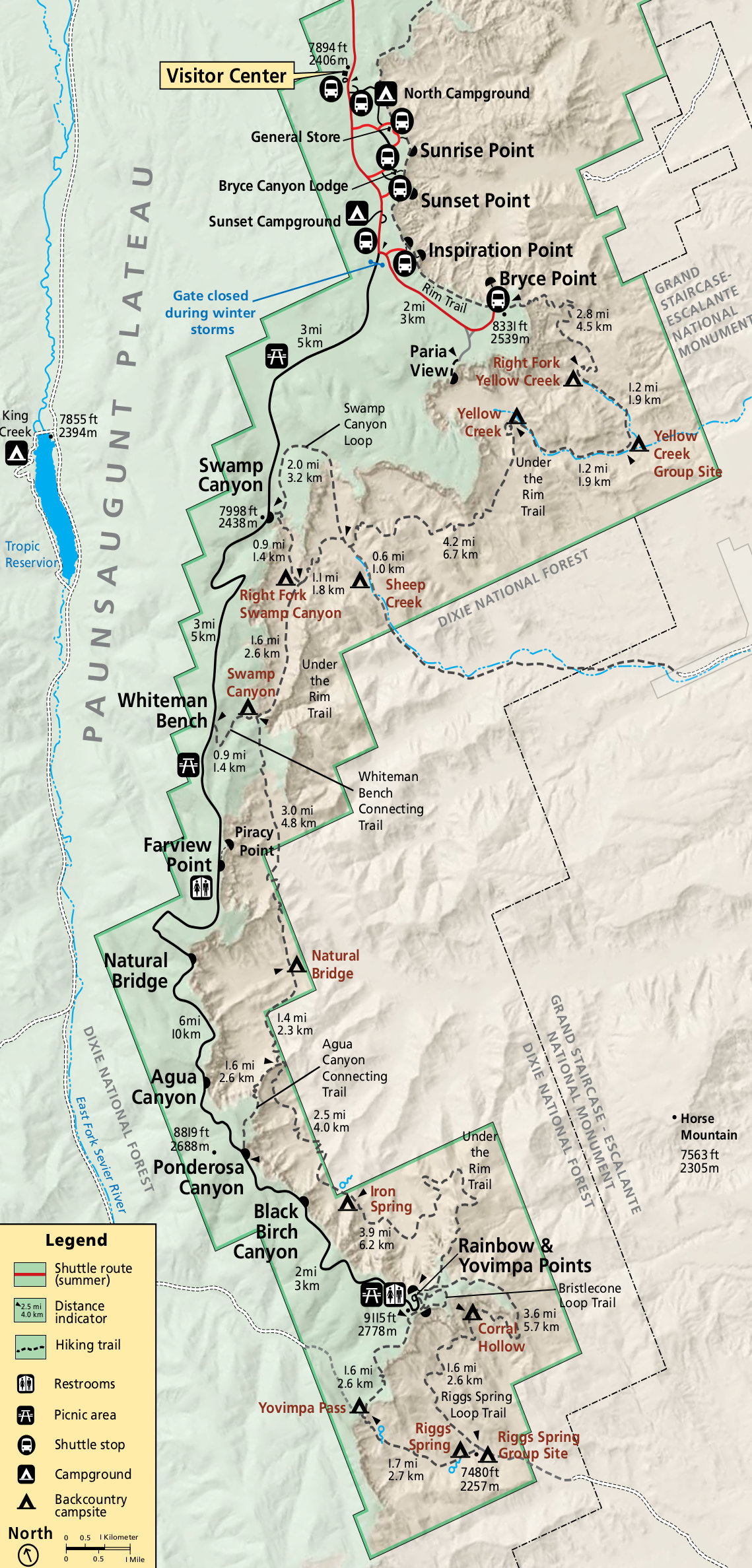 This is a Bryce Canyon backcountry map, showing trails, mileages, and campsites for those doing overnight backpacking trips. Click the image to view a full size map or download the PDF.
 Here’s a Bryce Canyon horse trail map, last updated in 2023. It shows horse trailer parking and traces the two horse trail loops, including the Peekaboo Loop Trail, which is shared with hikers.
Bryce Canyon campground maps
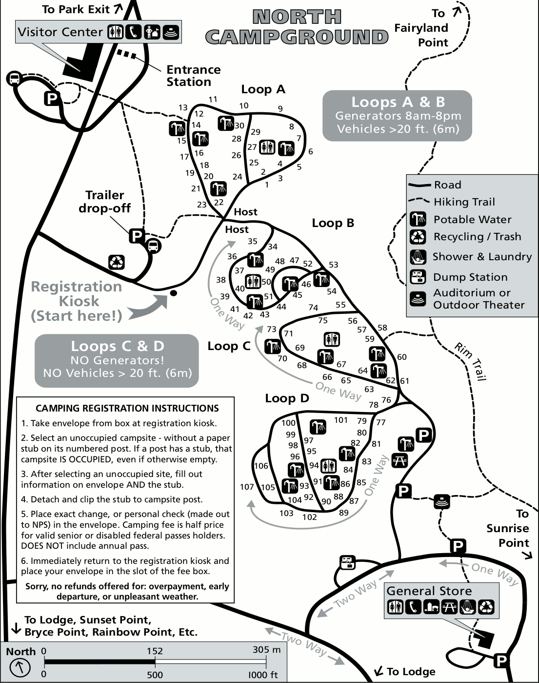
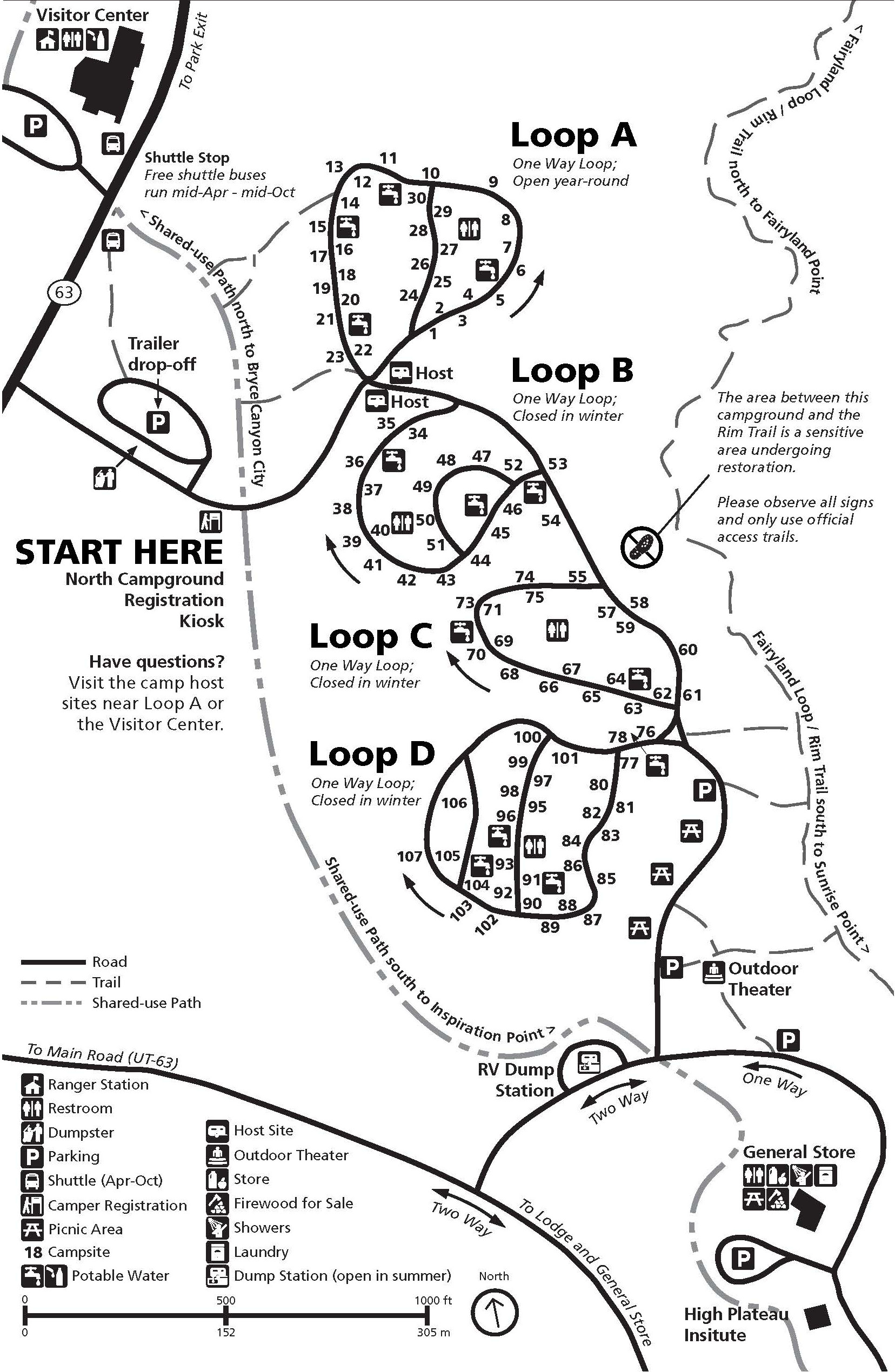 Here’s a North Campground map, which shows Bryce Canyon National Park’s year-round campground. It’s located across the street from the Bryce Canyon Visitor Center. The general store is also in walking distance.
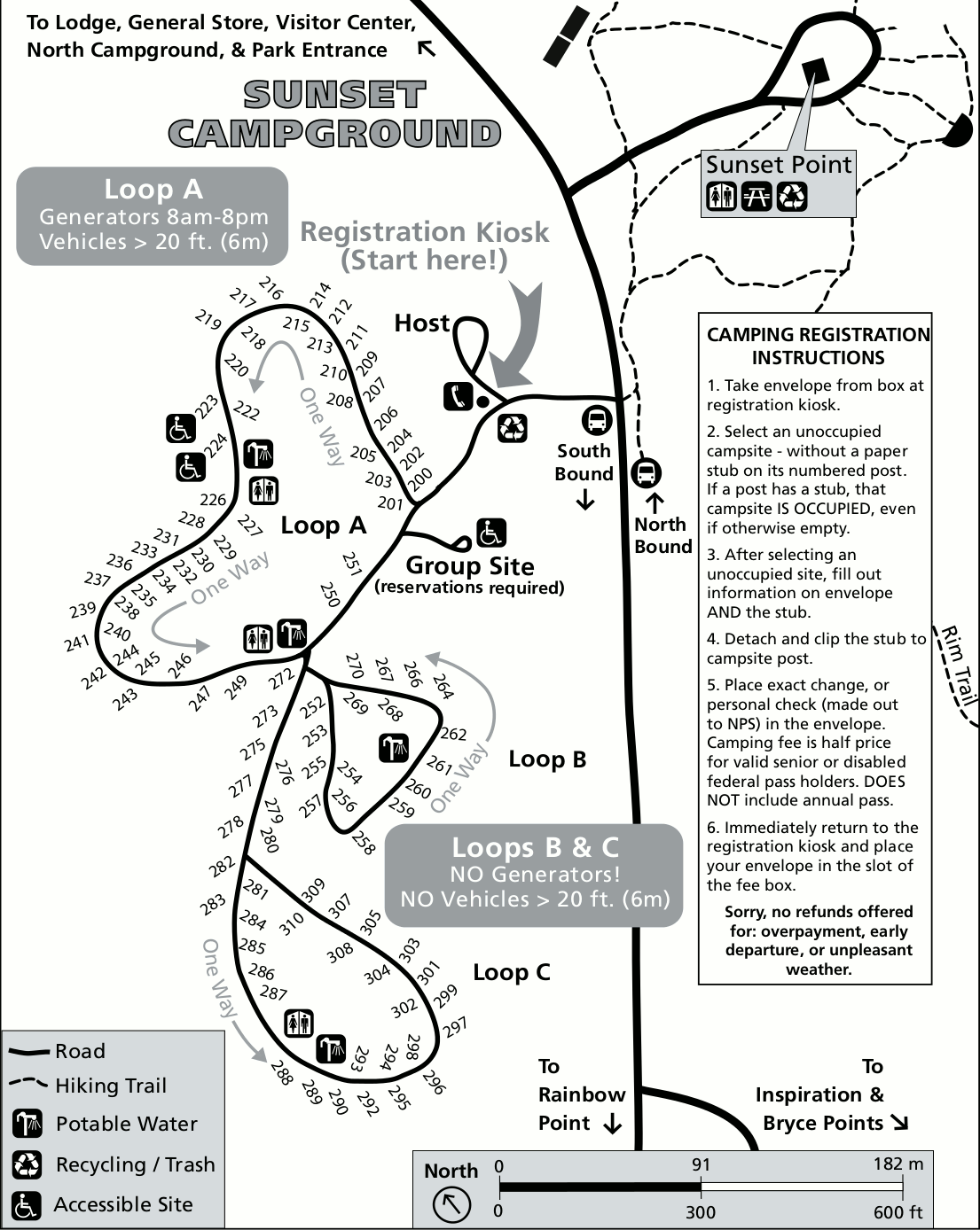
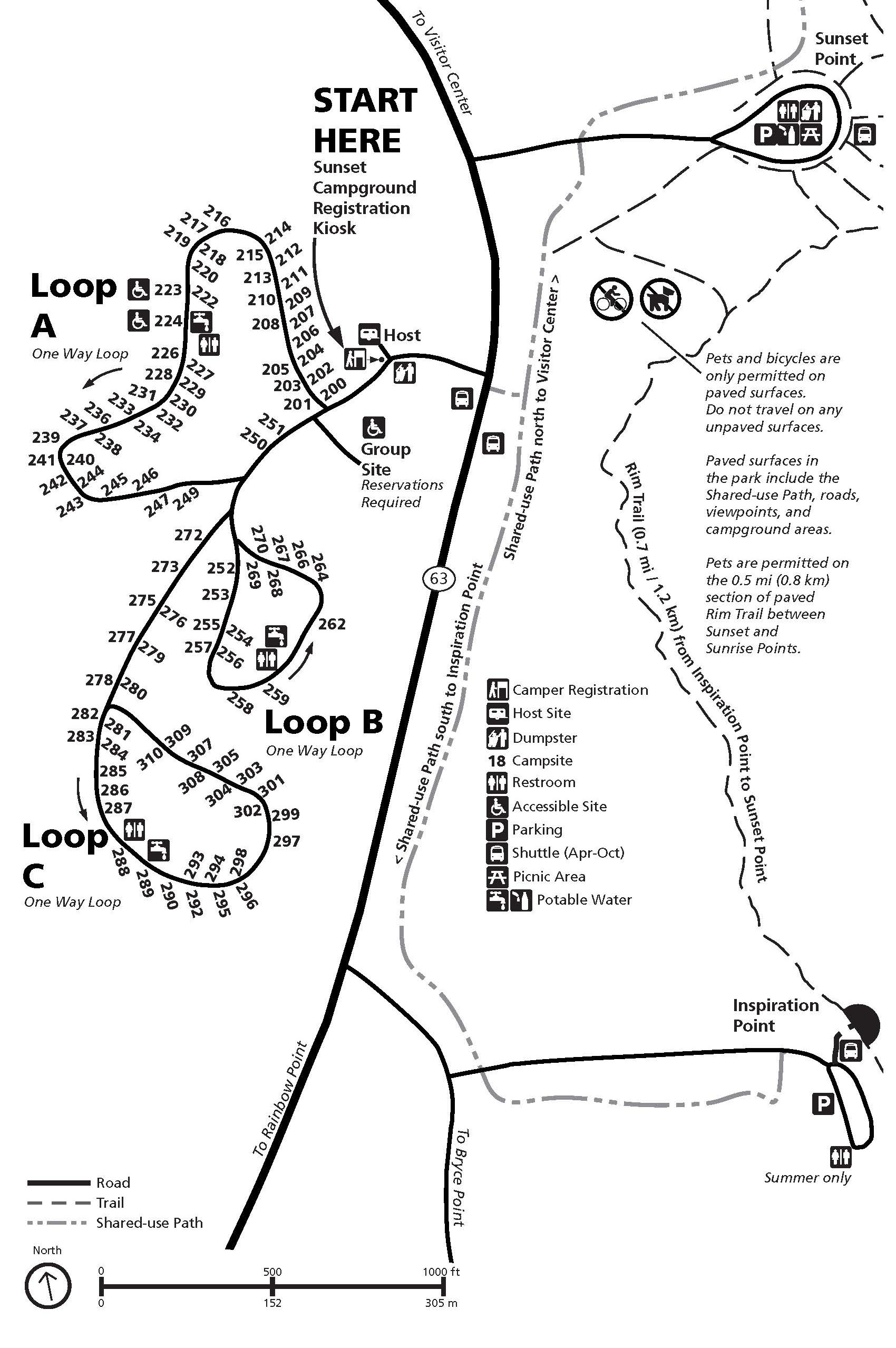 This is a Sunset Campground map. This campground is closed during winter, which is generally November through mid-April. Its best feature is its proximity to Sunset Point, which makes for an ideal evening stroll.
Bryce Canyon lodging map
 Bryce Canyon doesn’t have a single gateway town that most people stay in; to the right you can open an Expedia interactive Bryce Canyon lodging map to see all the nearby places to stay. The ones nearest Bryce Canyon are along the entrance road south of the Highway 12/63 junction; hotels in the nearby town of Tropic are also convenient. View Expedia’s top-rated Bryce lodging to compare prices, locations, and reviews.
Bryce Canyon regional maps
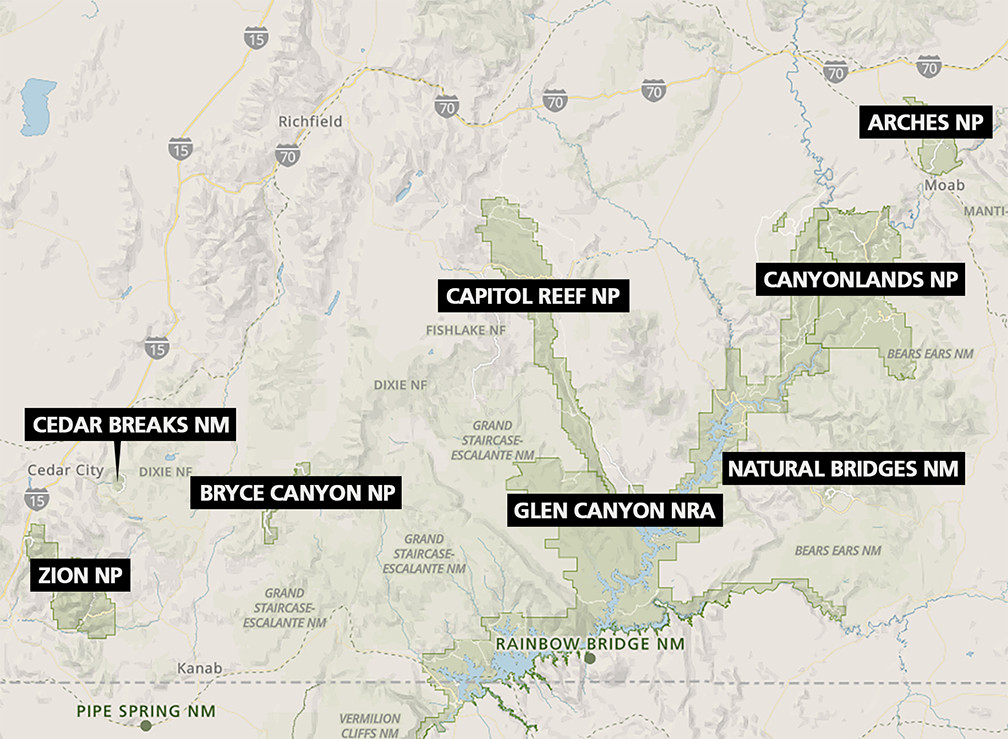
 The Bryce Canyon regional map is from the 2025 park newspaper. It zooms out to show highways and other national parks, national forest lands, tribal parks, and other visitor attractions.
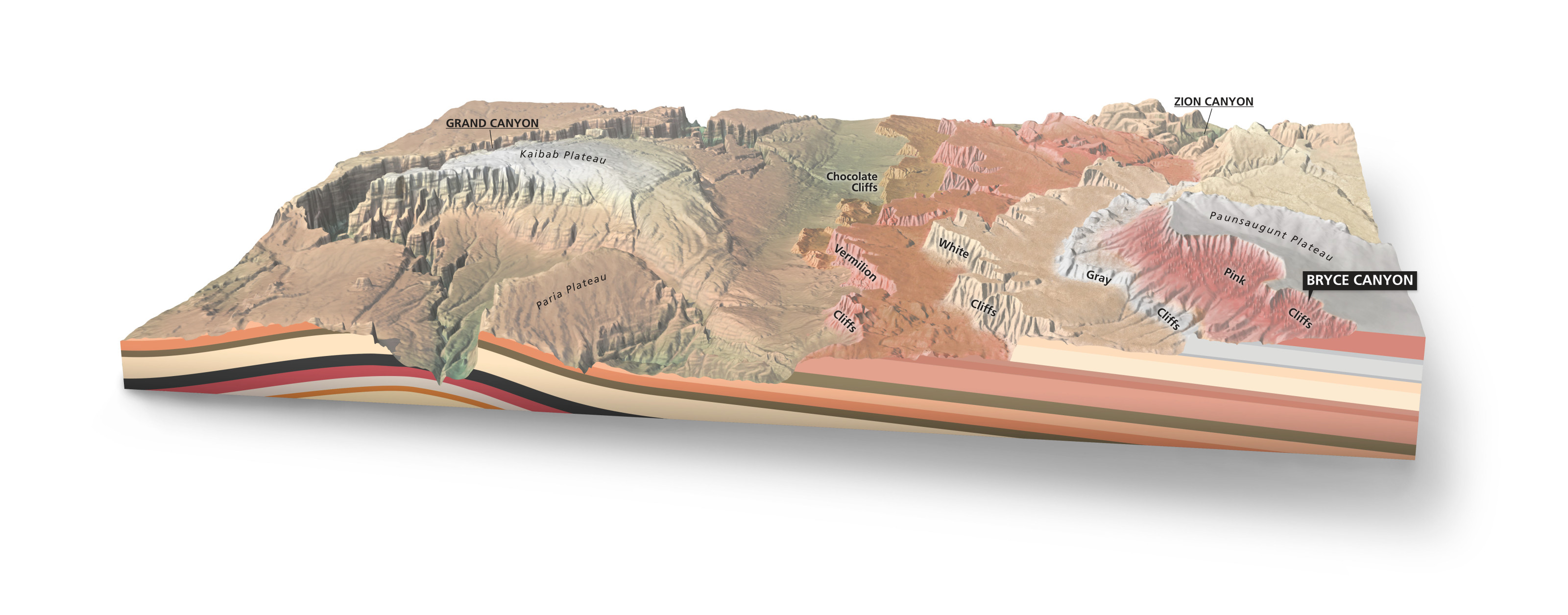 The Grand Staircase map shows the location of Bryce Canyon in comparison to Zion National Park and Grand Canyon National Park. It labels the cliff bands and shows their underground geology.
 Here’s a Mighty Five map, to borrow the marketing term coined by Utah’s Office of Tourism. But note that there are many more national park units in Utah beyond the Five; this map shows a few others nearby.
Assorted Bryce Canyon maps
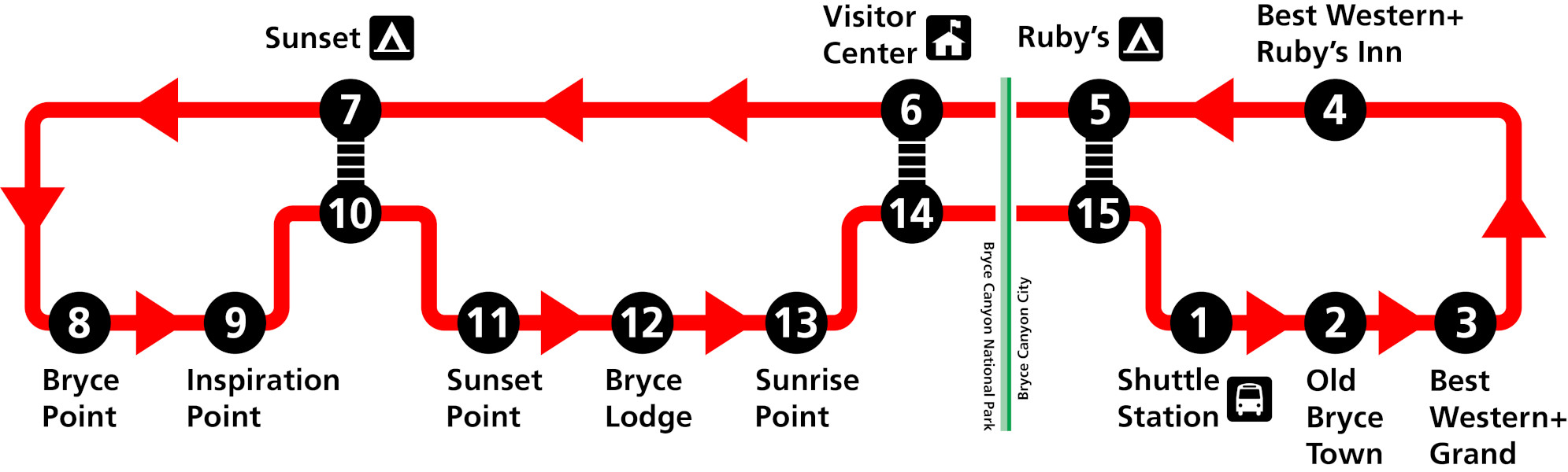 This Bryce Canyon shuttle map is current as of 2025. It shows the various stops the shuttles make as they complete their loops within the park and outside the boundary at lodges and parking in Bryce Canyon City.
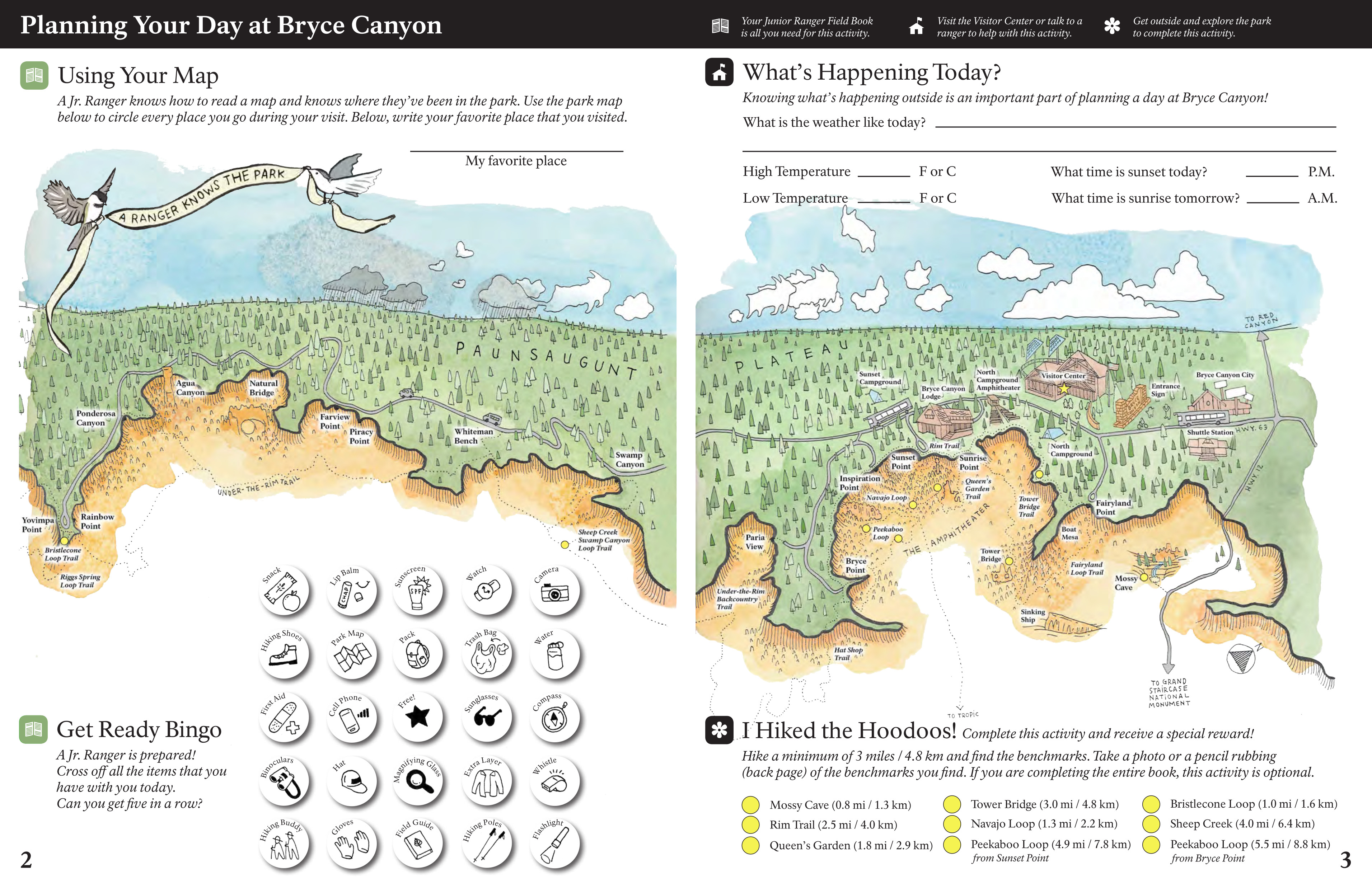 The Bryce Canyon Junior Ranger map is from the park’s Junior Ranger book. The whimsical art makes this one a particular delight, and some kids activities are included along the map margins.
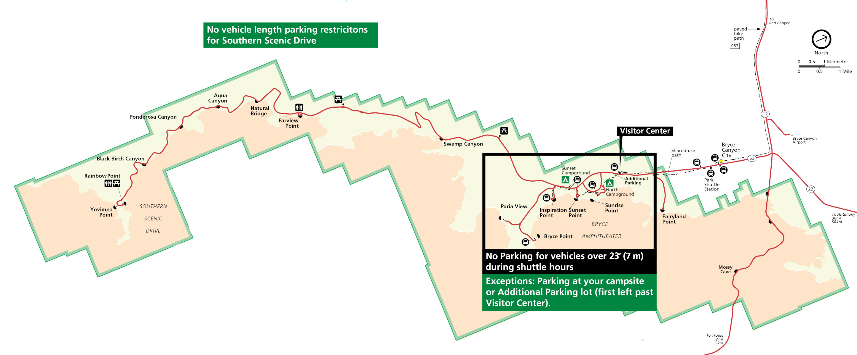 Here’s an oversize vehicle map showing the parking limitations for those driving vehicles greater than 23 feet long. You’ll need to keep your vehicle in your campsite or in the lot near the visitor center.
Bryce Canyon science maps
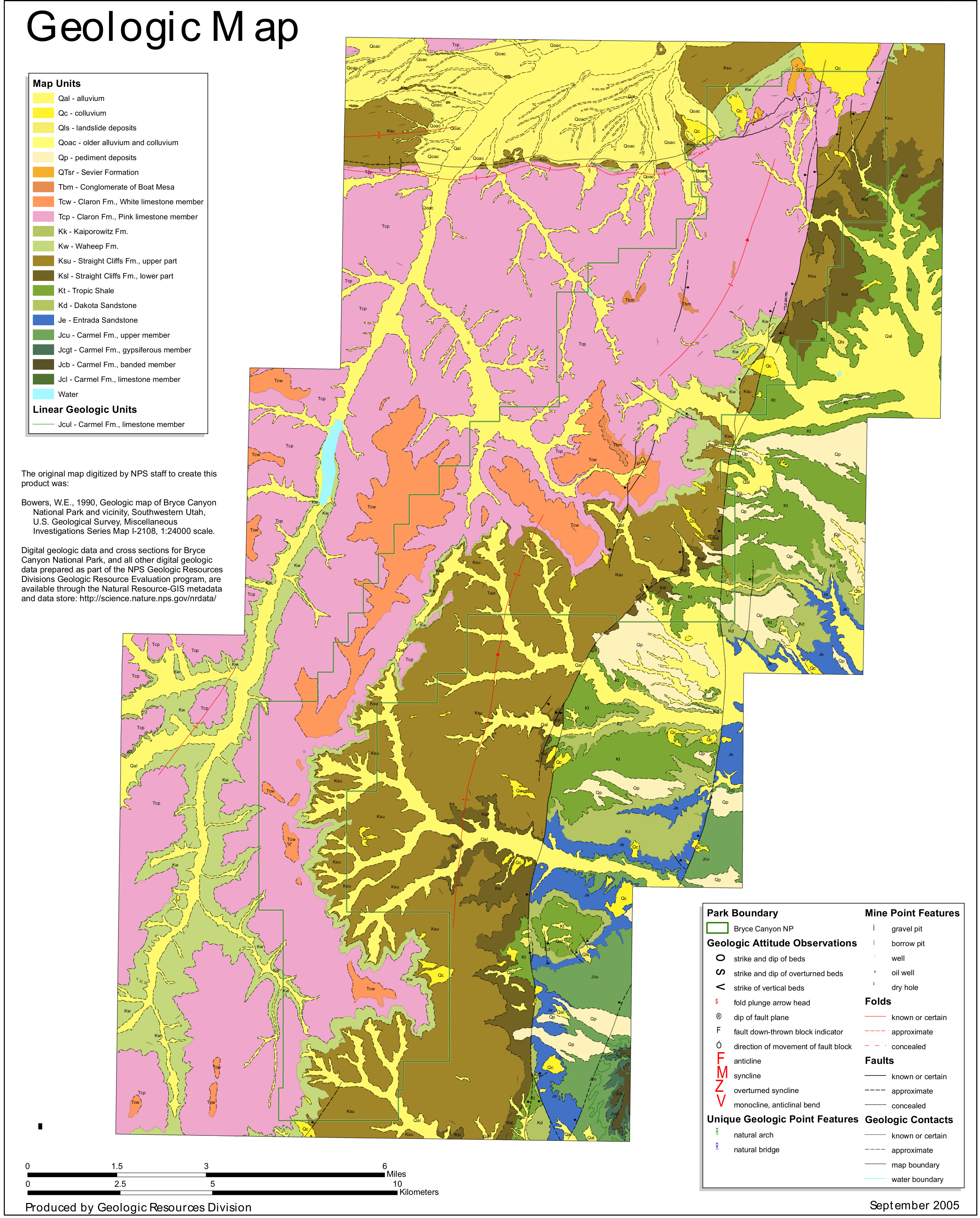 Here’s a Bryce Canyon geologic map, showing a variety of rock formations in the national park including the Claron Formation, which forms the park’s famous red hoodoos.
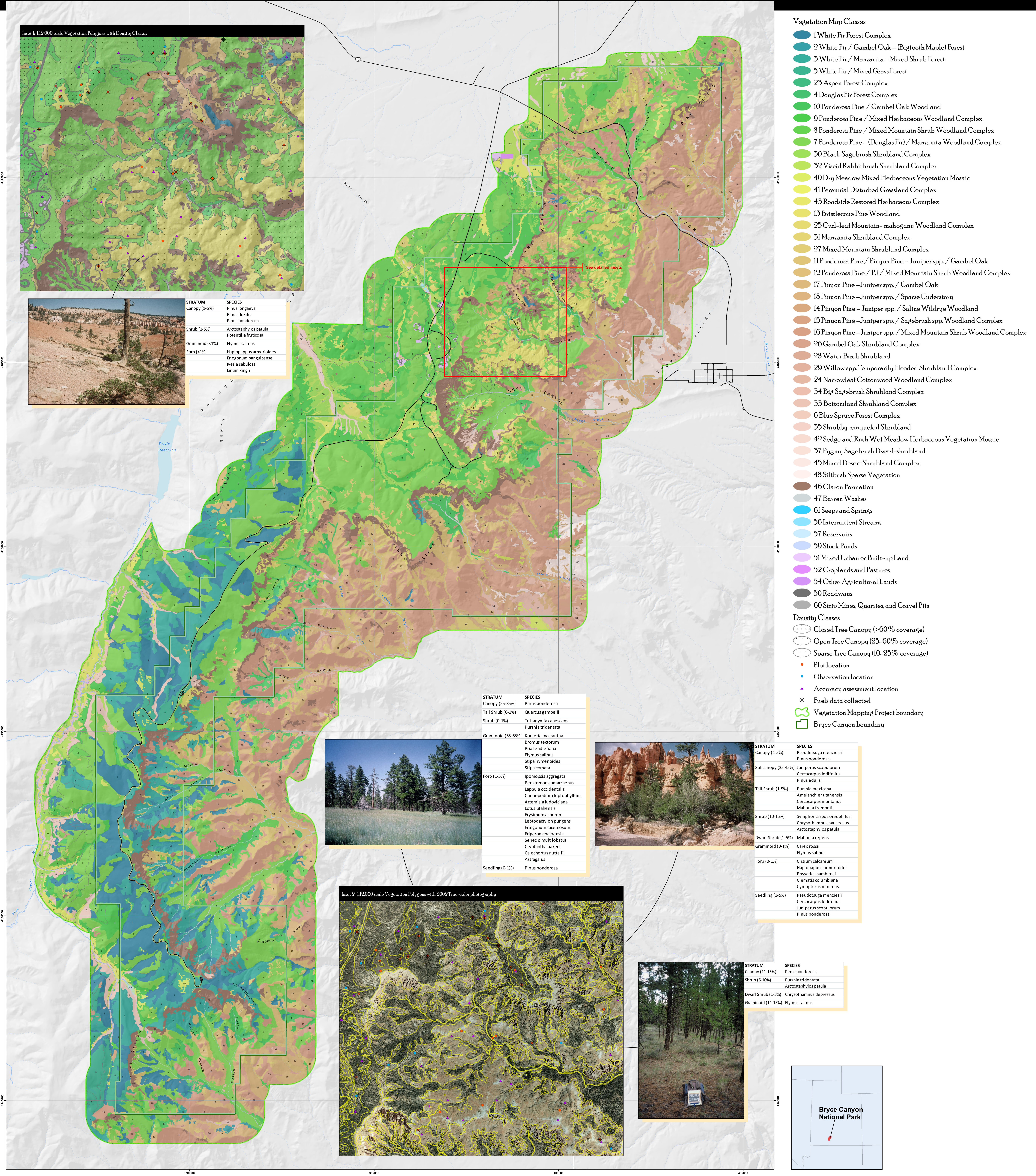 This Bryce Canyon vegetation map identifies the various forest and plant types found in Bryce Canyon National Park – white fir, pinyon pine, ponderosa pine, and more.
Archived Bryce Canyon maps
The maps below are no longer current, but I’m preserving them here for archival purposes, as I believe it’s important to be able to see how things in national parks change over time. You’ll find updated versions of these maps further up this page.
 This was the official Bryce Canyon National Park map from the brochure, showing the visitor center, trails, campgrounds, and roads. Click the image to view a full size map or download the PDF.
 This was the official detail map of Bryce Canyon Amphitheater, which has the most popular trails such as Queen’s Garden and Navajo Loop. Click the image to view a full size map or download the PDF.
 This is a pre-2013 Bryce Canyon National Park brochure map, archived here for posterity and historical record. Click the image to view a full size map or download the PDF.
 Here’s the pre-2013 detail map of Bryce Canyon Amphitheater, which has been superseded by maps on top of this page. Click the image to view a full size map or download the PDF.
 Here’s a pre-2013 alternate Bryce Canyon Amphitheater map, which also shows the shuttle bus route used to access the area. Click the image to view a full size map or download the PDF.
 This is an old map of North Campground, which is located between the Bryce Canyon Visitor Center and the general store. Here you’ll see the layout of the four loops of campsites, as well as associated facilities.
 This is an old map of Sunset Campground, which is located between Sunset Point and Inspiration Point, south of North Campground (go figure!). Note that two loops do not allow generator use.
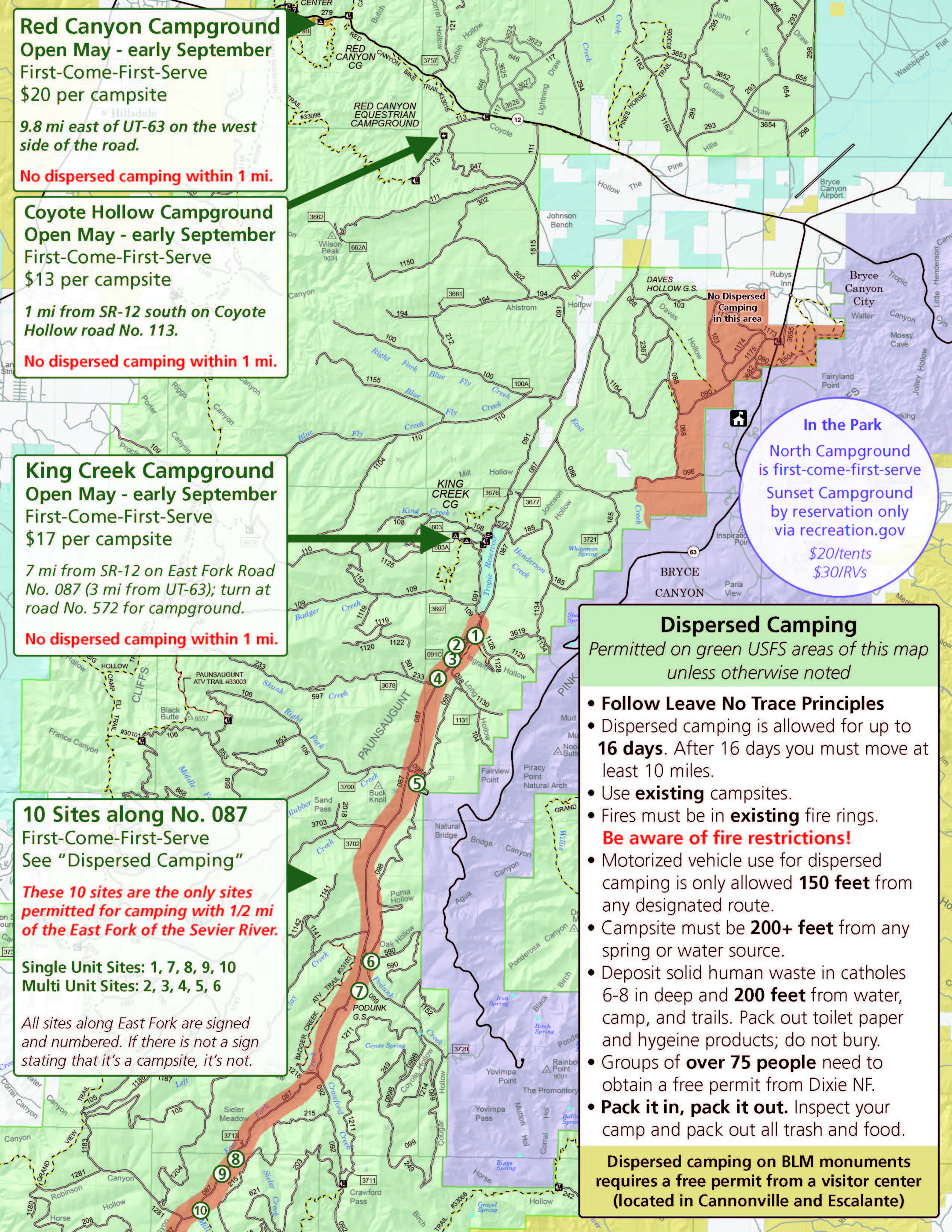 This nearby Bryce Canyon camping map shows camping opportunities in the surrounding region. Information and prices are no longer current, but the map is still useful to learn about other camping opportunities.
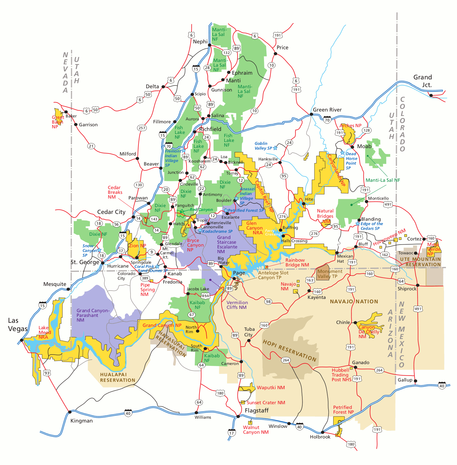 This old Bryce Canyon regional map shows nearby highways and parks (such as Zion, Grand Canyon, and others in Utah/Arizona). Click the image to view a full size map or download the PDF.
Bryce Canyon map prints and gifts
 Printed high-resolution Bryce Canyon map posters and other products are available at the Bryce Canyon Maps store. For art prints, gift ideas, and souvenirs featuring other national parks, support this site by visiting the National Park Maps store; you’ll find items to bring on vacation, keep at home for the memories, or give to your park-enthusiast friends and loved ones.
…and more!
< Return to National Park Maps home
< Return to Park List
< Return to List by State