Redwood maps from the park brochure
 This is a Redwood National Park map from the official NPS brochure. It includes California State Park lands, which are managed in cooperation with the NPS. Click the image to view a full size map or download the PDF.
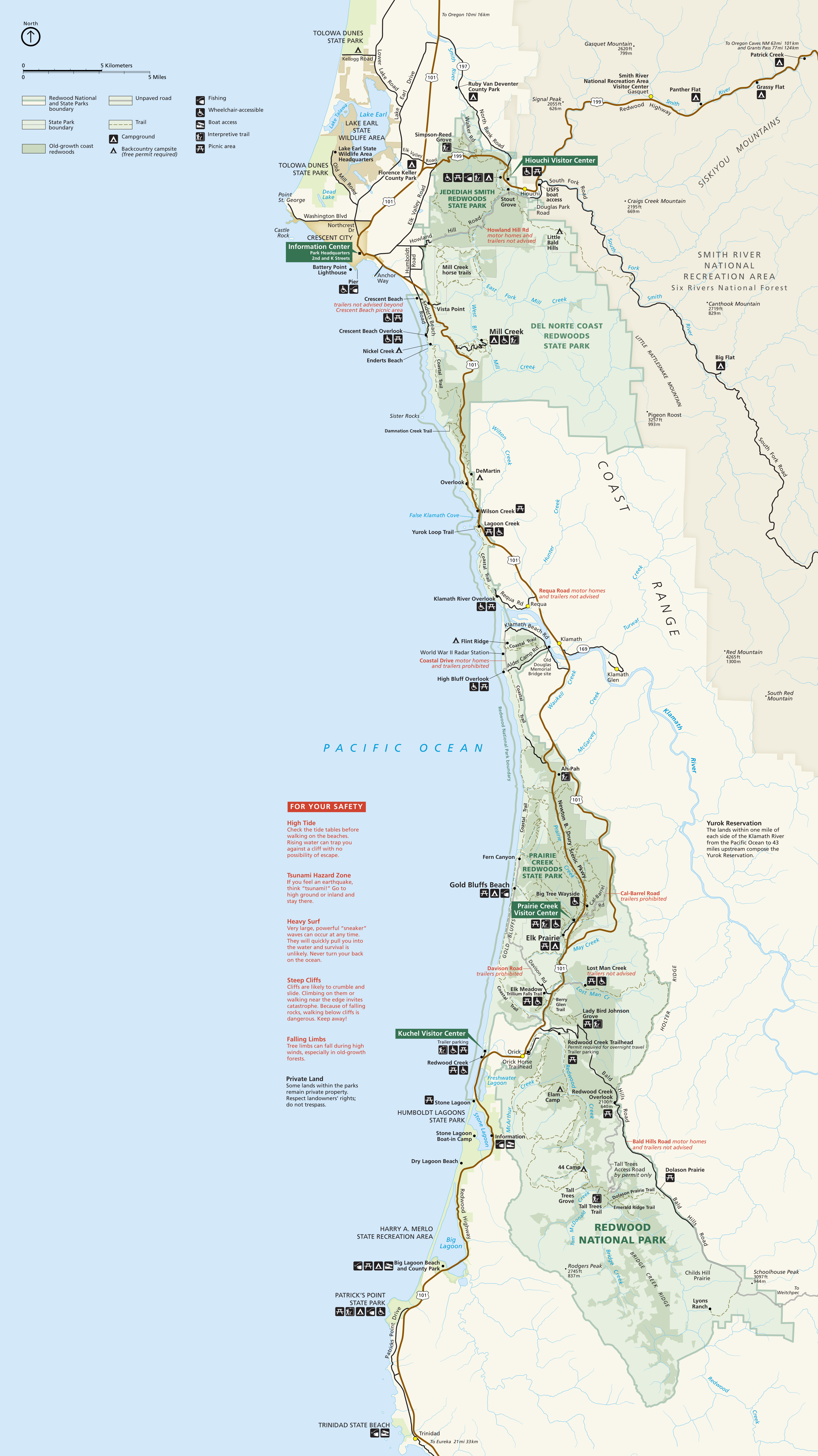
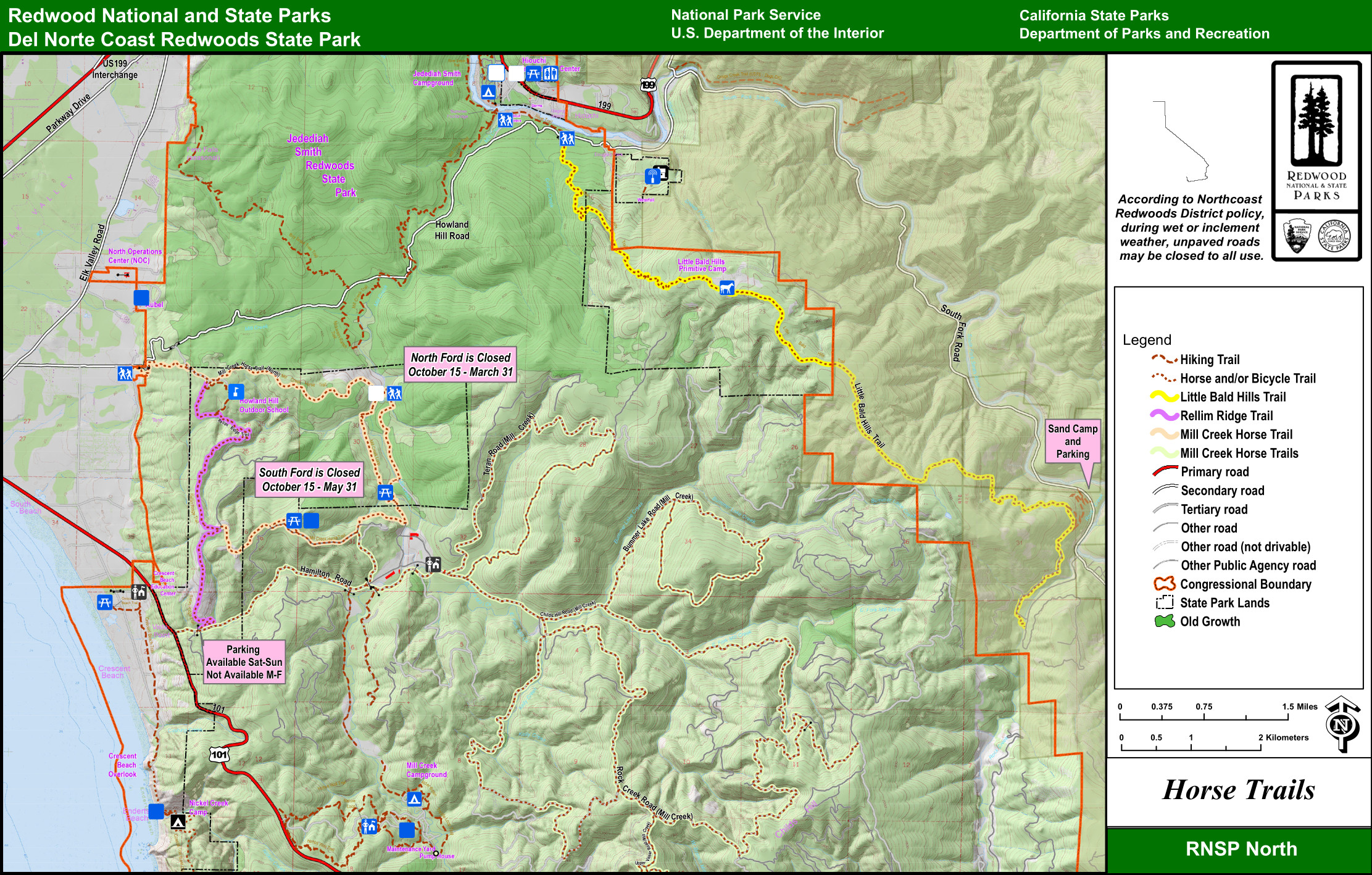
 This is a northern Redwoods map, zooming in on the northern lands in Redwood National and State Parks, including Jedediah Smith Redwoods. Click the image to view a full size map or download the PDF.
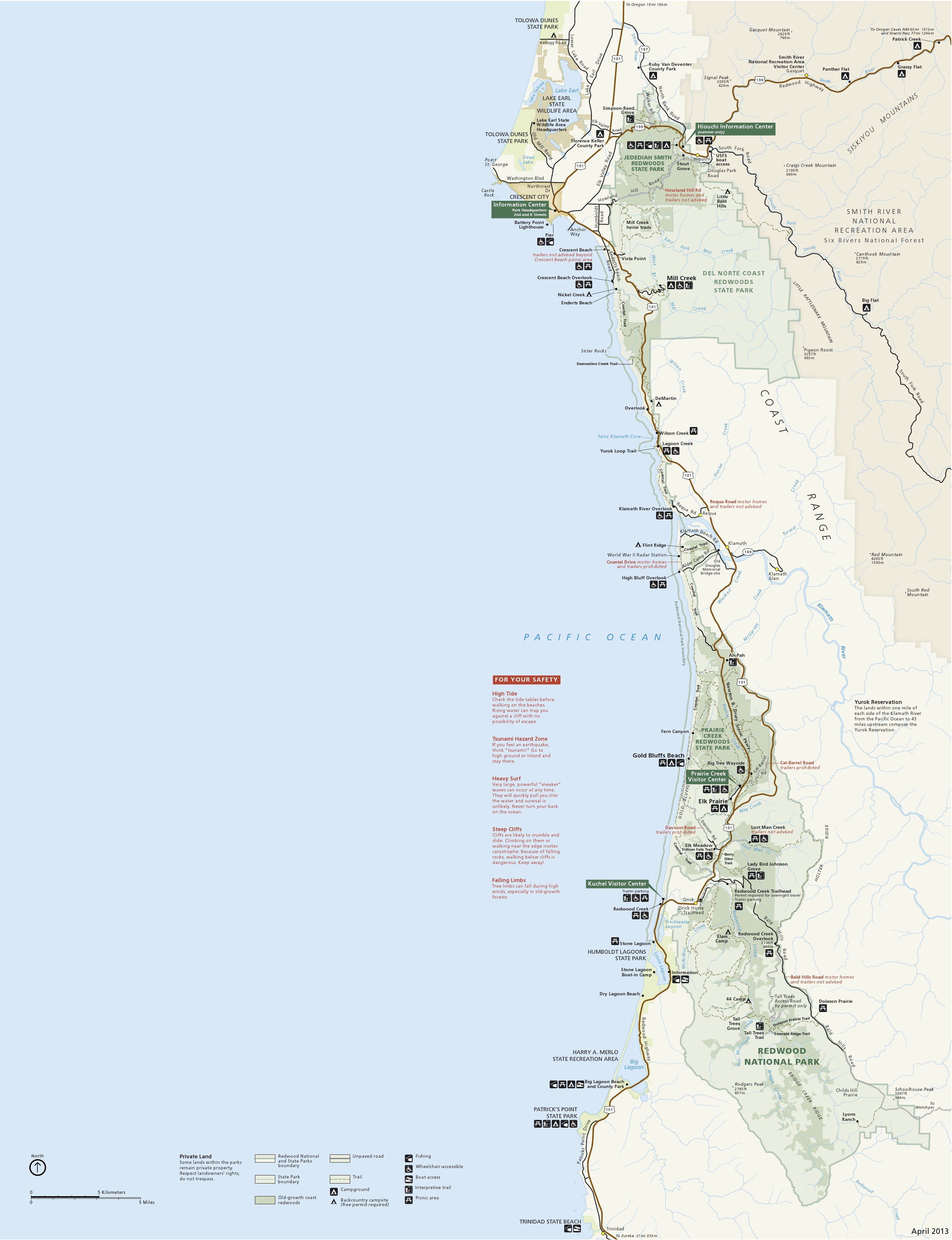
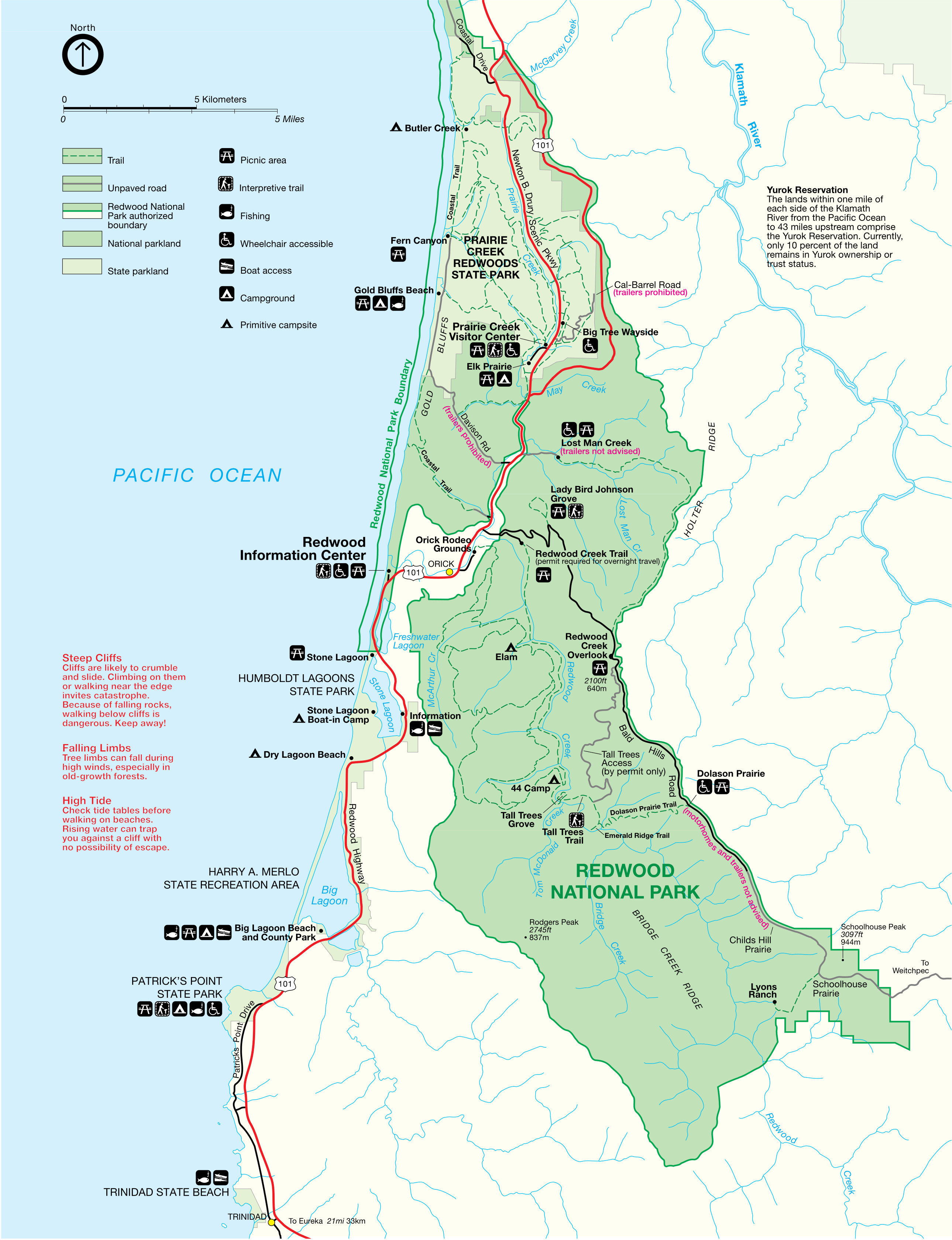 Here’s a southern Redwoods map, zooming in on the (surprise!) southern lands in Redwood National and State Parks, including Prairie Creek Redwoods. Click the image to view a full size map or download the PDF.
Redwood trail maps
 There’s no good free comprehensive trail map of Redwood National and State Parks available online, but the National Geographic Trails Illustrated map is definitely the best one for hiking in the redwoods. My first time backpacking in Redwood National Park, I was a cheap college student and didn’t buy a trail map to save a few dollars; we nearly ended up lost and didn’t find our first campsite well after dark. (We really wished we had that map.)
 The Redwood Creek trail map zooms in to label trails on the Redwood Creek section of the southern part of Redwood National Park. Download the associated Redwood Creek trail guide PDF for more.
Redwood campground maps
Each of the four campgrounds in Redwood National and State Parks is managed by California State Parks. The campground maps below are presented in order from north to south.
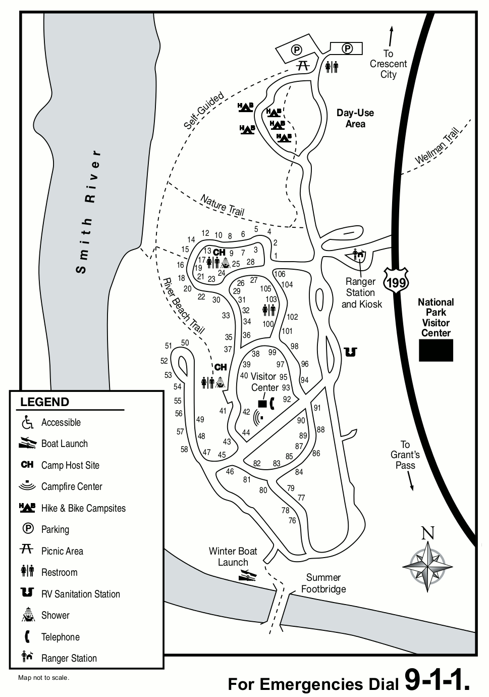
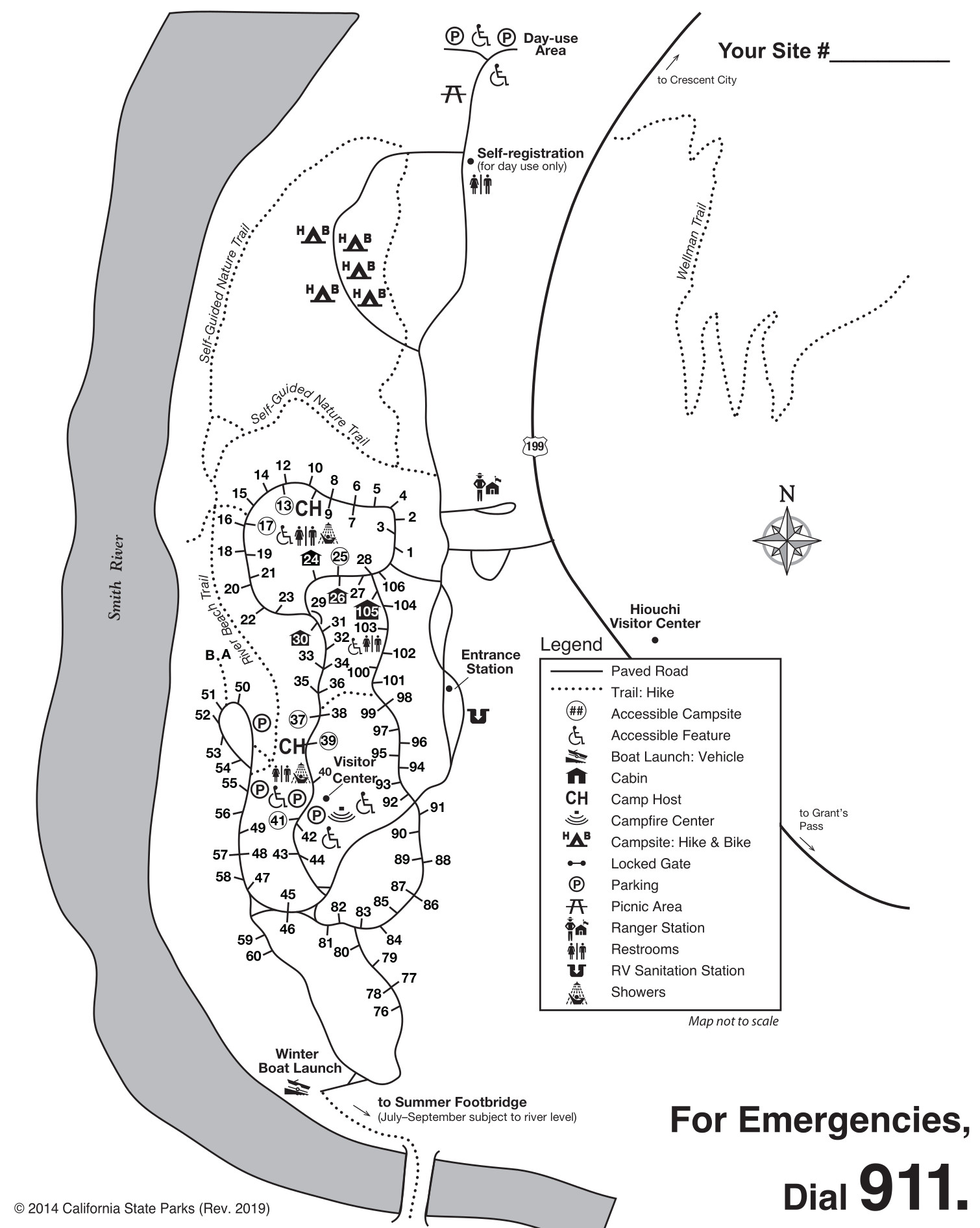 This is a Jedediah Smith Campground map. This popular campground in Jedediah Smith Redwoods State Park is northwest of Crescent City in an old-growth redwood forest along the Smith River.
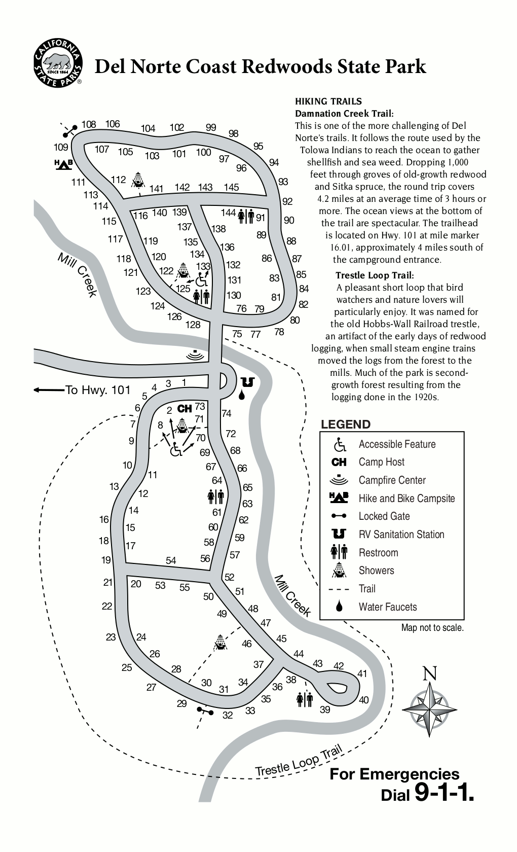
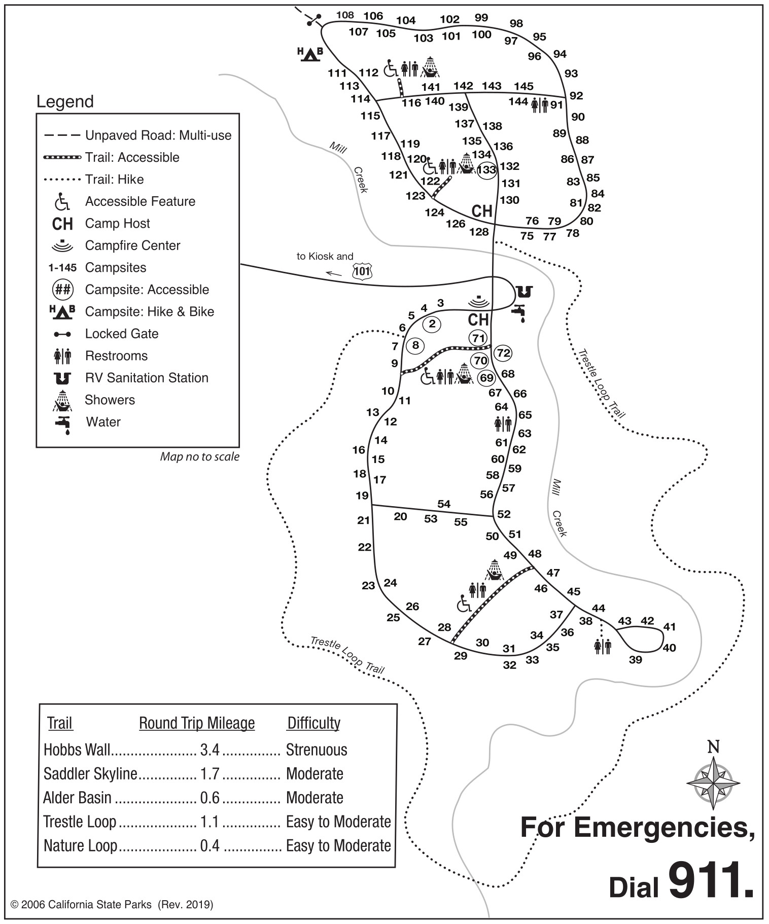 The Mill Creek Campground map shows the layout of this very large campground (nearly 150 sites) located on U.S. 101 south of Crescent City. It’s located in Del Norte Coast Redwoods State Park.
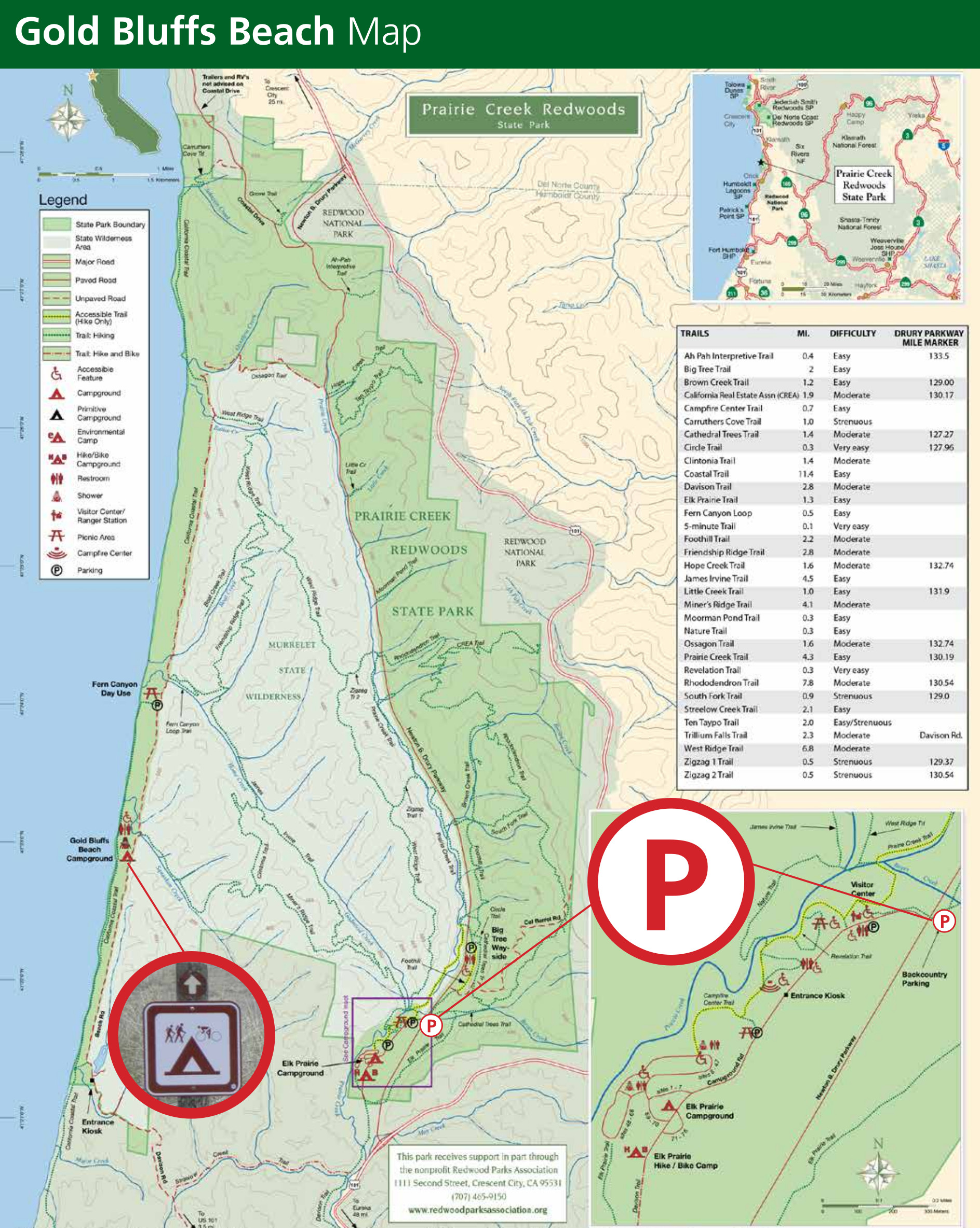
 Here’s a Gold Bluffs Beach Campground map, which is quite small and not suitable for RVs, but is located on the coast in Prairie Creek Redwoods State Park to offer the best beach access of any Redwoods campground.
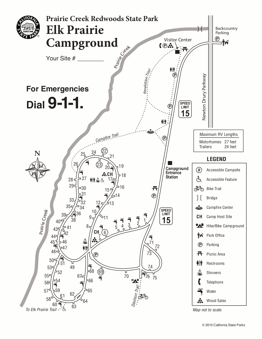
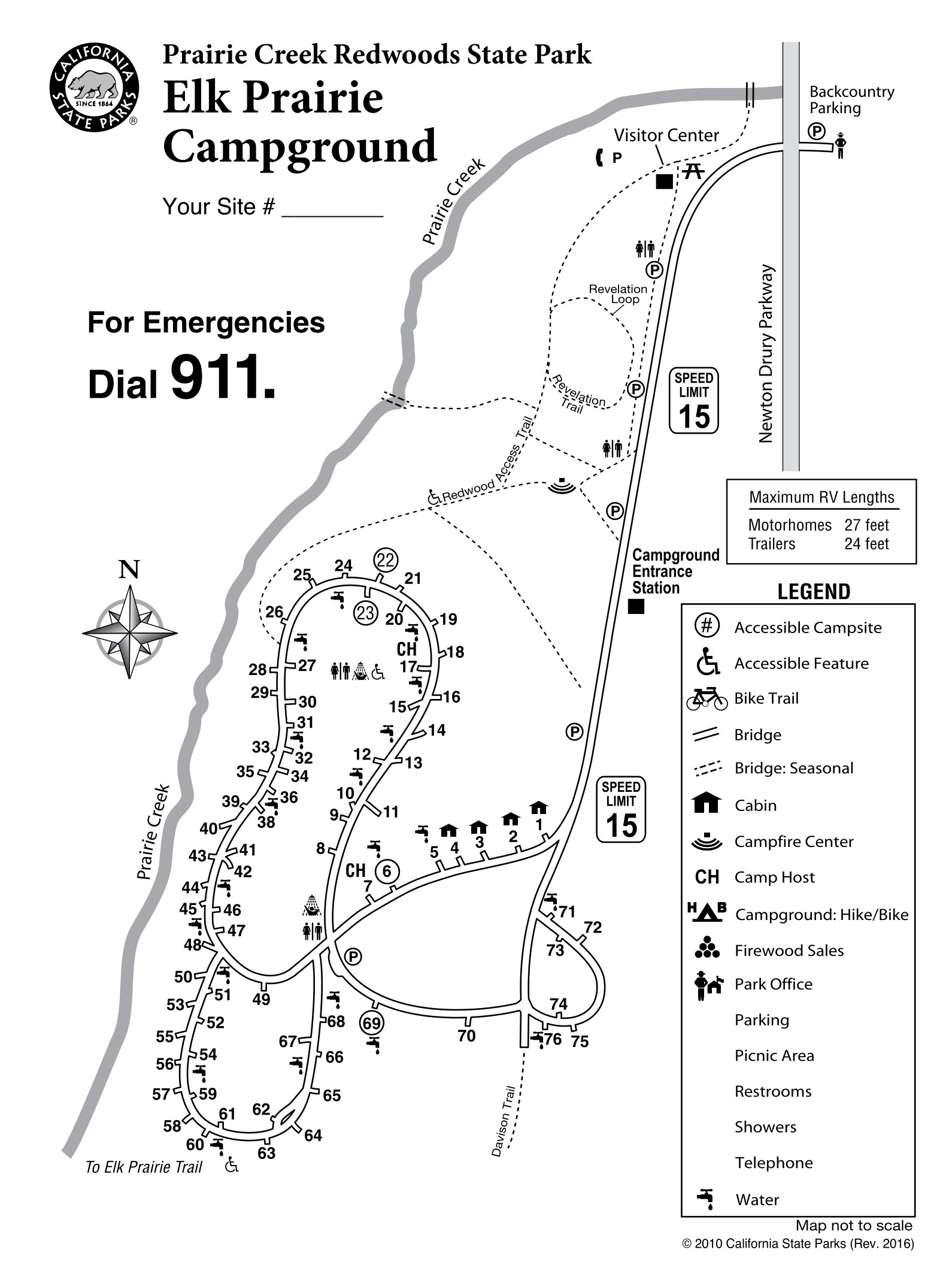 This Elk Prairie Campground map shows another campground in Prairie Creek Redwoods State Park. It’s more centrally located than Gold Bluffs Beach, giving easy access to sights and trails in the southern end of the park.
Redwood lodging map
 To the right you’ll find an Expedia interactive lodging map for Crescent City, which is the largest city near the northern end of Redwood National Park. It’s also nearby the popular Jedediah Smith Redwoods State Park, so it makes a logical base camp for your visit to this part of California. You can also see Expedia’s top-rated Crescent City lodging to compare photos, reviews, and prices of your options in this coastal town.
Redwood backcountry campground maps
The following trail maps show the trails surrounding Redwood backcountry campsites. While they’re aimed at those backpacking in the Redwoods, they should be useful for hikers too. Download the National Park Service’s Redwood Backcountry Trip Planner PDF for more comprehensive information about each campsite, including capacity, access, and food storage.
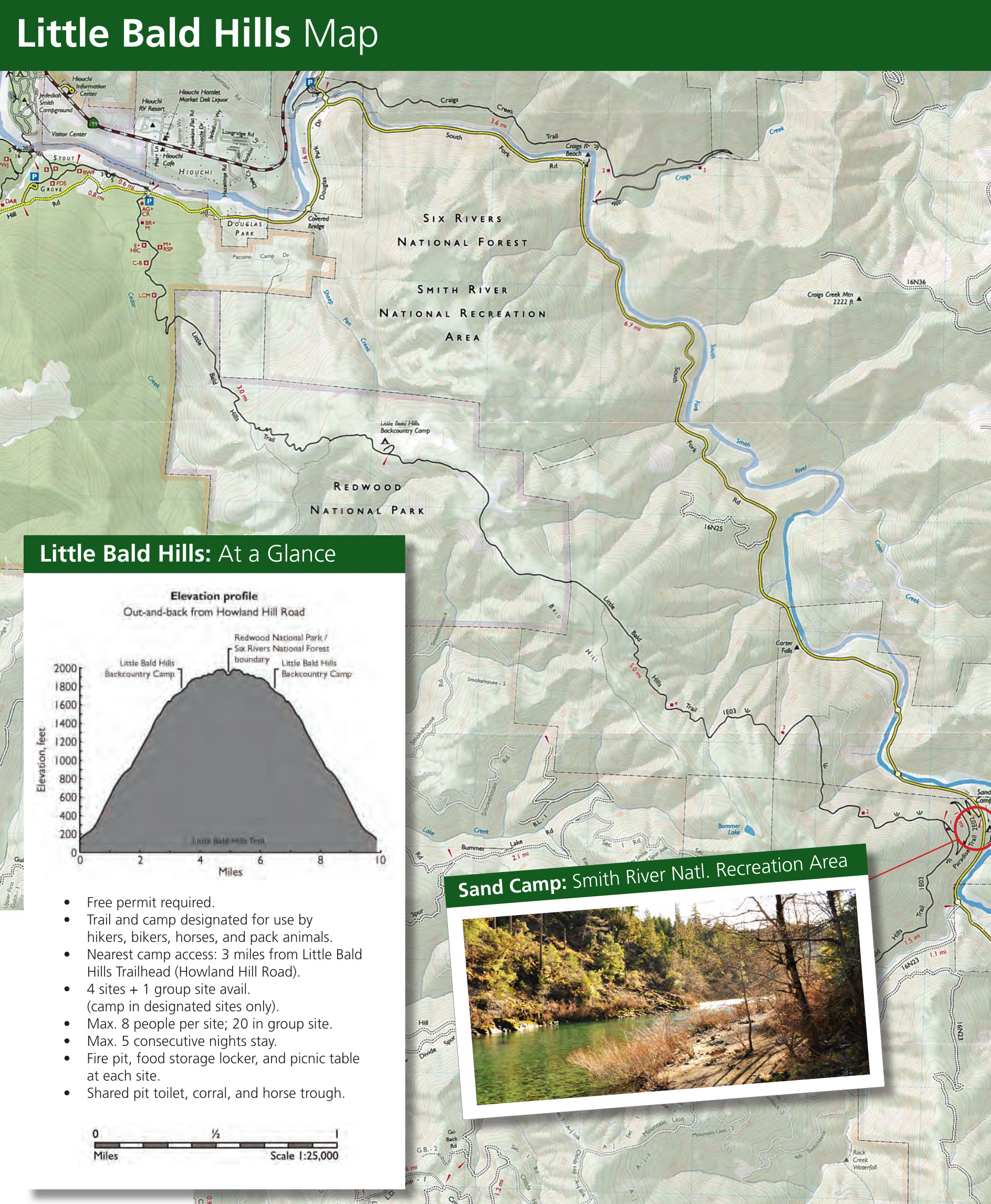 The Little Bald Hills backcountry campground map shows this 4-site campground on the Little Bald Hills Trail. This area can be accessed near Hiouchi, hiking in 3 miles from the parking lot or 5 miles from Sand Camp.
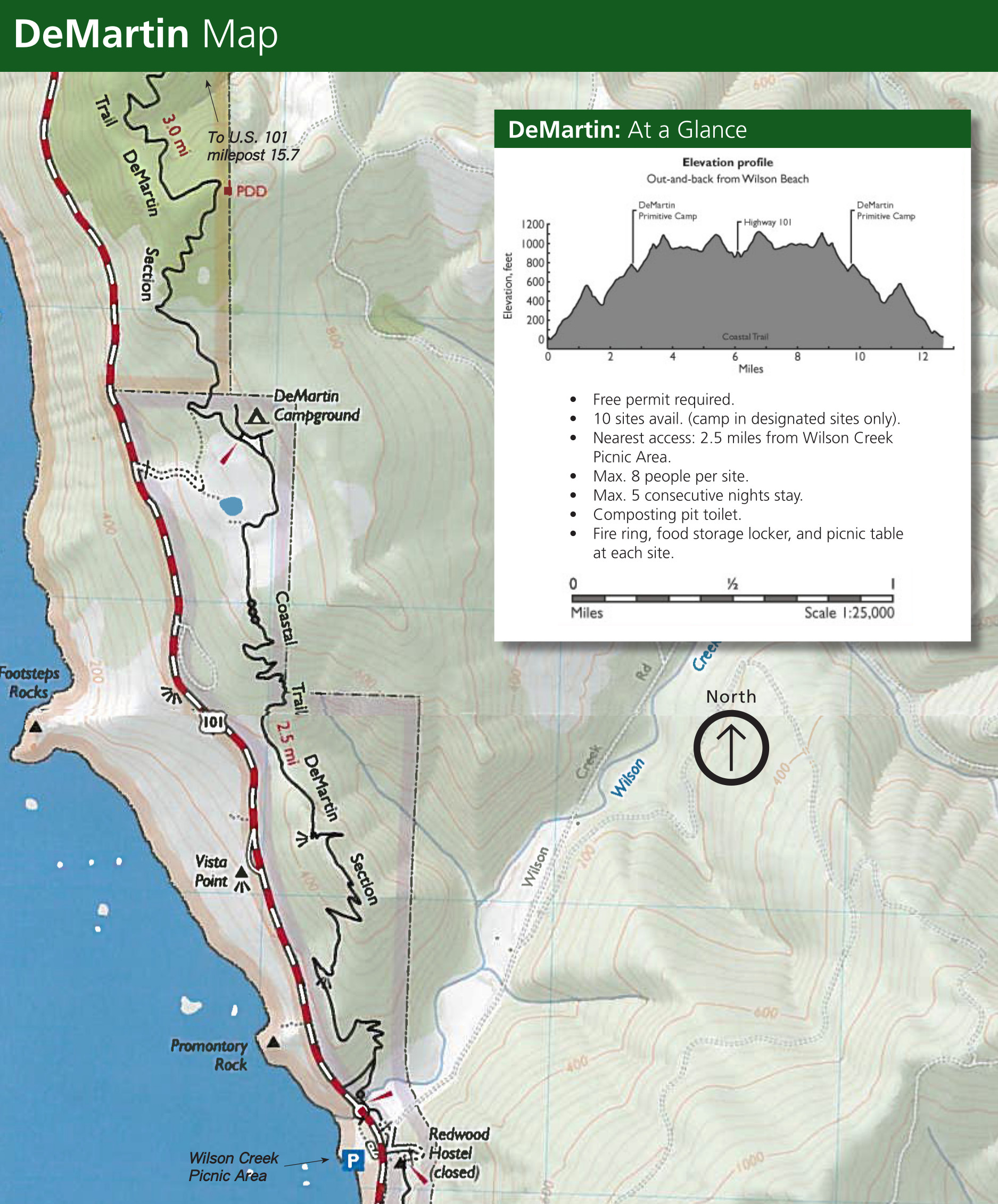 This is a DeMartin backcountry campground map, showing this 10-site campground accessed via the Coastal Trail that roughly parallels U.S. 101. The nearest access point is the Wilson Creek Picnic Area.
 Here’s a Flint Ridge backcountry campground map, showing this 8-site campground located only 1/2-mile from Coastal Drive or 4-1/2 miles from Alder Camp Road at Marshall Pond.
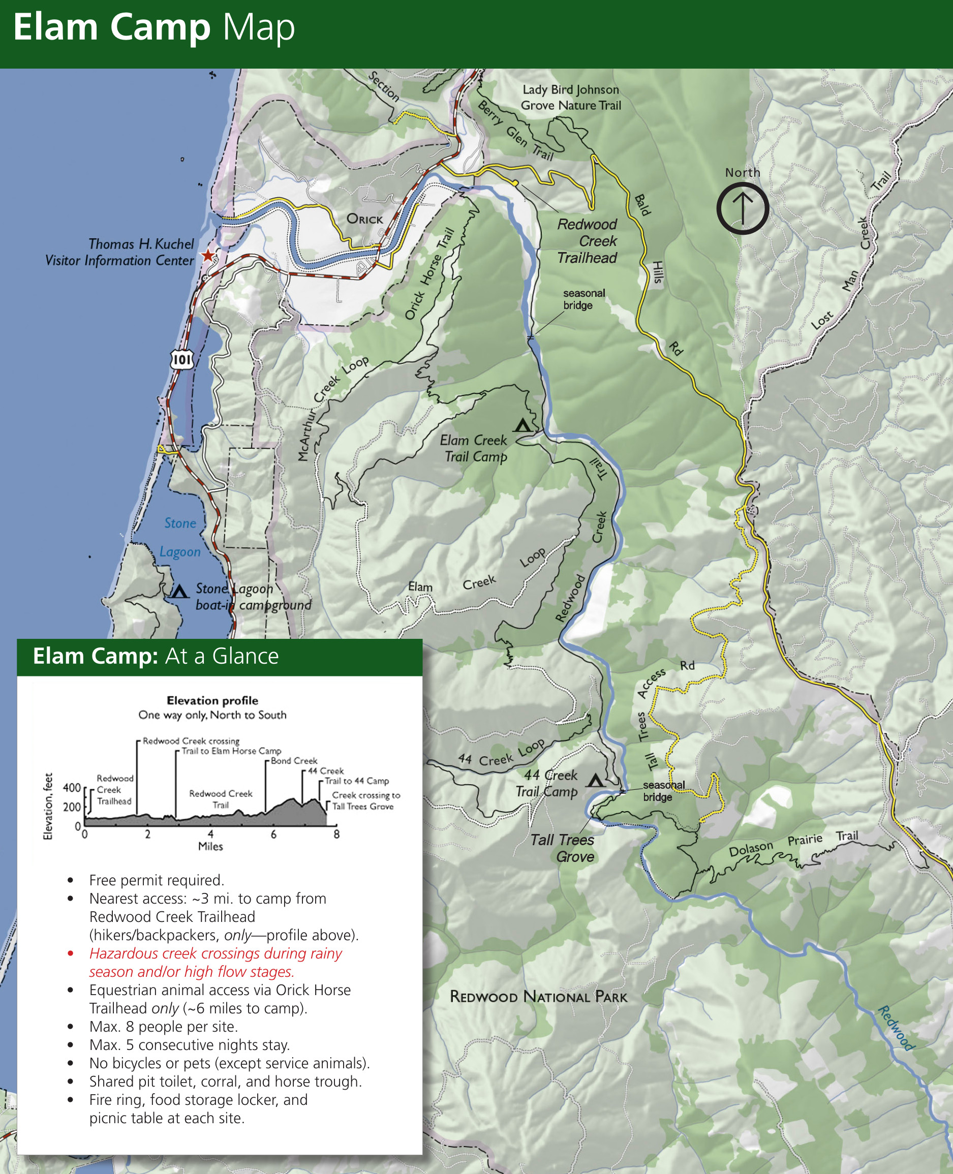 The Elam Camp backcountry campground map shows this 3-site campground located near Redwood Creek. It requires a 3-mile hike from the Redwood Creek Trailhead or 6-1/2 miles from the Tall Trees Trailhead.
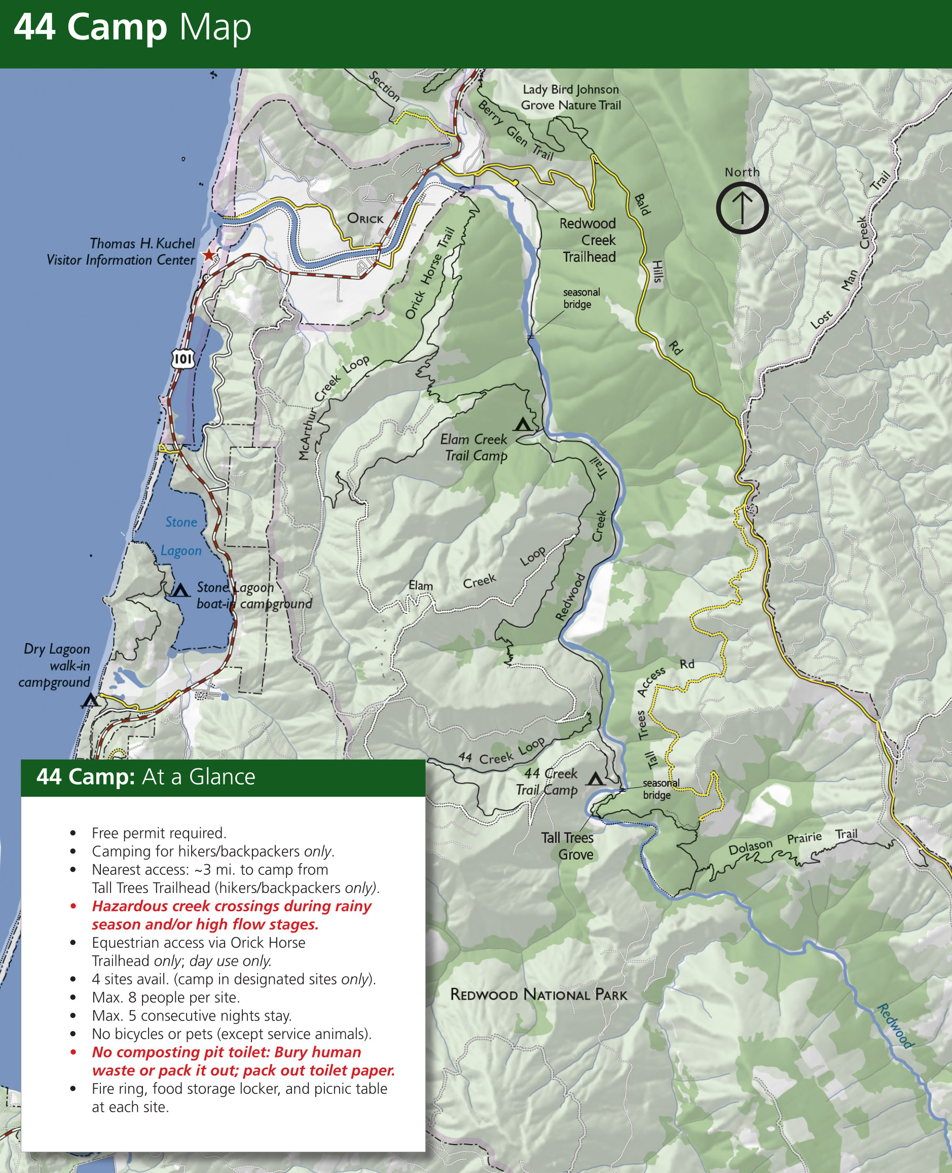 Here’s a 44 Camp backcountry campground map, showing this 4-site campground located about 3 miles south of Elam Camp. This is the nearest camping location to the Tall Trees Grove.
 The Redwood Creek dispersed camping map is a bit different, showing where you can camp on gravel bars upstream of McArthur Creek. This can feel like a more wild experience than in a backcountry campground.
 Here’s a Gold Bluffs Beach hiker/biker campsite map. This shows the location of a campsite in Gold Bluffs Beach Campground that is available only for those with a backcountry permit in hand, before or after their journey.
Redwood bike maps
 Here’s a Redwood bike map that identifies several recommended bike routes in both the national and state parks. Download the associated Redwood cycling guide PDF handout for more information.
 This Elk Meadow bike map zooms in on the Elk Meadow Day Use Area, which connects many bike trails that traverse old logging roads. The Lost Man Creek trail includes some old-growth forests.
Assorted Redwoods maps
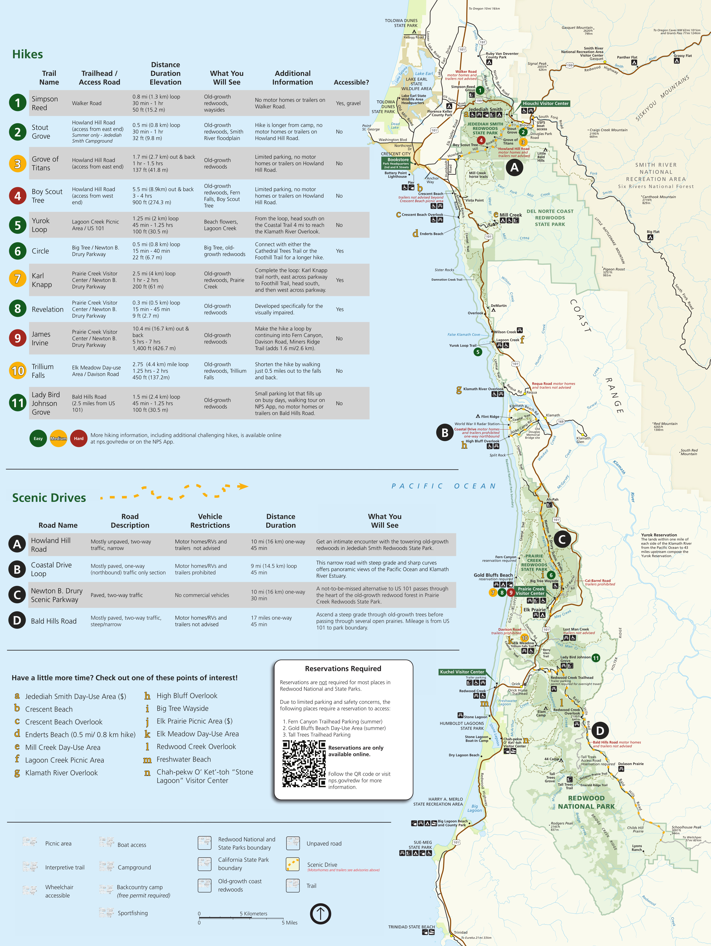 The Redwood National Park visitor guide map comes from the 2023 edition of the Redwood National and State Parks newspaper. It labels the most popular hikes and scenic drives and includes additional points of interest.
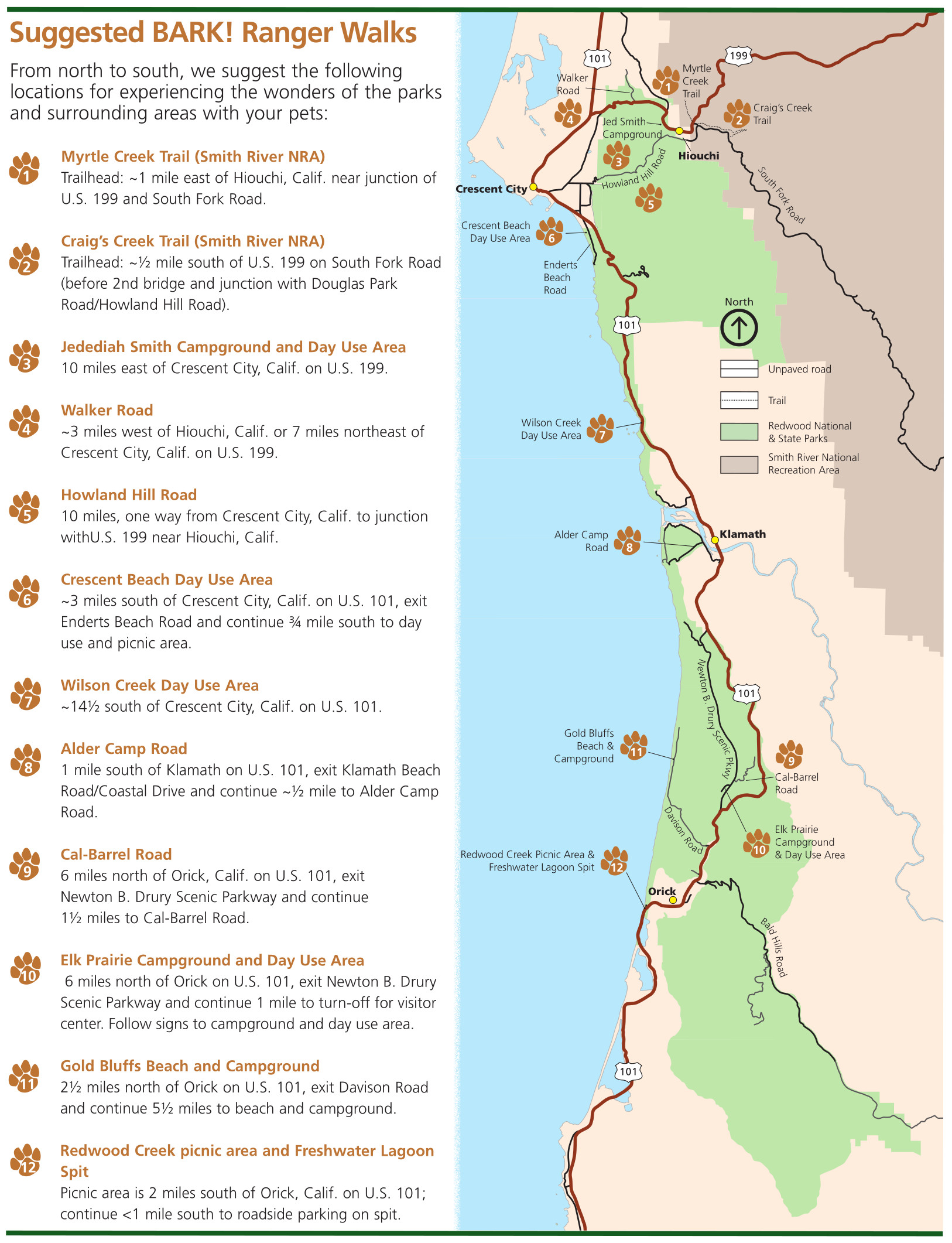 Here’s a Redwood dog trail map, showing a dozen suggested places to hike with your dog or other pet. It includes trails in the north near Jedediah Smith and Crescent City and also in the south near Orick.
 This is a Redwoods region map, zooming out to show the various National Park units nearby: Whiskeytown, Lassen Volcanic, Lava Beds, Crater Lake, and Oregon Caves. Combine them all into one trip!
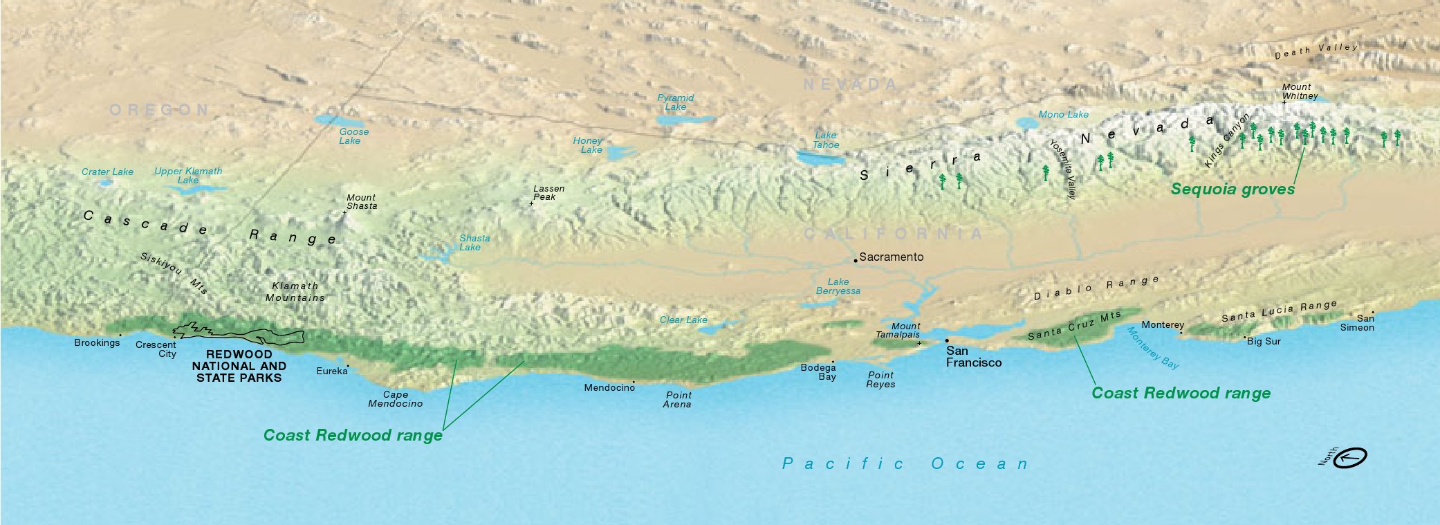 This is a Coast Redwood range map, stretching from southern Oregon to south of Big Sur, California. Click the image to view a full size map or download the PDF.
Redwood horse trail maps
 Here’s a Redwood National and State Parks horse trail map. It shows both NPS and state park lands with designated pack animal trails. You can also download the PDF Redwood horse trail guide.
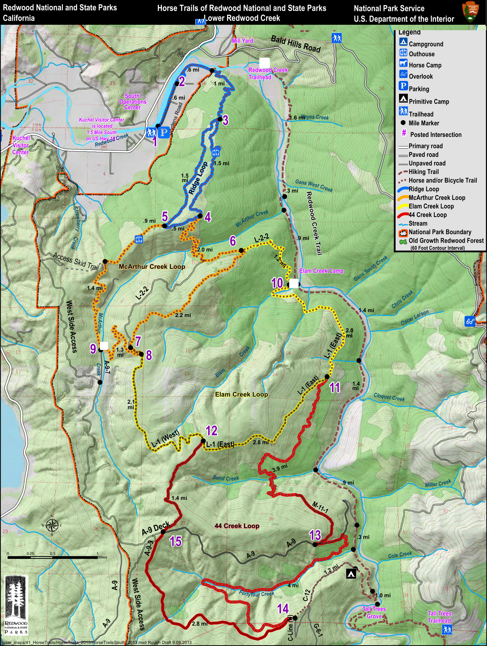 This is a Redwood Creek horse trail map, zooming in on the southern section of the national park to show horse trails. Download the PDF Redwood horse trail guide for additional information.
Archived Redwood maps
As the National Park Service releases new and updated maps, I do my best to add them to this page. As maps get replaced, I move the old ones down to this section. I think it’s important to preserve them so we can see how parks change over time, but just keep in mind that the ones in this section have newer ones further up this page.
 This is the old Redwood National Park map from the mid-2010s, showing both the national park and the local redwoods state parks. Click the image to view a full size map or download the PDF.
 Here’s an old Jedediah Smith Campground map from the mid-2010s. This very popular campground is located in Jedediah Smith Redwoods State Park and is open all year and includes hike-in and bike-in sites.
 Here’s an old Mill Creek Campground map (from the mid-2010s), which is the largest campground in Redwood National and State Parks. It is in Del Norte Coast Redwoods State Park and has over 100 campsites.
 Here’s an old Elk Prairie Campground map from the mid-2010s. This campground is located nearest the Prairie Creek Visitor Center in the southern part of the park and includes about 70 campsites.
…and more!
< Return to National Park Maps home
< Return to Park List
< Return to List by State