Lake Clark map from the park brochure
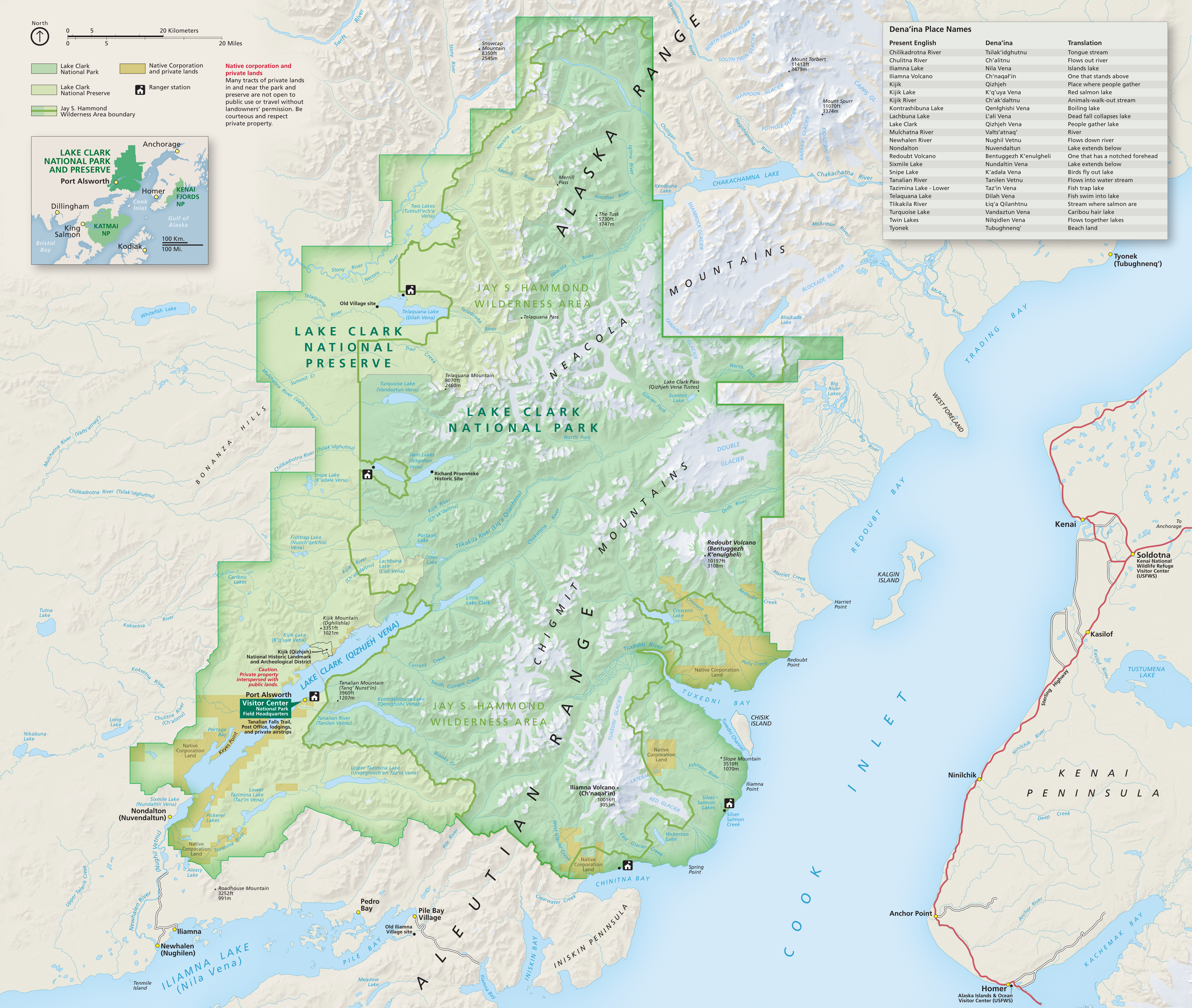
 This is the official Lake Clark National Park map from the NPS brochure. It includes a handy guide to Dena’ina place names, helping users understand that Lake Clark features already had names before Western exploration.
Lake Clark trail maps
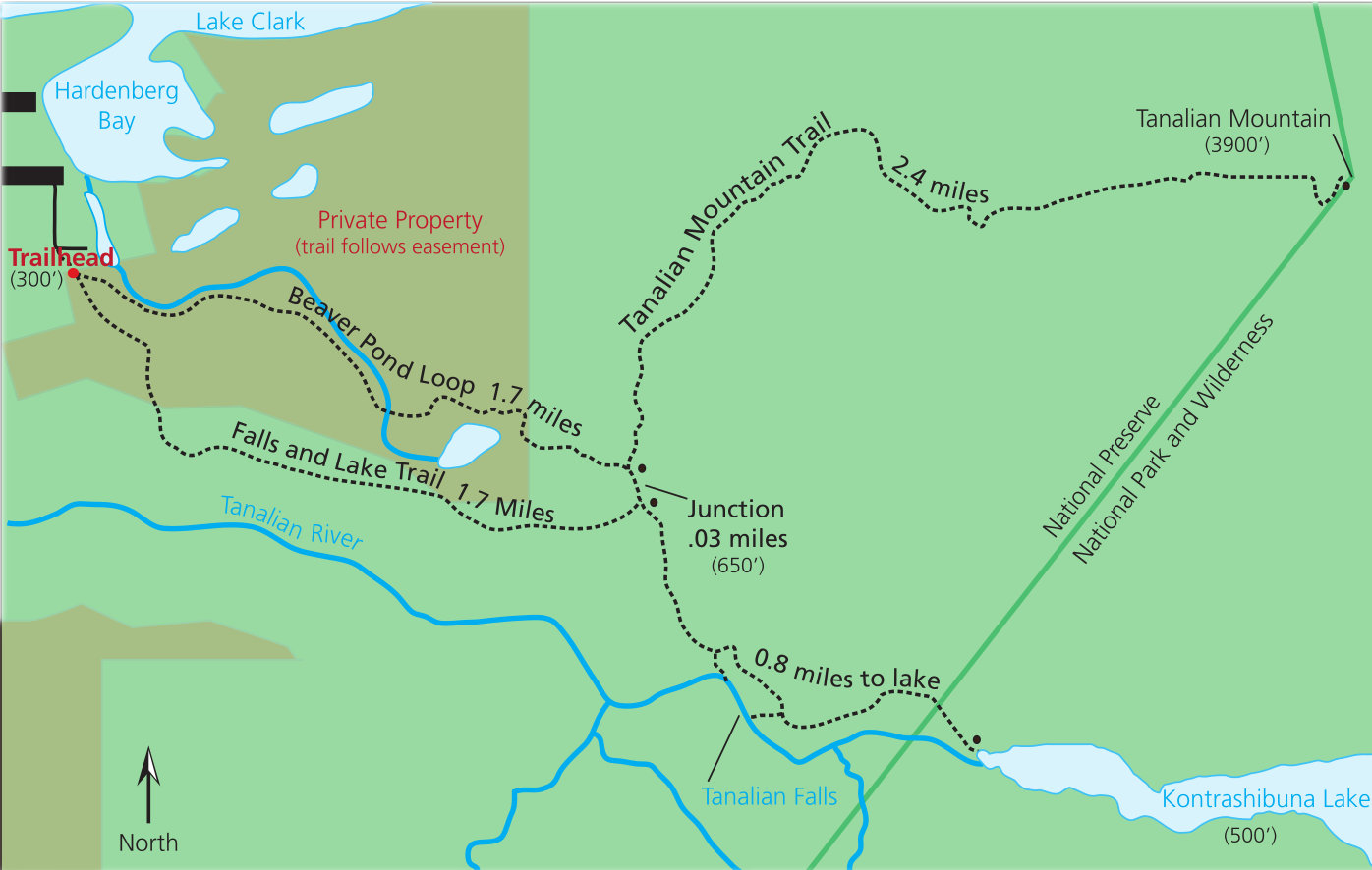
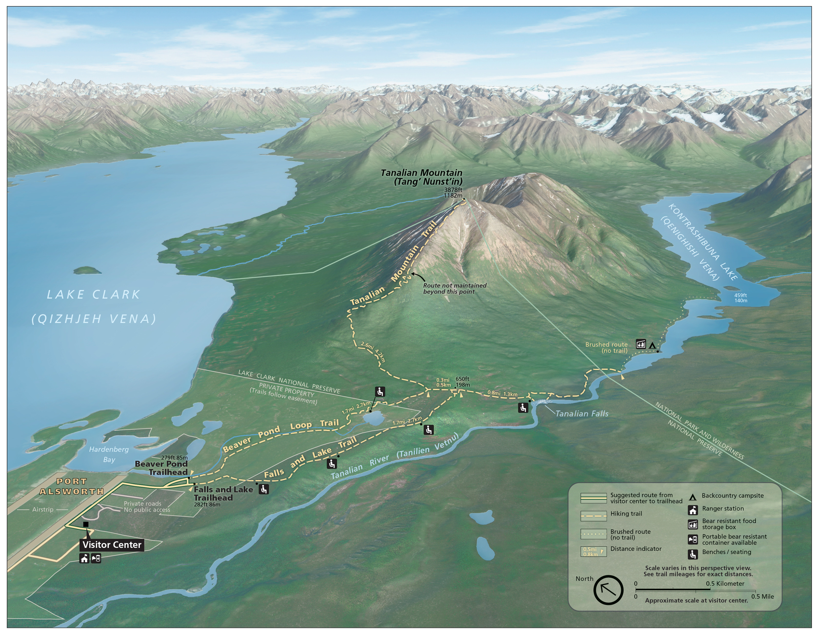 The Lake Clark National Park trail map shows the Tanalian Trails System in Port Alsworth. You’ll find the shorter Tanalian Falls and Beaver Pond trails, as well as the strenuous Tanalian Mountain hike.
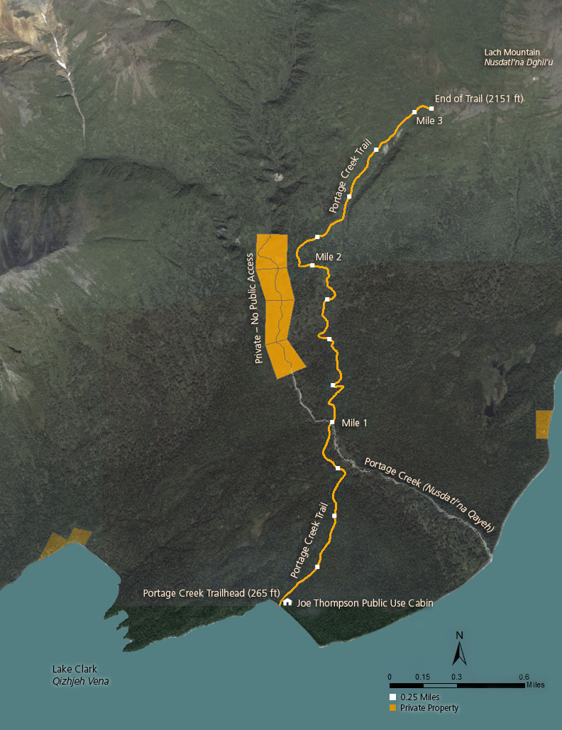 The Portage Creek trail map shows the only other maintained trail in the national park. This trail departs from the Joe Thompson public use cabin and can be accessed by boat or floatplane.
Dick Proenneke Cabin maps
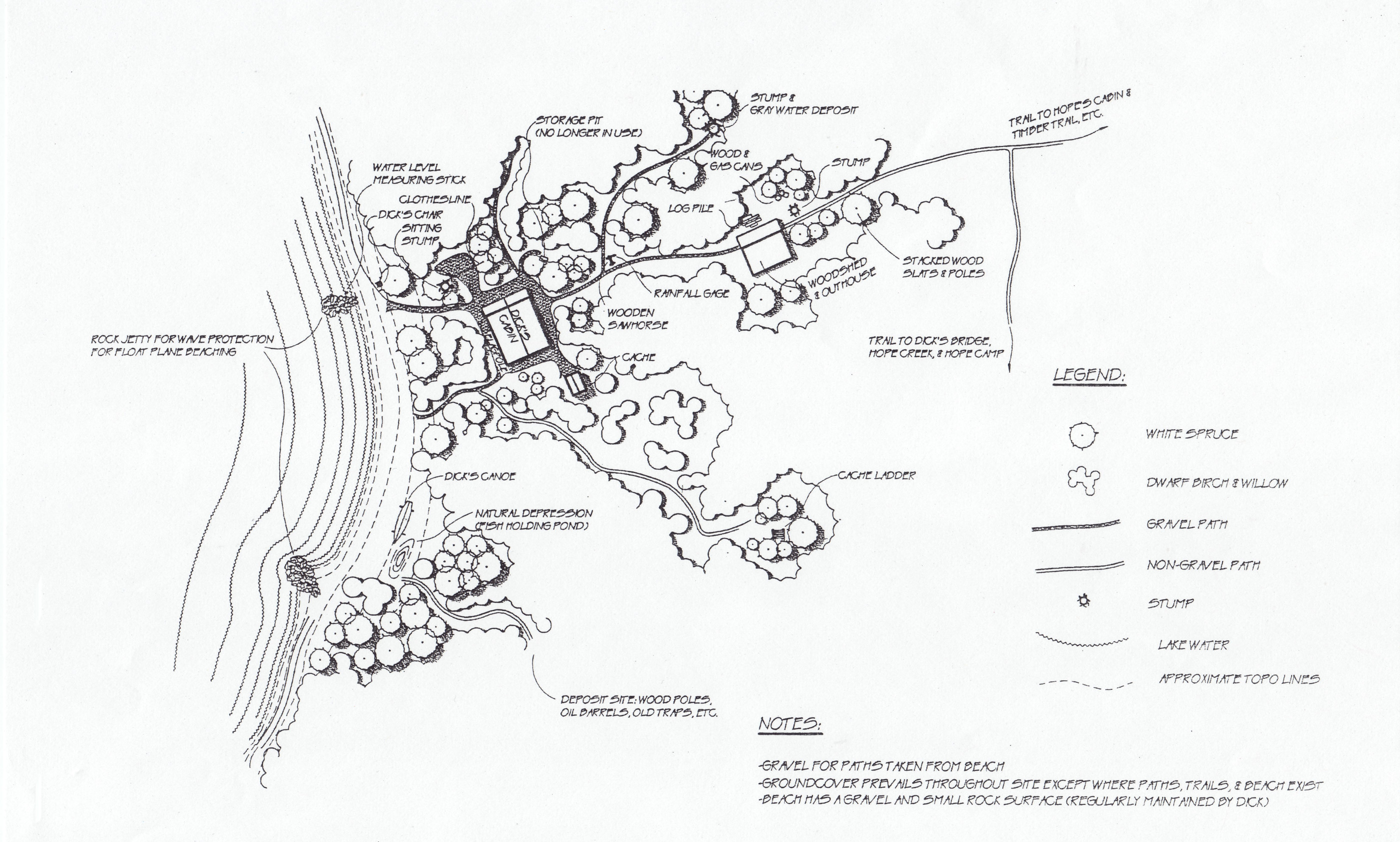 This is a Richard “Dick” Proenneke Cabin map. Made famous in the book One Man’s Wilderness: An Alaskan Odyssey and the PBS documentary Alone in the Wilderness, this cabin is open for visiting during the summer.
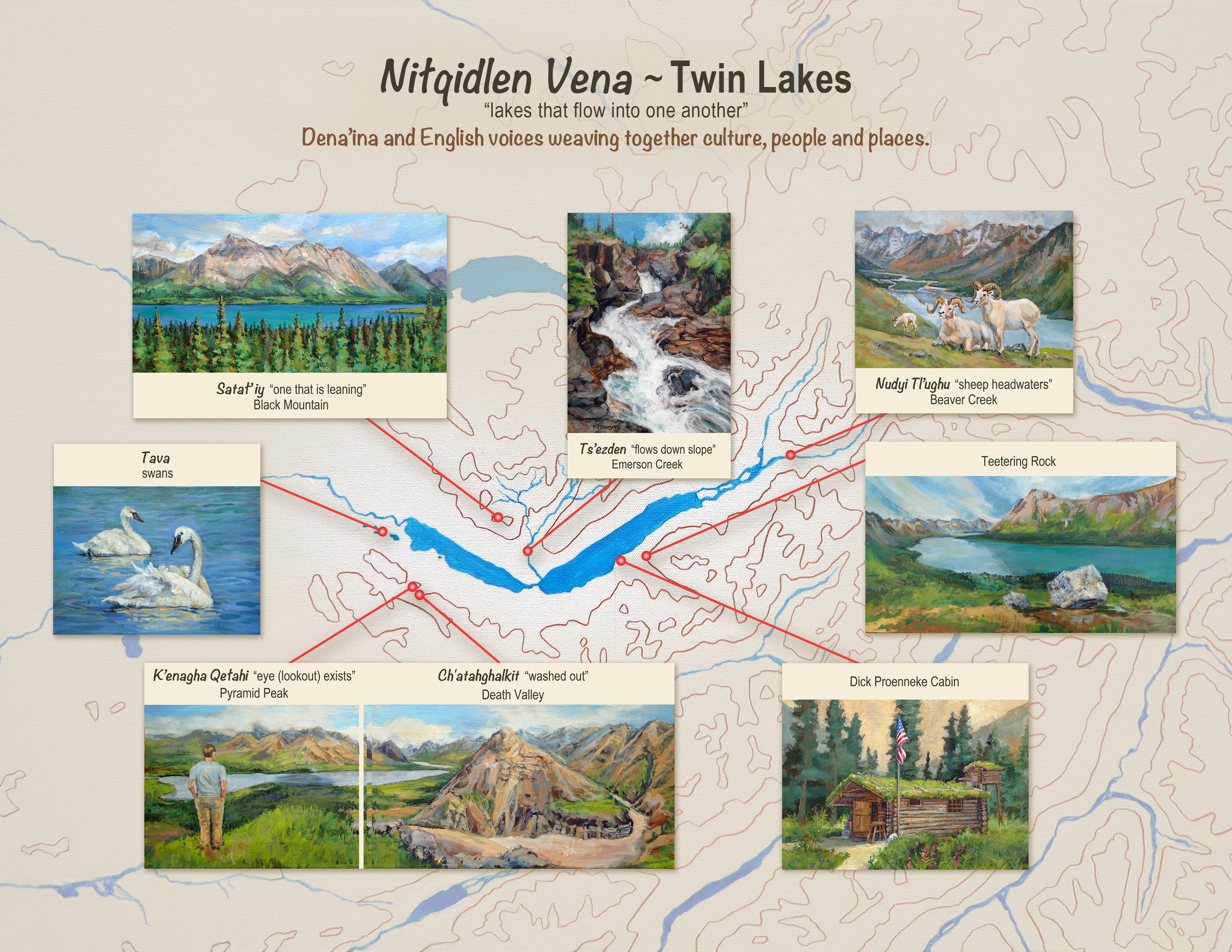 This is a Twin Lakes map, highlighting attractions in the Twin Lakes near the Proenneke Cabin, including Pyramid Peak, Black Mountain, Death Valley, Emerson Creek, Beaver Creek, and Teetering Rock.
Assorted Lake Clark maps
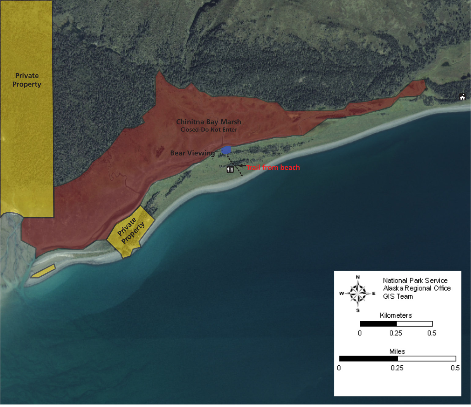
 Here’s a Chinitna Bay map, zooming in on the popular bear viewing area at the Chinitna Bay salt marsh, where bears commonly graze in early summer. Most arrive here using a bush plane to land on the beach.
 This Lake Clark public use cabin map shows the two cabins located on Lake Clark. They are available for overnight stays and are equipped with wooden bunks and a wood stove, table, chairs and detached outhouse.
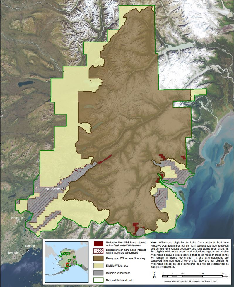 The Lake Clark National Park wilderness map highlights park lands that are designated wilderness, which is the highest level of protection offered by the U.S. government, and prohibits any sort of development.
Here’s a vegetation map of Lake Clark, showing 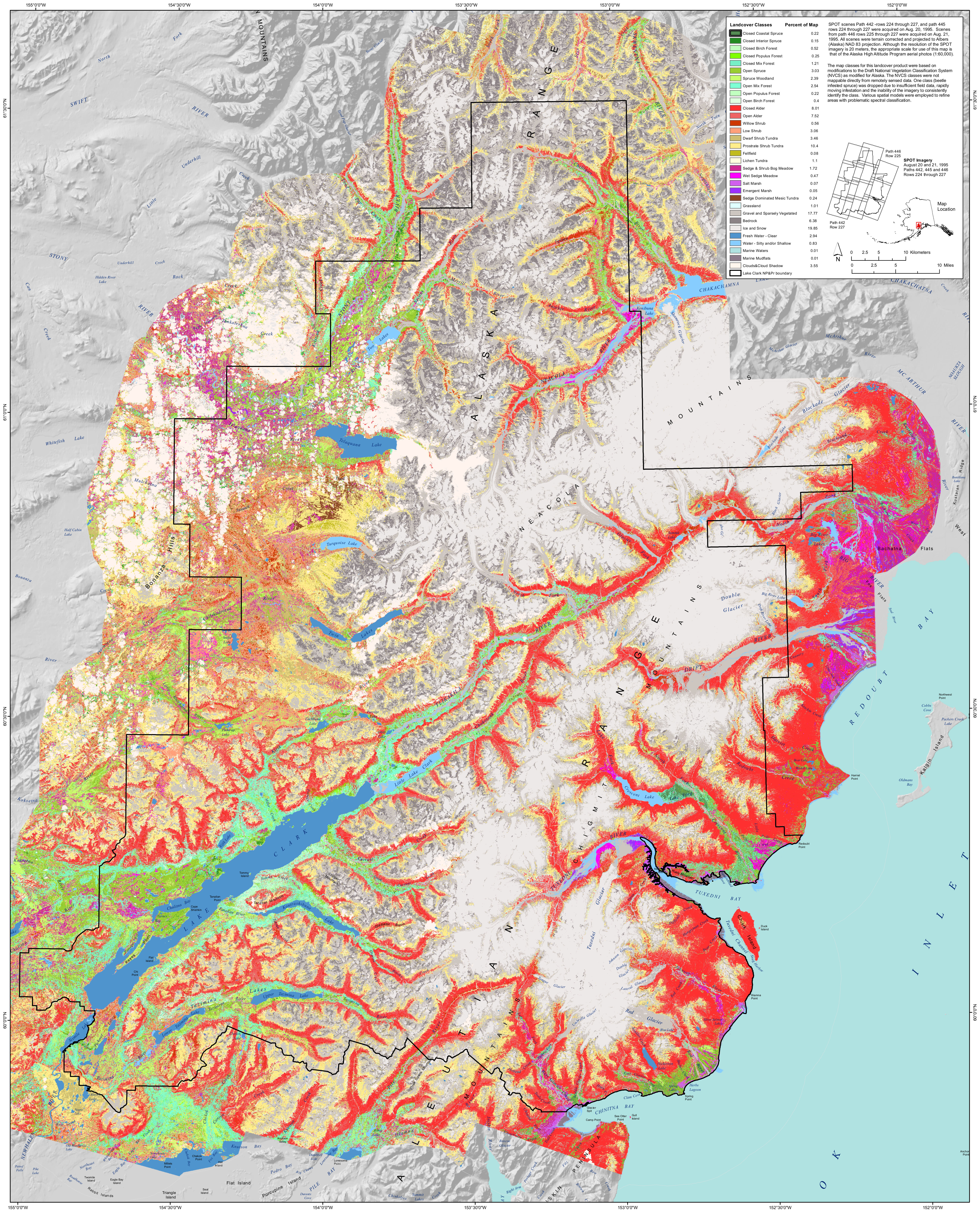 the variety of different types of forests in the park, along with rock, ice, marsh, tundra, and other land cover types in this diverse park.
Lake Clark regional maps
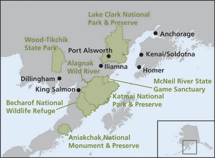 This Lake Clark regional map shows all the parks of the Alaska Peninsula: national parks (including Katmai National Park), national wildlife refuges, and parks managed by the state of Alaska.
 This Lake Clark area map focuses on NPS units, showing both Kenai Fjords National Park (on the Kenai Peninsula) and Katmai National Park (on the Alaska Peninsula), along with towns like Homer, Kodiak, and King Salmon.
Archived Lake Clark maps
The National Park Service often releases new maps and updates old ones. Accordingly, any maps in the section below have since been superseded by maps further up this page. But rather than delete old maps, I archive them here so users can see how parks (and their maps) change over time.
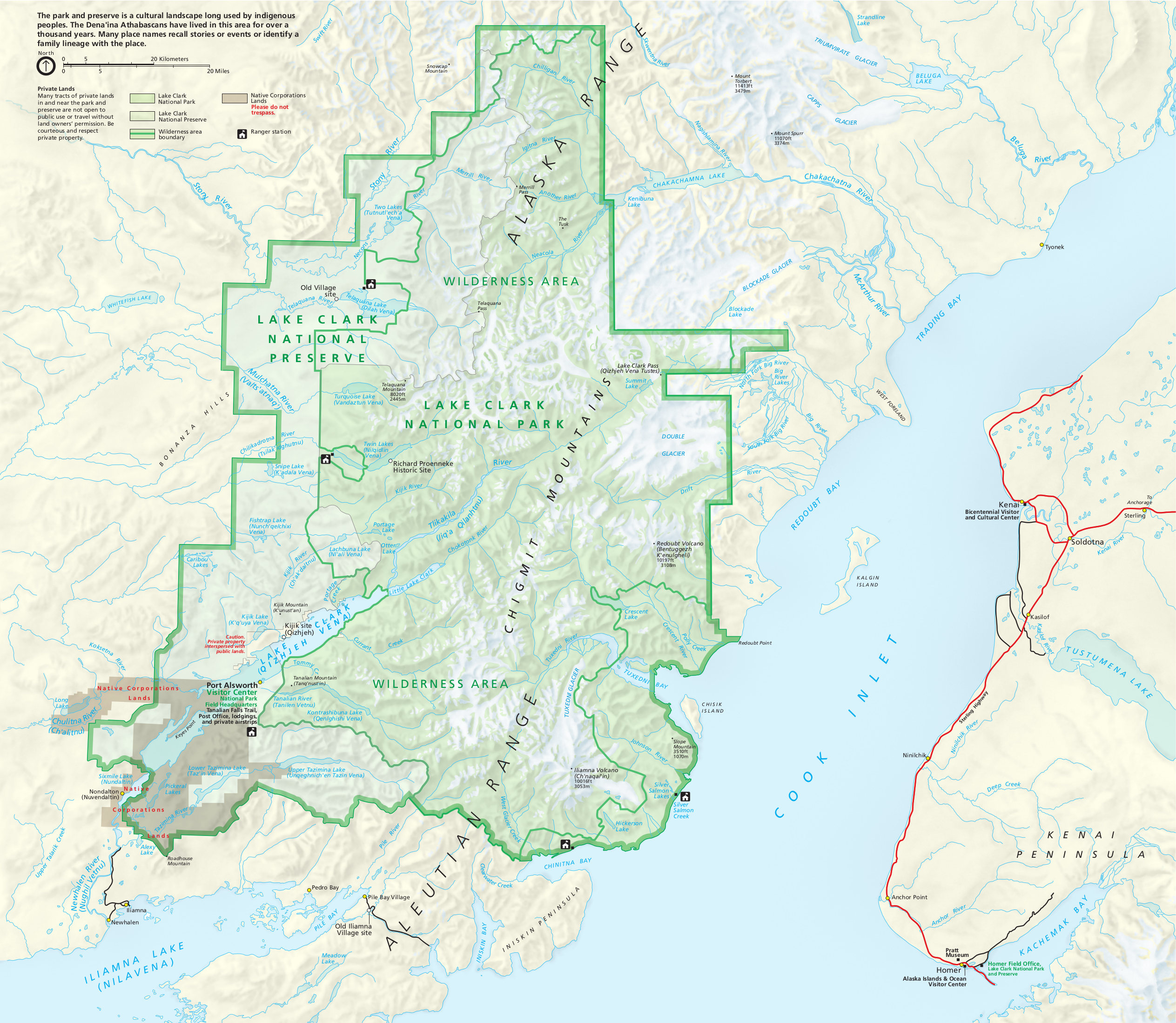
 This is the Lake Clark National Park map from 2018. Port Alsworth and associated facilities along the shores of Lake Clark are highlighted, and the rest of the park is largely untrammeled wilderness.
 This is the old Lake Clark map from the mid-2010s official brochure, showing Redoubt Volcano, Dick Proenneke’s cabin, and the entire park and preserve. Click the image to view a full size map or download the PDF.
 Here is the old Tanalian Trails map from the mid-2010s, showing which were then the only maintained trails in Lake Clark National Park, departing from Port Alsworth and the visitor center area near Hardenberg Bay.
 This is an old Chinitna Bay bear viewing map, showing the bear viewing area, beach, marsh closure, and access trail from Chinitna Bay, which is a part of the Cook Inlet.
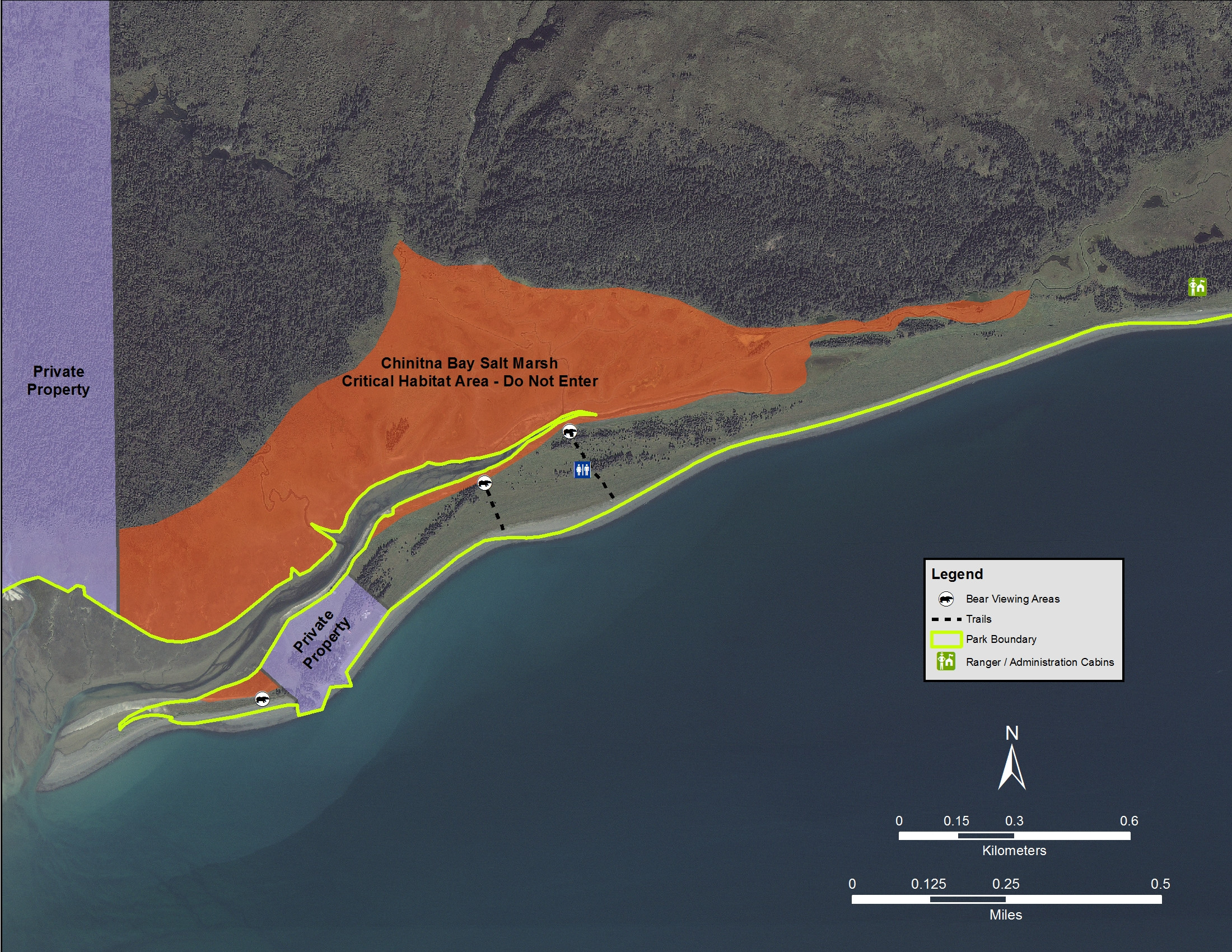
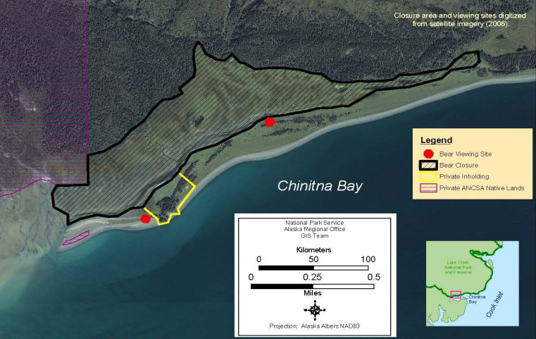 Here’s an alternate old Chinitna Bay map made from satellite imagery. This one doesn’t show the access trail from the beach, but it does show an additional bear viewing area not on the map above.
…and more!
< Return to National Park Maps home
< Return to Park List
< Return to List by State