Blue Ridge Parkway map from the park brochure
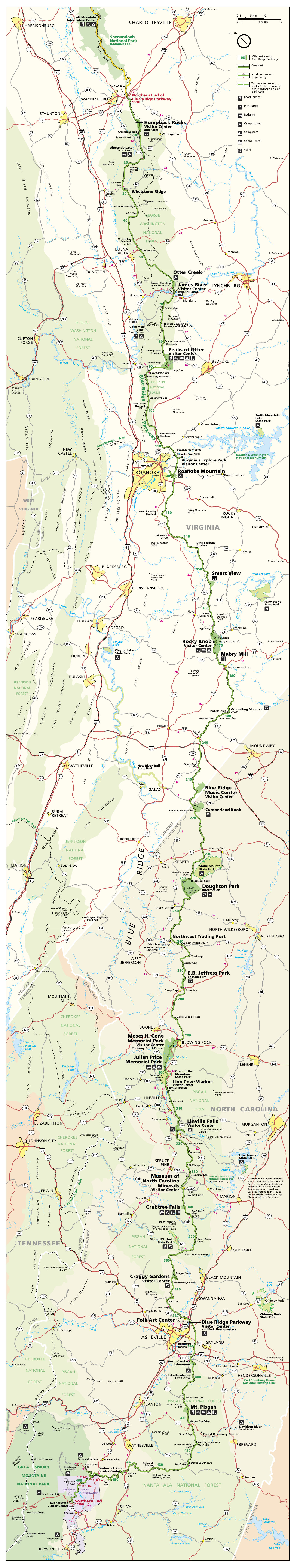
 Here’s the complete Blue Ridge Parkway map from the National Park Service brochure, showing the entire length of the parkway throughout North Carolina and Virginia. It was last updated in 2019.
Blue Ridge Parkway trail maps
 The trail maps below are arranged in order along the parkway from north to south. Although there’s not a single comprehensive hiking map of the entire parkway that I can find, the National Geographic Trails Illustrated series does have a waterproof Blue Ridge Parkway destination map, which is the best single travel map for showing the entire parkway and all associated roads and points of interest.
 Here is a Humpback Rocks trail map, showing the Appalachian Trail and other routes on the northern edge of the Blue Ridge Parkway where it approaches Shenandoah National Park.
 This Otter Creek and James River trail map shows trails on the northern end of the parkway (near the Otter Creek Campground and James River Visitor Center), including the Trail of Trees and Otter Lake Loop Trail.
 Here’s a Peaks of Otter trail map, featuring the Flat Top Trail, Harkening Hill Trail, Fallingwater Cascades Trail, and others near the Peaks of Otter Lodge, visitor center, and campground.
 This is a Roanoke Valley trail map, showing trails near the Roanoke Mountain Campground, Roanoke River, and Explore Park Visitor Center. You’ll find several parking areas and overlooks here.
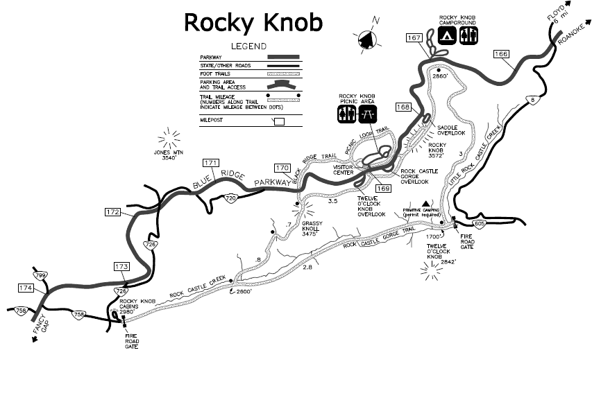
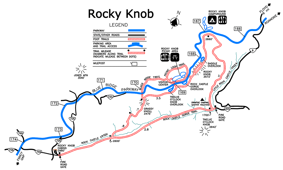 This Rocky Knob map includes a few trails: Rock Castle Gorge Trail, Black Ridge Trail, Smart View Trail, and the Rocky Knob Picnic Area Trail. Note too the backcountry campsite in Rock Castle Gorge, available by reservation.
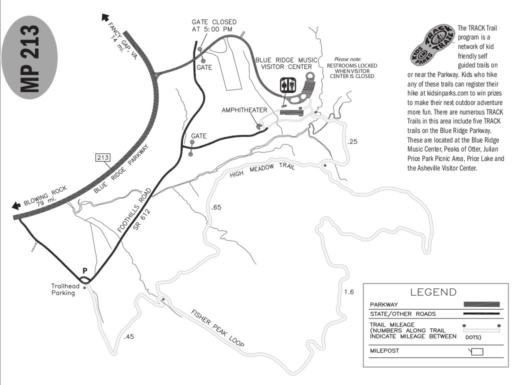 The Blue Ridge Music Center trail map zooms in on the music center itself, showing the amphitheater, parking area, and a couple trails (High Meadow Trail and Fisher Peak Loop) that make some nice loops.
 Here is a Cumberland Knob trail map, showing the Gully Creek and Cumberland Knob trails starting from the picnic area south of the Blue Ridge Music Center. Gully Creek has nice cascades and a waterfall.
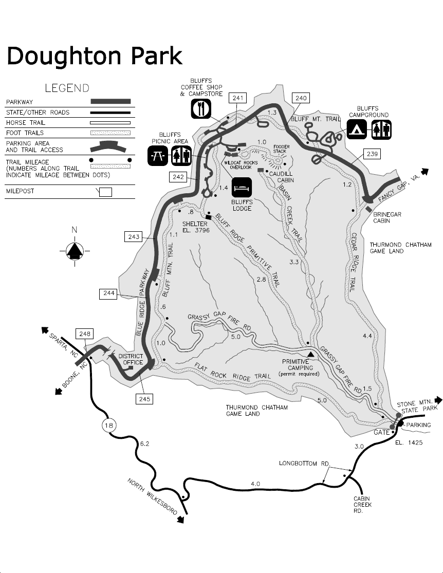
 The Doughton Park map shows many trails including the Bluff Mountain Trail, Cedar Ridge Trail, Basin Creek Trail, Bluff Ridge Primitive Trail, Flat Rock Ridge Trail, Fodder Stack Trail, and the Grassy Basin Fire Road.
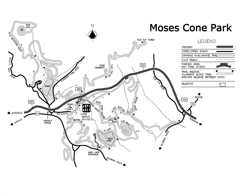 Here is a Moses Cone trail map, featuring trails near the Cone Manor House and up to Flat Top Tower, just outside Blowing Rock, NC. This area contains a whole maze of trails!
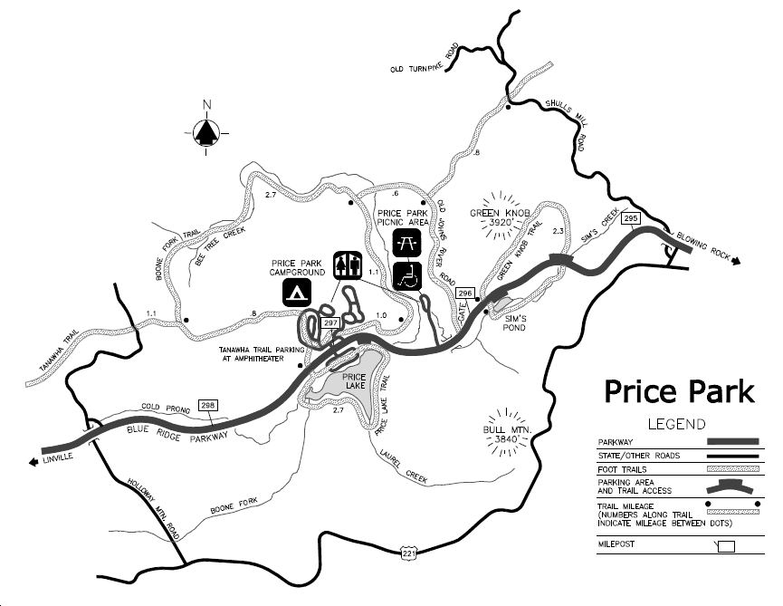
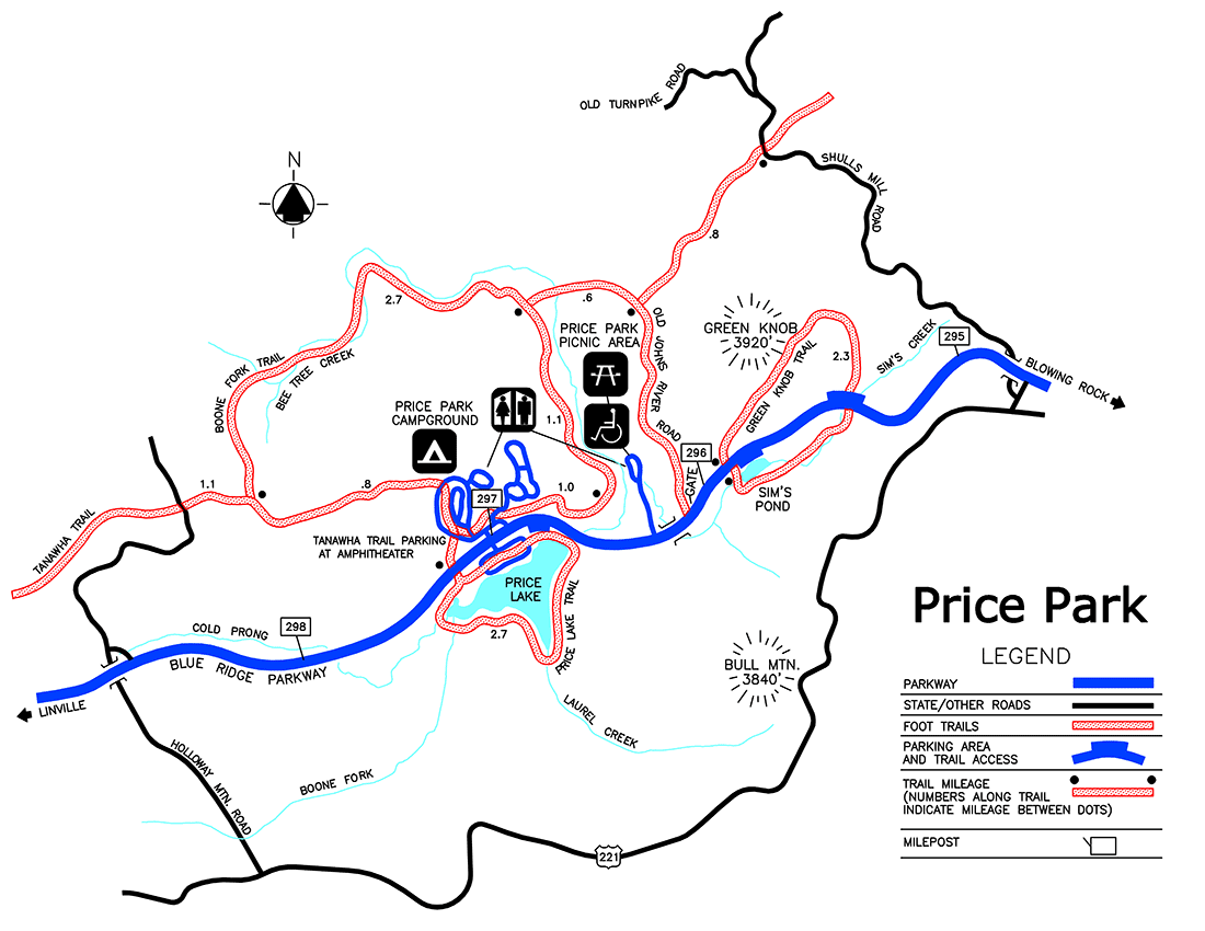 This Price Park map shows hiking trails in Julian Price Park near the Price Park Campground, including the Green Knob Trail, Boone Fork Trail, Mountains-to-Sea Trail, Price Lake Trail, and Tanawha Trail.
 This is a Tanawah and Grandfather Mountain trail map, featuring many trails in the Grandfather Mountain area near Linville, NC. This area has a number of parking areas and scenic overlooks.
 Here is a Linville Falls trail map, showing distances to various Linville Falls viewpoints from the visitor center and Linville Falls Campground. Also shown is the picnic area.
 Here’s a Crabtree Falls map that showcases the three-mile loop trail to Crabtree Falls that departs from the Crabtree Falls campground. Plan on one-and-a-half to two hours for this somewhat strenuous hike.
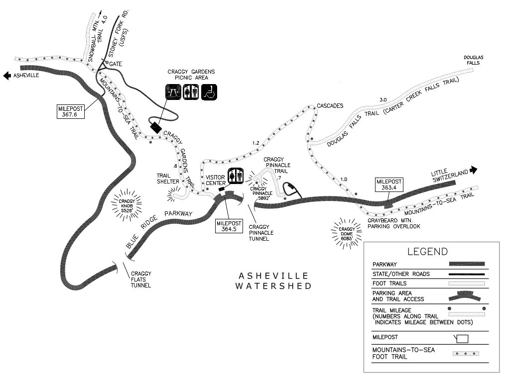 This is a Craggy Gardens trail map, featuring the trail up Craggy Pinnacle and others from the Craggy Gardens Visitor Center and picnic area. It also shows the Mountains-to-Sea Trail and Douglas Falls Trail.
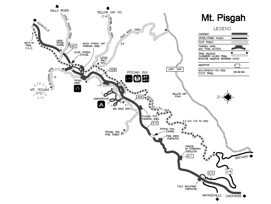
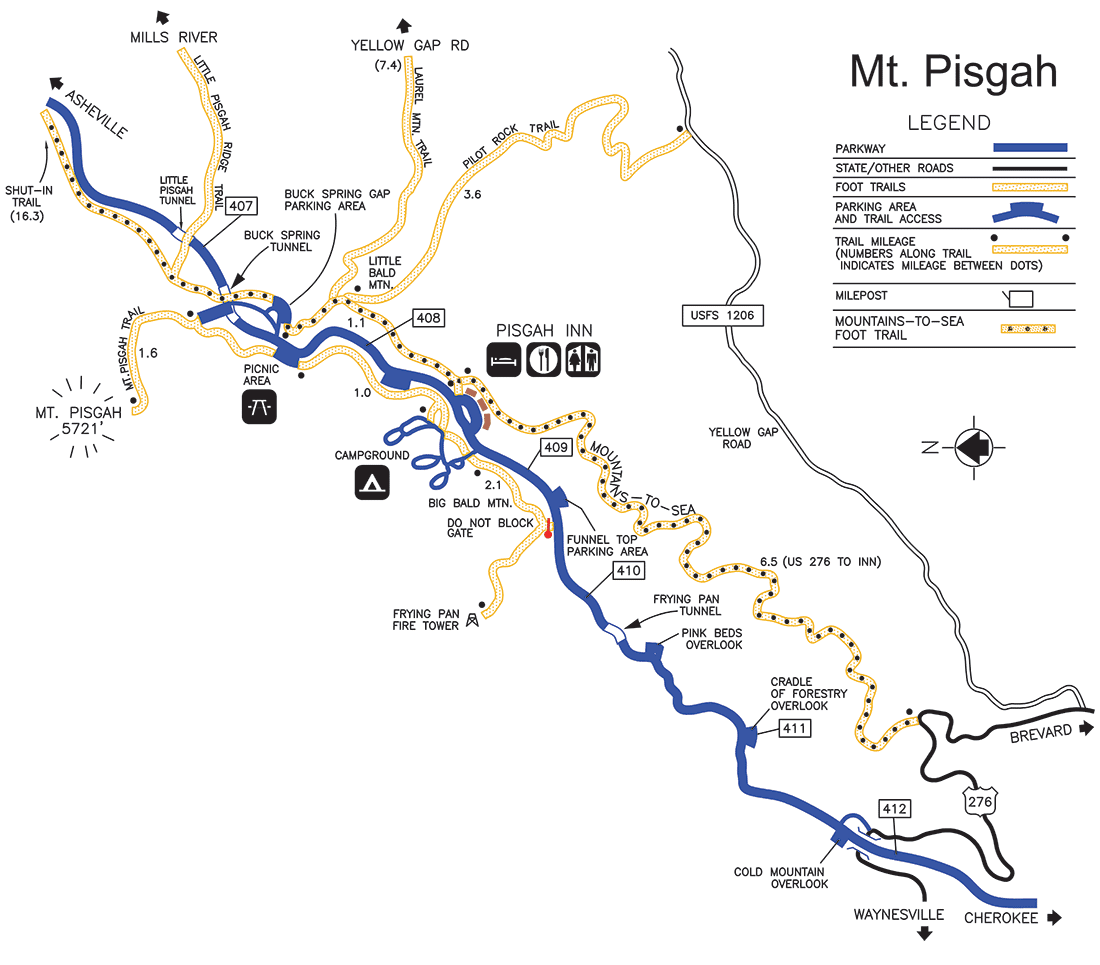 The Mt. Pisgah map shows many hiking trails near the Pisgah Inn and campground, including the Mount Pisgah Trail, Buck Spring Trail, Laurel Mountain Trail, Pilot Rock Trail, Shut-In Trail, and Frying Pan Trail.
Blue Ridge Parkway lodging map
 The Blue Ridge Parkway is so long and linear that you’ll never find a single home base to visit the whole thing. But Asheville, NC is my favorite place to stay because the town is amazing and it’s so close to the high elevations near Mt. Pisgah. To the right, open an Expedia interactive lodging map centered on Asheville. You can also browse Expedia’s top-rated Asheville lodging where you can compare reviews, photos, and prices.
Assorted Blue Ridge Parkway maps
 Here’s a regional Blue Ridge Parkway map that includes other national park sites. See how the parkway connects the Great Smoky Mountains with Shenandoah National Park, with the Appalachian Trail to the west.
Blue Ridge Parkway campground maps
The Blue Ridge Parkway campground maps are arranged here north to south in order along the parkway:
 This is an Otter Creek Campground map, located near the James River Visitor Center and Canal on the northern end of the Blue Ridge Parkway nearest Shenandoah National Park.
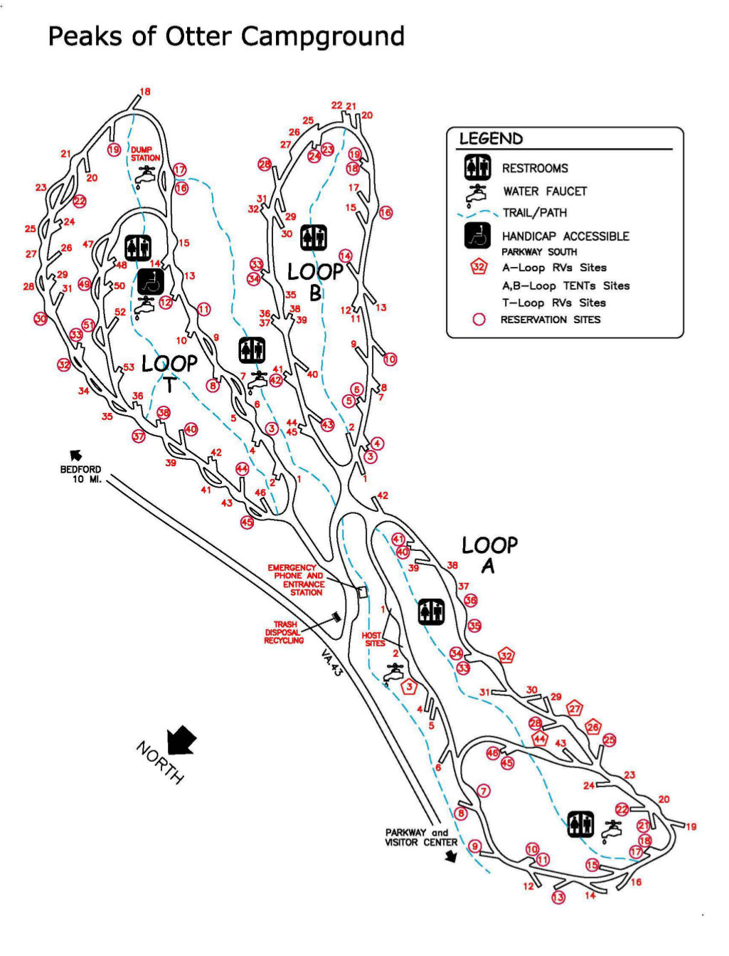 This is a Peaks of Otter Campground map, located about 85 miles south along the Blue Ridge Parkway (and 25 miles south of Otter Creek). This campground has both tent-only and RV-only loops.
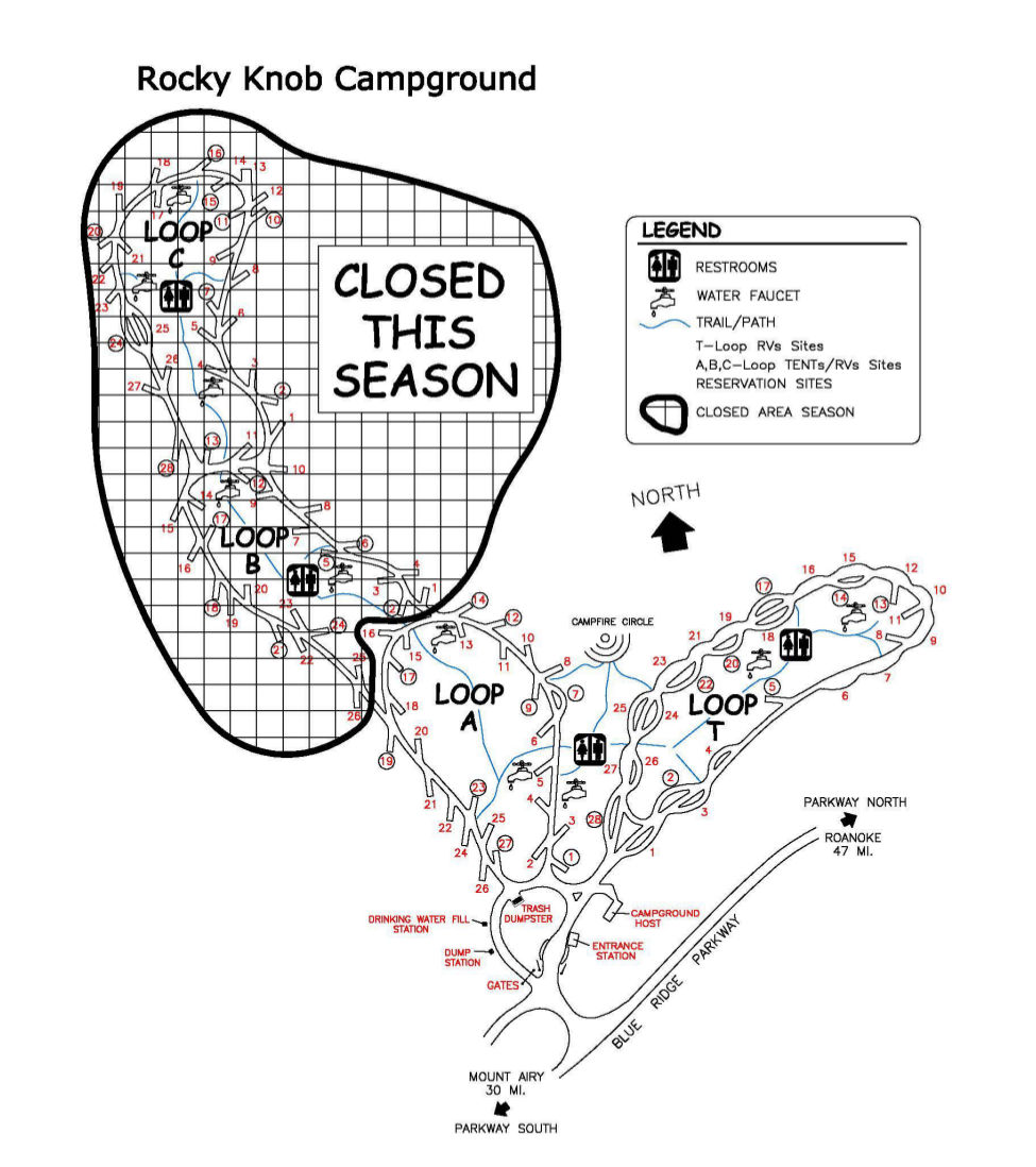 This is a Rocky Knob Campground map, located near Mabry Mill and The Saddle in Virginia. Two loops of this campground may be closed depending on the year’s funding levels.
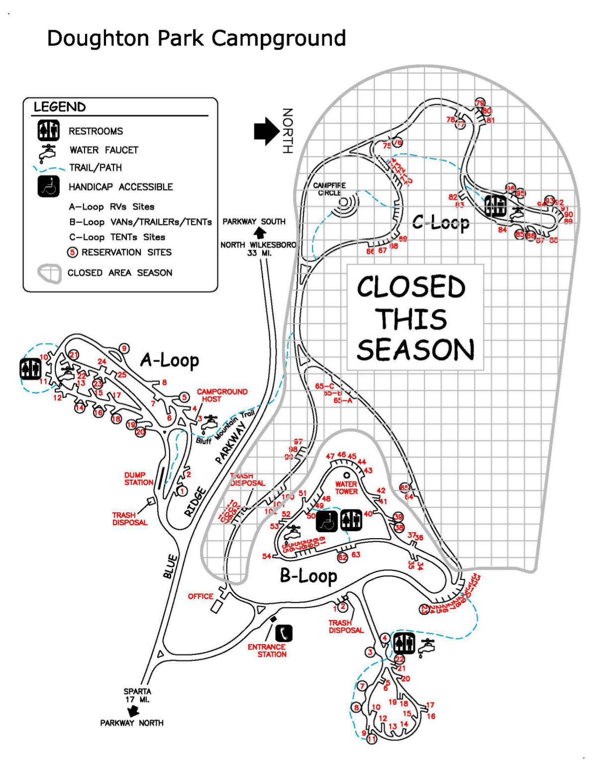 This is a Doughton Park Campground map, located near Stone Mountain State Park. Parts of this campground may be closed depending on funding levels, so inquire directly with the park before your visit.
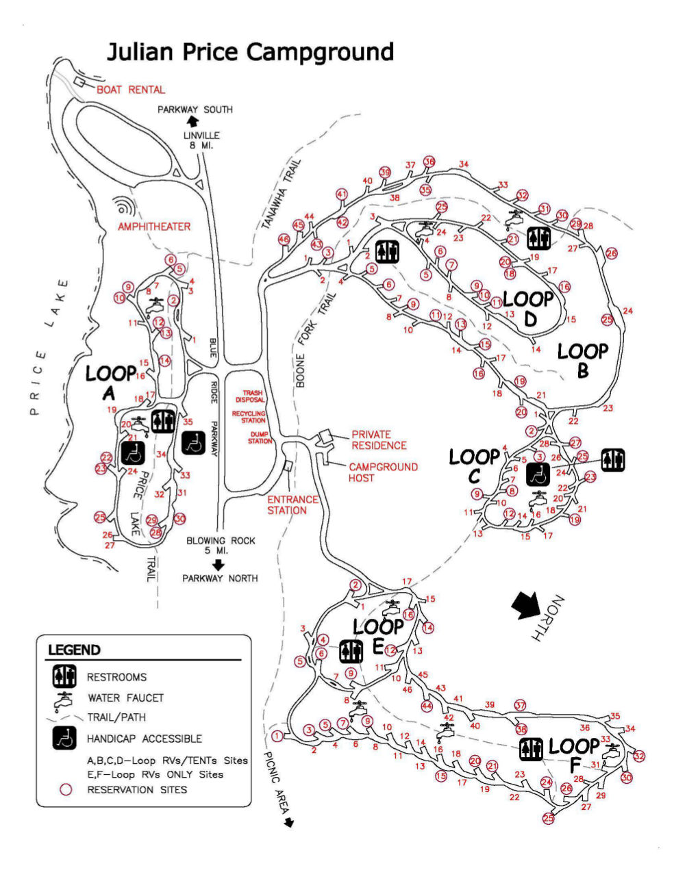 This is a Julian Price Campground map, located near Boone, Blowing Rock, and Linville, NC, as well as Grandfather Mountain. This large campground features six different loops, two of which are RV-only.
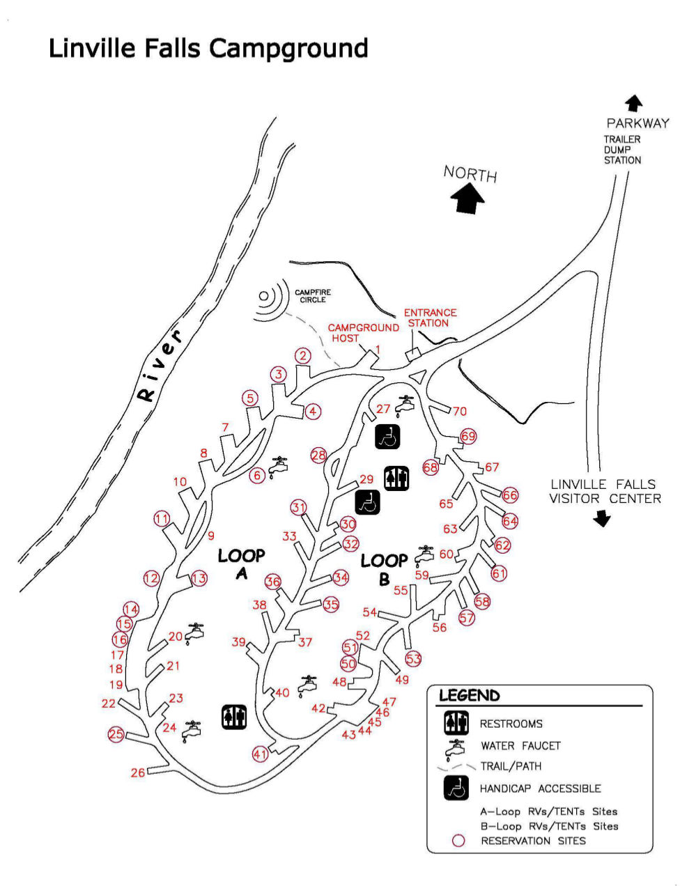 This is a Linville Falls Campground map, showing the campground located along the side road to the Linville Falls Visitor Center. Adjacent to the campground is the Linville River.
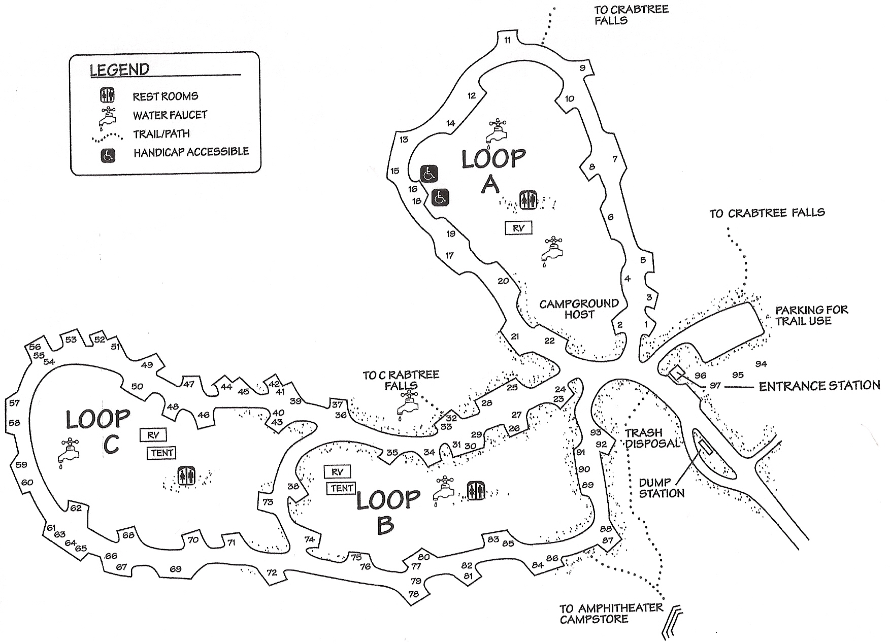 This is a Crabtree Falls Campground map, located near mile 340 of the Blue Ridge Parkway and nearest to Mount Mitchell State Park. You can hike from your campsite directly to Crabtree Falls.
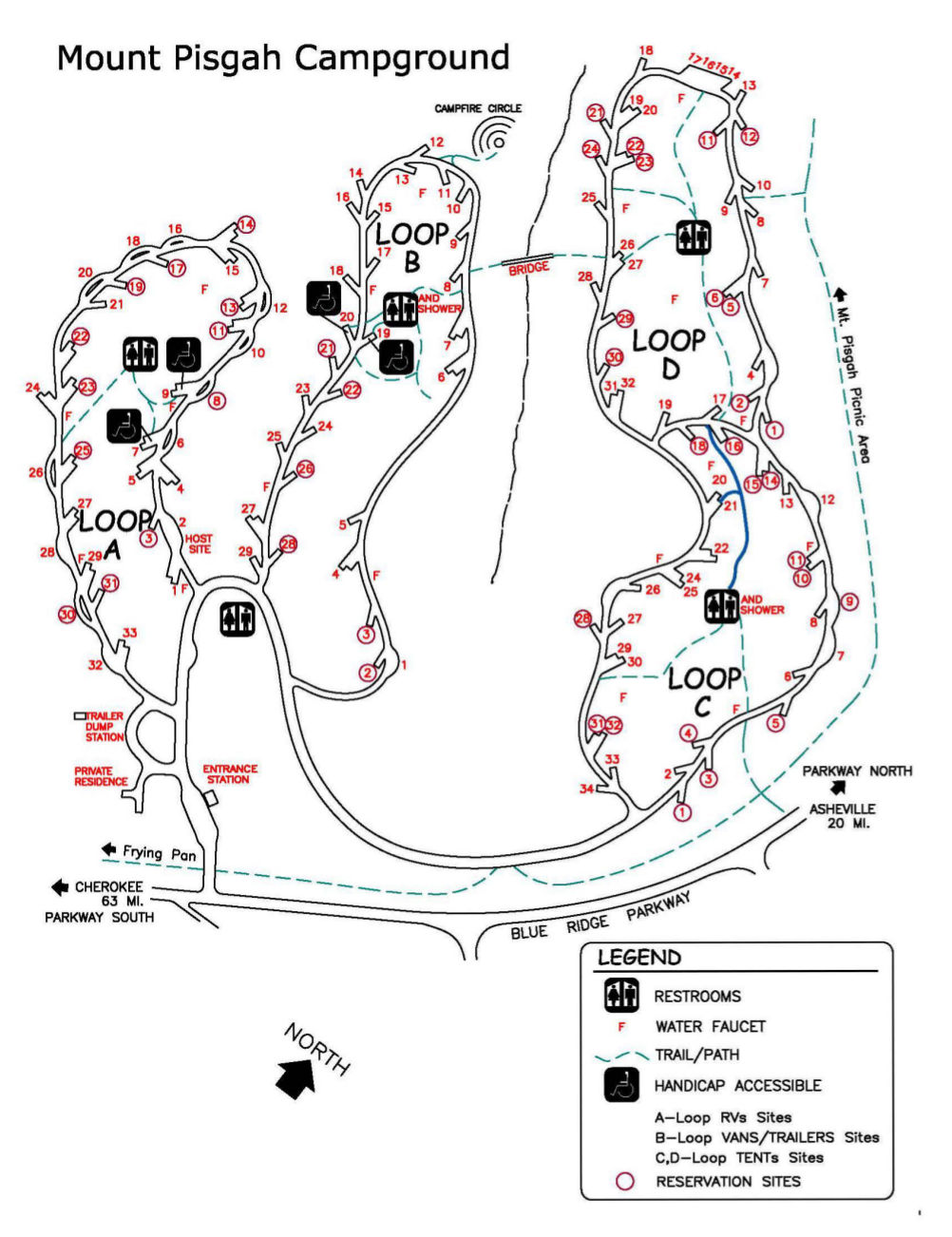 This is a Mt. Pisgah Campground map, the furthest south campground on the parkway and nearest to Great Smoky Mountains. The four campsite loops separate out the RVs/trailers from tent campers.
Archived Blue Ridge Parkway maps
The National Park Service is constantly releasing new maps and updating old ones, and I do my best to ensure the most recent ones are included here. But rather than deleting old maps that have been replaced, I simply move them down into this section; I believe it’s important to see how national park sites change over time.
 This is an older Blue Ridge Parkway brochure map, from an early-2010s edition of the National Park Service brochure. Click the image to view a full size map or download the PDF.
 Here is an old Rocky Knob trail map from the mid-2010s, showing the Rocky Knob Campground, visitor center, and picnic area near Rock Castle Gorge a bit north of Mabry Mill (near the town of Floyd, VA).
 This is an old Doughton Park trail map from the mid-2010s, showing Bluffs Lodge, Bluffs Campground, Bluffs Picnic Area, and Wildcat Rocks. The map includes trails accessed from the Parkway and also from outside roads.
 Here is an old Julian Price Park trail map from the mid-2010s, featuring the Green Knob Trail, Boone Fork Trail, Tanawah Trail, and others near Julian Price Memorial Park near Blowing Rock, NC.
 The old Crabtree Falls trail map from the mid-2010s shows the loop trail along Crabtree Creek to Crabtree Falls, departing from the Crabtree Falls Campground. This map also shows the campground layout.
 Here is an old Mt. Pisgah trail map from the mid-2010s, showing the trails near the Pisgah Inn and Mt. Pisgah Campground at the southern end of the Blue Ridge Parkway, nearest to Great Smoky Mountains National Park.
…and more!
< Return to National Park Maps home
< Return to Park List
< Return to List by State