Devils Postpile map from the park brochures
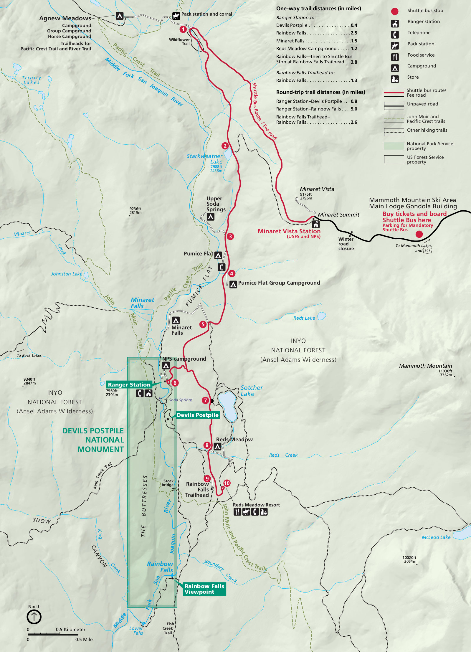 Here is the official Devils Postpile map, showing the road into the park, various hiking trails, and shuttle bus stops. Click the image to view a full size map or download the PDF.
 This is the regional Devils Postpile map, showing the monument in relation to Yosemite, Sequoia–Kings Canyon, and state highways. Click the image to view a full size map or download the PDF.
Devils Postpile trail map
 If you’re going to do a lot of hiking in the eastern Sierra around Devils Postpile and the Ansel Adams Wilderness, you should grab a National Geographic Trails Illustrated map – this one includes topographic lines and trail mileages. The map also extends south past Mammoth Lakes all the way through the John Muir Wilderness to the boundary of Kings Canyon National Park, so you can get a lot of use from this one.
Devils Postpile shuttle bus maps
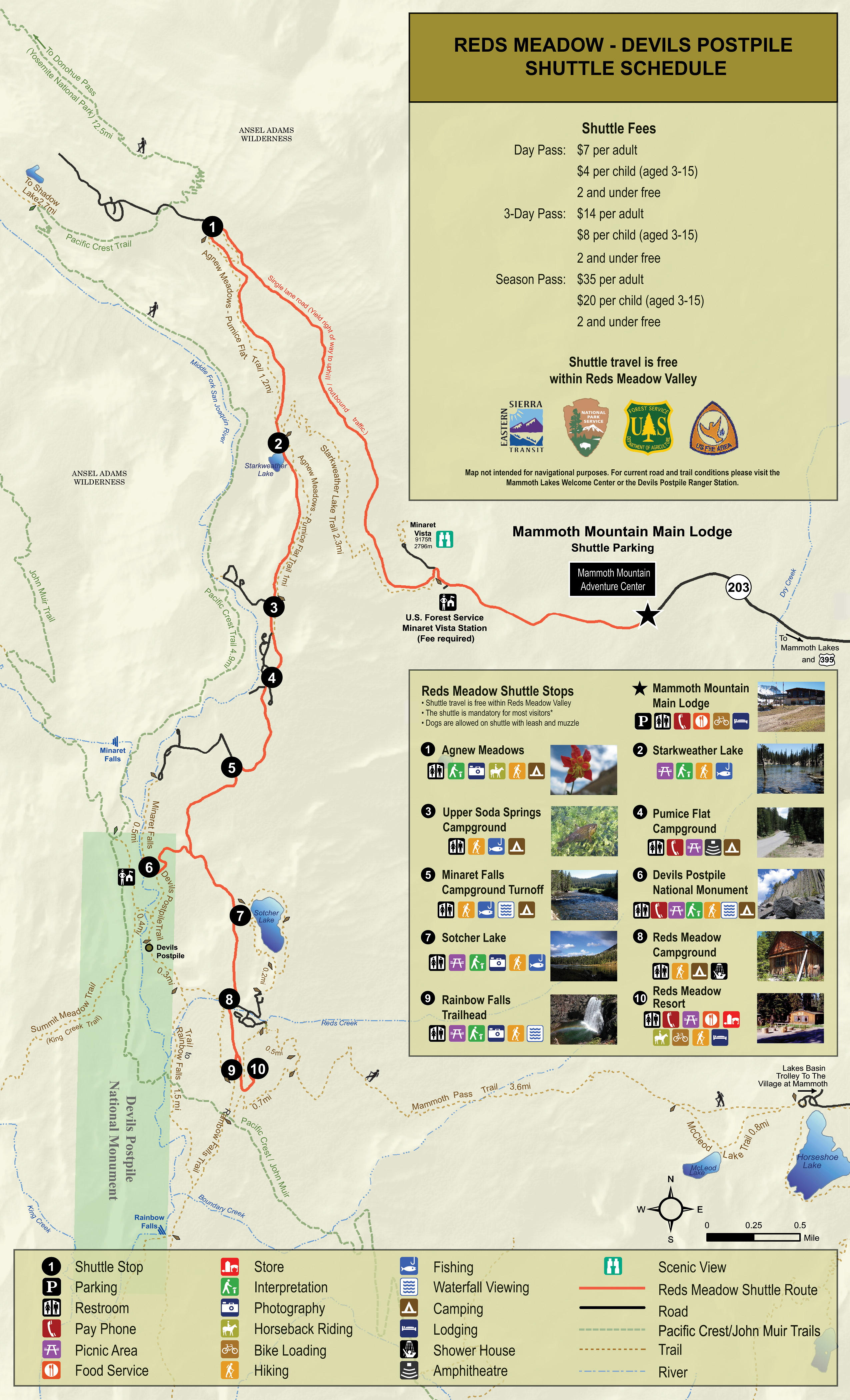 This is a shuttle bus map of Devils Postpile, showing more details about the trails and points of interest at each bus stop than the maps above. Each stop is labeled with a photo and visitor services.
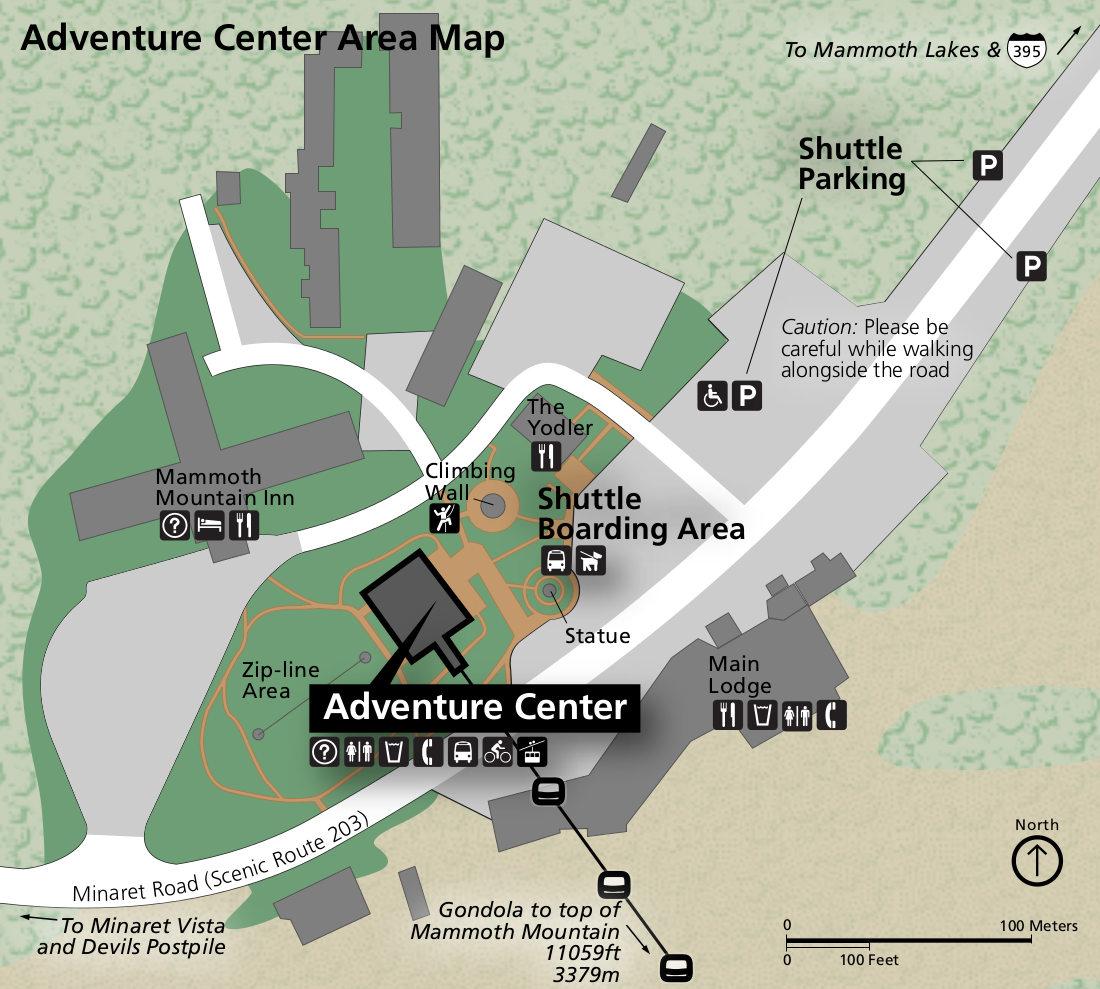 Here’s a shuttle bus parking map, which shows where you need to park at Mammoth Mountain to access the Devils Postpile/Reds Meadow shuttle. You can also see the facilities offered at Mammoth Mountain.
Devils Postpile lodging map
 For visiting Devils Postpile, you’ll definitely want to stay in Mammoth Lakes; that’s where you’ll need to catch the shuttle anyway to ride into the park. To the right, you can see a very busy Expedia interactive lodging map of Mammoth Lakes. Although you can filter by price and rating, it might be easier to simply browse the top-rated lodging for Mammoth Lakes first so you can compare photos, amenities, and reviews.
Devils Postpile geologic map
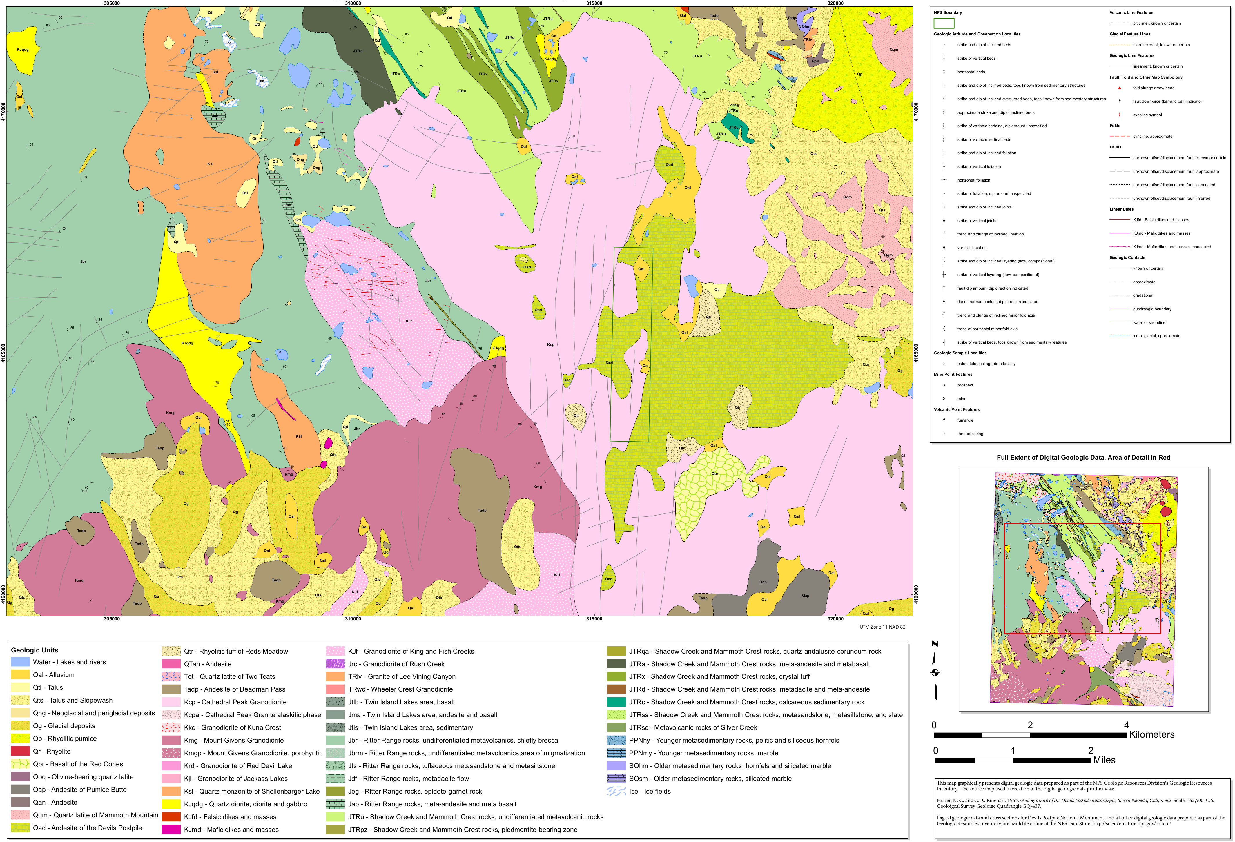 The geologic map of Devils Postpile includes both the monument as well as the surrounding Sierra Nevada, including Mount Ritter and the Ritter Range in the Ansel Adams Wilderness.
…and more!
< Return to National Park Maps home
< Return to Park List
< Return to List by State