1,000 maps are now uploaded (1,006 to be exact). Honestly, I never thought I’d actually get this far. I started this site on a whim and figured I’d lose interest after a while. And that’s partly true! There was a period of about 18 months when I hardly touched this site. Yet here I am again, plugging right along, slowly but surely. You can see my renewed interest after the new year:

So what pages are new since my last update?
 John Day Fossil Beds maps: on the board with 11 maps. I had to give Crater Lake some company so Oregon had more than one page. You’ll notice though that I have yet to add on any “Related parks” links to this page or any other of the new ones below. Honestly, that part is pretty time-consuming and not a lot of fun, so it gets put on the back burner when the alternative is to add some new pages. You’ll see the related parks links pop up soon enough.
 Jewel Cave maps rounds out the Black Hills area with 6 maps, to go along with Mount Rushmore, Badlands, and Wind Cave. Just an embarrassment of riches for western South Dakota.
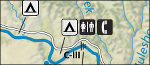
 Next we have 6 for Cape Lookout maps, the next-door neighbor to Cape Hatteras. North Carolina is sitting pretty smug with their four parks uploaded so far.
 I felt bad for poor Nebraska, without a single page to its name so far. Niobrara maps came to Nebraska’s rescue, but with just 4 maps for now. I’ve got to show some love to some of those National Scenic Rivers in the Midwest. St. Croix – your time is coming soon.
 Now we get into some heavy hitters! I’ve been procrastinating on Cape Cod maps for a while, as so many of the maps were locked up in PDF documents in a not-so-user-friendly format. I finally buckled down and got ‘er done. 24 maps!
 Another one I’ve long been putting off – Lake Mead maps jumps into the fray with 27 maps. A very auspicious debut! It’s going to be hard for any new page to start out with more than Lake Mead; it’s truly a force to be reckoned with, even as a rookie.
 Now some more modest pages – ones that don’t need to show off. Florissant Fossil Beds maps starts with a respectable 5, but nothing too flashy. Just the basics; a true workmanlike performance. (Clearly I’m getting tired when everything turns into sports vocabulary.)
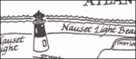
 And finally, bringing up the read, we have White Sands maps at 8 maps. New Mexico is climbing up the leaderboard with 3 parks represented on NPMaps so far!
Seems like I’ve gotta be almost done, right? Well, right now I’ve only got 93 of 411 national park units up so far. So, uh: not almost done. Although, yes, many national park units do not have maps, especially small national historic sites and newly established units. Not only that, but I’ve really covered much of the big well-visited parks that feature lots of parks; many of the remaining ones don’t have as many maps available. Sooooooooooo… I’m going to be optimistic and say I’m halfway done. The big question: can I pick up the pace? Here’s hoping I can speed things up and finish the site before 2019.
A random other behind-the-scenes note: I turned off ads on the site for now; I wasn’t too happy with some of the ones being displayed and felt like they were getting a bit overbearing. I might experiment a bit down the road with some different types or different placement; my goal is to cover hosting fees but without hurting the user experience. A couple people on reddit asked if I would be willing to accept donations, but I just feel weird about accepting money for something that ought to be free. So there will probably be an ad of some sort eventually (unless the Amazon links do well enough), but I will do my best to keep it unobtrusive.
 So, which is the lucky page? Why it’s none other than Glacier National Park maps! Through secret sources (ooooooh!), I’ve been given four new trail maps for Lake McDonald, Logan Pass/St. Mary, Many Glacier, and Two Medicine that are free to use and distribute. Enjoy! These are better than the ones the park includes in their free hiking handouts.
 Oh, but that’s not all – I actually have a second exclusive to share with you! This one is slightly less exciting, however; it’s just a campground map for East Portal Campground on the Black Canyon of the Gunnison maps page. So what makes it an exclusive? Well, this is a map I’ve never been able to find online; I actually got this map by visiting in person, taking a photo of the campground registration board, and digitizing it myself. (Never let it be said that I’m not dedicated.) So for now, this is the only place online you’ll be able to find this map.
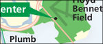 But I haven’t just been sitting here content with only a few exclusives. Nope; enjoy the 28 maps I’ve just uploaded to the new Gateway National Recreation Area maps page. Honestly, I’ve been procrastinating on this one for a while as I knew it would take me a long time. And it did. But hey, now it’s up and I can move on to something more fun. New parks coming soon…
 It’s been so much fun seeing it spread throughout social media this week, as users (
 The
The  I got a request to include more historic sites in the northeast U.S., so I added the
  I also had a visitor point out I didn’t have any Iowa parks yet. This was true. But not anymore, as
 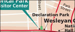 Another request I received was for Women’s Rights National Historical Park. I’m pretty lacking in the historical park category – and really don’t have any urban parks yet – so here’s 3 maps for the
  Some old pages got new updates. My biggest overhaul was to
  I had to give Alaska some love, so both
  And a new map each to each of the following pages: