If you’re looking for a Great Smoky Mountains map, you’ve come to the right place; currently I’ve collected 17 free Great Smoky Mountains National Park maps to view and download. (PDF files and external links will open in a new window.) The maps on this page range include mostly campgrounds, but also maps from the official park brochure and a trail map. You can also browse the best-selling Great Smoky Mountains maps and guidebooks on Amazon.
Great Smoky Mountains map from the brochures
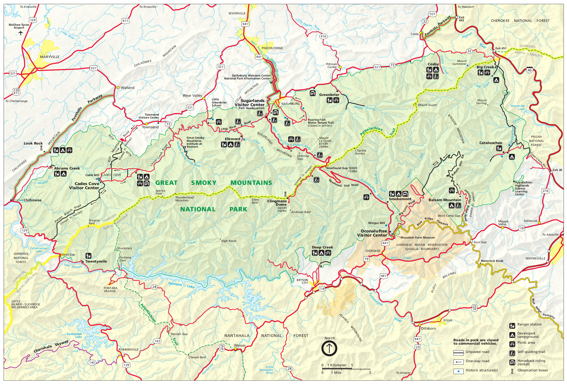 This is the complete Great Smoky Mountains map from the official park brochure, showing each of the visitor areas as well as outlying roads. Click the image to view a full size JPG (1.2 mb) or download a PDF (800 kb).
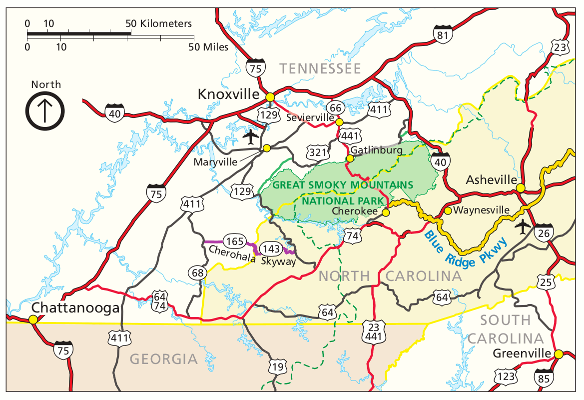 This is a Great Smoky Mountains regional map, showing roads and highways in the area along with nearby towns. Click the image to view a full size GIF (150 kb) or download a PDF (300 kb).
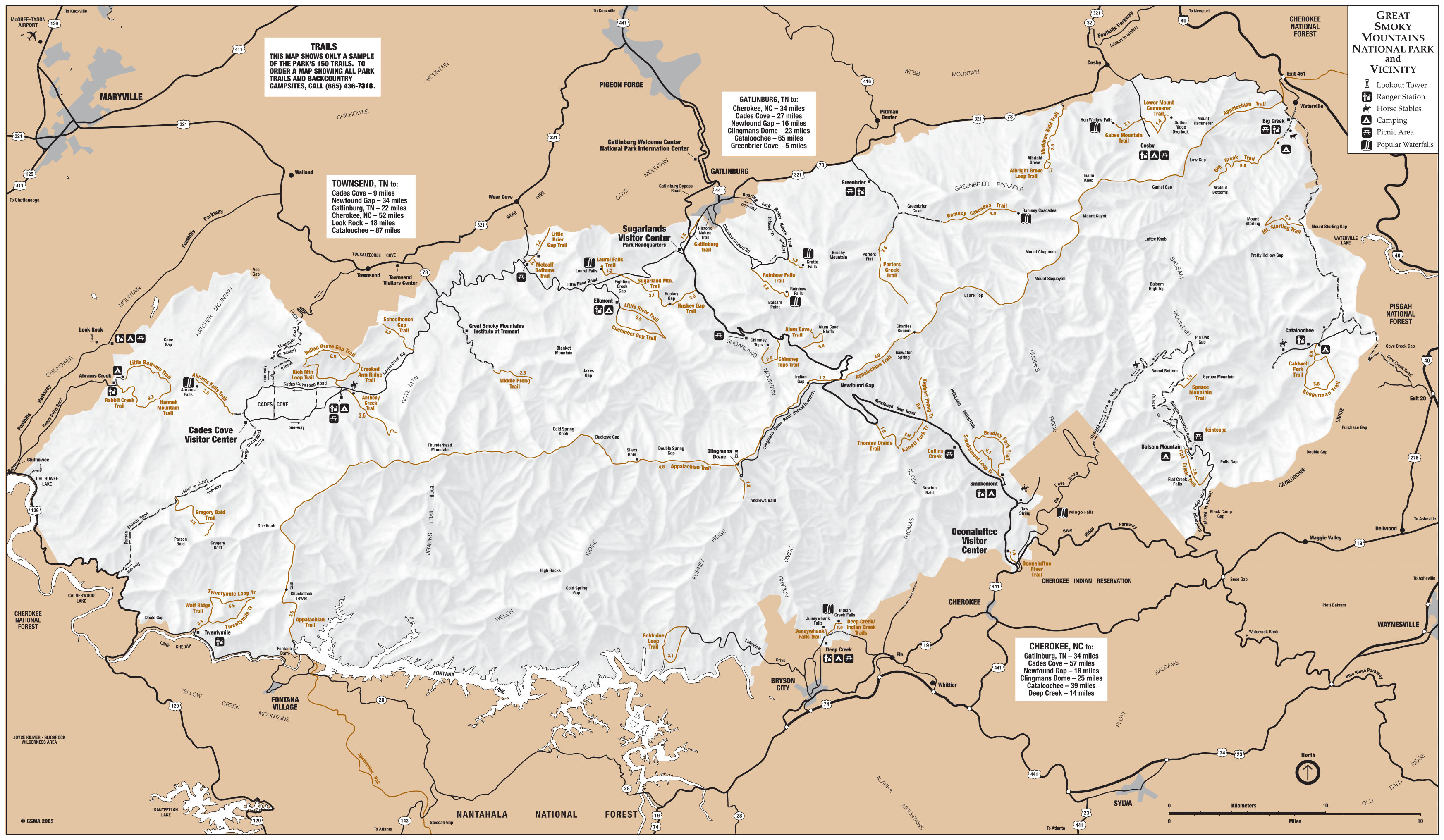 This Great Smoky Mountains map (1.0 mb) is from four separate pages in the park newspaper; here I’ve combined them for you into one giant map. It shows major points of interest and the popular hiking trails.
Great Smoky Mountains trail map
 The below trail map is great for trip planning, since it shows distances, trail shelters, etc. However, it’s not great for travel in the backcountry since it doesn’t show topographic lines; you may want to purchase the National Geographic Trails Illustrated map from Amazon if you’re going to be doing overnight trips or lots of long hikes. (If you’re just car touring and sticking near the roads, then this map probably isn’t necessary.)
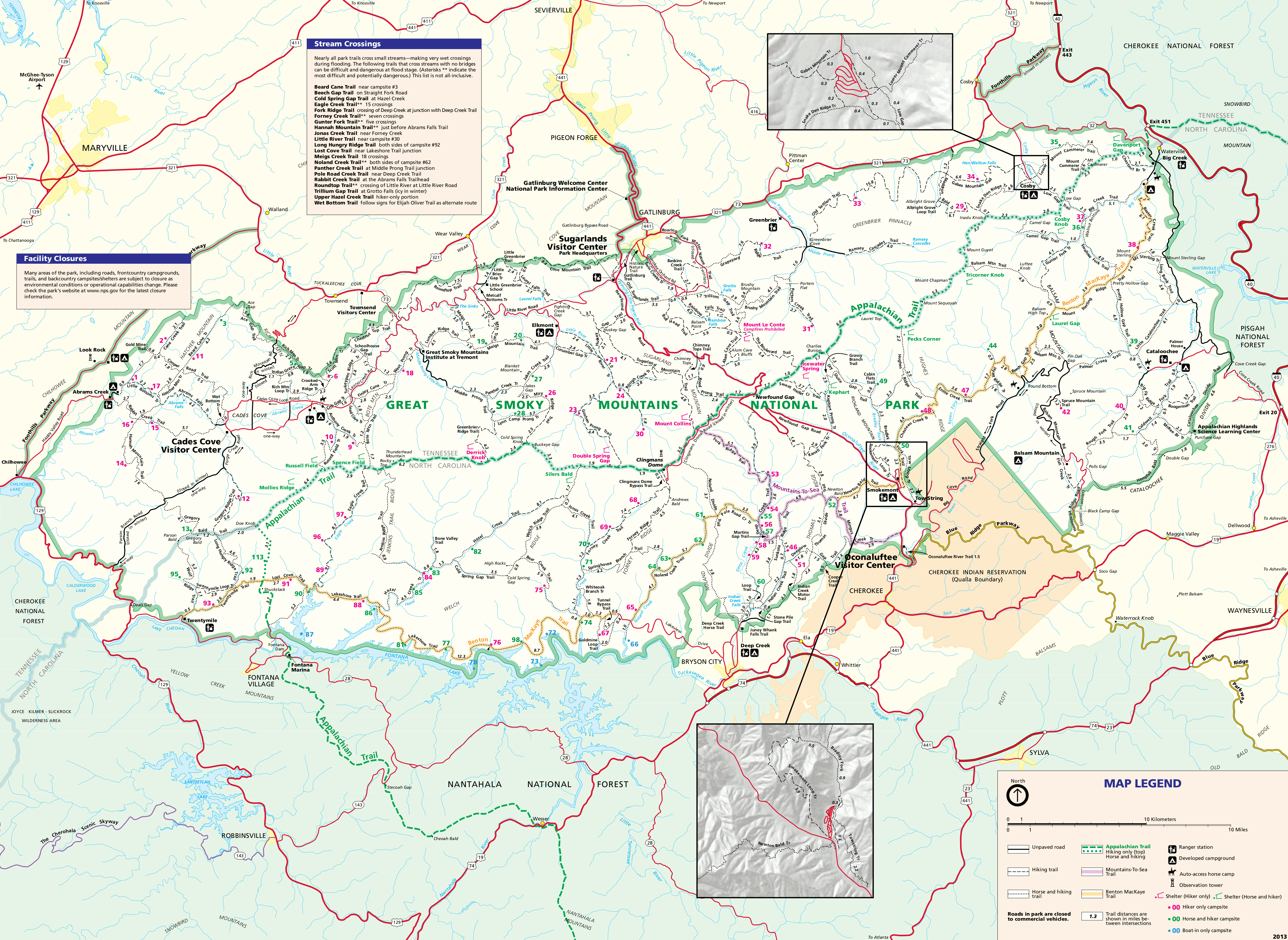 This is a Great Smoky Mountains trail map (2.1 mb), showing all the park trails, mileage between junctions, and points of interest such as Appalachian Trail shelters. It also labels backcountry campsites.
Great Smoky Mountains geologic map
 This is a geologic map of Great Smoky Mountains National Park (10.9 mb). The map below includes a cross-section and legend identifying the rock types found on this map. Warning – this is a very large file!
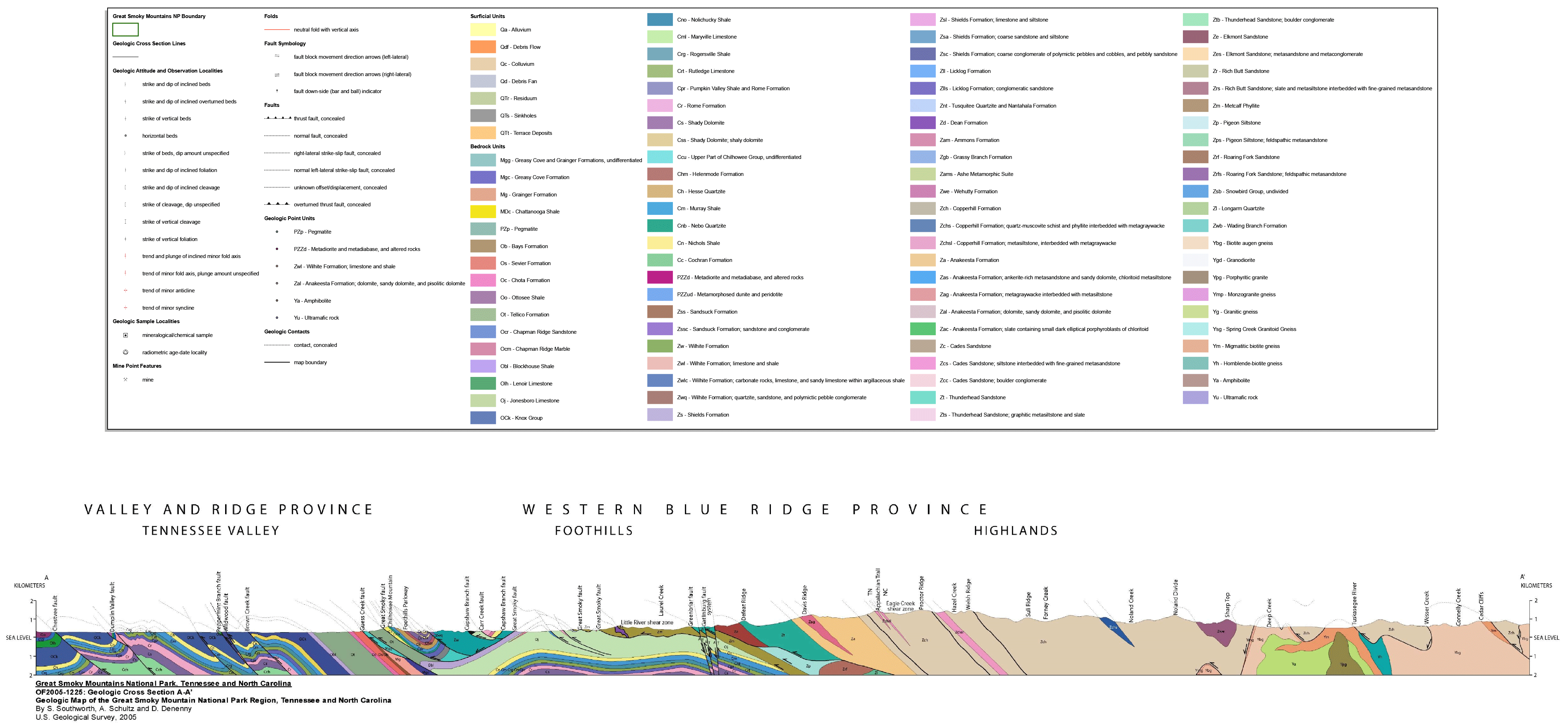 This is the legend and cross section (600 kb) for the Smokies geologic map above. It labels each of the rock layers and provides a cross-section showing the rock types in profile.
Great Smoky Mountains lodging map
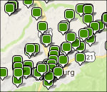 By far, the highest concentration of hotels near the park is in Gatlinburg, TN, and I’ve provided a Hotels.com interactive lodging map to the right. It might be a bit overwhelming, so instead you may want to compare prices and reviews of the highest-rated Gatlinburg lodging on Hotels.com. Or check out options outside of Gatlinburg, such as the highest-rated lodging on for Cherokee, NC, on the other side of the Smokies.
Great Smoky Mountains campground maps
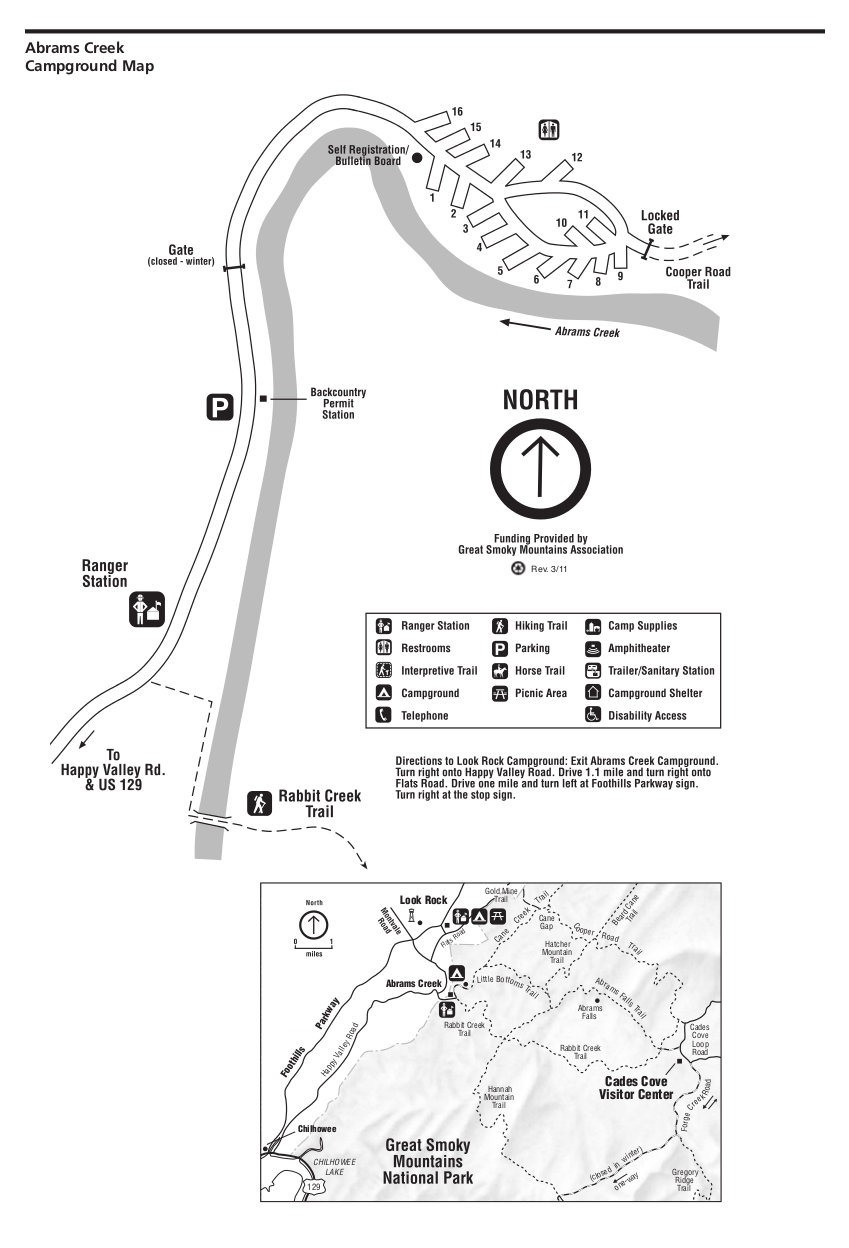 This is an Abrams Creek campground map. Abrams Creek is located in the far western part of the Great Smoky Mountains. Click the image to view a full size JPG (100 kb) or download the PDF (650 kb).
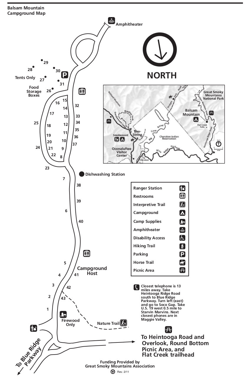 This is a map of Balsam Mountain campground, located in the southeast part of the park and is accessible via the Blue Ridge Parkway. Click the image to view a full size JPG (100 kb) or download the PDF (100 kb).
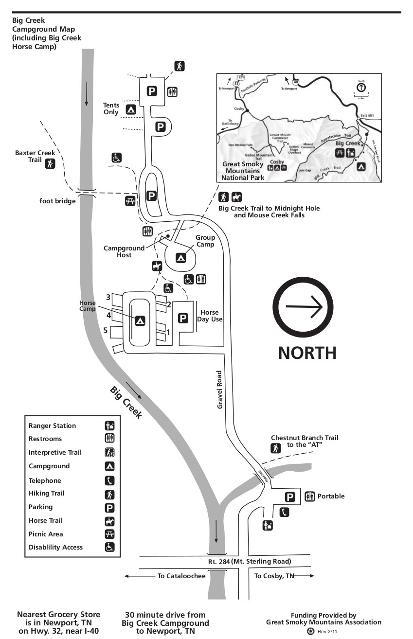 This is a Big Creek campground map. Big Creek is a very small isolated campground in the northeast corner of the park. Click the image to view a full size JPG (100 kb) or download the PDF (100 kb).
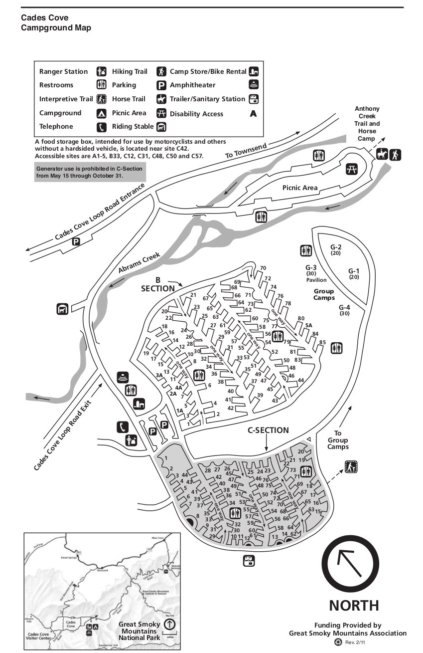 This is a Cades Cove campground map. This is the second largest campground in the park and is near (you guessed it!) Cades Cove. Click the image to view a full size JPG (200 kb) or download the PDF (100 kb).
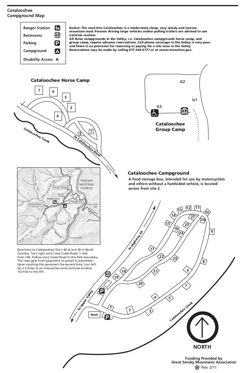 This is a Cataloochee campground map. Cataloochee is in the far eastern part of Great Smoky Mountains, up a narrow winding road. Click the image to view a full size JPG (150 kb) or download the PDF (100 kb).
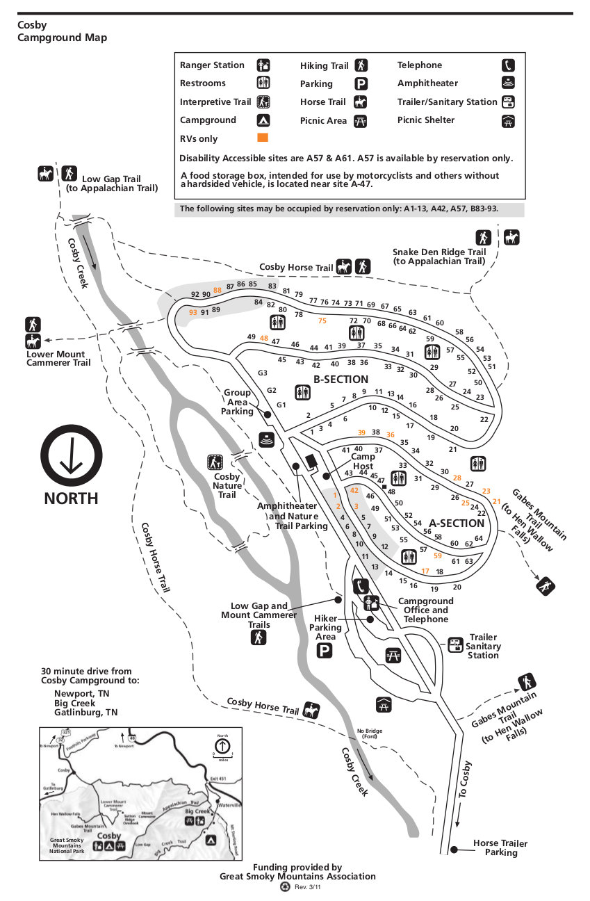 This is a Cosby campground map. Cosby is one of the larger campgrounds and is in the northeastern corner of the park. Click the image to view a full size JPG (200 kb) or download the PDF (100 kb).
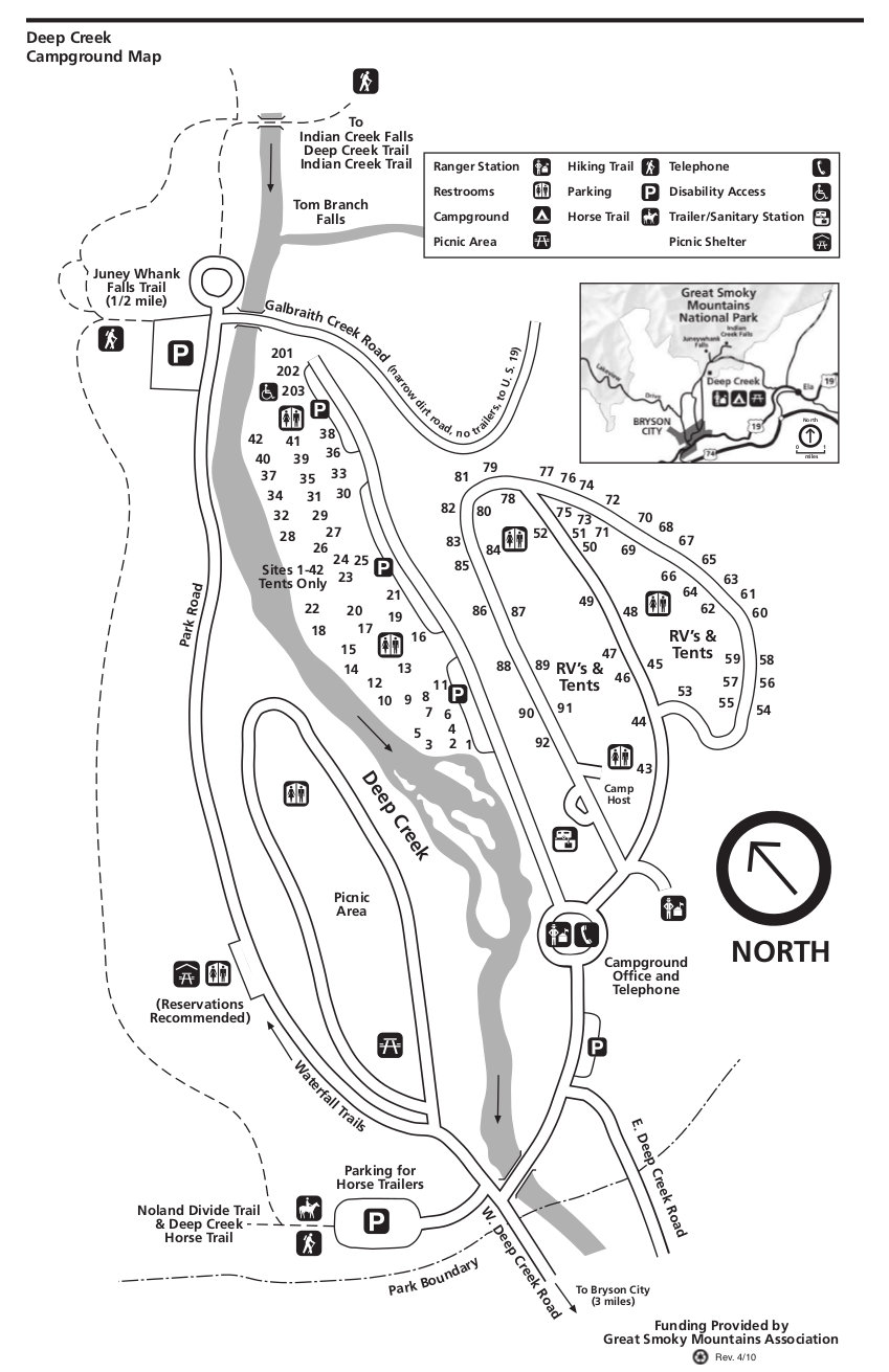 This is a Deep Creek campground map. Deep Creek is located near Bryson City in the southern part of the Great Smoky Mountains. Click the image to view a full size JPG (150 kb) or download the PDF (100 kb).
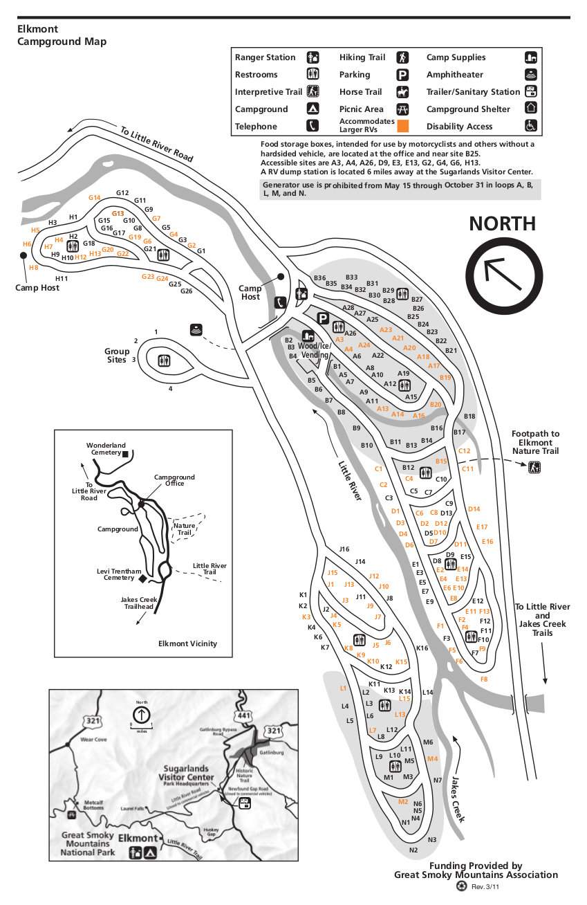 This is an Elkmont campground map. Elkmont is the largest campground in the park and is west of the Sugarlands Visitor Center. Click the image to view a full size JPG (200 kb) or download the PDF (100 kb).
 This is a Look Rock campground map. Look Rock is located along the foothills parkway, and is west of the park proper. Click the image to view a full size JPG (150 kb) or download the PDF (300 kb).
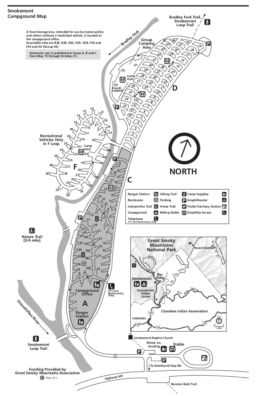 This is a Smokemont campground map. Smokemont is located north of the Oconaluftee Visitor Center on the way to Newfound Gap. Click the image to view a full size JPG (200 kb) or download the PDF (100 kb).
Great Smokies map prints and gifts
 Printed high-resolution Great Smokies map posters and other products are available at the Great Smokies Maps store. For prints, gift ideas, and souvenirs featuring other national parks, support this site and visit the National Park Maps store; you’ll find items to bring on vacation, keep at home for the memories, or give to your park-enthusiast friends and loved ones.
…and more!
< Return to National Park Maps home
< Return to Park List
< Return to List by State
Need more help? Browse Amazon’s best-selling Great Smokies maps and guidebooks.