If you’re looking for a Kennesaw Mountain map, you’ve come to the right place; currently I’ve collected 6 free Kennesaw Mountain National Battlefield Park maps to view and download. (PDF files and external links will open in a new window.) Most of these maps are focused on showing the park’s hiking trails, but a couple show the general layout of the entire park. You can also browse the best-selling Kennesaw Mountain maps and guidebooks on Amazon.
Kennesaw Mountain map from the park brochures
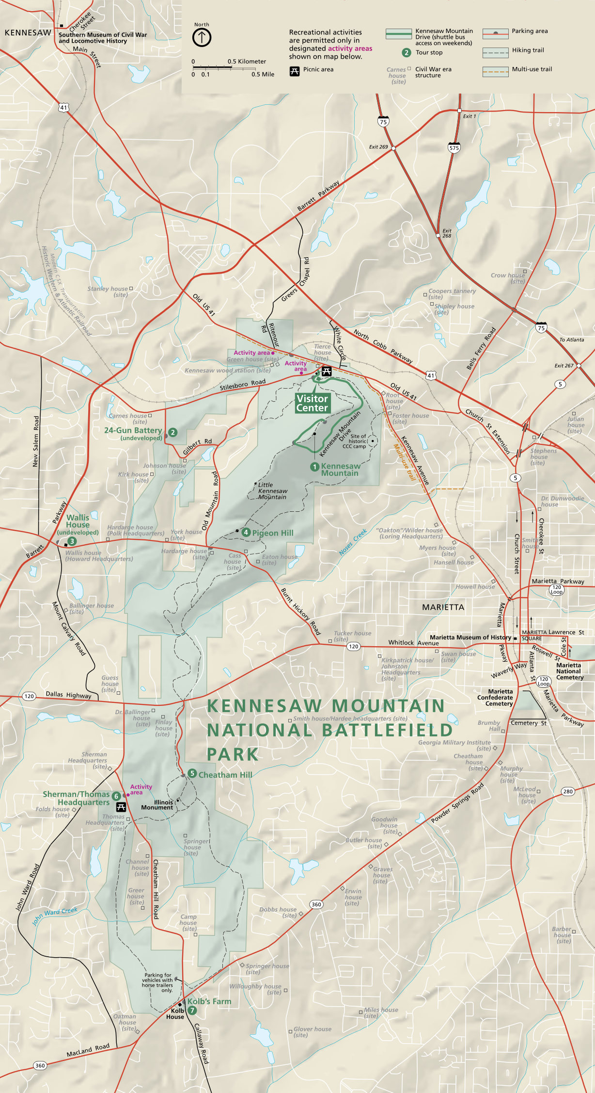 Here is the full Kennesaw Mountain map (600 kb), showing the roads, trails, and points of interest in the park. It also shows quite a bit of the surrounding roads and attractions in Marietta.
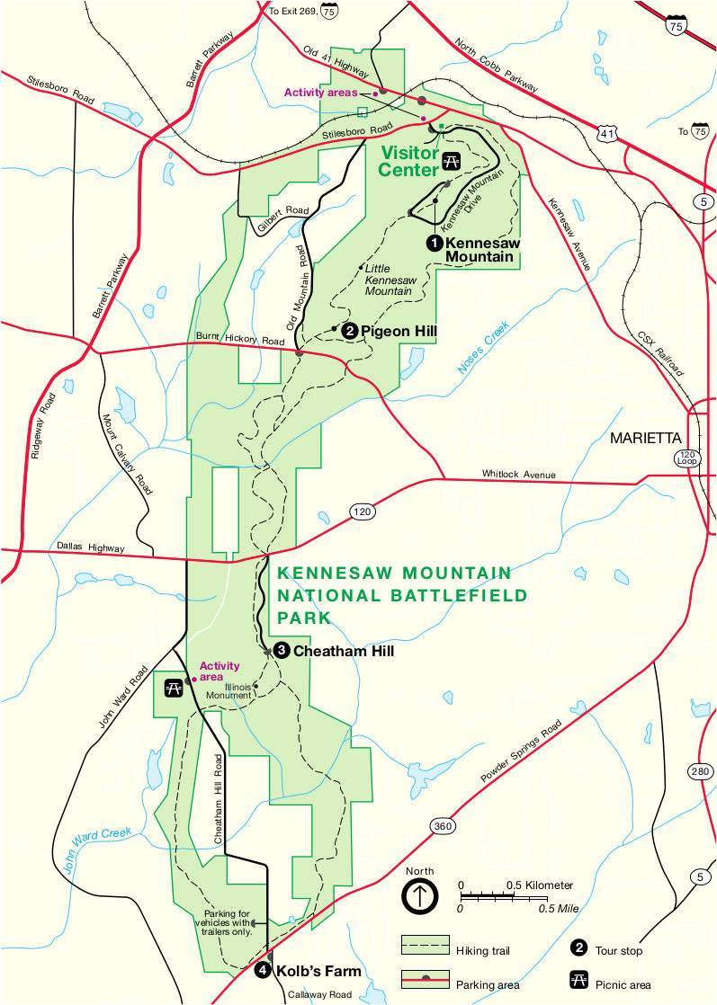 Here is the older Kennesaw Mountain map, a bit simpler and better for home printing since it’s less chaotic with fewer colors. Click the image to view a full size JPG (200 kb) or download the PDF (60 kb).
Kennesaw Mountain trail maps
 Here’s the north Kennesaw Mountain trail map (1.4 mb), showing trails that depart from the visitor center such as the Kennesaw Mountain Trail and Camp Brumby Trail. Included are distances and a trail profile.
 This is the central Kennesaw Mountain trail map (1.5 mb), focusing on the Noses Creek Loop and other trails in central Kennesaw Mountain National Battlefield Park. This map connects the one above and below.
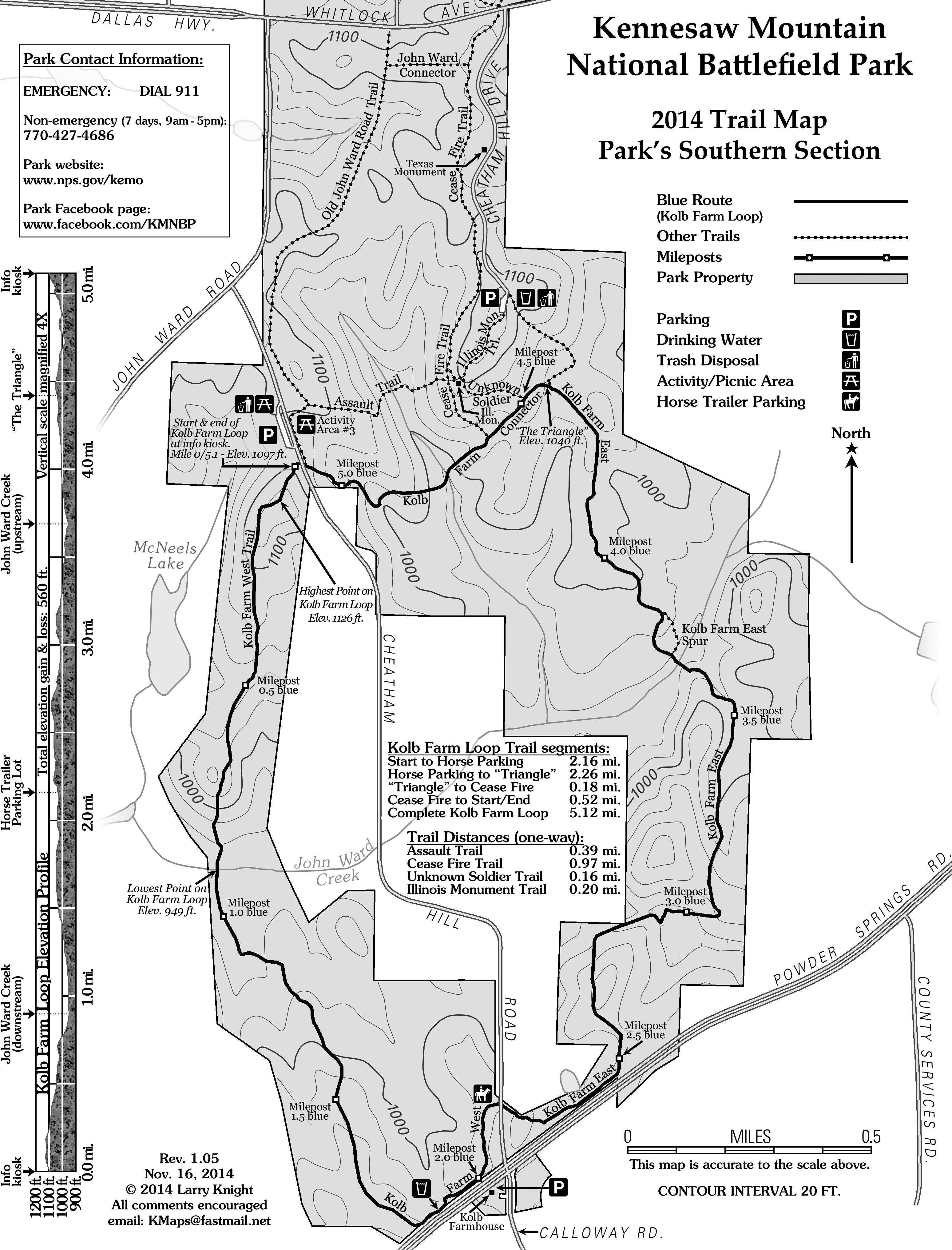 This is the south Kennesaw Mountain trail map (1.3 mb), focusing on the Kolb Farm loop and connector trails (such as John Ward), as well as access points to begin your hikes.
More information
< Return to National Park Maps home
< Return to Park List
< Return to List by State
Need more help? Browse Amazon’s best-selling Kennesaw Mountain maps and guidebooks.