If you’re looking for a Bandelier map, you’ve come to the right place; currently I’ve collected 9 free Bandelier National Monument maps to view and download. (PDF files and external links will open in a new window.) This page has maps zooming in on specific campgrounds and trails while other maps show all of the park. You can also browse the best-selling Bandelier maps and guidebooks on Amazon.
Bandelier map from the park brochures
 This is the Bandelier map from the brochure, showing the trails from the visitor center to the Cathedral Grove and Bohemian Grove. Click the image to view a full size JPG (500 kb) or download the PDF (3.1 mb).
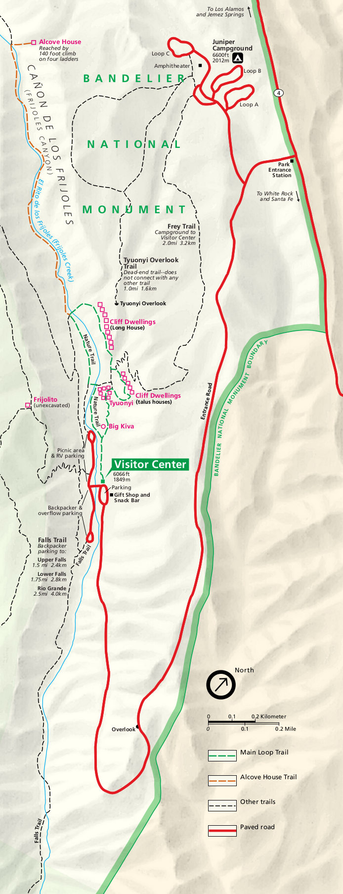 Here’s the Bandelier visitor center detail map, showing the roads and trails in the main visitor center area. Click the image to view a full size JPG (230 kb) or download the PDF (1.5 mb).
Bandelier trail maps
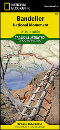
 Bandelier does have some spectacular backcountry, so my you may want to consider purchasing a National Geographic Trails Illustrated map if you plan to do a lot of hiking. I really like having the extra details such as topo lines and trail mileages. Personally, I usually buy these types of maps when doing overnight backcountry camping, but sometimes even when I’m just doing day hikes I use these maps for general route planning.
 Here is a Bandelier Main Loop trail map, showing the trail that starts from the visitor center and tours a pueblo and cliff dwellings. Click the image to view a full size JPG (240 kb) or download the PDF (1.3 mb).
 This is a Bandelier backcountry map (100 kb), showing the trail mileages from trail junctions and trailheads in the park. This rough outline isn’t suitable for navigation, but it does give you a sense of the trail network.
Various Bandelier maps
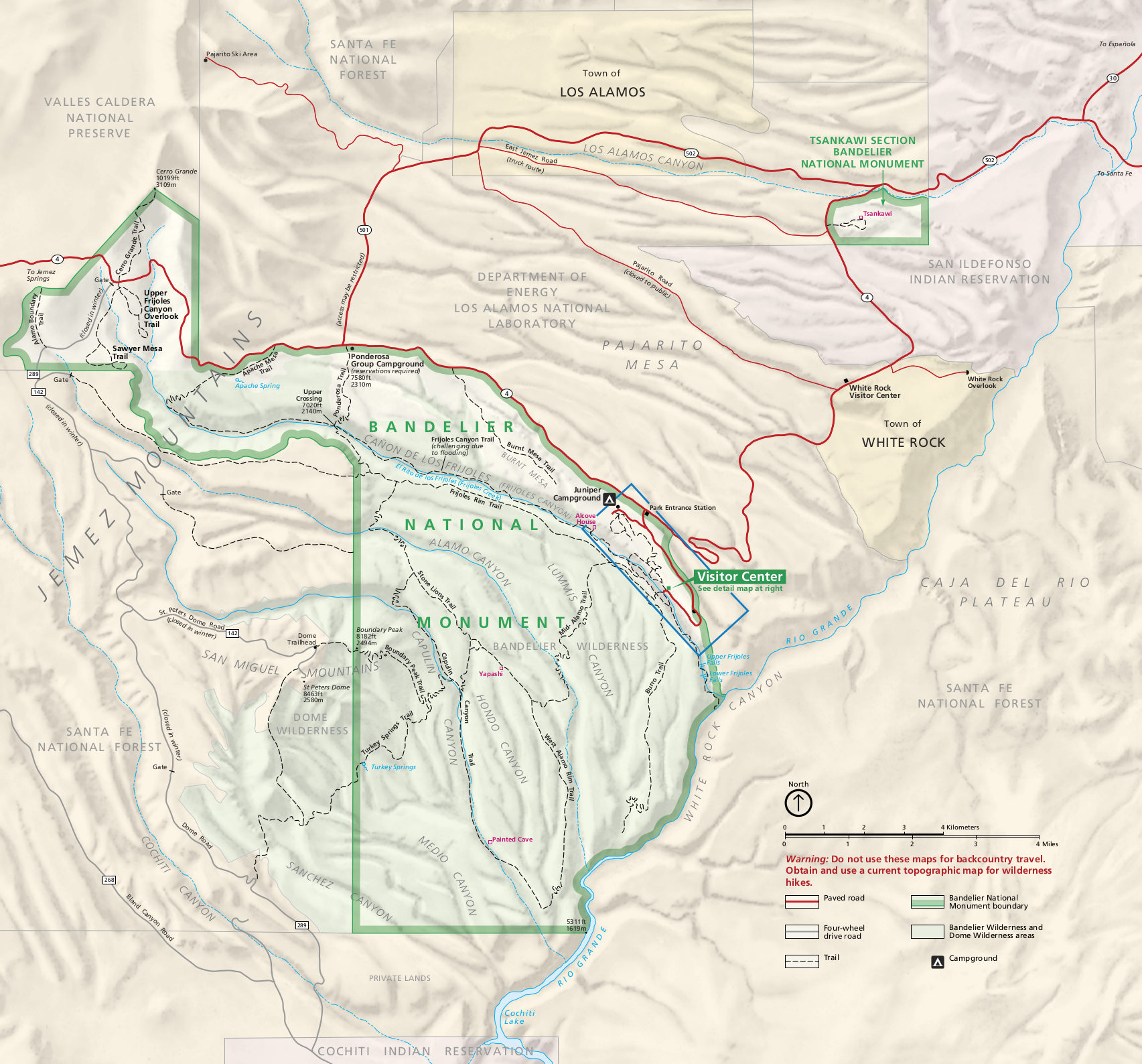
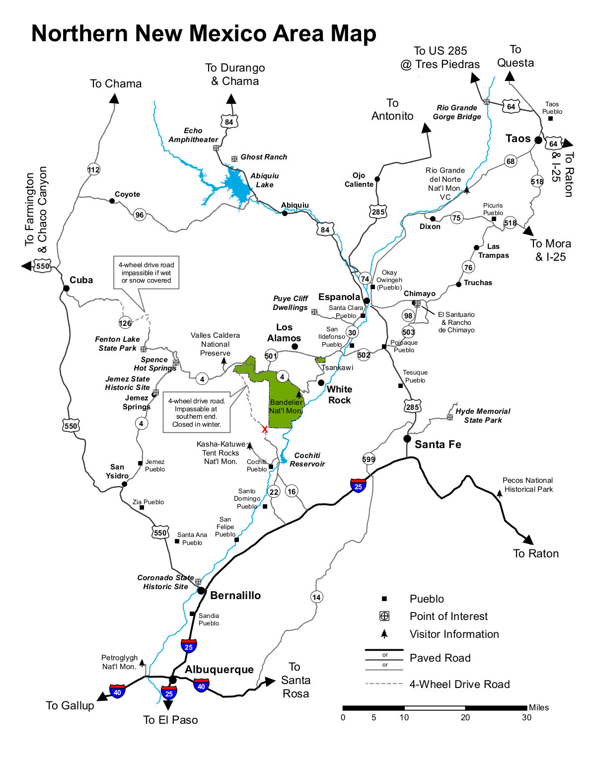 Here’s a regional map of Bandelier, showing the roads and other points of interests in northern New Mexico. Click the image to view a full size JPG (100 kb) or download the PDF (300 kb).
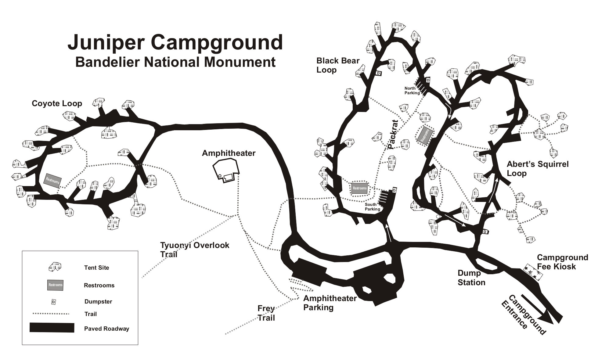 This is a Juniper Campground map, showing each of the three loops in the campground located just inside the entrance station. Click the image to view a full size JPG (220 kb) or download the PDF (80 kb).
Scientific Bandelier maps
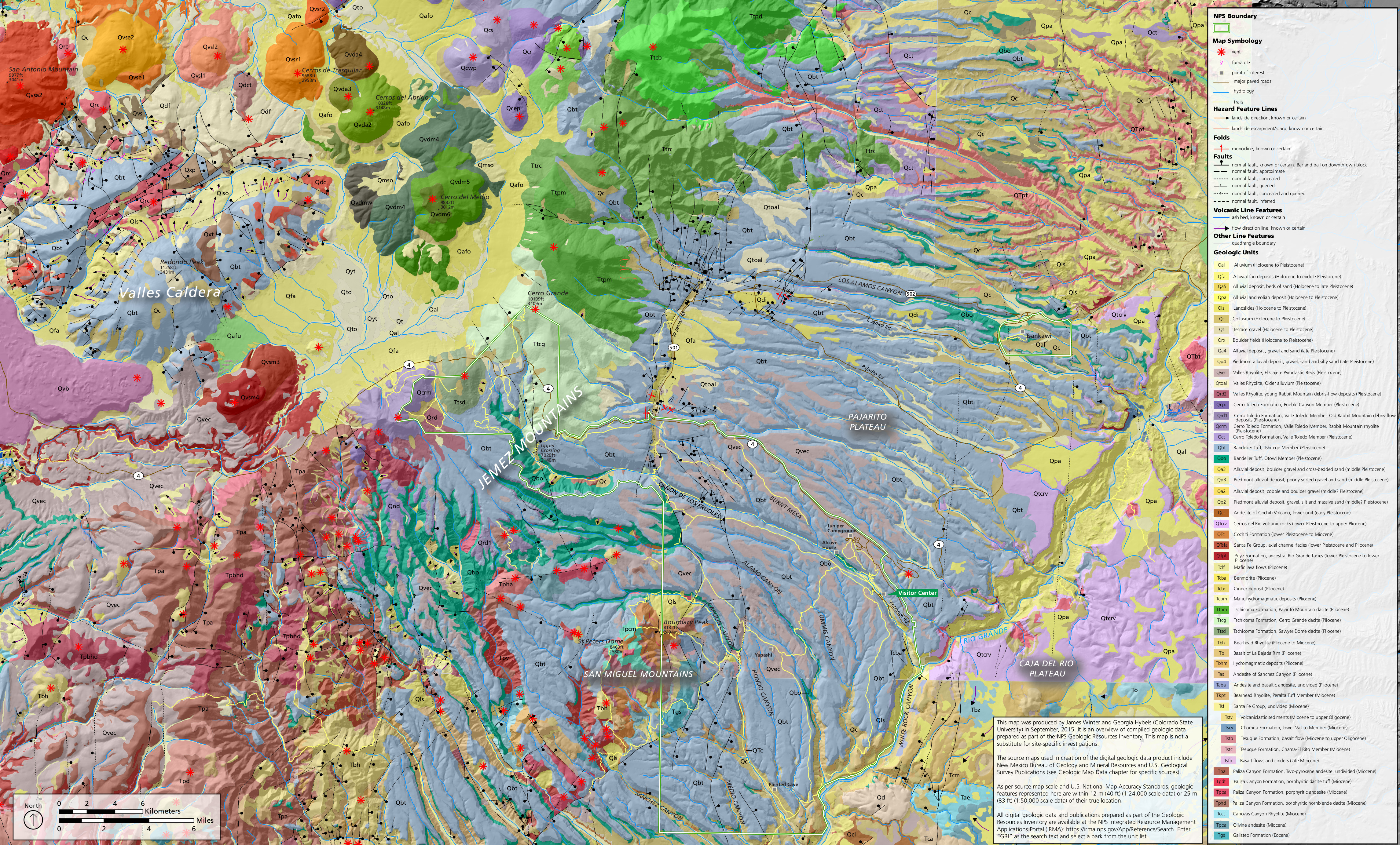 Here’s a Bandelier geologic map (4.7 mb), showing the variety of rock layers and geologic features inside Bandelier National Monument as well as nearby Valles Caldera National Preserve.
 The Bandelier vegetation map (4.3 mb) identifies the variety of forest, brush, and shrub communities that grow in Bandelier National Monument and in the detached Tsankawi unit of the park.
…and more!
< Return to National Park Maps home
< Return to Park List
< Return to List by State
Need more planning help? Browse Amazon’s best-selling Bandelier maps and guidebooks.