Mount Rainier maps from the park brochure
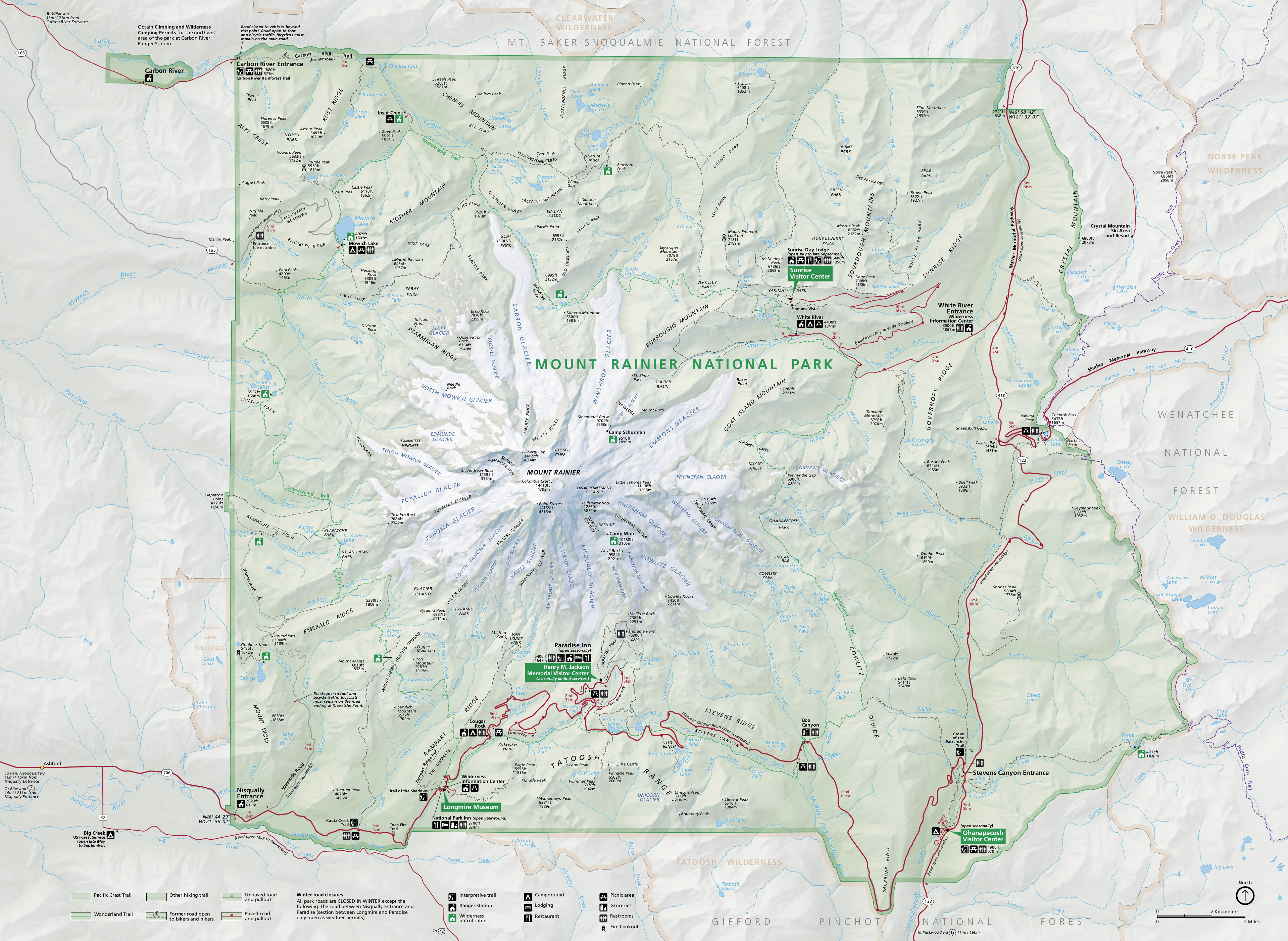
 This is the official Mount Rainier National Park map as of 2025. It was last updated in 2023 and mirrors the map you get in the park brochure. The amazing illustrations of the glaciers are this map’s highlight.
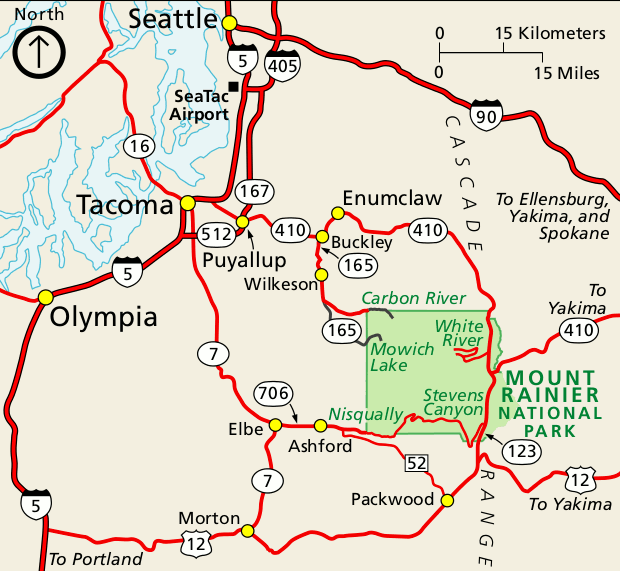 This is a regional Mount Rainier map, showing the primary roads used to reach Mount Rainier from Seattle and Tacoma. Click the image to view a full size map or download the PDF.
Mount Rainier trail maps
 If you want a full-color waterproof trail map with topographic lines, you should probably purchase the National Geographic Trails Illustrated map. The free maps below work well for trip planning and for short hikes, but aren’t going to be too useful for overnight wilderness trips. This map includes mileages, backcountry campgrounds, and detailed topo lines, and is the one you should take with you when backpacking.
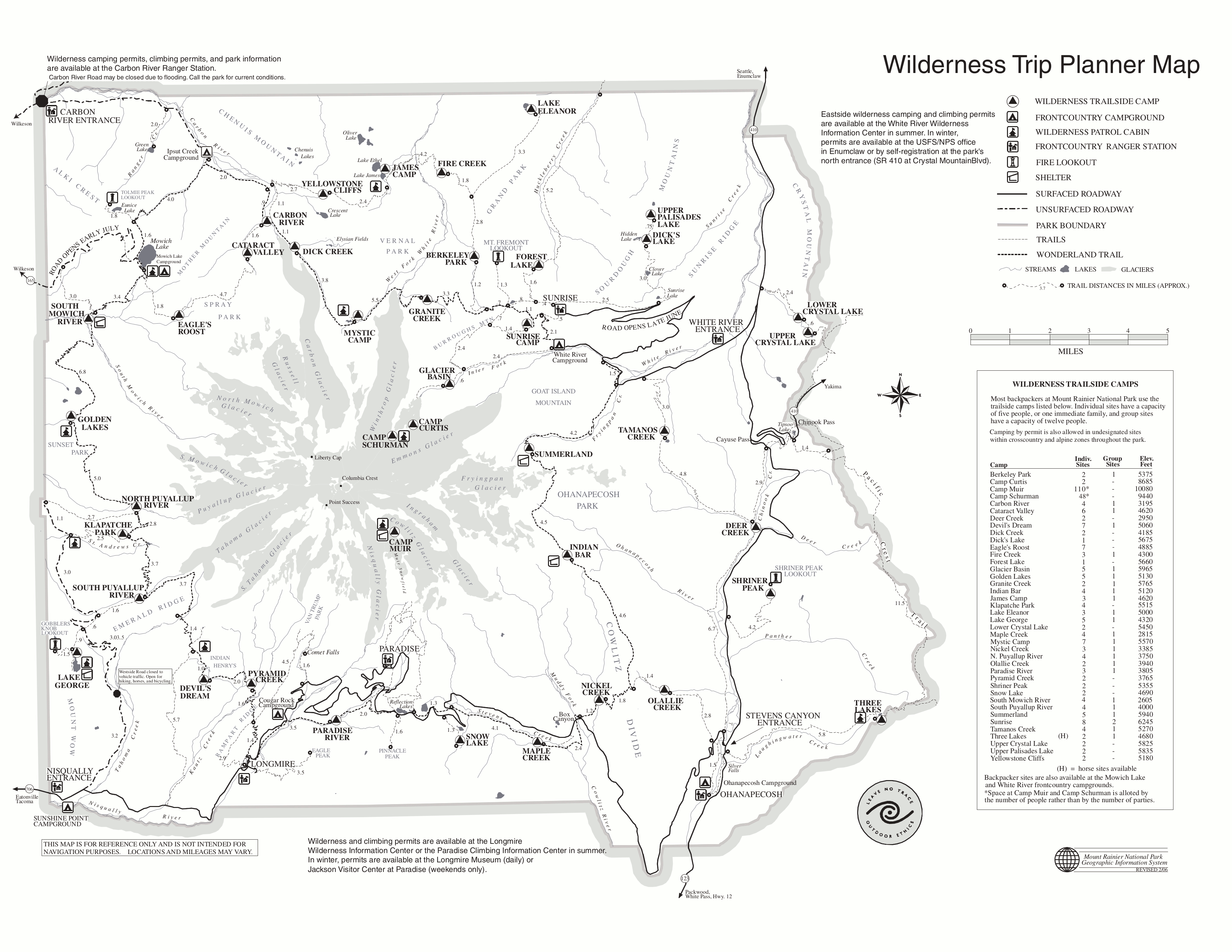 This is a Mount Rainier trail map, showing backcountry wilderness campsites and trail mileages, focusing on the Wonderland Trail. Click the image to view a full size map or download the PDF.
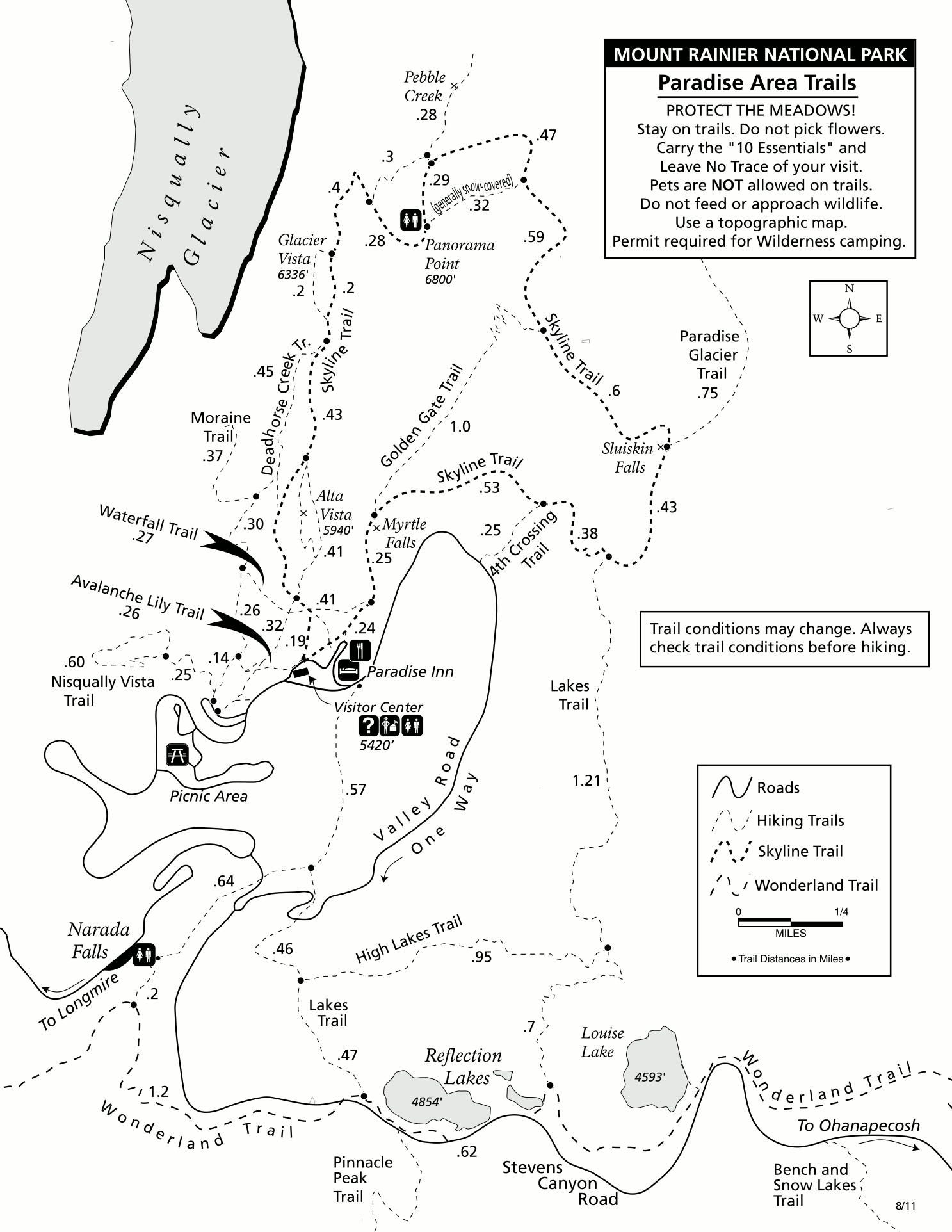 This is a summer Paradise trail map, showing popular hiking trails to views of waterfalls (Myrtle Falls, Sluiskin Falls), lakes, Nisqually Glacier, Paradise Glacier, and more.
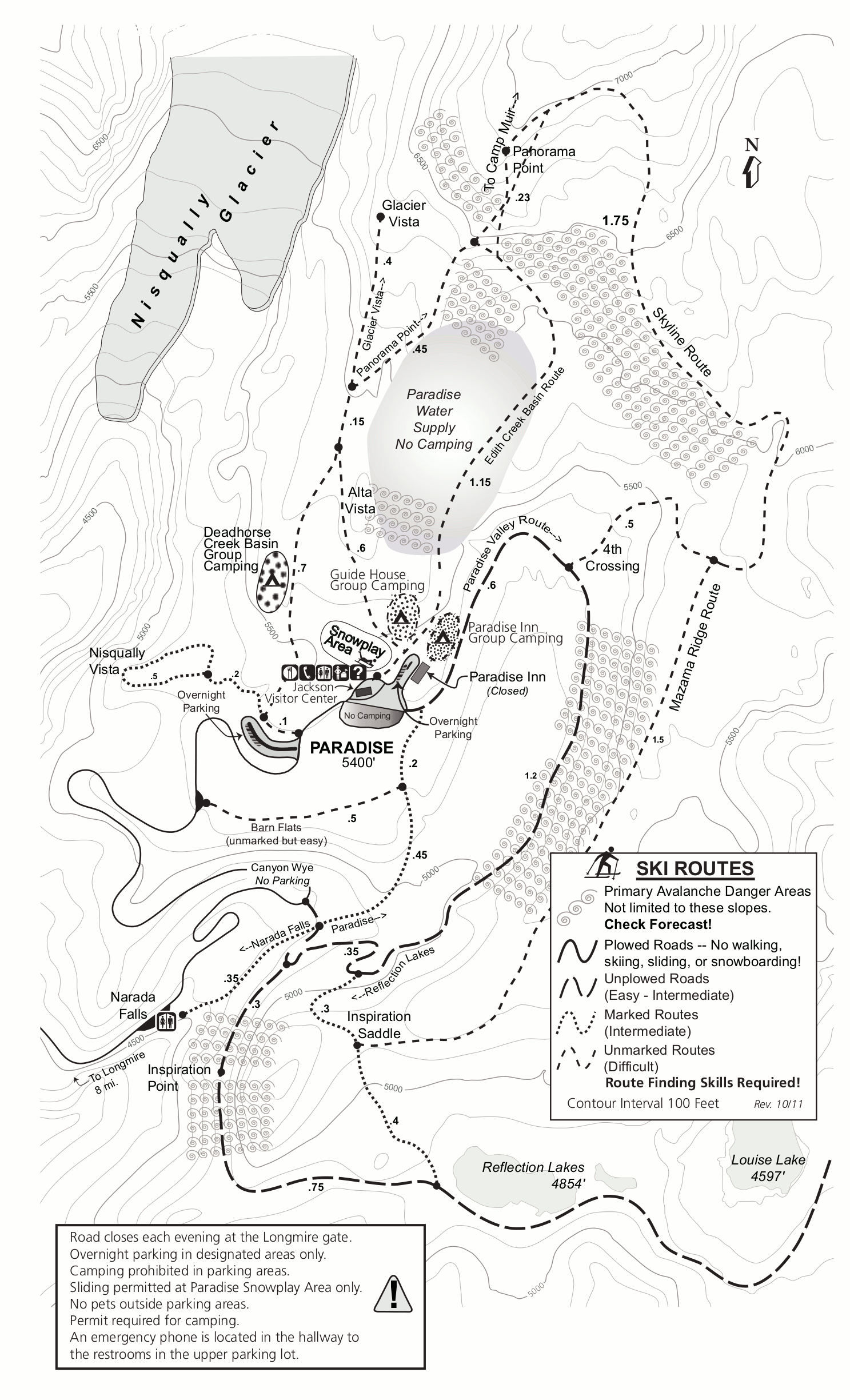 This is a Paradise winter trail map, showing the snowplay area, popular ski and snowshoe routes, avalanche danger zones, and snow camping areas near the Jackson Visitor Center.
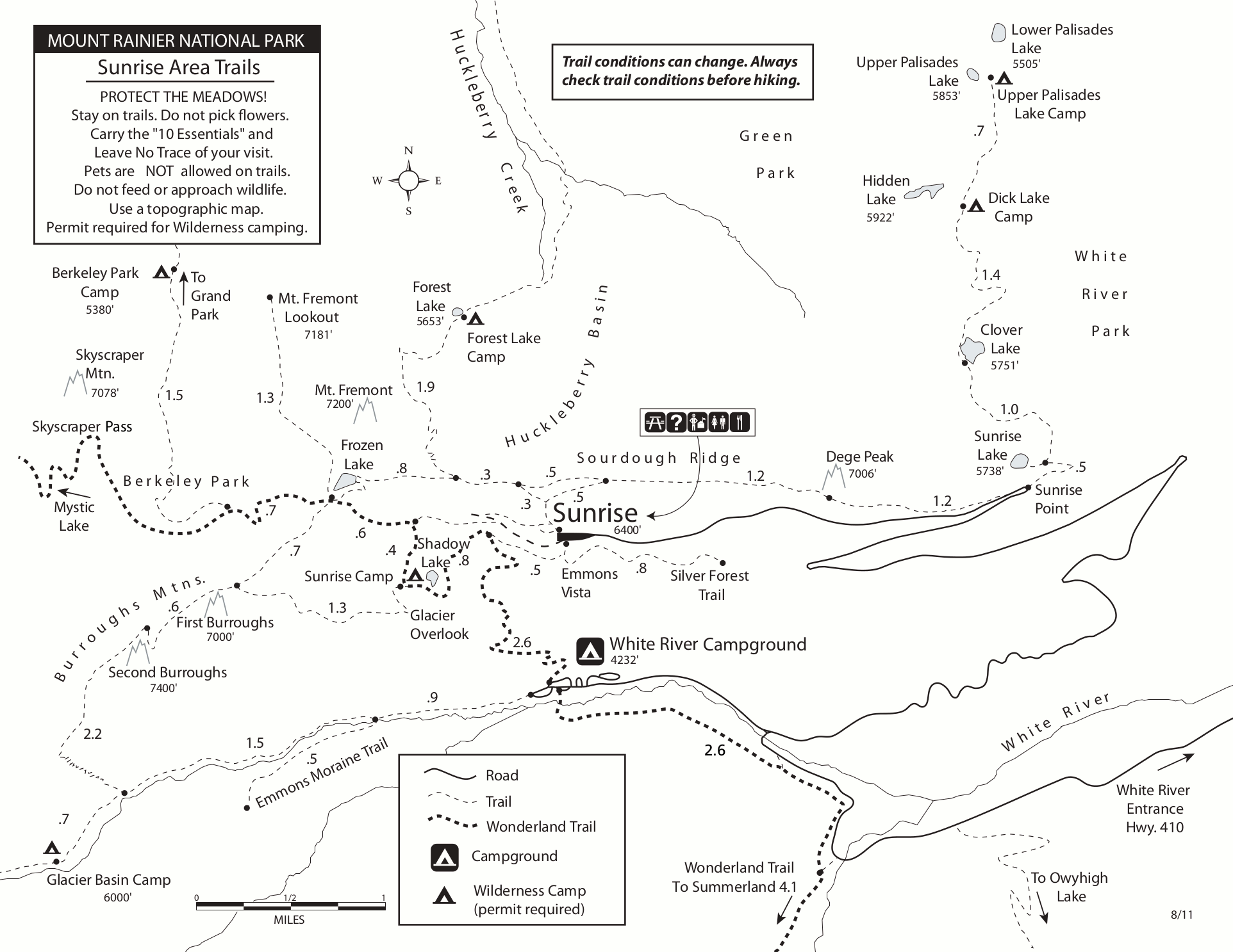 This is a Sunrise trail map, showing trails along Sourdough Ridge, Burroughs Mountain, and popular lakes and campsites along the Wonderland Trail like Shadow Lake and Frozen Lake.
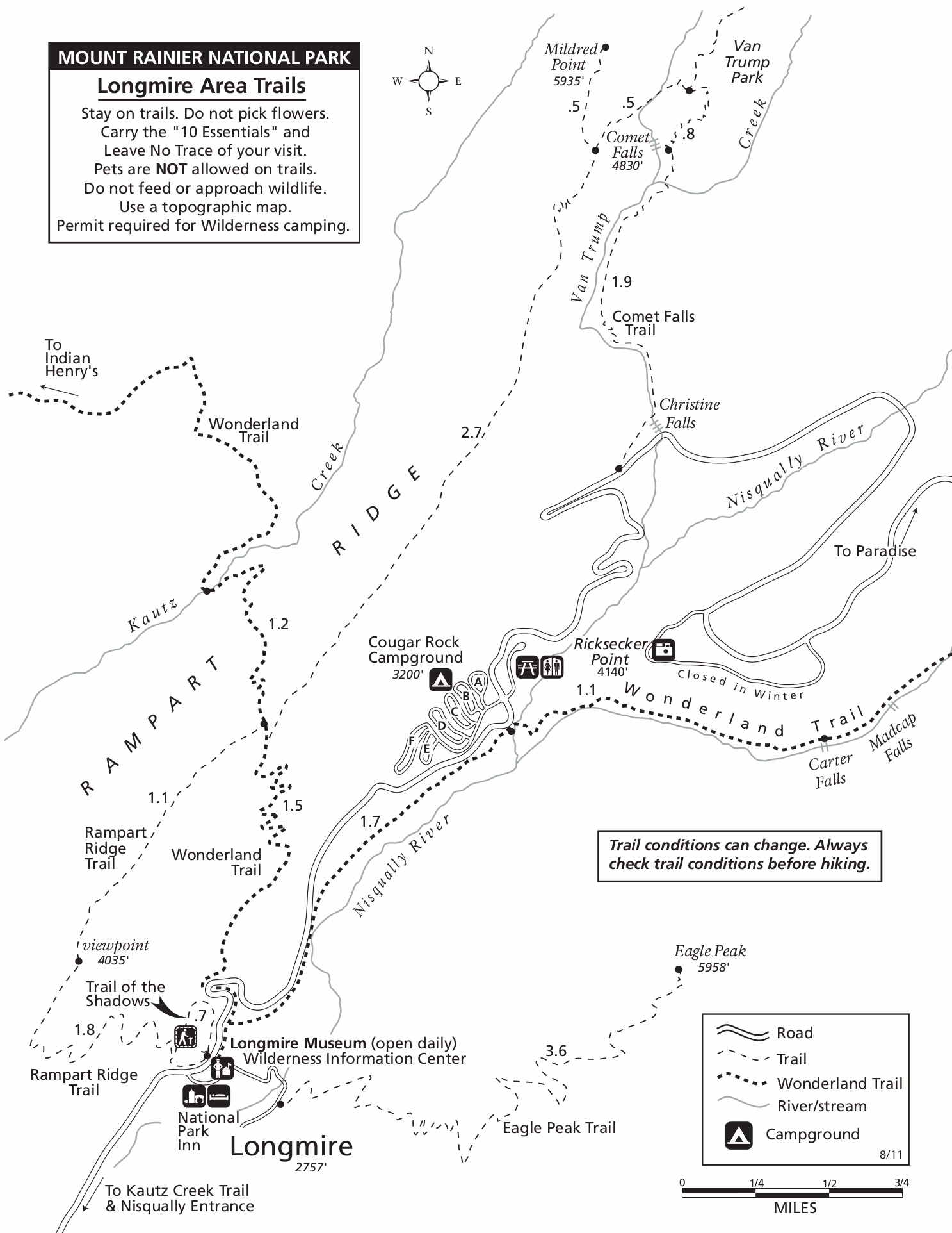 Here’s a Longmire trail map, showing the Wonderland Trail, Cougar Rock Campground, and a few hiking trails leading toward waterfalls (Christine Falls, Comet Falls, Carter Falls, Madcap Falls).
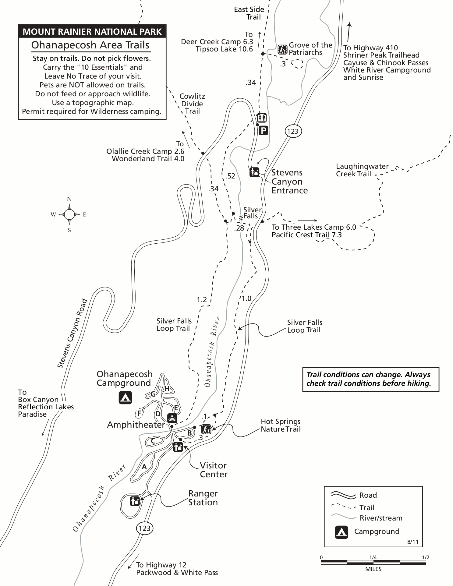 The Ohanapecosh trail map includes hikes to Silver Falls, Grove of the Patriarchs, and others in the Stevens Canyon area of Mount Rainier along the Ohanapecosh River.
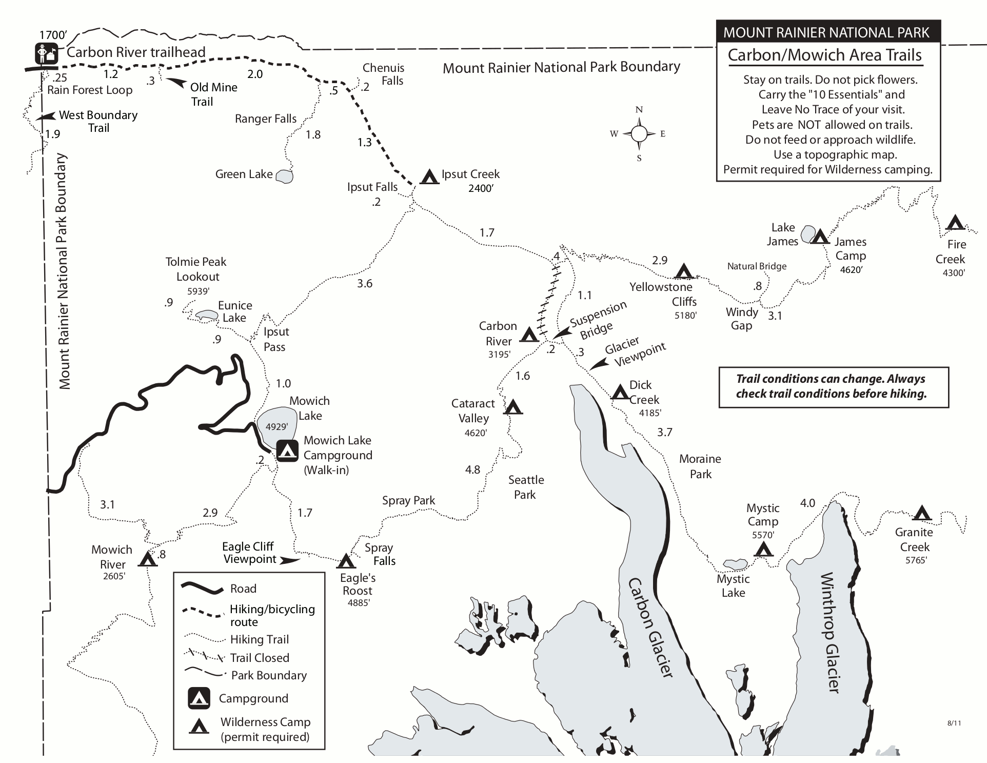 This is a Carbon River and Mowich Lake trail map, showing trails in the northwest corner of Mount Rainier National Park to places like Spray Park, Seattle Park, Carbon Glacier, and more.
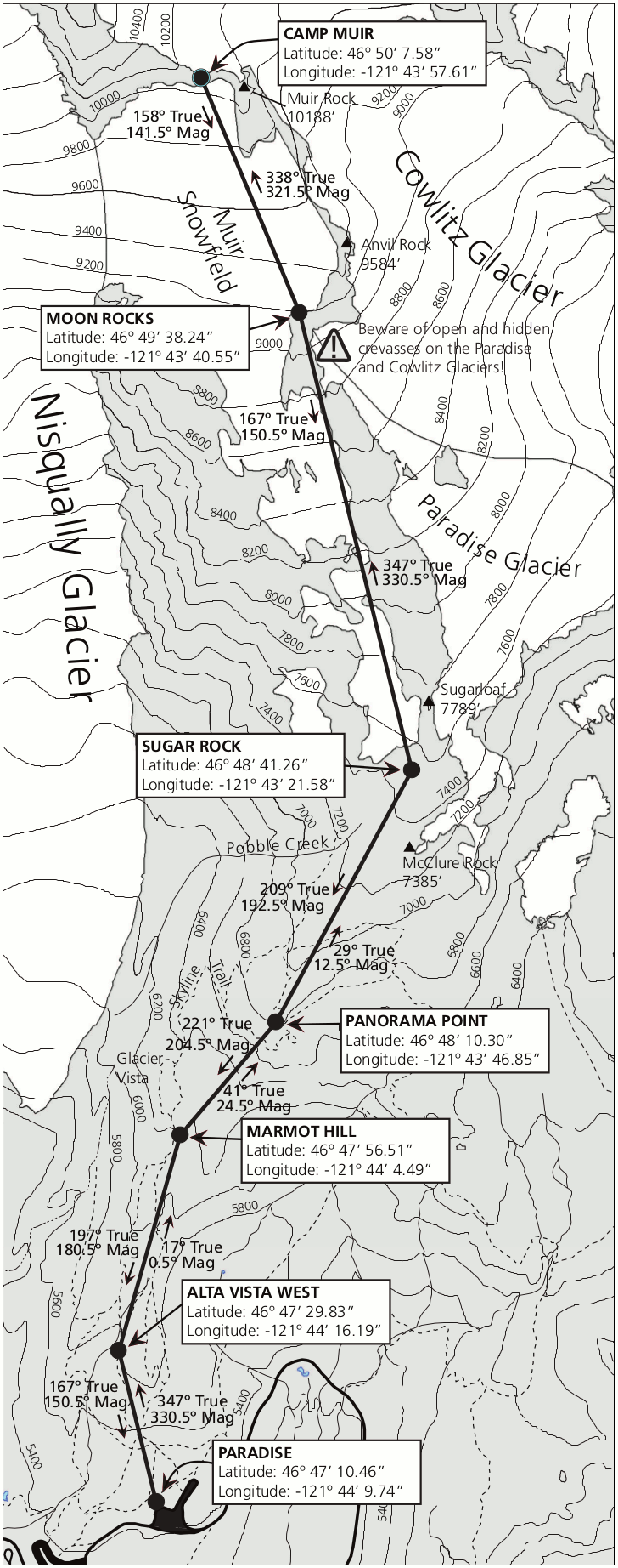 This is a navigation map to Camp Muir from Paradise, showing the route across the snowfields. This is not a hiking trail and should only be done by hikers with considerable off-trail experience.
Mount Rainier trailhead maps
The following maps are from trailhead wayside exhibits throughout the park.
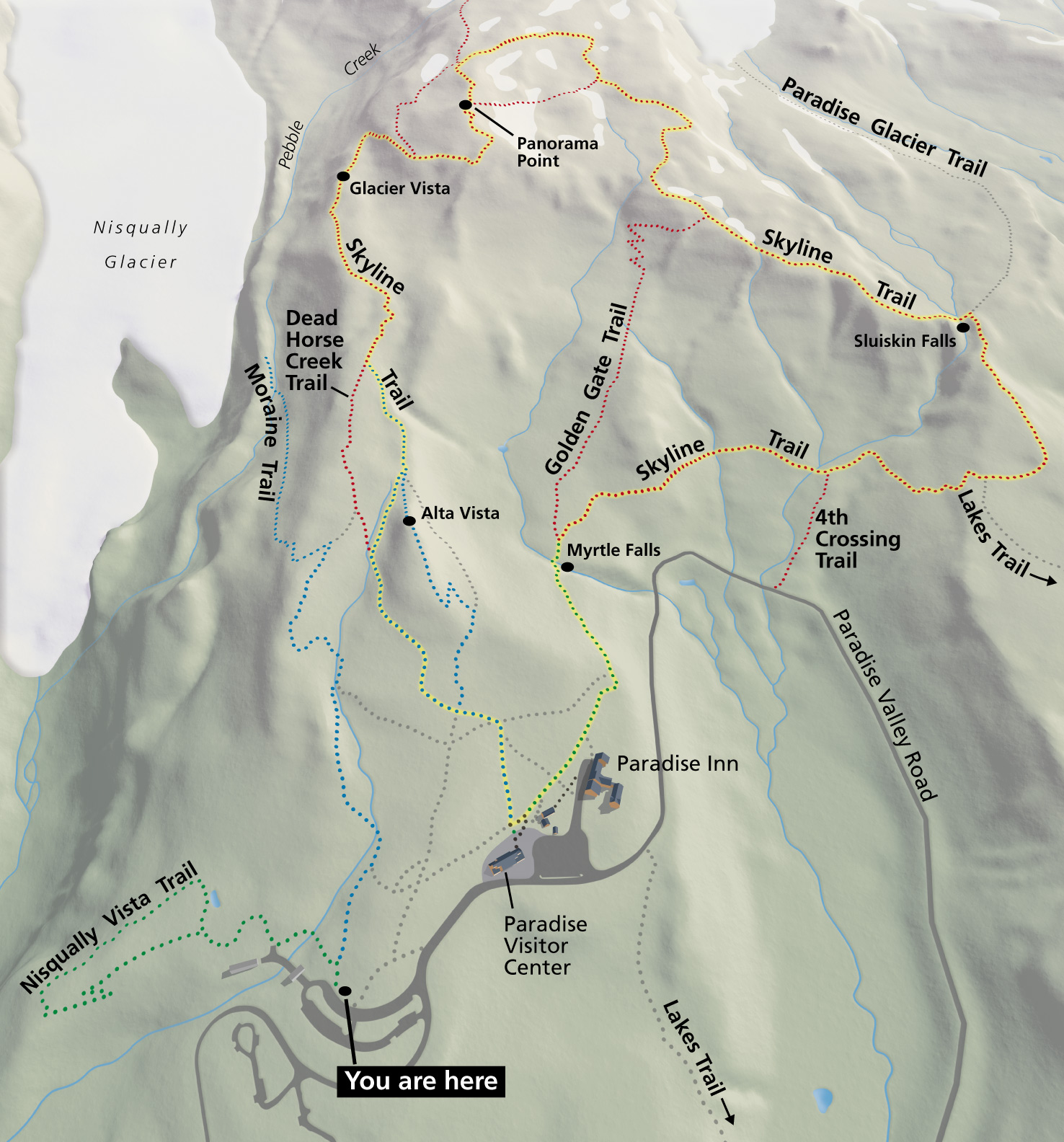 This Paradise area trails map is from a sign at the Paradise parking lot. It shows the entire network of trails that view the Nisqually Glacier, Paradise Glacier, Myrtle Falls, and Panorama Point.
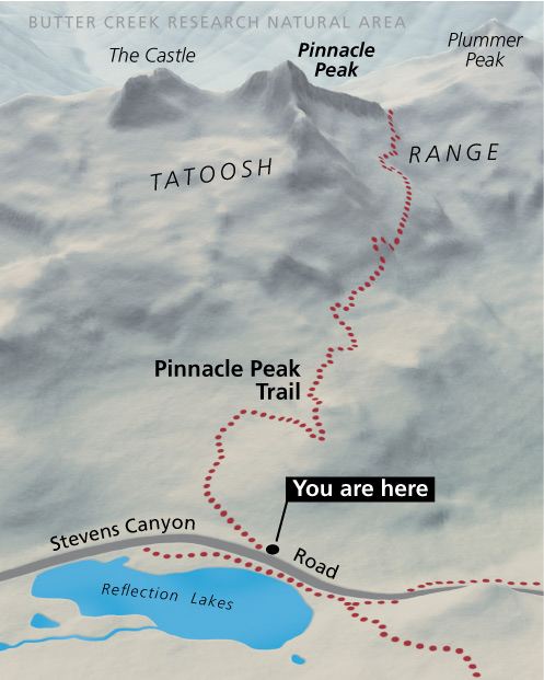 The Pinnacle Peak trail map shows the route to the top of (what else?) Pinnacle Peak, accessible from the Stevens Canyon Road near Reflection Lake, just south of the Paradise area.
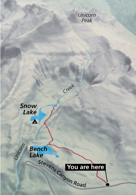 Here’s a Bench Lake trail map, from the trailhead sign at the parking area southeast of Paradise. The trail travels past Bench Lake to Snow Lake in the Tatoosh Range near Unicorn Peak.
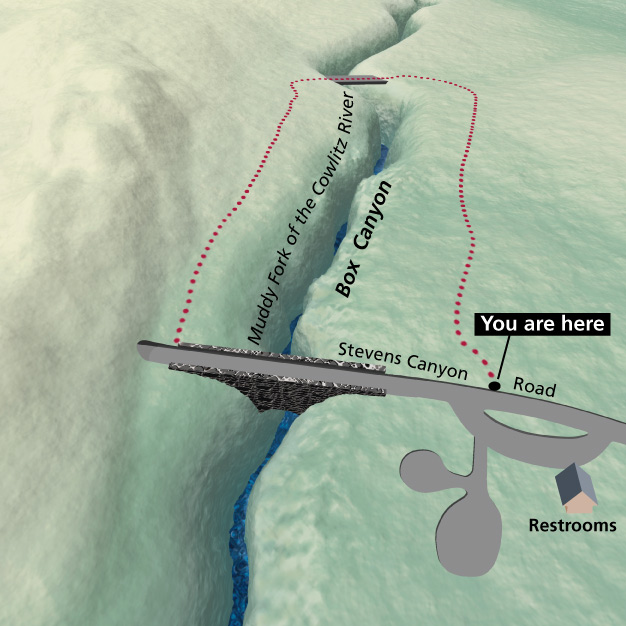 The Box Canyon trail map shows this very simple, flat loop of less than a mile. It’s located further down the Stevens Canyon Road, east of Paradise, Pinnacle Peak, and Bench Lake.
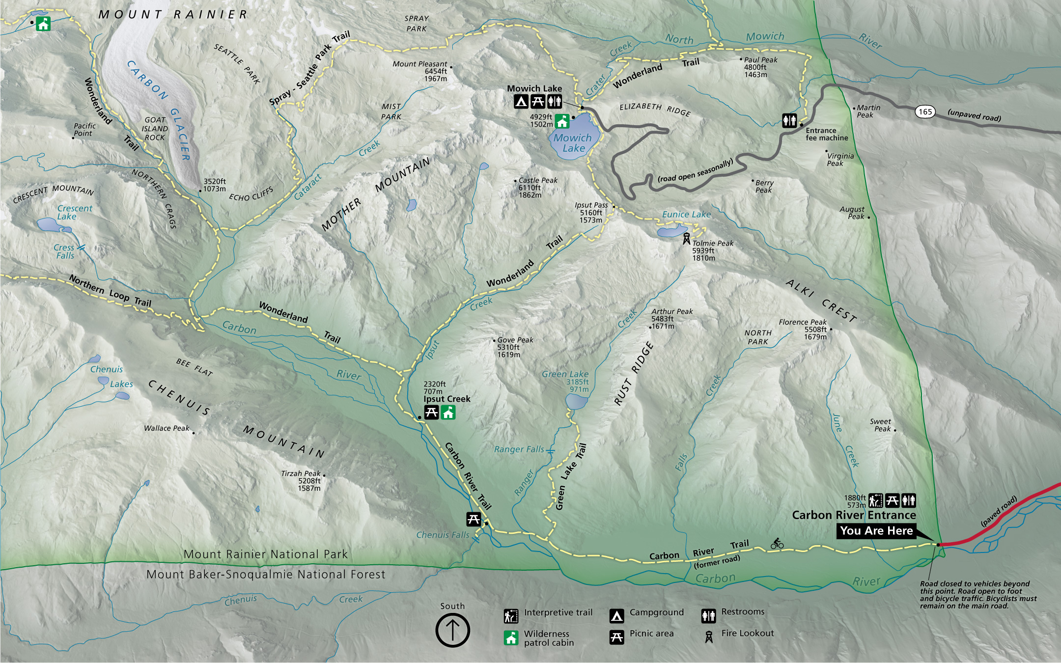 This Carbon River trail map is from a sign at the Carbon River entrance at the end of the road. It shows the trail network including Mowich Lake, the Carbon Glacier, and part of the Wonderland Trail.
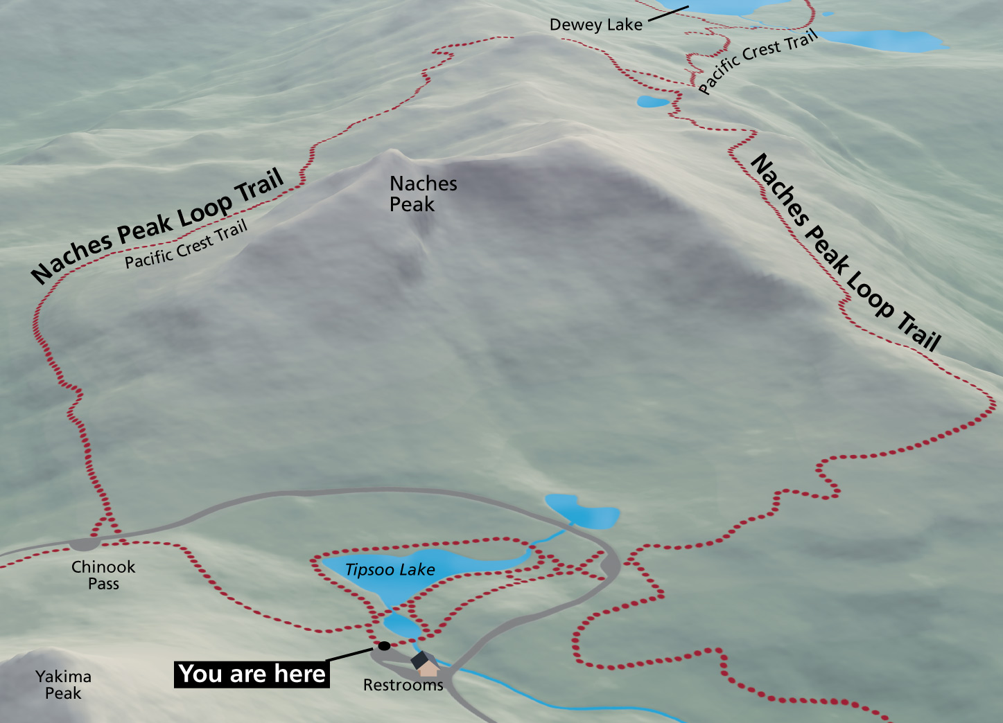 Here’s a Naches Peak trail map, showing the routes that depart Tipsoo Lake to loop around Naches Peak. Access to this trail is just inside the park boundary, west of Chinook Pass on Highway 410.
Mount Rainier lodging map
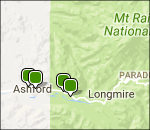 If you want to stay just outside Mount Rainier National Park, your closest bet will be the town of Ashford; to the right you can open an Expedia interactive lodging map centered there. Zooming out will show other lodging options in nearby towns, though they tend to be further away. Instead, you may be best off browsing Expedia’s top-rated Mount Rainier lodging where you can compare reviews, photos, locations, and prices.
Paradise area maps
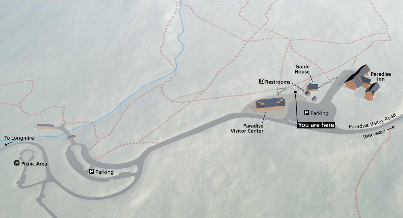 Here’s a current Paradise map, taken from a wayside exhibit in front of the Paradise Visitor Center. This will help you get oriented between the visitor center, Paradise Inn, and parking areas.
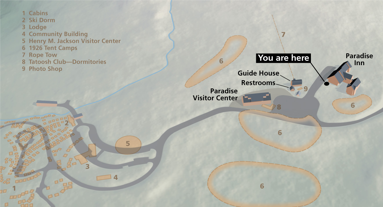 This is a historic Paradise map, located on the wayside next to the Paradise Inn. It shows the former locations of buildings from earlier days, such as cabins, ski dorms, rope tow, and old visitor center.
Assorted Mount Rainier maps
 This is a timed entry vehicle reservation map, showing where reservations are needed for entry to Sunrise in 2025. Permits are required daily through September 1 and then weekends until Sunrise closes for the season.
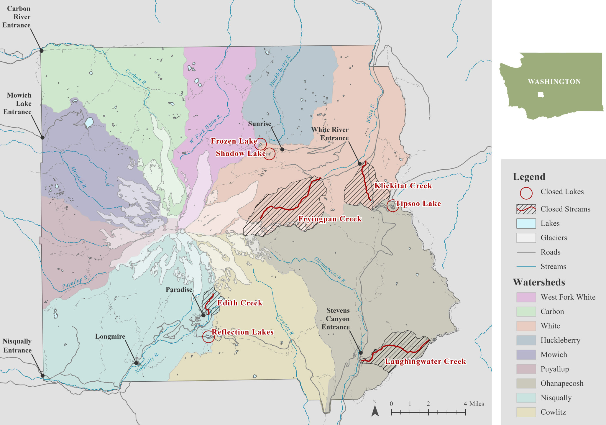 The Mount Rainier fishing map, color codes each of the park’s watersheds, which allows you to easily see the large size of the White River and Ohanapecosh drainages. It also labels lakes and streams closed to fishing.
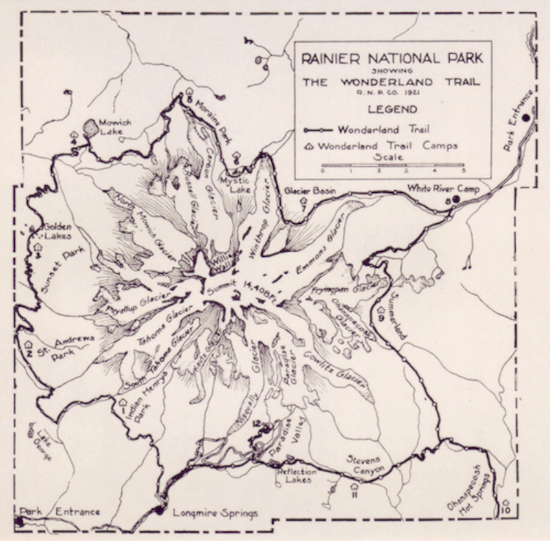 Here’s a historical Wonderland Trail map, showing the trail layout as it appeared in 1921. Note already the presence of various trail camps, and how closely today’s route follows the original from 100 years ago.
Mount Rainier climbing maps
Following are four maps that detail four climbing routes up Mount Rainier. Admittedly the maps aren’t as high-resolution as I’d like; this is simply the way they come from the National Park Service climbing guides. But honestly, that’s fine; this section is really meant for you to download the climbing guide PDFs to learn about these different routes to the summit.
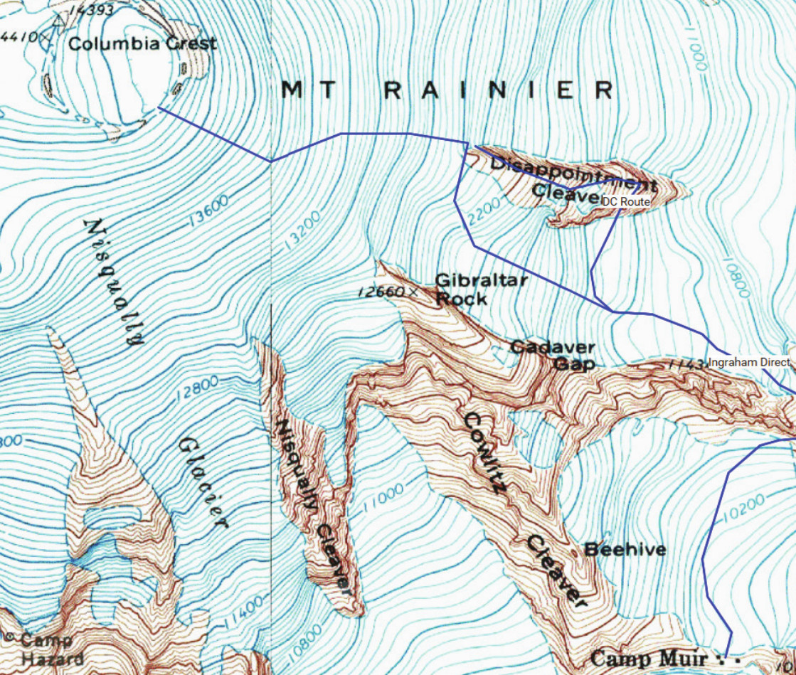 This is a Disappointment Cleaver route map, which is Rainier’s most popular climbing route, receiving 75% of all summit attempts. Download the NPS booklet: Disappointment Cleaver Route guide (PDF).
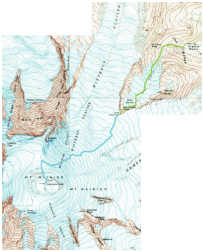 Here’s an Emmons Glacier route map, a.k.a. the Emmons–Winthrop route. It’s the next most popular route and a modest step up in difficulty. Download the NPS booklet: Emmons-Winthrop Route guide (PDF).
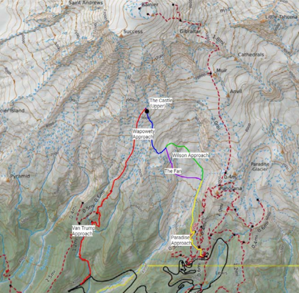 The Kautz Glacier route map shows the approaches to the third most popular route. Kautz has a greater difficulty increase, requiring ice climbing experience. Download the NPS booklet: Kautz Glacier Route guide (PDF).
 Here’s a Liberty Ridge route map. This is one of the most iconic climbs in North America and is only for expert mountaineers with years of experience. Download the NPS booklet: Liberty Ridge Route guide (PDF).
Mount Rainier campground maps
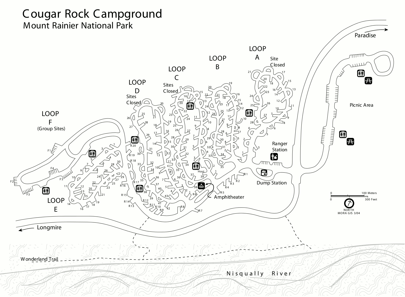 This is a Cougar Rock Campground map. Cougar Rock is located between Longmire and Paradise in the southwest corner of the park. Click the image to view a full size map or download the PDF.
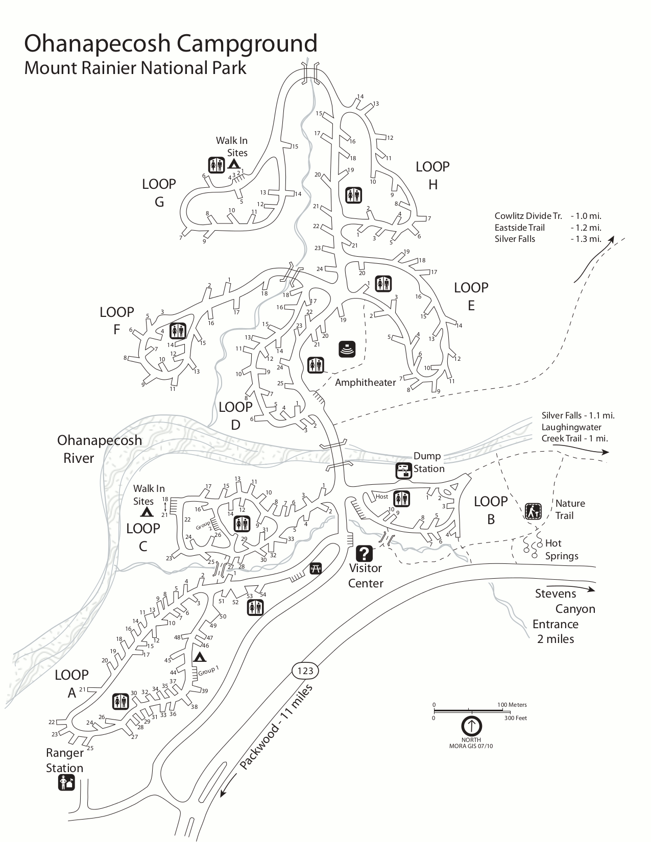 This is a map of Ohanapecosh Campground, which is located near the Ohanapecosh Visitor Center in the southeast corner of the park. Click the image to view a full size map or download the PDF.
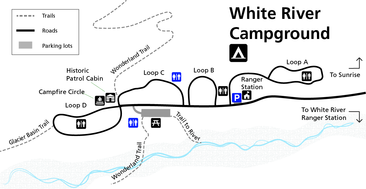
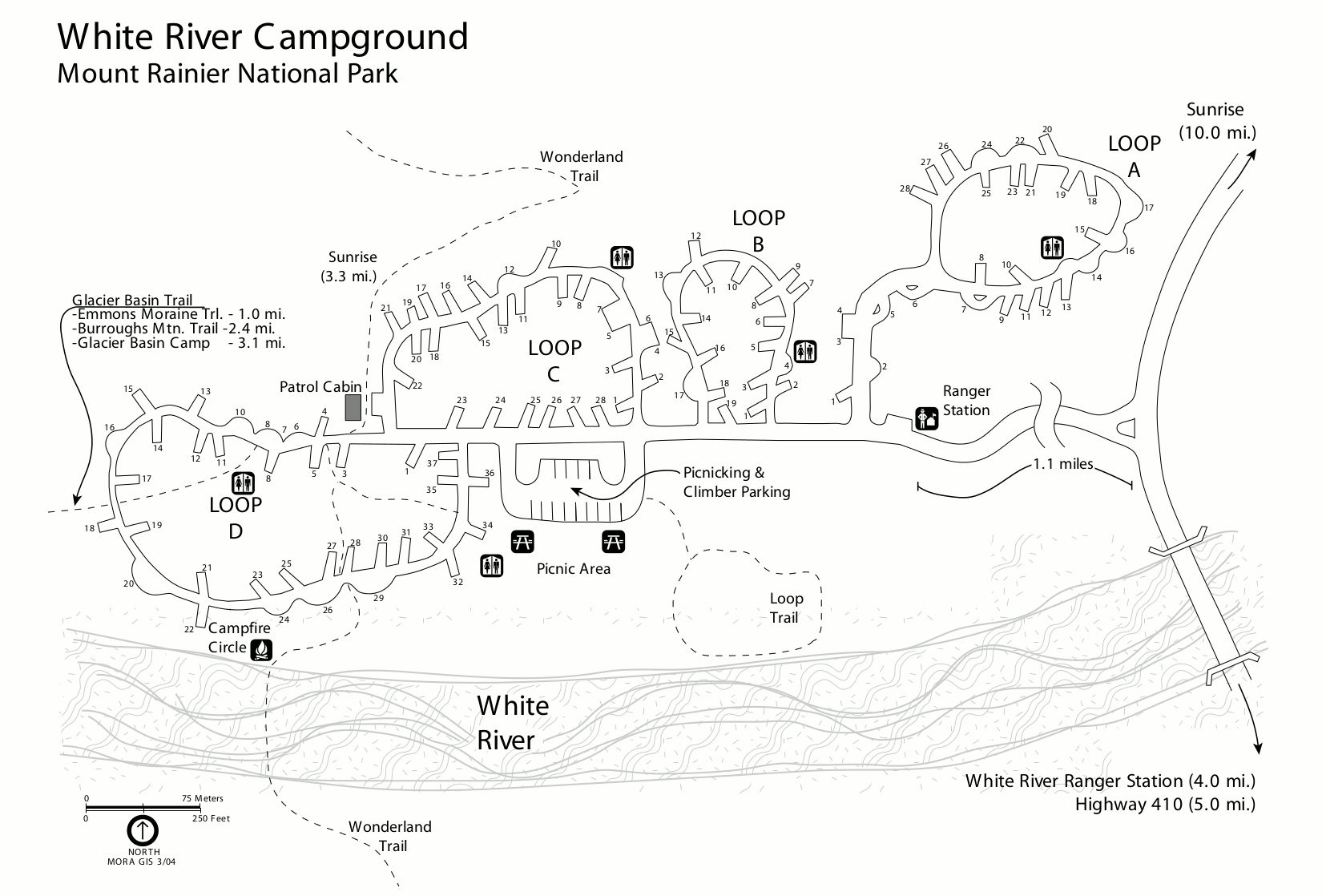 This is a White River Campground map. White River is the highest elevation campground and is located on the way to Sunrise. Click the image to view a full size map or download the PDF.
Accessible Mount Rainier maps
The maps in this section are meant to show accessible features such as restrooms, parking, and campsites. But they should also prove useful to everyone, as they show the layout of various developed areas.
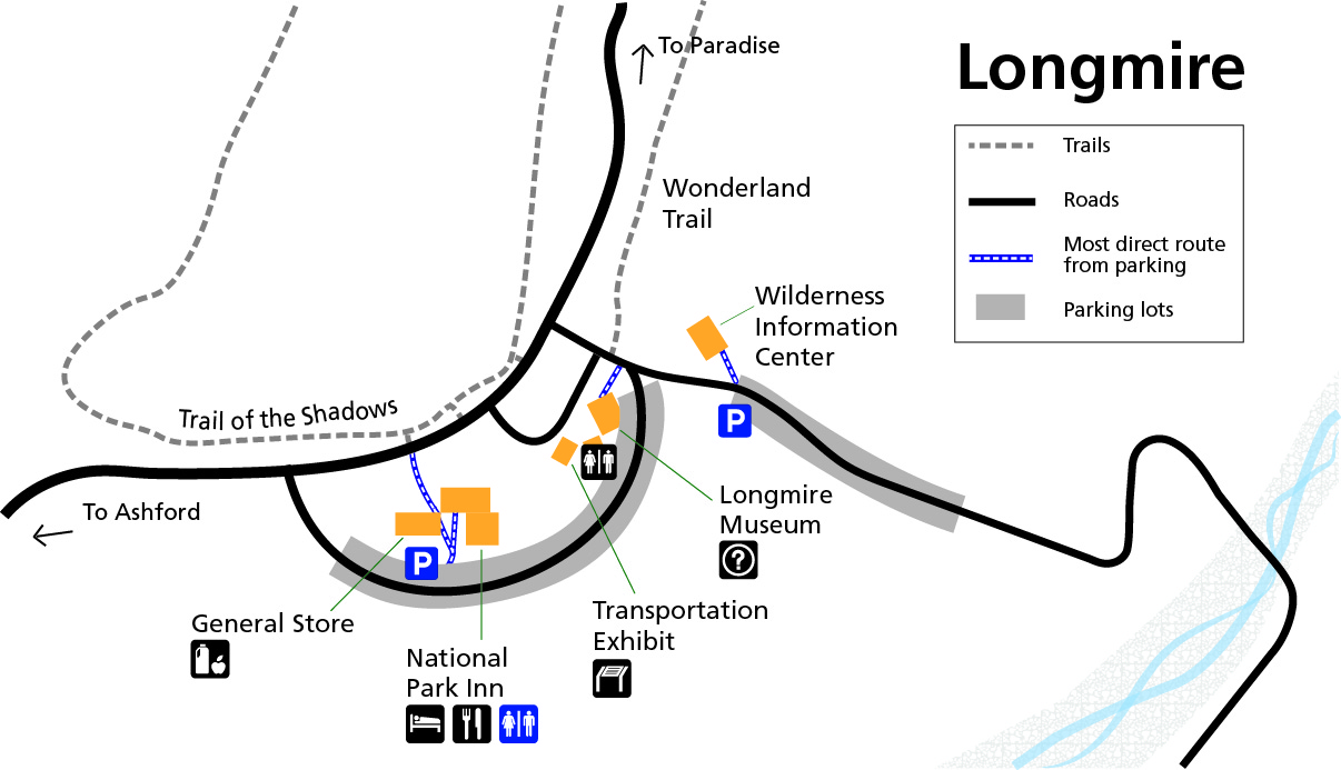 The Longmire accessible map zooms in on the area around the Longmire Museum, National Park Inn, Wilderness Information Center, and other facilities to show handicap accessible parking and restrooms.
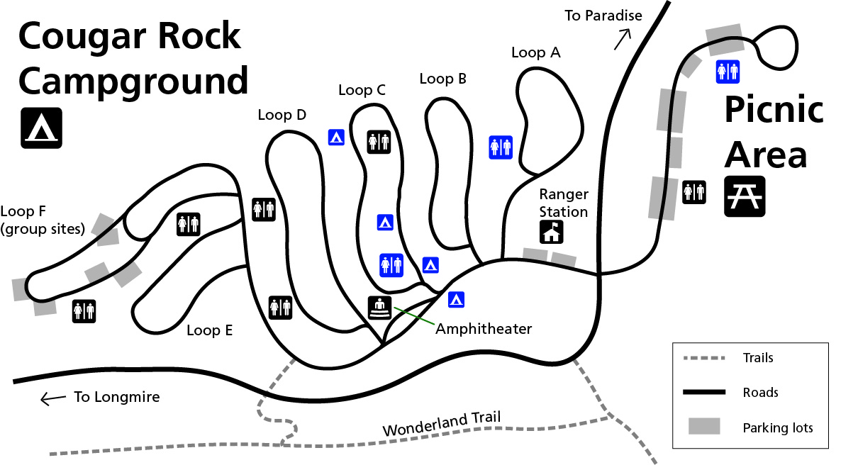 The Cougar Rock Campground accessible map labels several accessible campsites and two accessible restroom facilities at this campground located between Longmire and Paradise.
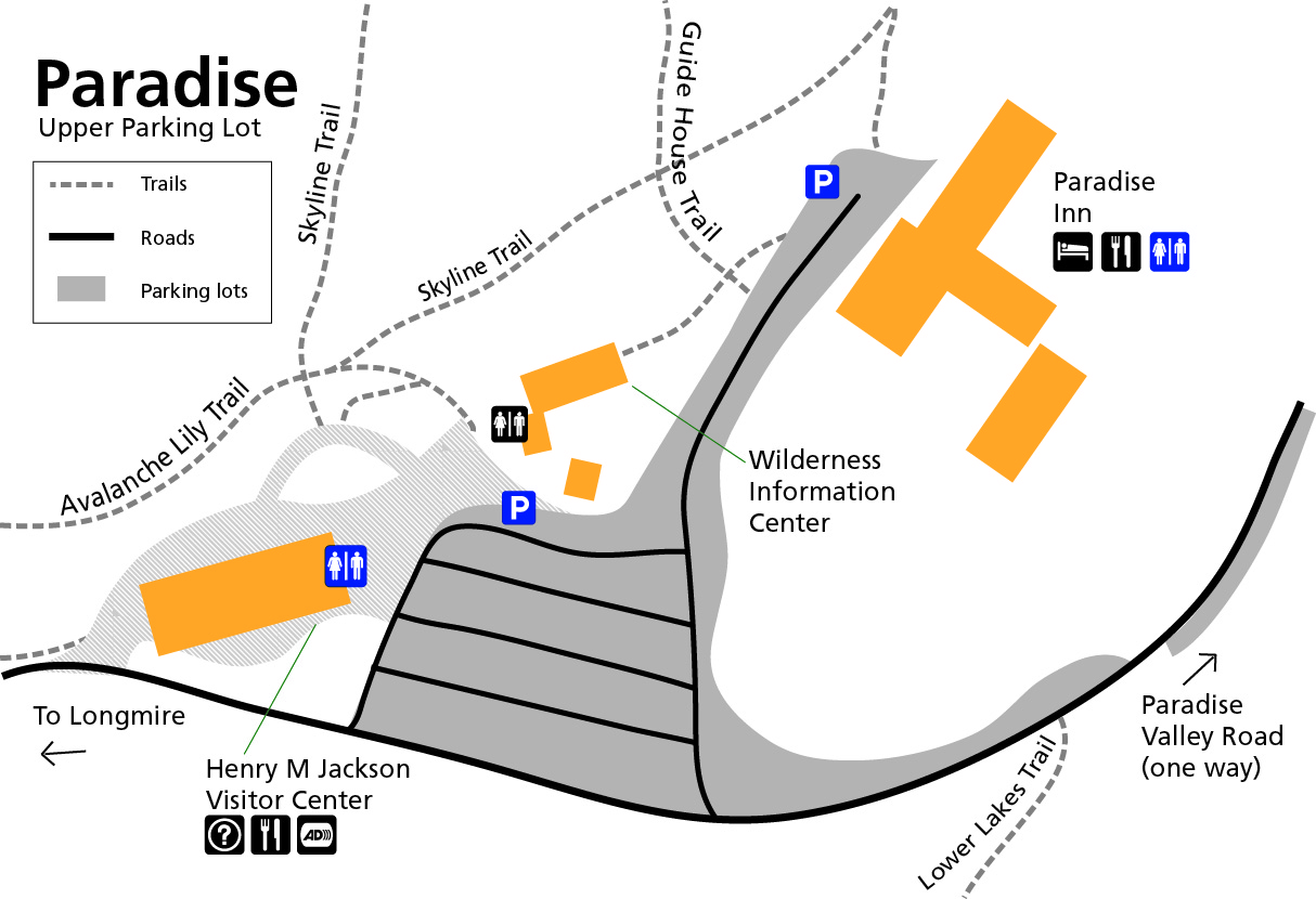 This Paradise accessible map shows the upper parking lot area near the Henry M. Jackson Memorial Visitor Center and Paradise Inn, labeling a few accessible restrooms and parking spaces.
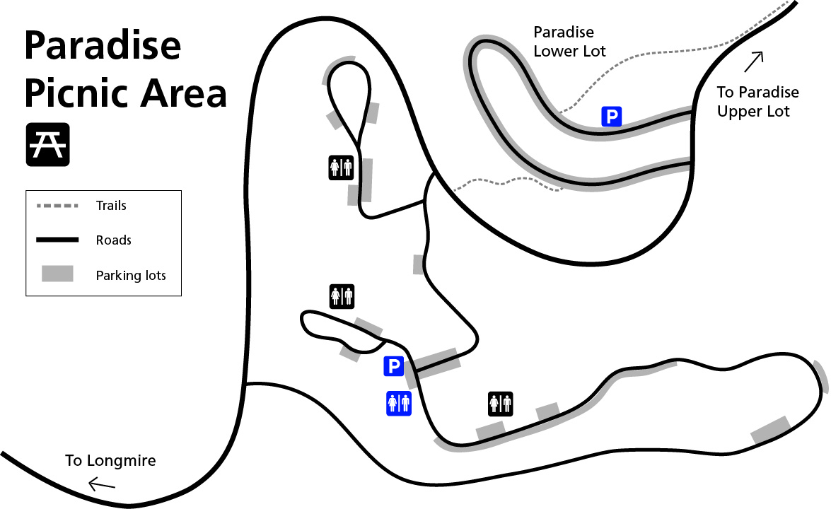 The Paradise Picnic Area accessible map shows the lower parking lot and picnic area, labeling accessible parking at each location as well as restrooms at the picnic area.
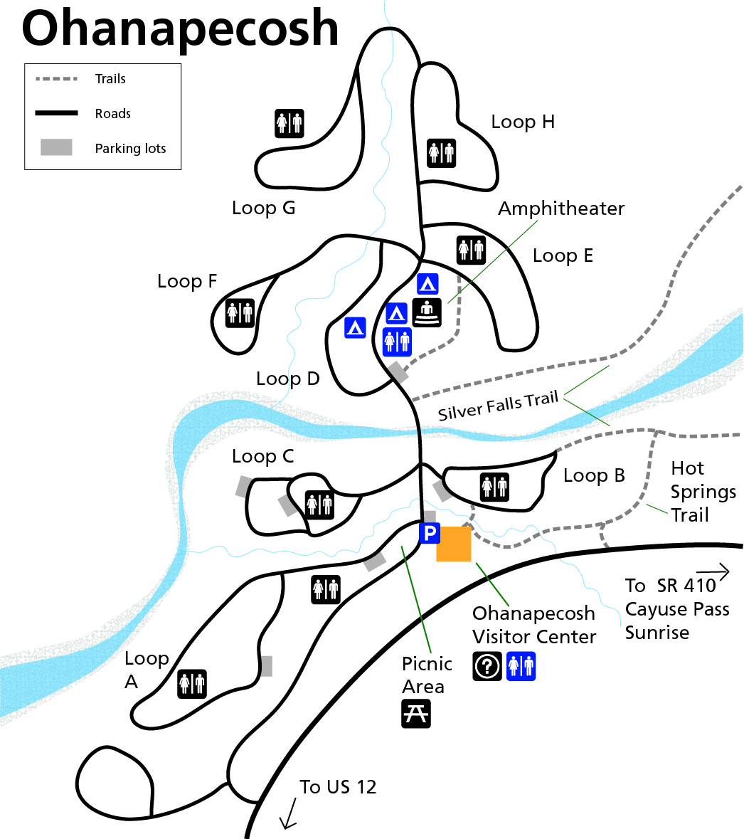 This Ohanapecosh accessible map shows accessible campsites and restrooms located in the Ohanapecosh Campground, as well as the accessible services near the visitor center and picnic area.
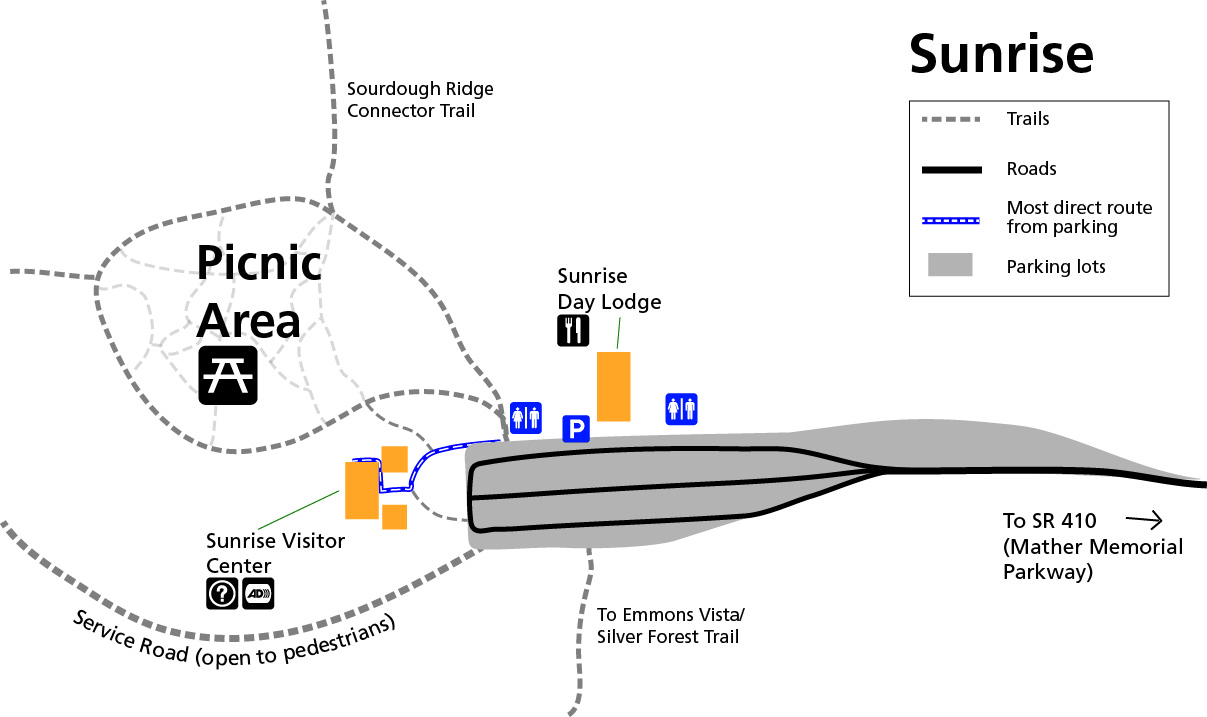 Here’s a Sunrise accessible map, showing accessible parking for the Sunrise Day Lodge, Sunrise Visitor Center, and Sunrise Picnic Area. The most direct route to the visitor center is marked.
 The White River Campground accessible map zooms in on this campground near Sunrise to show the accessible parking and restrooms in the campground.
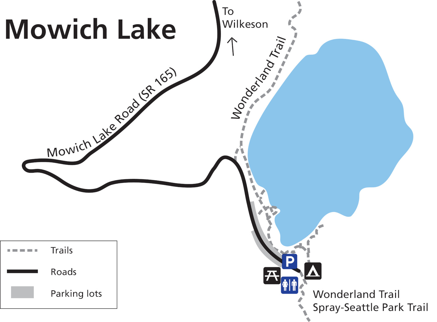 This Mowich Lake accessible map labels the accessible restrooms and parking at Mowich Lake. Note that this area may be inaccessible due to road closures, so make sure you inquire with staff before you try driving here.
Mount Rainier lahar maps
 Here’s a Mount Rainier lahar hazard map from the USGS, updated in 2023. It shows the potential for lahars from a Mount Rainier eruption, putting many cities including Puyallup and Tacoma at risk.
 This is a lahar travel time map. It’s similar to the one above but focuses on the estimated arrival time of the mudflow based on computer simulations. Even the more distant cities still only have a few hours to evacuate.
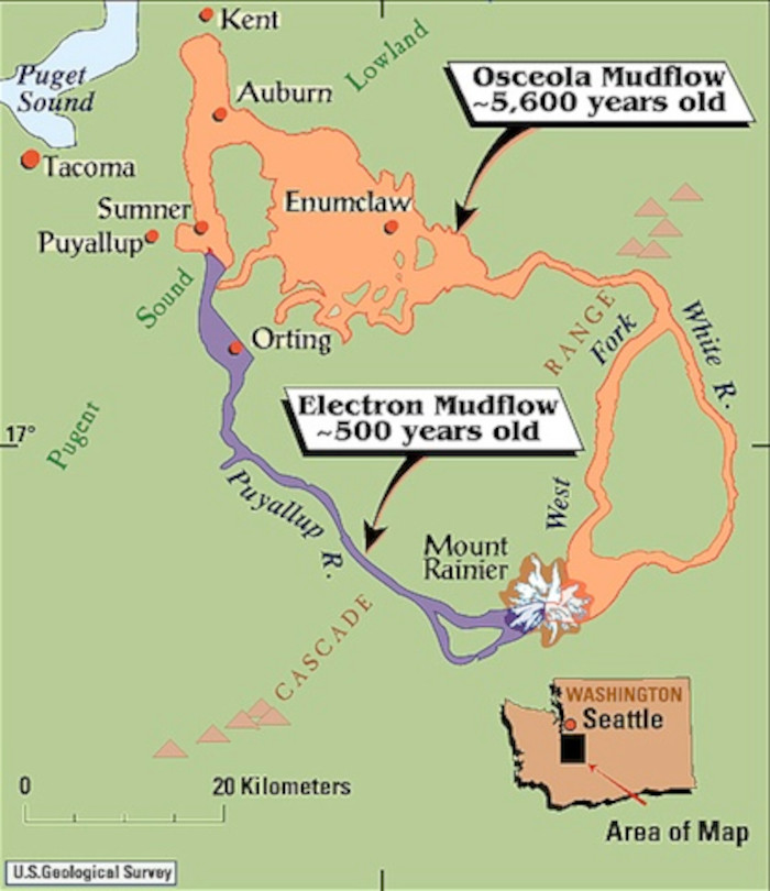 Here’s a historic Mount Rainier mudflow map. It shows deposits from the Electron Mudflow (500 years ago) and the Osceola Mudflow (5,600 years ago). Note the cities of today built upon those deposits.
Mount Rainier science maps
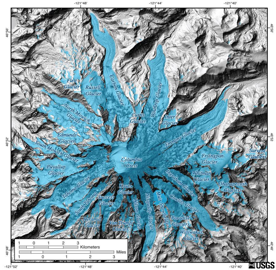 This is a Mount Rainier glacier map. This map was generated using LiDAR technology, and the glacial ice across the 28 glaciers is highlighted in blue to help it stand out against the adjacent bedrock.
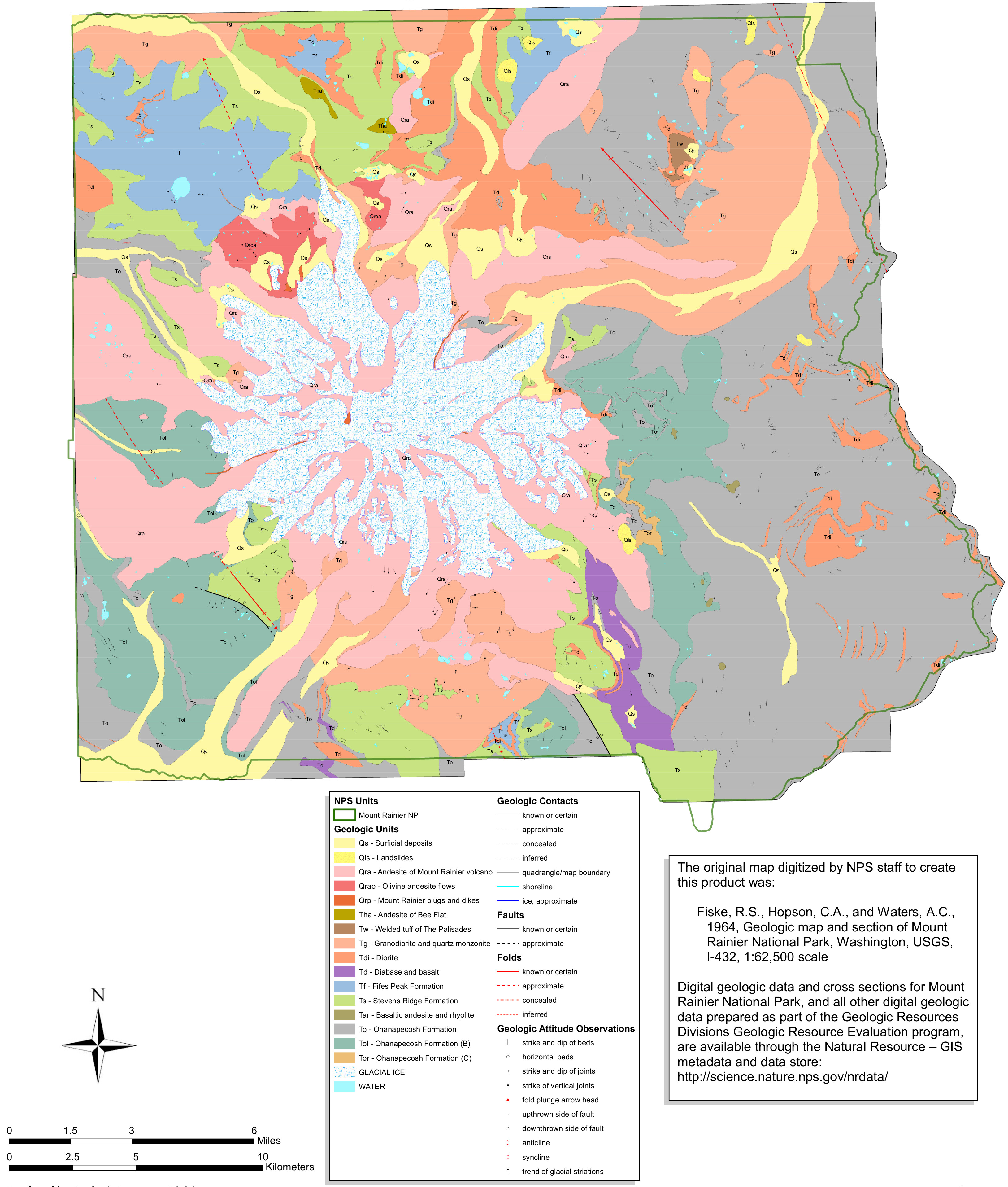 Here’s a bedrock geology map of Mount Rainier, showing the various volcanic rocks that make up the foundation of Mount Rainier and the surrounding lands throughout the national park.
 This is a Mount Rainier geologic map of surficial geology, showing mudflows and other more-recent features that appear on the ground surface, overlying the bedrock below.
 The Mount Rainier night sky map shows how Mount Rainier National Park’s dark skies compare to locations in Seattle, Tacoma, Yakima, and throughout the Puget Sound region.
Mount Rainier topographic maps
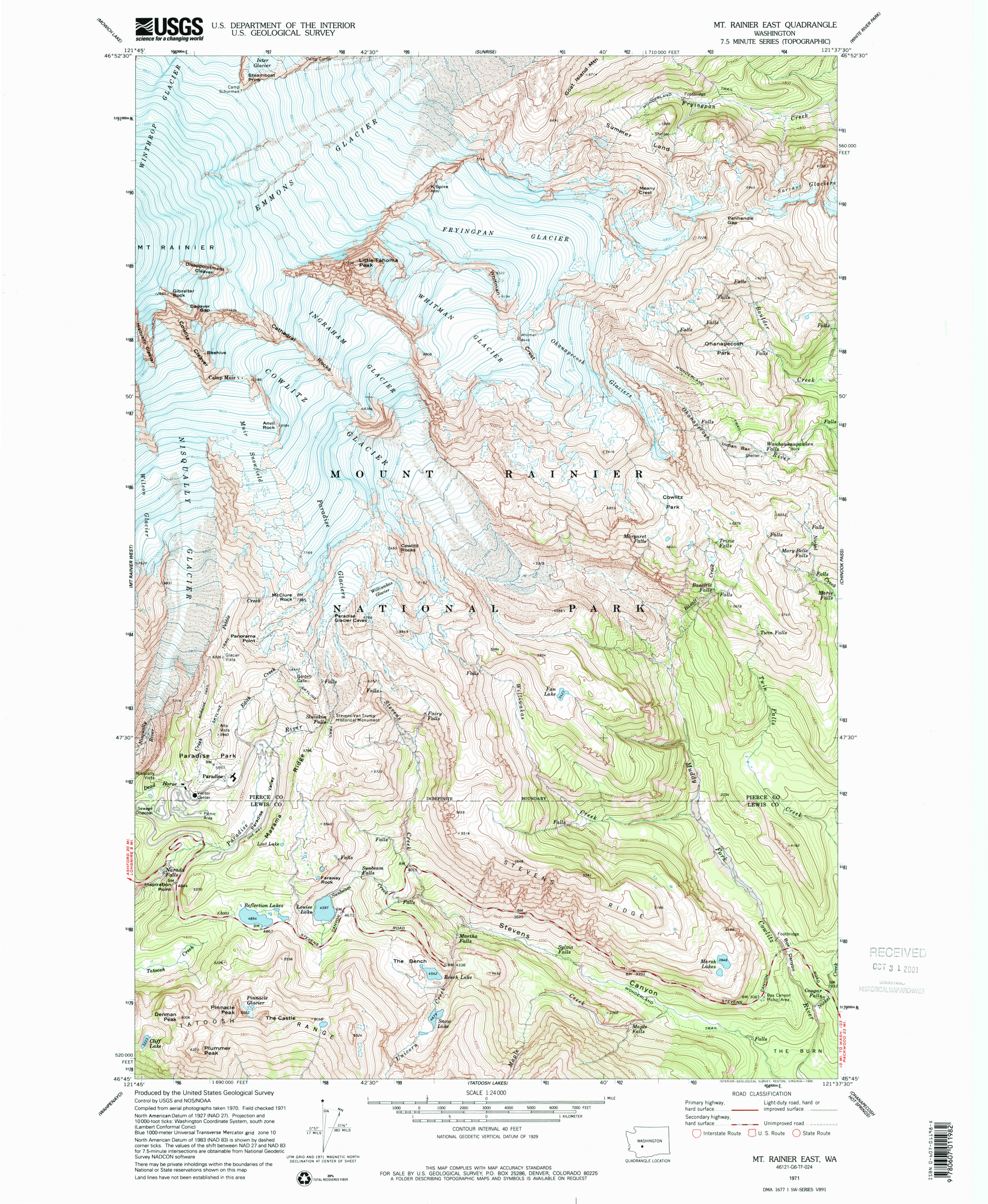 This Mount Rainier East topo map focuses on the southeast side of Mount Rainier and includes the Paradise developed area. Click the image to view a full size map or download the PDF.
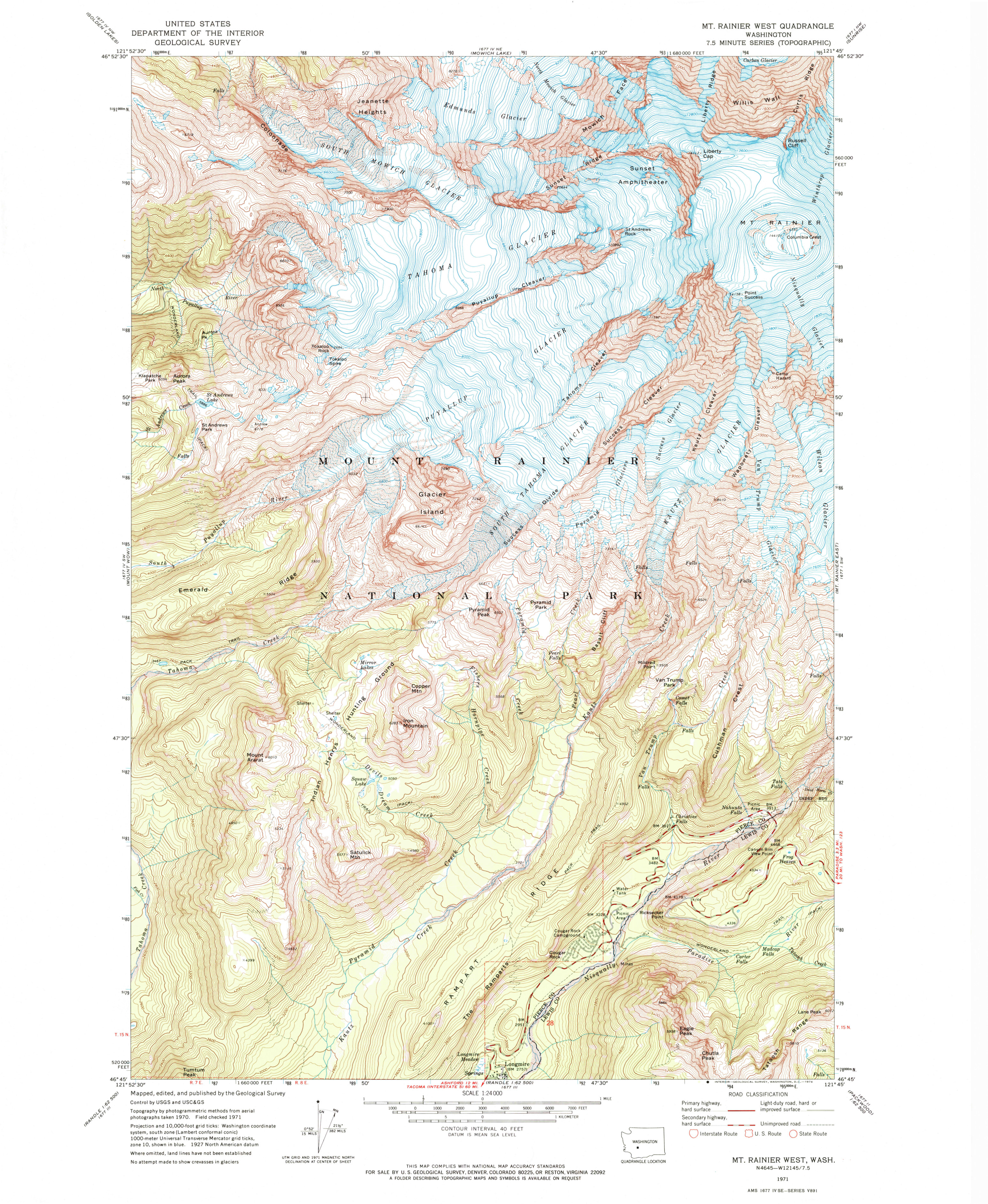 The Mount Rainier West topo map includes the Mount Rainier summit and the glaciers and features on the mountain’s southwest side. Click the image to view a full size map or download the PDF.
Archived Mount Rainier maps
 Here’s the official revised Mount Rainier map from 2015, which includes minor updates from the one below at the expense of a much larger PDF file size. Click the image to view a full size map or download the PDF.
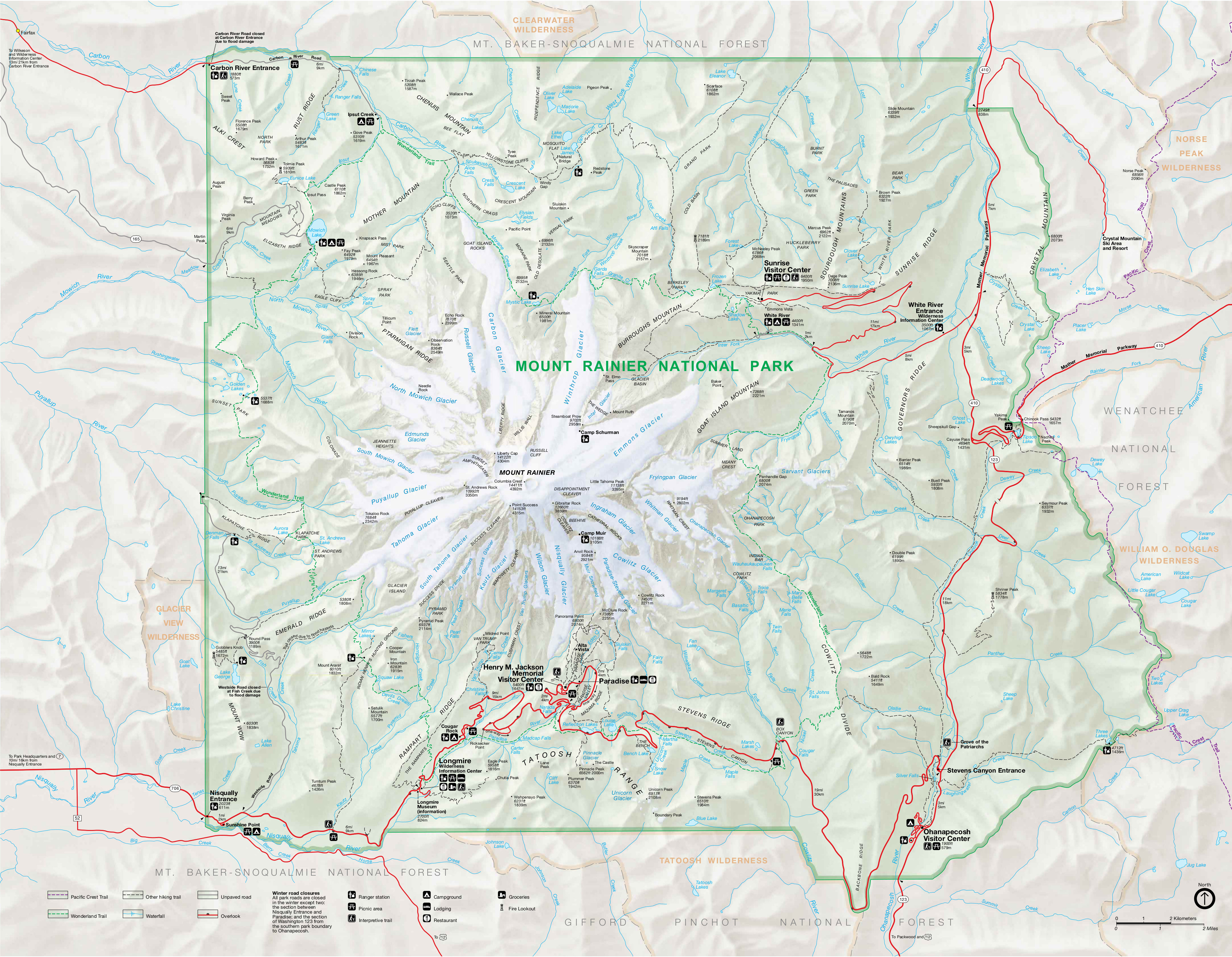 This is the main Mount Rainier National Park map from the 2023 park brochure, showing roads, major trails, and points of interest. Click the image to view a full size map or download the PDF.
Mount Rainier map prints and gifts

 Printed high-resolution Mount Rainier map posters and other products are available at the Mount Rainier Maps store. For prints, gift ideas, and souvenirs featuring other national parks, support this site and visit the National Park Maps store; you’ll find items to bring on vacation, keep at home for the memories, or give to your park-enthusiast friends and loved ones.
…and more!
< Return to National Park Maps home
< Return to Park List
< Return to List by State