If you’re looking for an Apostle Islands map, you’ve come to the right place; currently I’ve collected 12 free Apostle Islands National Lakeshore maps to view and download. (PDF files and external links will open in a new window.) There are a few overall maps here showing the entire park and several that focus on individual islands. You can also browse the best-selling Apostle Islands maps and guidebooks on Amazon.
Apostle Islands map from the park brochure
 Here is the full Apostle Islands map (500 kb), showing the visitor centers on the mainland as well as the campsites, trails, and points of interest on each of the park’s islands.
Detailed Apostle Islands maps
 The maps below are great for showing the general lay of the land on each island. However, if you’re wanting more detail in the form of topographic lines and Lake Superior depths, you’ll want to go with the National Geographic Trails Illustrated map of Apostle Islands. This is the map you want if you’re doing any backcountry camping or spending significant time in Apostle Islands.
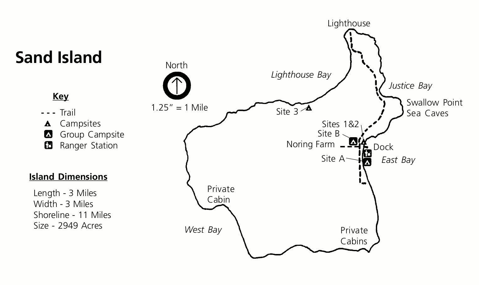 Here’s a Sand Island map (50 kb), showing an overview of the island as well as the trail along Justice Bay and Lighthouse Bay to the lighthouse from the dock and the campsites.
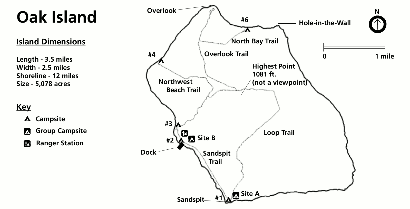 This Oak Island map (100 kb) shows the various trails, beaches, campsites, overlooks, and ranger station on Oak Island. Specific sites like Hole-in-the-Wall and the island’s high point are identified.
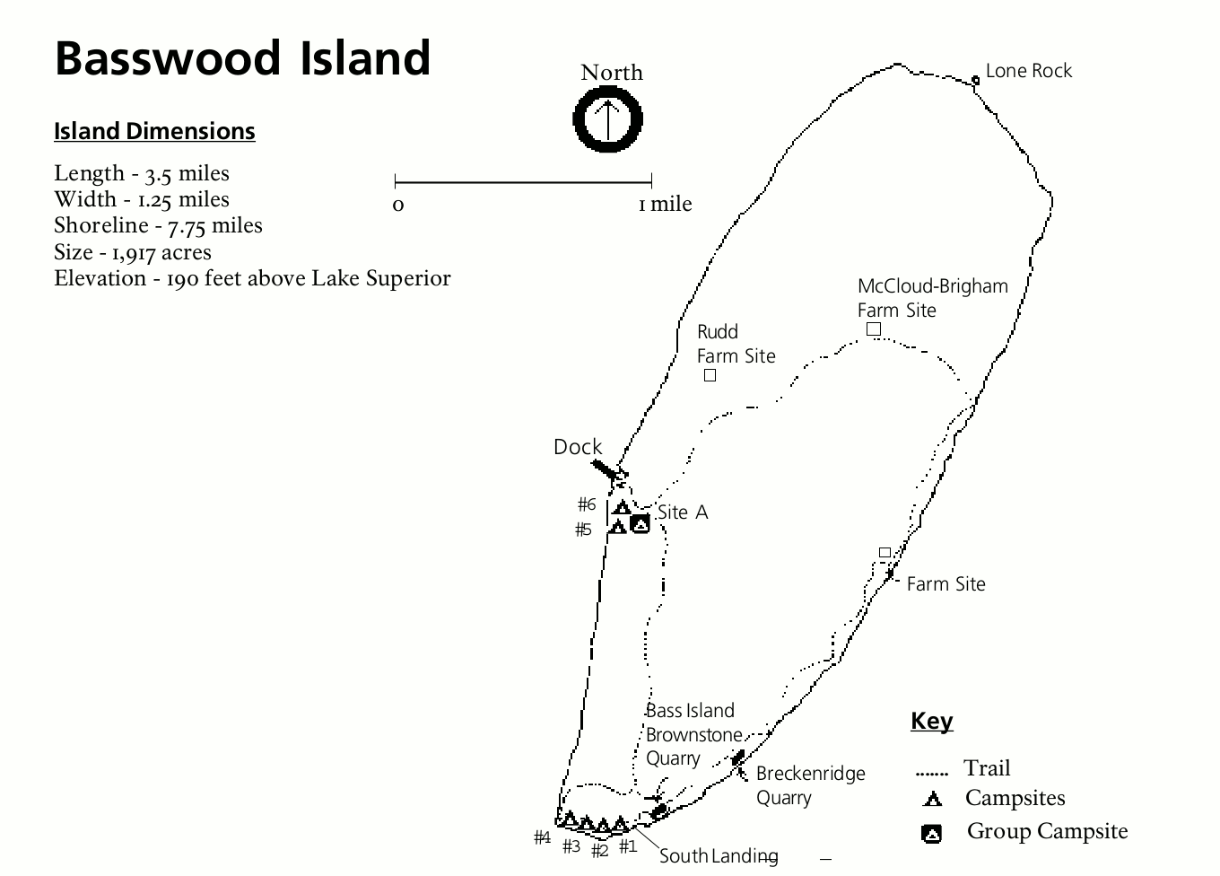 This is a Basswood Island map (50 kb), showing the trails and farm sites on Basswood Island, located just across West Channel from Red Cliff and the Bayfield Peninsula. Trails and campsites are labeled too.
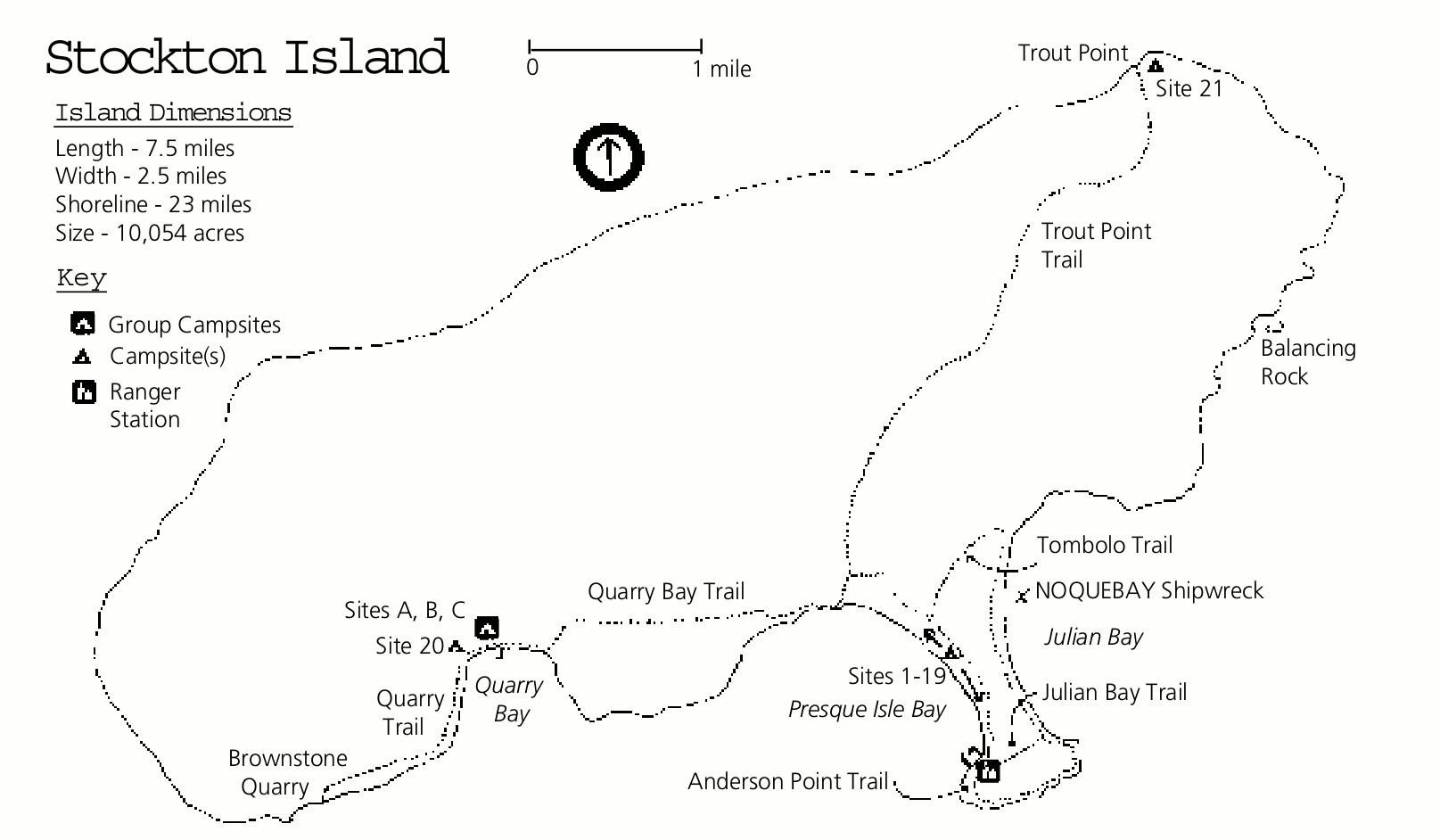 Here’s a Stockton Island map (50 kb), showing the Quarry Bay Trail, Trout Point Trail, Tombolo Trail, and others, along with campsites, the ranger station, quarry, dock, and rock formations.
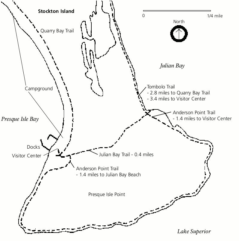 This Julian Bay trail map (30 kb) zooms in on the southern end of Stockton Island. It shows the dock and visitor center in additional detail as well as the several trails in this area around Anderson Point.
 Here’s a Long Island map (30 kb), featuring the LaPointe Lighthouse, Chequamegon Point Lighthouse, and the campsite on this diminutive island. Quite a contrast with Stockton Island above!
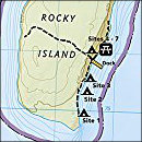
Apostle Islands camping map
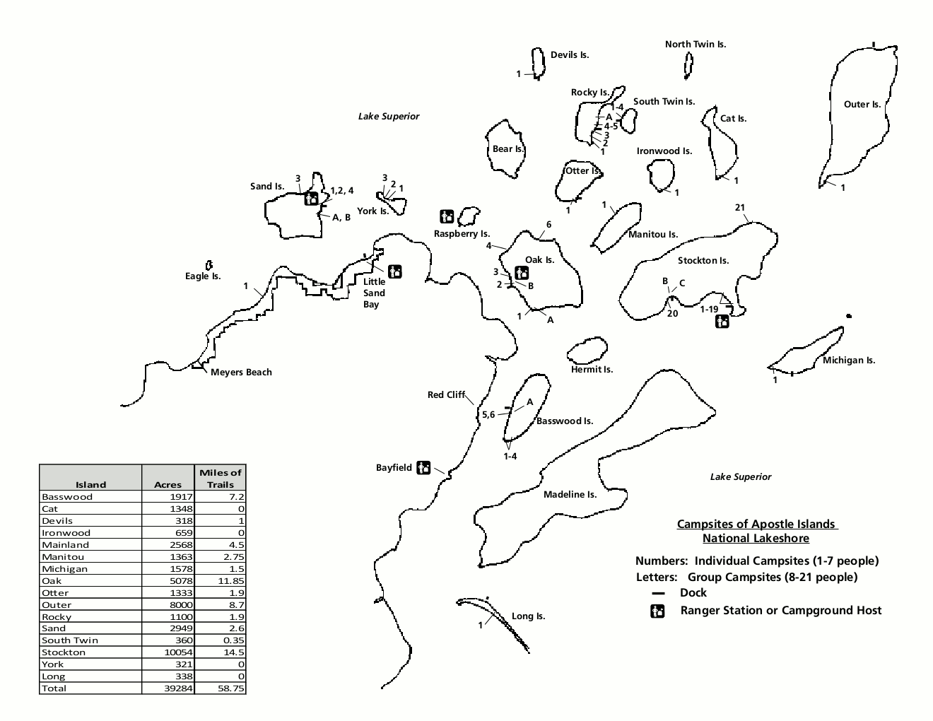 This is the Apostle Islands camping map (50 kb), showing all the individual and group campsites on the park islands on Lake Superior. You’ll also find a table showing trail mileages on each island.
Apostle Islands geologic maps
 If you’re a geology nut, you’ll appreciate this Apostle Islands geologic map (1.2 mb), which shows the various rock units exposed in the park. It’s almost all Chequamegon Sandstone!
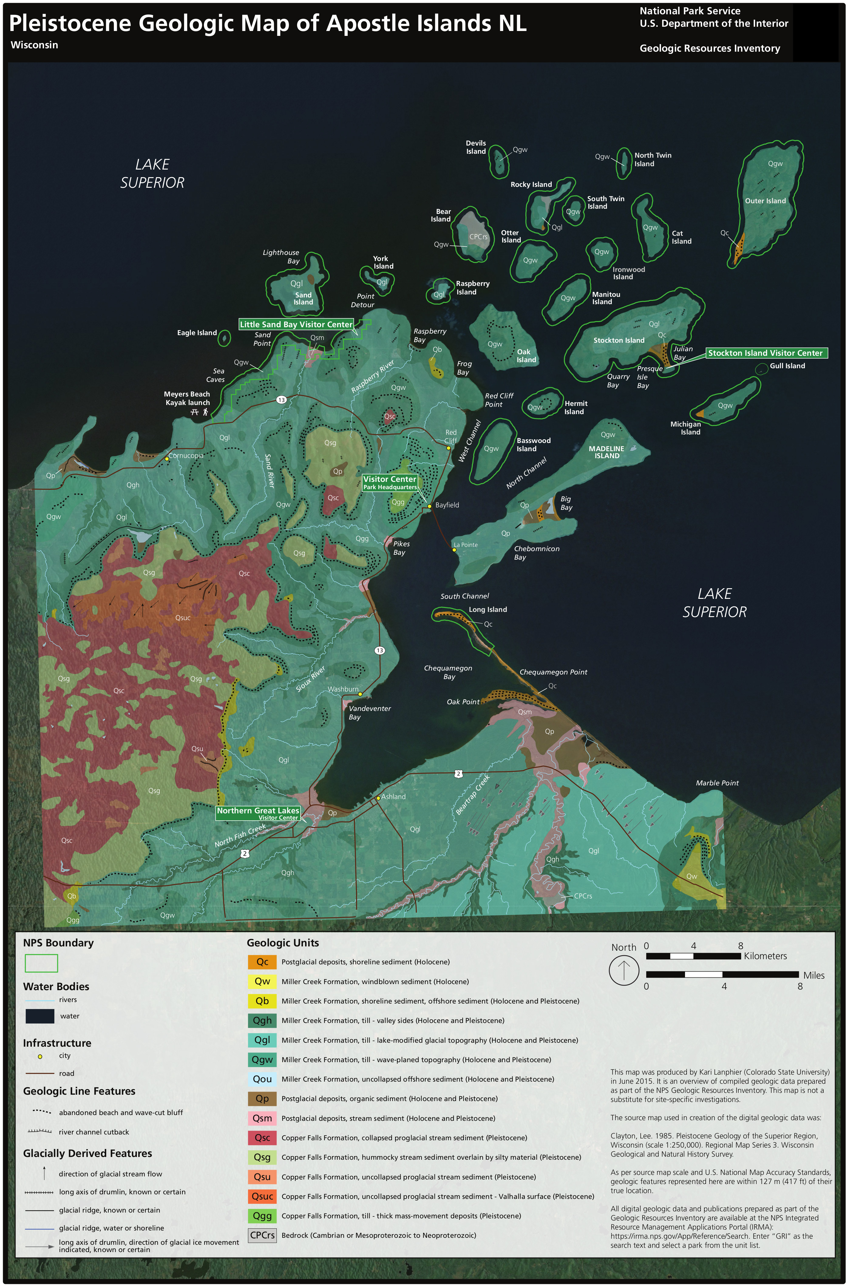 The Apostle Islands surficial geologic map (2.1 mb) focuses on the glacial deposits and more recently-formed landforms exposed at the park’s surface, shaped by wind and waves.
Apostle Islands forest map
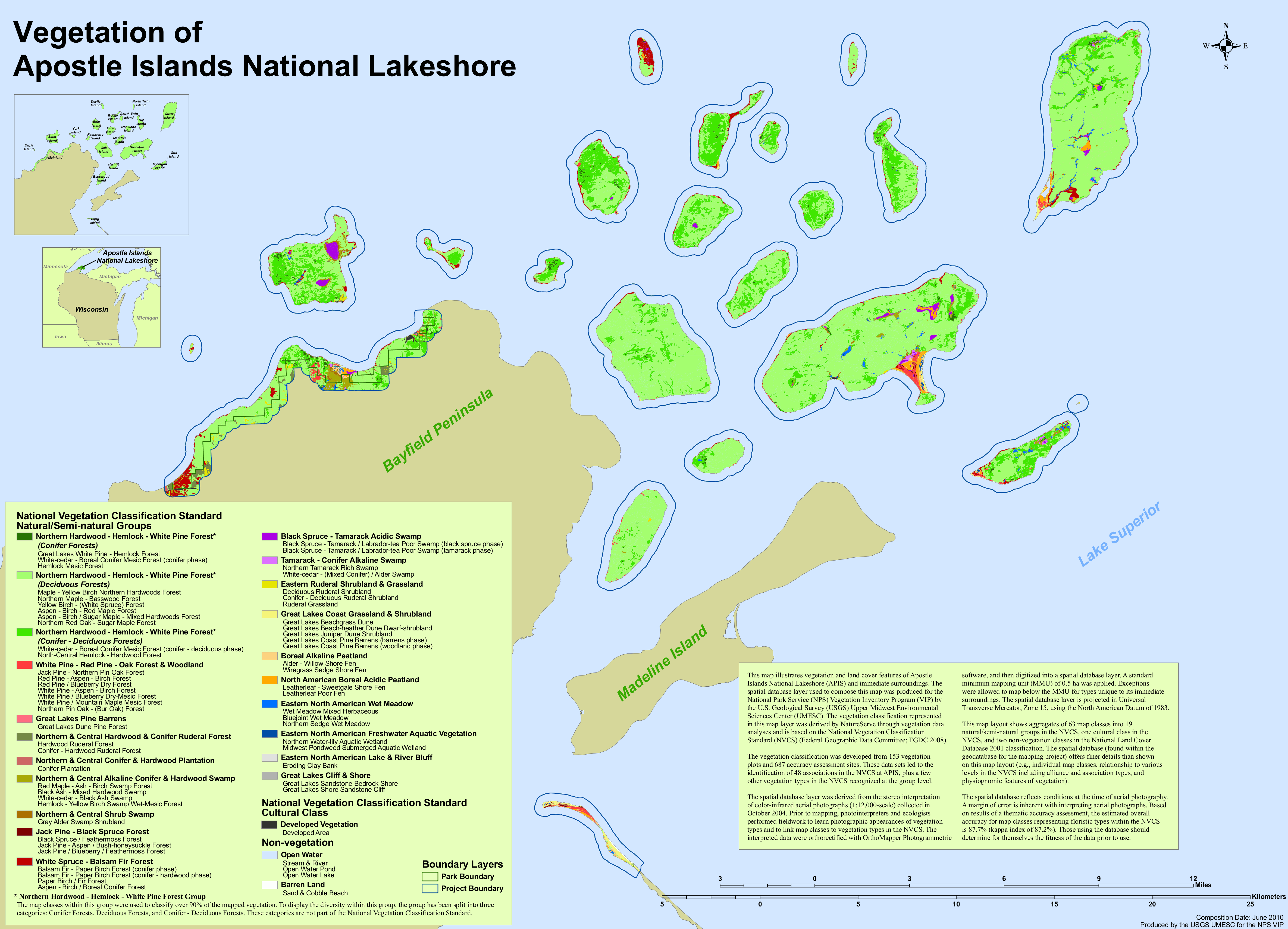 The Apostle Islands vegetation map (1.1 mb) shows the composition of the various forest types found in Apostle Islands National Lakeshore. Hint: it’s mostly northern hardwood.
…and more!
< Return to National Park Maps home
< Return to Park List
< Return to List by State
Need more help? Browse Amazon’s best-selling Apostle Islands maps and guidebooks.