If you’re looking for a Glen Canyon map, you’ve come to the right place; currently I’ve collected 22 free Glen Canyon National Recreation Area maps to view and download. (PDF files and external links will open in a new window.) Most of these maps show specific locations on Lake Powell but others include other areas in Glen Canyon National Recreation Area. You can also browse the best-selling Glen Canyon maps and guidebooks on Amazon.
Glen Canyon map from the park brochure
 This is the Glen Canyon map from the official brochure, ranging from Page in the south beyond Hite to the north. Click the image to view a full size JPG (2.3 mb) or download the PDF (7.9 mb).
Glen Canyon detail maps
 The maps on this page work well for very general trip planning, but they’re not going to help you for navigating on Lake Powell. For that, you’d want something like this National Geographic Trails Illustrated map, which shows Lake Powell in extra detail as well as the surrounding topography and hiking trails in Glen Canyon National Recreation Area and Rainbow Bridge National Monument.
Following are maps of the various developed areas of Glen Canyon National Recreation Area, arranged approximately in order from south to north.
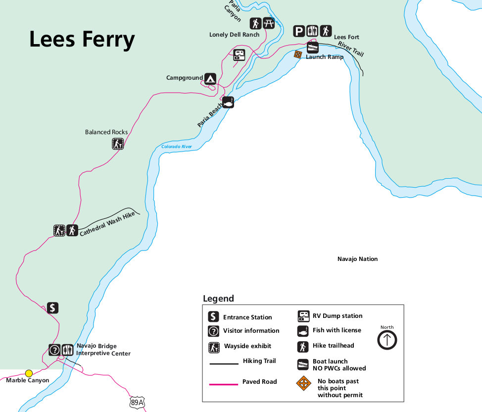 Here’s a Lees Ferry map (100 kb), which is a bit downstream of the Glen Canyon Dam and is the starting point for many Grand Canyon rafting trips. This shows the campground, launch point, and trails.
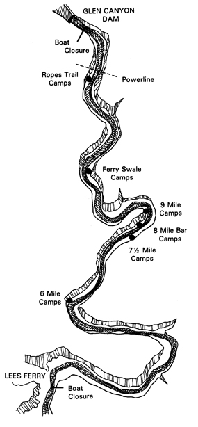 This is a Lees Ferry area camping map (75 kb), showing the Colorado River campsites accessible by river travelers, located between the Glen Canyon Dam and Lees Ferry.
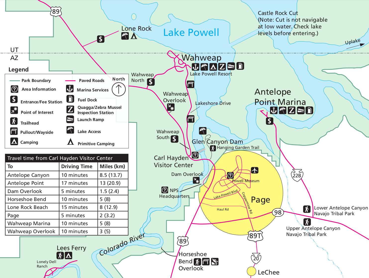 This overview map of Page and Wahweap (300 kb) shows the busiest area of the park near the Glen Canyon Dam and Carl Hayden Visitor Center around the town of Page, AZ.
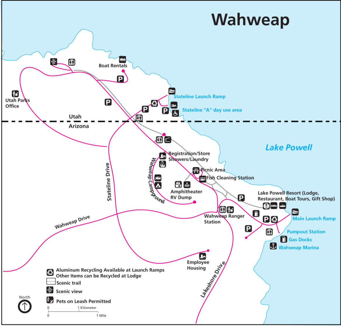 Here’s a detailed Wahweap map (150 kb) which is one of the busy marinas on Lake Powell and features a resort, campground, picnic area, rentals, and docks, and multiple launch ramps.
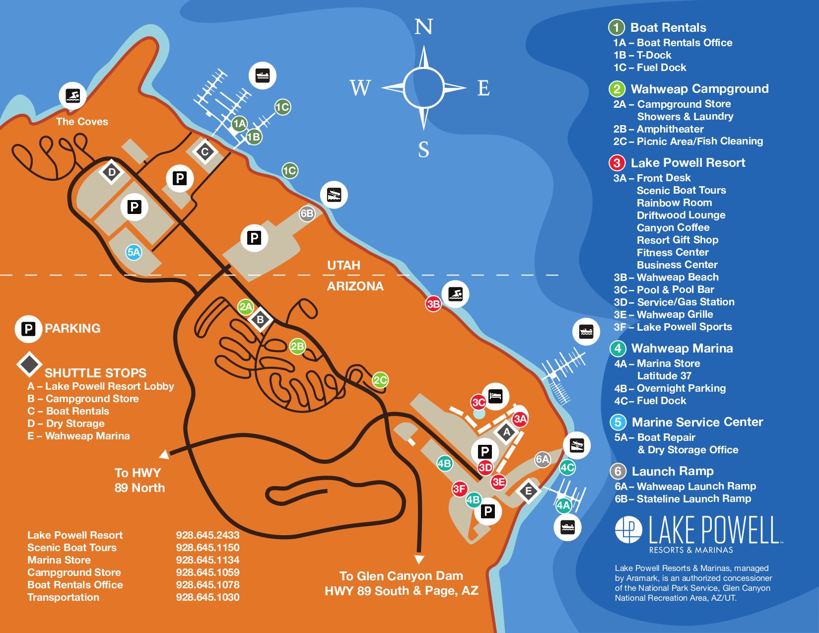 Alternatively, this color Wahweap map (400 kb) looks a bit nicer although it’s probably not as good for printing since it’ll use up more ink. It also shows the layout of the marina vicinity.
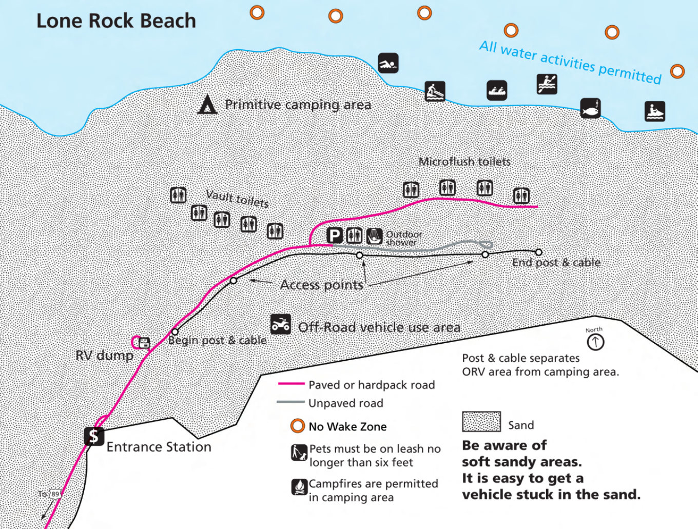 Here’s a Lone Rock Beach map (400 kb), which is a primitive campground northwest of Wahweap that is for tents only. This map shows the toilets, camping area, and showers.
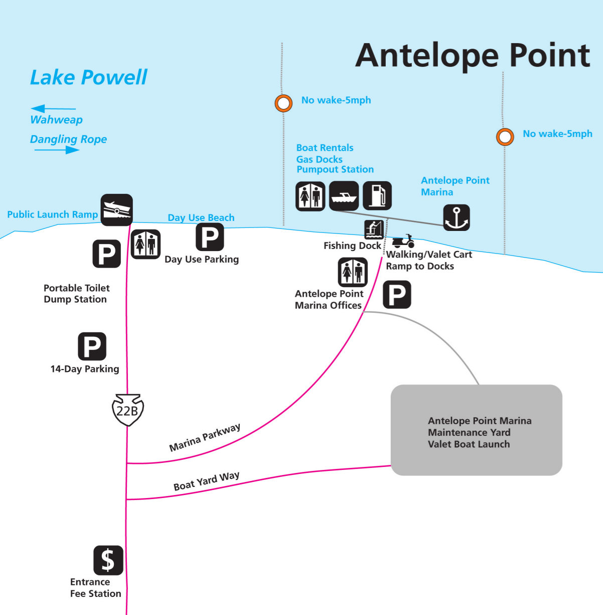 The Antelope Point map (120 kb) includes the parking lots and launch ramps at this marina located just northeast of the town of Page. It also labels some lake features, such as the no-wake zone.
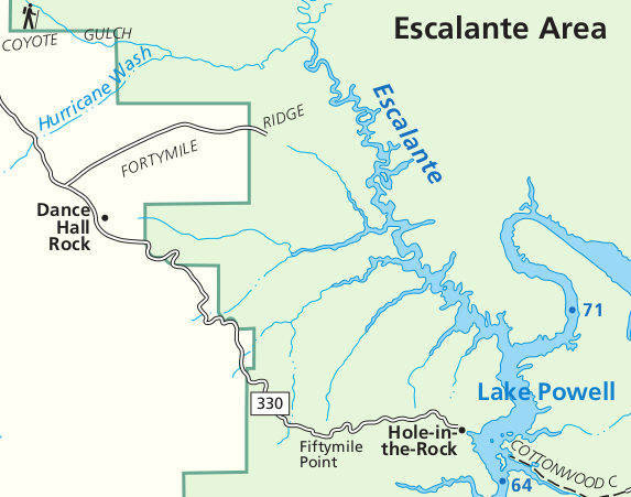 This is an Escalante map (50 kb), which shows the road coming into the park from the west toward Hole-in-the-Rock and Escalante River access points. This is very remote Utah here!
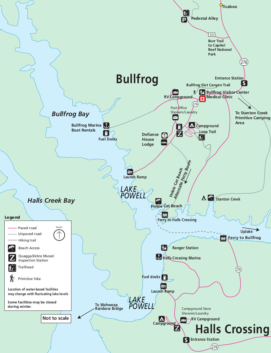 Here’s a Bullfrog and Halls Crossing map (150 kb), showing an overview of these two developed areas including the ferry route across Lake Powell that services the main docks in each location.
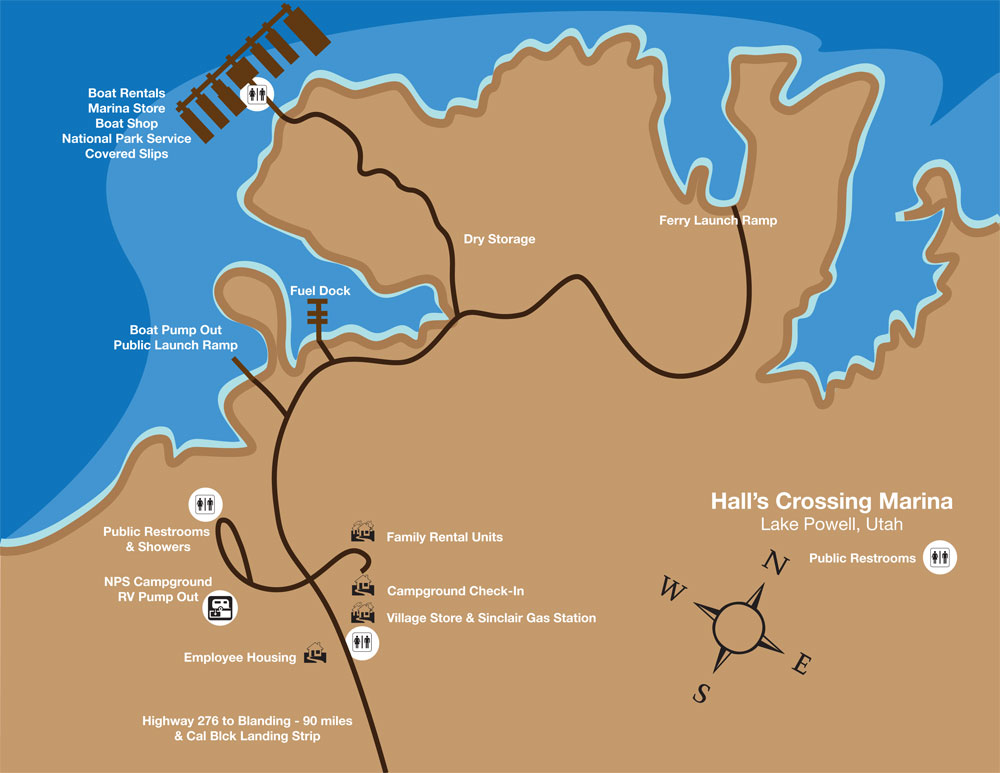 This is a Halls Crossing map (100 kb), labeling features such as the campground, boat ramps, ferry dock, stores, gas station, restrooms, showers, boat rentals, and more.
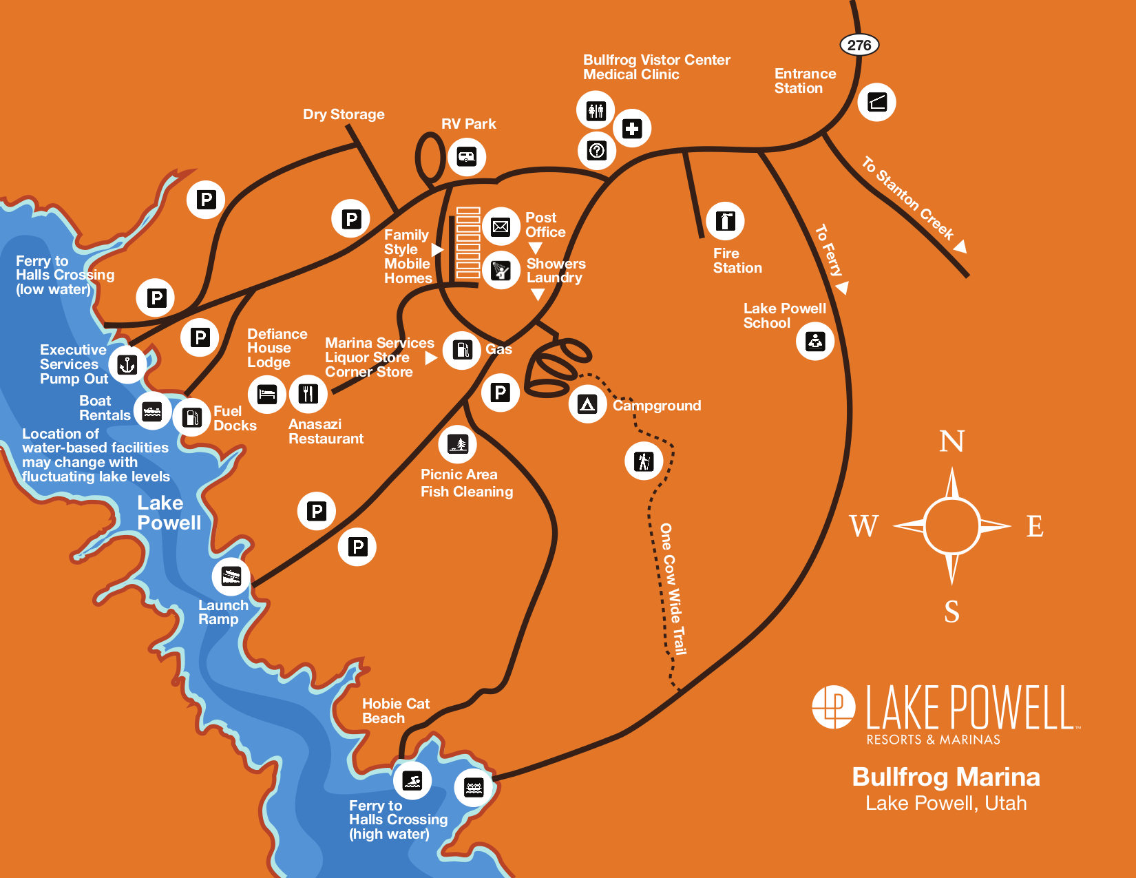 This Bullfrog Marina map (300 kb) shows the considerable development surrounding the marina – stores, rentals, ferry dock, campground, picnic area, visitor center, etc.
 Here’s a Hite map (80 kb), showing the one location a road crosses Lake Powell throughout the entirety of the park. This is the quiet end of Lake Powell, way upstream near Cataract Canyon.
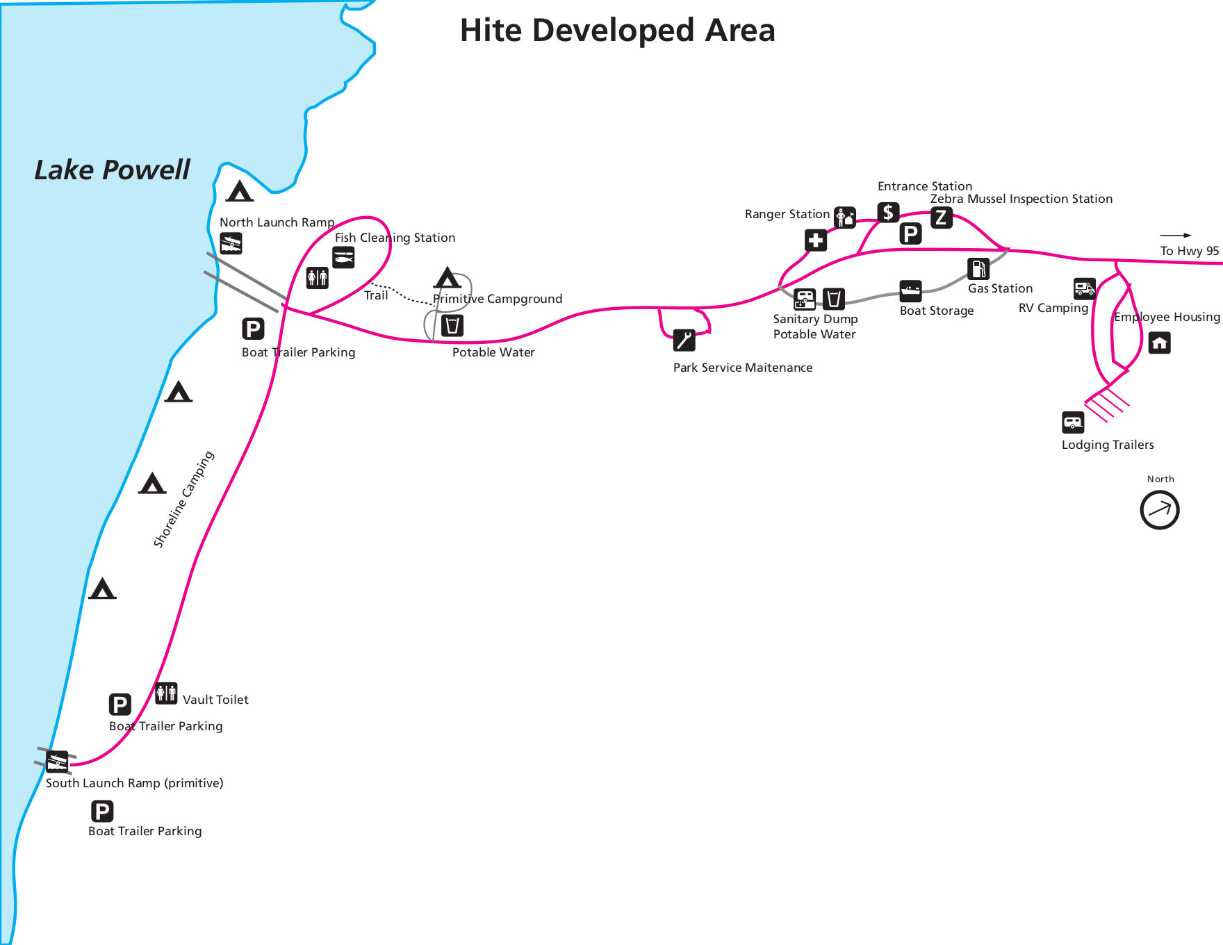 This map of Hite (150 kb) focuses on the developed area, including the visitor center, shoreline camping, campground, and launch ramps. The experience here can vary tremendously upon lake level!
Glen Canyon campground map
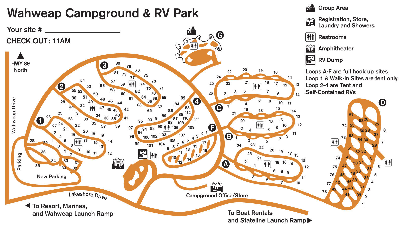 Here’s a Wahweap Campground map (300 kb), showing the layout of the tent sites and RV loops in relation to the restrooms, amphitheater, laundry, showers, and campground store.
Rainbow Bridge maps
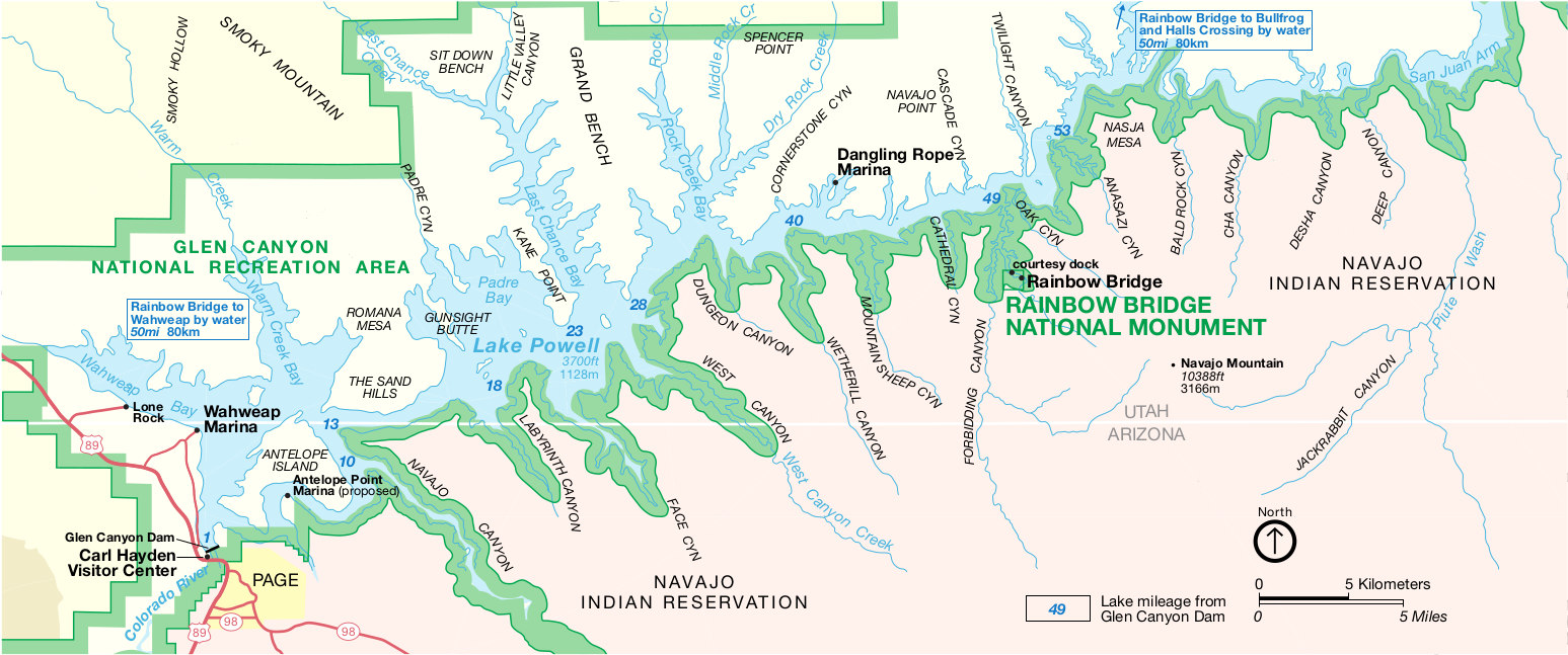 This is the official National Park Service Rainbow Bridge map, showing the monument’s location along Lake Powell and Glen Canyon. Click the image to view a full size JPG (300 kb) or download the PDF (200 kb).
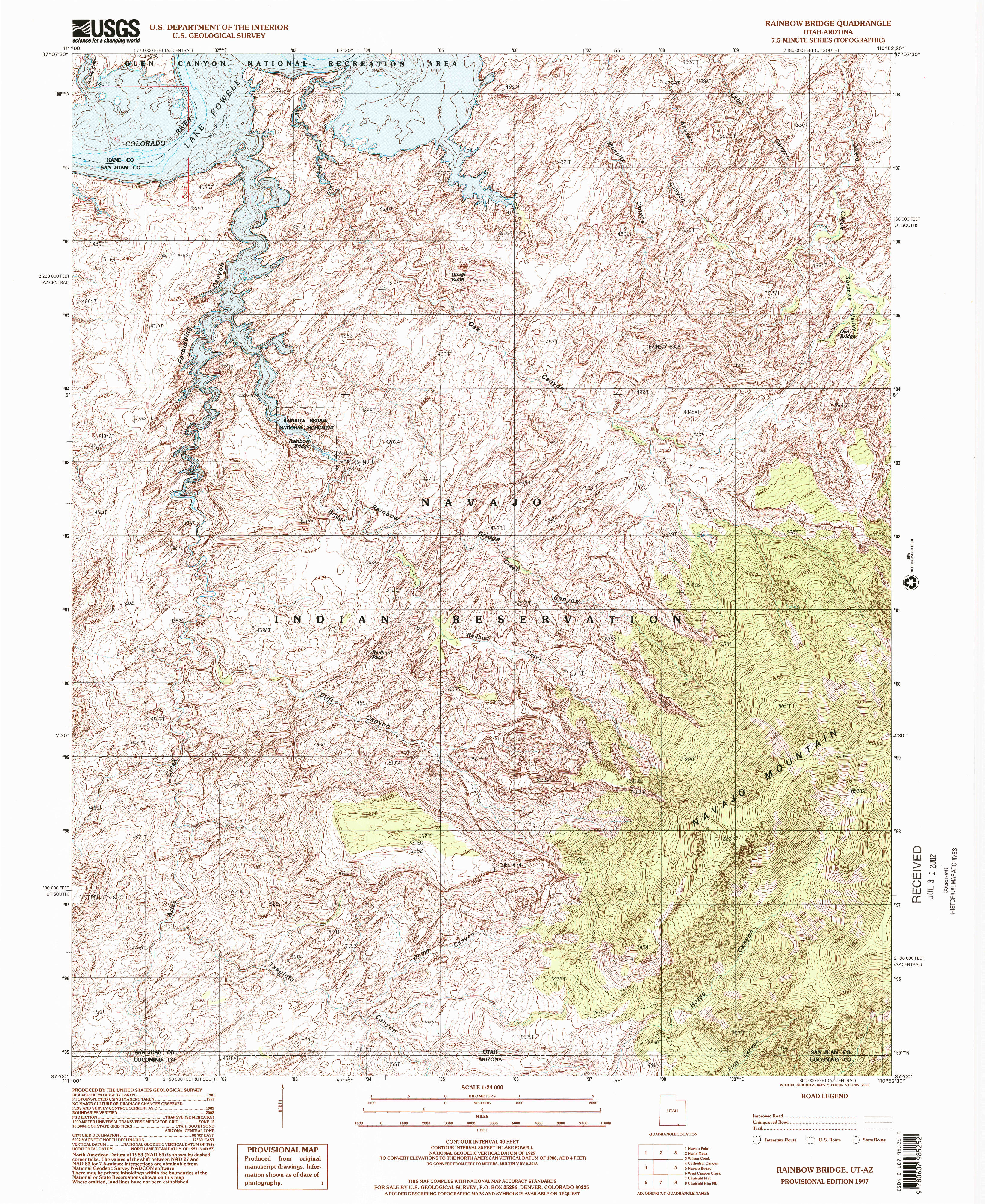 Here’s a Rainbow Bridge topo map (4.4 mb), which zooms in to show the elevation contours. Note that the current Lake Powell level might be significantly different than what this map shows.
Lake Powell restrooms map
 It sounds strange, but the Lake Powell restrooms map (400 kb) is really quite helpful to locate the floating restrooms and waste dumps on the reservoir while you’re out-and-about on a small boat.
Glen Canyon geologic maps
 This is the south Glen Canyon geologic map (2.2 mb), focusing on the area around Glen Canyon Dam and the southernmost marinas on Lake Powell near the Utah/Arizona border
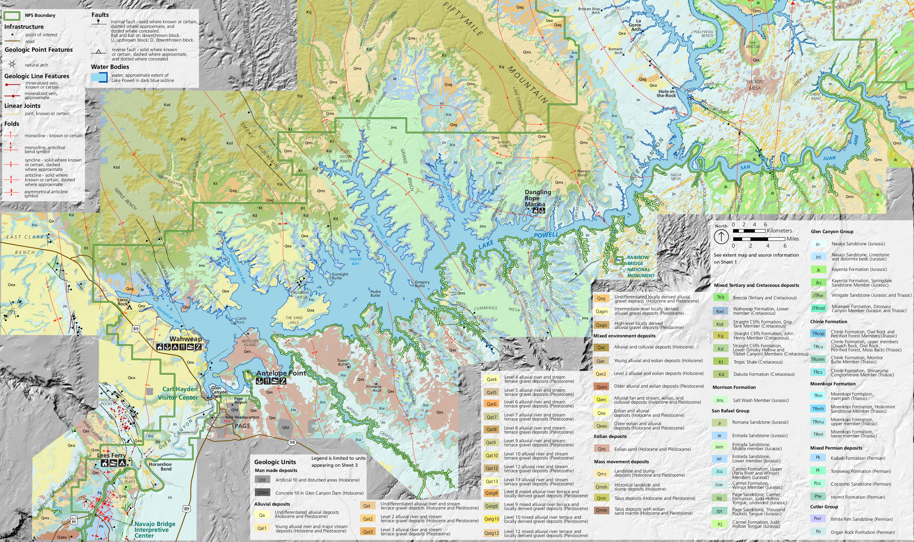
 Here’s a central geologic map of Glen Canyon (2.5 mb), showing the central part of the Glen Canyon National Recreation Area, including Halls Crossing and Dangling Rope.
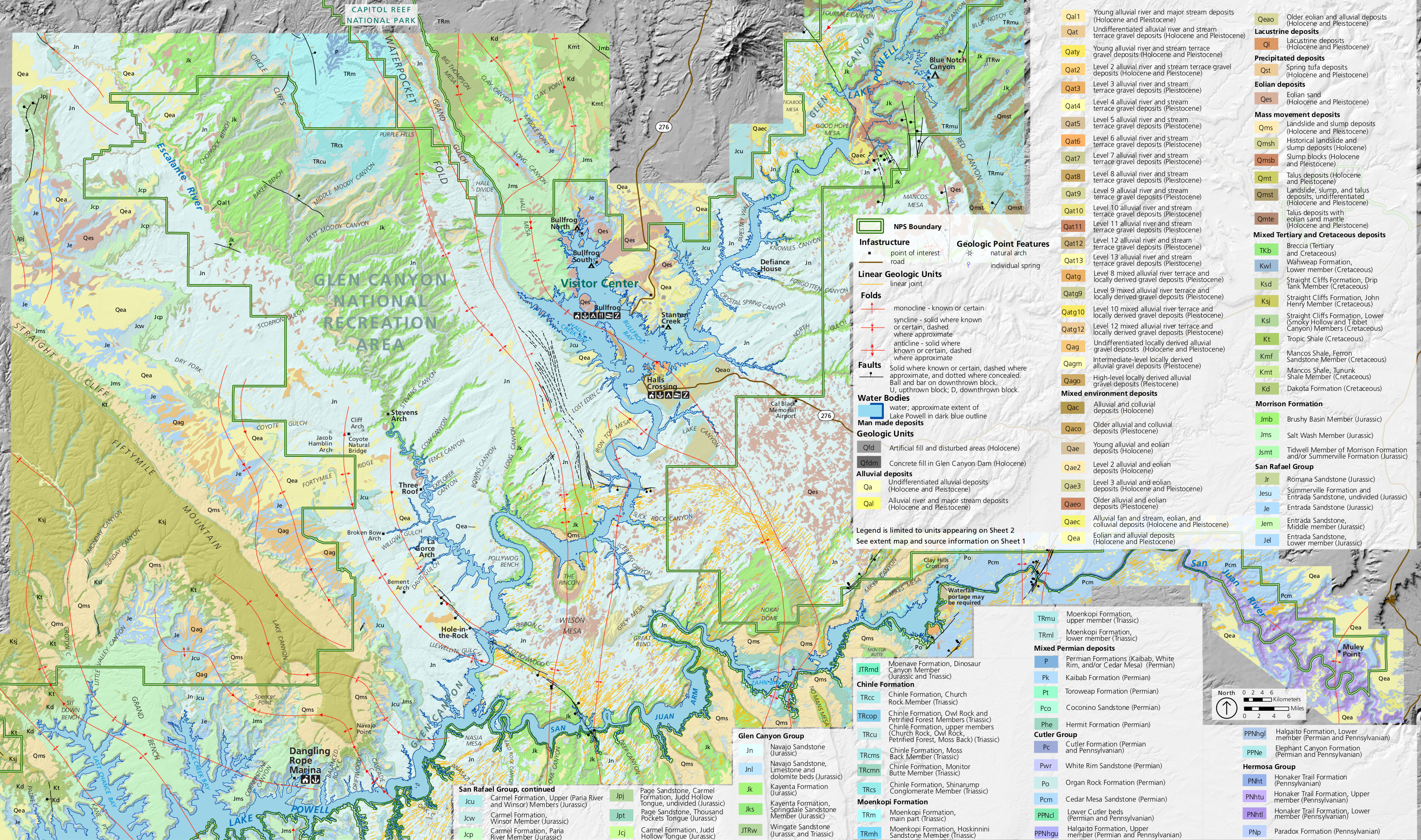
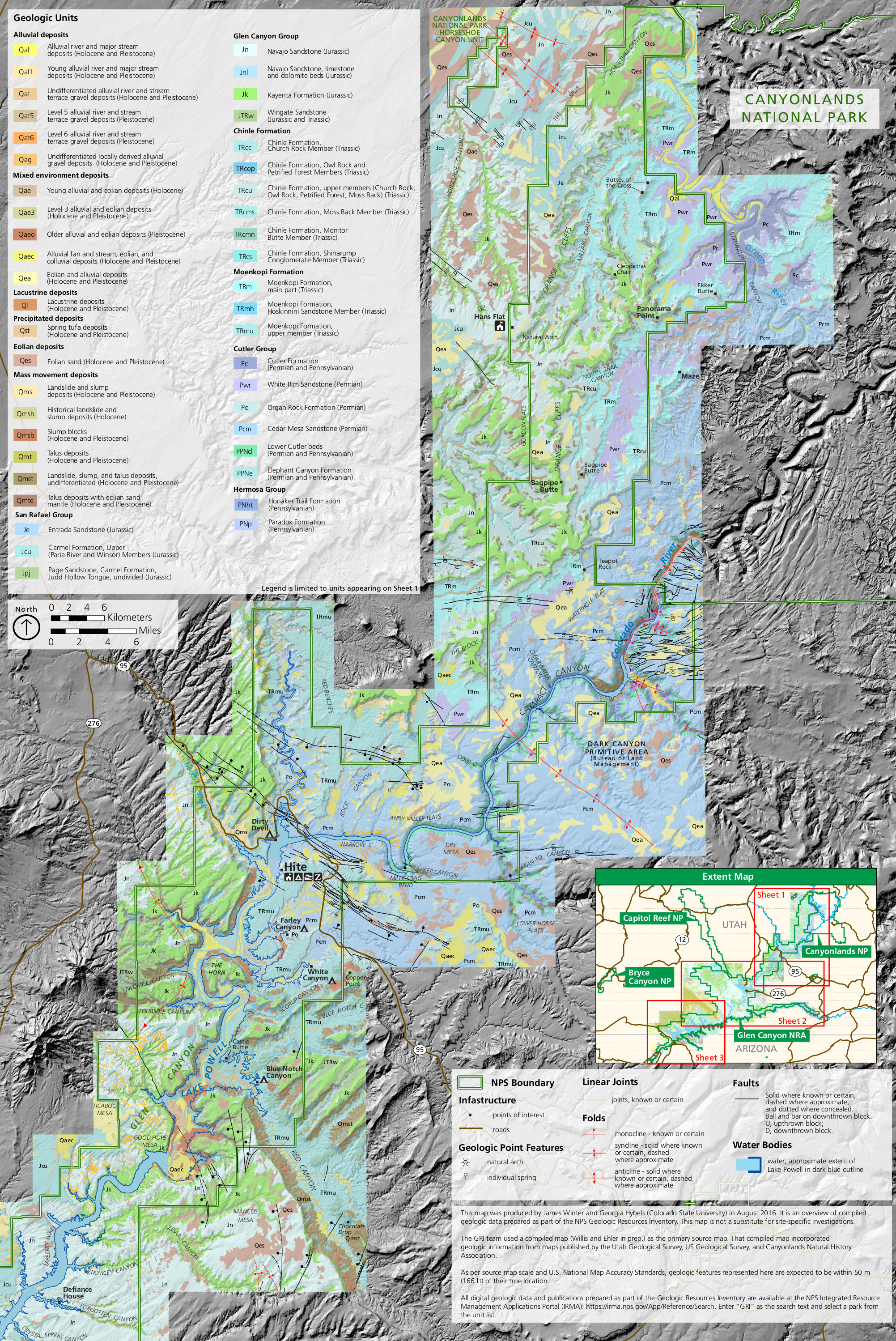 This north Glen Canyon geologic map (2.3 mb) shows Hite and the region north, including Cataract Canyon and the area bordering Canyonlands National Park around the Colorado River.
…and more!
< Return to National Park Maps home
< Return to Park List
< Return to List by State
Need more planning help? Browse Amazon’s best-selling Glen Canyon maps and guidebooks.