If you’re looking for a Death Valley map, you’ve come to the right place; currently I’ve collected 13 free Death Valley National Park maps to view and download. (PDF files and external links will open in a new window.) Here you’ll find a few maps that come from the National Park Service brochure, along with some campground, backcountry, and trail maps. You can also browse the best-selling Death Valley maps and guidebooks on Amazon.
Death Valley map from the park brochures
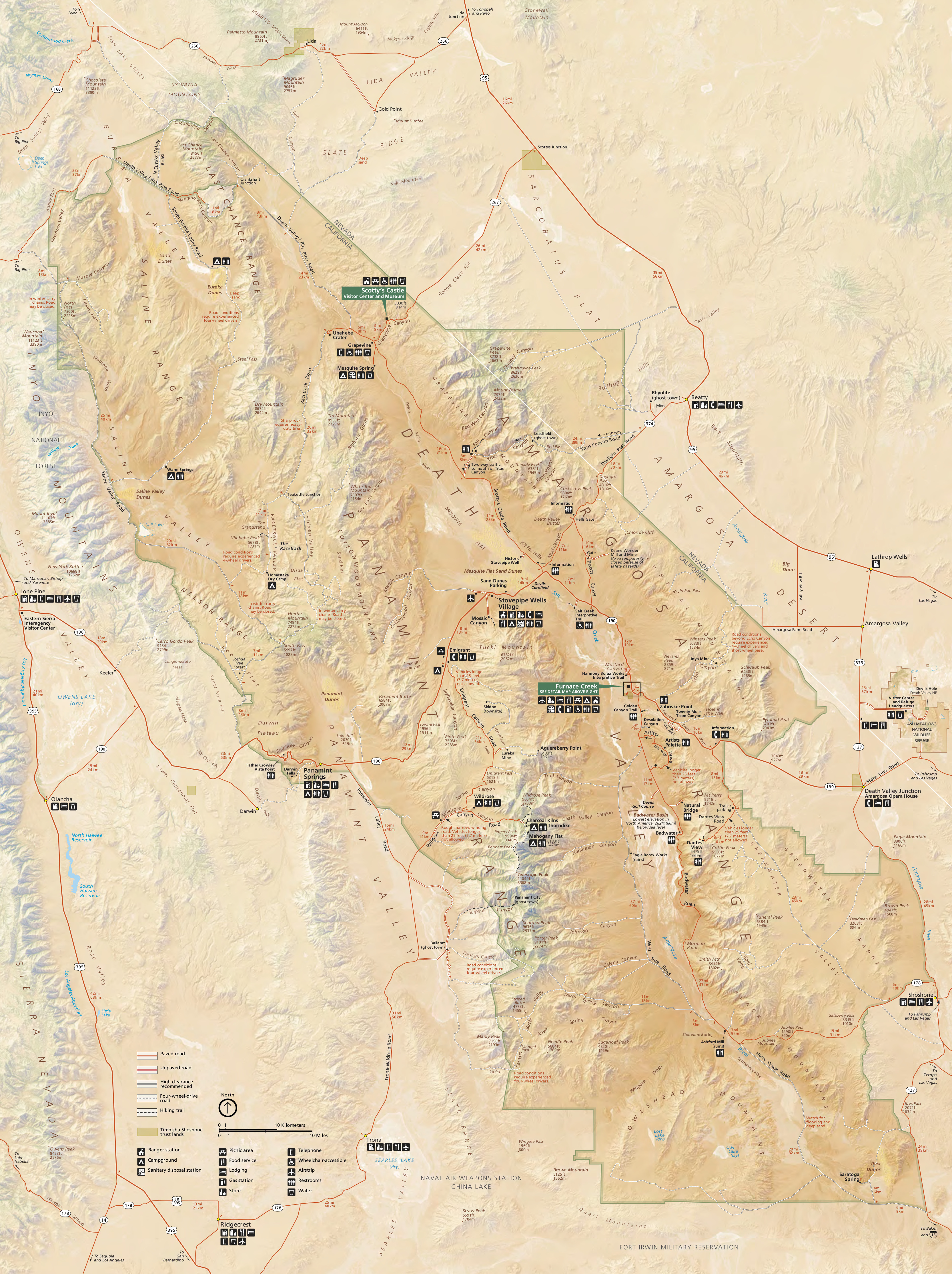 Here’s the new – revised for 2016 – Death Valley National Park map from the NPS brochure, showing all the roads and visitor highlights. Click the image to view a full size JPG (3.6 mb) or download the PDF (2.8 mb).
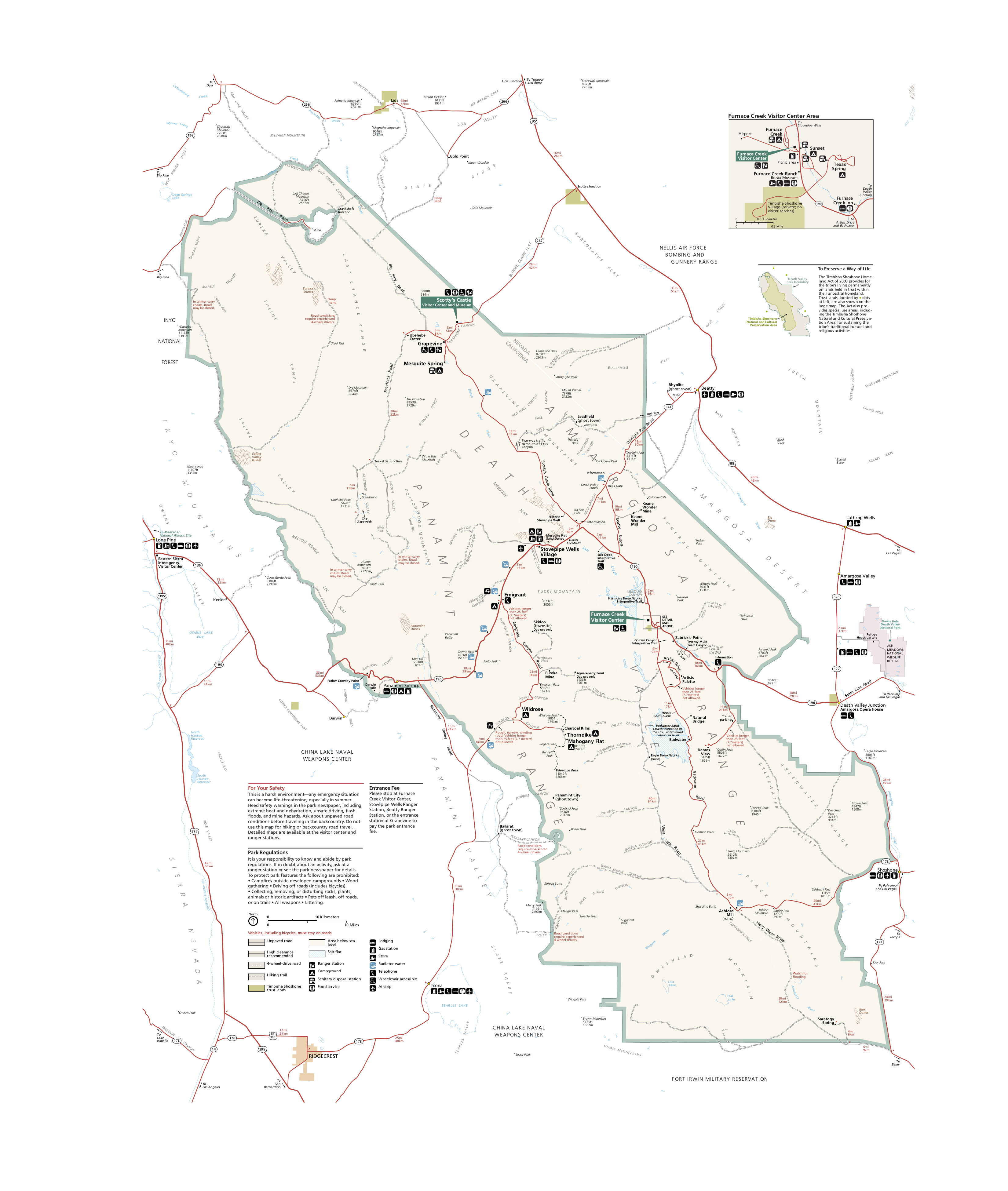
 This is the new 2016 Furnace Creek map, zooming in on the main area of Death Valley that features the majority of visitor services. Click the image to view a full size JPG (200 kb) or download the PDF (1.7 mb).
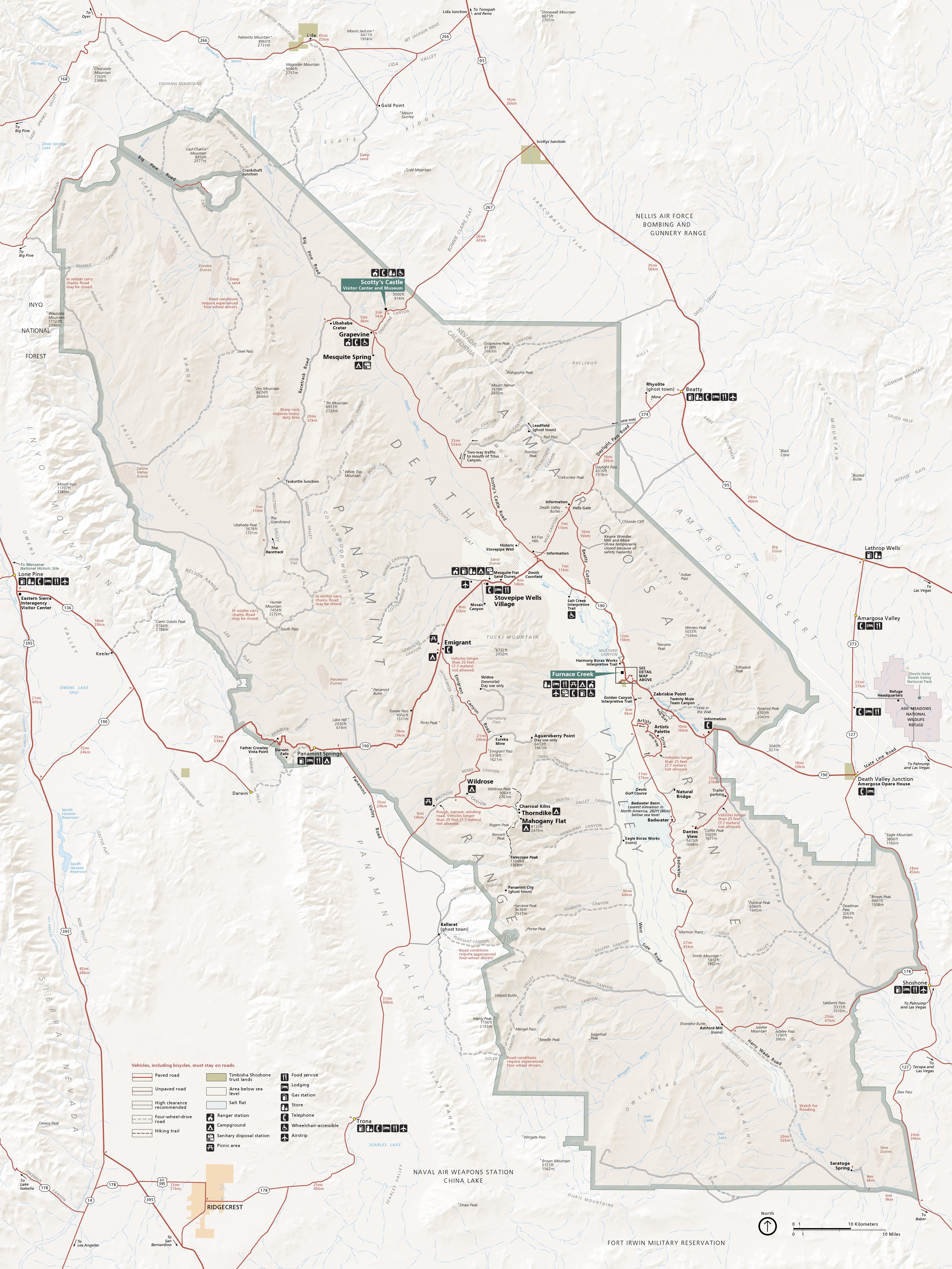 This is the older Death Valley map that has less color contrast and might be a bit more legible for printing or reading on a cell phone. Click the image to view a full size JPG (2.8 mb) or download the PDF (8.9 mb).
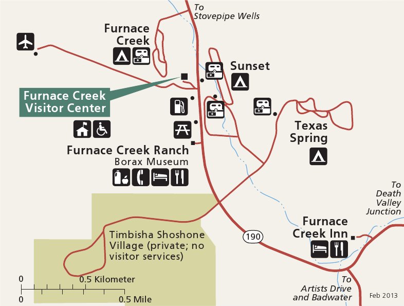 Similarly, this is the older detail map of Furnace Creek that has fewer colors and is easier to read at a glance. Click the image to view a full size JPG (70 kb) or download the PDF (80 kb).
 Finally, here’s a printable Death Valley map, showing pretty much the same thing as the maps above but without topography shading. Click the image to view a full size JPG (950 kb) or download the PDF (1.2 mb).
Death Valley trails maps
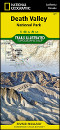
 If you’re looking to buy a detailed Death Valley trails map that covers the entire park, the National Geographic Trails Illustrated map is a great choice, as is the Tom Harrison map. I personally own the Trails Illustrated map, although the Tom Harrison map is slightly less expensive (and it can be nice to support a small business). Both show lots of detail and are super important when hiking in isolated places like Death Valley.
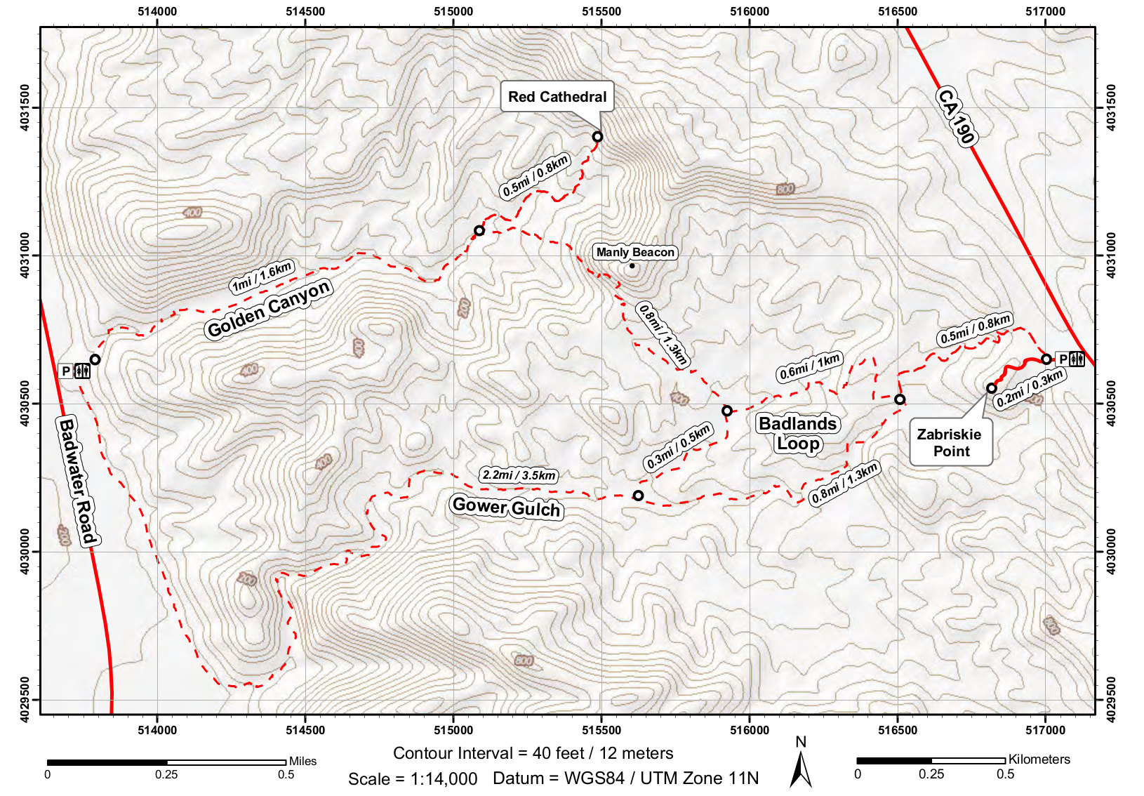 Here is a Death Valley trail map (500 kb) of the Golden Canyon/Gower Gulch Loop, accessible from Zabriskie Point and the Badwater Road. This trail is a great introduction to canyon hiking.
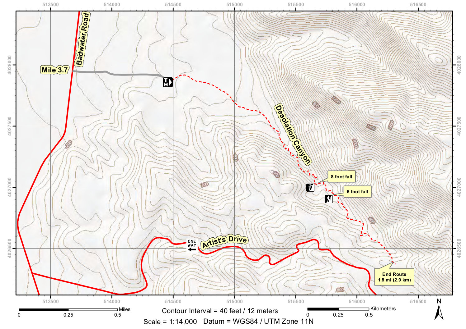 This is a Desolation Canyon trail map (400 kb), showing a scenic route from Badwater Road that ends with a great overview of Death Valley. You’ll find this trail just north of Artist’s Drive.
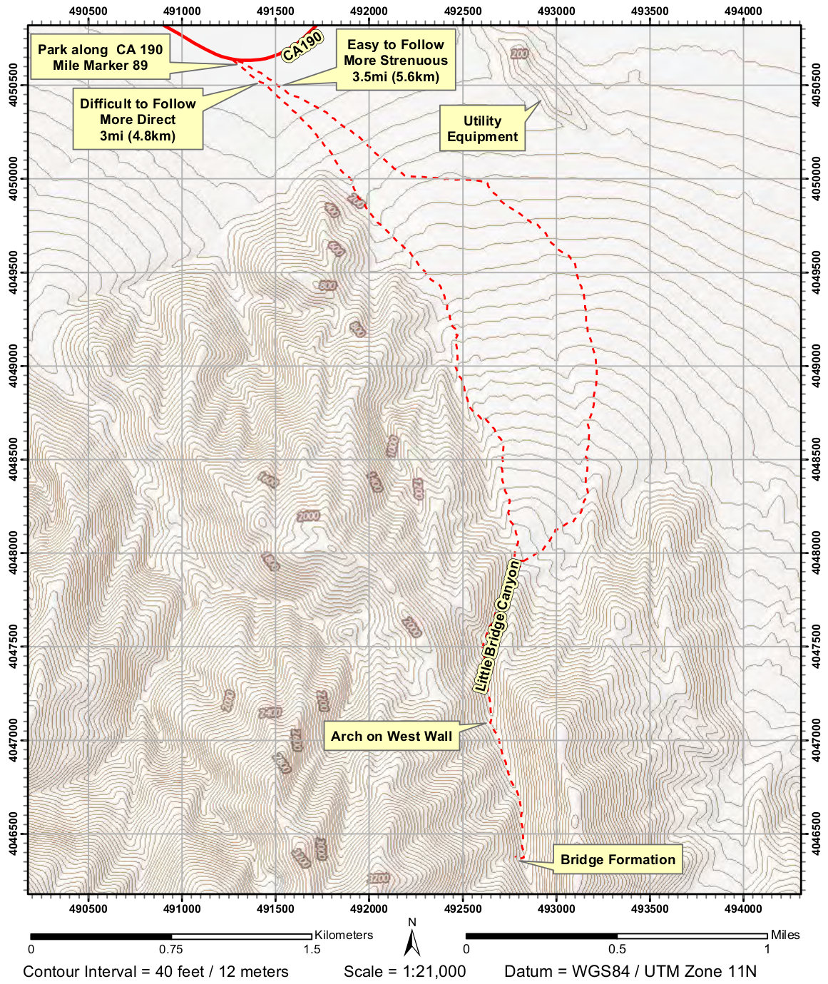 Here’s a Little Bridge Canyon trail map (500 kb) featuring a difficult, challenging unmarked route near Stovepipe Wells – for advanced hikers only! You have a choice of two routes to follow.
Death Valley campground map
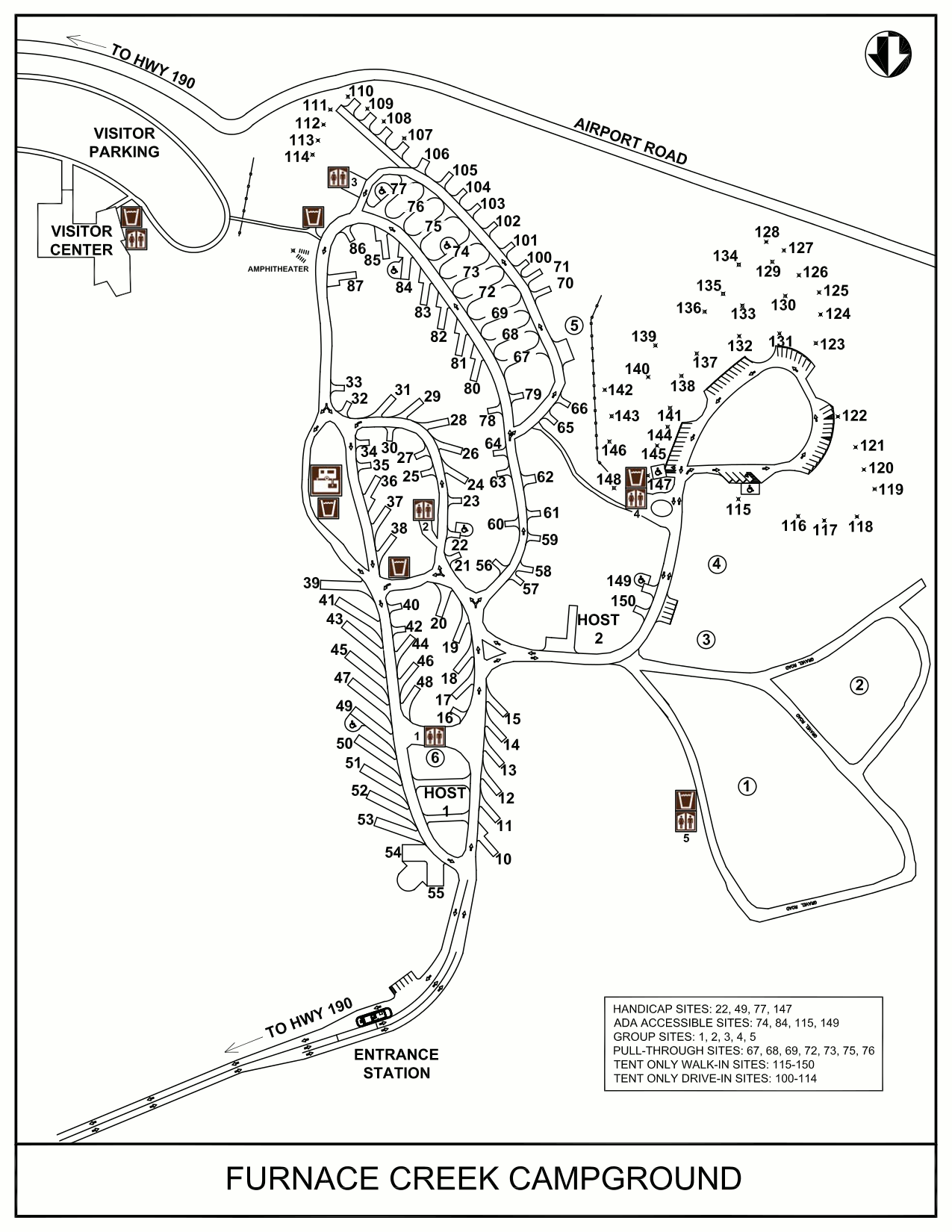 This is a Furnace Creek Campground map. Furnace Creek is the main visitor camping and lodging destination and is centrally located. Click the image to view a full size GIF (200 kb) or download the PDF (150 kb).
Death Valley lodging map
 Because Death Valley is in one of the harshest environments in the U.S., there are no nearby towns to stay; you’ll want to lodge inside the park. To the right you can open a Hotels.com interactive Death Valley lodging map; zoom out to see there’s not much there! You’re probably best off browsing the top-rated Death Valley lodging to compare prices, reviews, and location of the few options there are.
Death Valley backcountry roads map
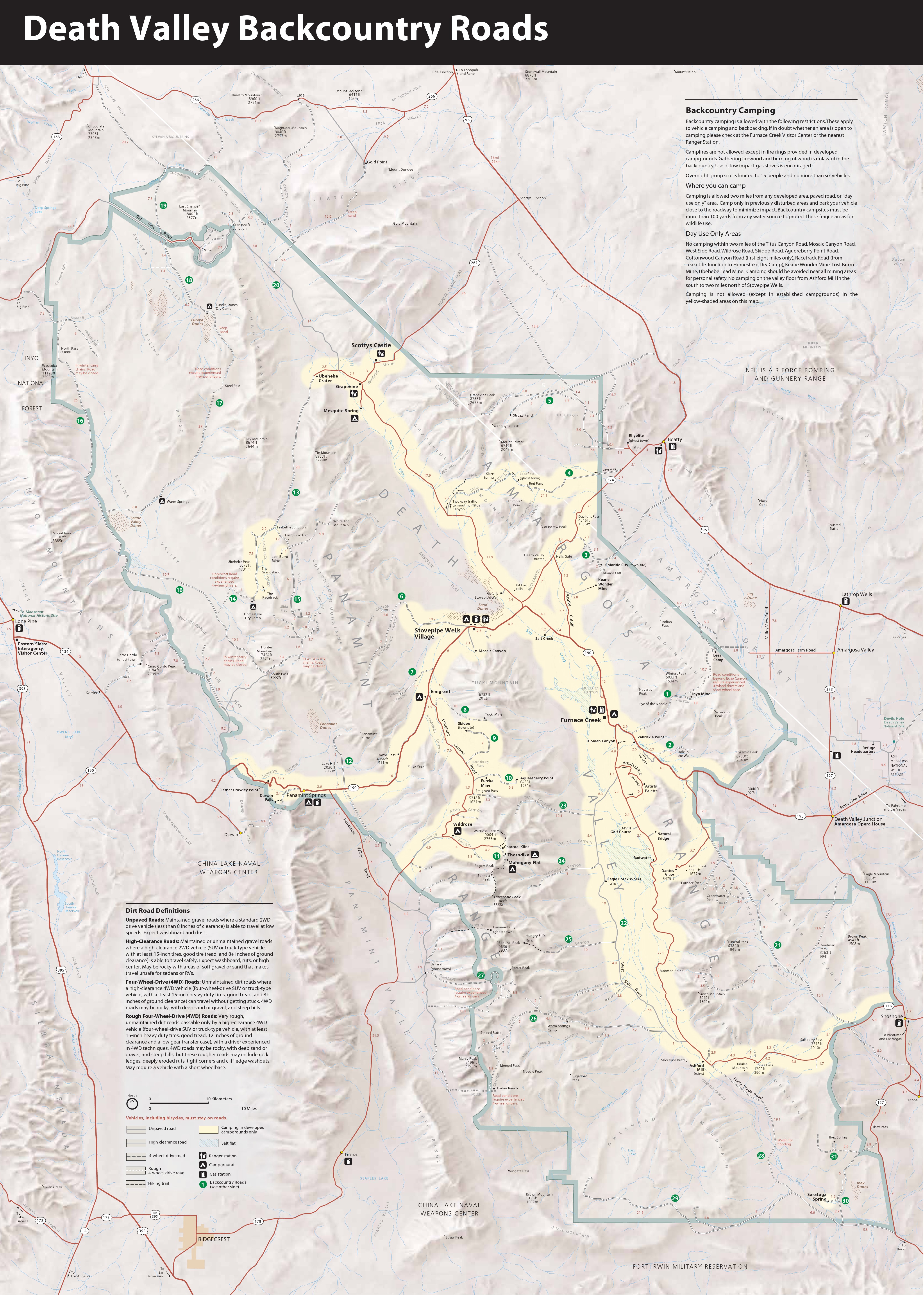 This is a map of Death Valley backcountry roads, showing mileages and road condition (including the Racetrack). Click the image to view a full size JPG (3.2 mb) or download the PDF (1.0 mb).
Death Valley regional road maps
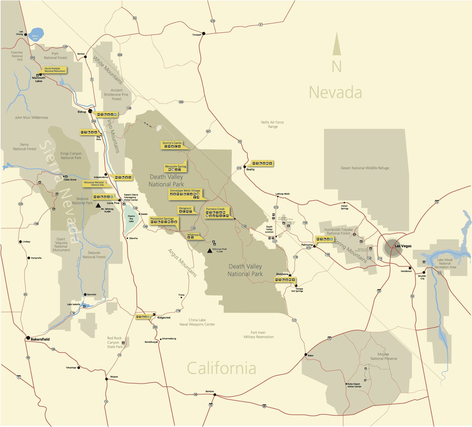 This is a regional Death Valley map (100 kb) showing the roads and surrounding towns, services, and natural areas in California and Nevada. Each point of interest is labeled with available visitor services.
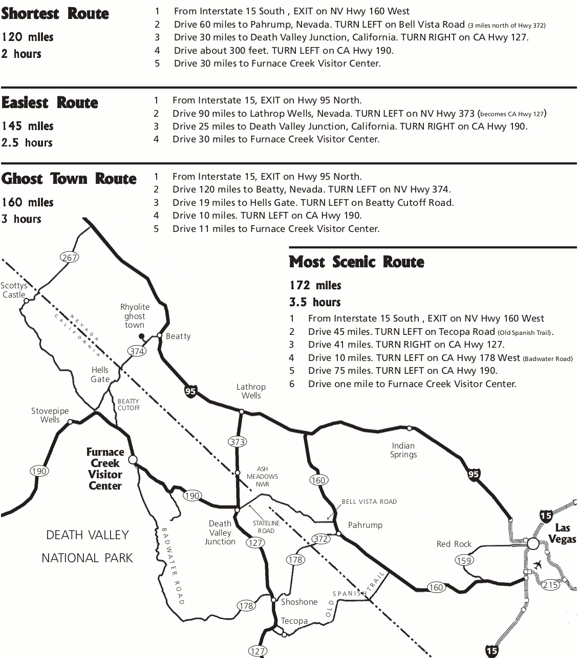 This is a Las Vegas to Death Valley road map (150 kb), describing alternate routes to reach Death Valley from Las Vegas, NV. Choose your route depending on whether you want speed, ease, or scenery.
Death Valley map prints and gifts
 Printed high-resolution Death Valley map posters and other products are available at the Death Valley Maps store. For art prints, gift ideas, and souvenirs featuring other national parks, support this site and visit the National Park Maps store; you’ll find items to bring on vacation, keep at home for the memories, or give to your park-enthusiast friends and loved ones.
…and more!
< Return to National Park Maps home
< Return to Park List
< Return to List by State
Need more planning help? Browse Amazon’s best-selling Death Valley maps and guidebooks.