Mesa Verde maps from the park brochure
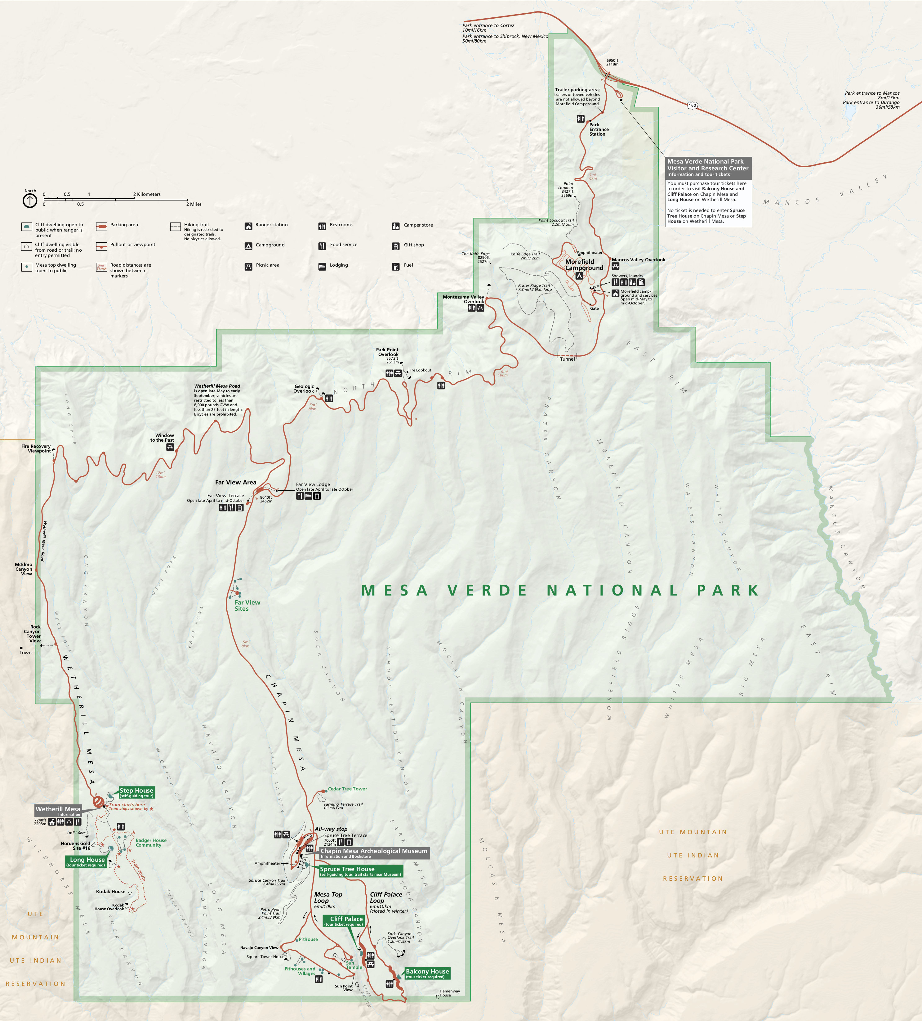
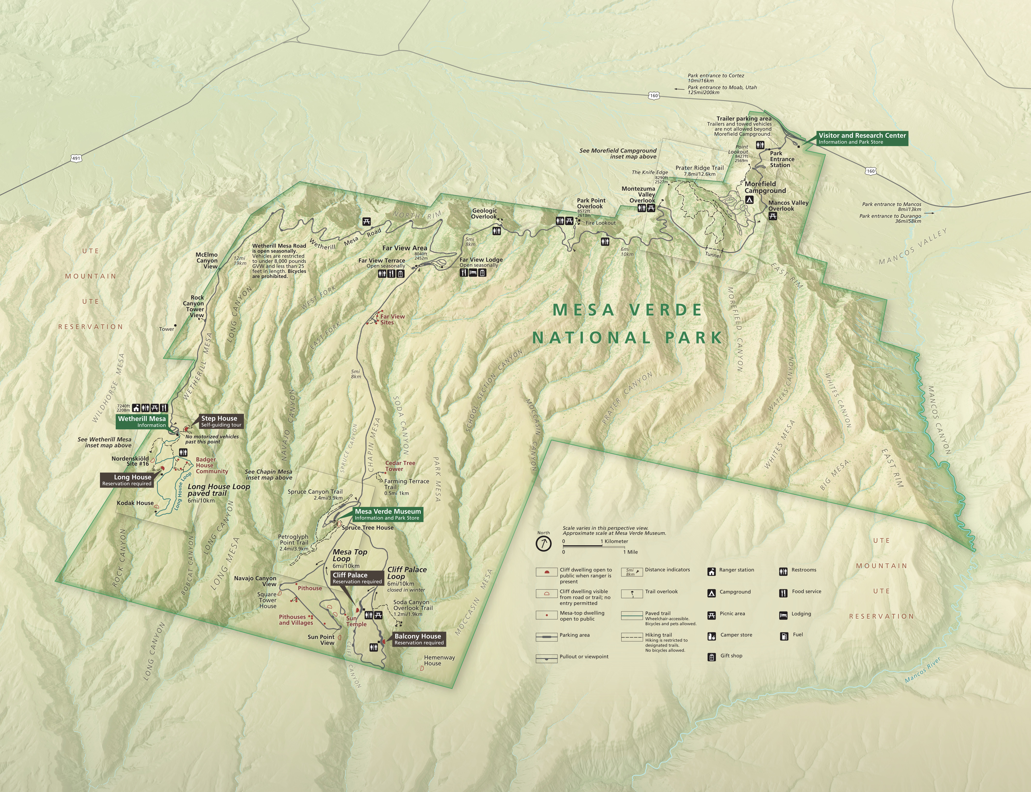 Here’s the official Mesa Verde map from the NPS brochure, revised for the 2025 season. This new oblique view really shows off the park’s unique and rugged topography, so vital to the Ancestral Pueblo people.
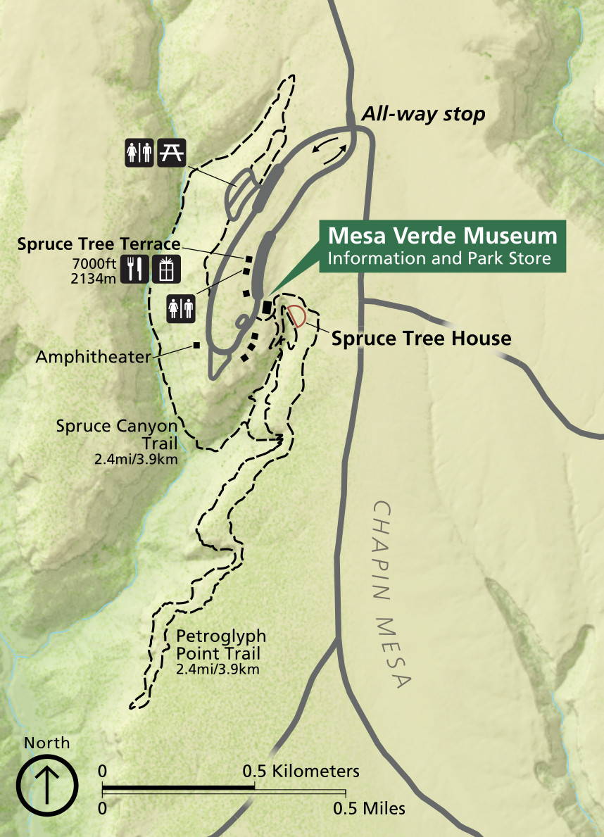 Here is a detailed Chapin Mesa map, zooming in on the Mesa Verde Museum and the Spruce Tree House. (I really enjoy the Petroglyph Point trail too.) Click the image to view a full size map or download the PDF.
 This detailed Wetherill Mesa map focuses on the end of the Wetherill Mesa Road, where you’ll find the Step House and Long House. Click the image to view a full size map or download the PDF.
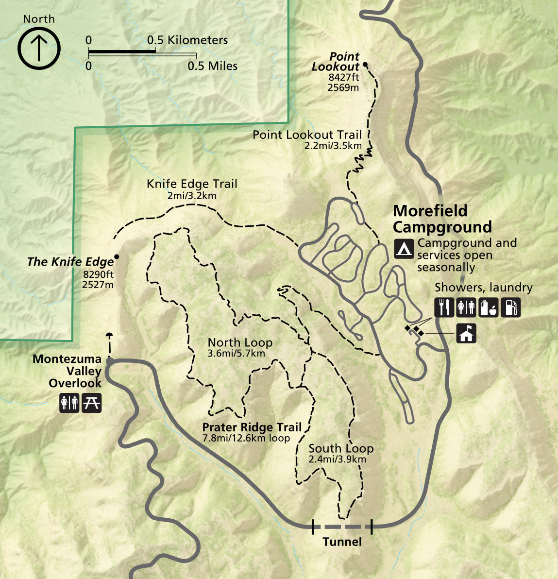 This is a detailed Morefield map, zooming in on the Morefield Campground and associated trails near the Mesa Verde entrance station. Click the image to view a full size map or download the PDF.
Mesa Verde trail maps
 The maps below do a nice job of showing an overview of each major point of interest. If you’re doing a lot of hiking or exploring elsewhere in the area near Cortez or Durango, you’ll probably want to order a National Geographic Trails Illustrated map that covers Mesa Verde as well as the surrounding national forest land around Durango in the San Juan Mountains. (Select the map on the drop-down menu under “Size.”)
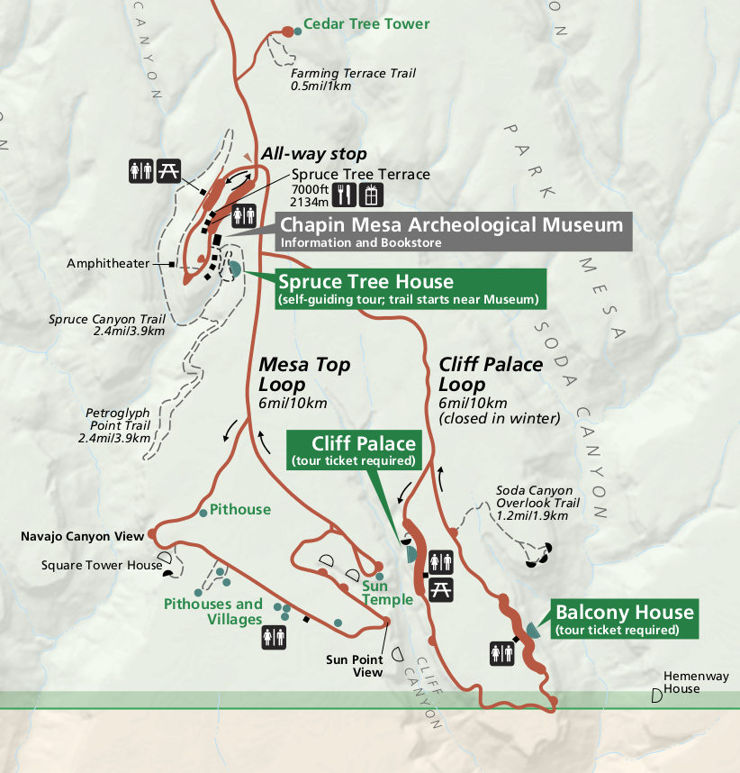
 This is a Chapin Mesa map showing the location of the Cliff Palace, Spruce Tree House, Balcony House, and other ruins like Square Tower House, Sun Temple, Pueblo Village, and more.
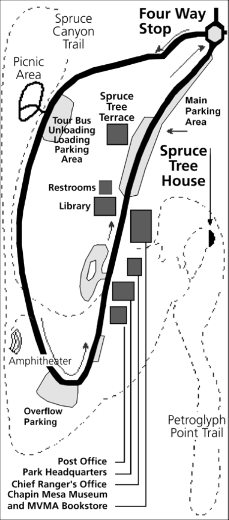 This is a Spruce Tree House area map, showing the Petroglyph Point trail, Spruce Canyon trail, picnic area, museum, parking, restrooms, and other visitor support services.
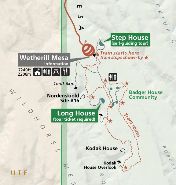
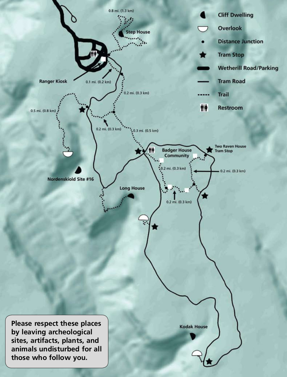 This is a Wetherill Mesa map showing the ruins, overlooks, and hiking trails at the end of Wetherill Mesa Road along the tram route. Many trails are labeled with their distance.
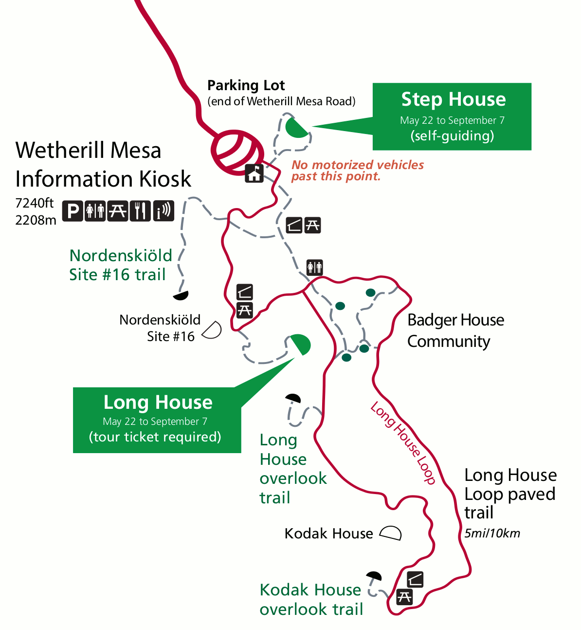 Here’s an alternate Wetherill Mesa map, which works much better for printing since it has a white background. The tram route and trails are labeled in different colors for easier reading.
Mesa Verde campground map
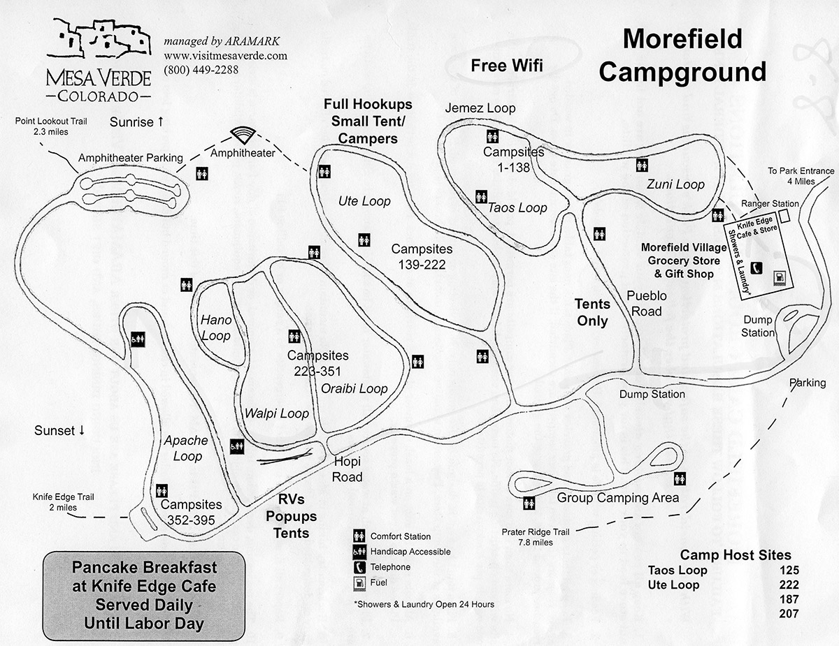 This is a Morefield Campground map, located just inside the park entrance before the climb up to the ruins. (Thanks to Those Young Guys for the map!) Services like restrooms and the store are shown.
Mesa Verde lodging map
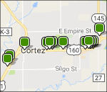 If you’re visiting Mesa Verde, you’ll want to find a place in Cortez, CO — the nearest major town to the park. An Expedia interactive lodging map is to the right, allowing you to see where the options are in Cortez (or move the map if you’d rather stay in a different town). Here I’ve also linked to Expedia’s top-rated Mesa Verde lodging, where you can view photos, read reviews, and compare prices and amenities.
Mesa Verde Panorama maps
The following four maps show views from the Park Point Overlook. This is a short paved walk to the highest point in the park, which is located between the entrance station and turnoff for Chapin Mesa.
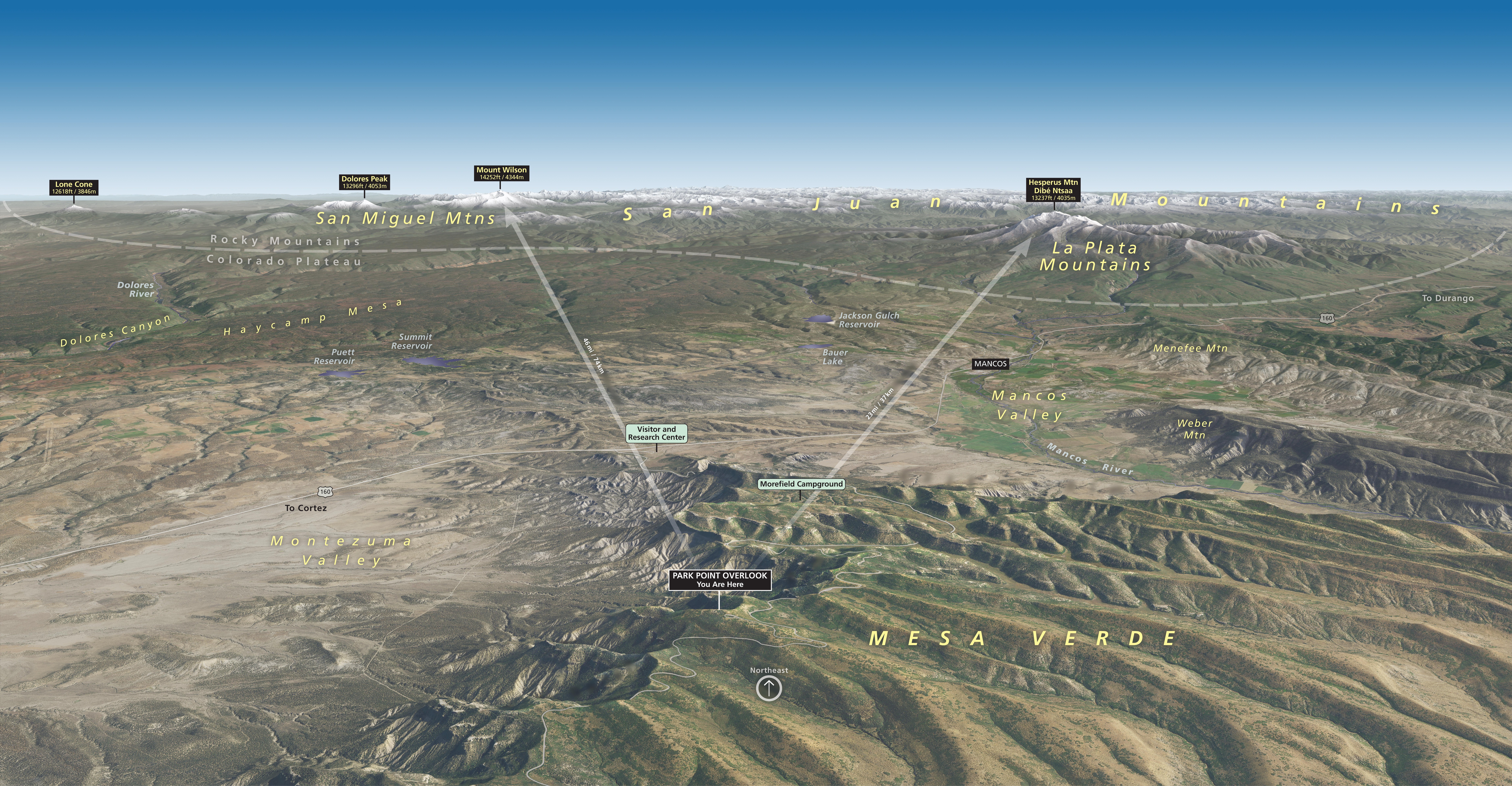 This map is from the Park Point Overlook viewpoint, looking northeast. Views over reservoirs and Haycamp Mesa extend toward the San Miguel, San Juan, and La Plata Mountains.
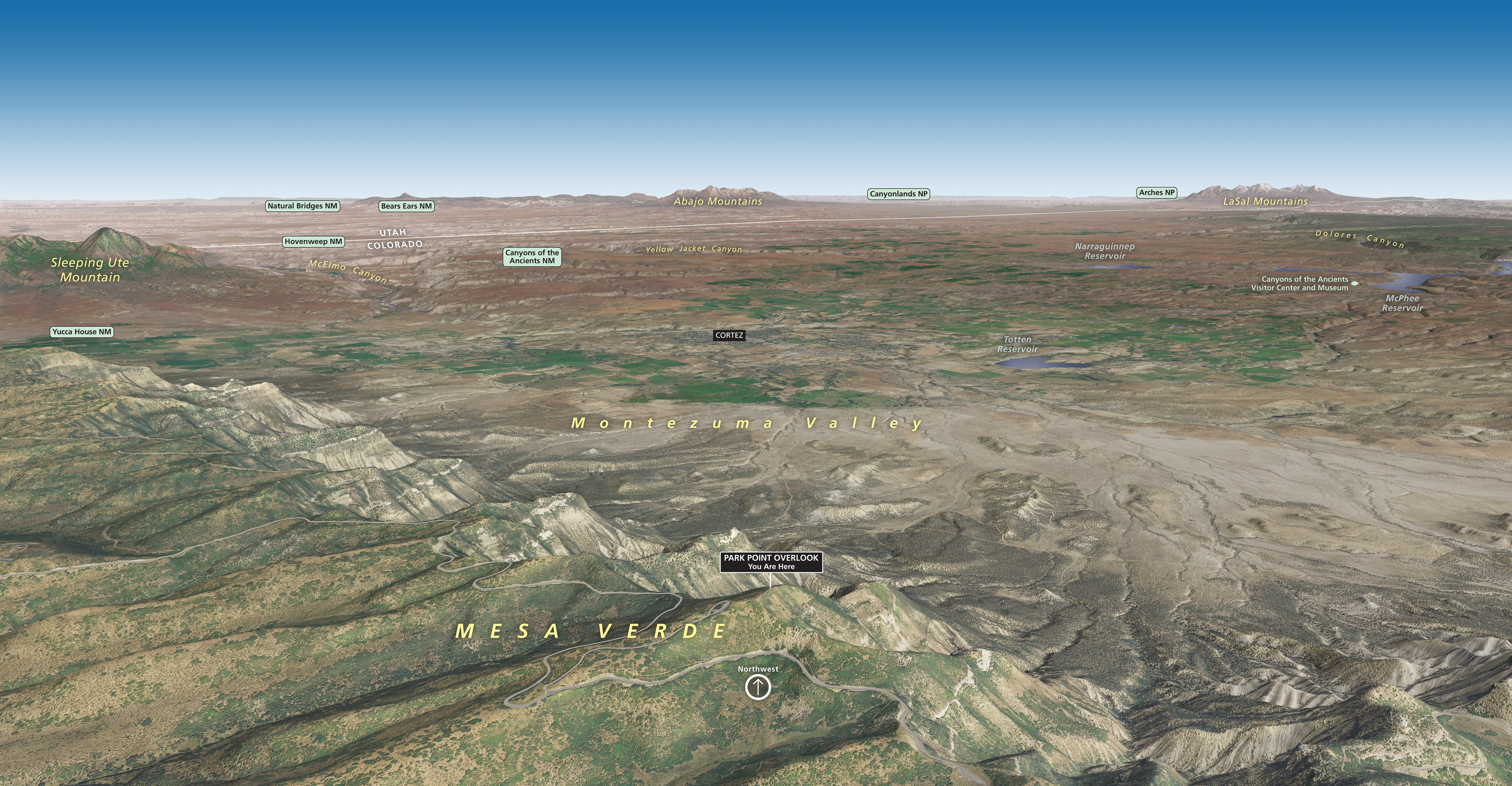 This map is from the Park Point Overlook viewpoint, looking northwest. In this direction you’re looking toward the canyonlands of southeast Utah, including several national parks and monuments.
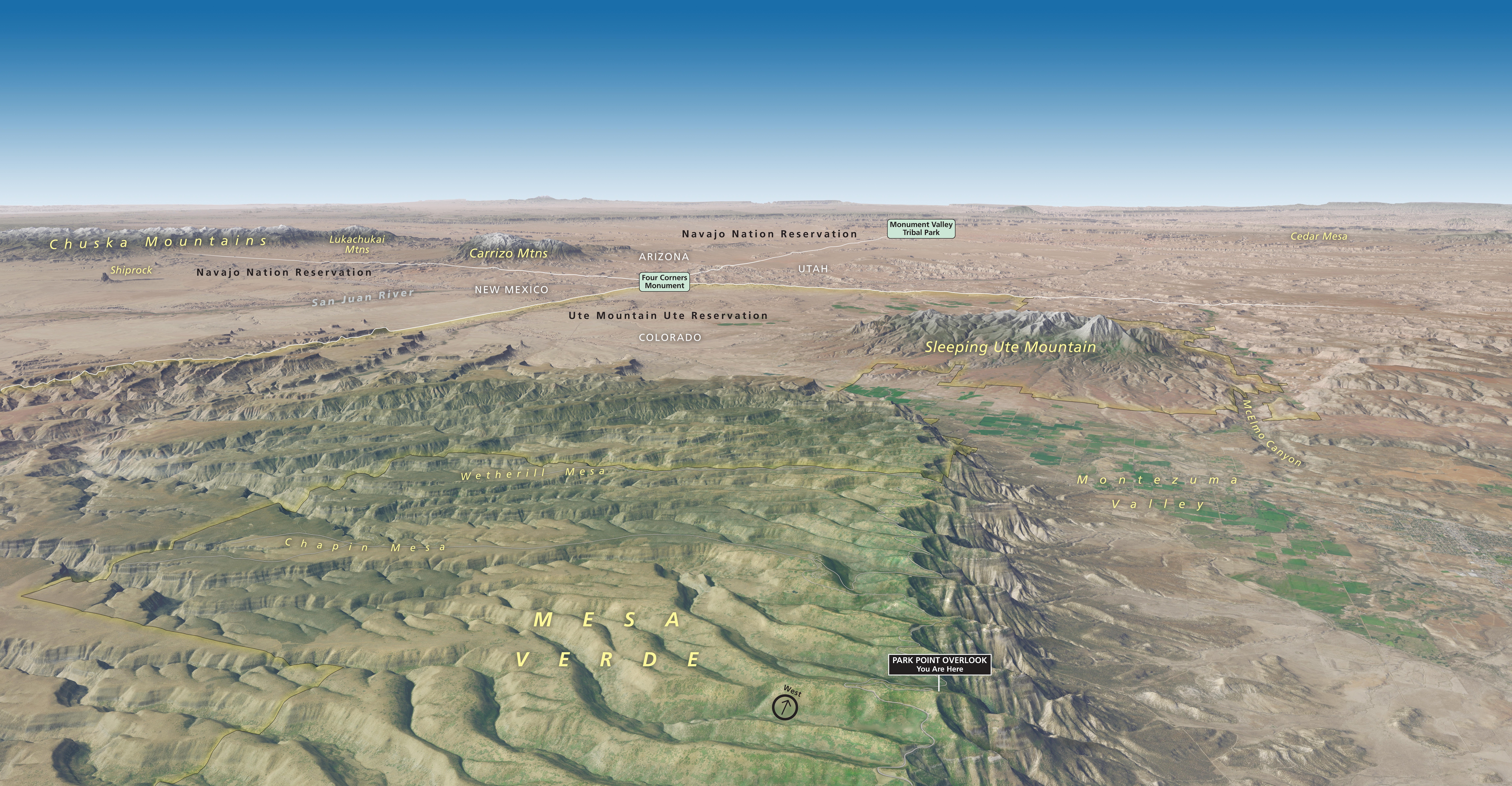 This map is from the Park Point Overlook viewpoint, looking west. Views extend past Sleeping Ute Mountain and into the incredible geology of the Four Corners region of Colorado, New Mexico, Arizona, and Utah.
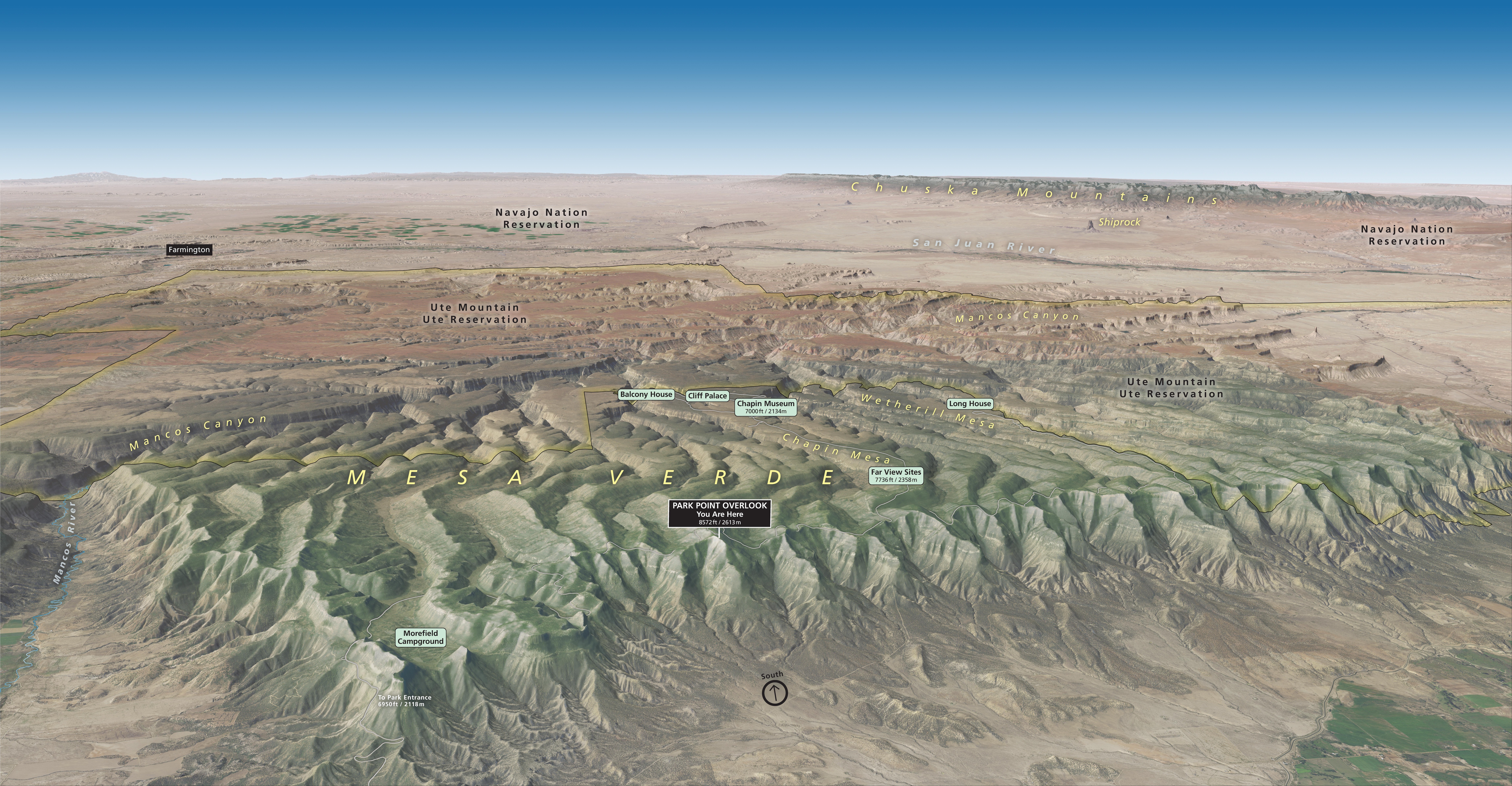 This map is from the Park Point Overlook viewpoint, looking south. It gives you a good sense of Mesa Verde canyon topography in comparison to the surrounding region. It really is a green mesa!
Various Mesa Verde maps
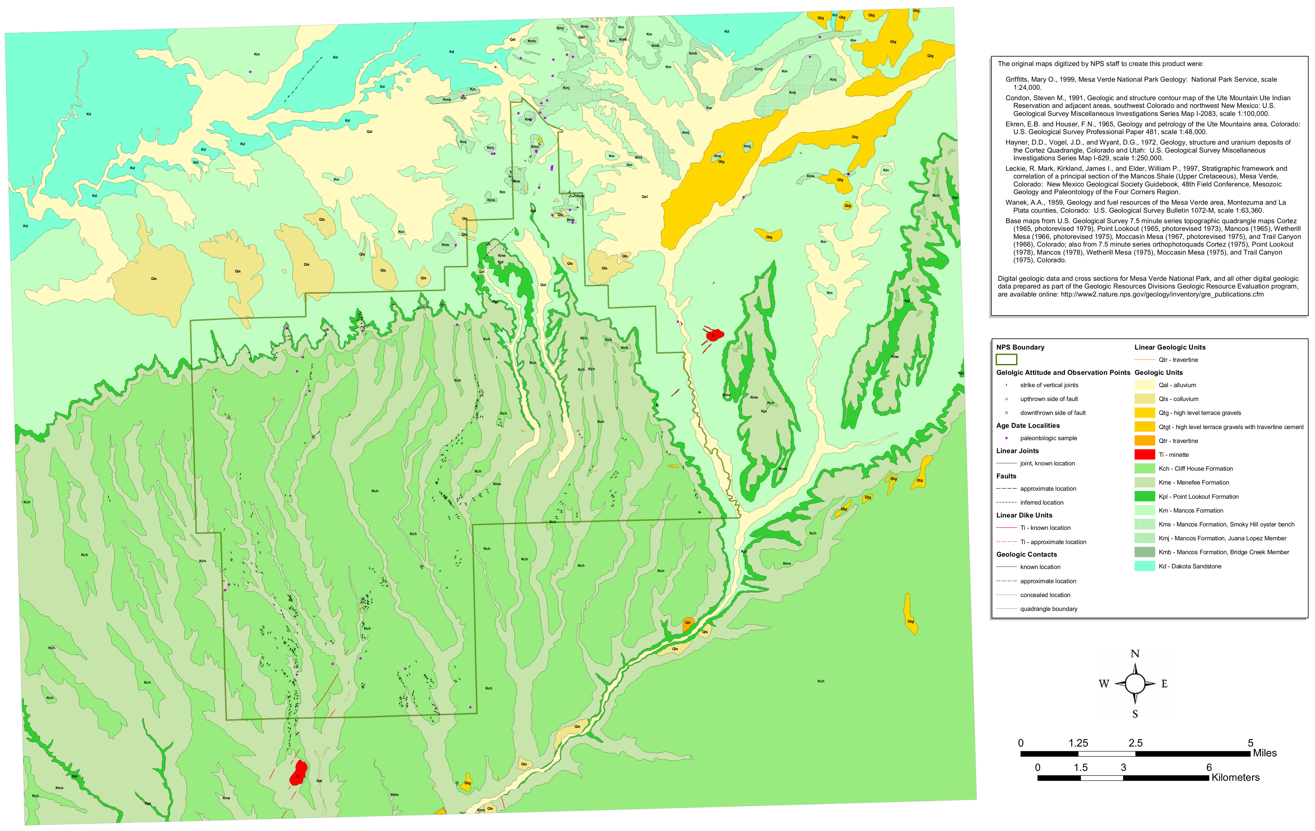 This Mesa Verde geologic map features both the bedrock that makes up the Mesa Verde cliffs as well as the more recent surface deposits in the park and in surrounding Colorado.
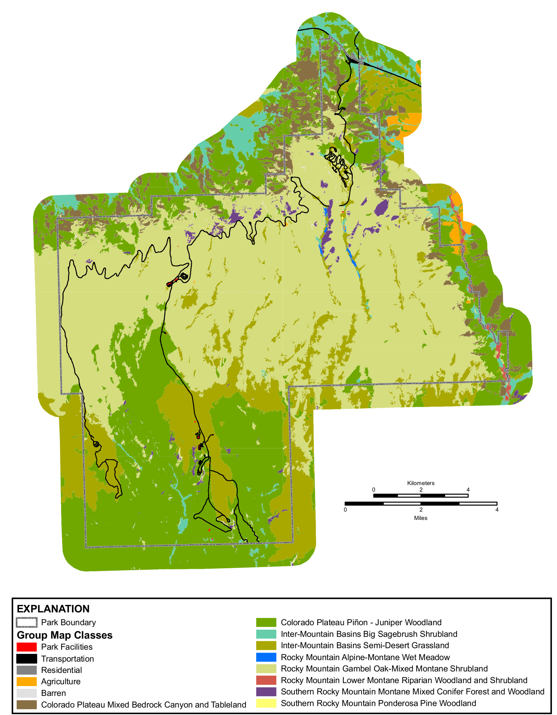 This Mesa Verde vegetation map shows how the plant communities change as you drive further (and higher) into the park. Roads are shown as well, to help you orient yourself to the vegetation.
Archived Mesa Verde maps
The four maps below used to be the official brochure maps, but they’ve since been superseded by the ones on top of this page. I’ve preserved them here for archival purposes and to ensure any direct links to these maps from around the web remain active and unbroken.
 This was the official Mesa Verde map from the park brochure, showing roads, campgrounds, trails, museums, and all the cliff dwellings. Click the image to view a full size map or download the PDF.
 Here is the old Chapin Mesa map, which shows a number of the famous sites: Cliff Palace, Spruce Tree House, Balcony House, Mesa Top Loop, and nearby trails like Petroglyph Point and Soda Canyon Overlook.
 This is the old Wetherill Mesa map, focusing on the tram route that serves the Long House, Badger House, and Kodak House. You’ll also find trails to other lookouts and ruins, such as the Step House.
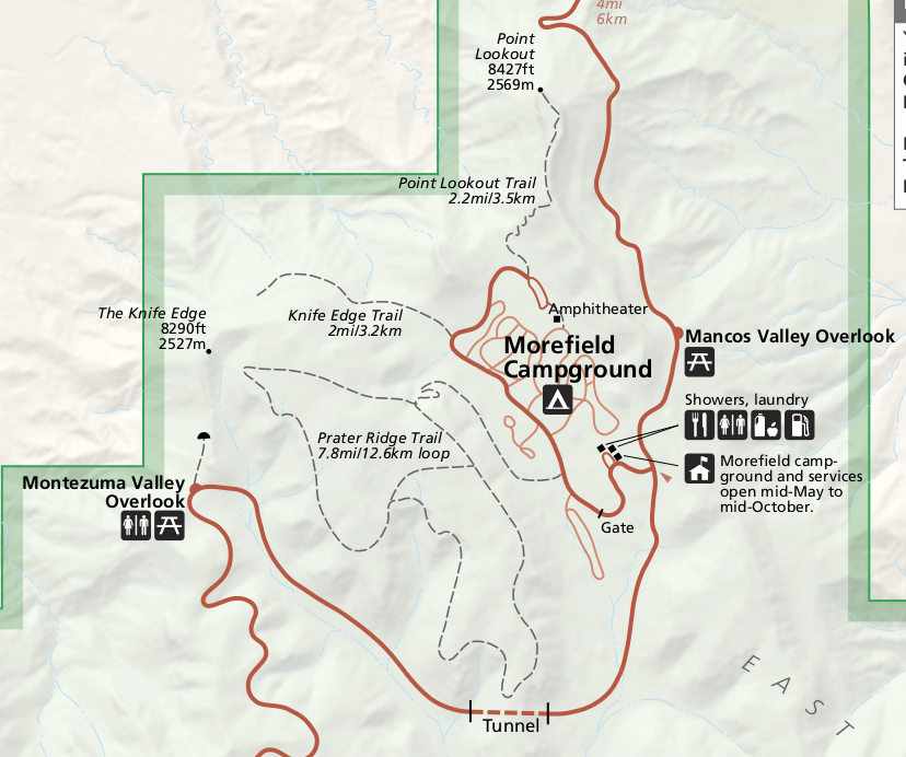 This is the old entrance area map, which centers on the Morefield Campground and shows the trails in the area to various view points: Montezuma Valley Overlook, Point Overlook, and the Knife Edge Trail.
…and more!
< Return to National Park Maps home
< Return to Park List
< Return to List by State