If you’re looking for a Hovenweep map, you’ve come to the right place; currently I’ve collected 4 free Hovenweep National Monument maps to view and download. (PDF files and external links will open in a new window.) This page includes a map showing the detail around the visitor center as well as the roads in the area. You can also browse the best-selling Hovenweep maps and guidebooks on Amazon.
Hovenweep map from the park brochure
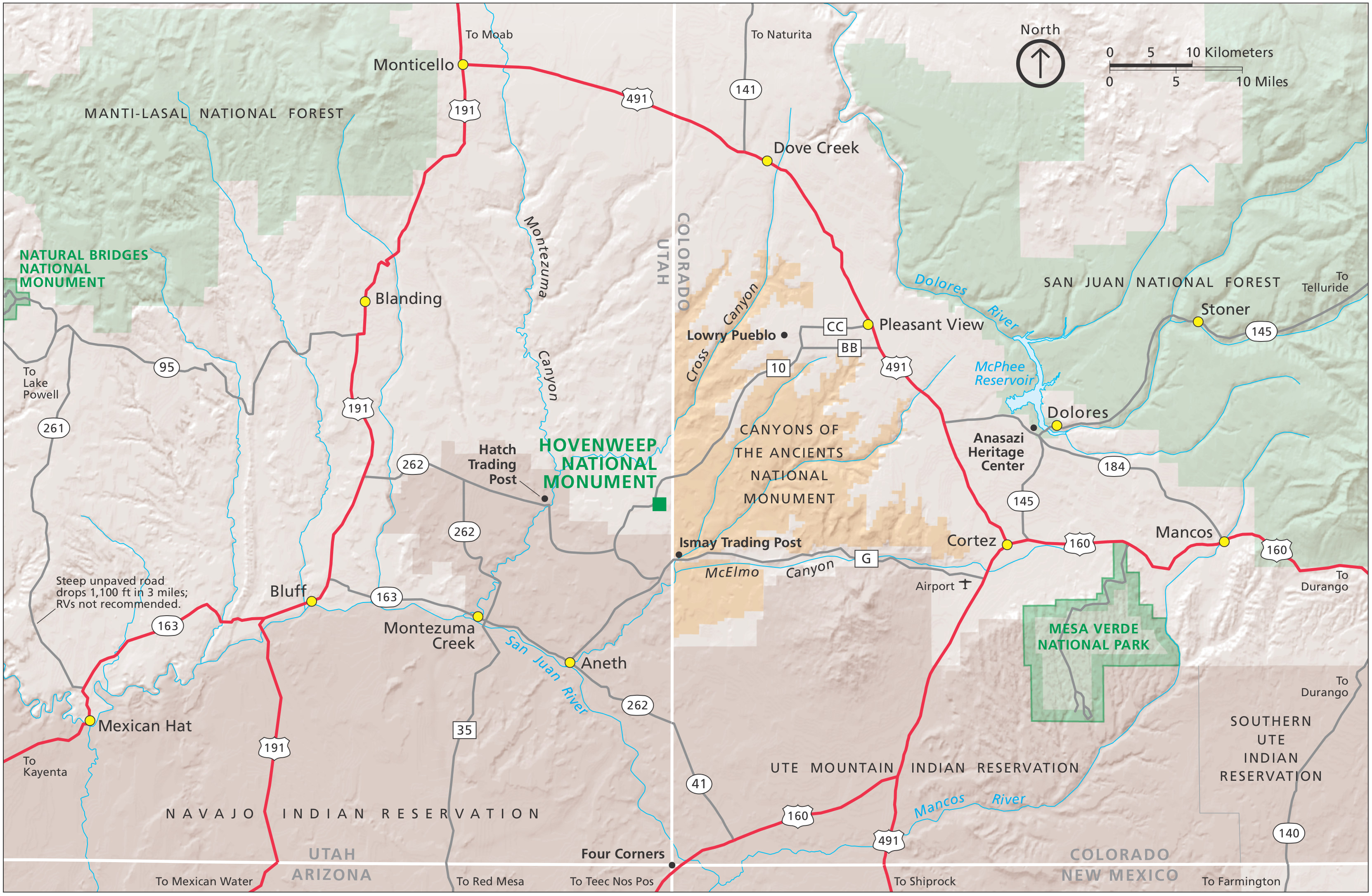 This is the Hovenweep map from the brochure, showing the location of the park in relation to nearby towns and parks in Utah and Colorado. Click the image to view a full size JPG (1.3 mb) or download the PDF (250 kb).
Hovenweep detail map
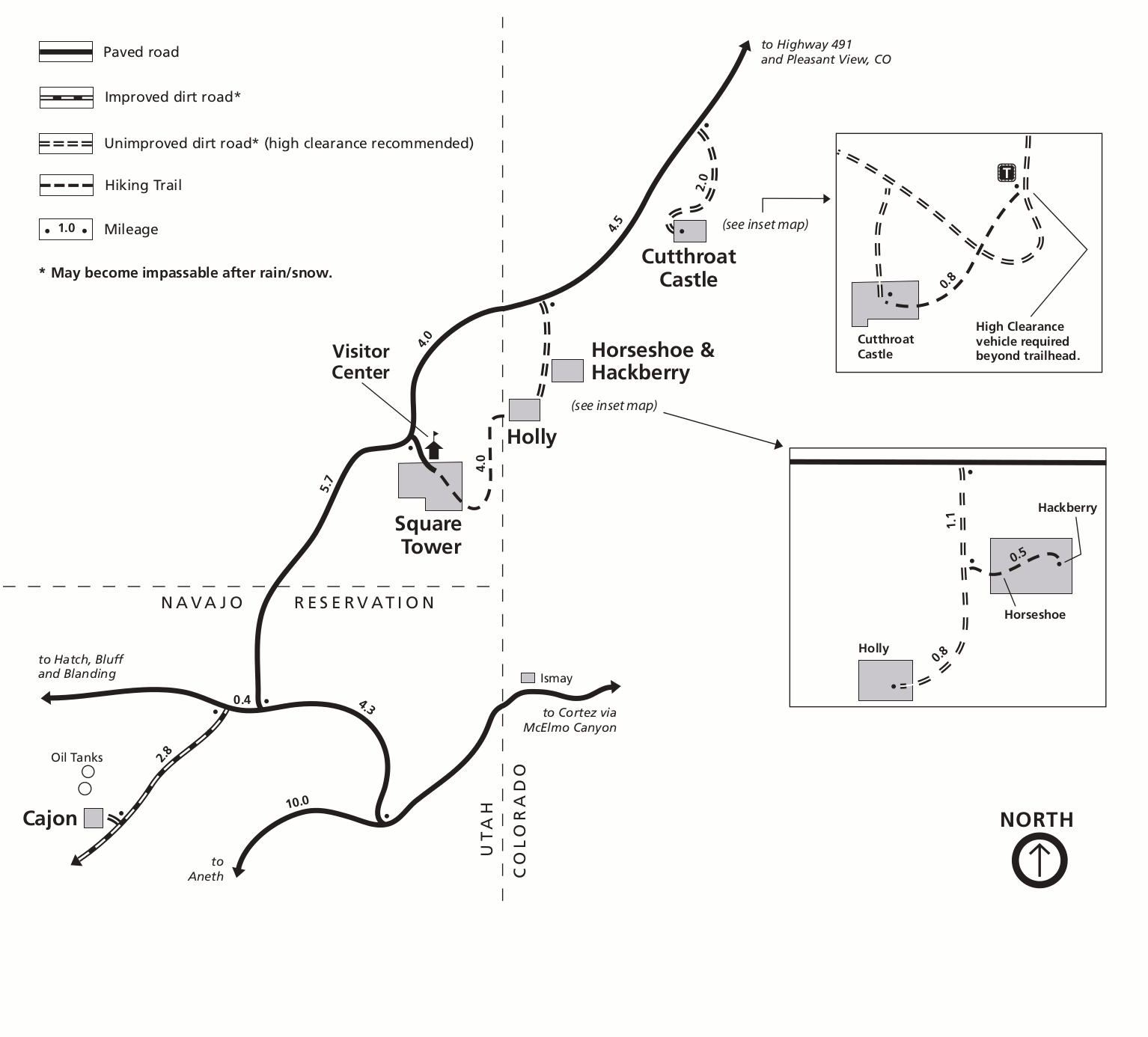 Here’s a detail map of Hovenweep (100 kb), showing the roads, hiking trails, and towers located around the visitor center area: Square Tower, Holly, Horseshoe & Hackberry, and Cutthroat Castle.
Hovenweep vegetation map
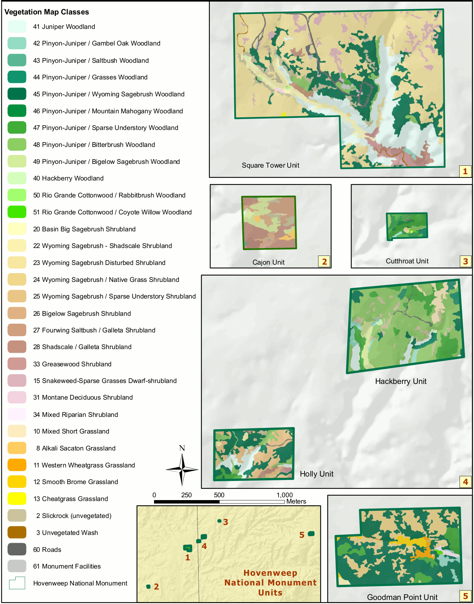 This Hovenweep vegetation map (450 kb) shows the juniper woodlands, grasslands, and shrublands located in each of the Hovenweep park units. (You’ll see a lot of pinyon-juniper woodlands!)
…and more!
< Return to National Park Maps home
< Return to Park List
< Return to List by State
Need more planning help? Browse Amazon’s best-selling Hovenweep maps and guidebooks.