Capitol Reef map from the park brochure
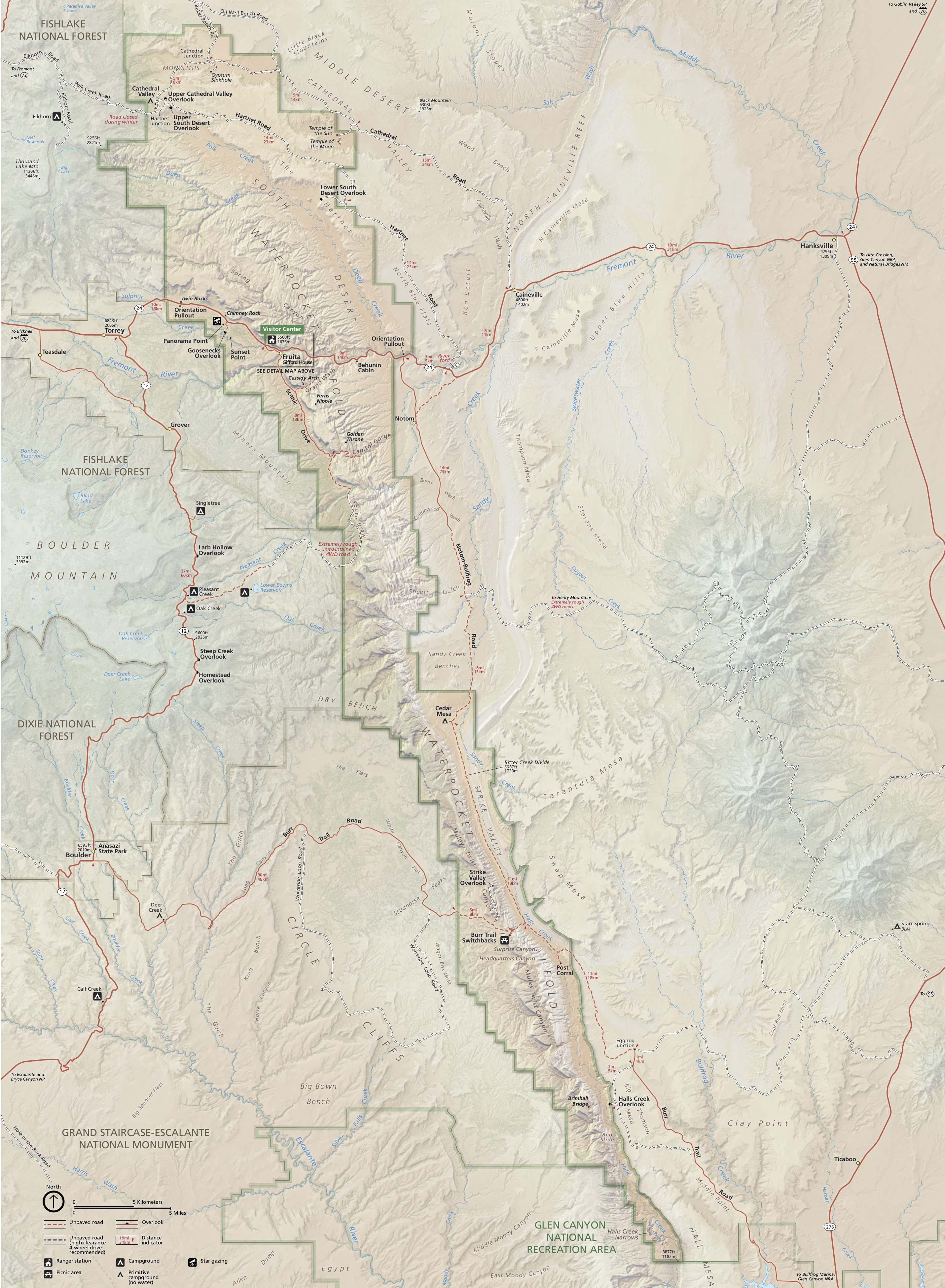 Here’s the new Capitol Reef National Park map, showing topographic relief and true color a bit better than the older park brochure maps below. It looks much nicer and gives you a better feel for the park!
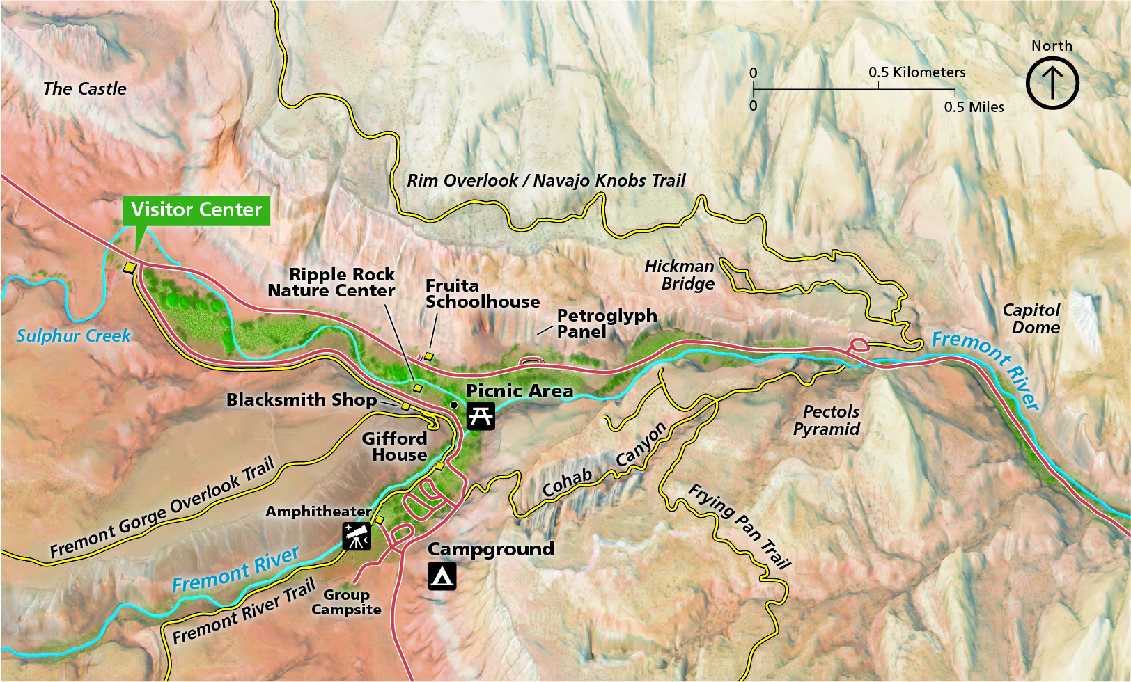 This is a Capitol Reef detail map, zooming in on the Fruita area — you’ll see the campground, visitor center, picnic area, and several trails including Cohob Canyon and the Frying Pan Trail.
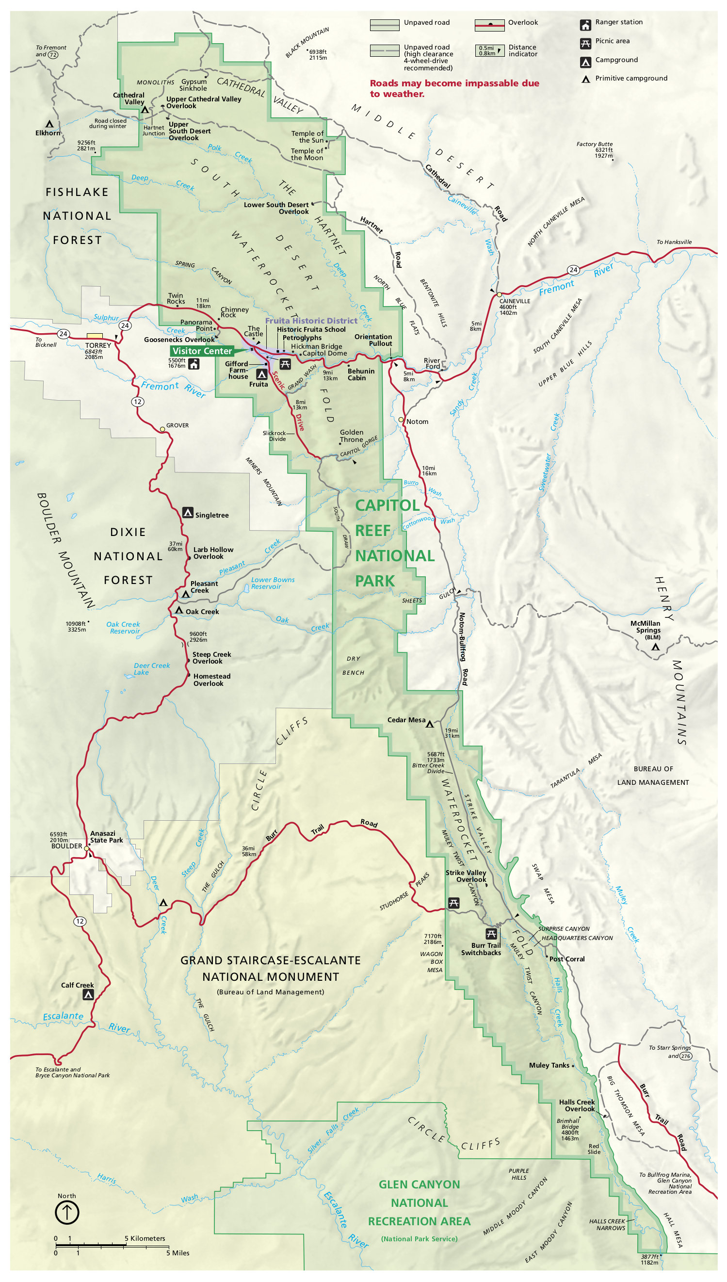 This is the older Capitol Reef brochure map, showing the roads, campgrounds, the Fruita area, and part of Dixie National Forest. Click the image to view a full size map or download the PDF.
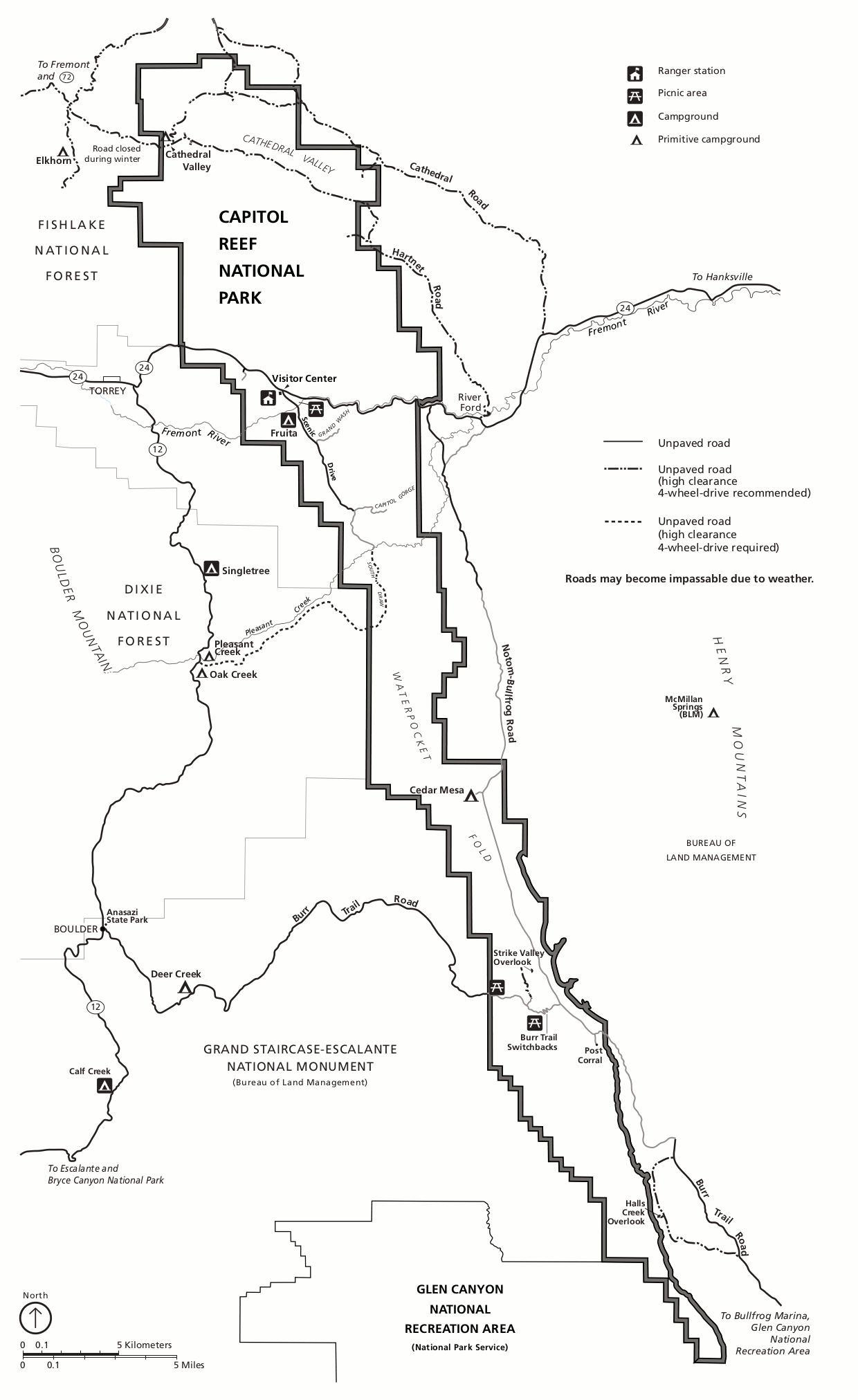 This is a printable Capitol Reef map, showing the same things as the map above but in black and white only, making it a bit easier to print legibly without using a bunch of your printer ink.
Capitol Reef trail maps
 If you’re looking for a trail map to cover the entire park and show trail mileages and topo lines, you’ll want a National Geographic Trails Illustrated map. This is especially true at a park like Capitol Reef, where trails are not all well marked and require route-finding skills. Last time I was there I thought I could get away without a topo map; I ended up lost for about 20 minutes before finding cairns again. Don’t make my mistake!
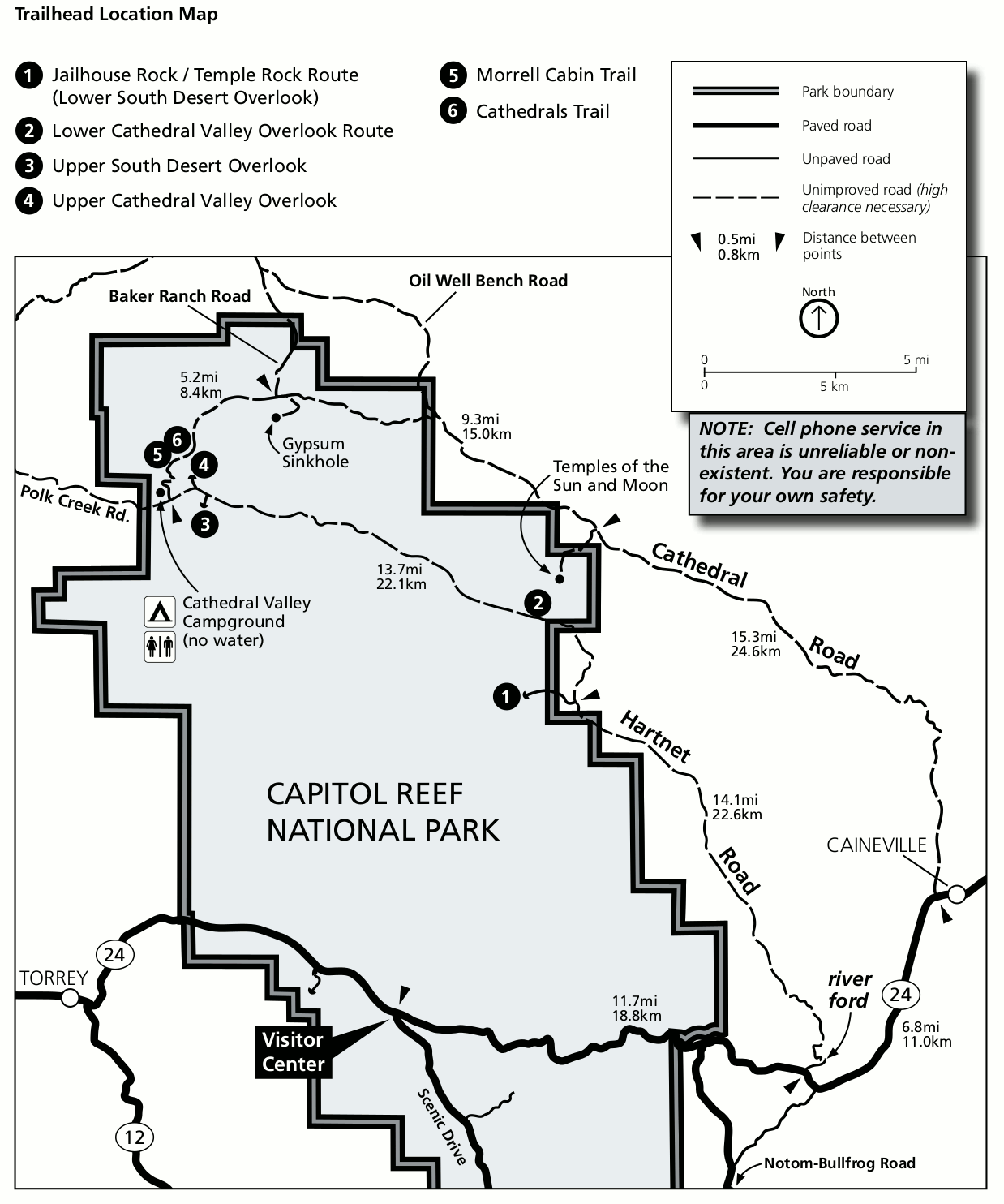 This is a Cathedral District trailhead map, which shows the trailheads accessed from the Cathedral Valley Campground area (and Cathedral Road and Hartnet Road) in the northern part of the park.
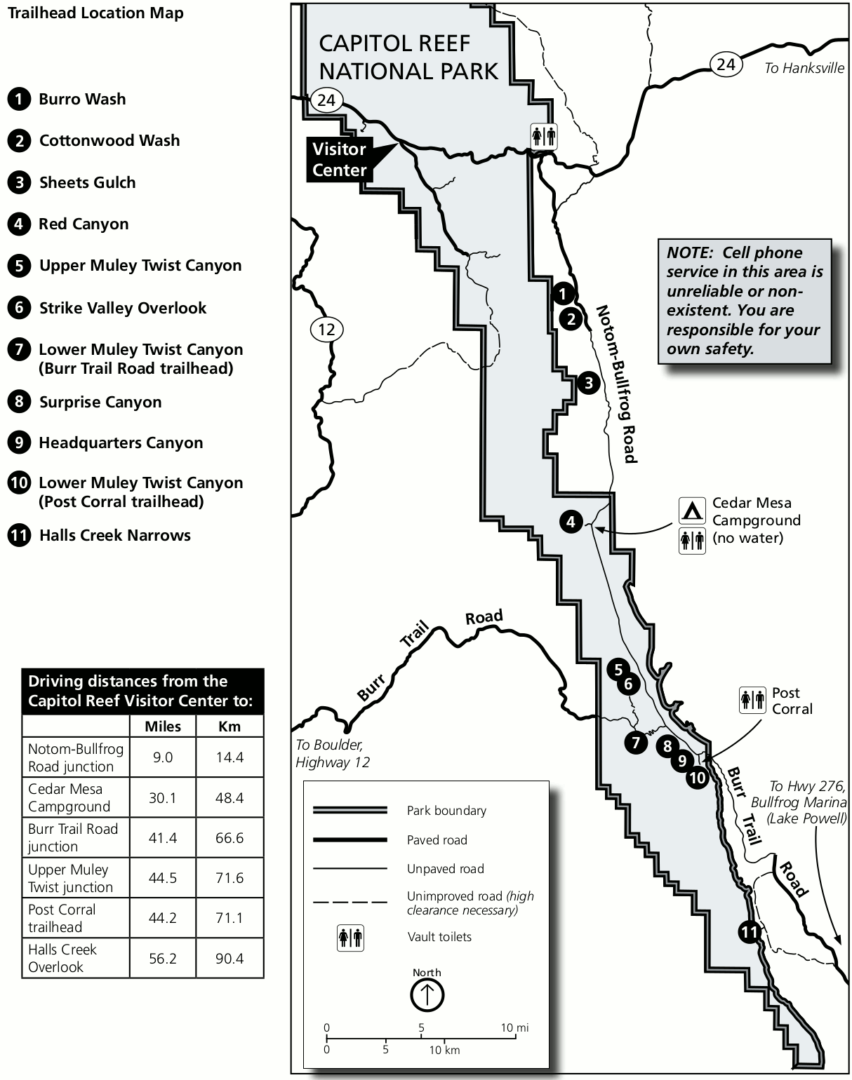 Here’s a Waterpocket District trailhead map, showing the location of each trailhead accessed off the Notom-Bullfrog Road and Burr Trail Road, further south in a remote area of Capitol Reef.
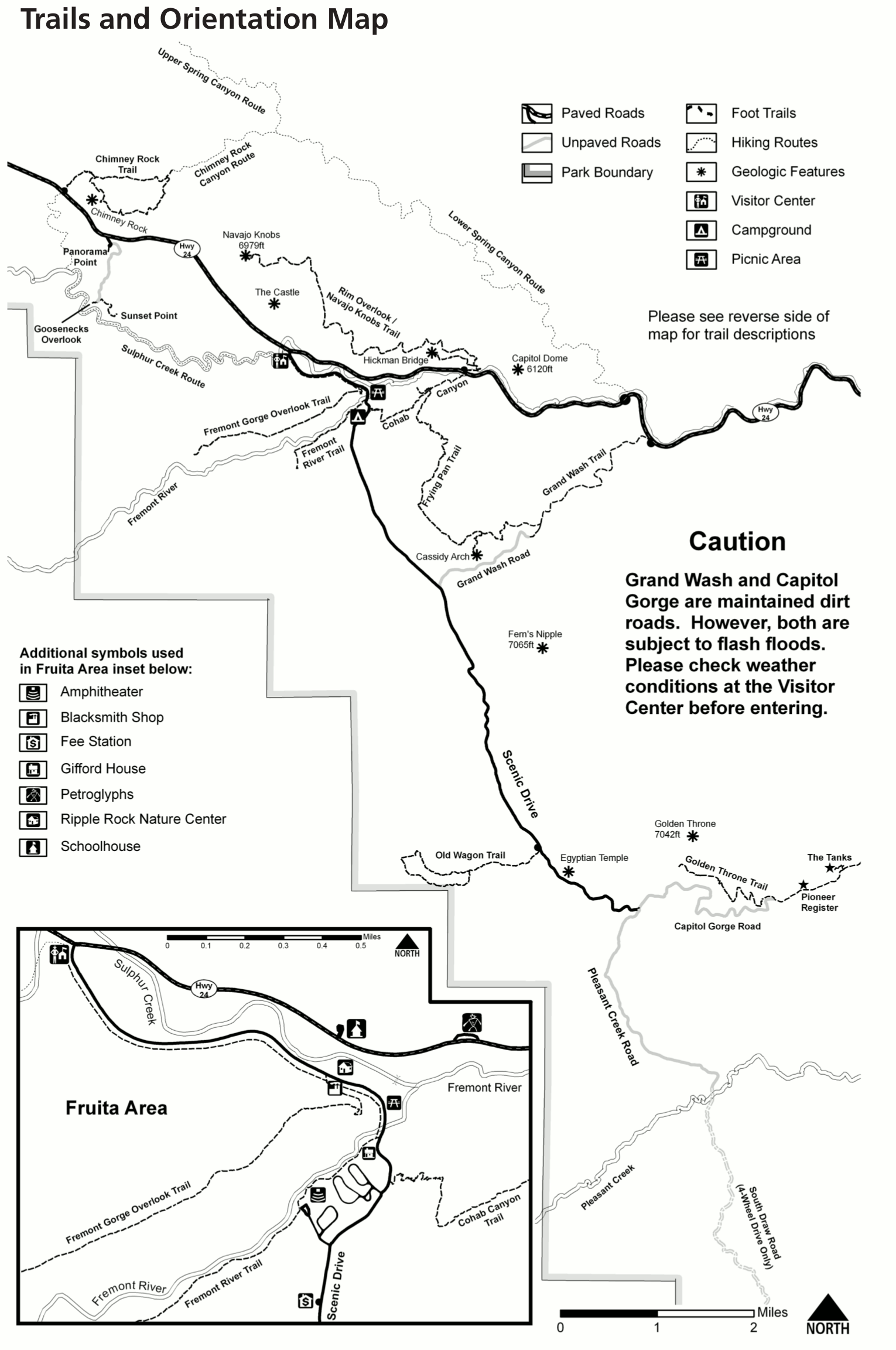 Here is a Capitol Reef trail map, featuring the major trails in the main developed area of the park along the Scenic Drive, Highway 24, and near Fruita. This is probably the area you’ll be driving through.
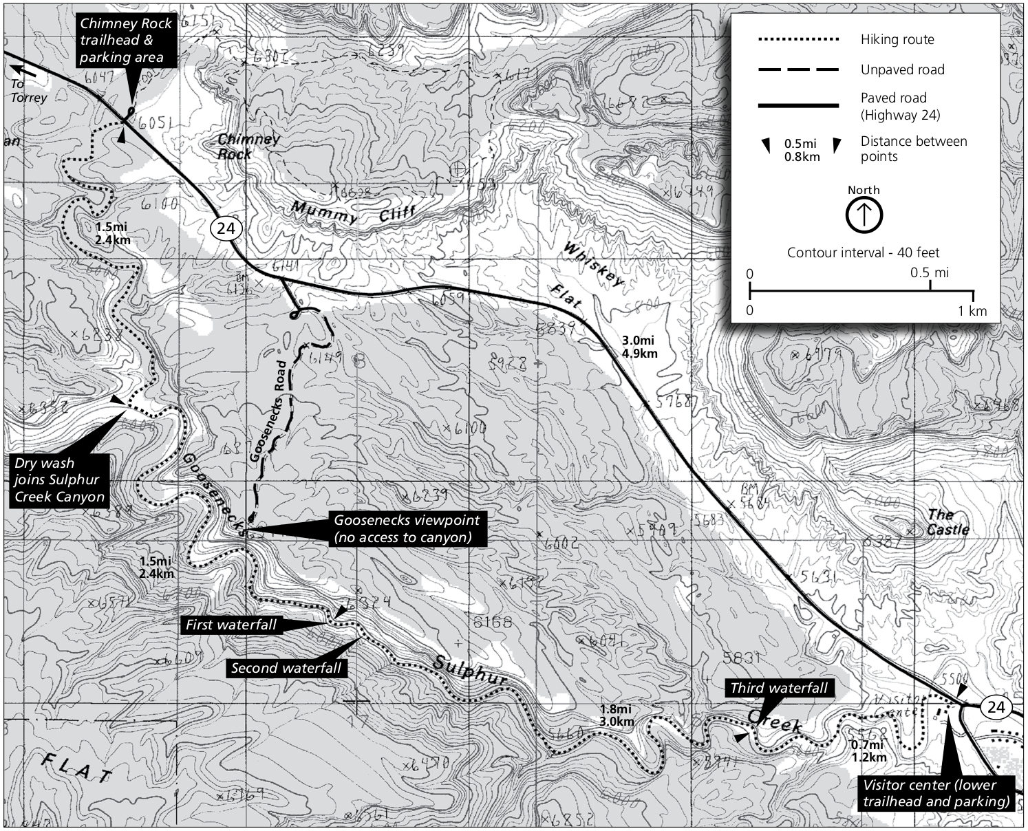 The Sulphur Creek trail map includes both the Chimney Rock and visitor center trailheads, with trails into Sulphur Creek (with some waterfalls) and the Goosenecks.
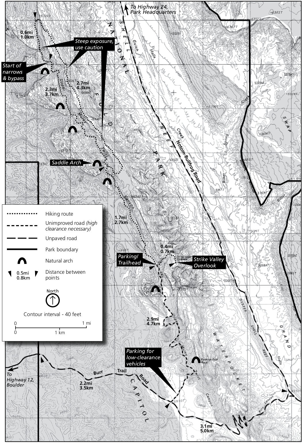 The Upper Muley Twist Canyon trail map shows the route from the Burr Trail Road and identifies the various arches along the way: Saddle Arch, Peek-a-boo Rock, and more.
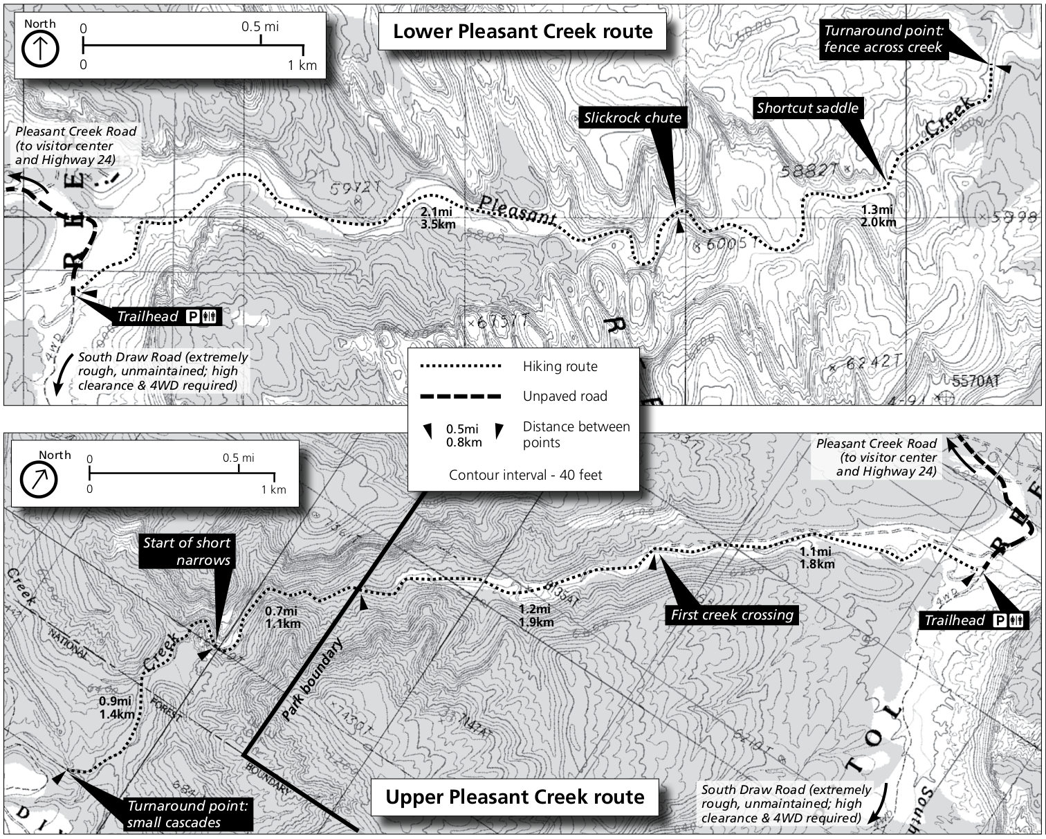 This Pleasant Creek trail map shows both the Upper and Lower Pleasant Creek routes, heading upstream and downstream from the trailhead into some narrow canyons.
Capitol Reef lodging map
 If you’re going to stay near Capitol Reef, the town of Torrey, UT is your only game in town. To the right you can open an Expedia interactive lodging map of the Torrey area, which is just a few minutes outside the park entrance. I also recommend browsing Expedia’s top-rated Capitol Reef lodging to compare reviews, prices, photos, features, and locations, finding the best place for you and your budget.
Various Capitol Reef maps
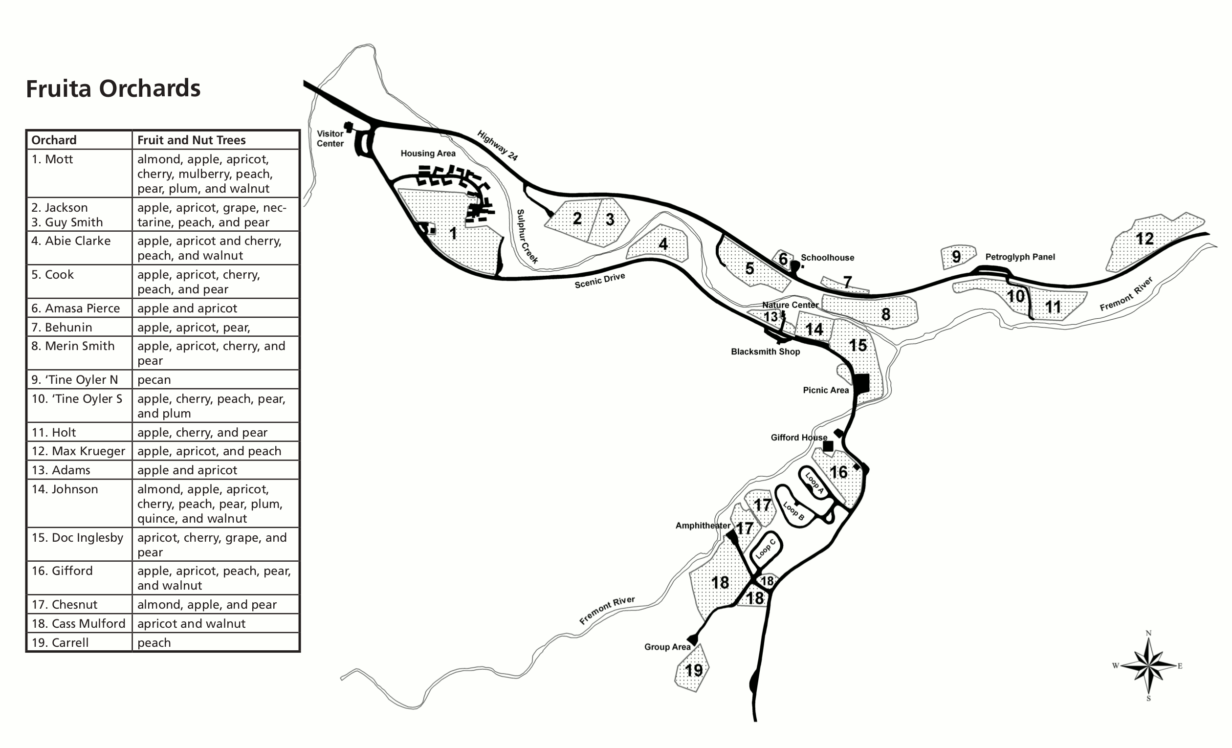 Here is the Fruita Orchard map, showing each fruit orchard and what grows in it. It also shows the campground, picnic area, visitor center, and other sites in the main Fruita developed area.
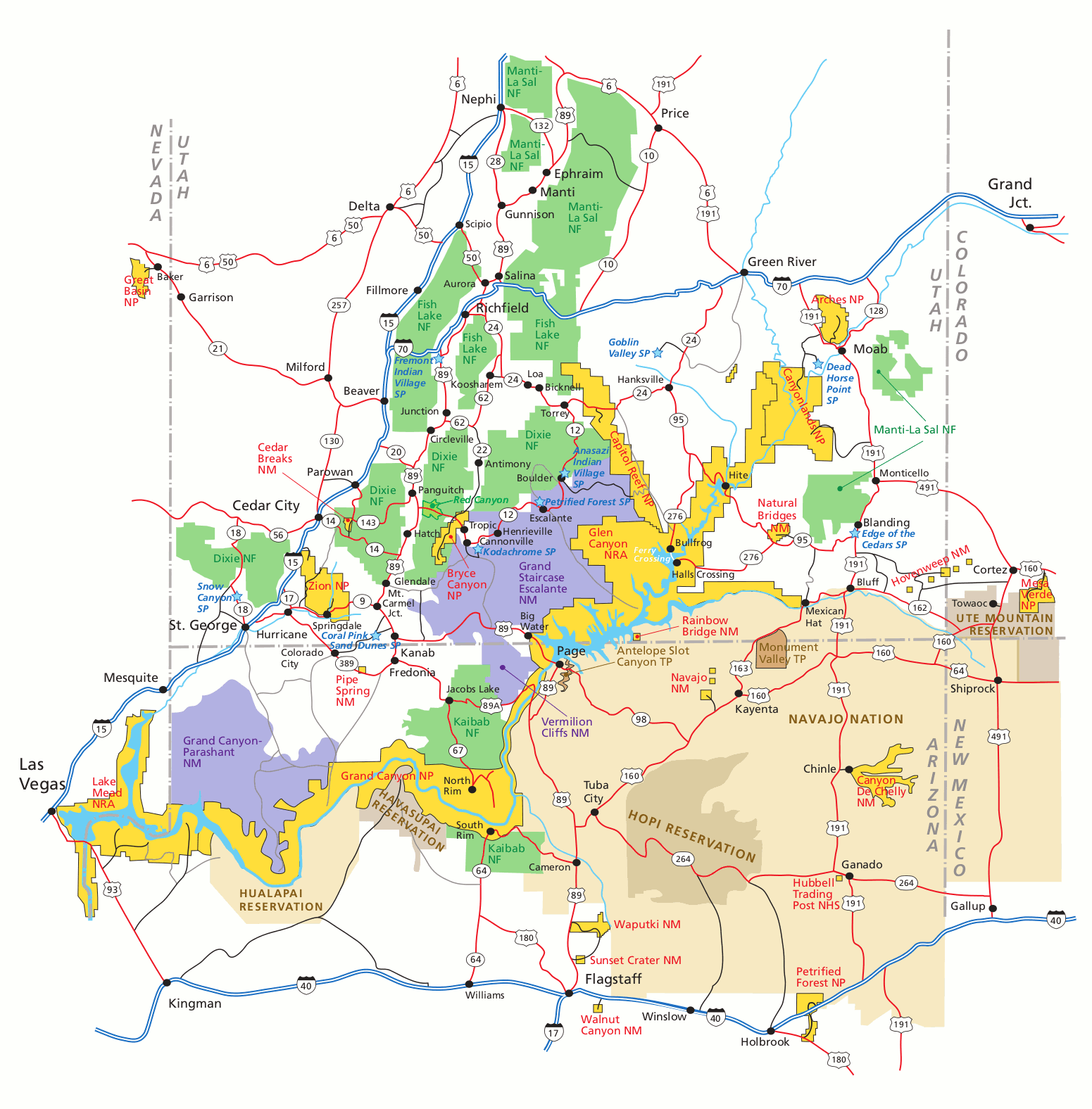 Here is a regional map of Capitol Reef, showing Capitol Reef as well as the surrounding parks and natural areas in southern Utah. Click the image to view a full size map or download the PDF.
Scientific Capitol Reef maps
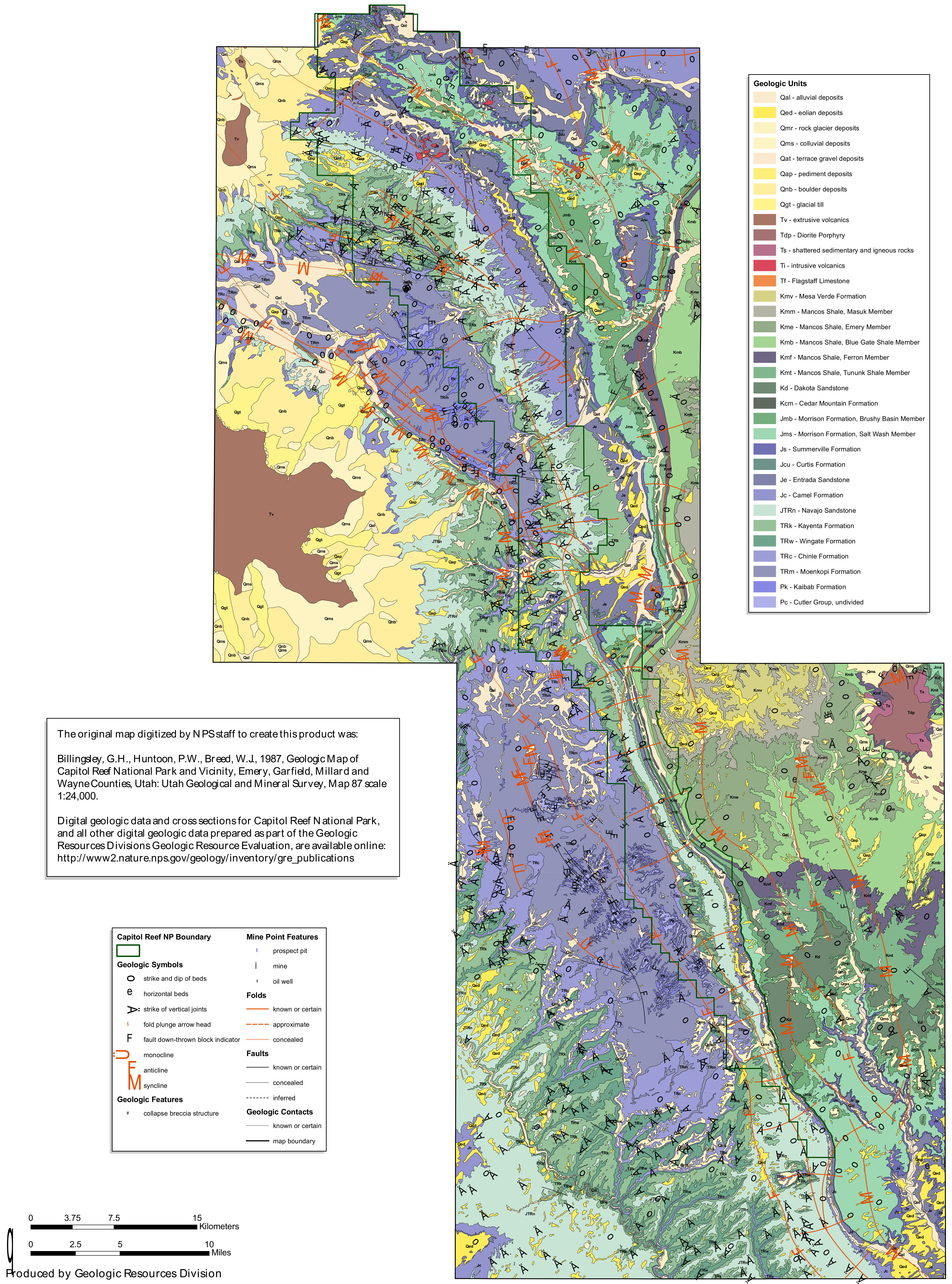 This Capitol Reef geologic map shows the folds and faults along the Waterpocket Fold, which makes up the backbone of Capitol Reef National Park. It’s more complicated than it looks in person, right?
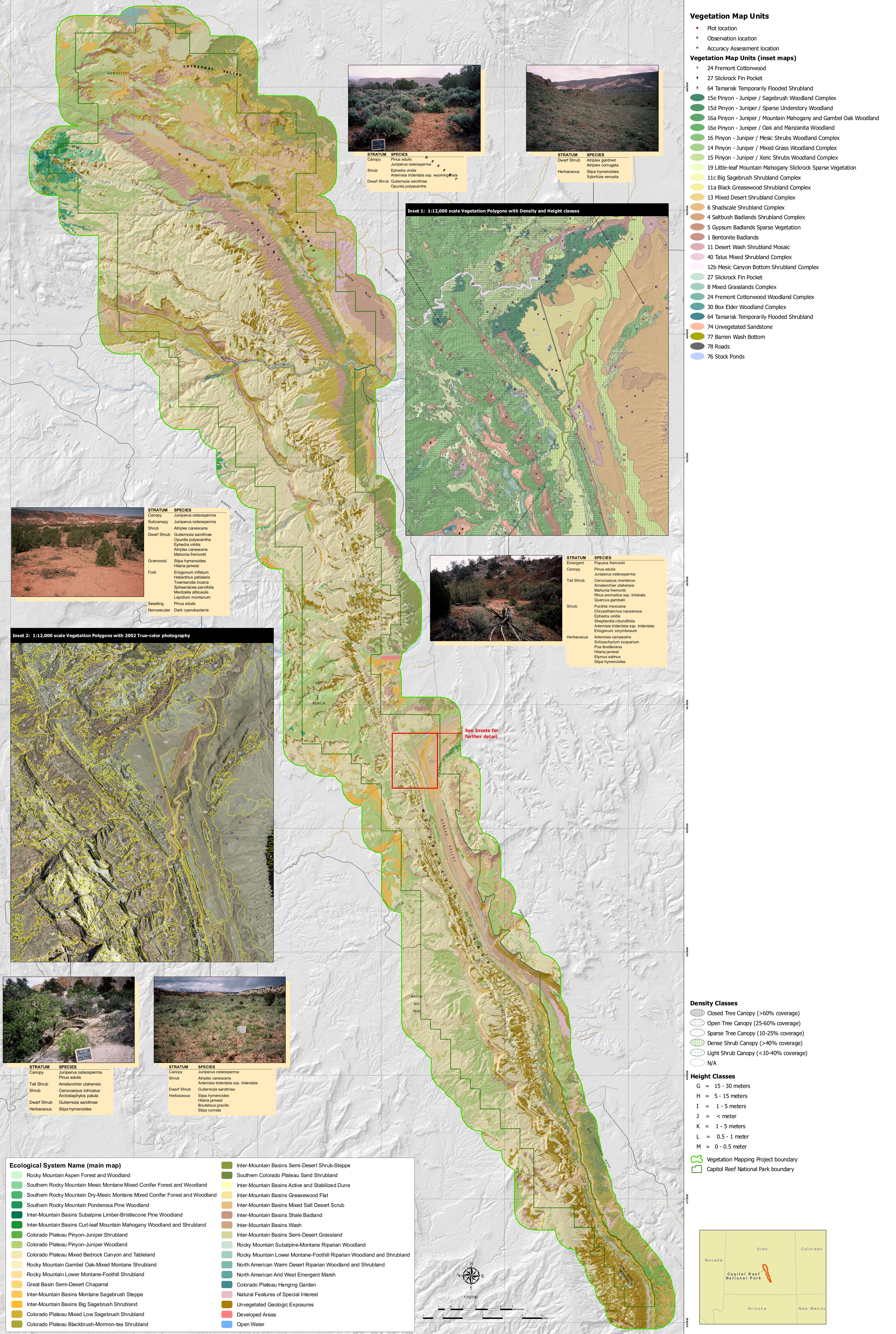 Here’s a Capitol Reef vegetation map, labeling the various plant and forest communities found within the boundaries of Capitol Reef National Park and in the surrounding landscape.
…and more!
< Return to National Park Maps home
< Return to Park List
< Return to List by State