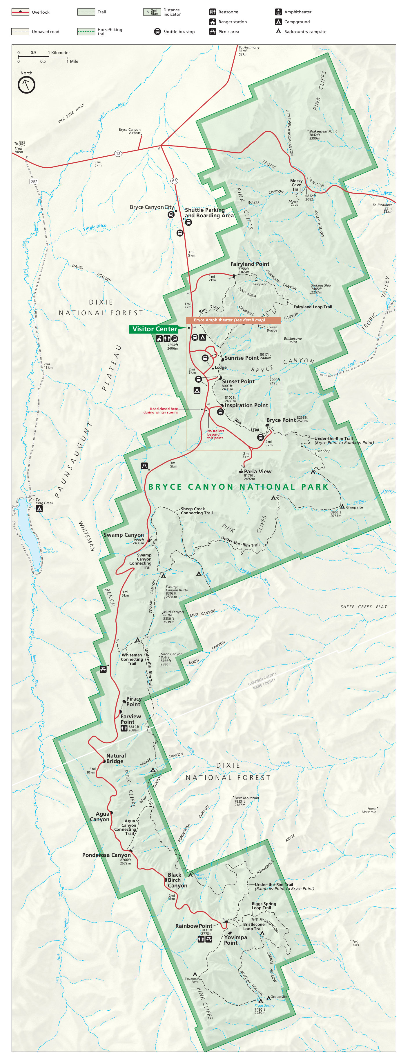
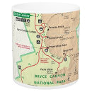
Bryce Canyon map from the park brochures
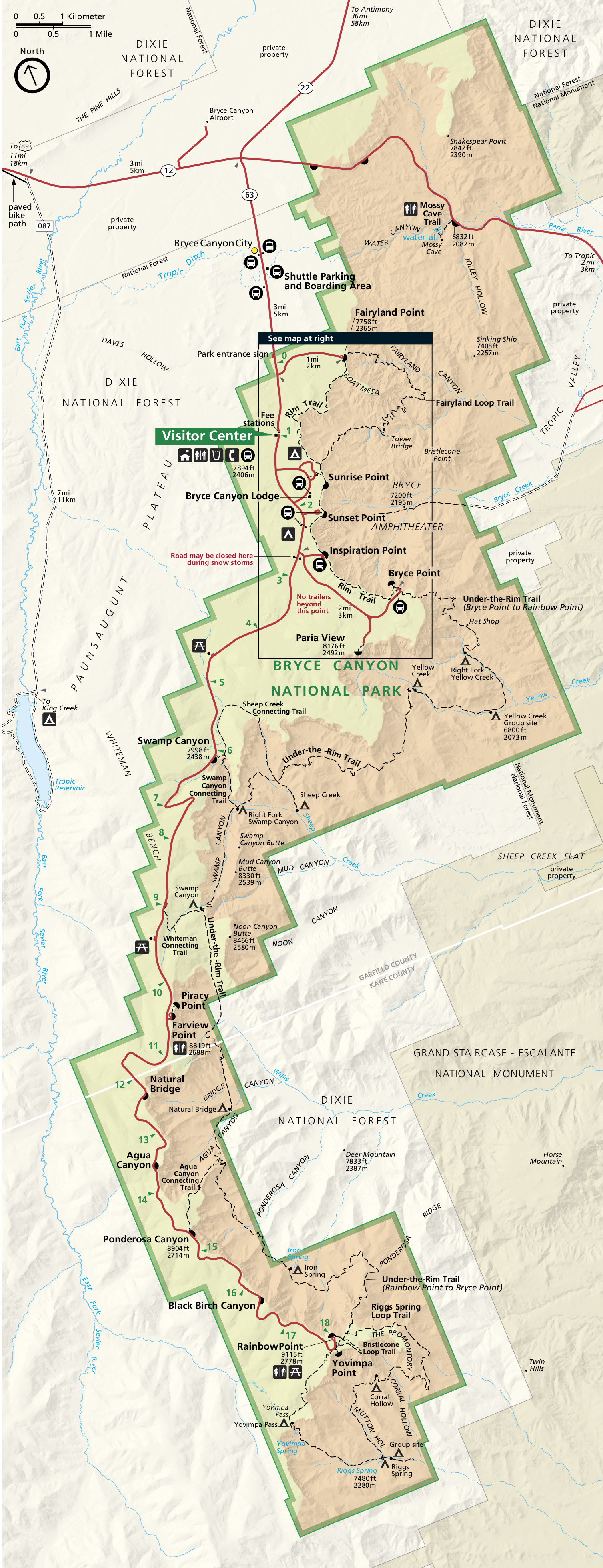 This is the official Bryce Canyon National Park map from the brochure, showing the visitor center, trails, campgrounds, and roads. Click the image to view a full size map or download the PDF.
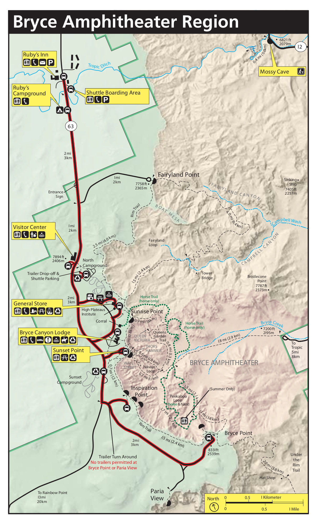
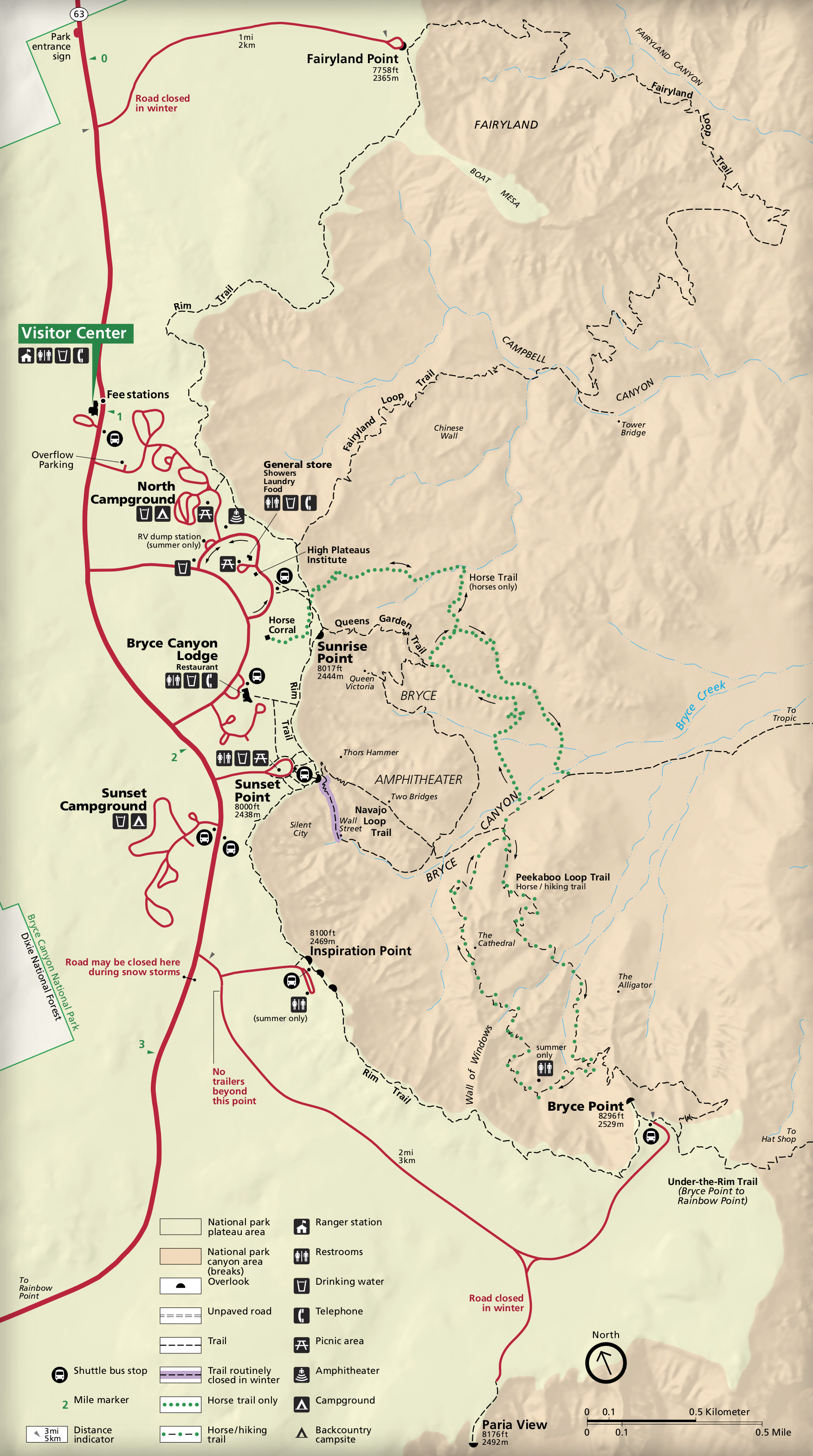 This is a detail map of Bryce Canyon Amphitheater, which has the most popular trails such as Queen’s Garden and Navajo Loop. Click the image to view a full size map or download the PDF.
Bryce Canyon trail map
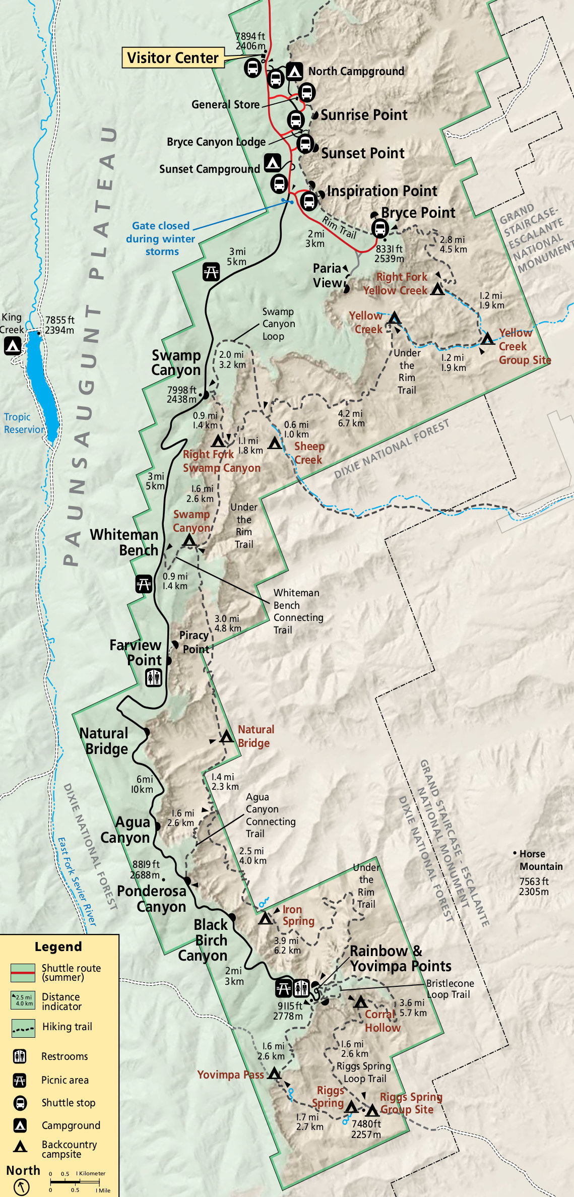 This is a Bryce Canyon backcountry map, showing trails, mileages, and campsites for those doing overnight backpacking trips. Click the image to view a full size map or download the PDF.
 While the above map is good for trip planning, you’ll probably want a more detailed map with topographic lines to take into the Bryce Canyon backcountry. The National Geographic Trails Illustrated map is great for overnight trips, although you probably don’t need it if you’re just doing short day hikes in Bryce Canyon. Still, for only about $15, the peace of mind it gives on the trail is totally worth it.
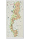
Bryce Canyon regional map
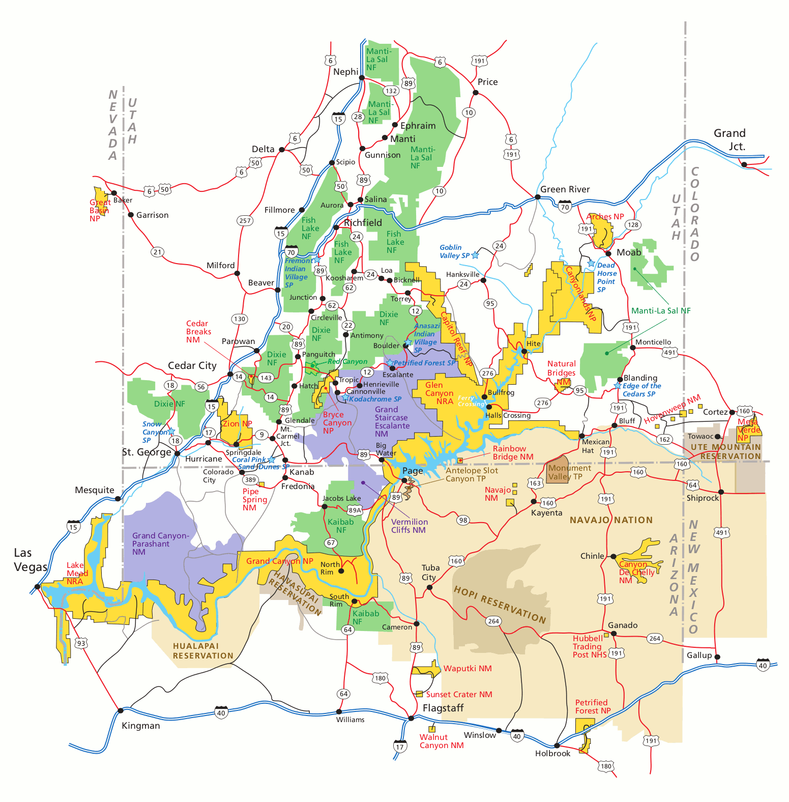 This Bryce Canyon regional map shows nearby highways and parks (such as Zion, Grand Canyon, and others in Utah/Arizona). Click the image to view a full size map or download the PDF.
Bryce Canyon campground maps
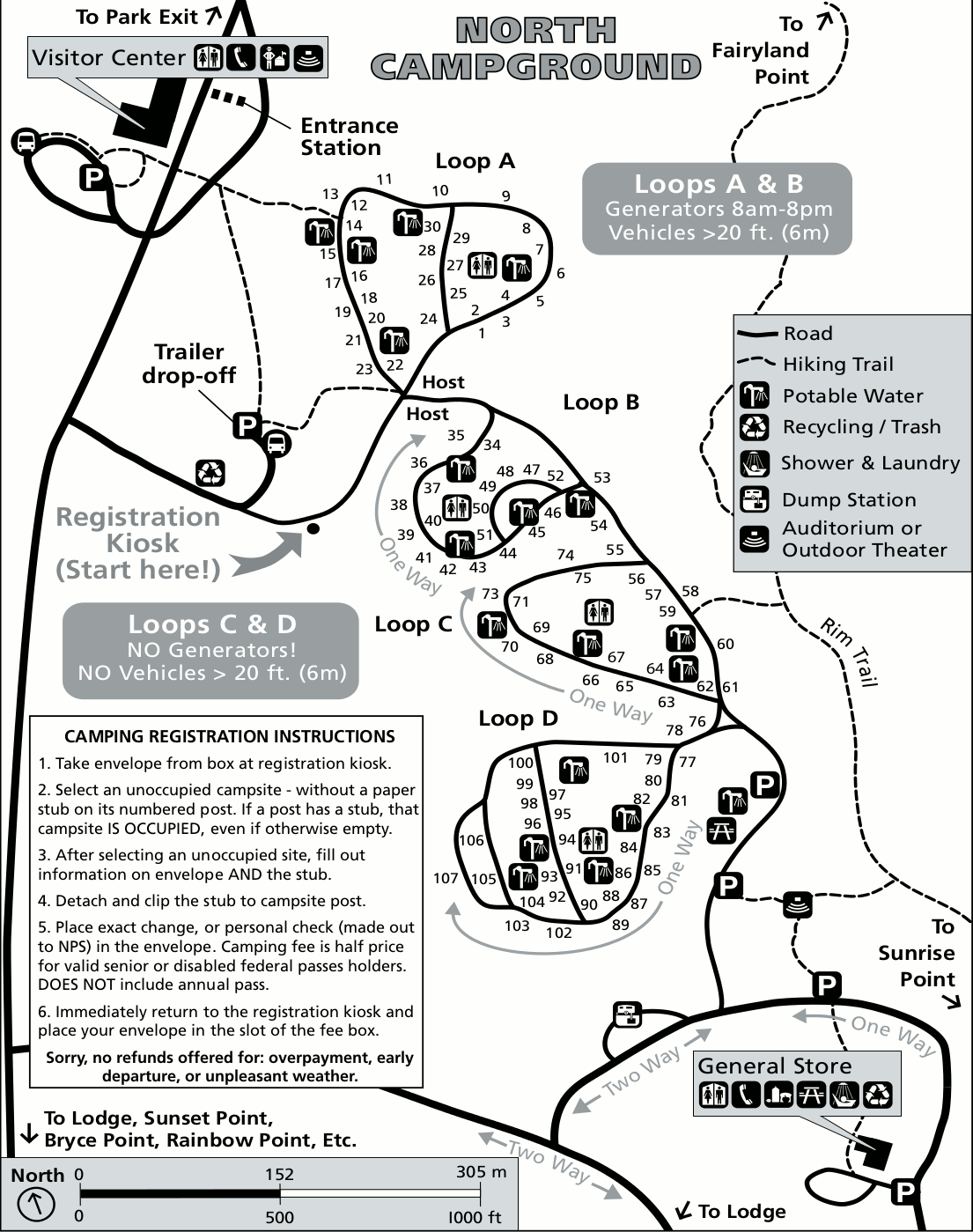 This is a map of North Campground, which is located between the Bryce Canyon Visitor Center and the general store. Here you’ll see the layout of the four loops of campsites, as well as associated facilities.
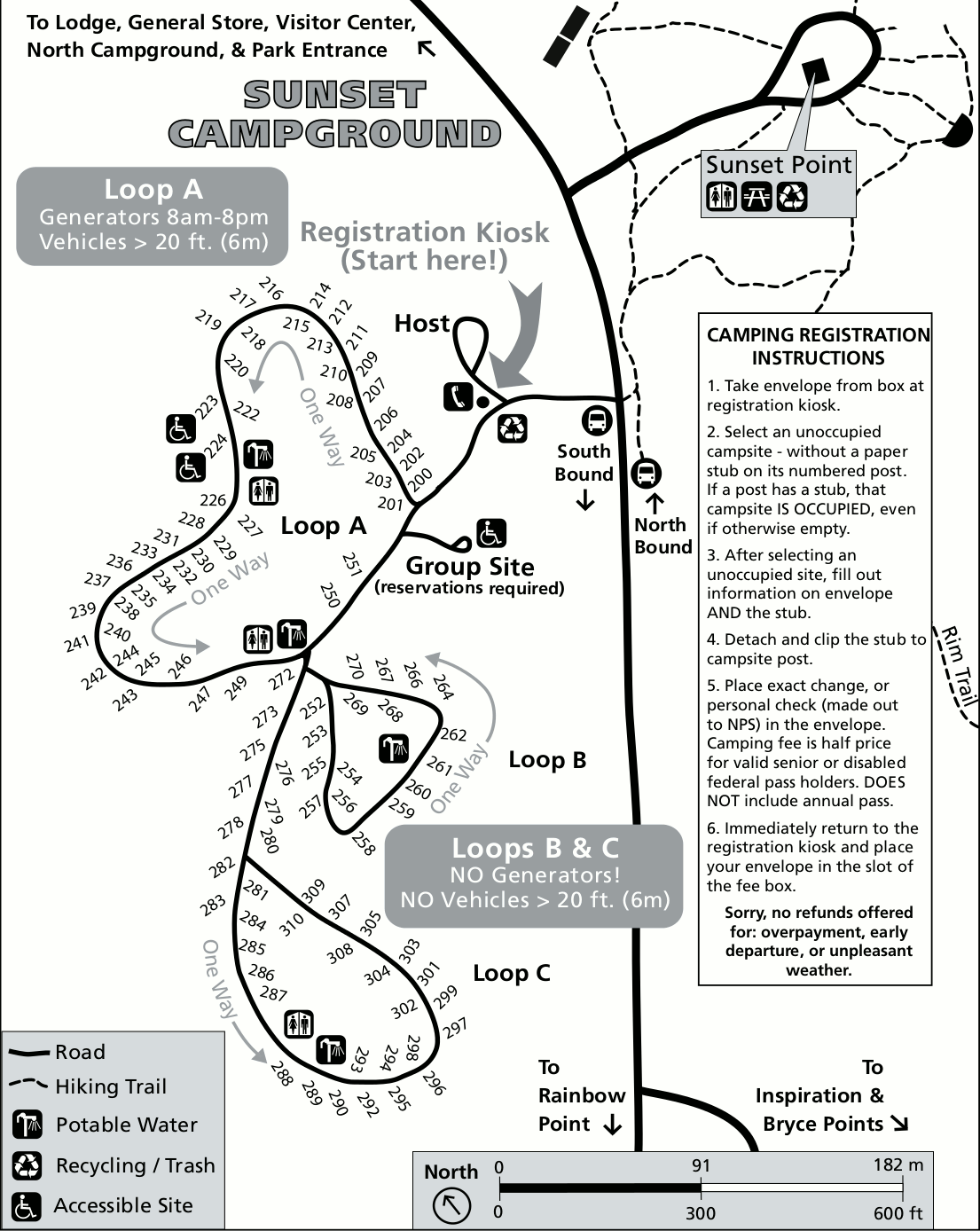 This is a map of Sunset Campground, which is located between Sunset Point and Inspiration Point, south of North Campground (go figure!). Note that two loops do not allow generator use.
Bryce Canyon lodging map
 Bryce Canyon doesn’t have a single gateway town that most people stay in; to the right you can open an Expedia interactive Bryce Canyon lodging map to see all the nearby places to stay. The ones nearest Bryce Canyon are along the entrance road south of the Highway 12/63 junction; hotels in the nearby town of Tropic are also close. View Expedia’s top-rated Bryce lodging to compare prices, locations, and reviews.
Bryce Canyon scientific maps
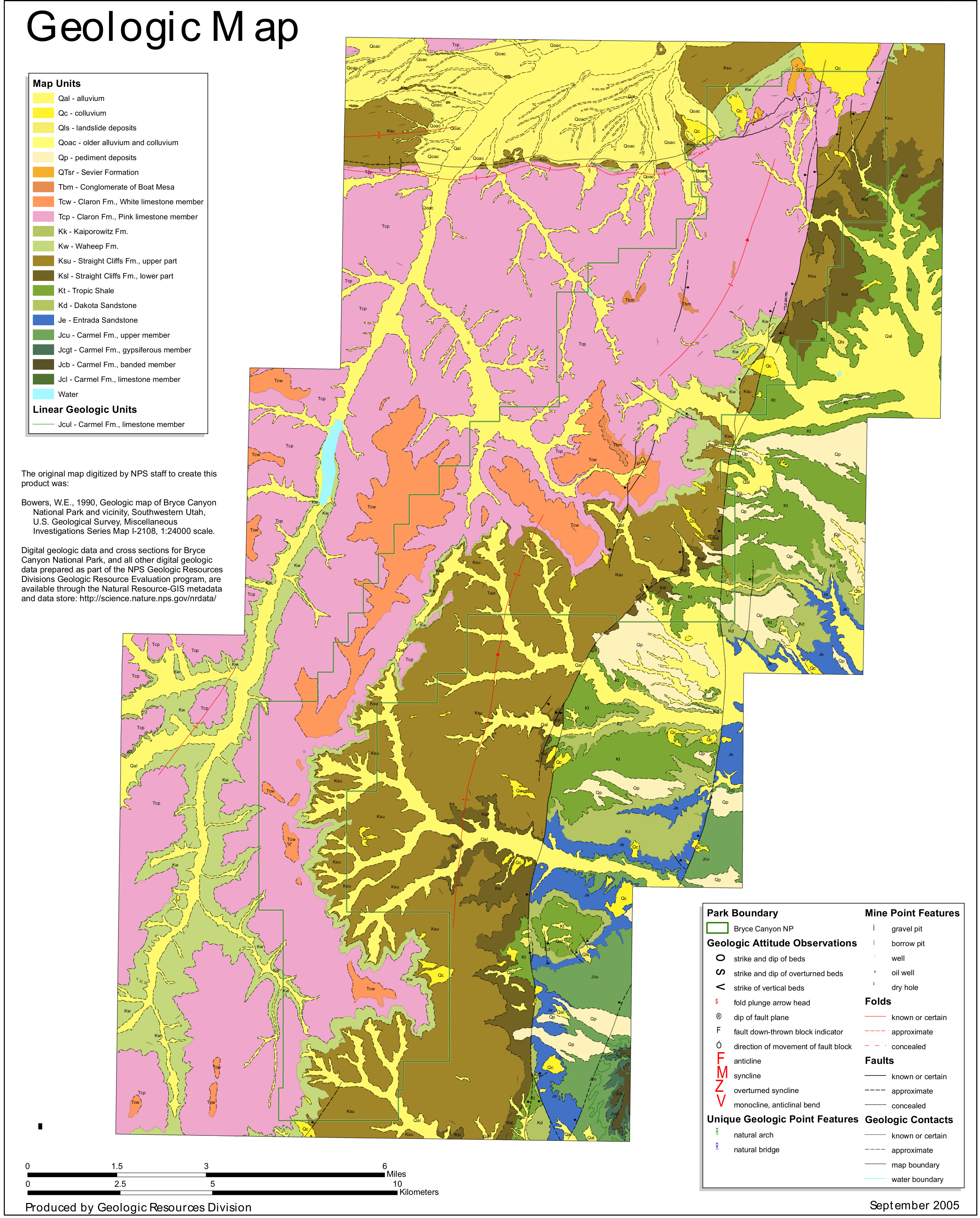 Here’s a Bryce Canyon geologic map, showing a variety of rock formations in the national park including the Claron Formation, which forms the park’s famous red hoodoos.
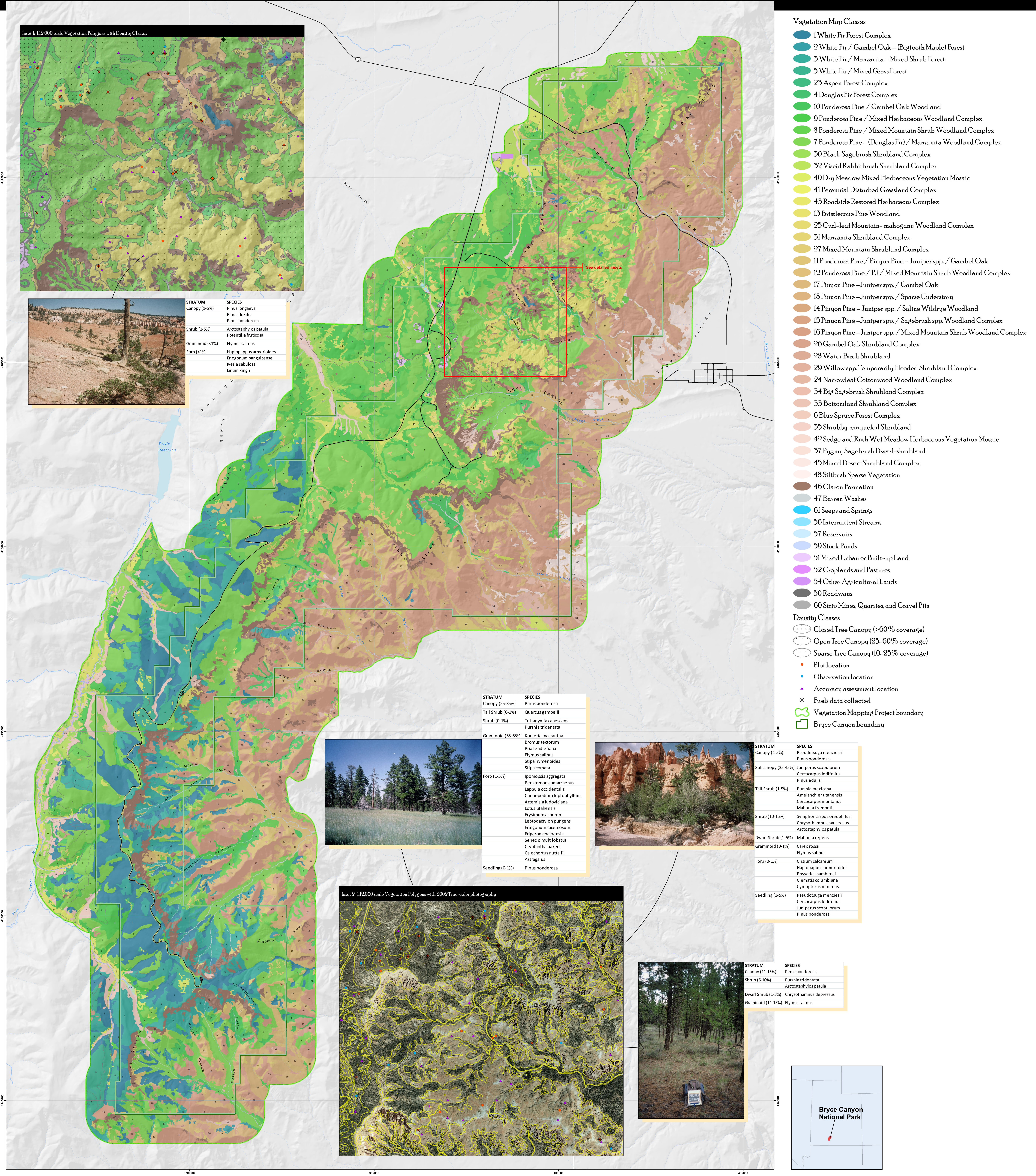 This Bryce Canyon vegetation map identifies the various forest and plant types found in Bryce Canyon National Park – white fir, pinyon pine, ponderosa pine, and more.
Archived Bryce Canyon maps
 This is pre-2013 Bryce Canyon National Park brochure map, archived here for posterity and historical record. Click the image to view a full size map or download the PDF.
 Here’s the pre-2013 detail map of Bryce Canyon Amphitheater, which has been superseded by maps on top of this page. Click the image to view a full size map or download the PDF.
 Here’s a pre-2013 alternate Bryce Canyon Amphitheater map, which also shows the shuttle bus route used to access the area. Click the image to view a full size map or download the PDF.
Bryce Canyon map prints and gifts
 Printed high-resolution Bryce Canyon map posters and other products are available at the Bryce Canyon Maps store. For art prints, gift ideas, and souvenirs featuring other national parks, support this site and visit the National Park Maps store; you’ll find items to bring on vacation, keep at home for the memories, or give to your park-enthusiast friends and loved ones.
…and more!
< Return to National Park Maps home
< Return to Park List
< Return to List by State