Cedar Breaks map from the park brochure
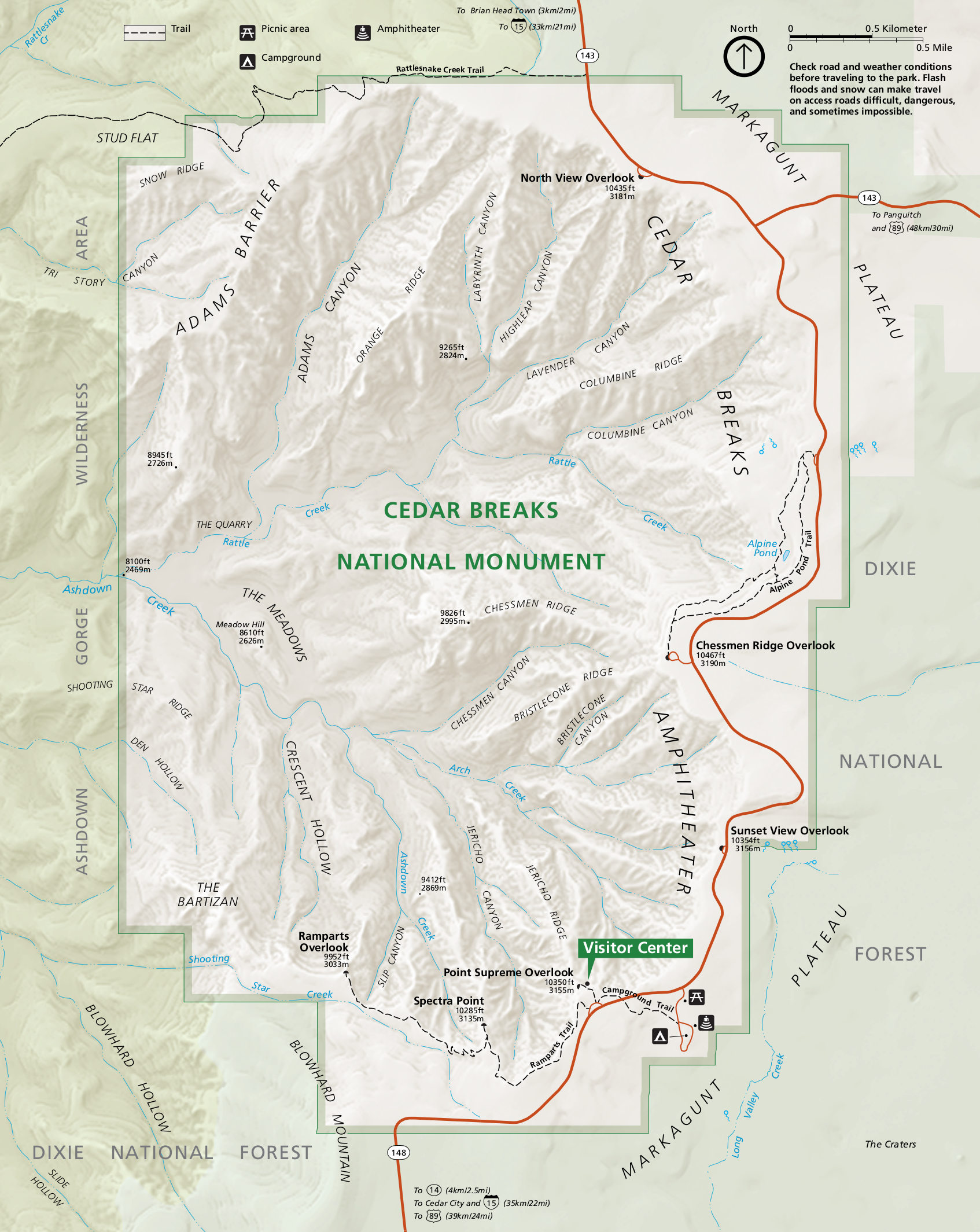 Here’s the official Cedar Breaks map, which shows the park’s roads, overlooks, trails, named features, and visitor center. Click the image to view a full size map or download the PDF.
Cedar Breaks geologic map
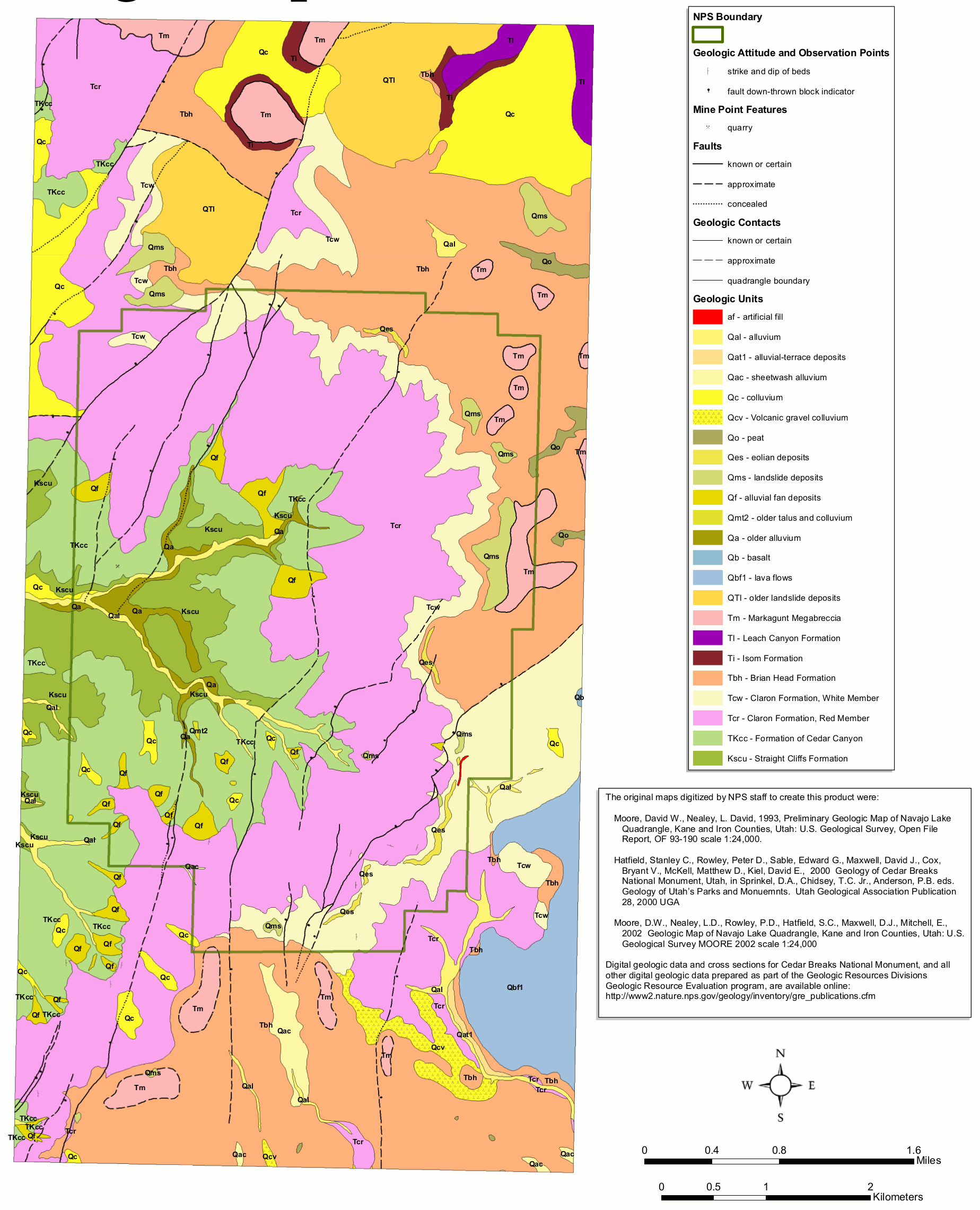 The Cedar Breaks geologic map includes both recent surficial deposits and also older bedrock such as the beautiful Claron Formation, which makes up the incredible formations Cedar Breaks is famous for.
Dixie National Forest maps
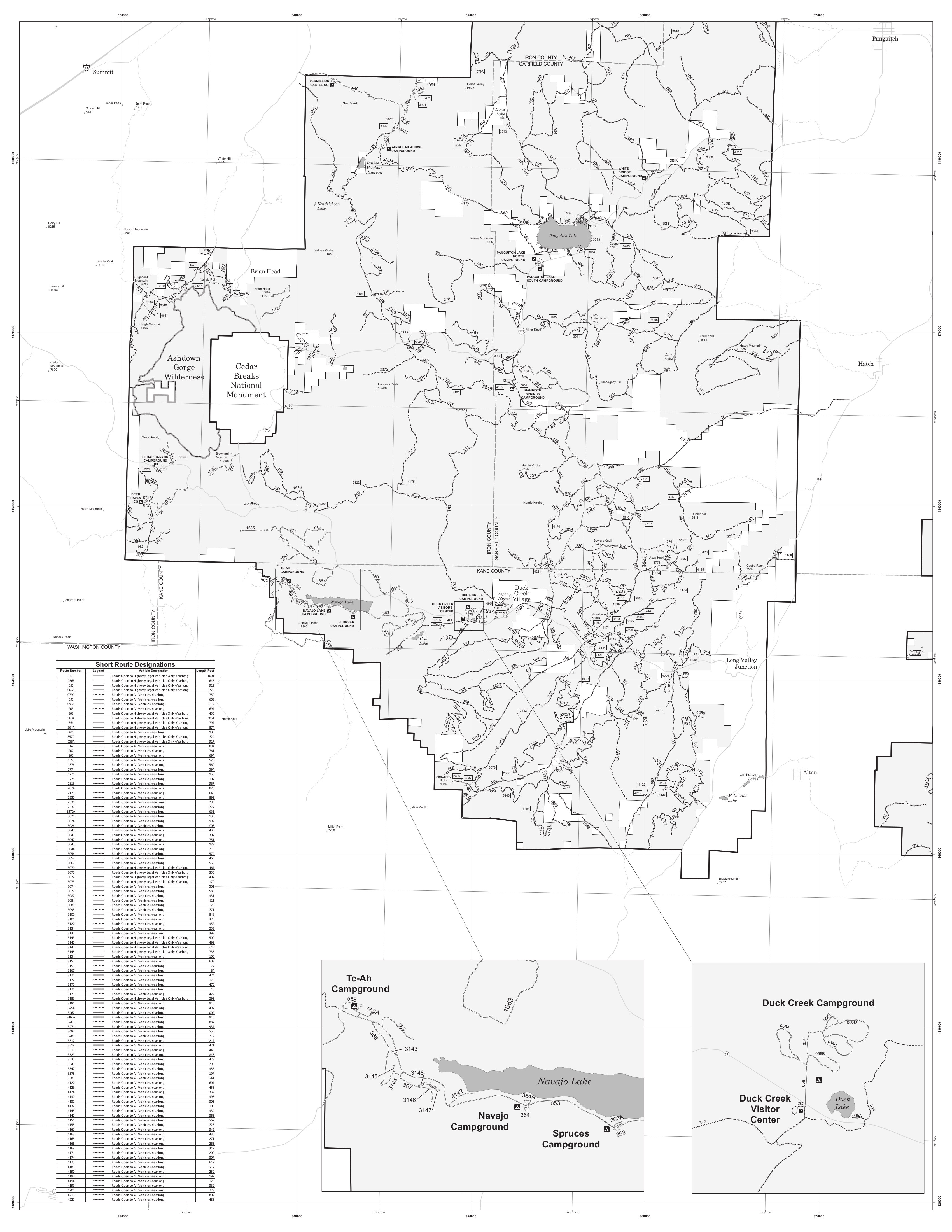
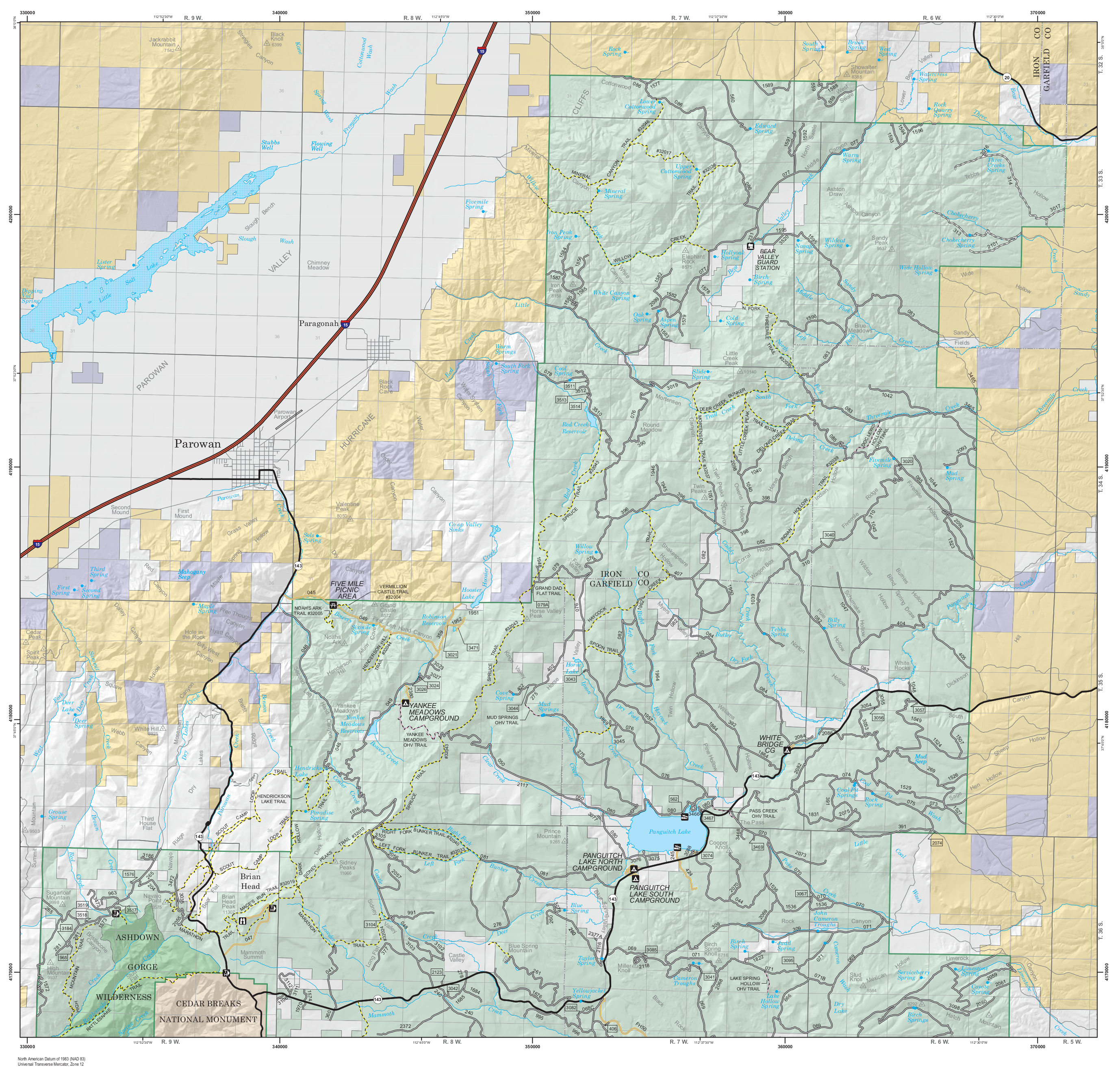 This is a north Dixie National Forest map, showing all the roads, campgrounds, and trails northeast of Cedar Breaks. Highway 143 accesses a few campgrounds in the area around Panguitch Lake.
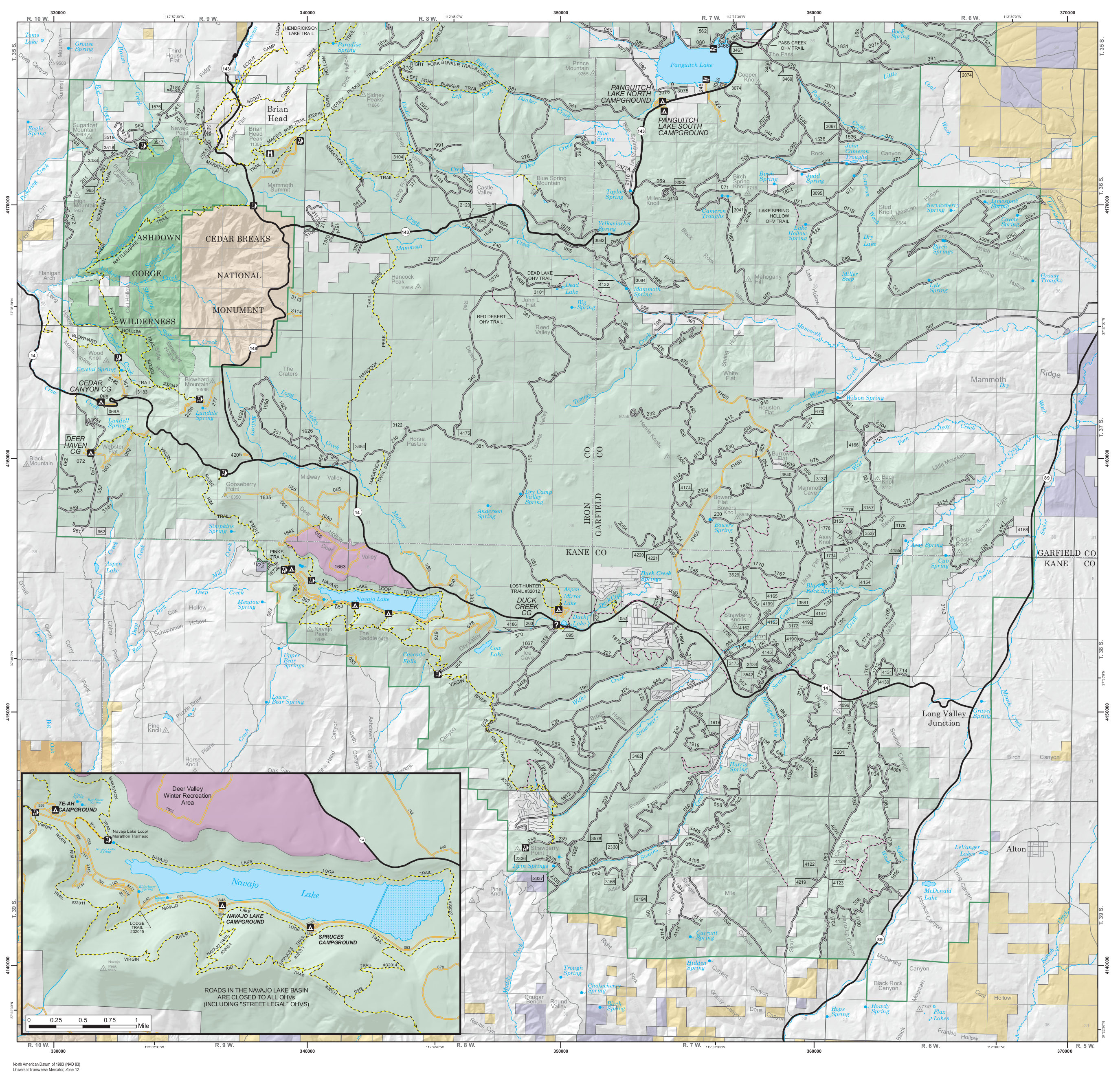 This is a south Dixie National Forest map, showing the main park access road (Highway 14) and small forest service roads east and southeast of Cedar Breaks, including an inset around Navajo Lake.
 Here is a printable north Dixie National Forest map, showing the area northeast of Cedar Breaks (like the one above) but in black-and-white, which makes for much easier printing.
 Here is a printable south Dixie National Forest map, including the Duck Lake area and Navajo Lake. It overlaps with the map above quite a bit and includes the Panguitch Lake area campgrounds.
Cedar Breaks forest map
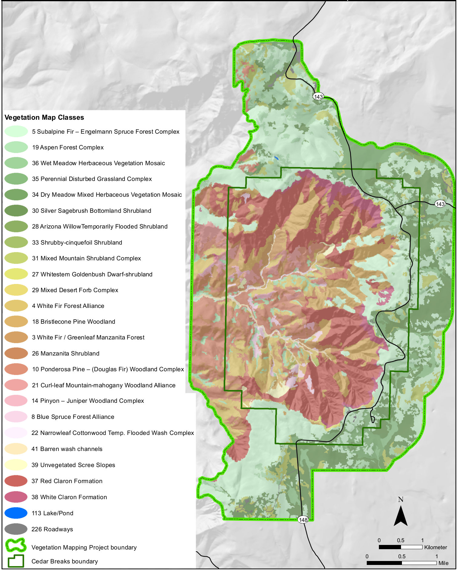 The Cedar Breaks vegetation map identifies the various forest types inside Cedar Breaks National Monument, as well as areas of bare rock, grasslands, shrubs, and woodlands.
…and more!
< Return to National Park Maps home
< Return to Park List
< Return to List by State