Canyon de Chelly brochure maps
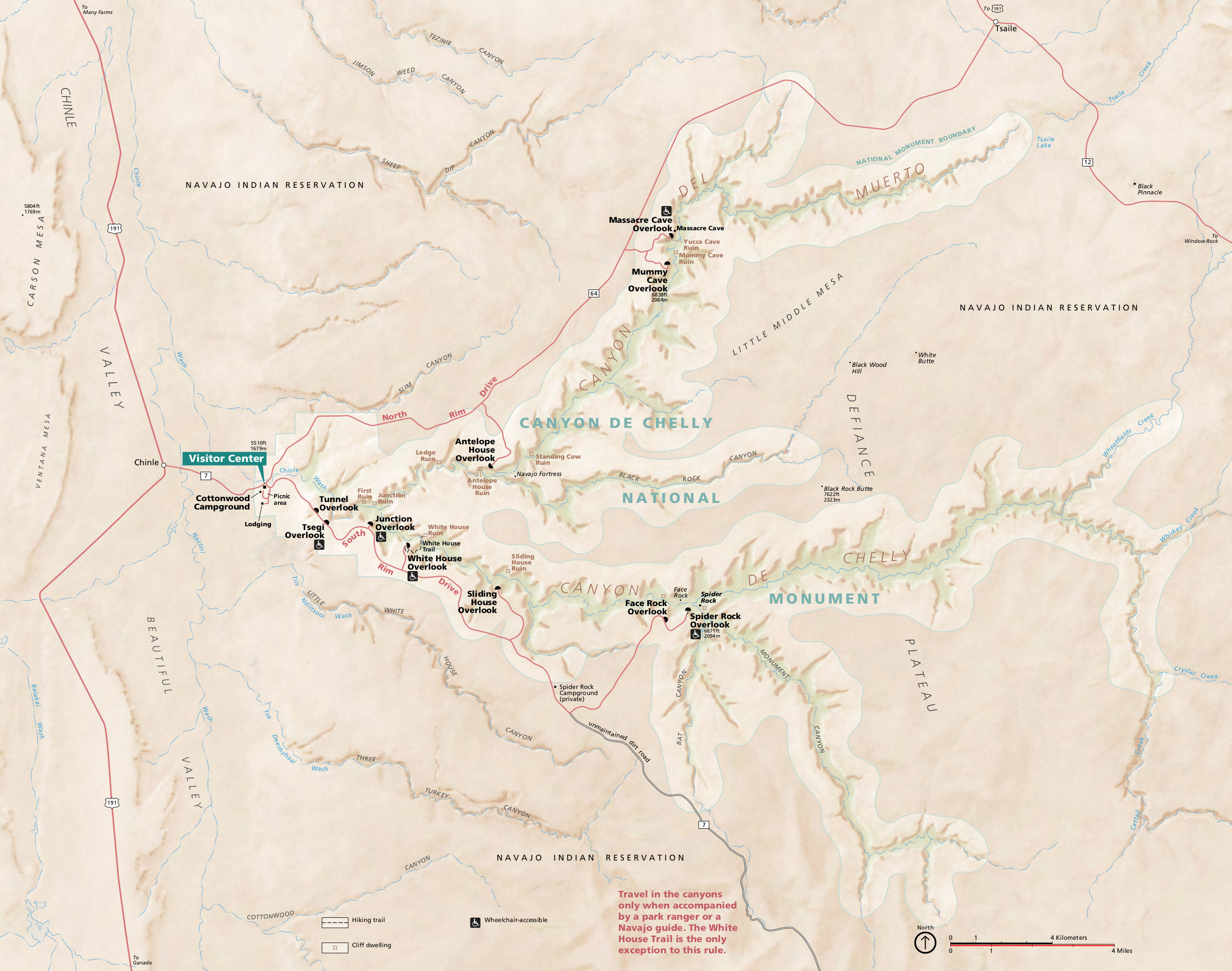 This is the official Canyon de Chelly map from the park brochure, showing the visitor center, campground, and overlooks. Click the image to view a full size map or download the PDF.
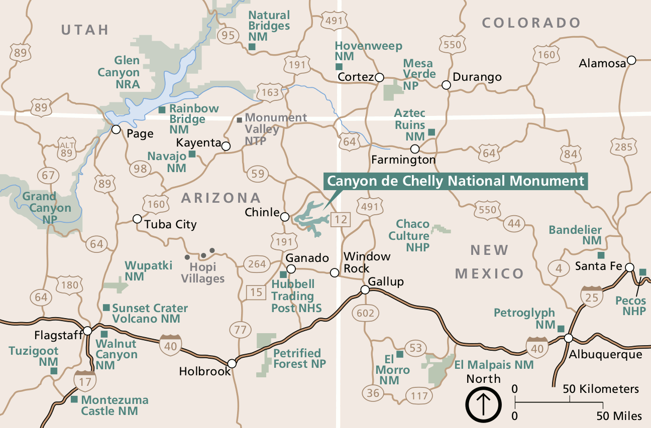 Here’s a regional Canyon de Chelly map, showing the roads and the huge number of nearby parks in the Four Corners region. Click the image to view a full size map or download the PDF.
Various Canyon de Chelly maps
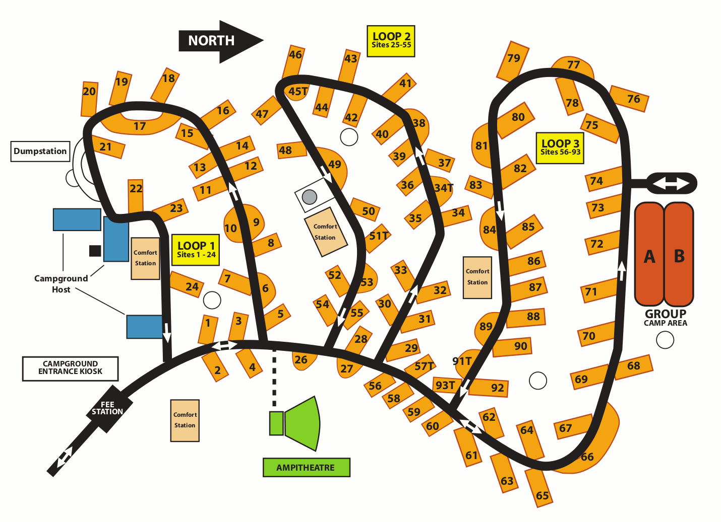 Here’s a Cottonwood Campground map, located near the visitor center and run by Navajo Parks and Recreation. This map shows each loop and various camper services: amphitheater, restrooms, etc.
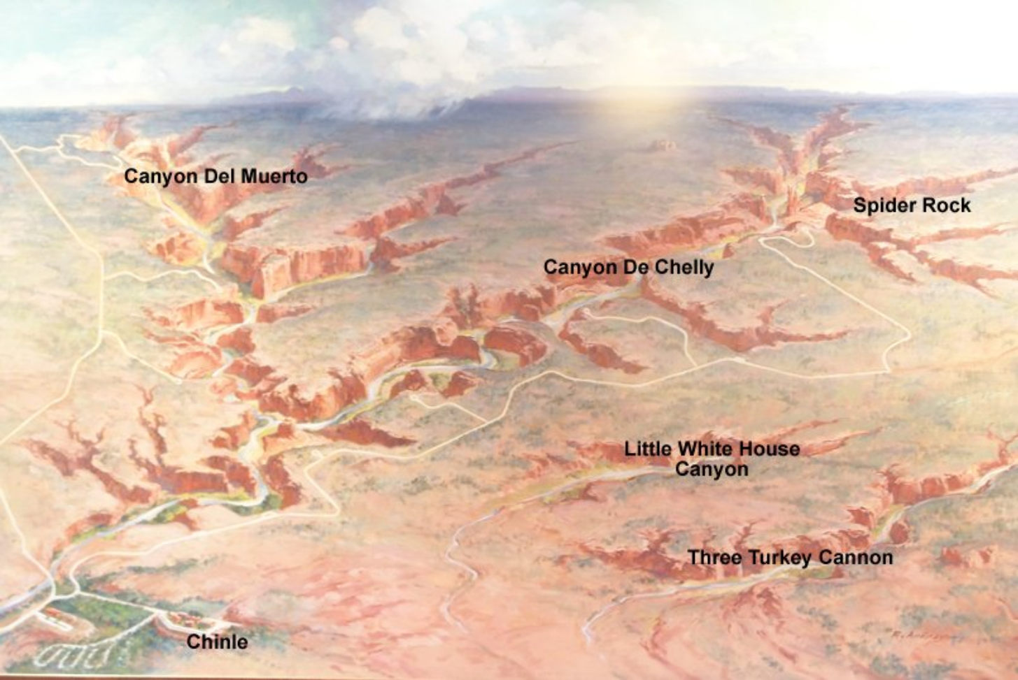 Here’s an artistic Canyon de Chelly map, showing the park and canyons. Both Canyon de Chelly and Canyon del Muerto are inside the park, while Little White House and Three Turkey are not.
…and more!
< Return to National Park Maps home
< Return to Park List
< Return to List by State