Wind Cave map from the park brochures
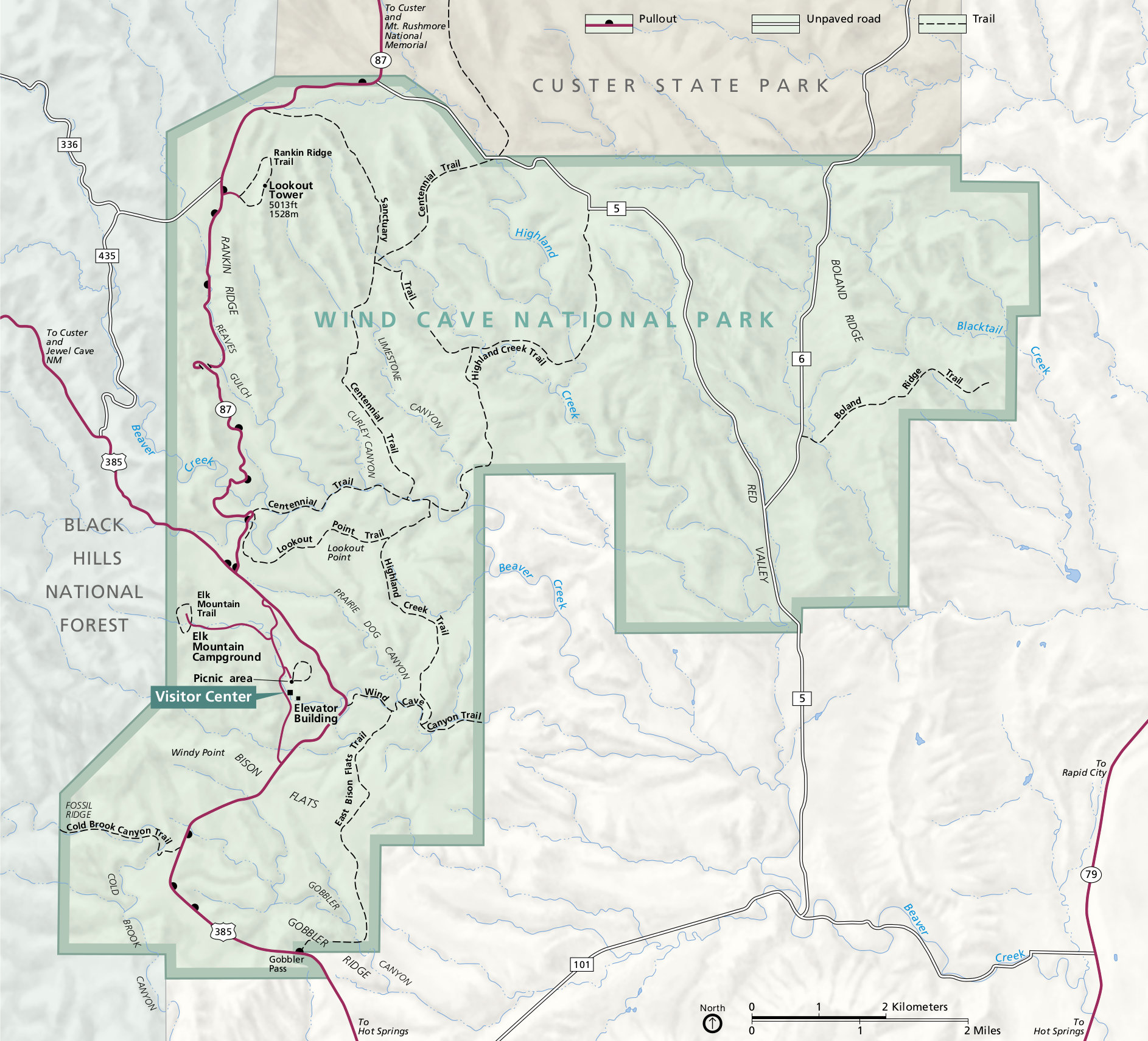 This is the official Wind Cave National Park map from the brochure, showing roads, trails, campground, and visitor center. Click the image to view a full size map or download the PDF.
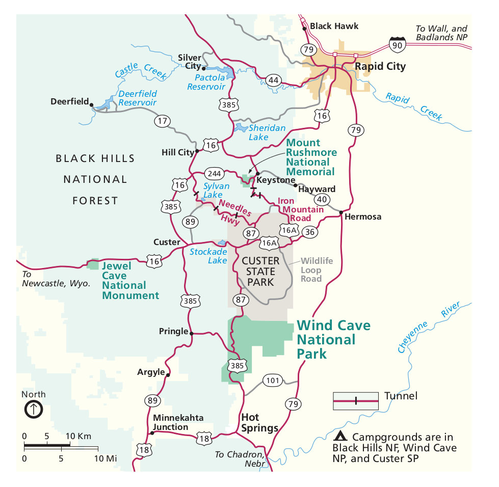 This is the Wind Cave regional map showing the park in relation to Mount Rushmore, Custer State Park, Jewel Cave, and Rapid City. Click the image to view a full size map or download the PDF.
Wind Cave trail map
 If you’re doing hikes around Wind Cave or are checking out some other points of interest in the Black Hills, you should probably grab the National Geographic Trails Illustrated map for the southern Black Hills. This map also covers other national and state park sites including Mount Rushmore, Jewel Cave, Custer State Park, and others. A Black Hills North map is also available for your further Black Hills wanderings.
Wind Cave tour maps
 This is a map of Wind Cave tour routes, showing the routes taken by each of the ranger-guided tours (tours my vary depending on season or staffing). Click the image to view a full size map or download the PDF.
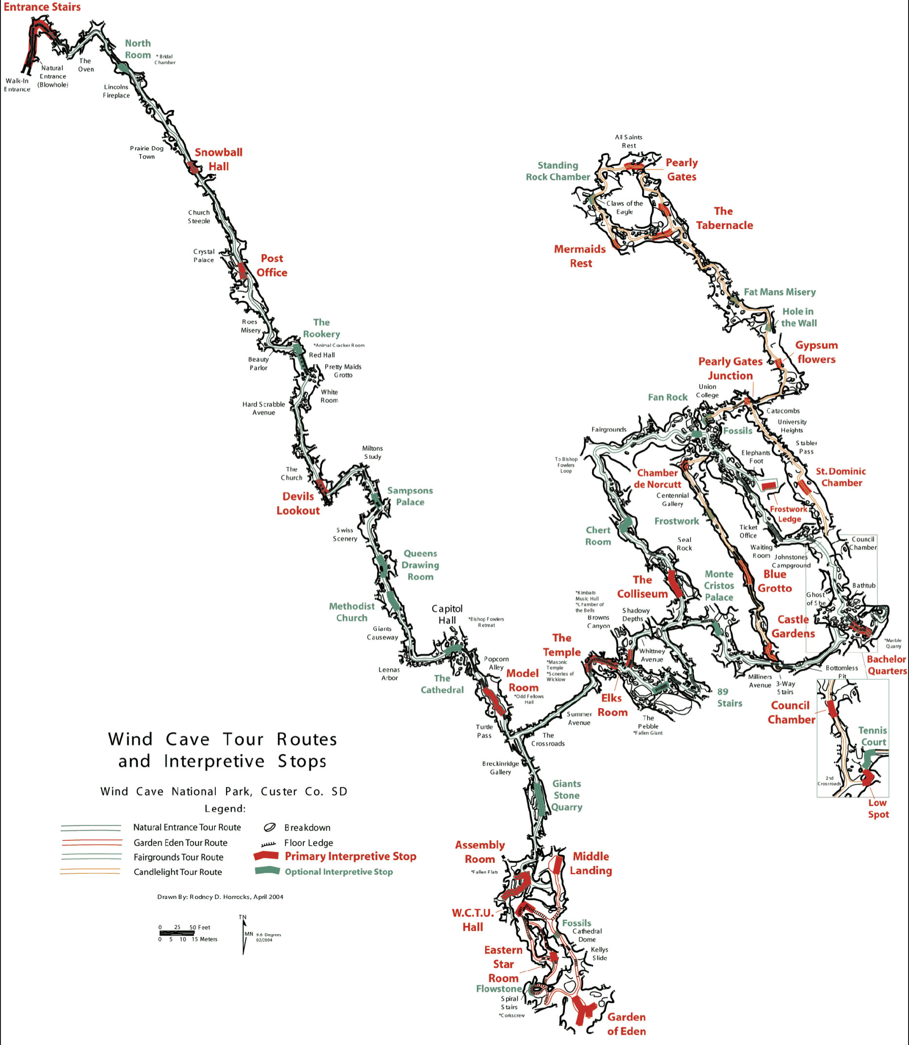 This is an older Wind Cave tour map that has a bit more detail of some of the cave locations, with tons of physical features labeled. Click the image to view a full size map or download the PDF.
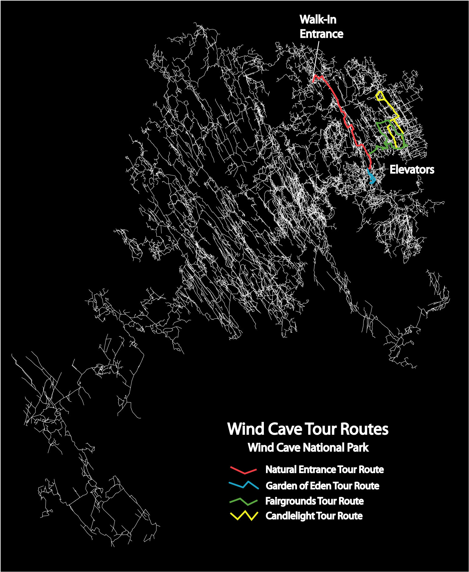 This is a map of the entire Wind Cave system, showing the tour routes in context of the entire cave. Click the image to view a full size map or download the PDF.
Scientific Wind Cave maps
 The geologic map of Wind Cave shows the layers of rock types found in Wind Cave National Park as well as the surrounding area in South Dakota. This colorful map includes a legend for easy interpretation.
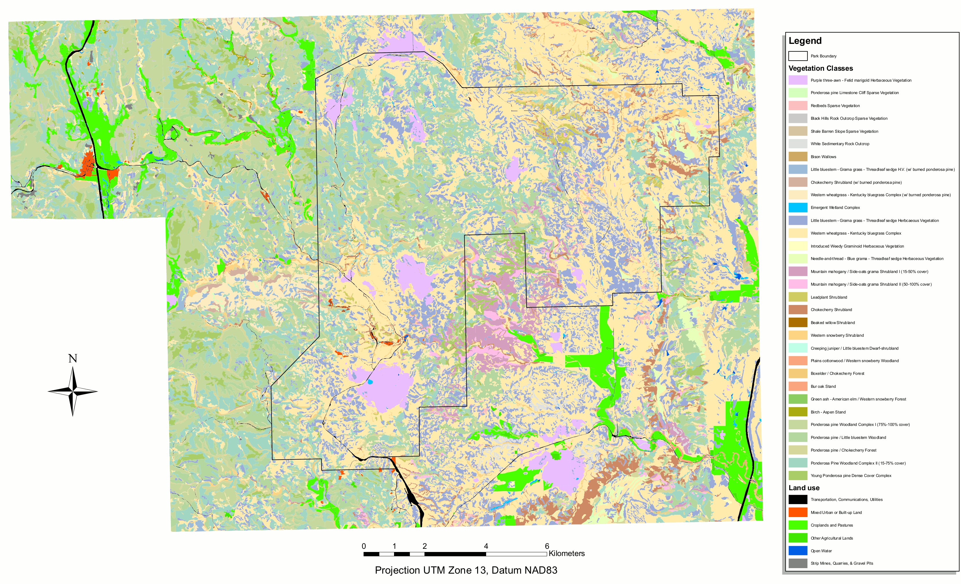 Here’s a Wind Cave vegetation map, showing the large expanses of grasses and shrublands along with some ponderosa pine and hardwood woodlands.
…and more!
< Return to National Park Maps home
< Return to Park List
< Return to List by State