Great Sand Dunes map from the park brochures
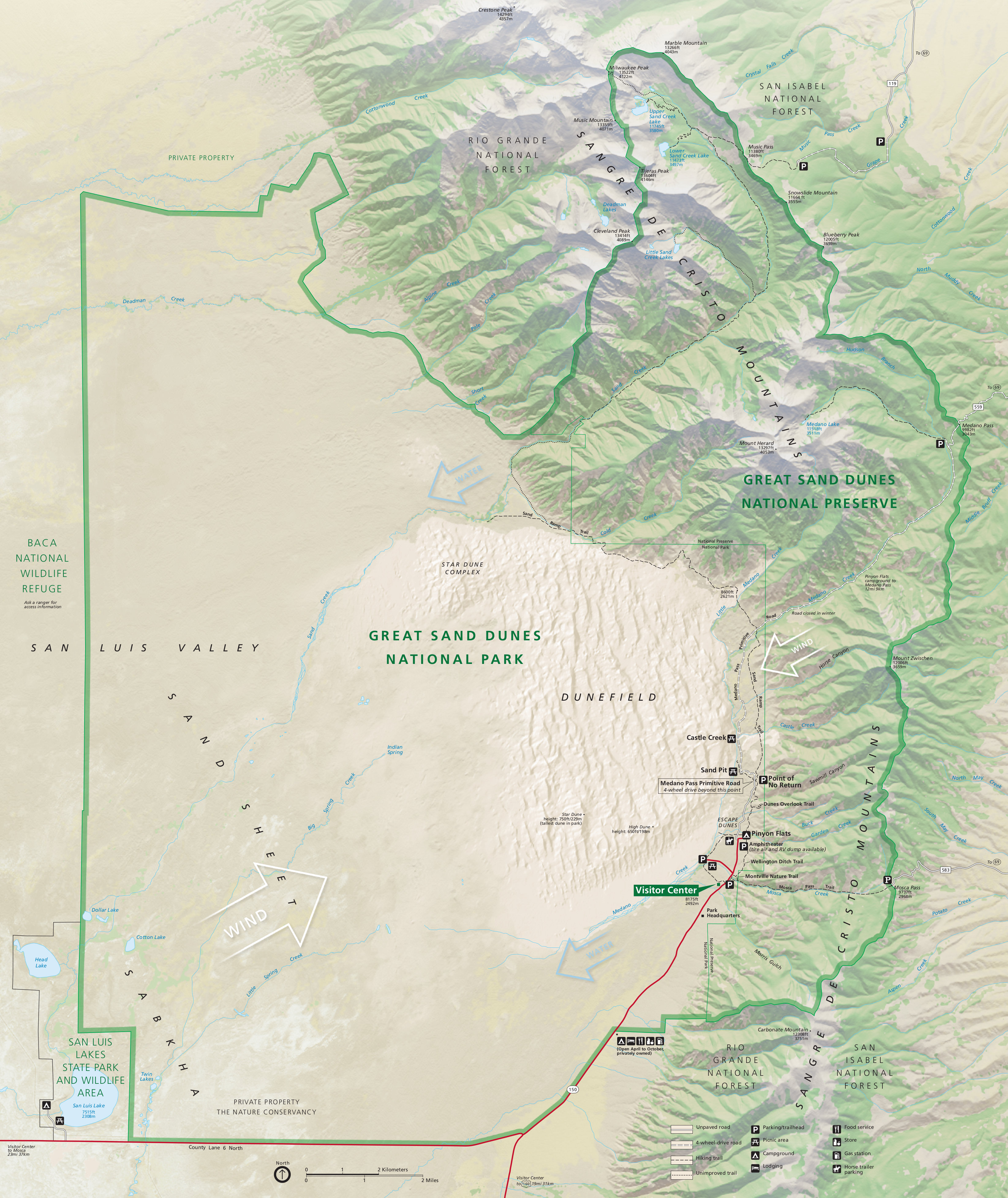 This is the complete Great Sand Dunes map from the official brochure, showing the dune field as well as the Sangre de Cristo Mountains. Click the image to view a full size map or download the PDF.
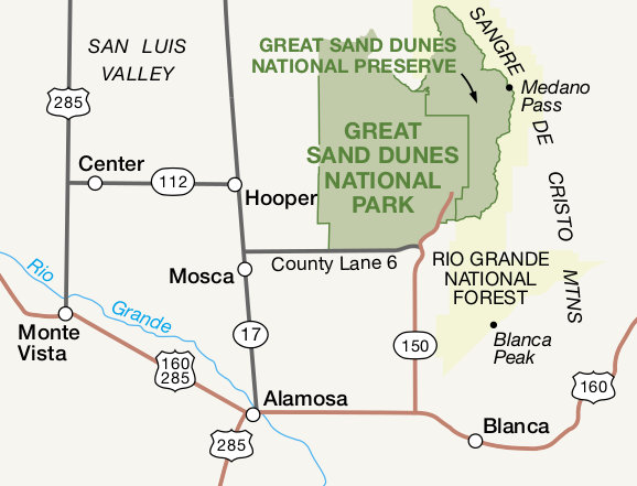 This is a regional map of Great Sand Dunes that shows roads and towns that surround the park and preserve. Click the image to view a full size map or download the PDF.
Great Sand Dunes backcountry maps
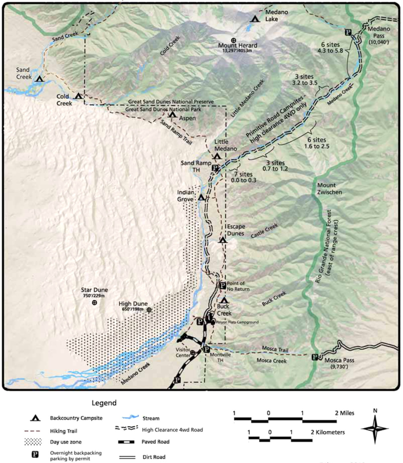 The Great Sand Dunes backcountry map shows backcountry campsites and trails into the Sangre de Cristo Mountains as well as those that follow the boundaries of the dune field.
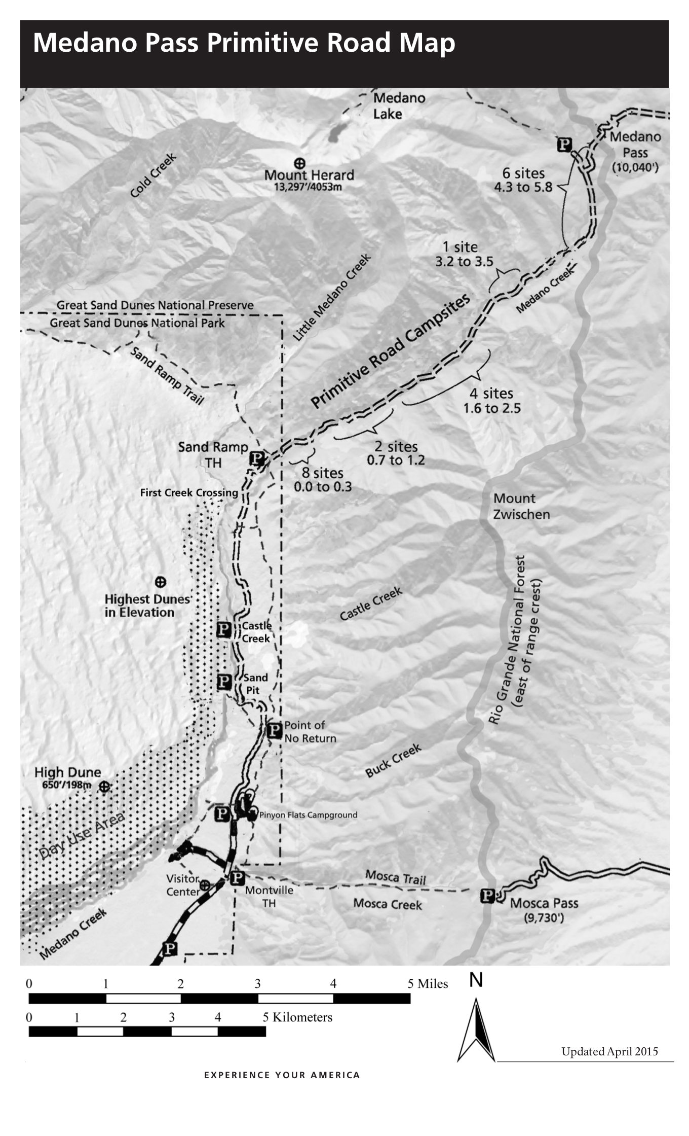 This is a Medano Pass primitive road map, showing the four-wheel-drive road up to Medano Pass and the campsites along the way with their approximate locations in mileage from the road start.
 While the maps above are great for a general overview and trip planning, they shouldn’t be used for navigation and route-finding. Instead, take a look at getting the National Geographic Trails Illustrated map, which includes topographic lines and much more detail about water sources, trail routes, trailhead access roads, etc. It covers the dune field as well as the Sangre de Cristo mountains.
Great Sand Dunes campground map
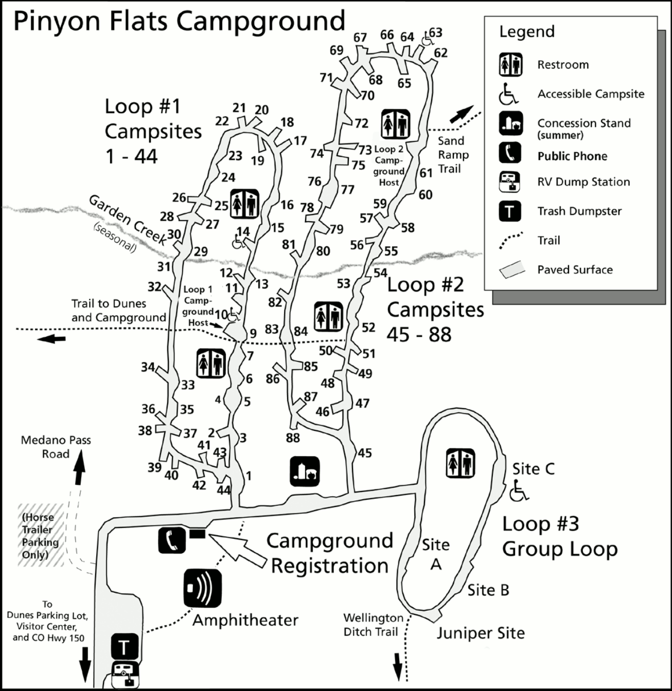 This is a Pinyon Flats Campground map. This is the only developed Great Sand Dunes drive-in campground and is located past the visitor center. You’ll find three loops, restrooms, and an amphitheater.
Great Sand Dunes geologic map
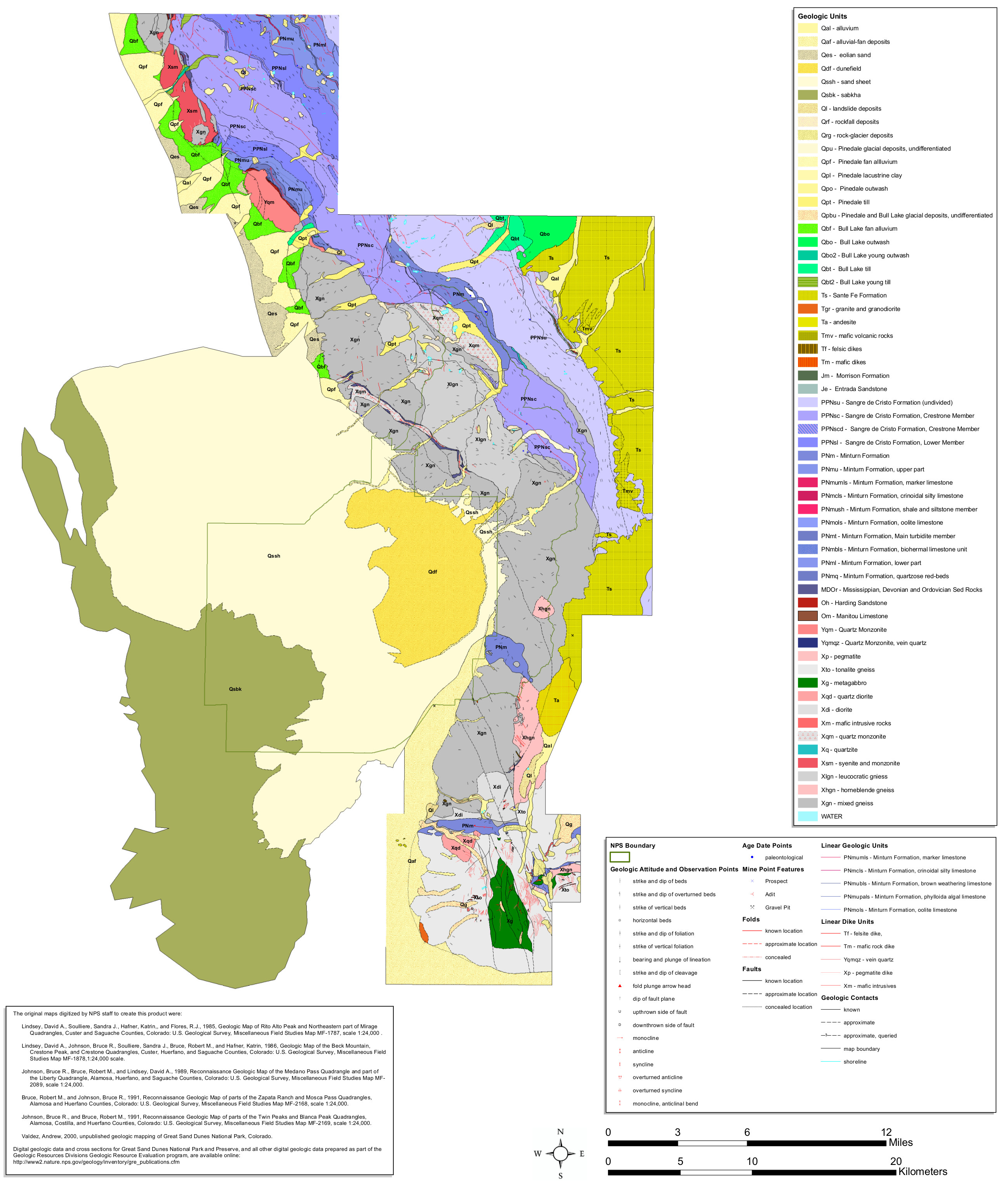 The Great Sand Dunes geologic map includes the dune field as well as the surrounding mountains in the Sangre de Cristo Mountains, leading to some huge geological variety!
Great Sand Dunes lodging map
 If you want to stay near Great Sand Dunes, there’s really just one game in town: Alamosa, CO. To the right you can open an Expedia interactive lodging map that will show each option. I’d also recommend comparing prices, photos, reviews, and distance from the park on Expedia’s best-rated Great Sand Dunes lodging where you’ll find a mix of hotels, cabins, lodges, and guesthouses.
…and more!
< Return to National Park Maps home
< Return to Park List
< Return to List by State