Sleeping Bear Dunes map from the official brochure
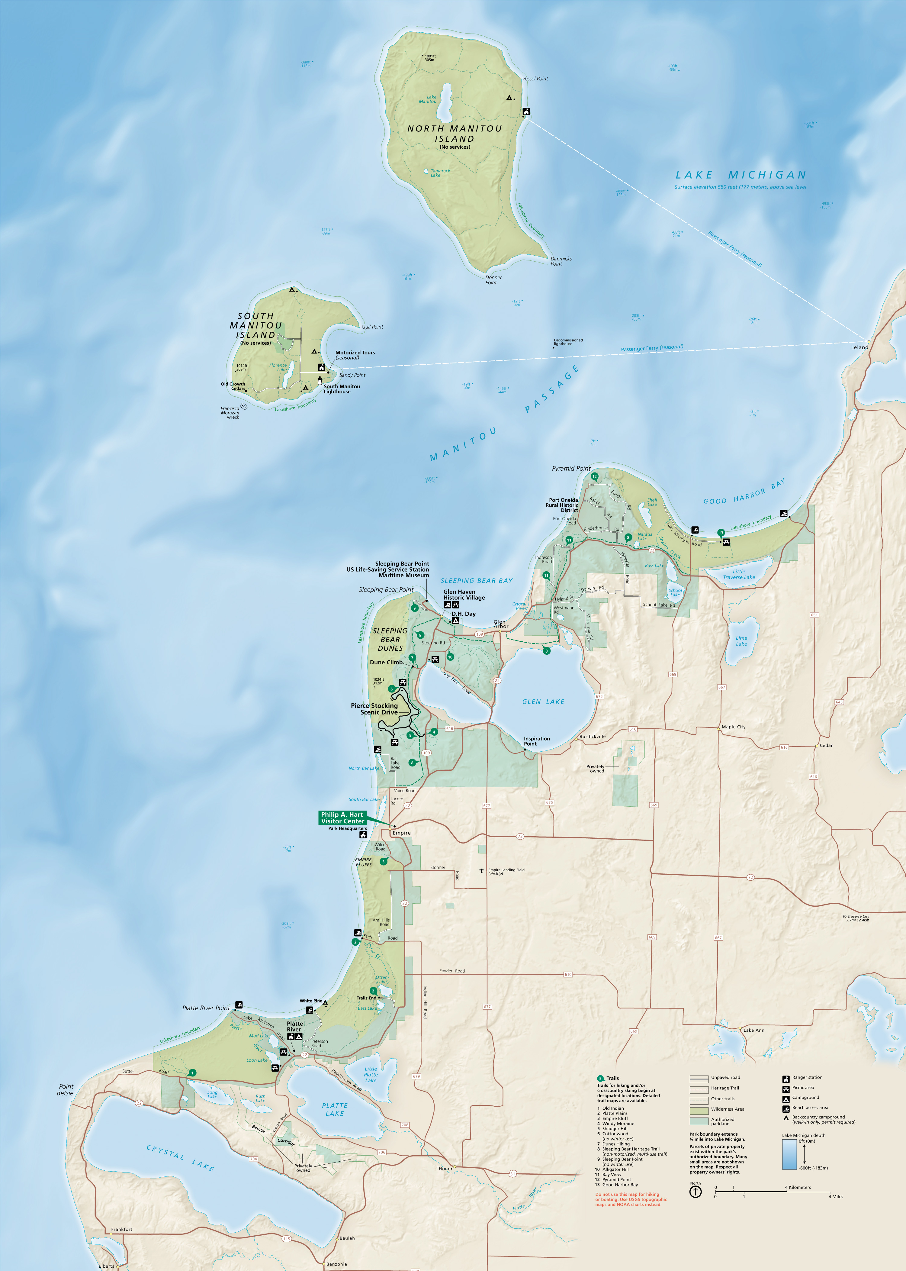 This is the current (as of 2025) NPS Sleeping Bear Dunes map. It was last updated in 2020 and includes a graphical overhaul that shows Lake Michigan and park lands in a more beautiful, artistic manner.
Mainland Sleeping Bear Dunes maps
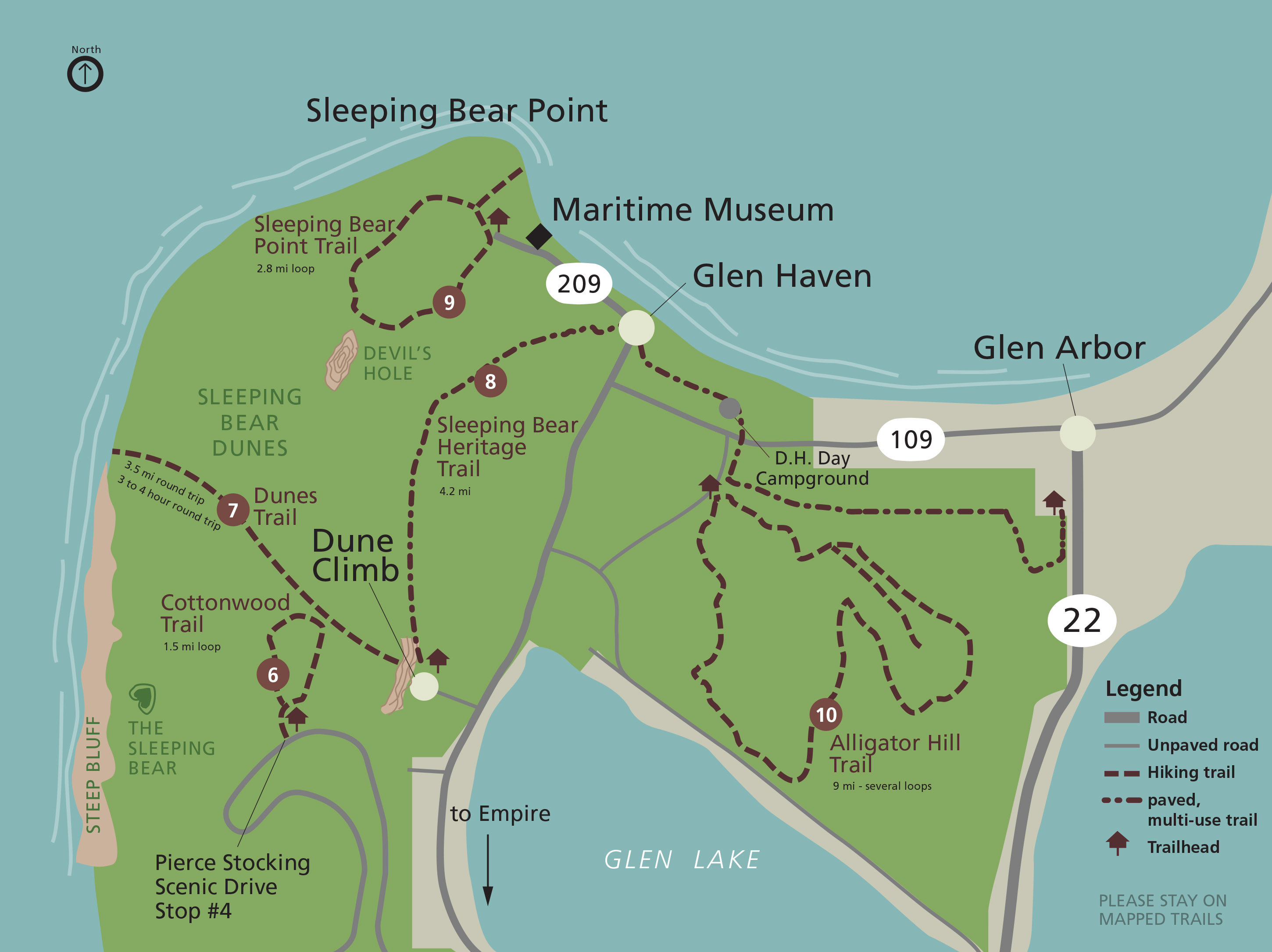
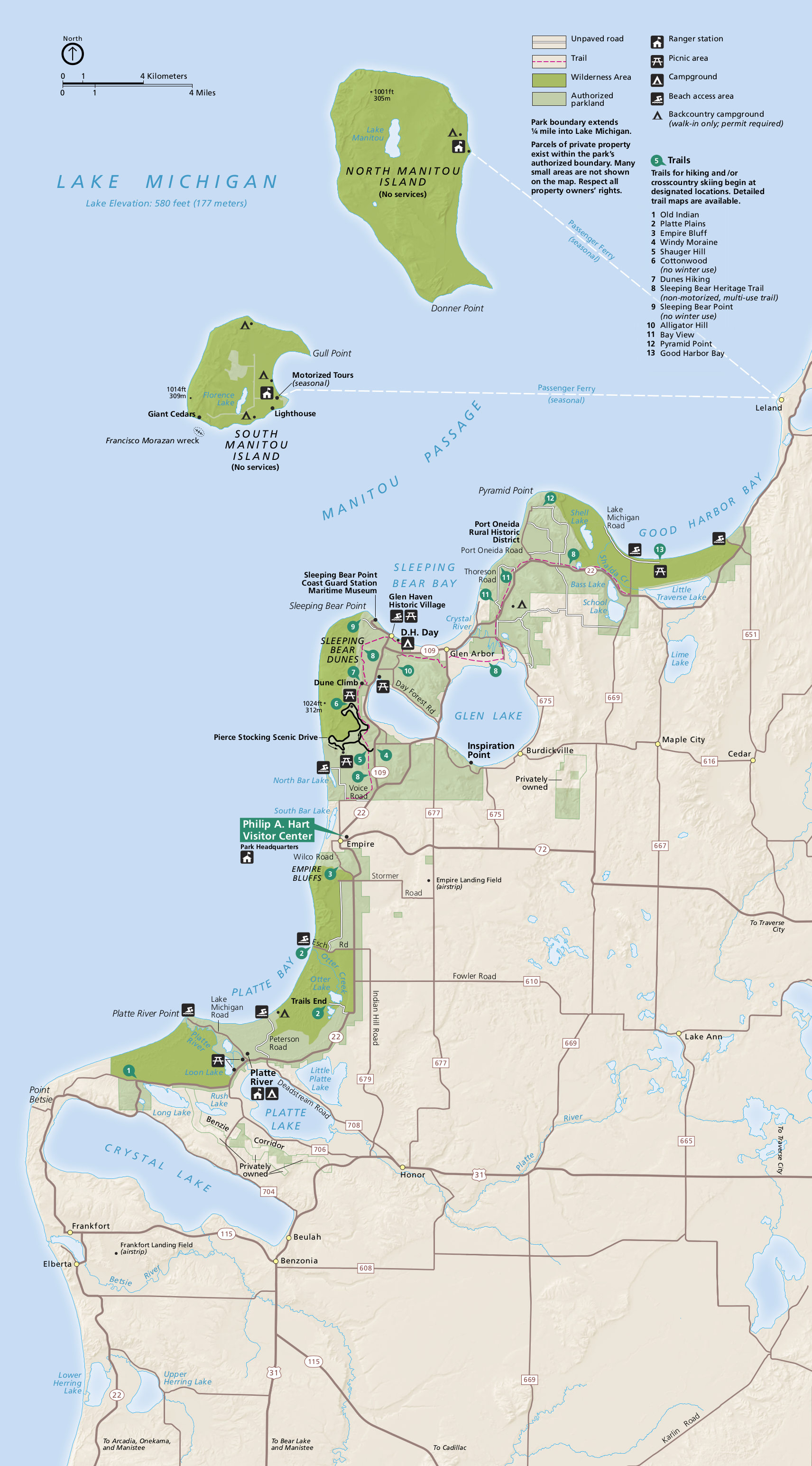
 This is a Sleeping Bear Dunes trailhead map, showing the location of each main trailhead in the mainland part of Sleeping Bear Dunes. Maps of the Manitou Islands are found further below.
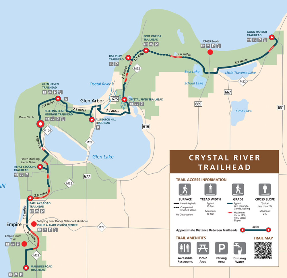 Here’s a Sleeping Bear Heritage Trail map, showing the length of the trail from Good Harbor Trailhead in the north to Manning Road Trailhead to the south, labeling the distance between points of interest.
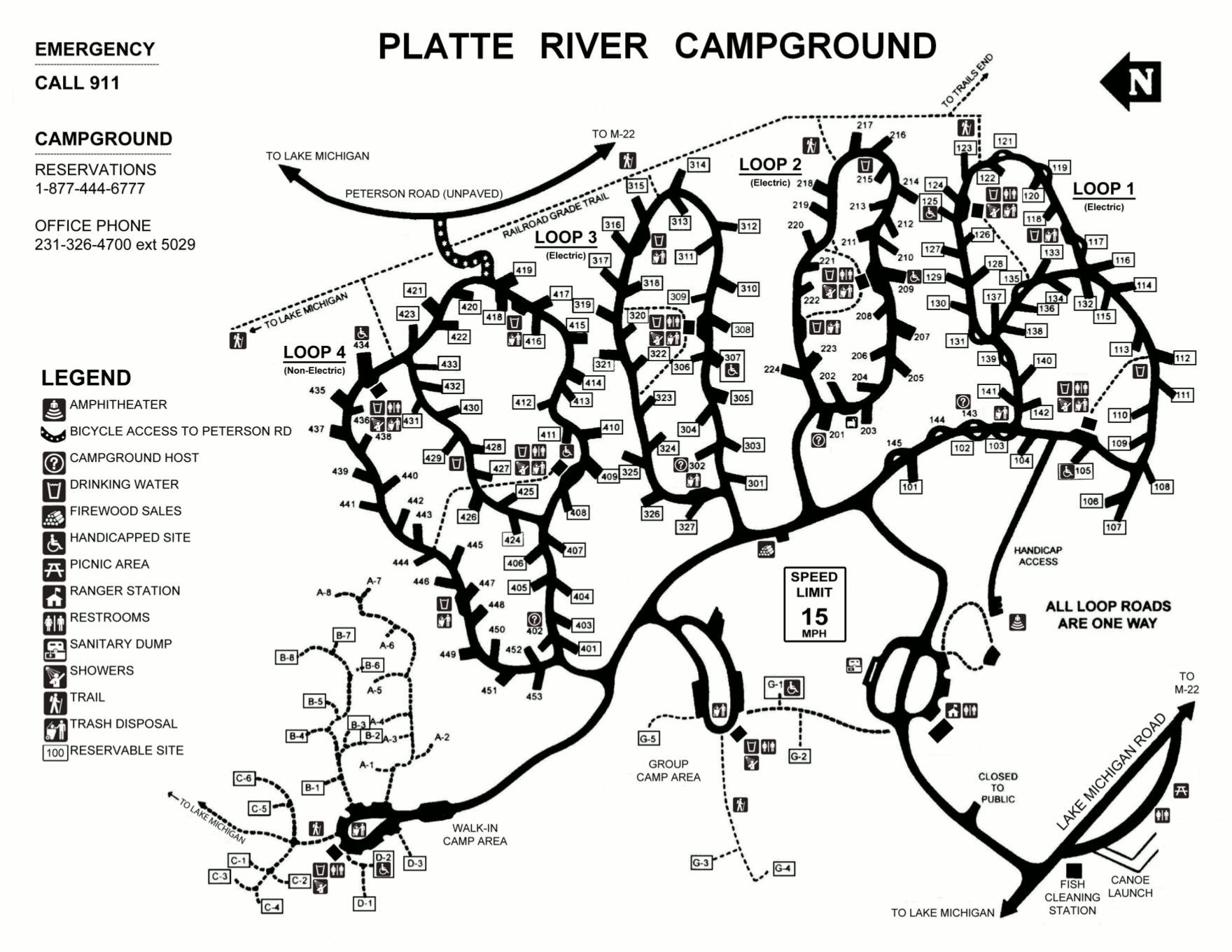 The Platte River Campground map shows the large car-accessible campground located on the southern end of Sleeping Bear Dunes National Lakeshore, labeling restrooms, water, and facilities.
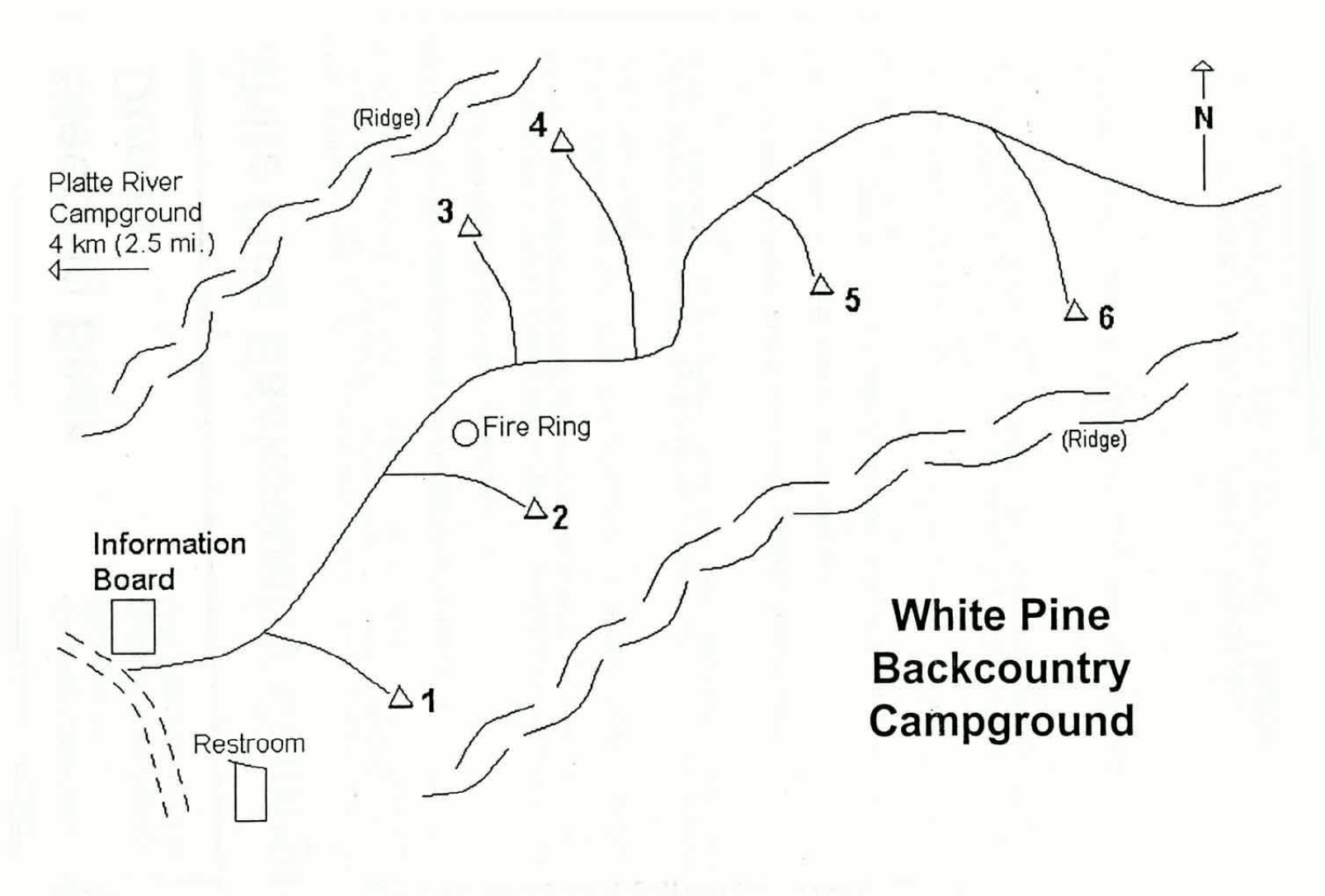 Here’s a White Pine Backcountry Campground map, located in the Platte Plains area of the park. This map shows the six campsites, fire ring, information board, and restrooms.
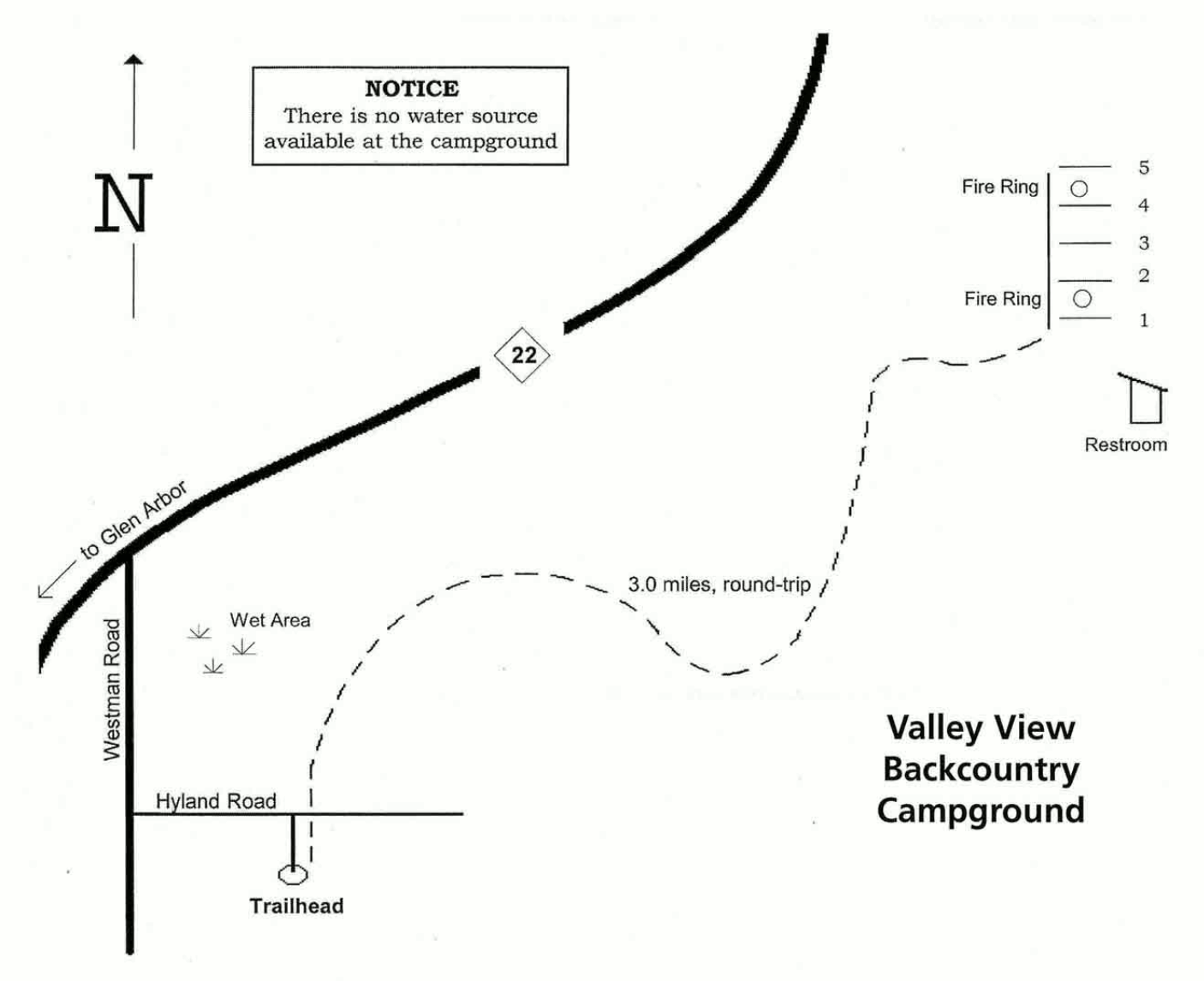 The Valley View Backcountry Campground map shows the five campsites, two fire rings, and restrooms in this primitive campground in the northeastern part of the park. Bring all your own water!
Sleeping Bear Dunes lodging map
 For staying overnight near the park, you have a few options; to the right you can open an Expedia interactive lodging map showing your nearest choices. (For more selection, you can zoom out and scroll east to Traverse City.) You might also want to browse the top-rated Sleeping Bear Dunes lodging where you can compare reviews and prices of places nearby, as there is no lodging in the park.
Sleeping Bear Dunes hiking and ski maps
Following are a variety of hiking and ski trail maps located on mainland Michigan in Sleeping Bear Dunes National Lakeshore. They are arranged roughly northeast to southwest.
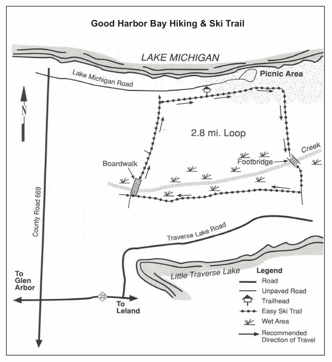 The Good Harbor Bay hiking and skiing map is in the northeastern part of the park and shows the 2.8-mile loop leaving from Lake Michigan Road near the picnic area. It’s rated as an easy ski trail.
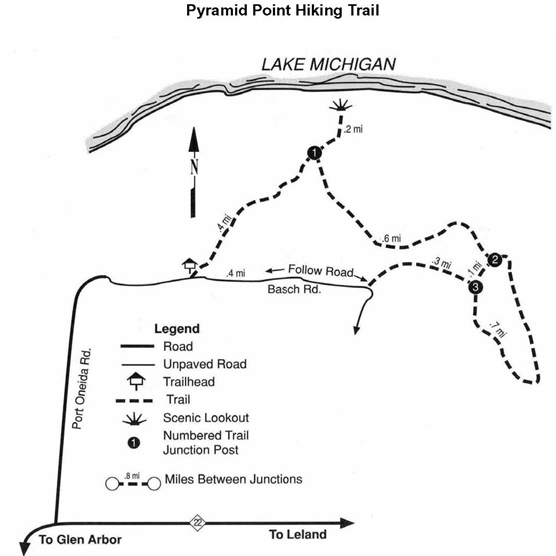 The Pyramid Point trail map covers the northernmost point on the Michigan mainland in Sleeping Bear Dunes National Lakeshore. You can make a nice loop hike here, though there is no maintained ski trail.
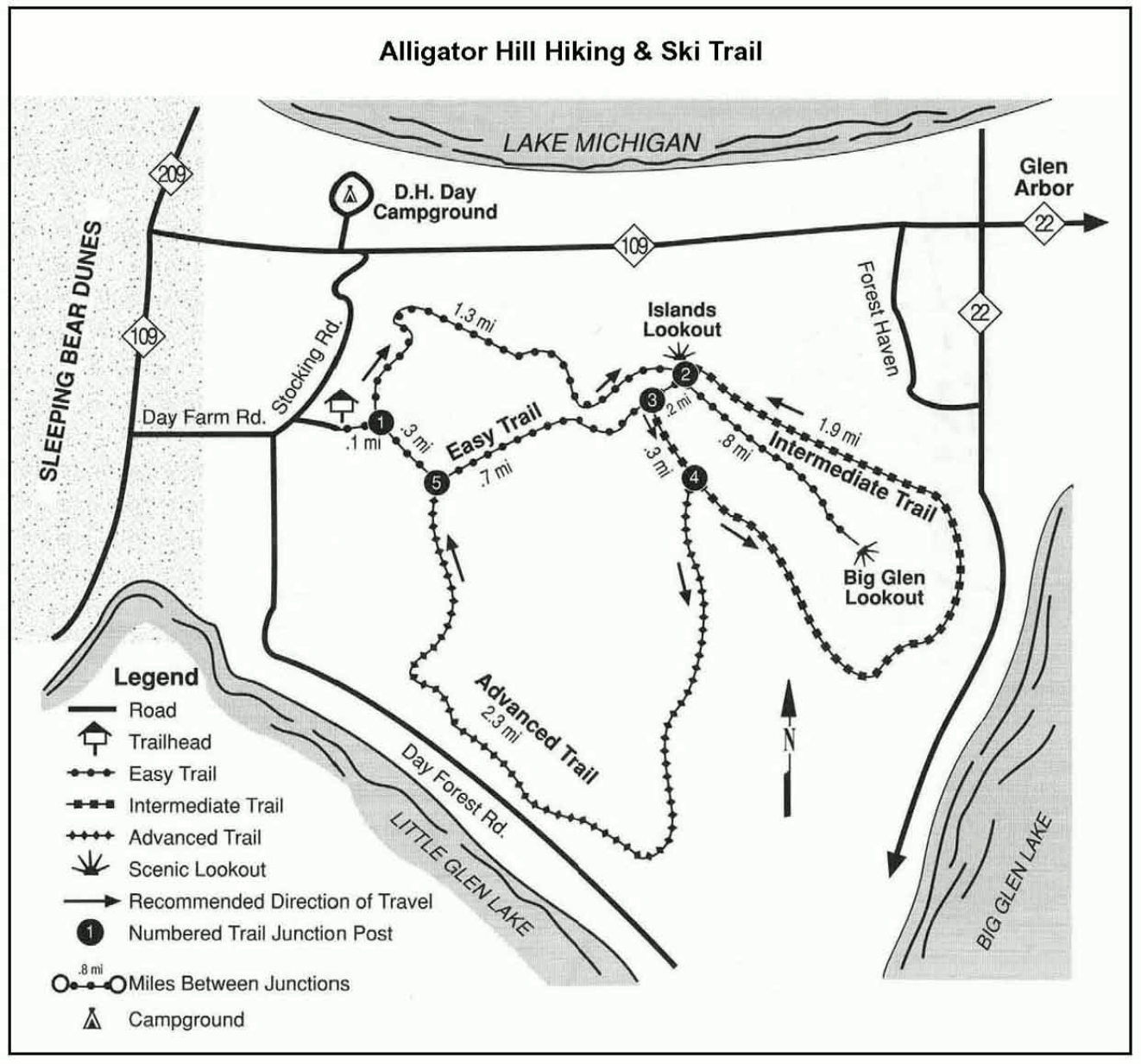 Here’s an Alligator Hill map, showing the ski trails labeled with a variety of difficulty levels along with a suggested direction to travel. You’ll find easy, intermediate, and advanced ski trails here.
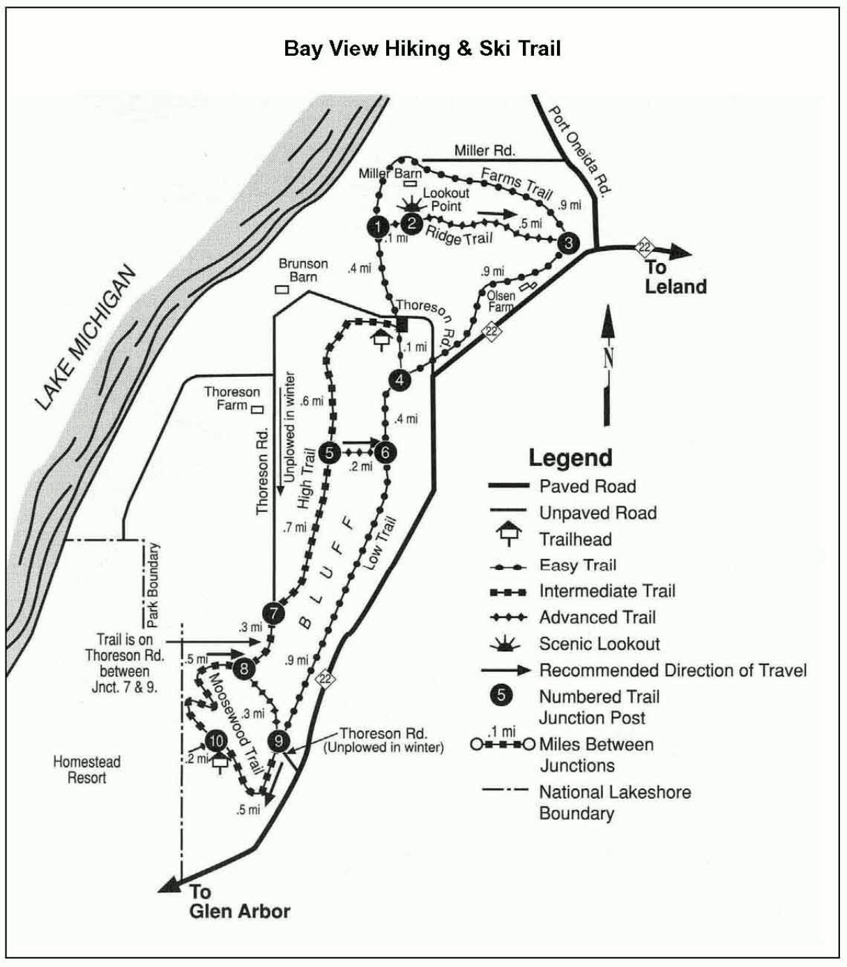 This Bay View hiking and ski trail map displays the trails near Thoreson Road, overlooking Sleeping Bear Bay from the east. Here you can also find ski routes of all difficulty levels.
 This is a Dunes Trail map, focusing on the main Sleeping Bear Dunes trails on Sleeping Bear Point (including the Dune Climb). This is a very popular part of the park and a great place to experience dunes.
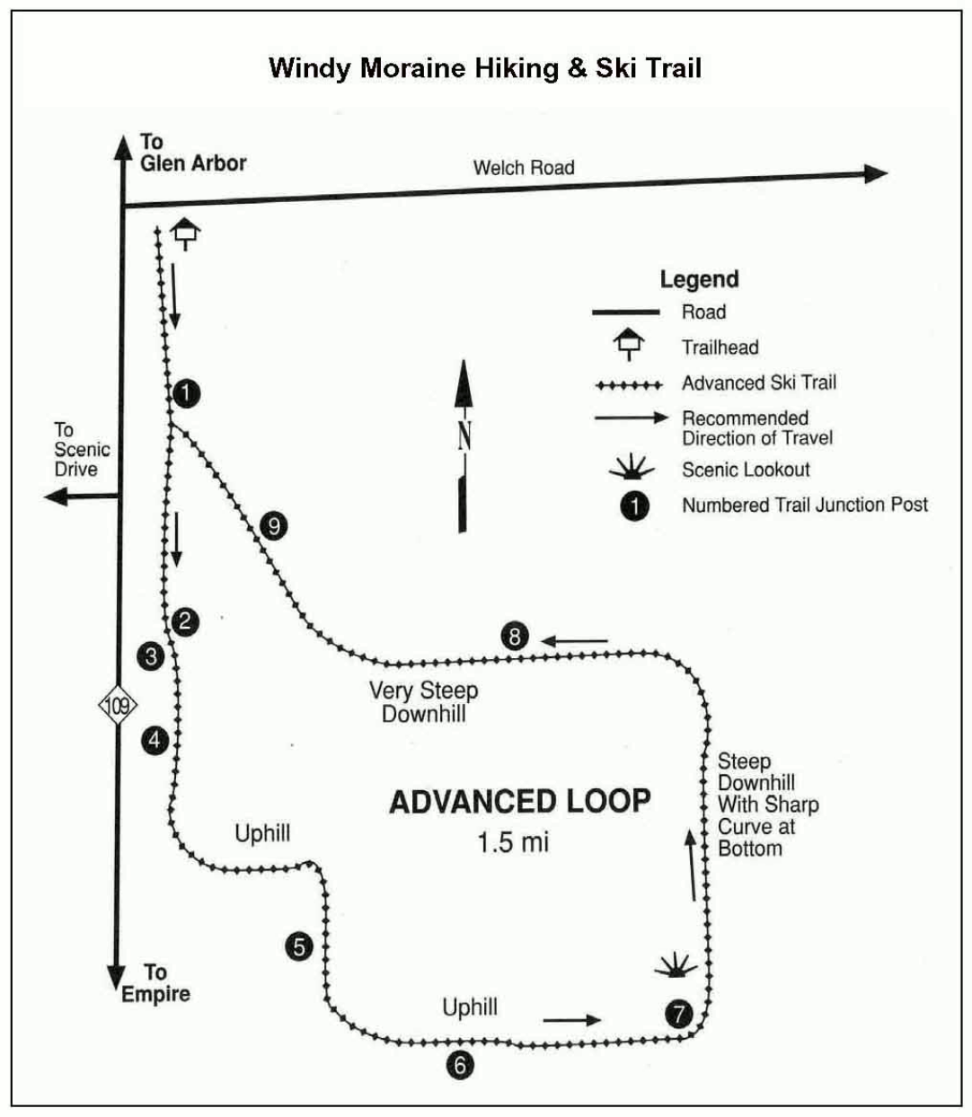 The Windy Moraine ski and hiking trail map shows the Advanced Loop – a relatively difficult ski trail that involves some steep downhill and sharp curves. It’s best to stay away if you’re a beginner.
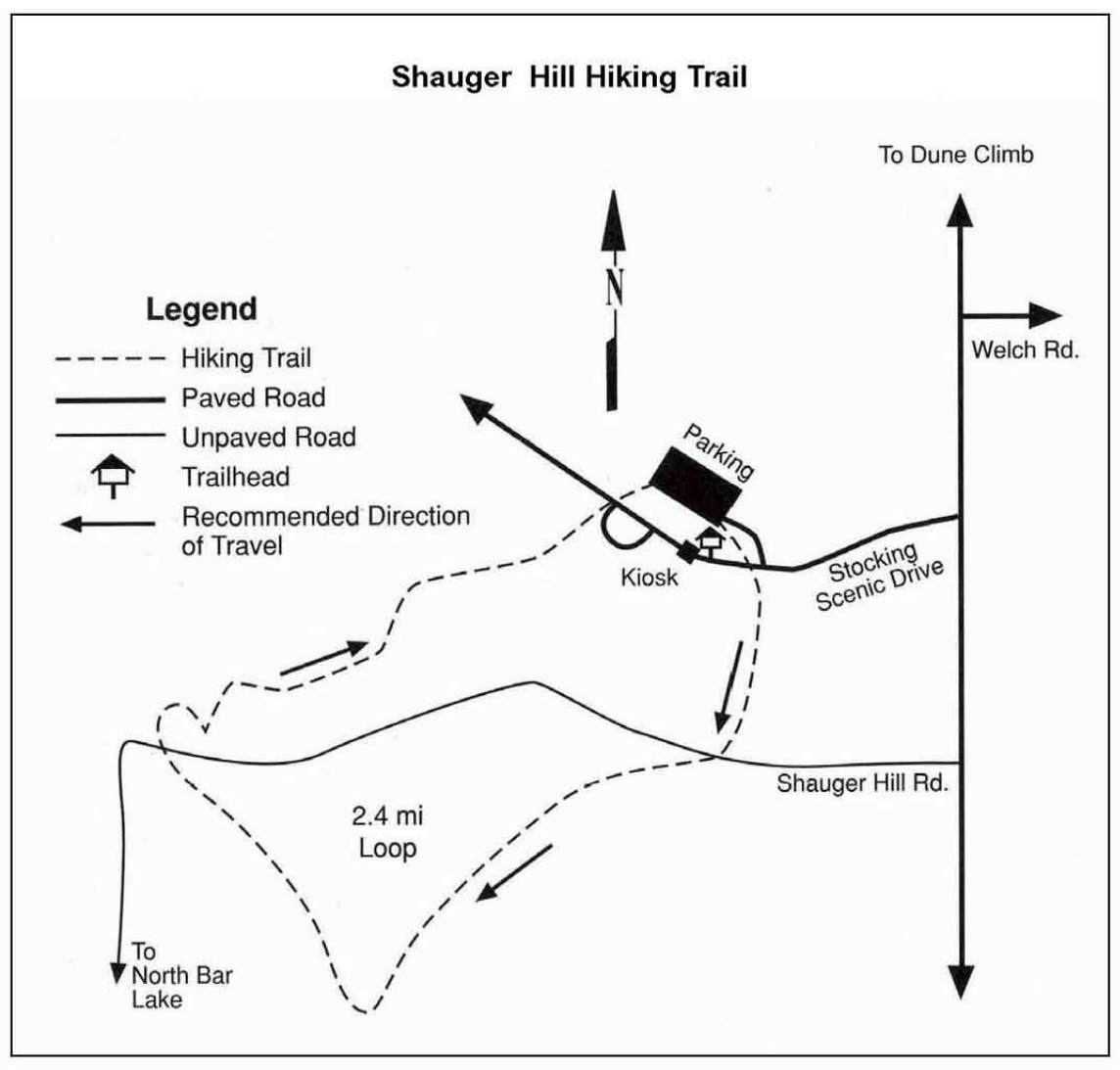 The Shauger Hill hiking trail map covers the 2.4-mile loop that departs from the parking area and kiosk off Stocking Scenic Drive. It’s recommended to take this route in a clockwise direction.
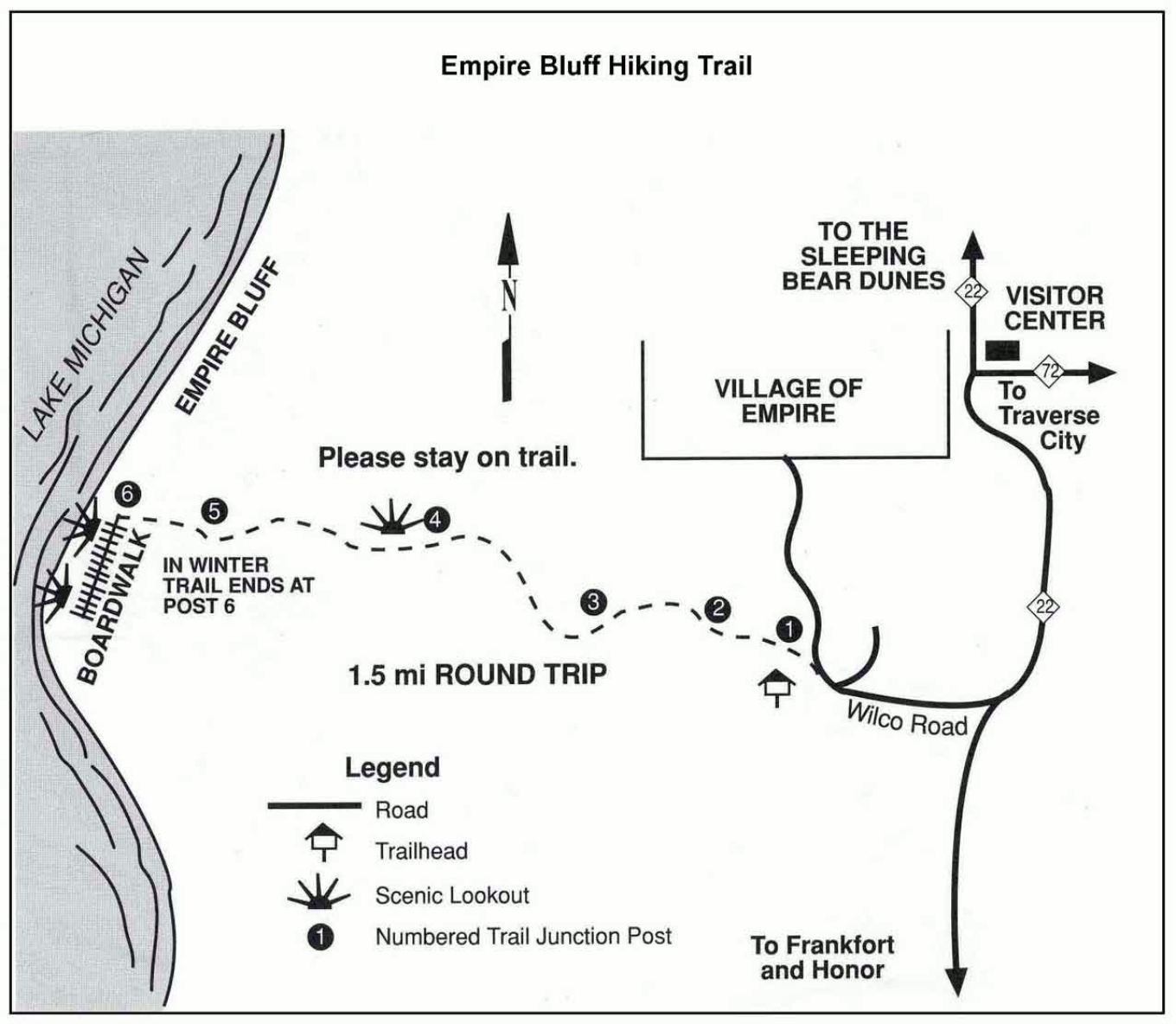 Here’s the Empire Bluff trail map, showing the three-quarters mile trail (one way) leading to the edge of the bluff overlooking Lake Michigan. You’ll get some amazing views here!
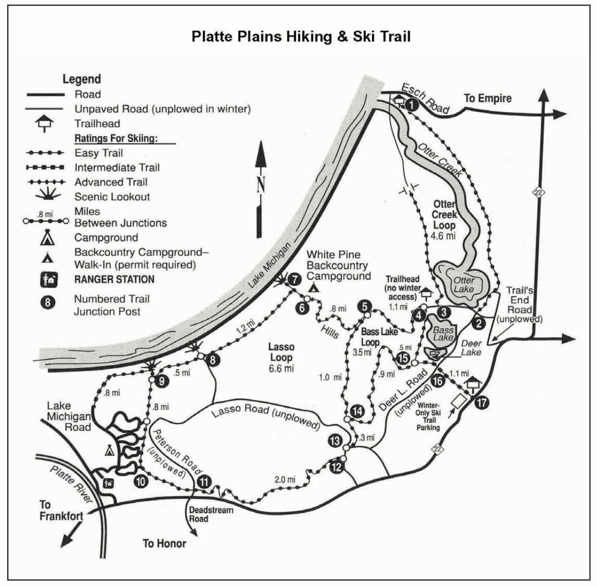 The Platte Plains map focuses on the hiking and ski trails located in the area near Otter Lake, Bass Lake, and the White Pine backcountry campground. These are mostly easy ski trails.
 The Old Indian hiking and ski trail map is in the southwestern-most area of the park and shows the Green Arrow Loop and Black Arrow Loop — the Black Arrow being the more difficult one.
South Manitou Island maps
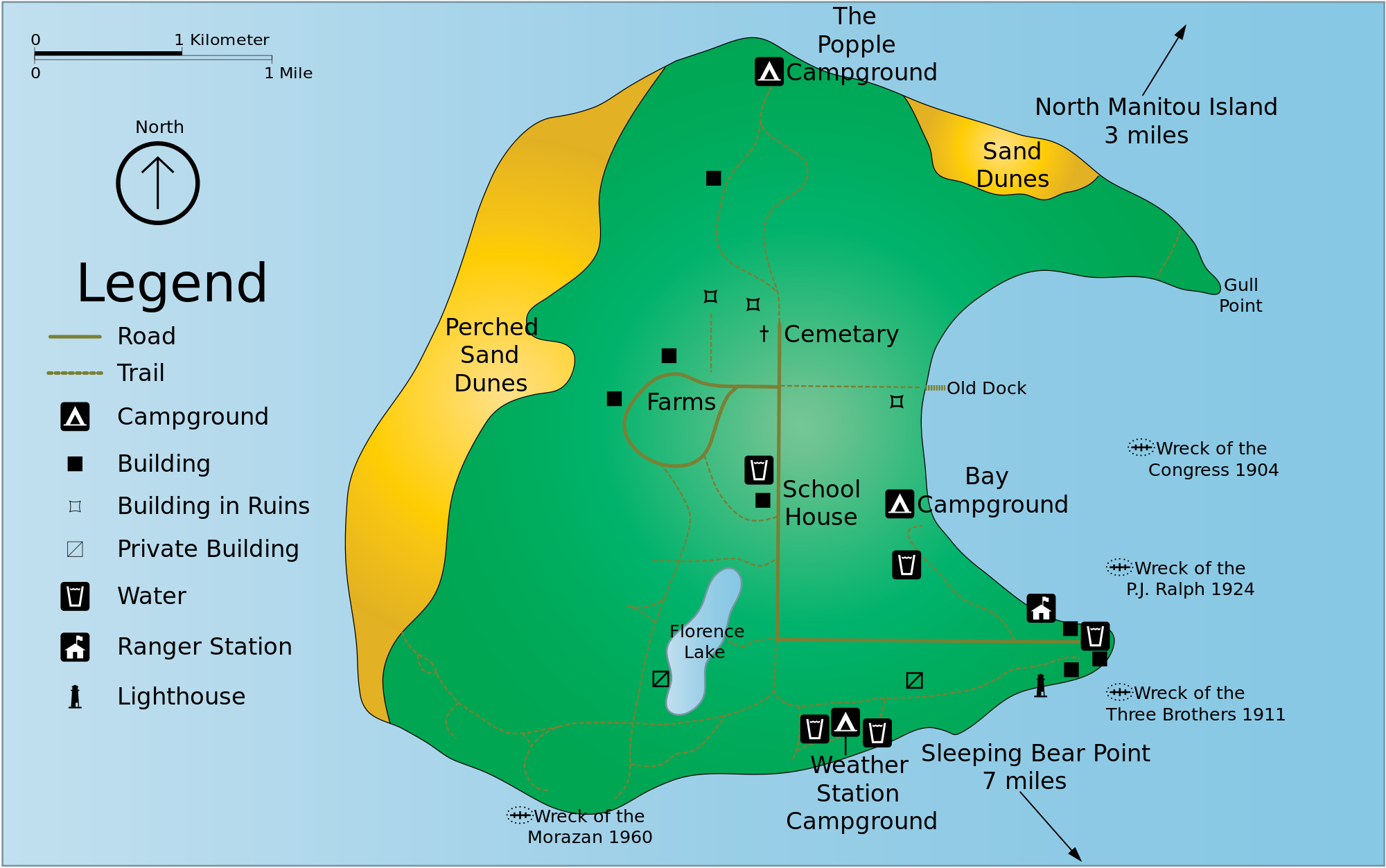 This South Manitou Island map is provided by Phizzy of Wikipedia and shows the campgrounds, trails, and sights on the island. Drinking water is only available in the village; otherwise it must be treated.
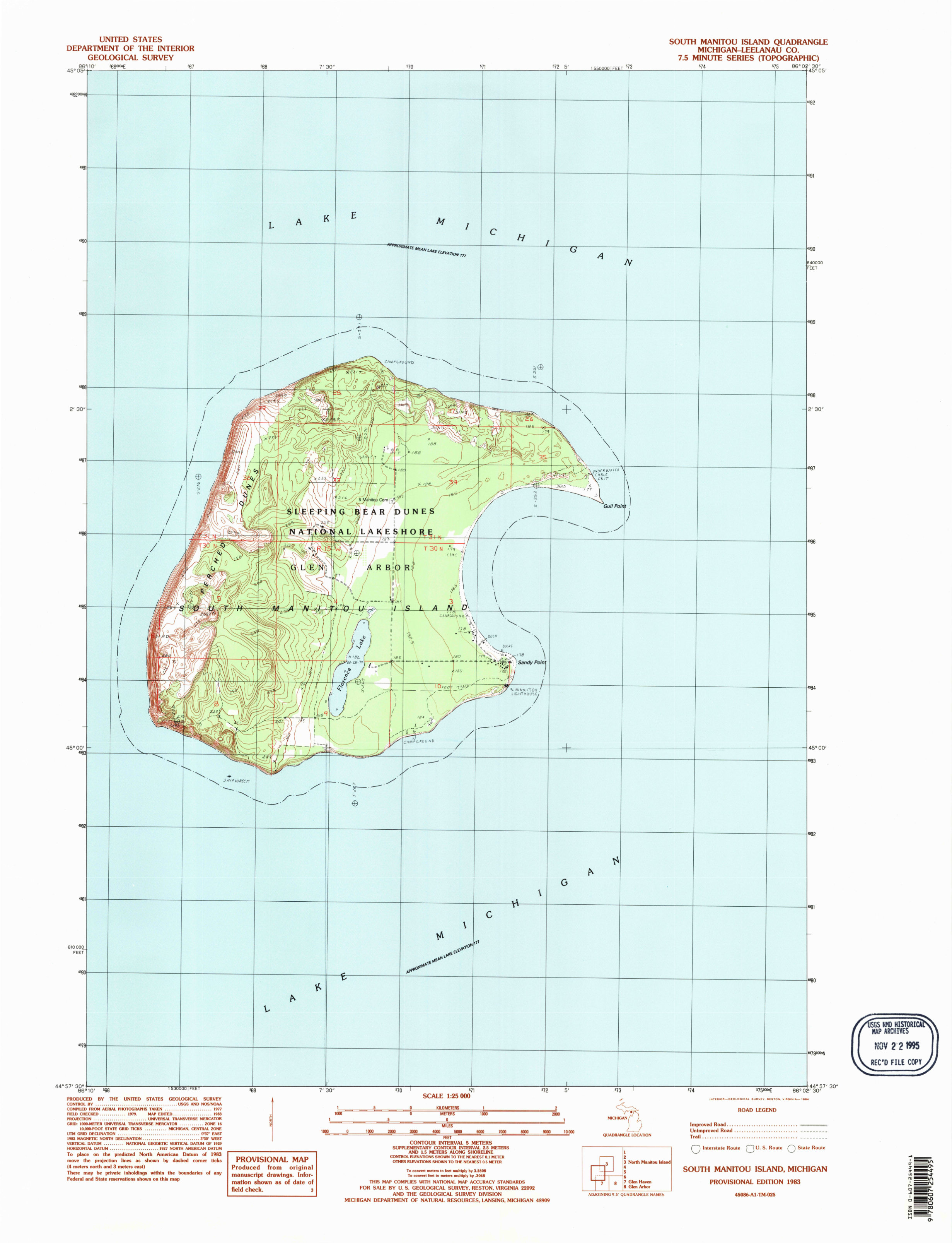 Here’s a South Manitou Island topographic map from the USGS, showing the topography and lay of the land in great detail. Click the image to view a full size map or download the PDF.
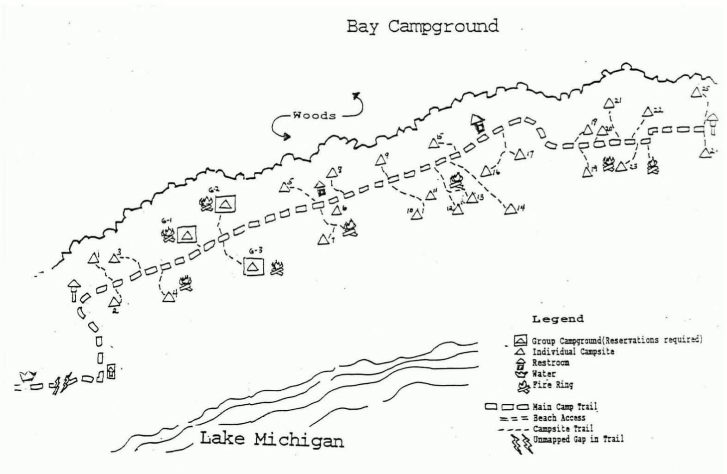 Here’s a Bay Campground map, showing the sites, fire rings, water availability, trails, and restrooms located in this campground in along the east shoreline of South Manitou Island.
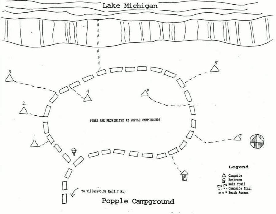 The Popple Campground map shows the seven separate campsites (and one restroom) located on the north shore of South Manitou Island. Also shown is the beach access trail.
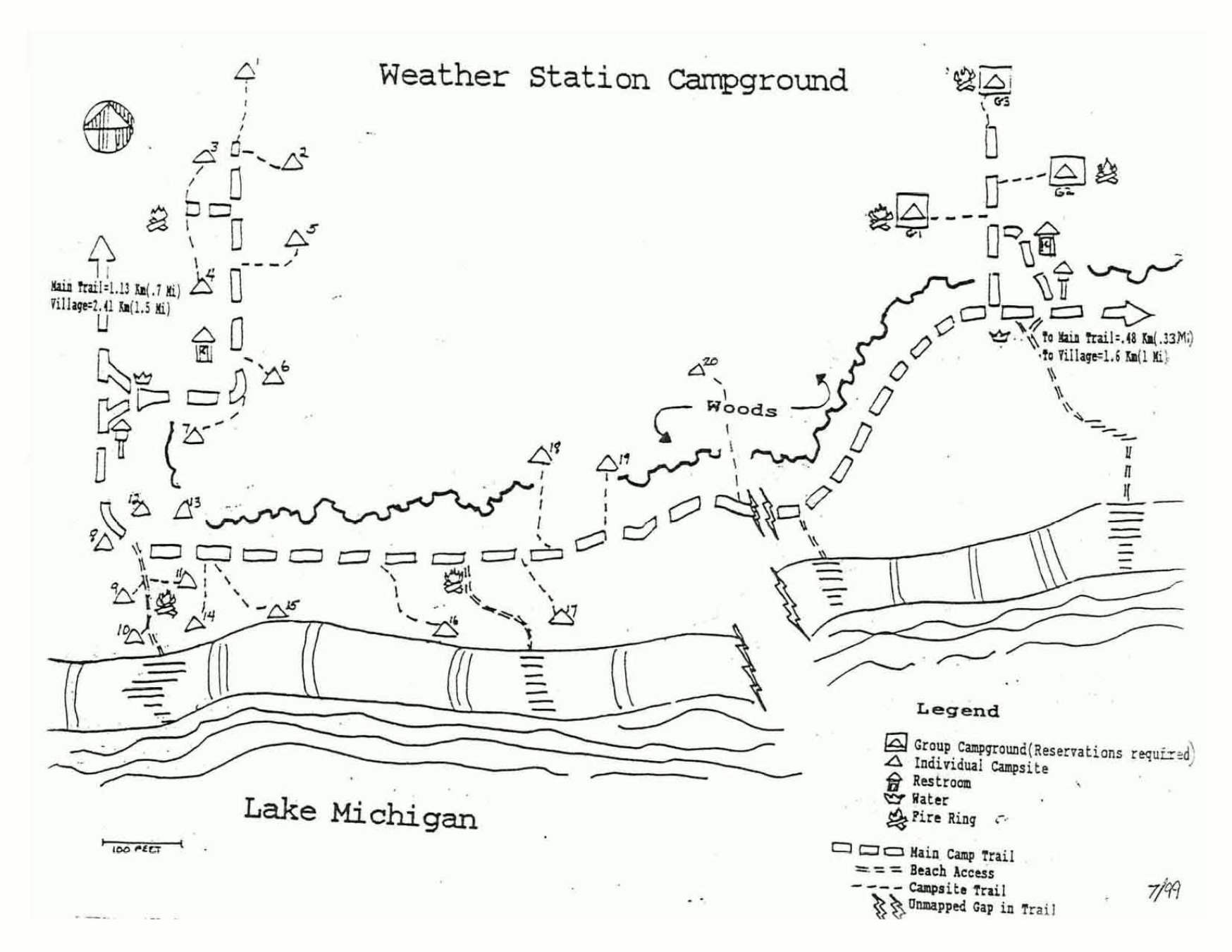 This Weather Station Campground map shows the individual campsites in the two separate camping areas in this campground located on the south shoreline of South Manitou Island.
North Manitou Island maps
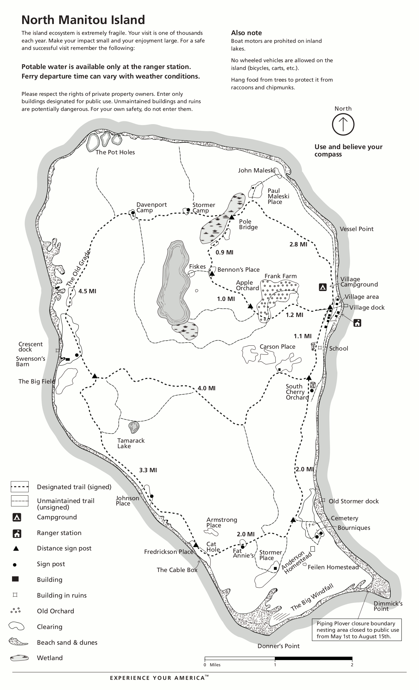 The North Manitou Island trail map shows the campgrounds, trails, and points of interest across the island radiating out from the village dock. Trail labels include distances between junctions.
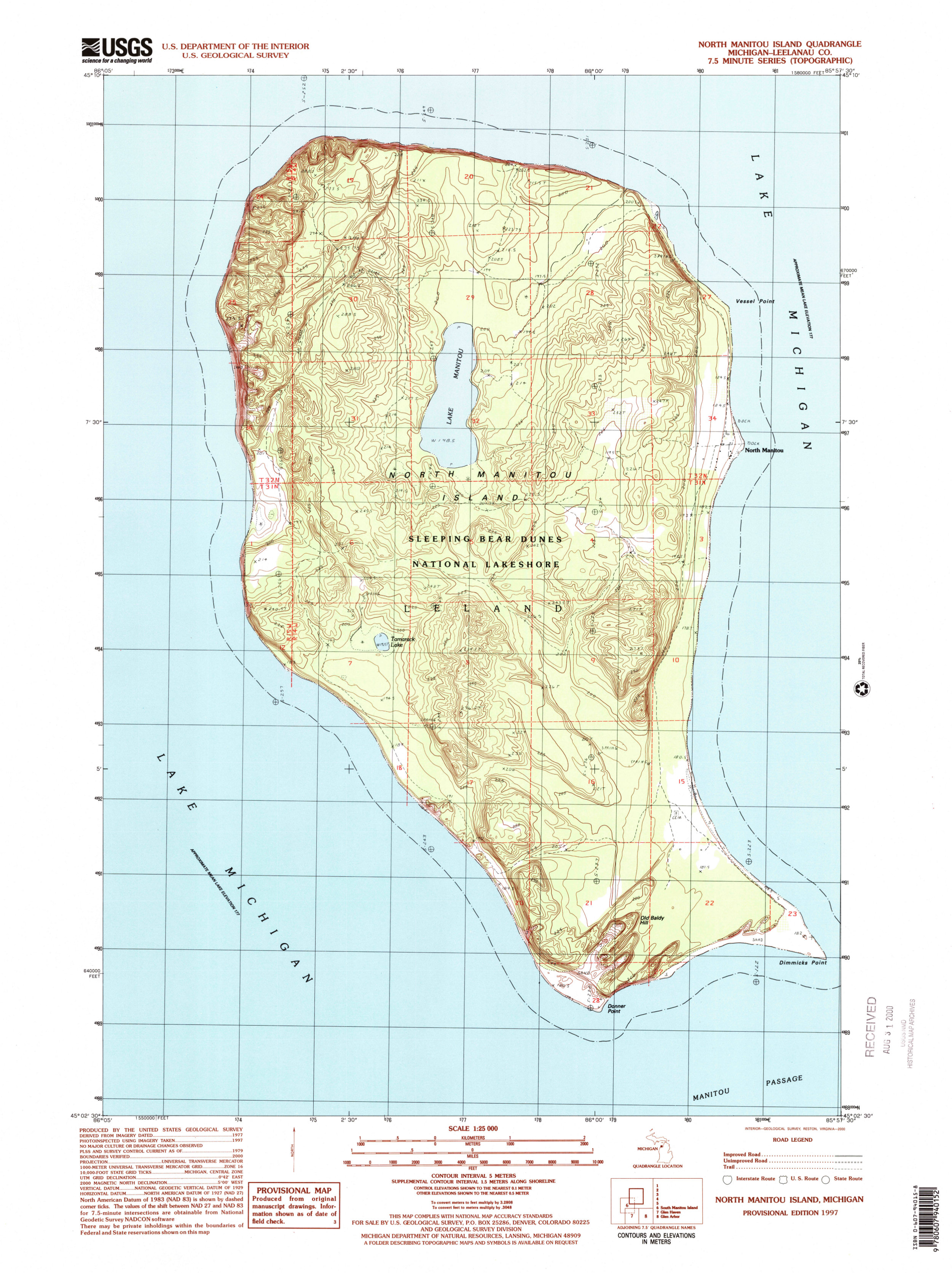 Here’s a North Manitou Island topographic map, showing topo lines and the extensive network of trails across the island. Click the image to view a full size map or download the PDF.
Various Sleeping Bear Dunes maps
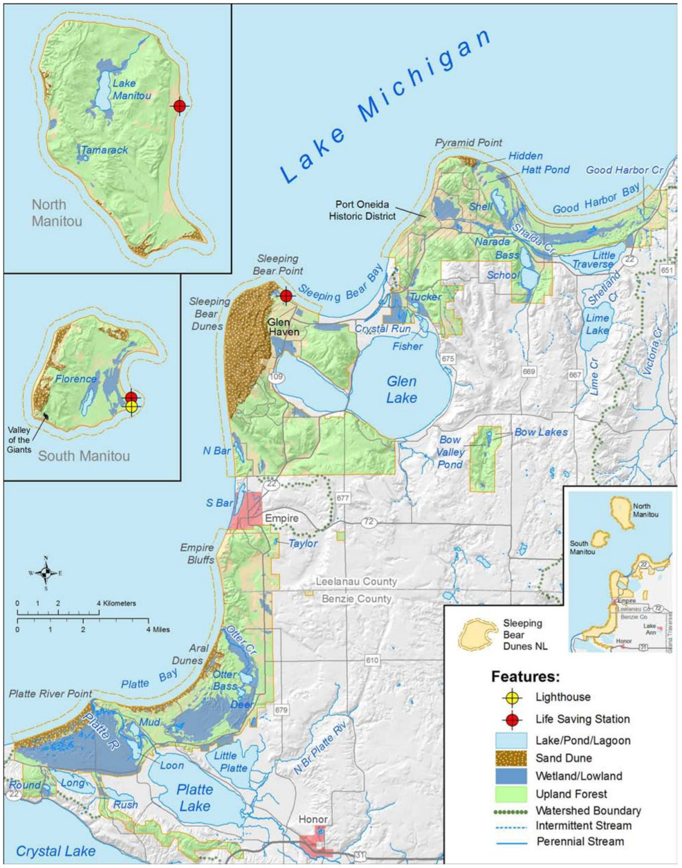 The Sleeping Bear Dunes features map identifies both natural landforms (forests, dunes, lakes) as well as human structures like lighthouses. This and the following maps include the Manitou Islands too.
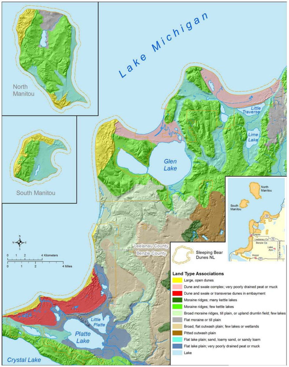 Here’s a Sleeping Bear Dunes land type map that shows the different landforms that are found on the surface of the park — sand dunes, ridges, plains, etc. There’s much more than dunes here!
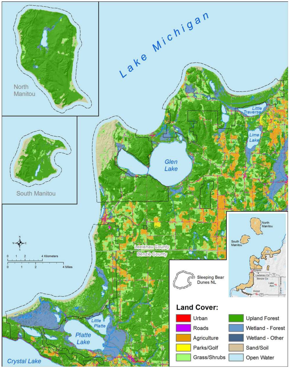 The Sleeping Bear Dunes land cover map identifies specifically what makes up the ground surface in all areas of the park and surrounding area – sand, grass, forest, water, roads, farms, etc.
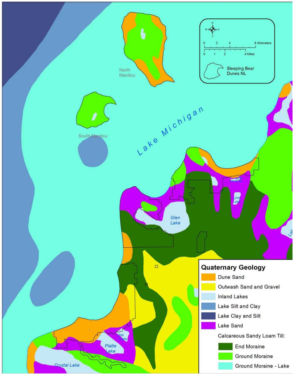 This Sleeping Bear Dunes simple geologic map shows the basic rocks, soils, and glacial features that make up the park lands and surrounding region. Besides sand, you’ll mostly find silt and clay.
 Here is the pre-2020 official Sleeping Bear Dunes map, which has since been replaced by the more beautiful one on top of this page. Click the image to view a full size map or download the PDF.
…and more!
< Return to National Park Maps home
< Return to Park List
< Return to List by State