This page currently offers 4 free Gila Cliff Dwellings National Monument maps for you to view or download: NPS brochure maps, trail maps, and more. In addition to the free Gila Cliff Dwellings maps, I include external affiliate links that help cover my costs and allow me to keep this site ad-free. These links have shaded backgrounds (like this example) so you can easily recognize or skip past them: Browse the best-selling New Mexico maps and books on Amazon.
Gila Cliff Dwellings brochure maps
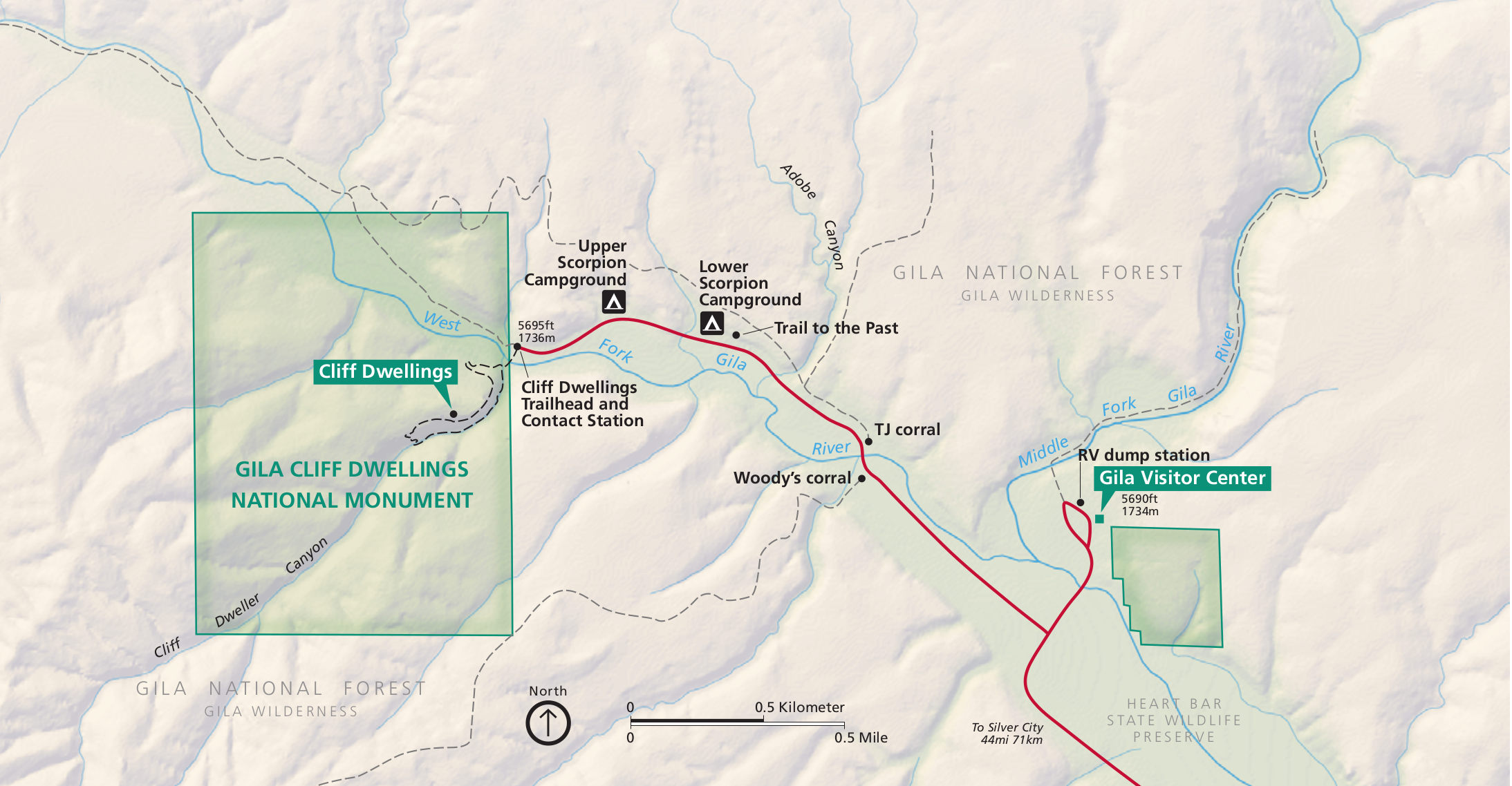 This is the official Gila Cliff Dwellings map, showing the monument itself as well as the surrounding Gila National Forest. Click the image to view a full size map or download the PDF.
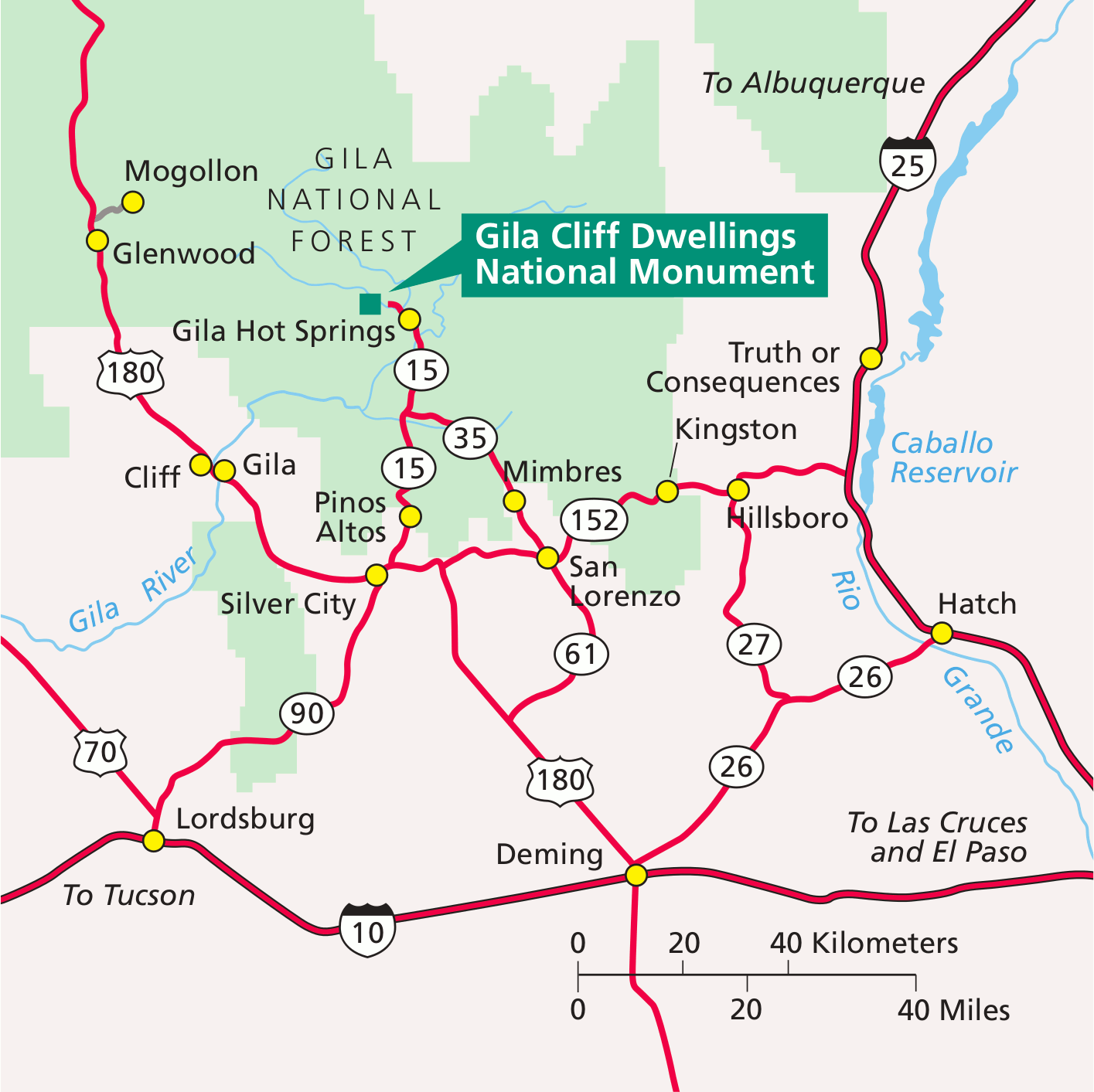 The regional map of Gila Cliff Dwellings shows the surrounding roads and interstate highway – note there’s only one way in and out! Click the image to view a full size map or download the PDF.
Gila Cliff Dwellings trail map
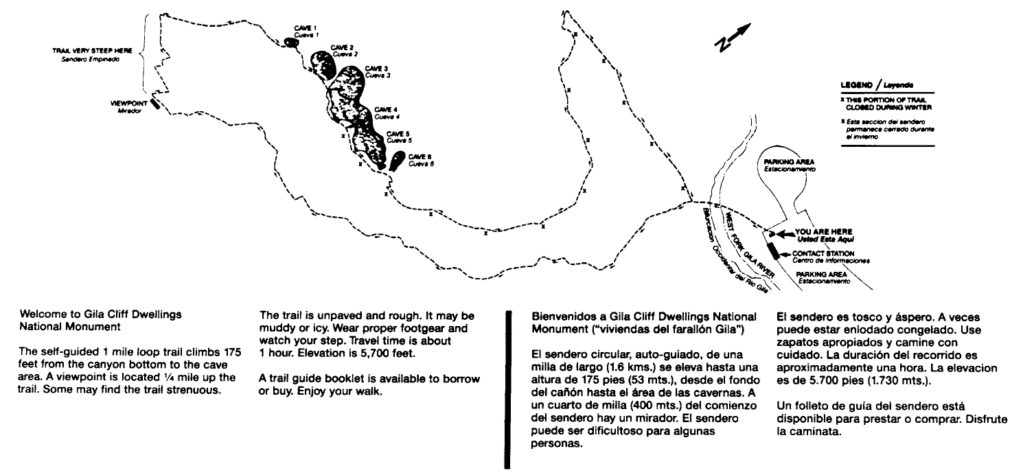 Here’s a Gila Cliff Dwellings trail map, showing the one-mile loop from the end of the road that leads through the cave areas. Apologies for the poor image quality – this is the best version I could find!
…and more!
< Return to National Park Maps home
< Return to Park List
< Return to List by State
Need more planning help? Browse Amazon’s best-selling New Mexico maps and guidebooks.