Redwood map from the park brochure
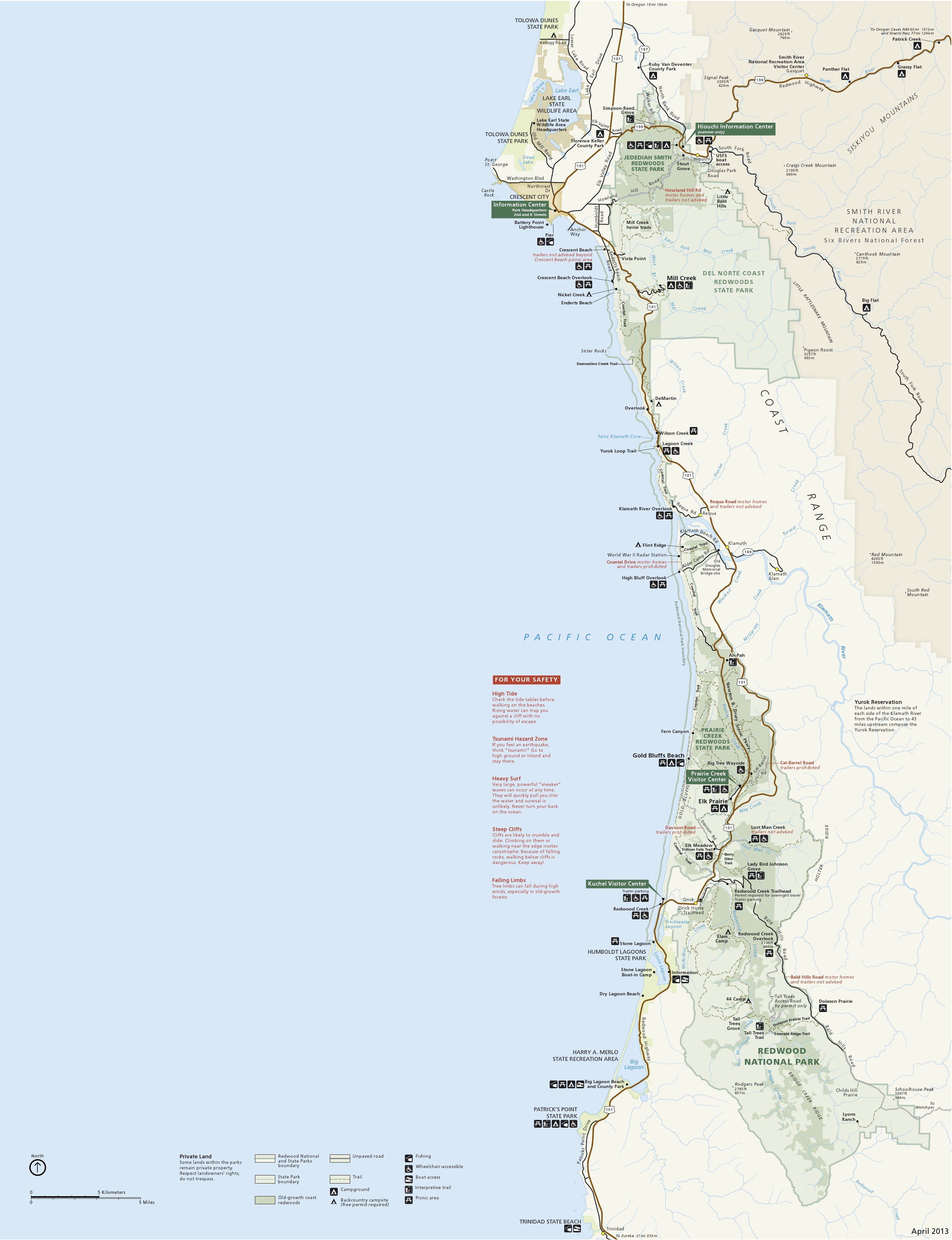 This is the main Redwood National Park map, showing both the national park and the local redwoods state parks. Click the image to view a full size map or download the PDF.
Redwood trail map
 There’s no good free trail map of Redwood available online, but the National Geographic Trails Illustrated map is definitely the best one for hiking in the redwoods. My first time backpacking in Redwood National Park, I didn’t bring a trail map because I didn’t want to spend $10; we nearly ended up lost, finding our first campsite well after dark. We really wished we had that map. Don’t make my same mistake!
Redwood campground maps
 Here’s a Jedediah Smith Campground map. This very popular campground is located in Jedediah Smith Redwoods State Park and is open all year and includes hike-in and bike-in sites.
 Here’s a Mill Creek Campground map, which is the largest campground in Redwood National and State Parks. It is in Del Norte Coast Redwoods State Park and has over 100 campsites.
 Here’s an Elk Prairie Campground map. This campground is located nearest the Prairie Creek Visitor Center in the southern part of the park and includes about 70 campsites.
 Here’s a Gold Bluffs Beach Campground map, which is quite small and not suitable for RVs, but is located on the coast to give you the best beach access of any Redwoods campground.
Redwood lodging map
 To the right you’ll find an Expedia interactive lodging map for Crescent City – the largest city located near the northern end of Redwood National Park. It’s also nearby the popular Jedediah Smith Redwoods State Park, so it makes a logical base camp for your visit to this part of California. You can also see Expedia’s top-rated Crescent City lodging to compare photos, reviews, and prices of your options in this coastal town.
Coast Redwoods range map
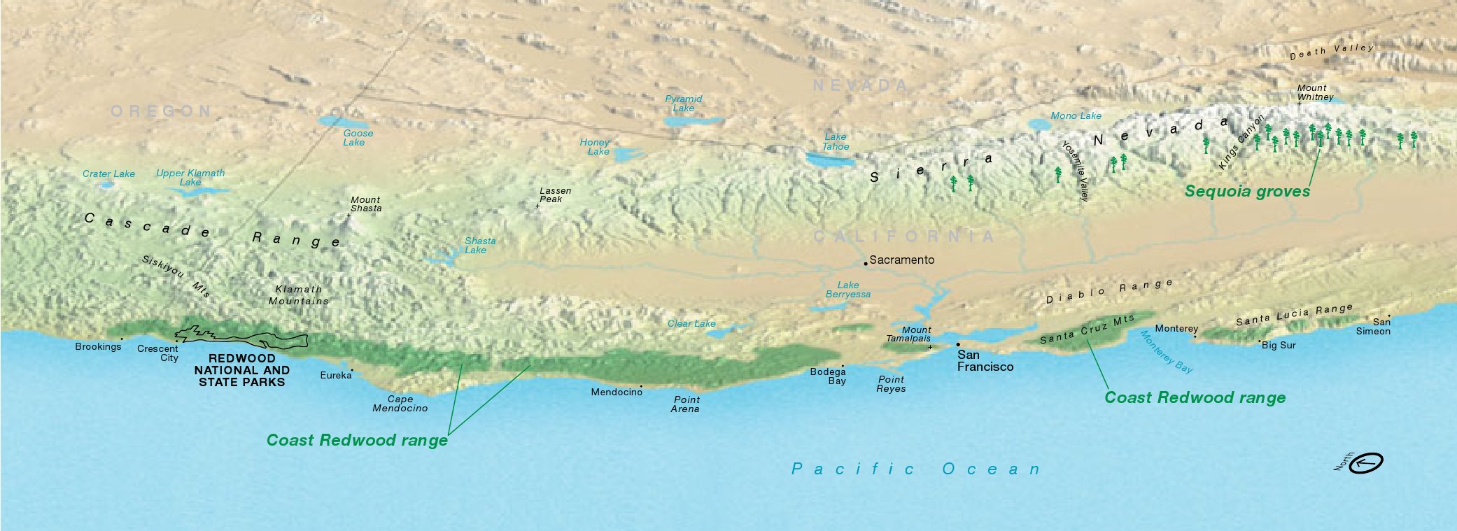 This map shows the range of the Coast Redwood, stretching from southern Oregon to south of Big Sur, California. Click the image to view a full size map or download the PDF.
…and more!
< Return to National Park Maps home
< Return to Park List
< Return to List by State