If you’re looking for a Point Reyes map, you’ve come to the right place; currently I’ve collected 13 free Point Reyes National Seashore maps to view and download. (PDF files and external links will open in a new window.) Here you’ll find maps that focus on backcountry camping and trails and others that cover the entire park. You can also browse the best-selling Point Reyes maps and guidebooks on Amazon.
Point Reyes map from the park brochure
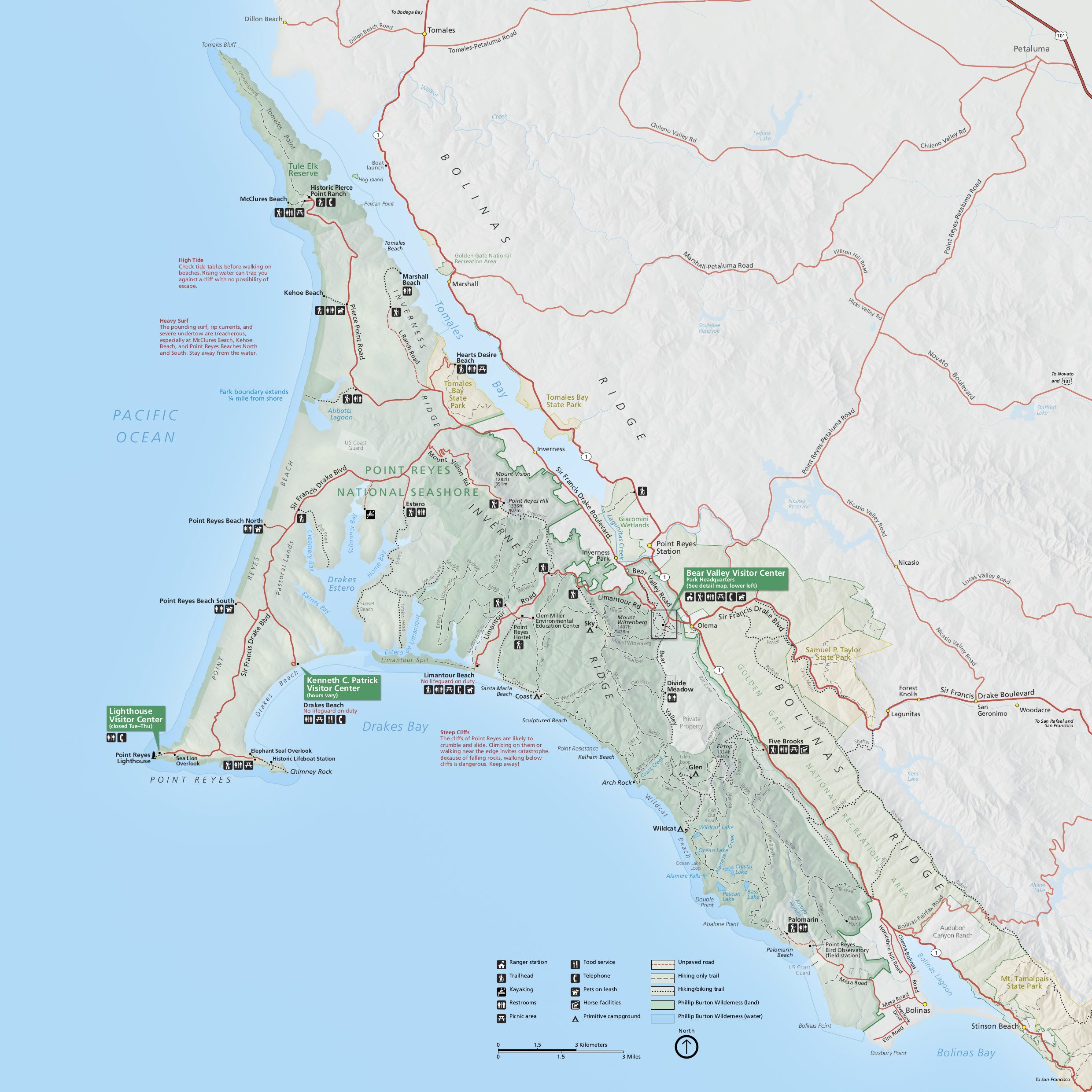 Here is the full Point Reyes map, showing the entire park, roads, trails, beaches, visitor centers, and points of interest. Click the image to view a full size JPG (900 kb) or download the PDF (5.0 mb).
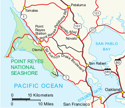 This is a regional map of Point Reyes, showing the park in relation to San Francisco, Oakland, and other cities. Click the image to view a full size JPG (60 kb) or download the PDF (45 kb).
Point Reyes trail maps
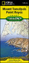
 Point Reyes is popular for backcountry camping, and you’ll want this National Geographic Trails Illustrated map if you’re doing any overnights, since it shows topographic lines and trail mileages. I like these maps too even when doing a lot of day hikes, since it makes easier trip planning. This one is especially nice nice it shows trails nearby in the Marin Headlands and in Muir Woods National Monument.
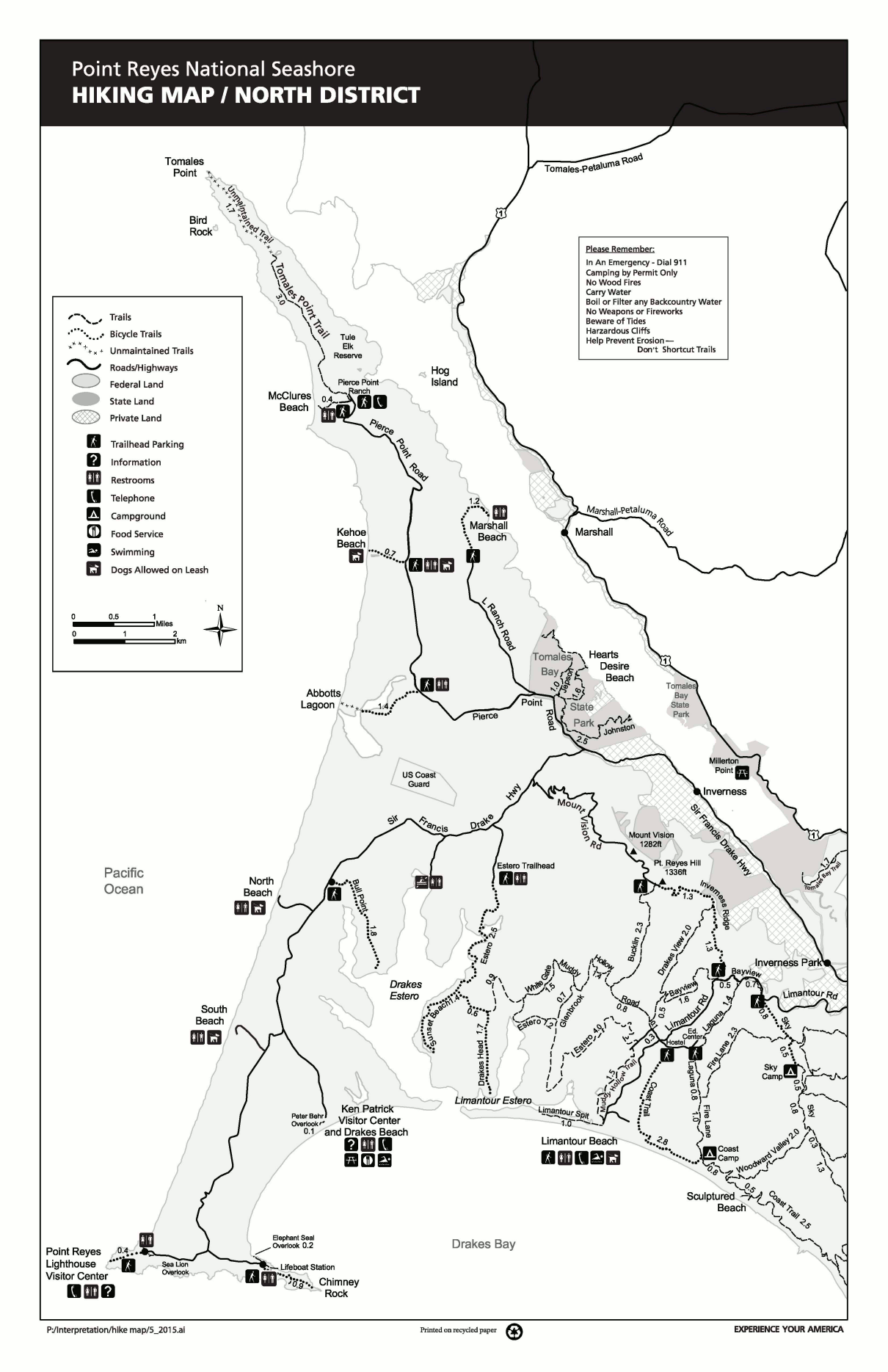 Here’s a north Point Reyes trail map (350 kb), showing the trails along the beaches and Sir Frances Drake Highway. This is the most popular area of the park to visit, especially near the Point Reyes lighthouse.
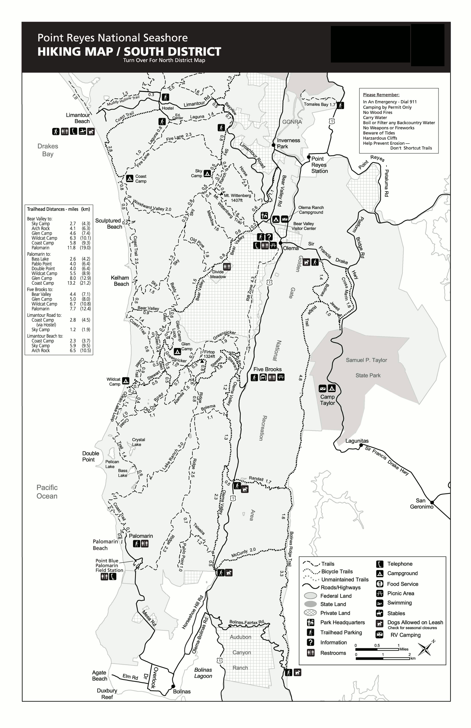 Here’s a south Point Reyes trail map (700 kb), featuring the backcountry trails that lead to the campgrounds in the remote, less-visited part of Point Reyes that gives you a wilderness experience.
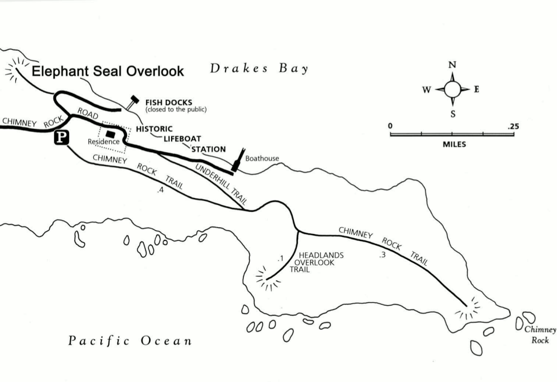 This is a detailed Chimney Rock trail map, which shows the trails to Chimney Rock, Elephant Seal Overlook, and Headlands Overlook. Click the image to view a full size GIF (110 kb) or download the PDF (75 kb).
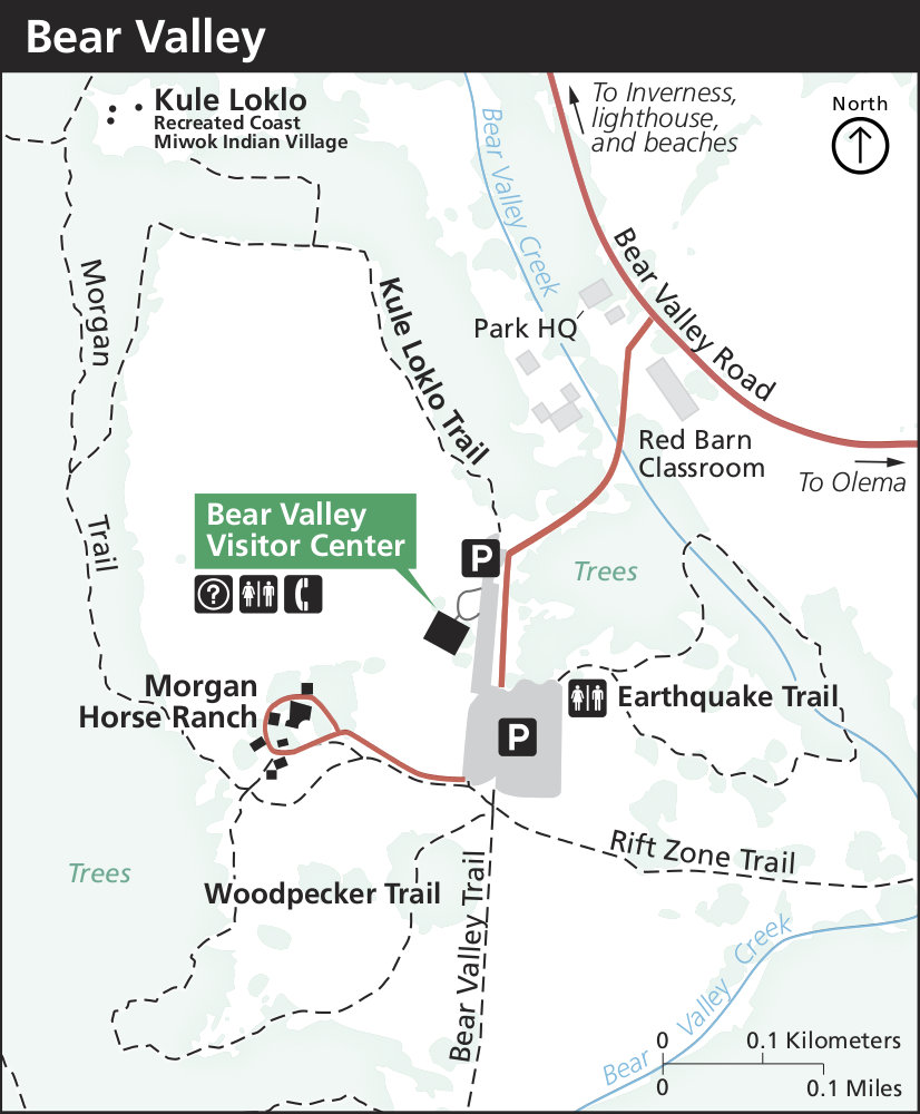 Here’s a Bear Valley trail map, showing the trails around the Bear Valley Visitor Center including the Earthquake Trail. Click the image to view a full size JPG (130 kb) download the PDF (1.3 mb).
Point Reyes camping maps
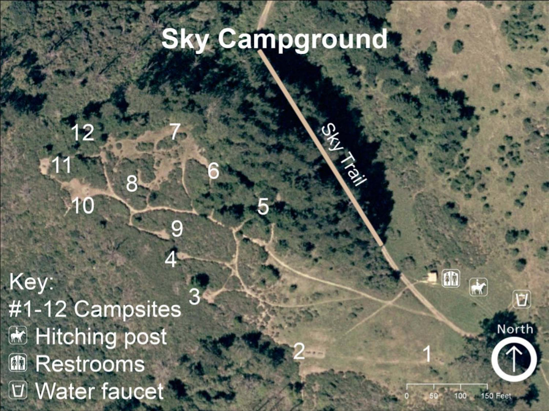 Here is the backcountry Sky Campground map, showing the 12 campsites located nearest the Bear Valley Visitor Center. Click the image to view a full size JPG (240 kb) or download the PDF (230 kb).
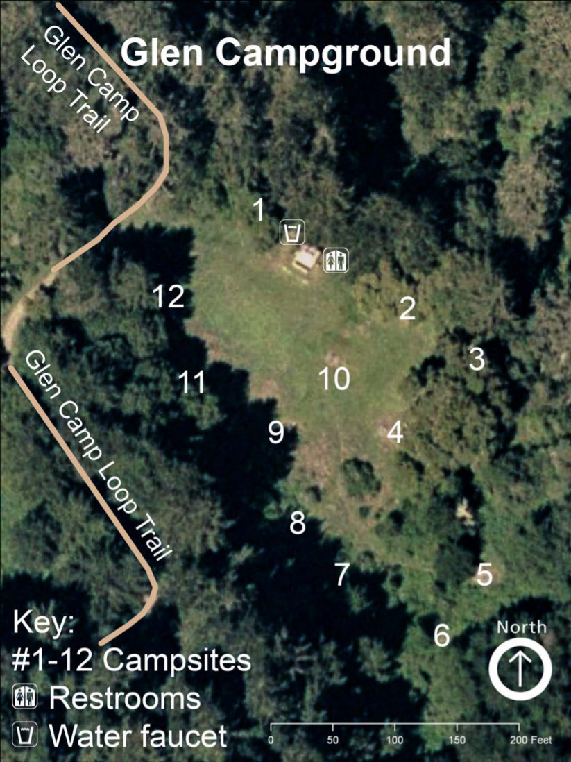 This is the backcountry Glen Campground map, showing the 12 campsites located nearest the Five Brooks trailhead. Click the image to view a full size JPG (200 kb) or download the PDF (200 kb).
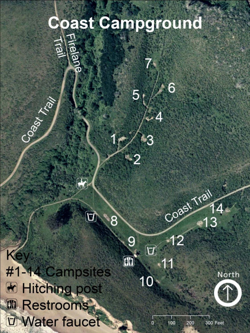 This is the Coast Campground map, the furthest north of the two backcountry campgrounds on the Coast Trail. Click the image to view a full size JPG (275 kb) or download the PDF (270 kb).
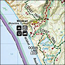
 This is the backcountry Wildcat Campground map, located on the Coast and Stewart Trails between Wildcat Beach and Wildcat Lake. Click the image to view a full size JPG (200 kb) or download the PDF (120 kb).
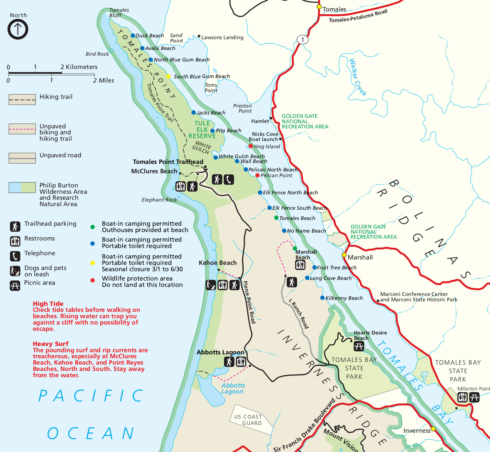 This is the Point Reyes boat-in campsite map, showing all the campsites on Tomales Bay only accessible by water. Click the image to view a full size JPG (500 kb) or download the PDF (250 kb).
Point Reyes geologic map
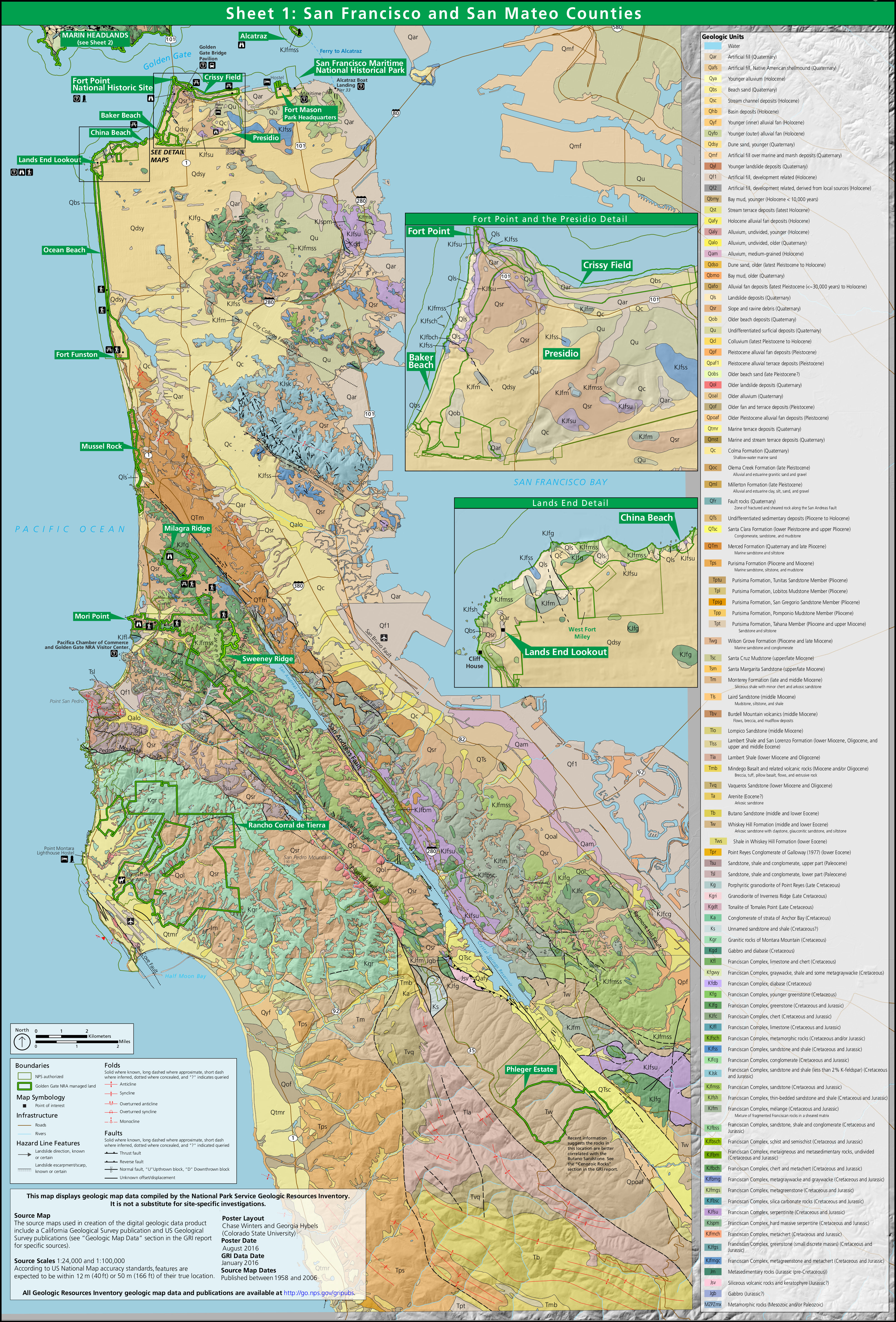
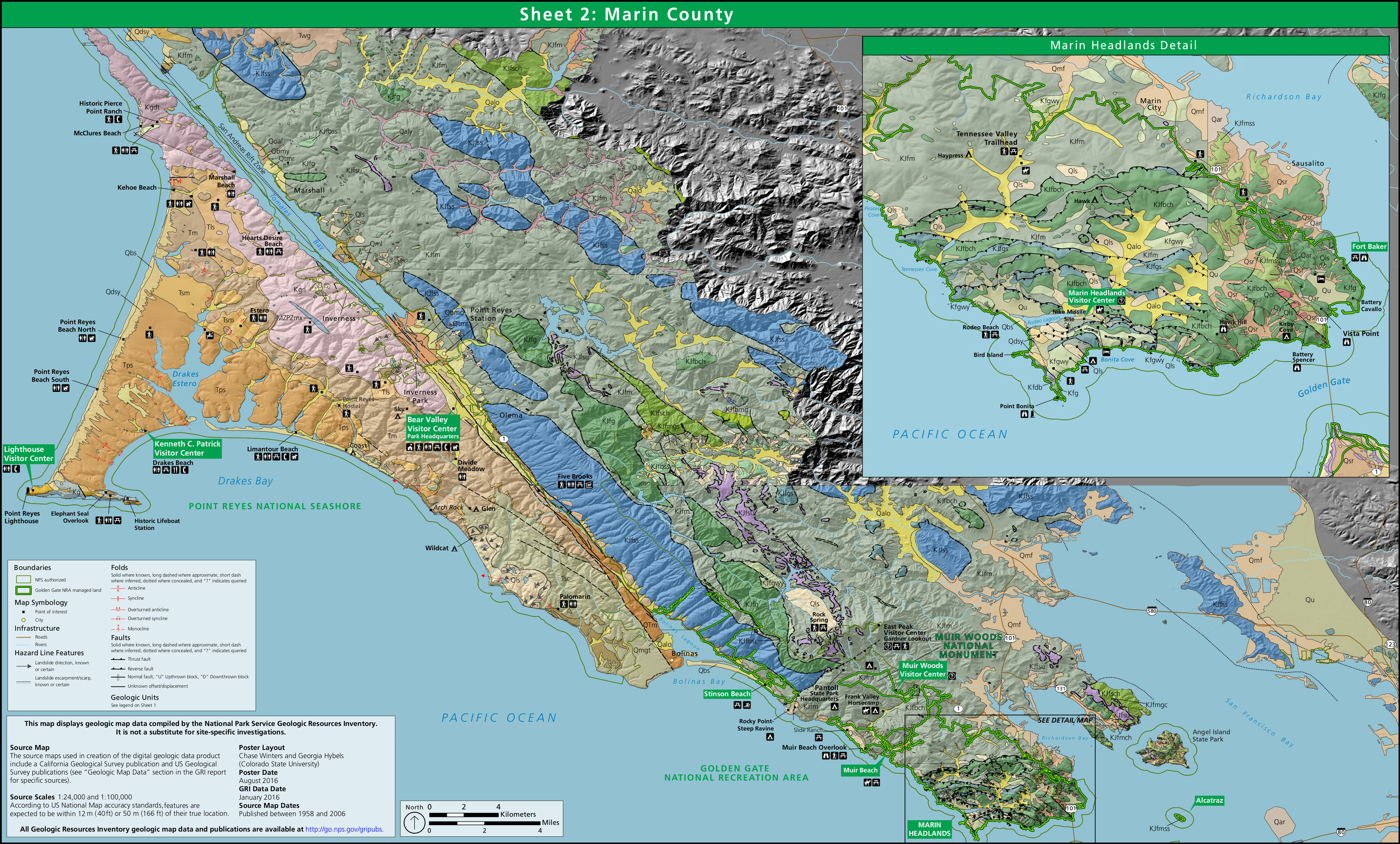 This is a Point Reyes geologic map (2.9 mb), showing the rock types you’ll find in Point Reyes National Seashore. For a legend labeling the rock types, open the Golden Gate National Seashore geologic map.
…and more!
< Return to National Park Maps home
< Return to Park List
< Return to List by State
Need more planning help? Browse Amazon’s best-selling Point Reyes maps and guidebooks.