If you’re looking for a Golden Gate map, you’ve come to the right place; currently I’ve collected 34 free Golden Gate National Recreation Area maps to view and download. (PDF files and external links will open in a new window.) On this page you’ll find maps covering all aspects of the national park – hiking trails and walking tours for all areas of the park. You can also browse best-selling San Francisco maps and guidebooks on Amazon.
Golden Gate brochure maps
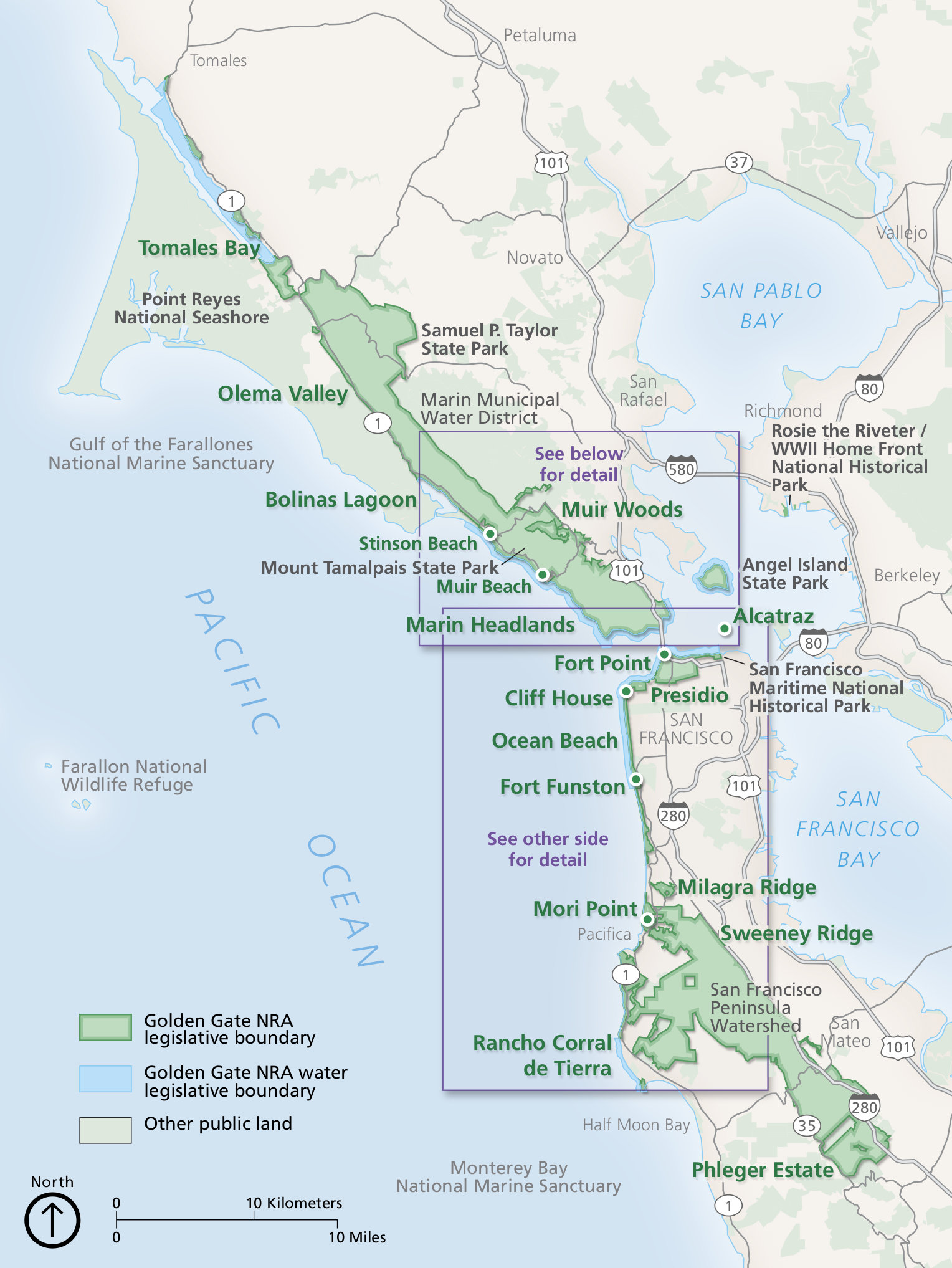 Here’s a Golden Gate National Recreation Area map, zoomed out to show all the National Park Service lands around San Francisco. Click the image to view a full size JPG (400 kb) or download the PDF (2.7 mb).
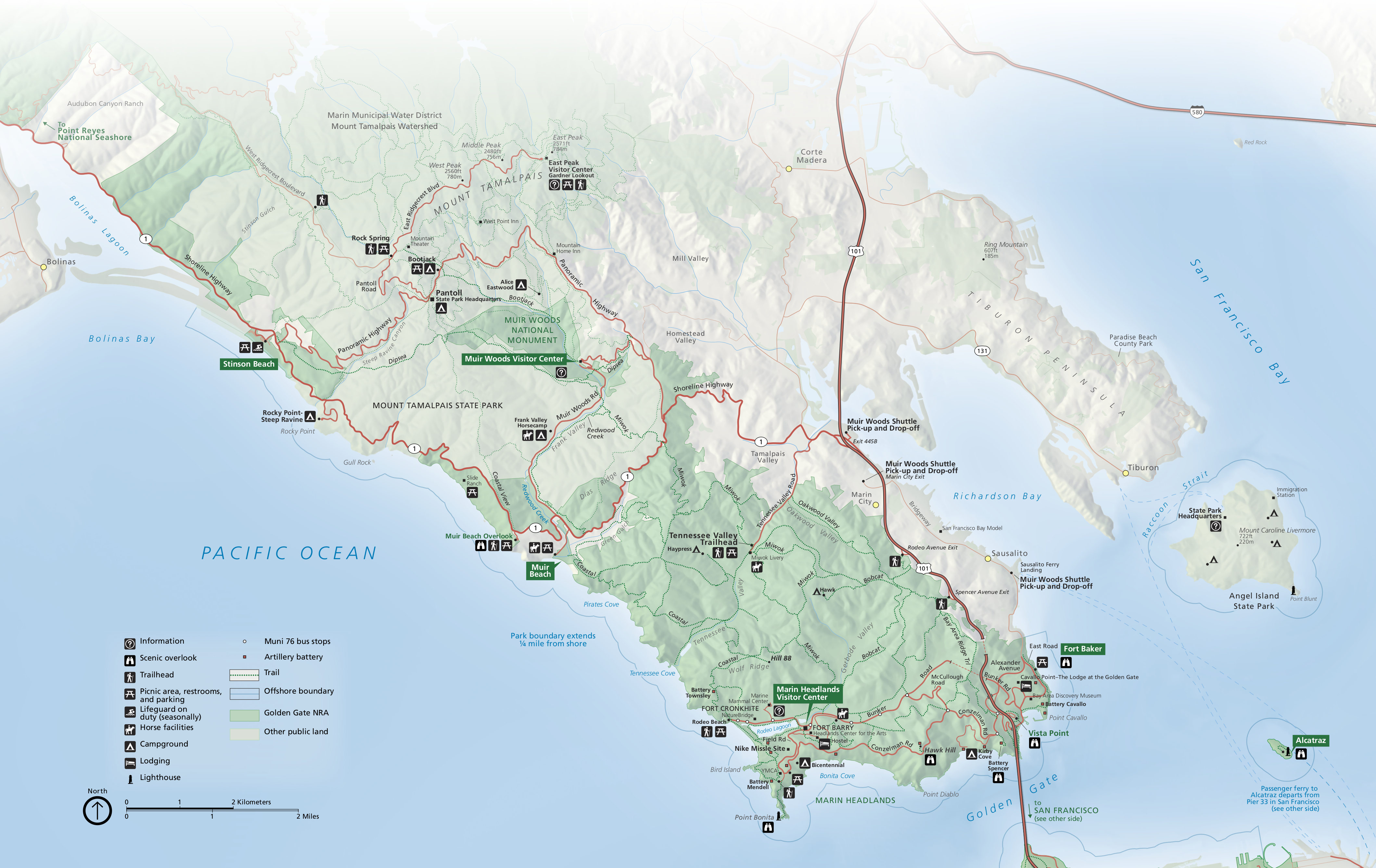 Here’s a north Golden Gate map (1.2 mb), focused on the park lands north of the Golden Gate Bridge, including the Marin Headlands and Muir Woods. This is labeled on the map above as “see below for detail.”
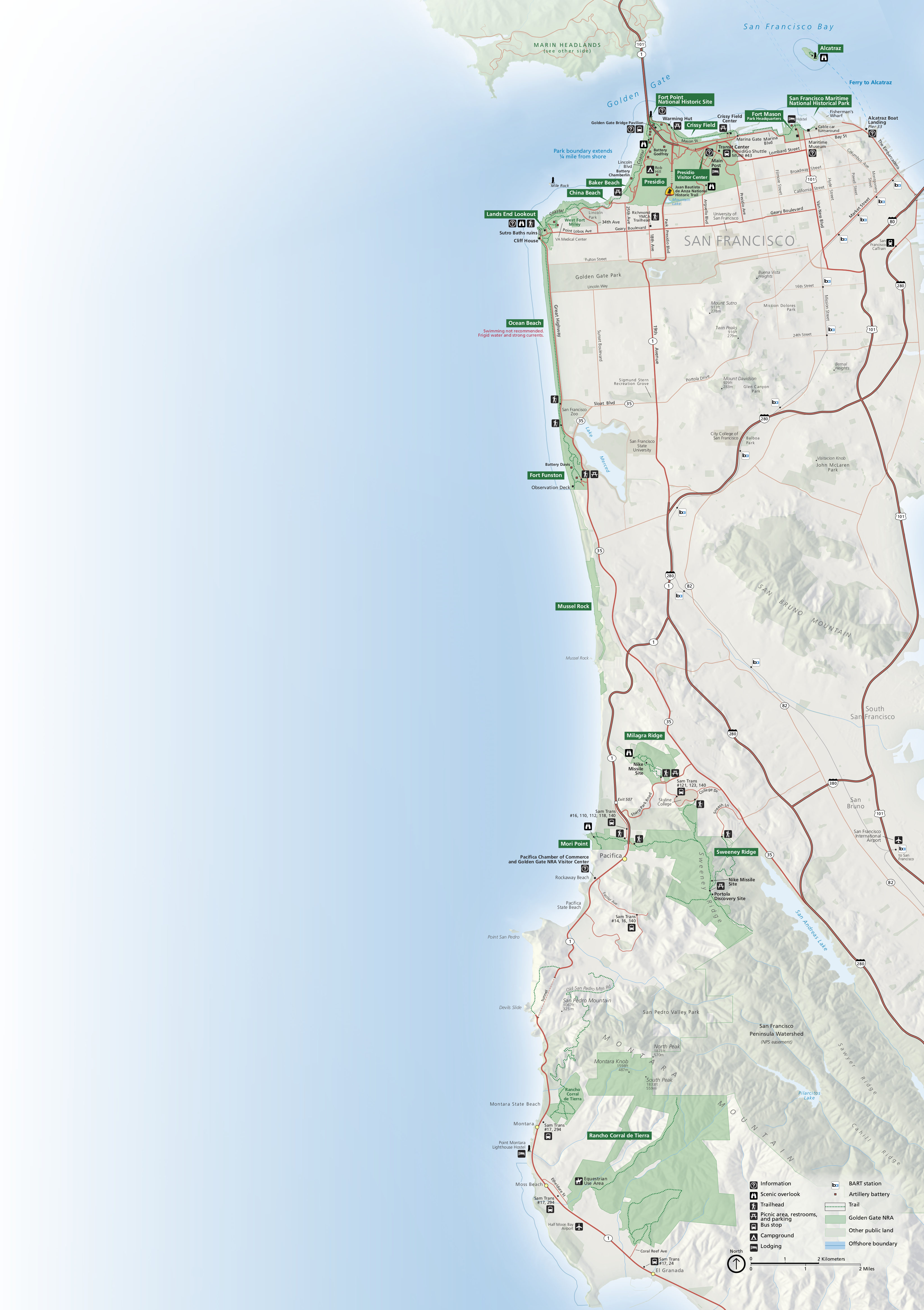 This is a south Golden Gate map (1.2 mb), labeled on the top map as “see other side for detail.” This map focuses on park lands south of the Golden Gate Bridge: Lands End, Fort Mason, Crissy Field, Presidio, etc.
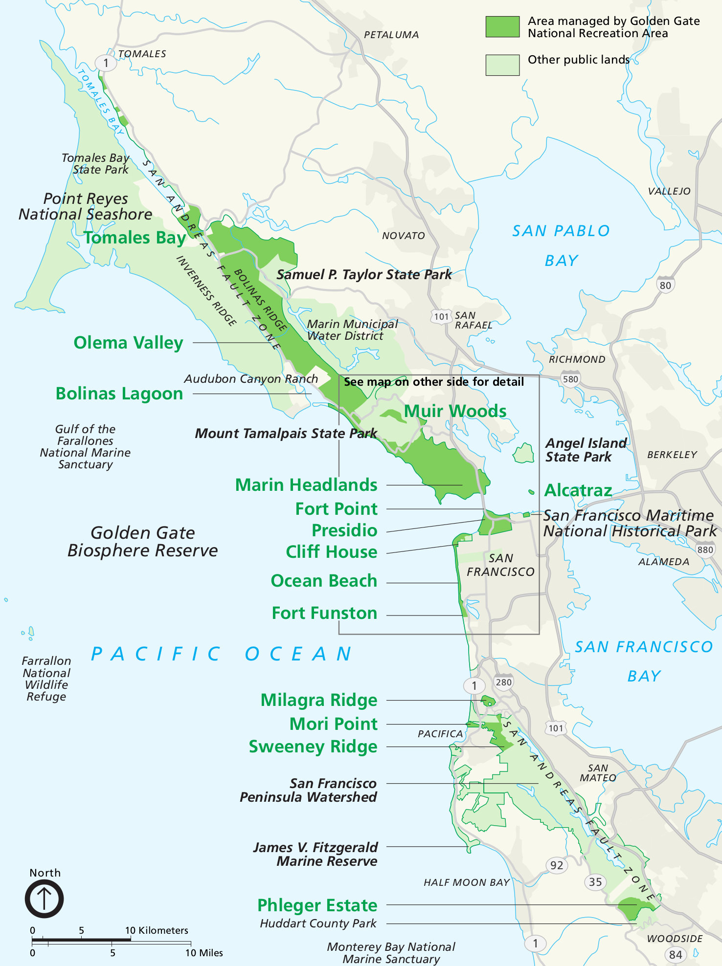 Here’s an older Golden Gate National Recreation Area map, flatter with fewer colors, making for easier legibility after printing. Click the image to view a full size JPG (500 kb) or download the PDF (600 kb).
 Here’s a Golden Gate detail map, zooming in on the area shown on the previous map as “see other side for detail.” Click the image to view a full size JPG (2.0 mb) or download the PDF (1.5 mb).
Muir Woods maps
Muir Woods is its own national park unit, but below I’ve included a few Muir Woods maps here since it’s managed by Golden Gate National Recreation Area. I also have a separate page for Muir Woods maps.
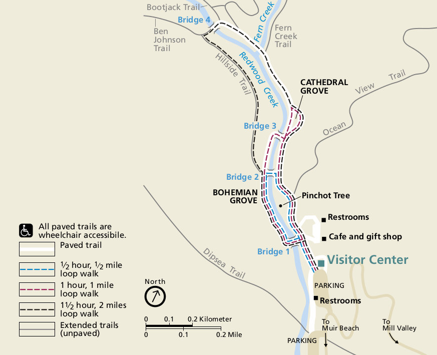 This is the official Muir Woods map from the brochure, showing the trails from the visitor center to the Cathedral Grove and Bohemian Grove. Click the image to view a full size JPG (85 kb) or download the PDF (650 kb).
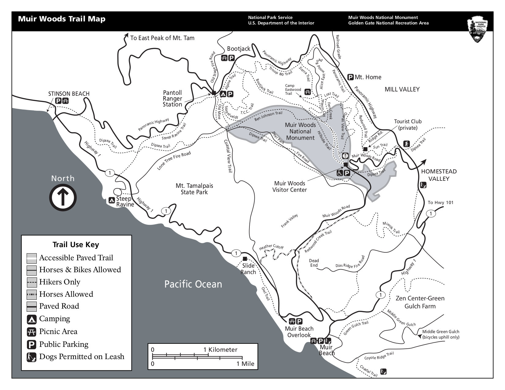 Here is a Muir Woods trail map that shows the hiking trails within Muir Woods National Monument as well as the surrounding area. Click the image to view a full size JPG (275 kb) or download the PDF (100 kb).
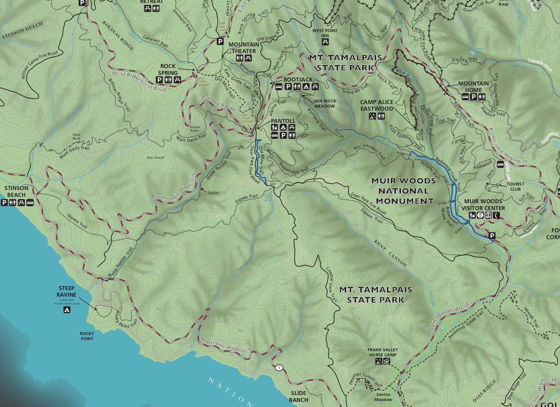 This Muir Woods trail map is full color and shows topographic lines for the entire region, including Muir Woods and Mount Tamalpais. Click the image to view a full size JPG (800 kb) or download the PDF (7.5 mb).
Alcatraz maps
Similarly, Alcatraz is its own national park unit, but below I’ve included two Alcatraz maps here since it’s also managed by Golden Gate National Recreation Area. You can also check out the Alcatraz maps page which includes several more historical maps of the prison.
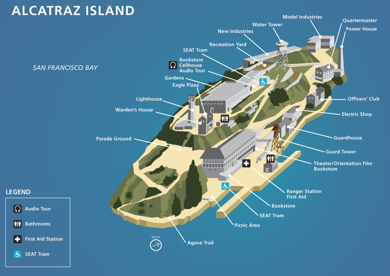 Here is the official Alcatraz map (200 kb) from the brochure, labeling the points of interest and showing the location of where to begin the cellhouse audio tour and other visitor facilities.
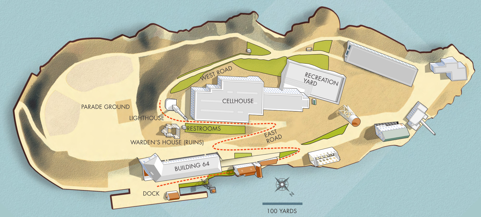 This is an overhead Alcatraz Island map (400 kb), showing the island from a top-down view including the route from the ferry dock to the cellhouse and lighthouse on top of the island.
Marin Headlands maps
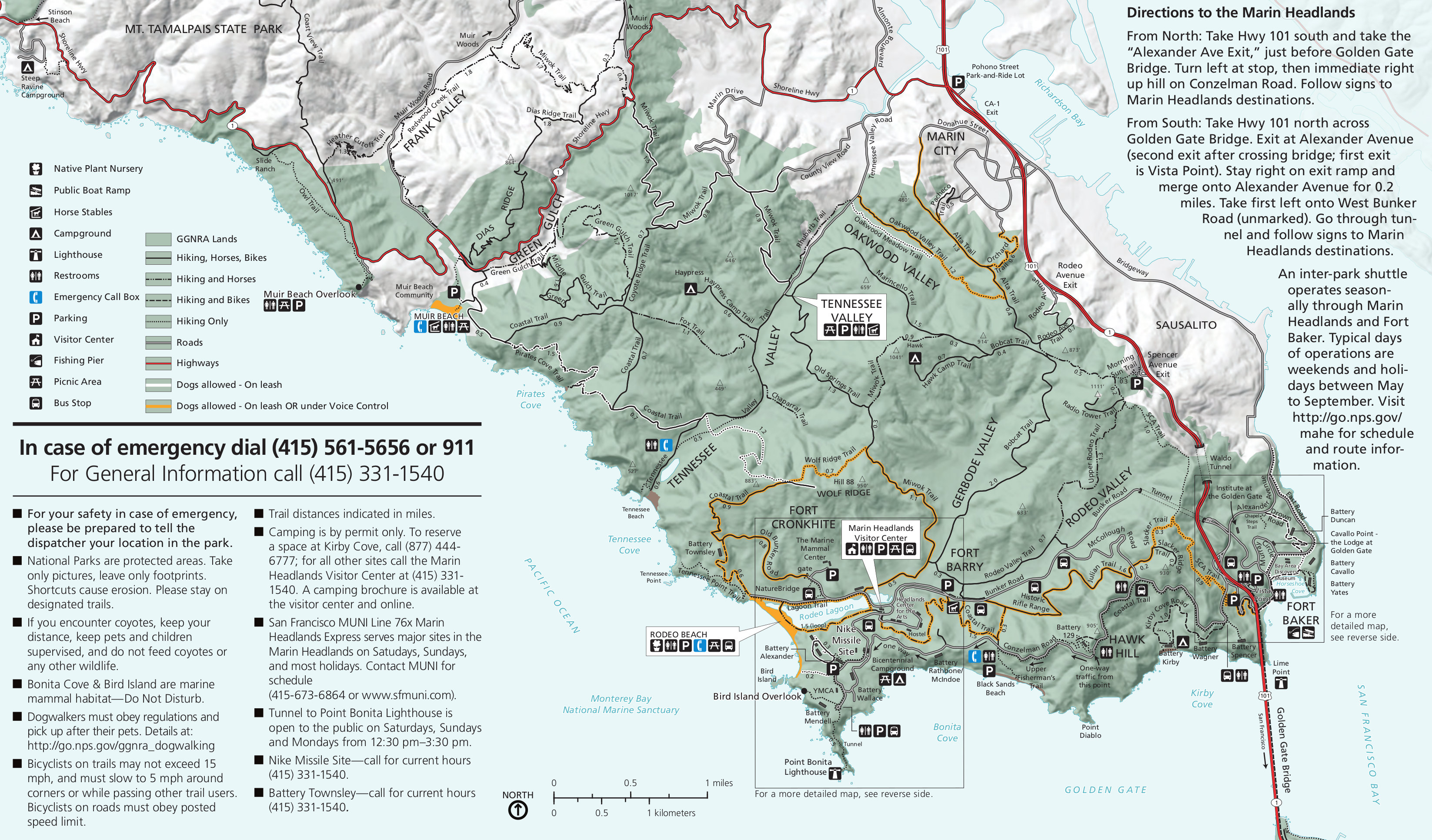 This Marin Headlands map (1.3 mb) shows the park lands immediately north of the Golden Gate Bridge – Fort Baker, Rodeo Beach, Point Bonita, and various campgrounds, visitor centers, and picnic areas.
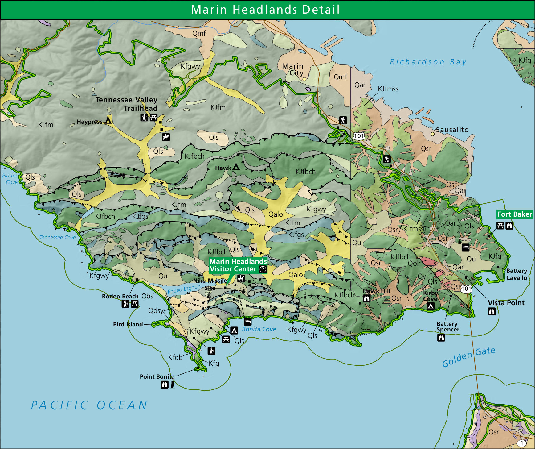
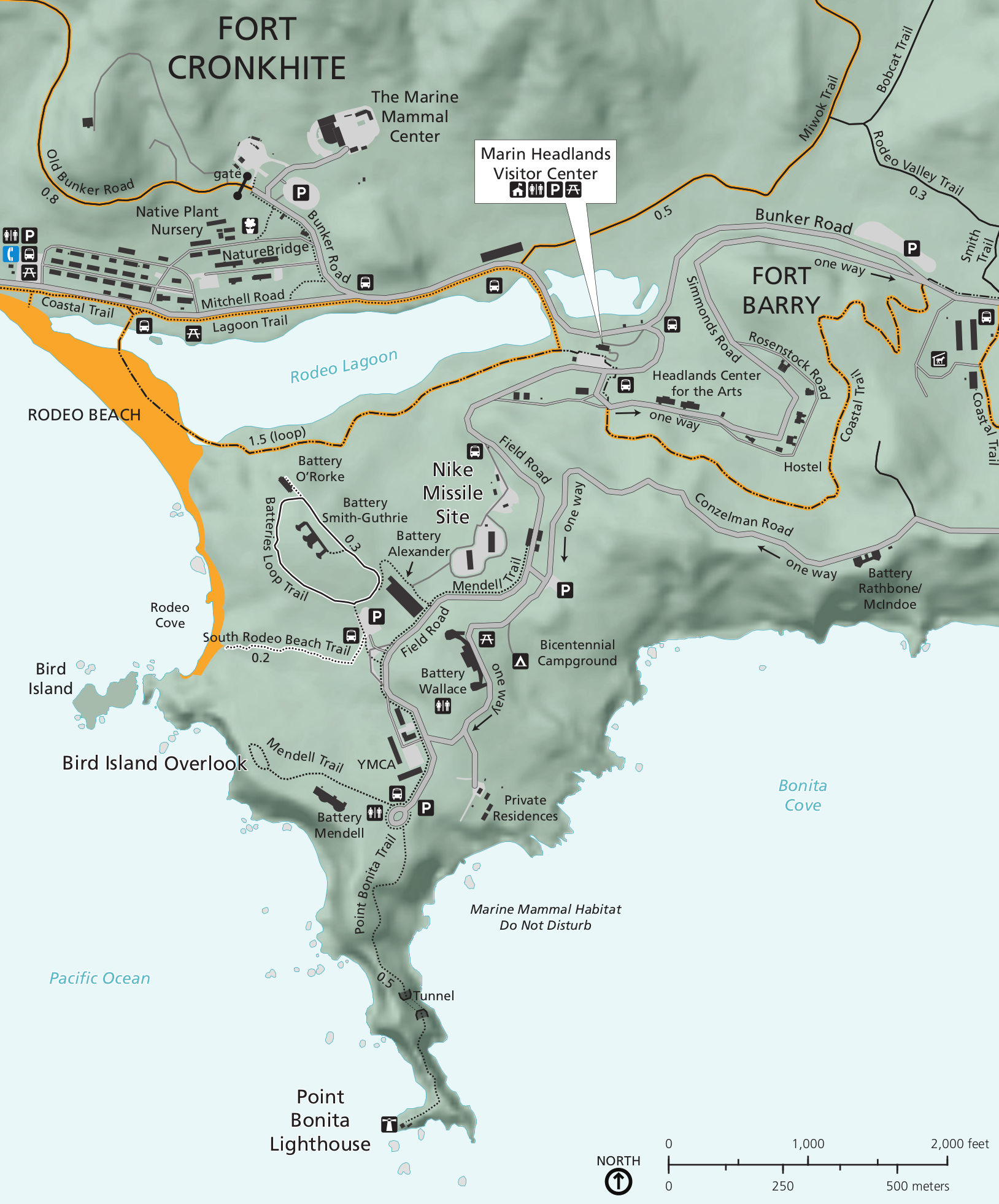 The Marin Headlands detail map (400 kb) zooms in on the west part of the previous map to the area around Rodeo Beach, the Nike Missile Site, Marin Headlands Visitor Center, and Point Bonita Lighthouse.
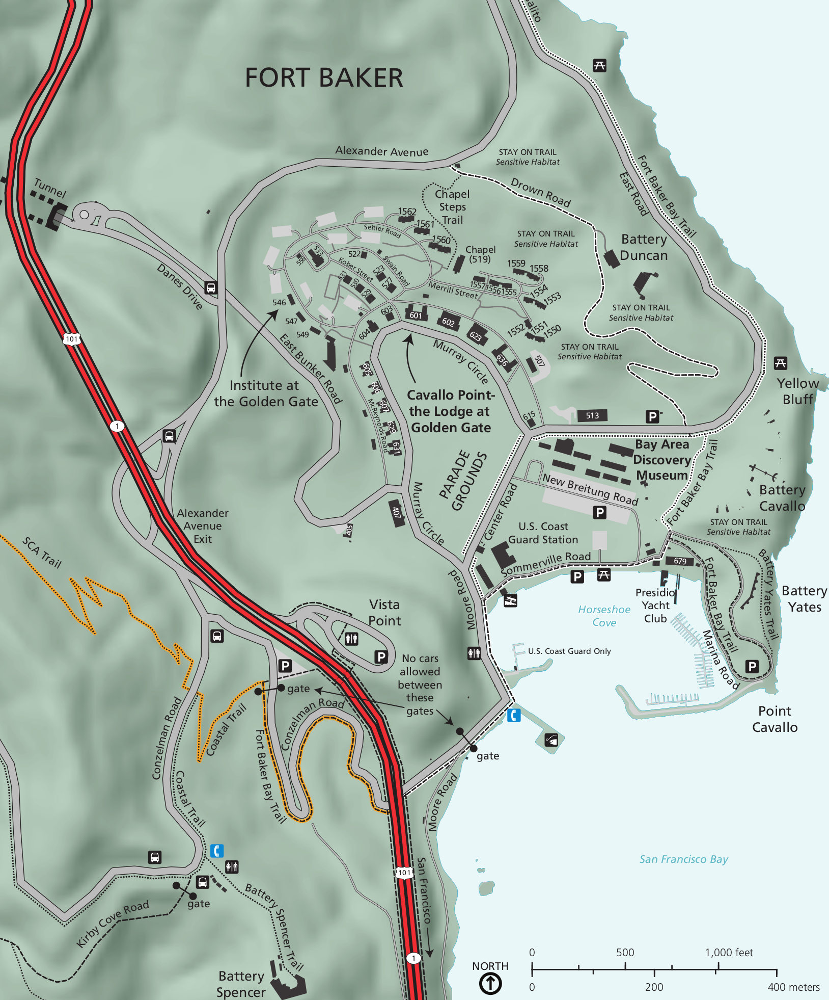 Here’s a Fort Baker map (500 kb), zooming in on the eastern section of the Marin Headlands map to show the the fort nestled in between U.S. 101 and Horseshoe Cove, just south of Sausalito.
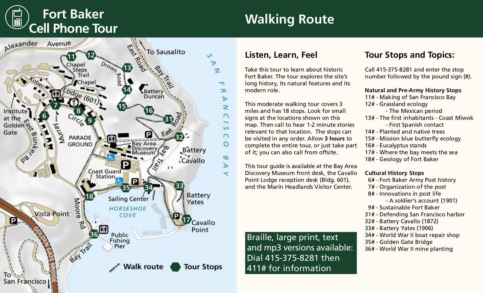 This Fort Baker walking tour map (300 kb) shows the route of the cell phone audio walking tour, numbering the stop locations. The tour takes about three hours, but you can call in and virtually take it from anywhere!
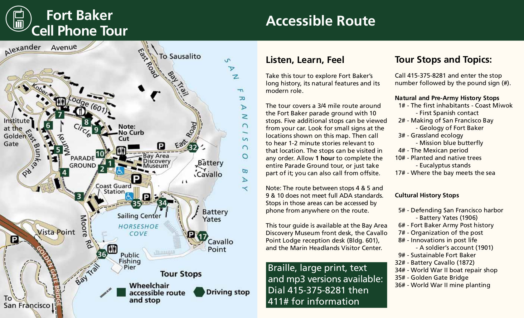 The Fort Baker accessible walking tour map (350 kb) provides an alternate self-guided tour that is suitable for wheelchairs and those with mobility issues. This one should take about one hour.
Lands End maps
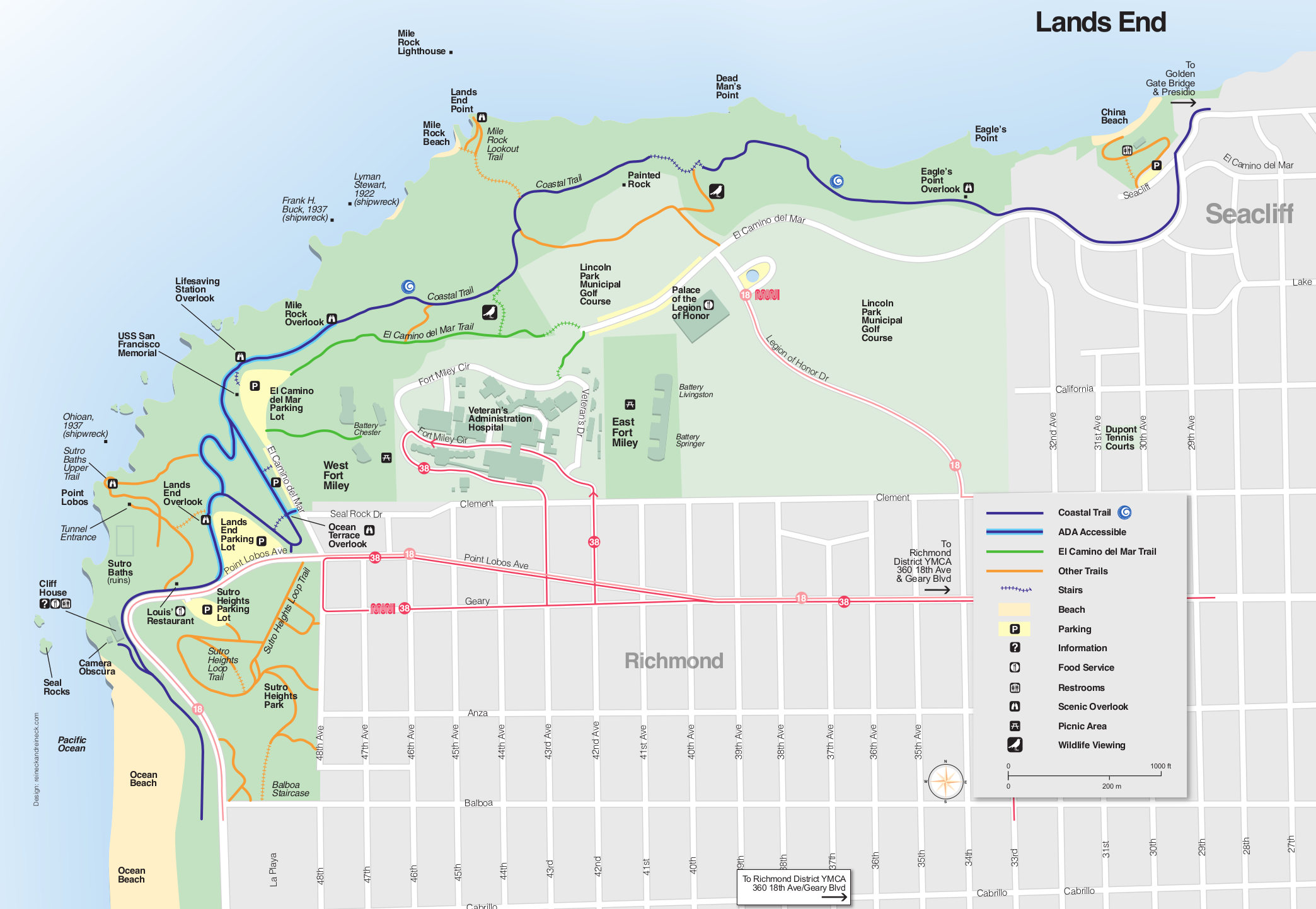 Here’s a Lands End map (350 kb), showing the northwest coast of San Francisco ranging from Ocean Beach to China Beach. Many trails are marked on this map, including those that are ADA accessible.
 The black-and-white Lands End map (700 kb) zooms out a bit further than the map above, showing the Coastal Trail all the way to the Presidio. Visitor services such as parking, food, and visitor centers are also shown.
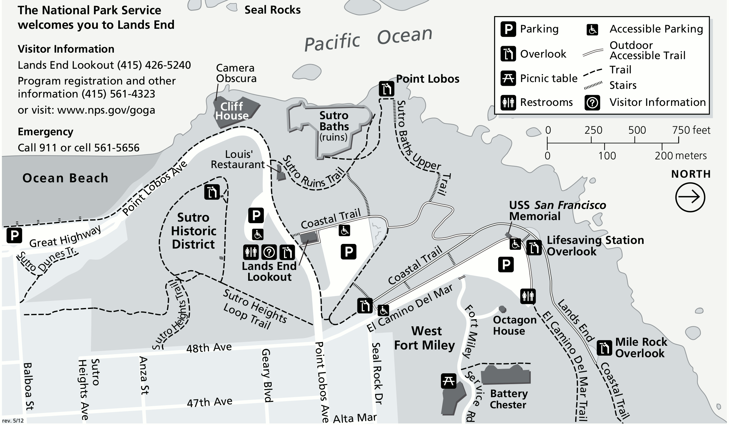 This Lands End detail map (300 kb) zooms in on the far northwest corner of Lands End, showing Point Lobos, the Sutro Bath ruins, the Cliff House, and the north end of Ocean Beach. (Note that north is to the right.)
Presidio and Fort Mason maps
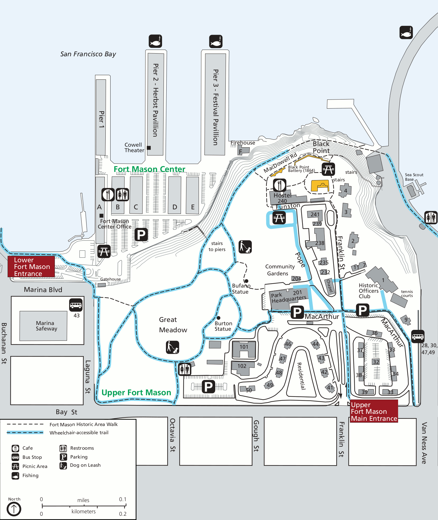 This Fort Mason map (300 kb) shows visitor services like parking, restrooms, picnic areas, and bus stops. It also details a historic area walk and wheelchair-accessible trail.
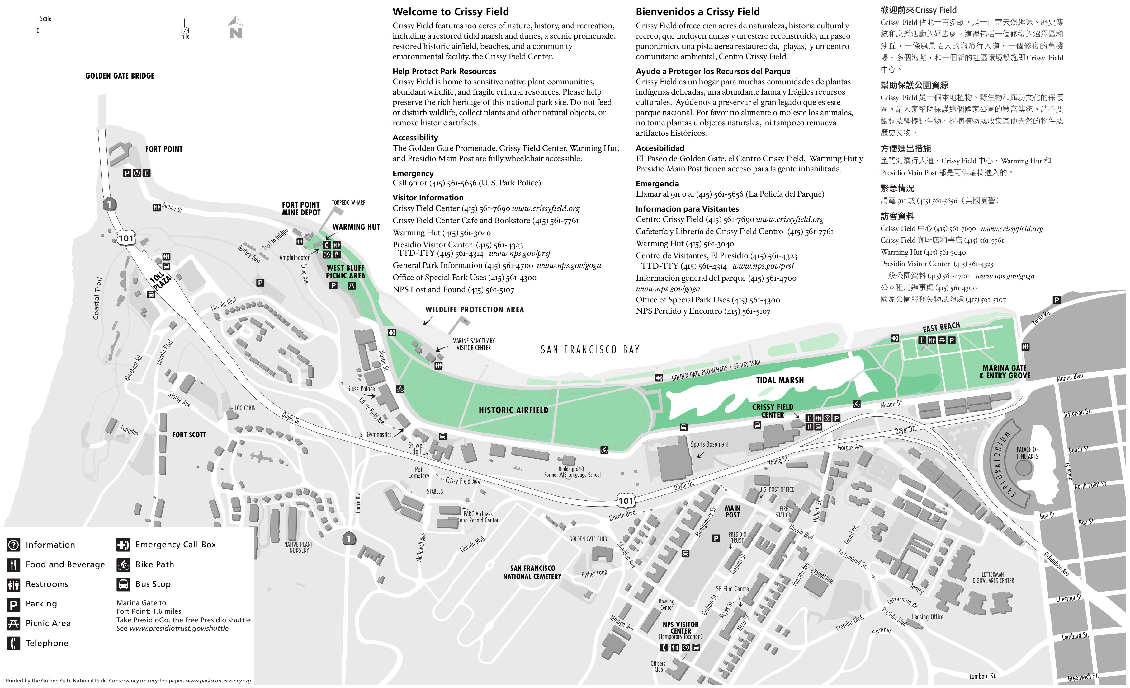 This Crissy Field map (1.0 mb) covers the area from the Golden Gate Bridge on the west to Fort Mason to the east, centered on the tidal marsh and historic airfield. Parking and visitor services are labeled.
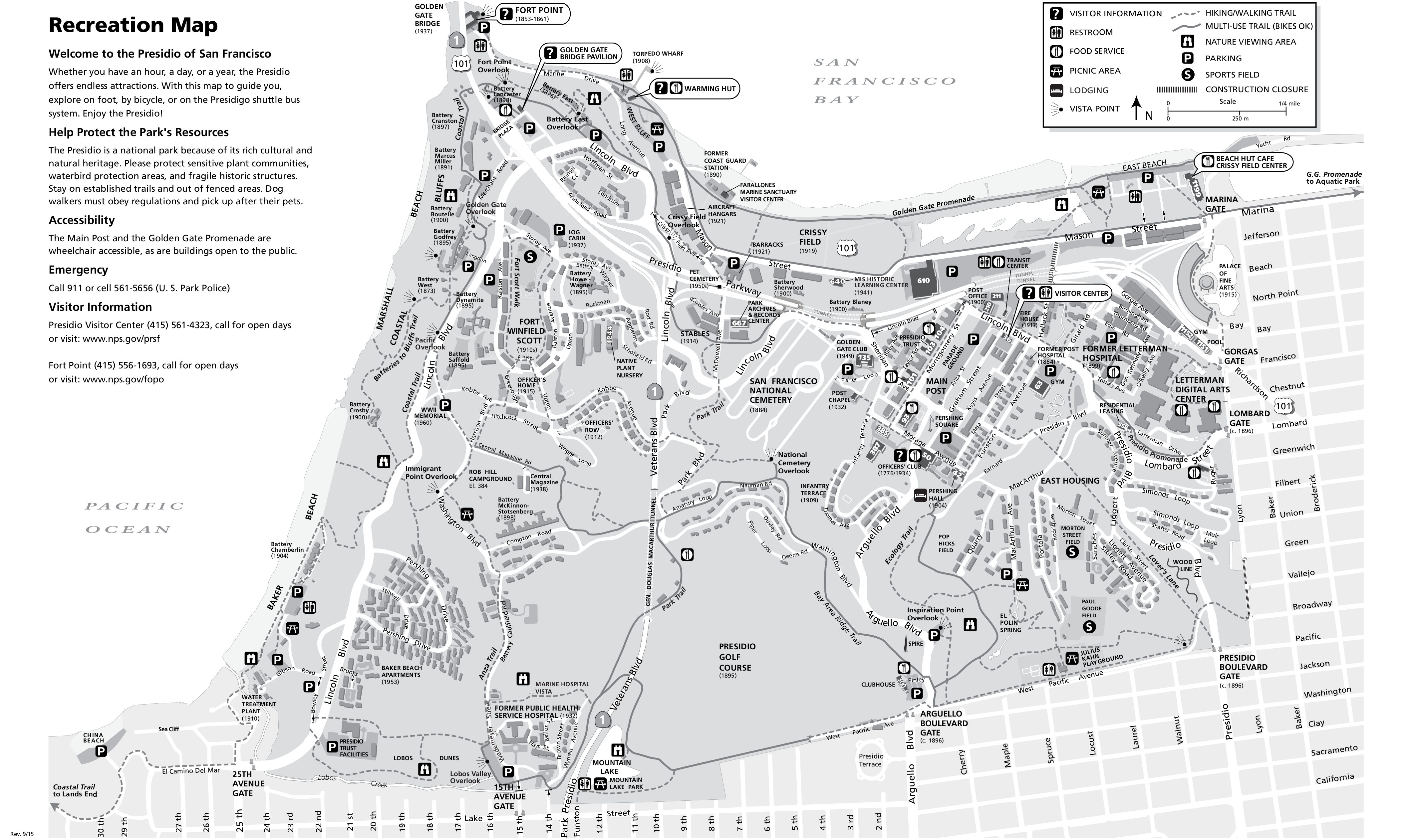
 Here’s a Presidio map (1.7 mb), labeling the walking paths, hiking trails, viewpoints, picnic areas, and other services. One interesting feature is that this map shows the dates of construction for Presidio buildings.
 The black-and-white Presidio map (1.4 mb) is virtually identical to the color map above. The key difference is that because it’s in grayscale, it’ll print a bit nicer if you only have a black-and-white printer.
 This is a Presidio vegetation map (350 kb), showing the types of ground cover found in the Presidio today. Also fun: it shows the former plant communities that covered this area before the Presidio was built.
Golden Gate beach maps
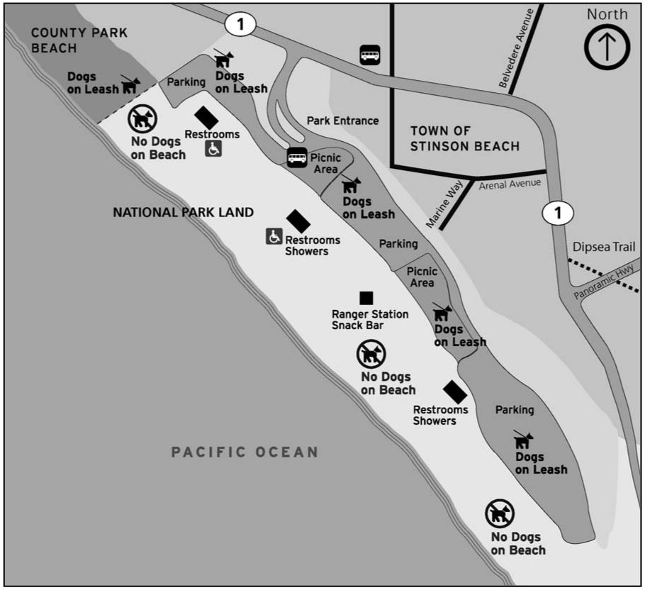 The Stinson Beach map (80 kb) shows this beach way up north, beyond the Marin Headlands and Mount Tamalpais State Park. Hike here from Muir Woods on the Dipsea Trail for beautiful views of coastal California.
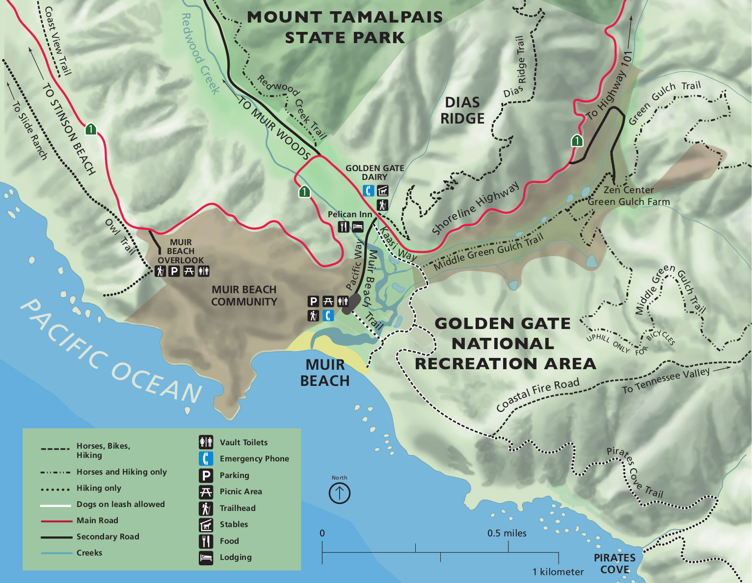 Here’s a Muir Beach map (300 kb), located between the Marin Headlands and Mount Tam. The map shows the nearby trails and overlooks, labeling picnic areas, parking lots, and other services.
Southern Golden Gate maps
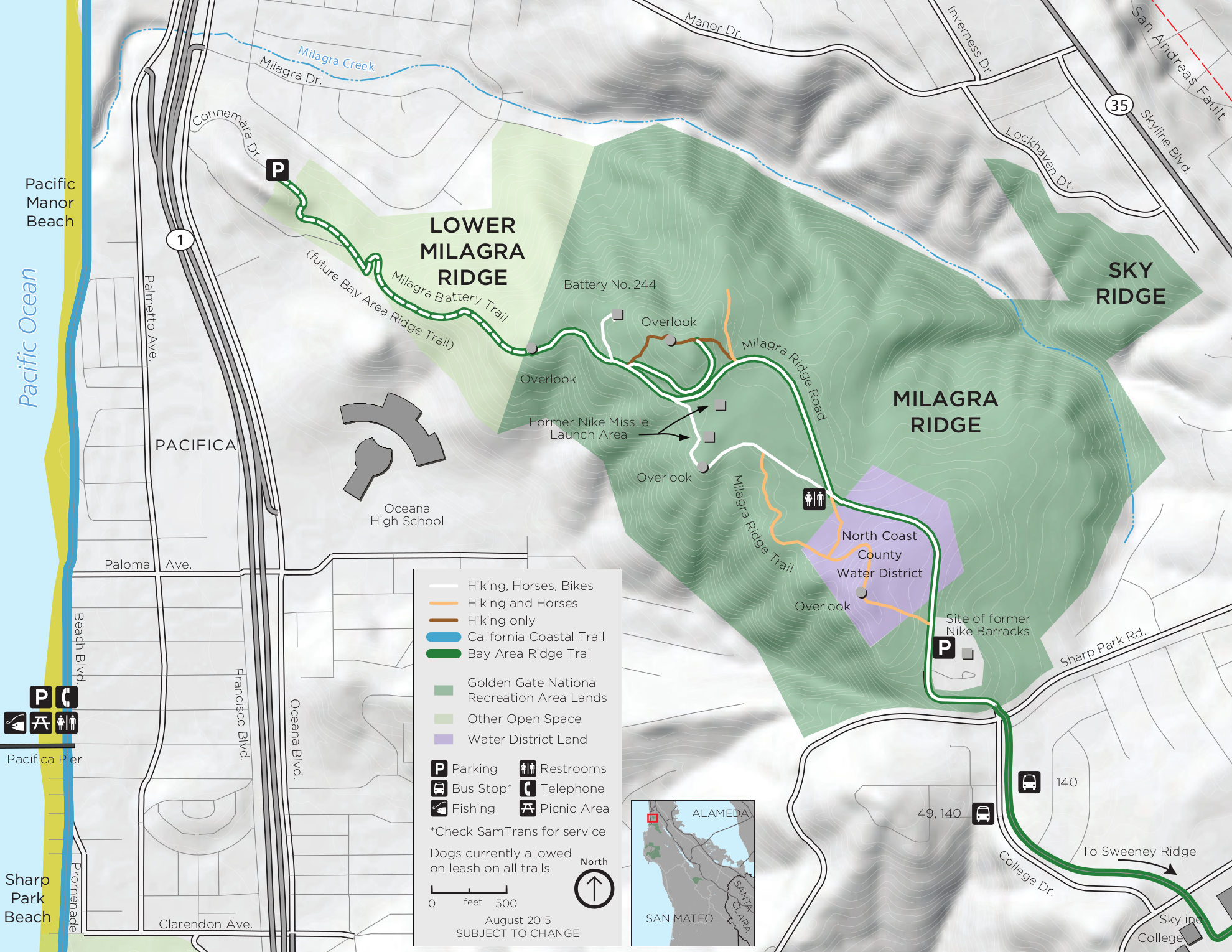 The Milagra Ridge trail map includes the former launch sites of Nike missiles as well as parking, restrooms, and trails. Click the image to view a full size JPG (500 kb) or download the PDF (900 kb).
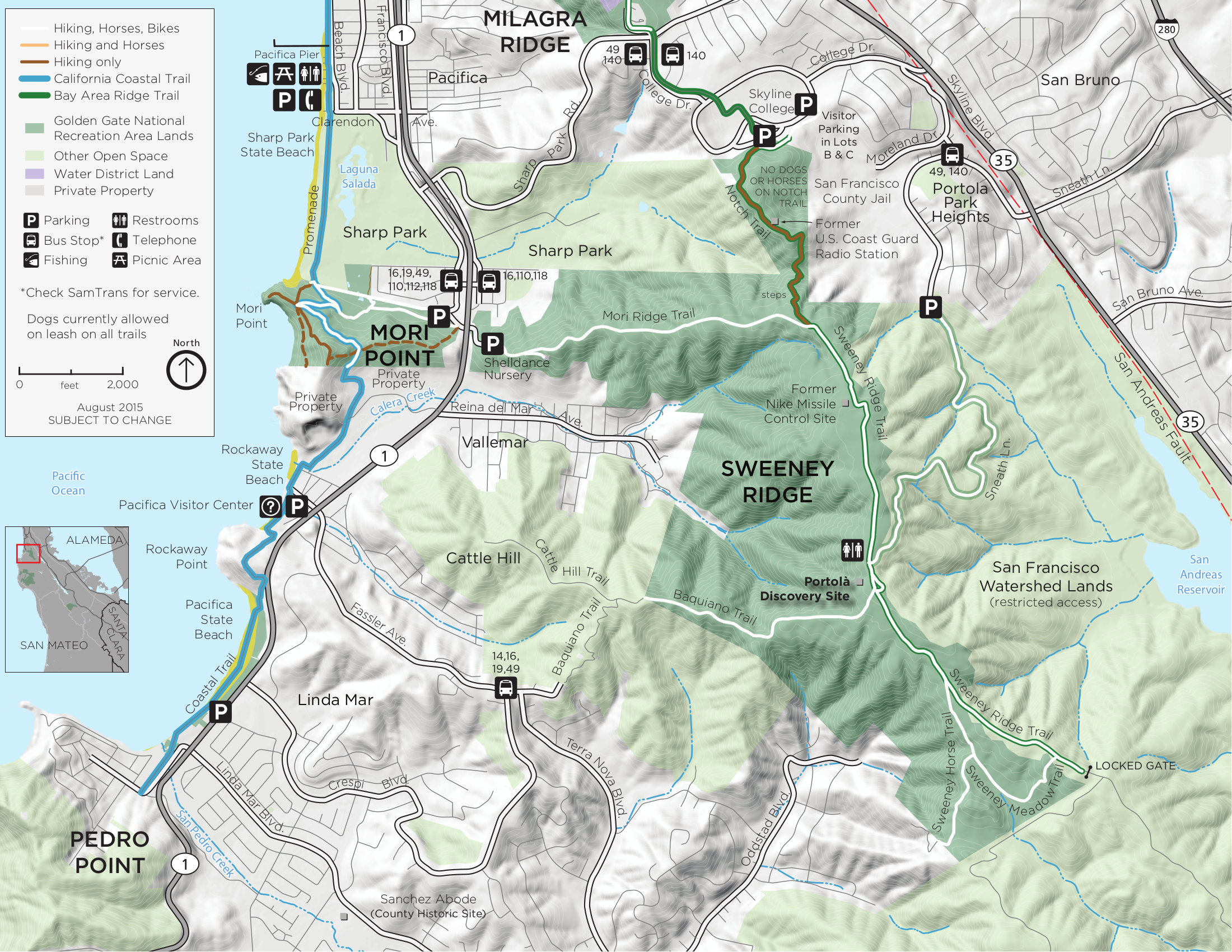 The Sweeney Ridge trail map zooms in on Sweeney Ridge and the surrounding landscape south of San Francisco. Click the image to view a full size JPG (800 kb) or download the PDF (5.5 mb).
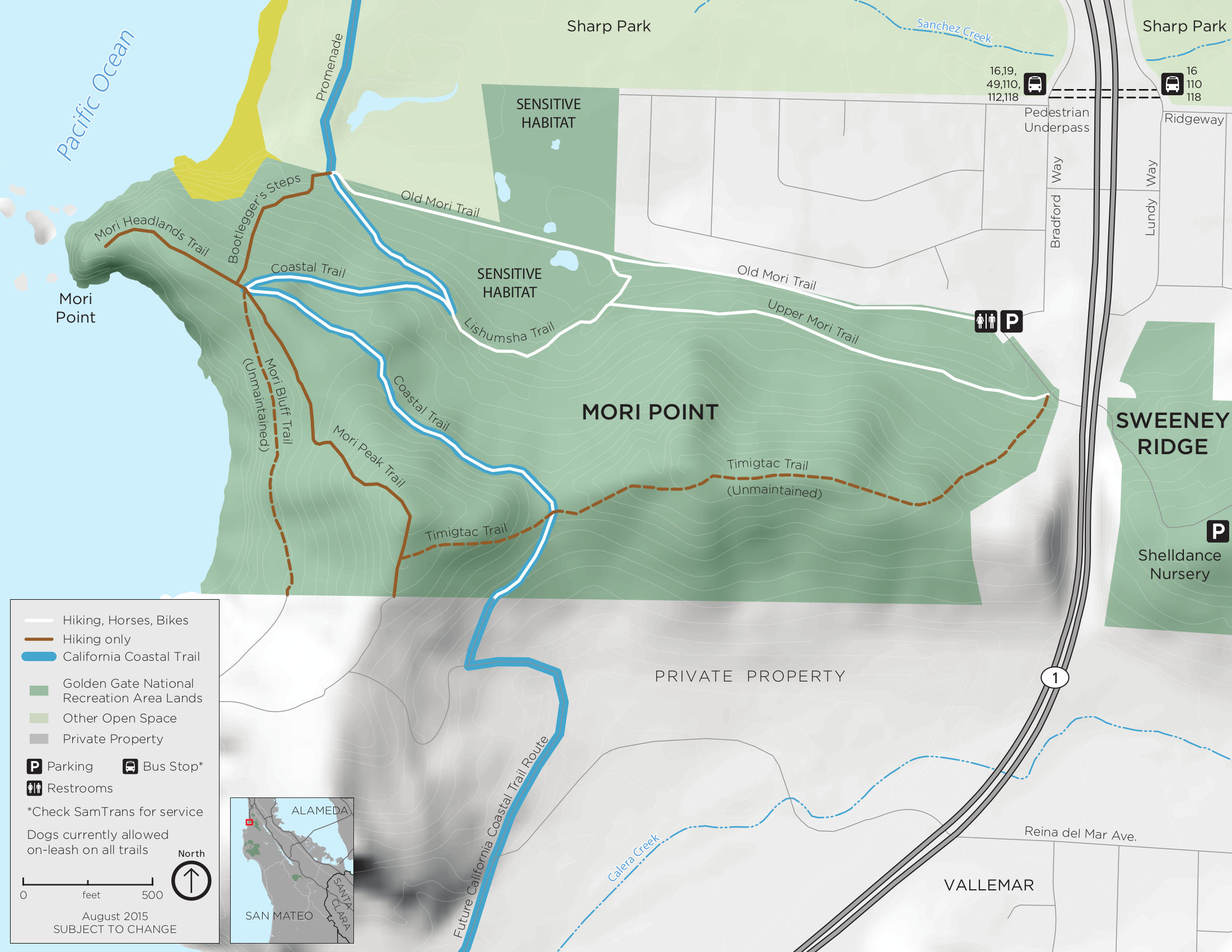 Here’s a Mori Point trail map showing additional detail of the trails near Mori Point, including topographic lines. Click the image to view a full size JPG (400 kb) or download the PDF (1.9 mb).
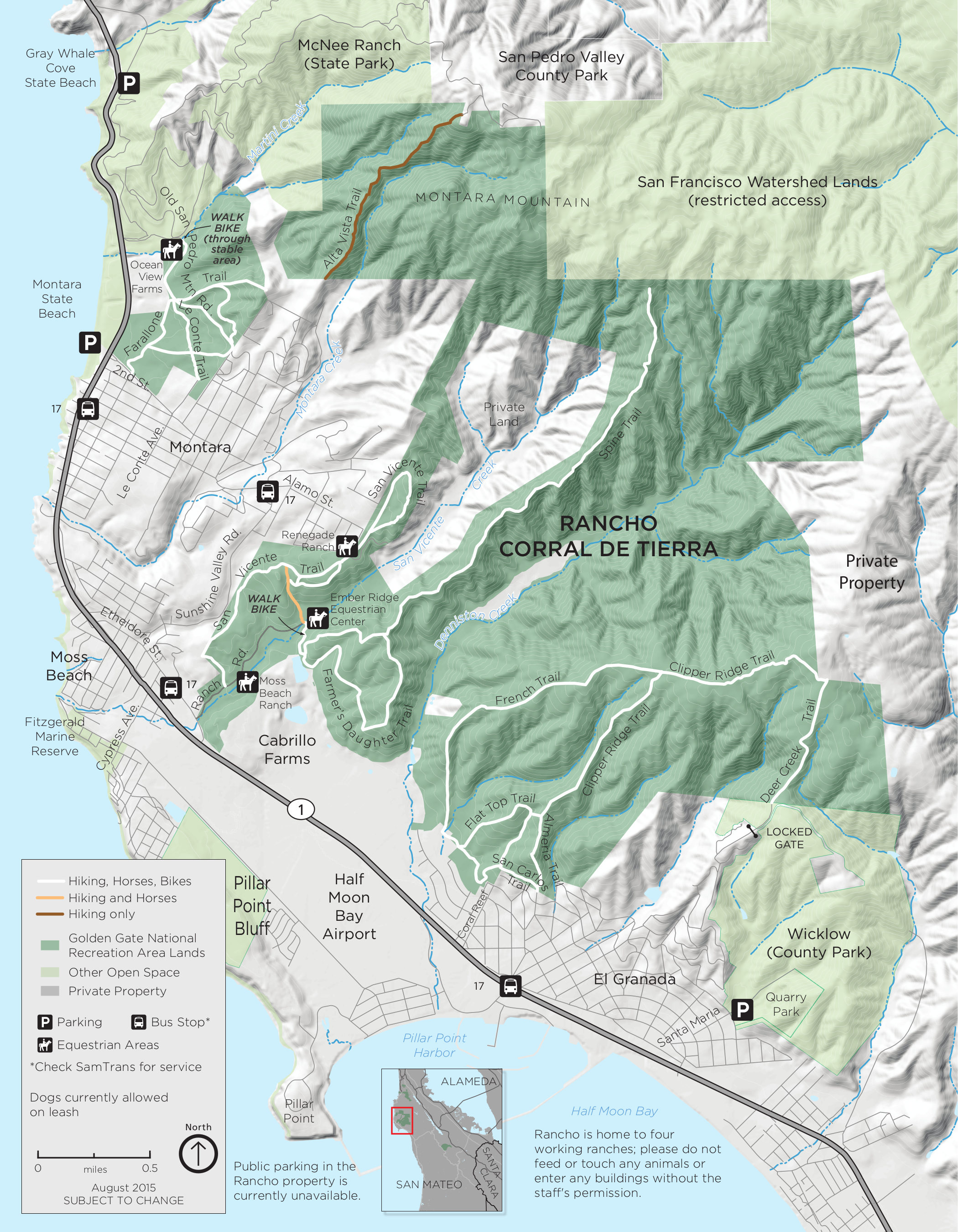 This is a Rancho Corral de Tierra map (1.0 mb), showing the newest lands of Golden Gate National Recreation Area south of San Francisco. These new lands are undeveloped and have no visitor services.
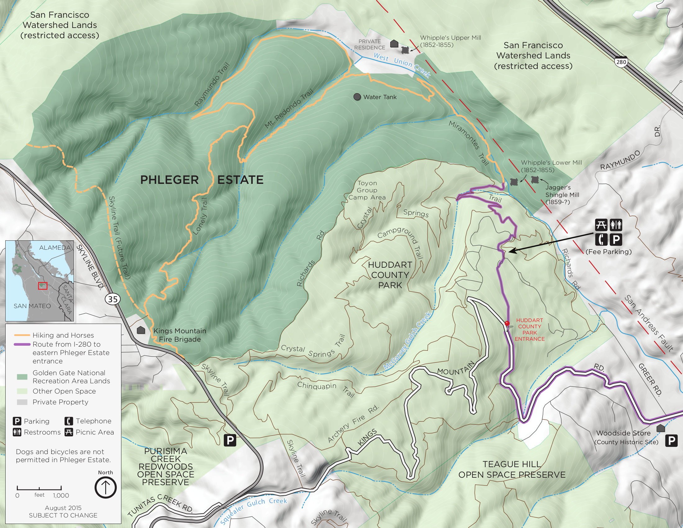 The Phleger Estate trail map (700 kb) shows the southernmost lands of the park nearby San Mateo and Palo Alto. The trails are most commonly accessed through Huddart County Park.
Golden Gate geologic maps
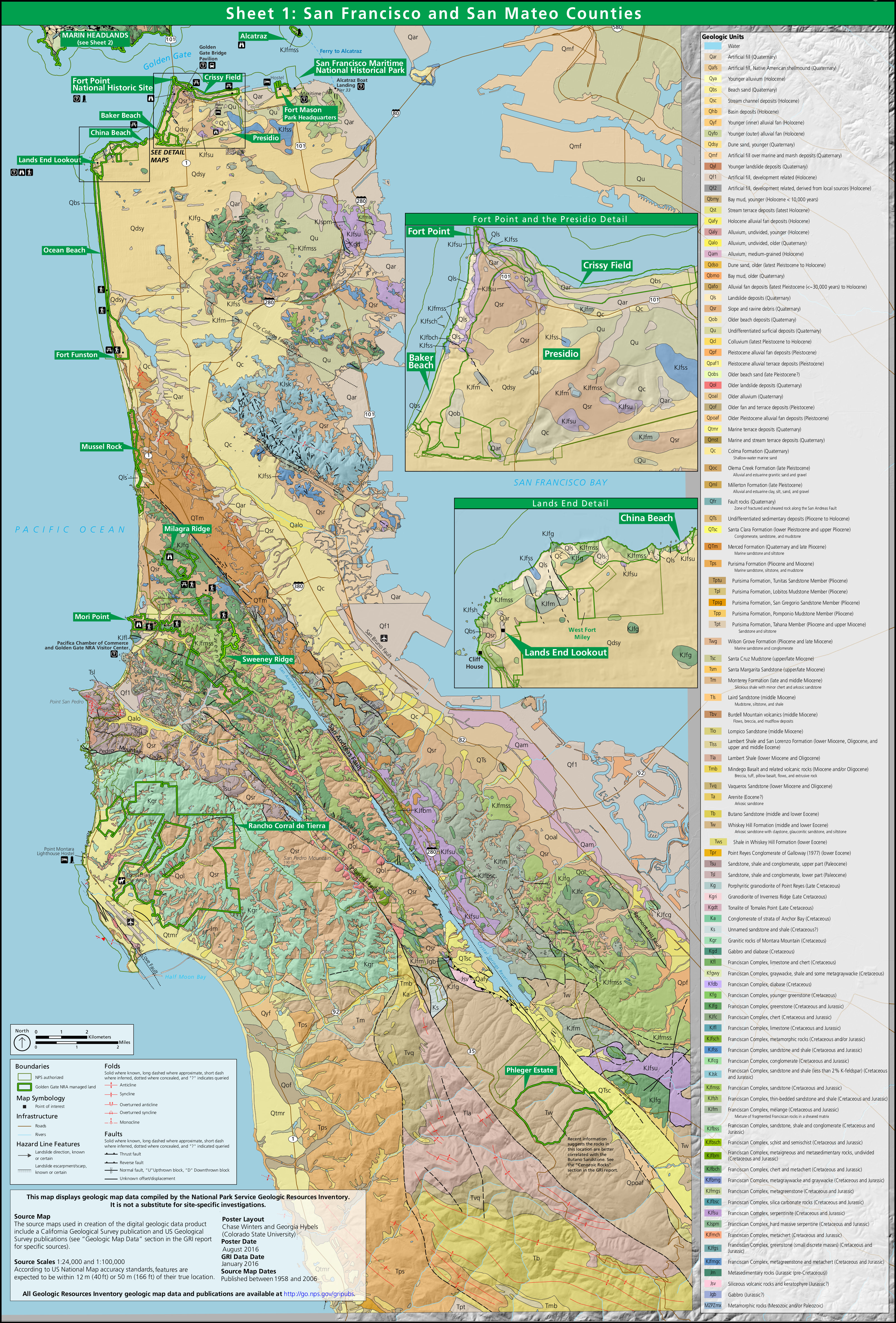 This San Francisco geologic map (3.8 mb) shows the rock types of the park lands in Golden Gate as well as the rest of San Francisco. A legend here shows the rock types you’ll find on each of these three maps.
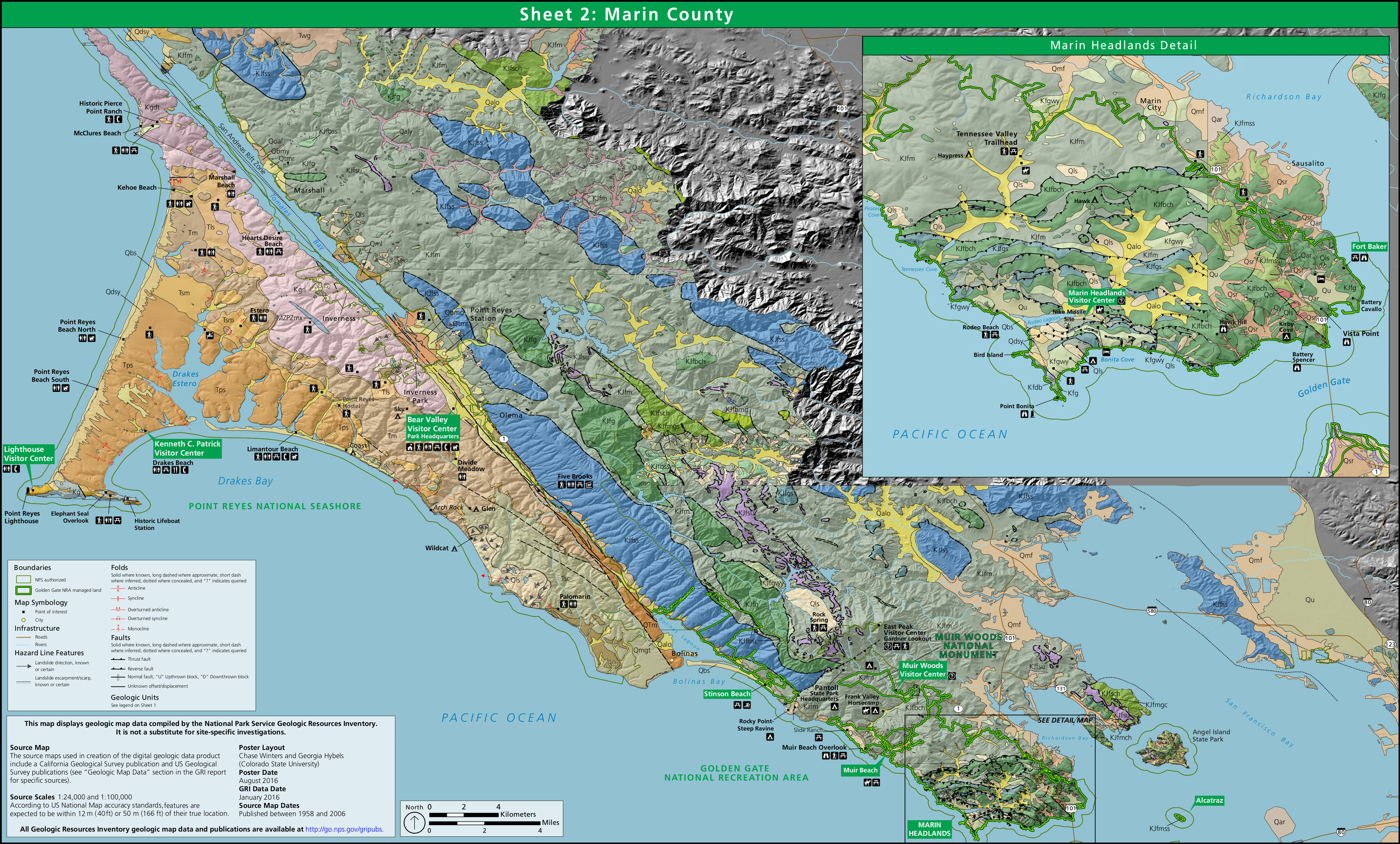 Here’s a Marin County geologic map (2.9 mb) that focuses on the park lands and surrounding area north of the Golden Gate Bridge in Marin County. You’ll also see Point Reyes National Seashore included as well.
 The Marin Headlands geologic map (550 kb) focuses only on the land immediately north of the Golden Gate Bridge. It’s also shown as an inset in the map above, but I’ve cropped it down in case this is all you want.
…and more!
< Return to National Park Maps home
< Return to Park List
< Return to List by State
Need more help? Browse Amazon’s best-selling San Francisco maps and guidebooks.