North Cascades map from the park brochures
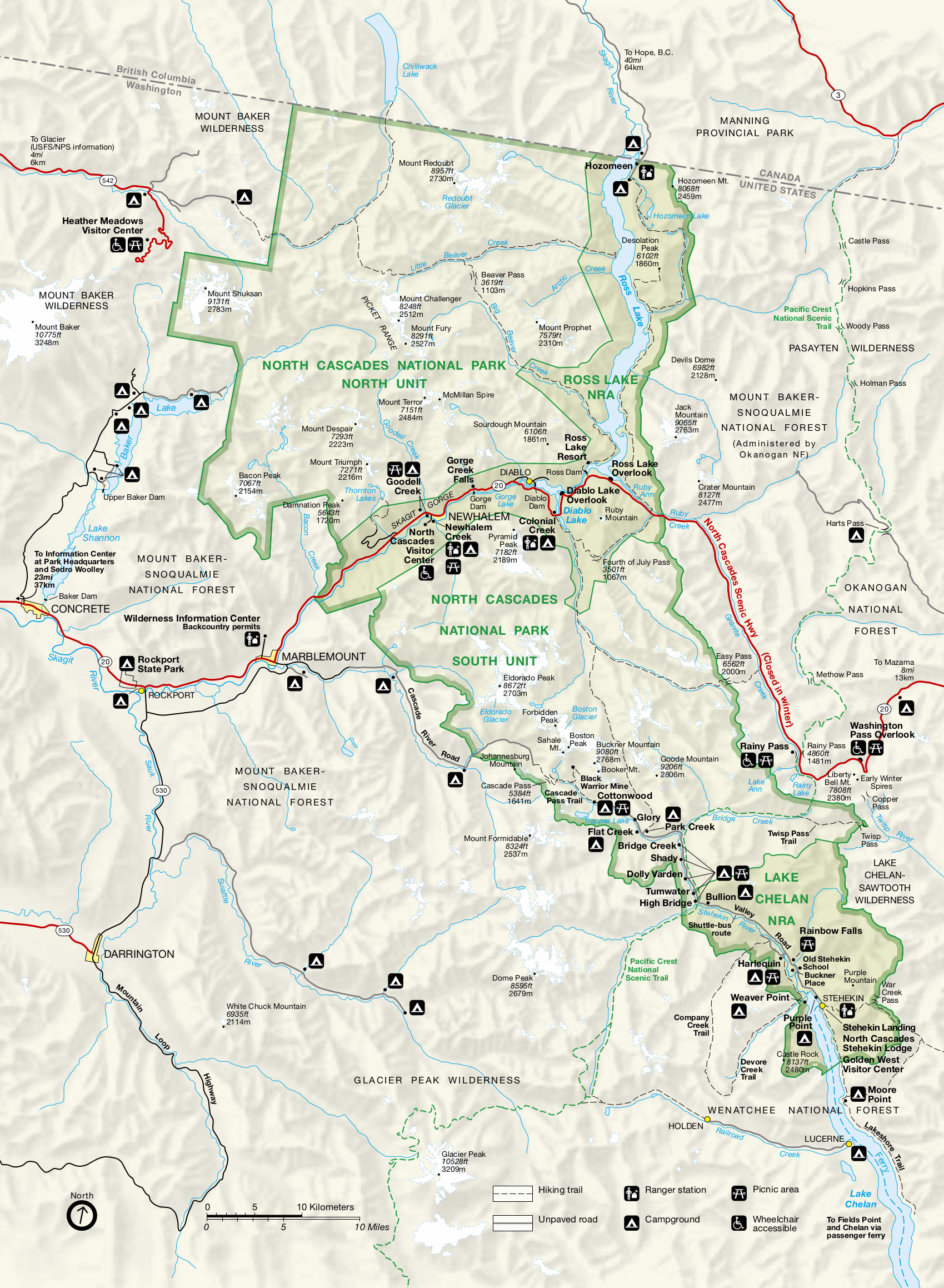 This is the complete North Cascades map from the official brochure, showing all the trails, roads, and points of interest. Click the image to view a full size map or download the PDF.
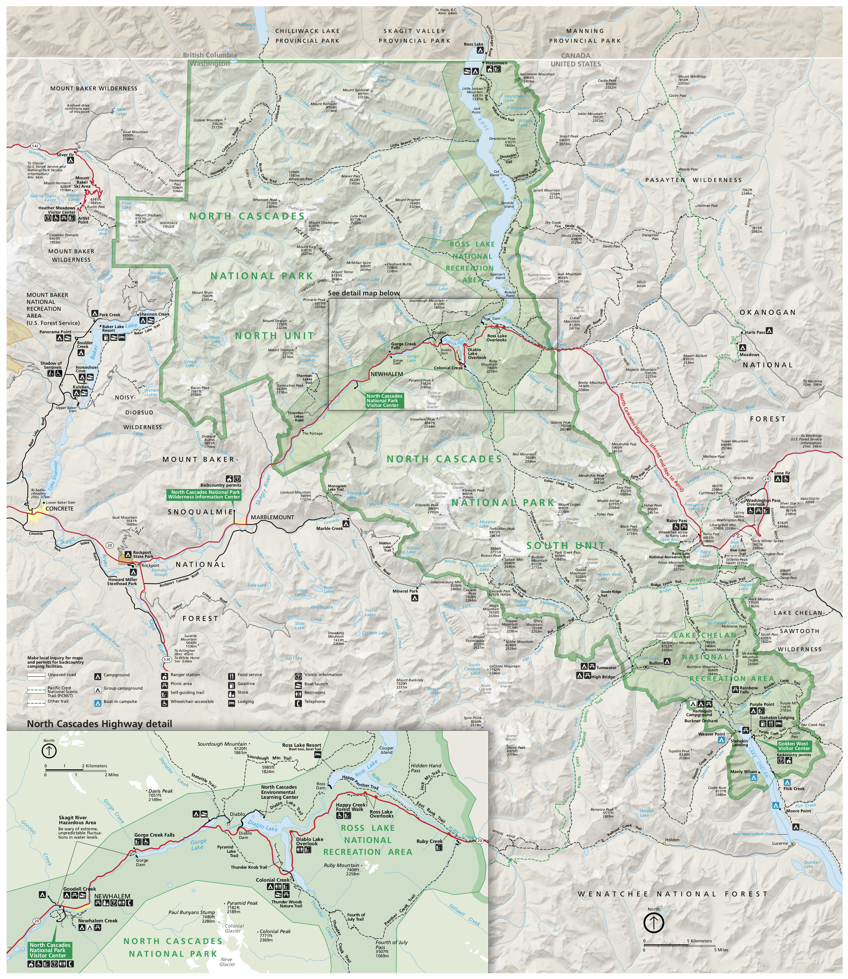
 This is a detail map of the North Cascades Highway, showing the areas around Ross Lake, Diablo Lake, and Gorge Lake in additional detail including hiking trails, camping, picnic areas, and services.
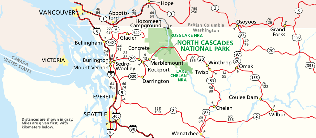 This is a regional map of North Cascades National Park that shows the park’s location relative to Vancouver, Bellingham, and Seattle. Click the image to view a full size map or download the PDF.
 This is a map of North Cascades that’s better for printing. It’s the older style so it doesn’t look quite as nice, but the fewer colors means it’s a bit easier to read if you print it at home.
North Cascades trail map
 North Cascades as an incredibly wild and remote park full of primitive trails, campsites, and wilderness areas. If you’re going to be hiking or backpacking, you absolutely need a topographic map such as the National Geographic Trails Illustrated map, which also shows trail mileages between junctions and points of interest. The remoteness of North Cascades is a big part of what makes the park so special!
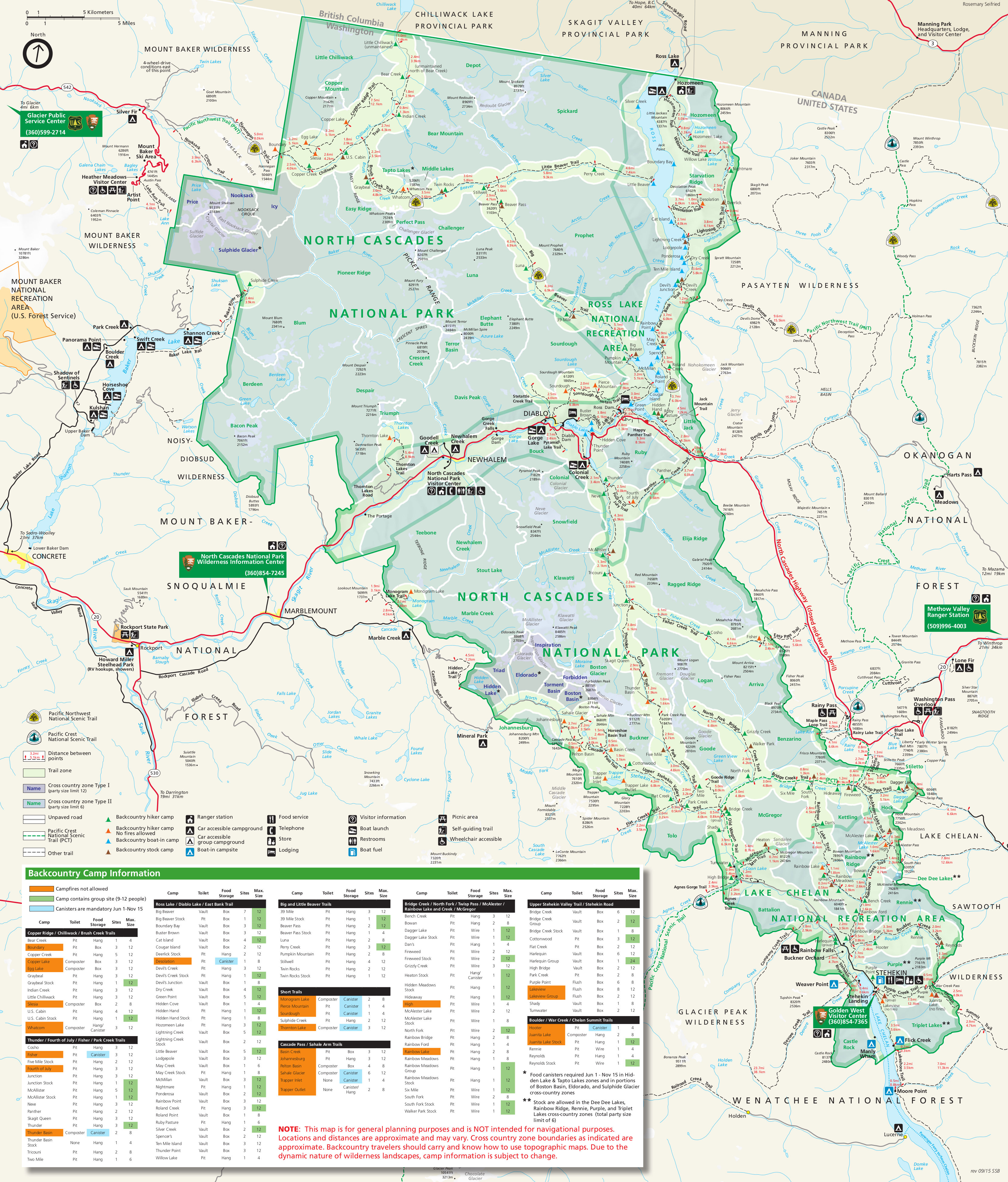 Here’s a North Cascades wilderness map, which is great for trip planning, including campsites and trail mileages. Don’t use it for navigation, though – it’s not detailed enough for that!
North Cascades landscape maps
 This amazing North Cascades painted map was created for the National Park Service by Austrian artist Heinrich Berann. Don’t you just want to hang this up and stare at it for hours?
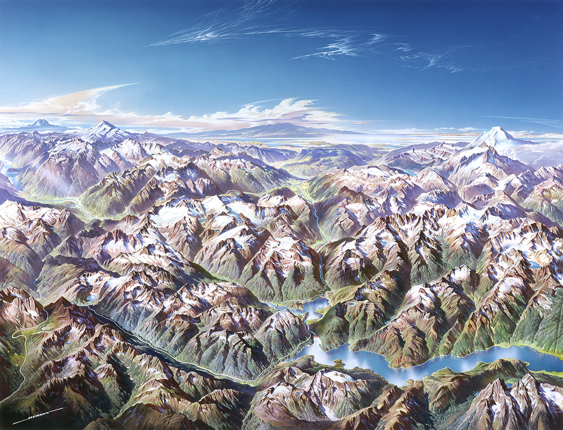 This unlabeled landscape map of North Cascades is the same as the map above but with the labels removed, providing a more natural perspective of this part of northern Washington.
North Cascades lodging map
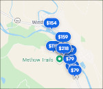 North Cascades is pretty remote, so there’s not an obvious town to stay in when visiting. Many stay on the west side off I-5, but my favorite location is Winthrop, the cool town on the east side in the beautiful Methow Valley. To the right is an Expedia interactive lodging map that shows the Winthrop hotel locations. You may also want to view out Expedia’s top-rated Winthrop lodging to compare photos and ratings.
…and more!
< Return to National Park Maps home
< Return to Park List
< Return to List by State