I hope everyone’s been having a good winter holiday season so far! I’m happy to report that I’ve created a few new pages, putting me over 1,200 maps for the first time.
 Although it’s not a heavily-visited park — it’s way down on the Mexican border in Arizona — I dug up 11 maps for the Organ Pipe Cactus maps page. Although I wouldn’t recommend a summer visit, the desert can be beautiful in the spring!
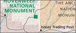 I unfortunately don’t have much yet for Hovenweep maps, but I’m hoping I’ll have more soon. There are some incredible parks in this part of the country for those fascinated by human stories – stay tuned for more pages soon.
 The National Mall maps page was a bit tricky, as I couldn’t decide whether to also include parks that are also nearby the Mall even if they’re managed as a separate park unit. In the end, I decided to keep parks like President’s Park (The White House) on separate pages, but with links back and forth for easy access.
 White House maps gets its own page since I was able to dig up enough different maps that I didn’t want to clog up the National Mall maps page. Technically this should be called “President’s Park maps,” but how many people out there know that President’s Park is the official name for the White House park grounds? For clarity, I decided White House Maps worked much better.
 I replaced the campground maps on the
  I uploaded a couple new full-park
  I uploaded some beautiful terrain maps to the
 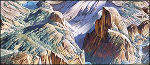 I added some amazing looking Heinrich Berann map paintings to a few parks:
  I gave the upper Midwest some love with
  My most requested park was Buffalo National River, so I present to you
  Poor Mississippi had been shut out so far, but I got
  In Mississippi, when it rains, it pours so I continued that tradition by uploading my second Mississippi park in a row with
  And more for Tennessee!
 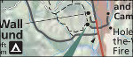 Now a quick jaunt west, to get the missing Mojave desert park,
  Up north: my fifth cave park and third Oregon park added:
  And finally, a traveling a little bit northeast from Oregon, we have
 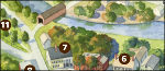 My apologies to the entire state of Vermont; I am deeply sorry if I’ve offended Ben, Jerry, or Bernie Sanders. So today I gave Vermont some love and added
  So, which is the lucky page? Why it’s none other than
  Oh, but that’s not all – I actually have a second exclusive to share with you! This one is slightly less exciting, however; it’s just a campground map for East Portal Campground on the
  But I haven’t just been sitting here content with only a few exclusives. Nope; enjoy the 28 maps I’ve just uploaded to the new