Organ Pipe Cactus maps from the park brochure
 This is the official Organ Pipe Cactus National Monument map from the park brochure, showing the entire monument including roads, trails, and campgrounds. Click the image to view a full size map or download the PDF.
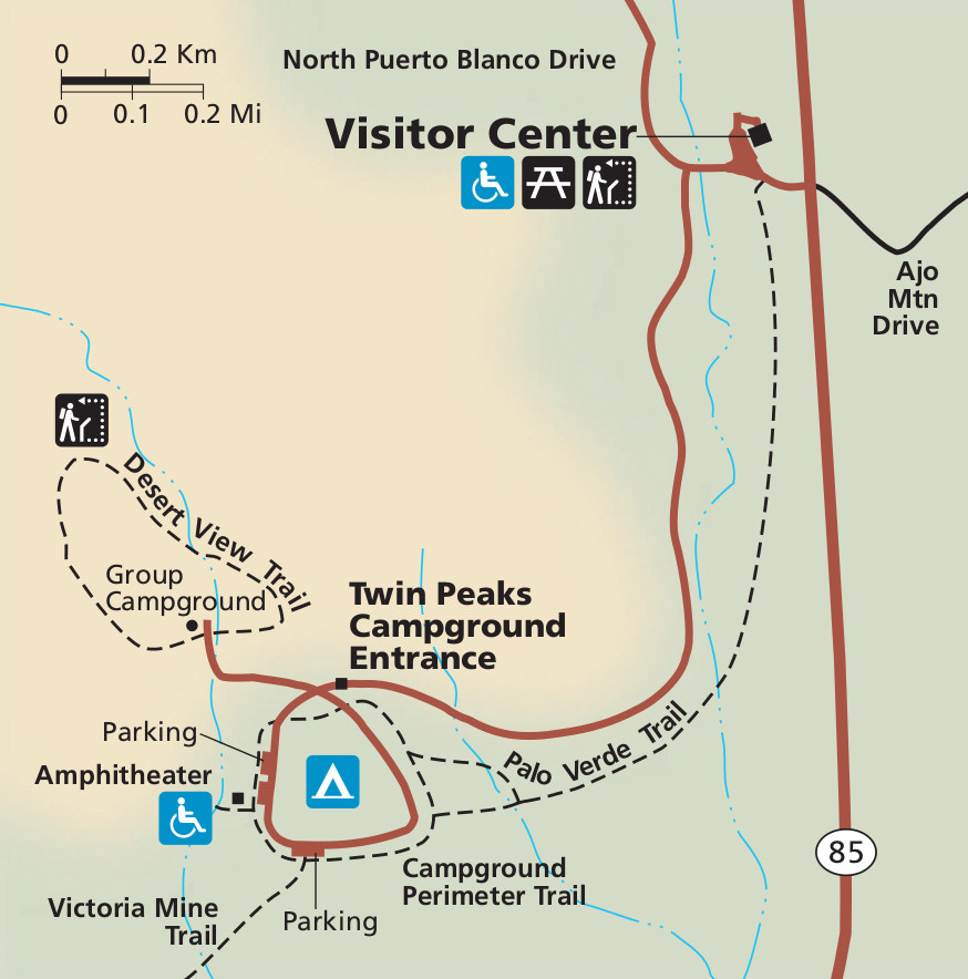 This Organ Pipe Cactus visitor center map zooms in on the main visitor services, including the Twin Peaks Campground and Kris Eggle Visitor Center. Click the image to view a full size map or download the PDF.
Organ Pipe Cactus trail maps
 If you want one map to cover all of Organ Pipe Cactus National Monument with greater detail than the free maps here, check out the weatherproof National Geographic Trails Illustrated map, which includes all the backcountry roads, trails, and topography. This is especially useful if you’re going to do anything more than driving or very short walks; after all, the Sonoran Desert is incredibly dry, hot, and unforgiving.
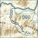
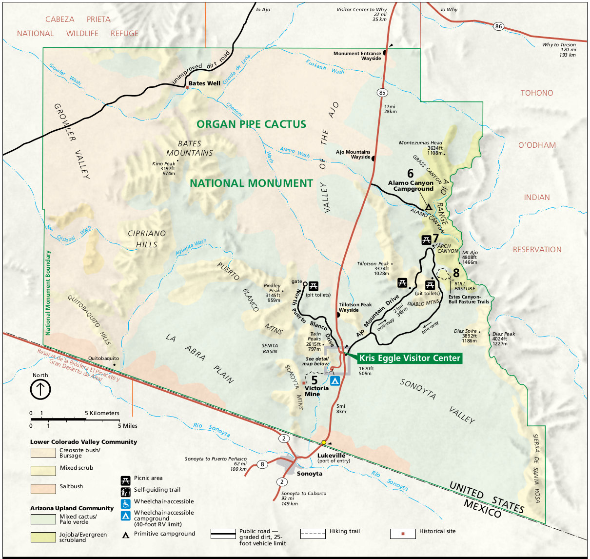 Here is an Organ Pipe Cactus trail locator map that shows the location of each of the four trail maps listed below (labeled with numbers five through eight), so you can find them on the full park map.
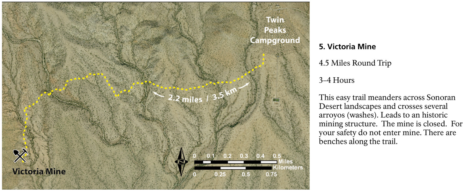 This is a Victoria Mine trail map, showing the 4.5-mile trail (round trip) to the historic Victoria Mine, departing from the Twin Peaks Campground. The mine itself is closed for safety.
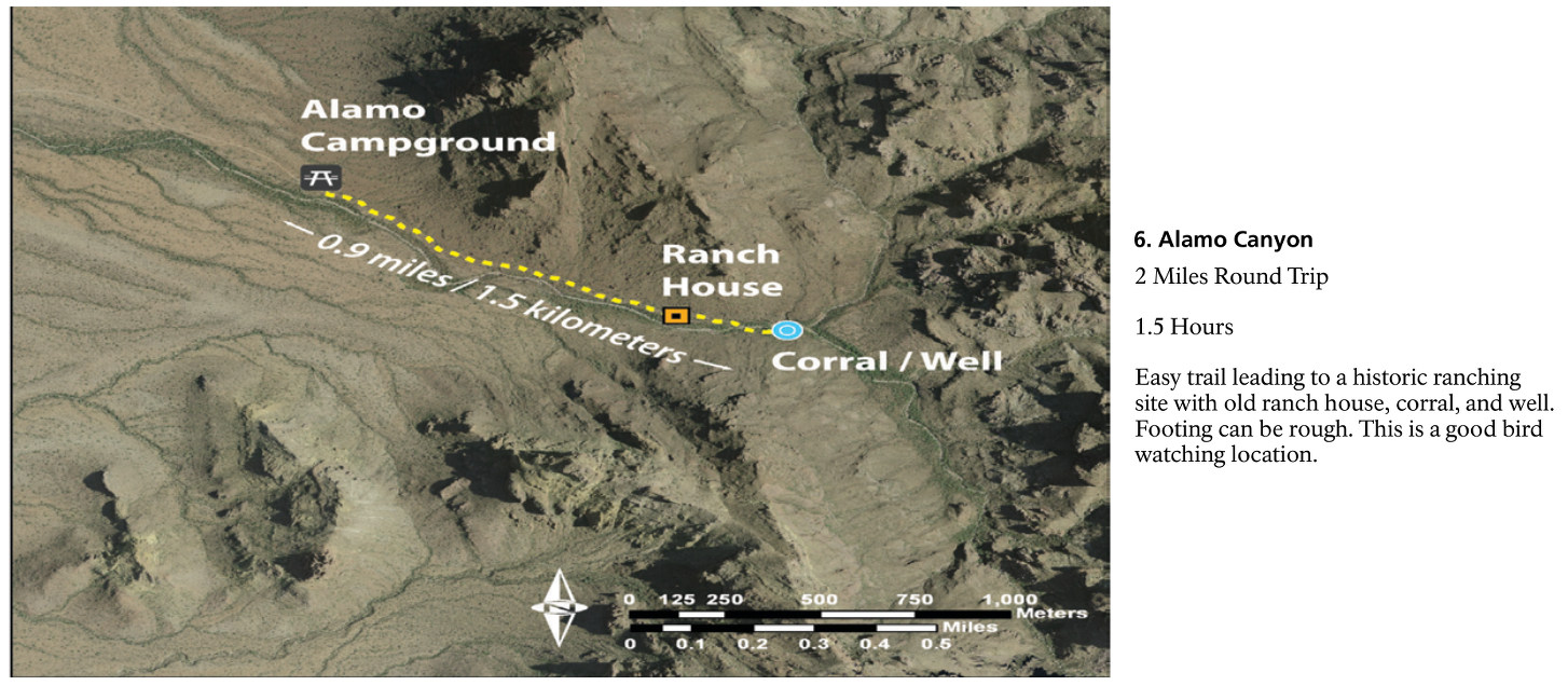 The Alamo Canyon trail map shows the easy route from the Alamo Campground to the historic ranching site, featuring a ranch house, corral, and well. This is a great trail if you’re a birder.
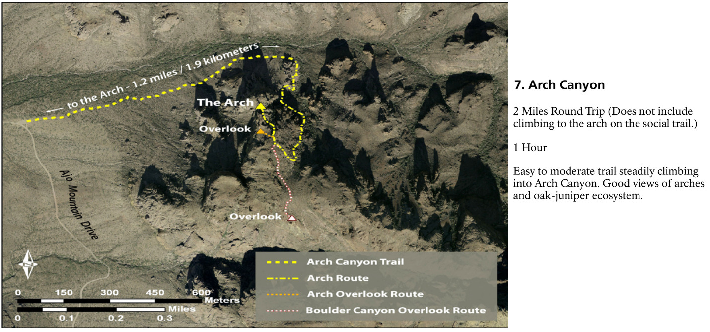 Here’s an Arch Canyon trail map, focusing on the trail to the (you guessed it!) arch. It’s located off the one-way Ajo Mountain Drive and has some nice overlooks. You can hike up to the arch or view it from below.
 The Estes Canyon/Bull Pasture trail map shows the two routes accessed from the same trailhead – they can be combined into a single loop hike as well. This is another great spot for viewing birds.
Organ Pipe Cactus lodging map
 You’ll be hard-pressed to find a more remote park than Organ Pipe Cactus National Monument. But you do have lodging options in Ajo, AZ, about 30 minutes away. Otherwise you could stay in Gila Bend, AZ, off I-8. To the right is an Expedia interactive lodging map showing these locations. You can also browse Expedia’s best-rated nearby lodging to compare prices, read reviews, and view photos of your options.
Assorted Organ Pipe Cactus maps
 Here’s an Ajo Mountain Drive map. This is the most popular road in the park and takes about two hours to complete. Download the associated NPS Ajo Mountain Drive Guide PDF for information about each stop.
 This is an Organ Pipe Cactus relief map that shows the smaller mountain ranges in the western park and the larger, steeper Ajo Range to the east, where the mountains catch more rain.
 The Organ Pipe Cactus regional map includes roads and protected areas in both the U.S. and Mexico, including national wildlife refuges, national monuments, and biosphere reserves.
Organ Pipe Cactus backcountry maps
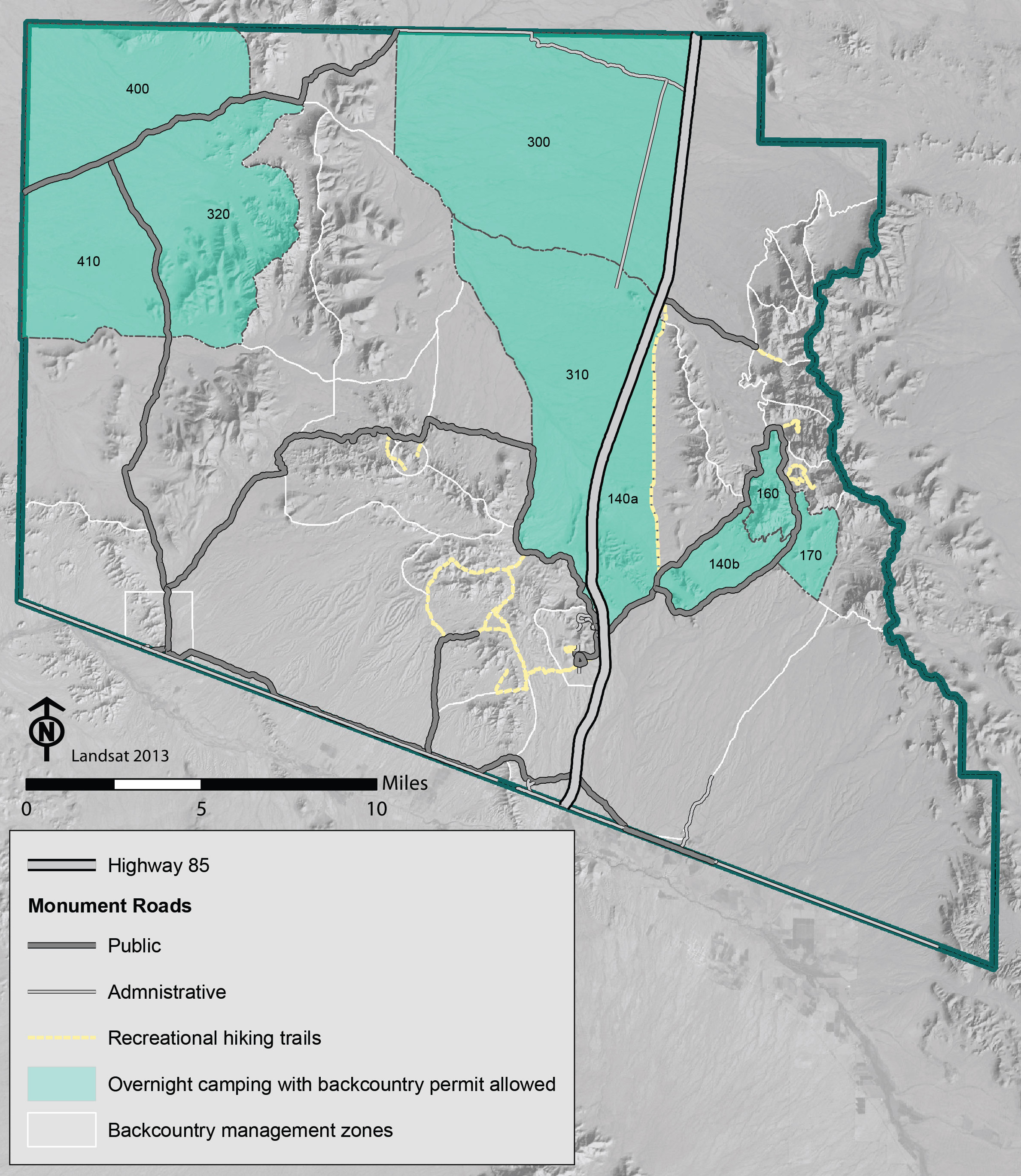 Here’s an Organ Pipe Cactus backcountry map that highlights the zones where overnight backcountry camping is allowed. You need to obtain a permit in person at the Kris Eggle Visitor Center before your trip.
 This is an Organ Pipe Cactus National Monument wilderness map. 95% of this park is congressionally-designated wilderness, which is the highest level of protection any U.S. land can receive.
Organ Pipe Cactus science maps
 This Organ Pipe Cactus precipitation map shows the range of climates in the park, from the incredibly dry southwest corner to the comparatively wet mountains to the east where elevations are highest.
 Here’s an Organ Pipe Cactus vegetation map. This map color-codes the national monument according to what grows. You’ll find a lot of creosote bush, mesquite, saltbush, and other Sonoran Desert landscapes.
 The Organ Pipe Cactus soil map is similarly complex to the one above. You’ll notice some commonalities, as soils can often determine what vegetation will be most successful in that particular location.
…and more!
< Return to National Park Maps home
< Return to Park List
< Return to List by State