Shenandoah maps from the park brochure
 Here’s the official Shenandoah National Park map from the NPS brochure, identical to the one you receive at the park entrance station. Click the image to view a full size map or download the PDF.
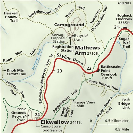 This is a detail map of Mathews Arm and Elkwallow showing the campground, viewpoints, trails, and picnic areas. Click the image to view a full size map or download the PDF.
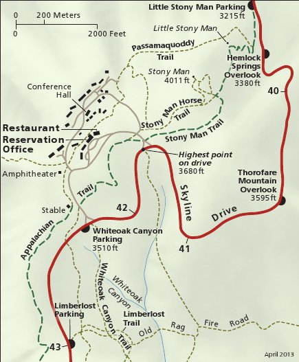 This is a detail map of Skyland, showing overlooks, hiking trails (including Stony Man), and lodging in this area along Skyline Drive’s highest point. Click the image to view a full size map or download the PDF.
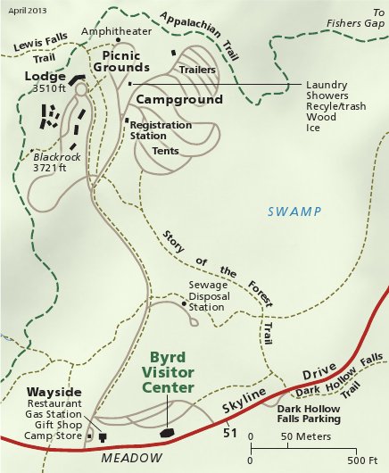 This is a detail map of Big Meadows, showing the campground, lodge, visitor center, and hiking trails (including the Appalachian Trail). Click the image to view a full size map or download a PDF.
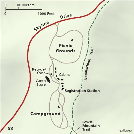 This is a detail map of Lewis Mountain, showing the campground, picnic area, cabins, and nearby Appalachian Trail. Click the image to view a full size map or download the PDF.
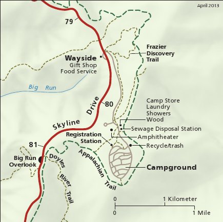 This is a detail map of Loft Mountain, showing the campground, trails, overlooks, visitor services, and Skyline Drive. Click the image to view a full size map or download the PDF.
Shenandoah trail maps
 If you’re looking for one Shenandoah trail map to cover the entire national park, then you might want to get the National Geographic Trails Illustrated map from Amazon. It probably isn’t necessary for a quick day-hike, but it certainly comes in handy when doing overnight backpacking trips. Otherwise, the free maps below should be sufficient, although they aren’t in color and don’t have topographic lines.
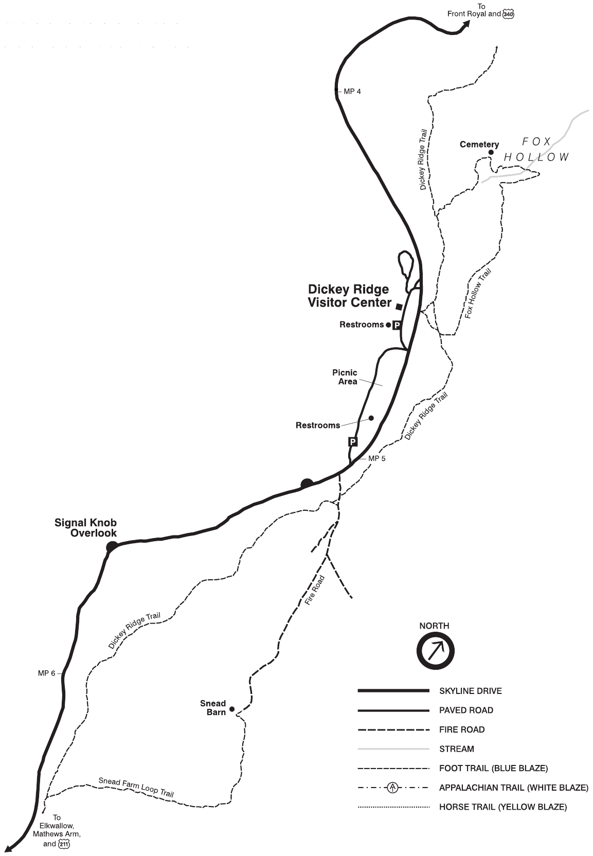
 The Dickey Ridge trail map zooms in on miles 4-7 of Skyline Drive and shows trails including Fox Hollow and the Snead Farm Loop. Click the image to view a full size map or download the NPS Dickey Ridge trail guide.
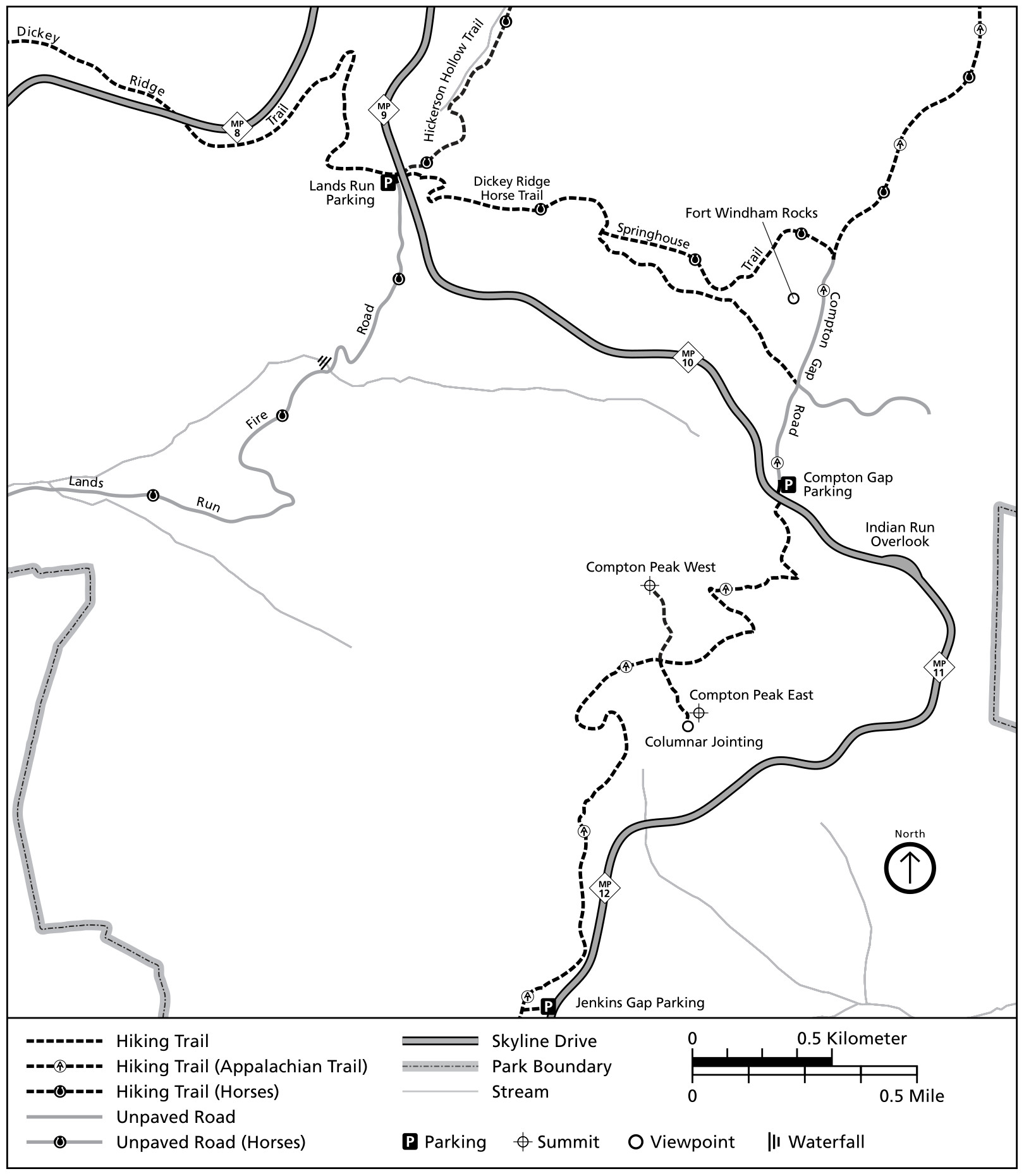 The Compton Gap trail map shows miles 9-13 of Skyline Drive and includes Lands Run Falls, Fort Windham Rocks, and Compton Peak. Click the image to view a full size map or download the NPS Compton Gap trail guide.
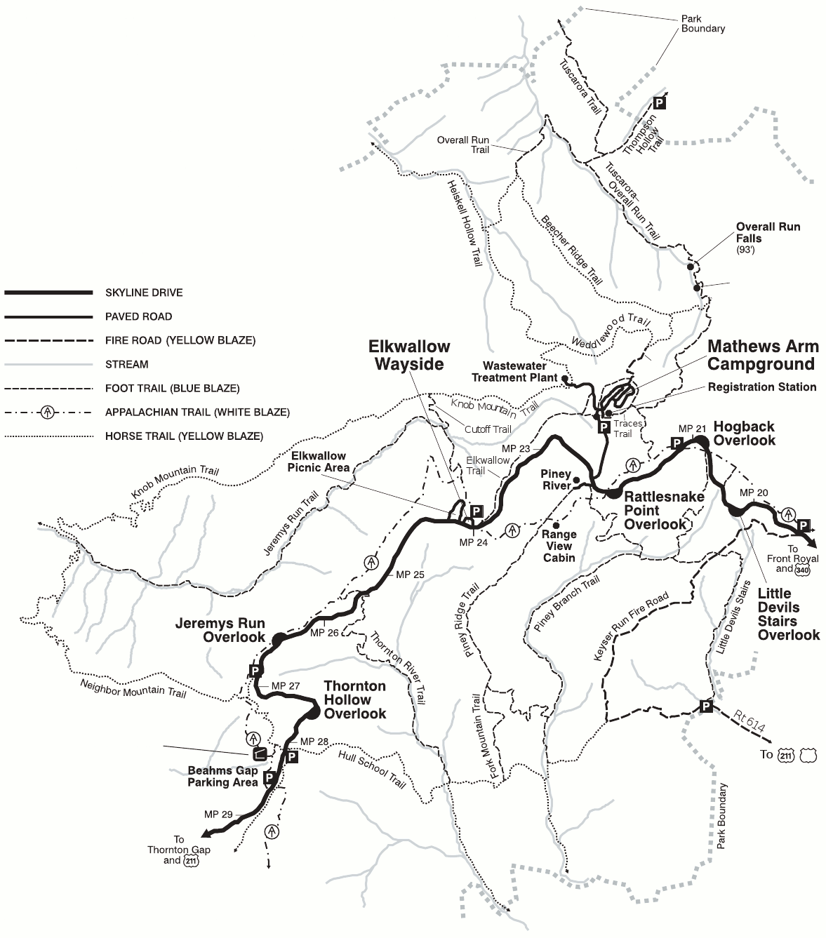
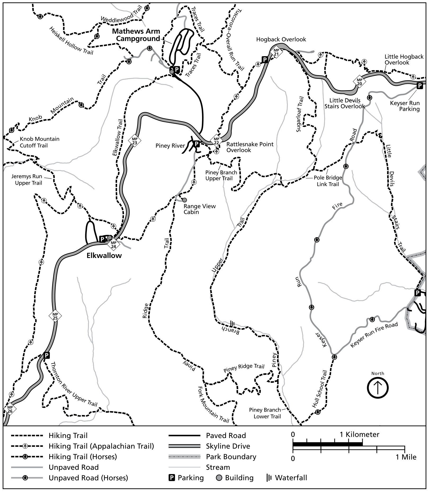 The Keyser Run trail map zooms in on mile 20-26 of Skyline Drive near Elkwallow and includes Little Devils Stairs and Sugarloaf Trail. Click the image to view a full size map or download the NPS Keyser Run trail guide.
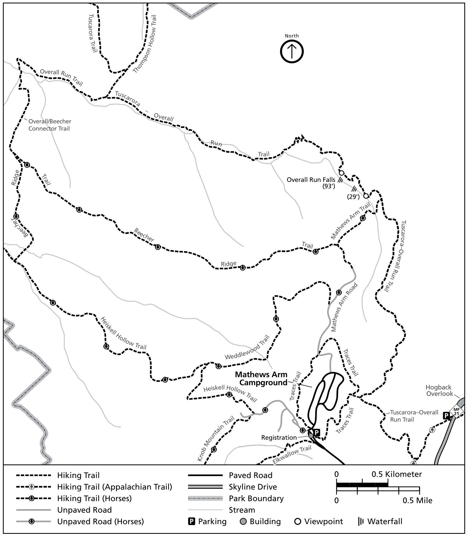 The Mathews Arm trail map shows trails originating from the Mathews Arm Campground area, including Overall Run Falls and the Traces Trail. Click the image to view a full size map or download the NPS Mathews Arm trail guide.
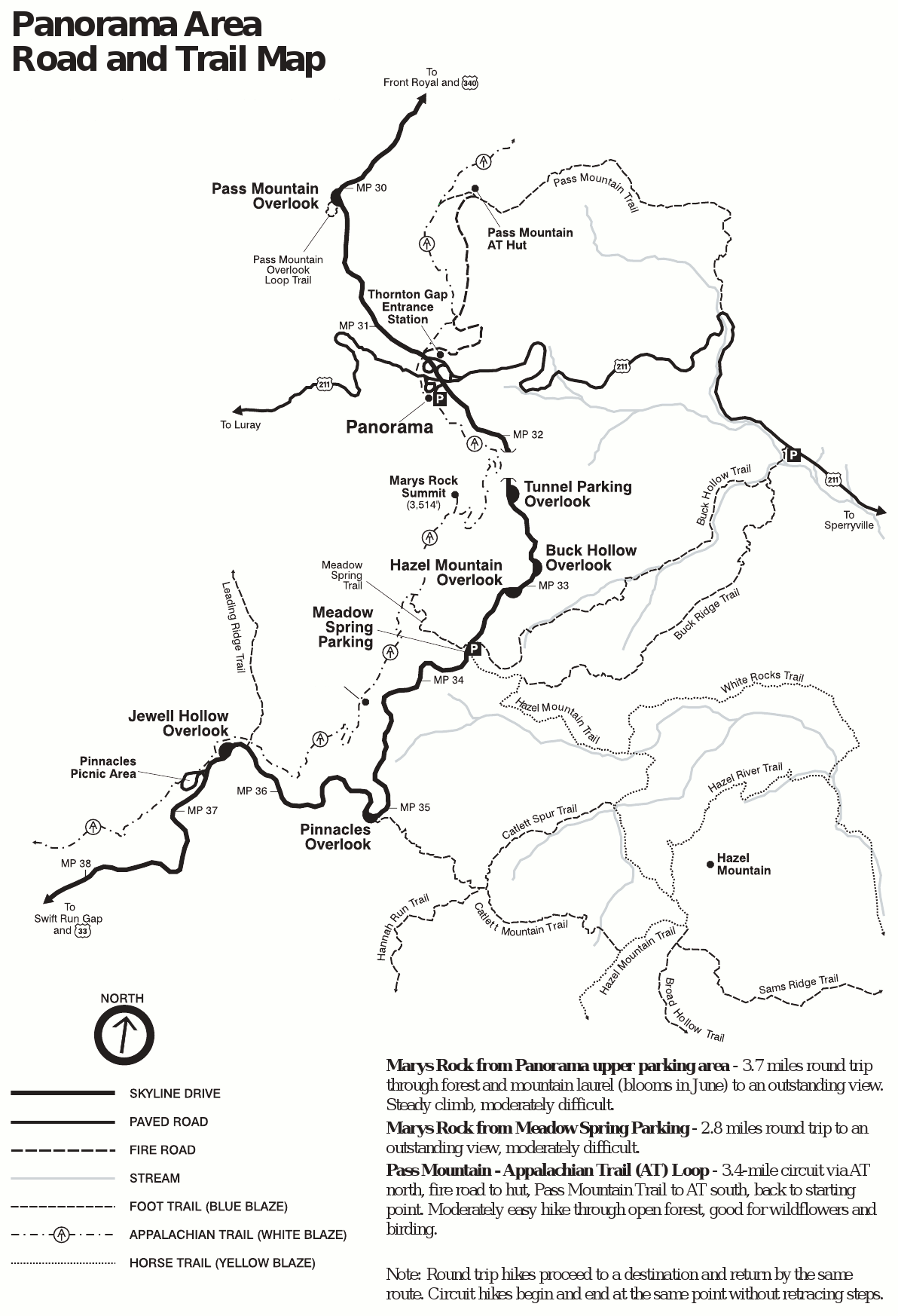
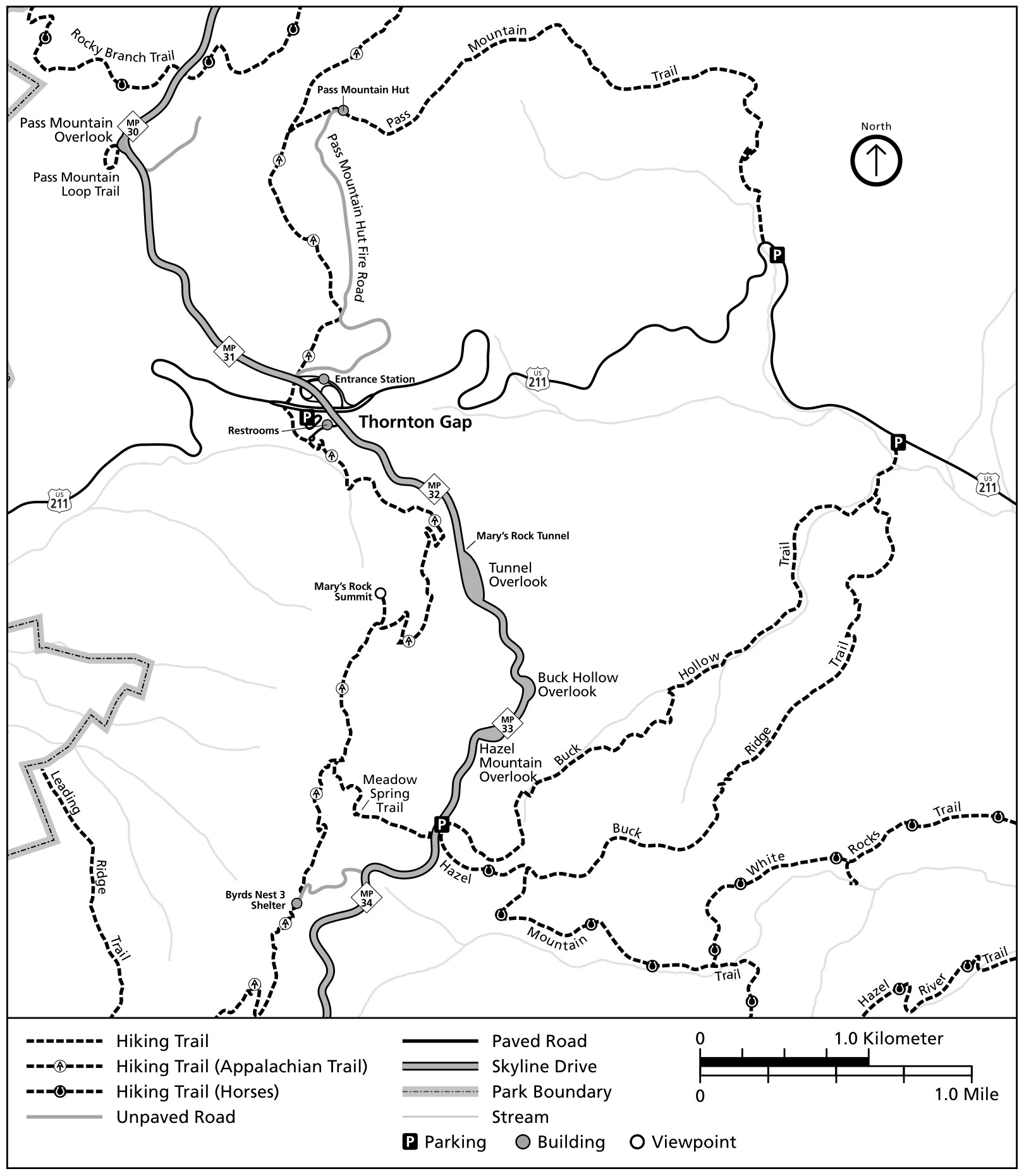 The Thornton Gap trail map focuses on miles 30-34 of Skyline Drive and features Marys Rock, Hazel River Falls, and Pass Mountain. Click the image to view a full size map or download the NPS Thornton Gap trail guide.
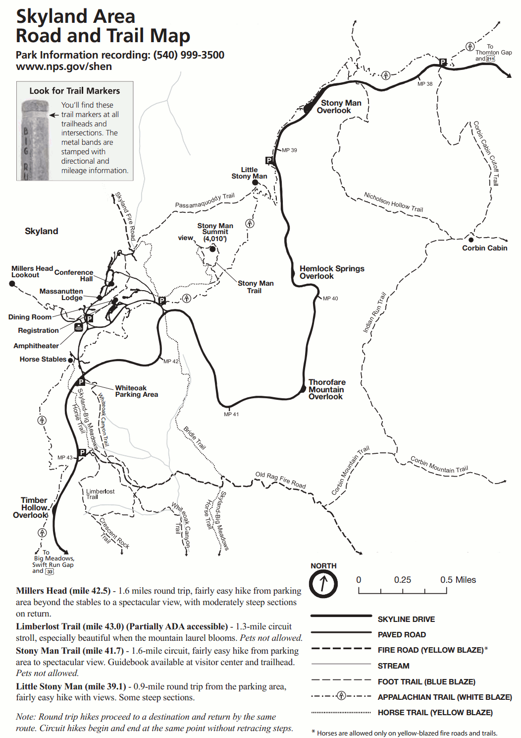
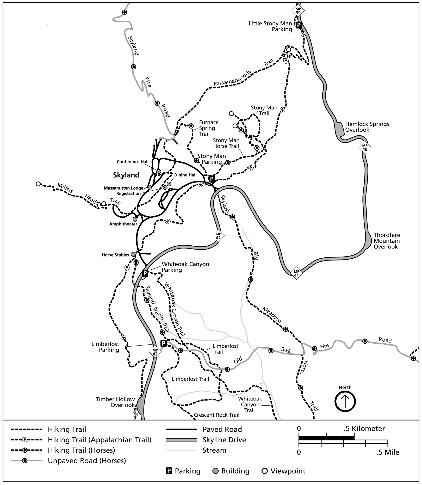 The Skyland trail map zooms in on miles 39-43 of Skyline Drive and shows the Limberlost Trail, Stony Man, Millers Head, and more. Click the image to view a full size map or download the NPS Skyland trail guide.
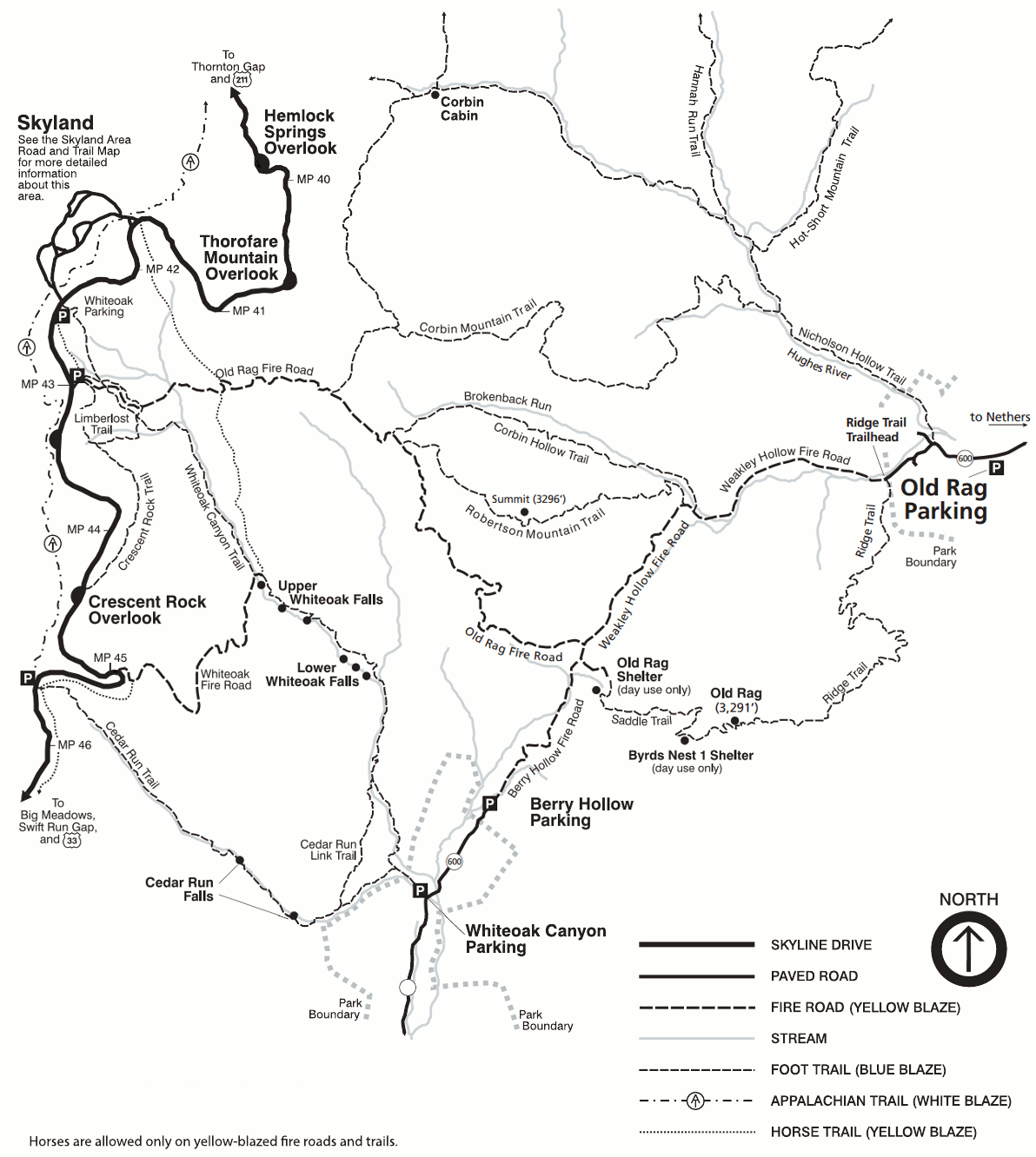
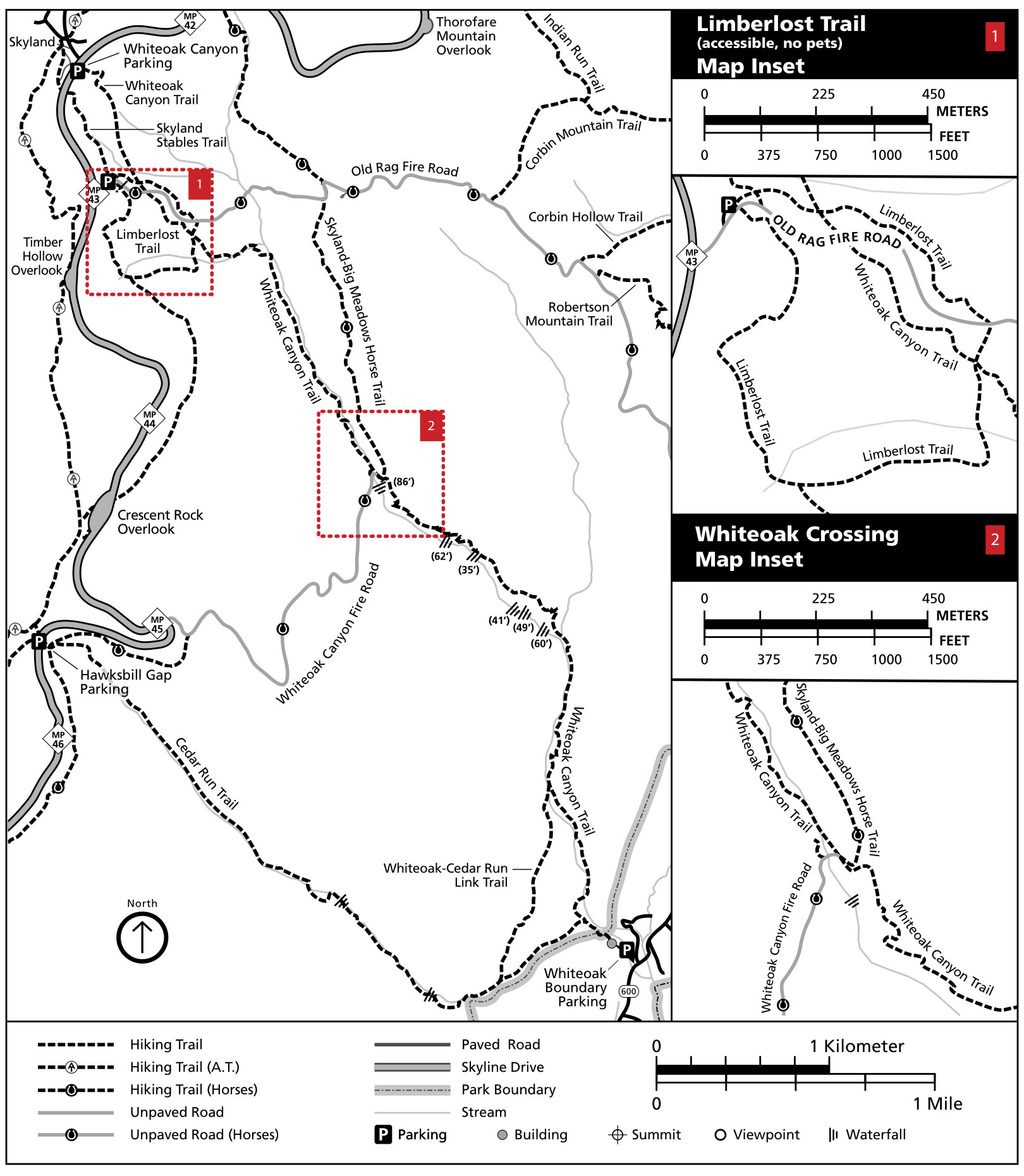 The Whiteoak Canyon trail map shows miles 42-46 of Skyline Drive and includes maps of the Limberlost Trail and Whiteoak Crossing. Click the image to view a full size map or download the NPS Whiteoak Canyon trail guide.
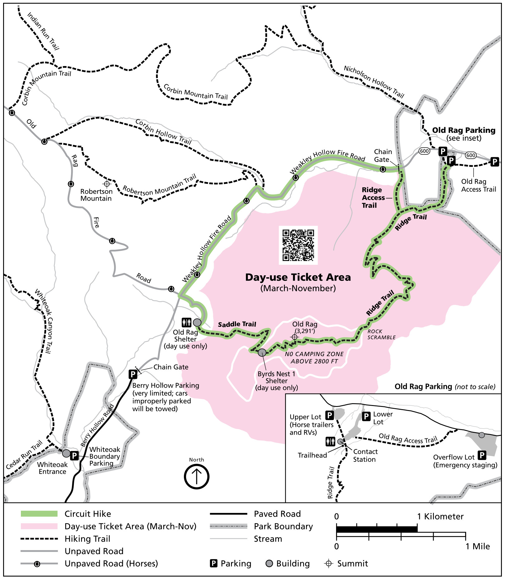 The Old Rag trail map shows the day use ticket area and several trails around Old Rag Mountain, including the Ridge Trail and Saddle Trail. Click the image to view a full size map or download the NPS Old Rag trail guide.
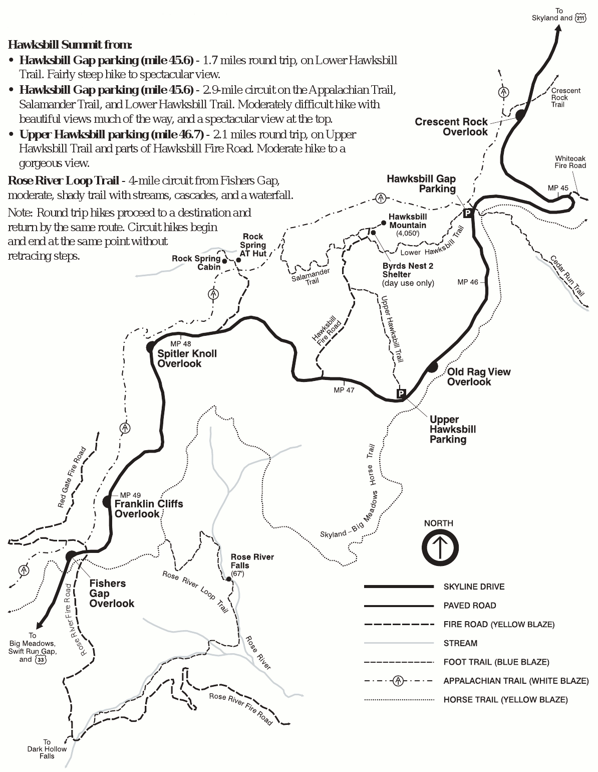
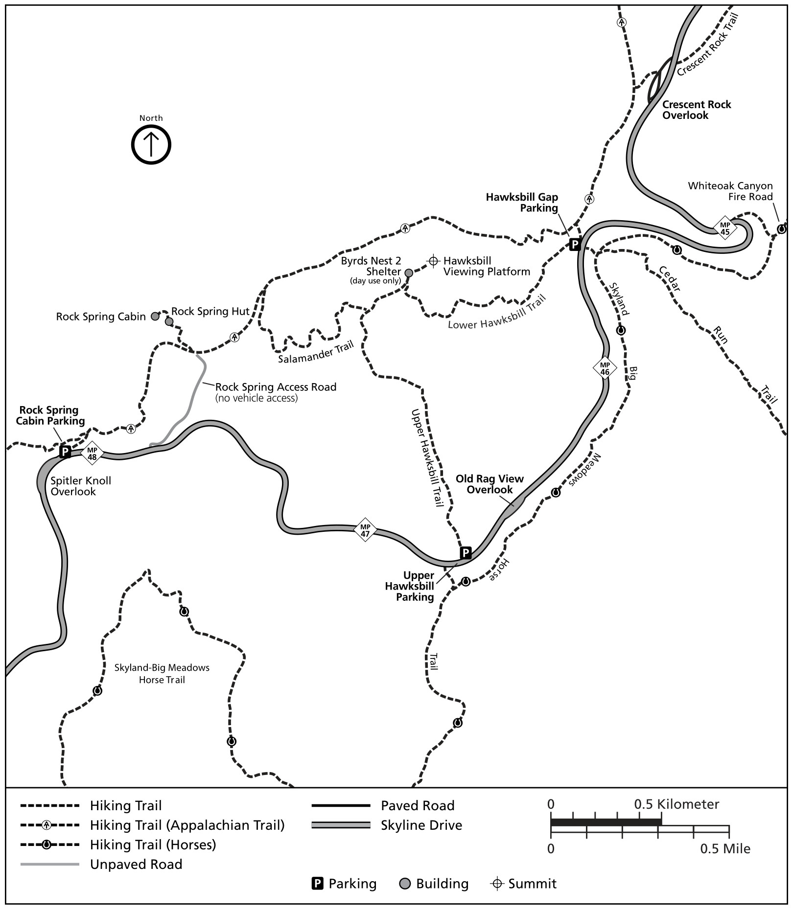 The Hawksbill trail map shows mile 44-48 of Skyline Drive and features trails up to the viewing platform on Hawksbill Summit. Click the image to view a full size map or download the NPS Hawksbill trail guide.
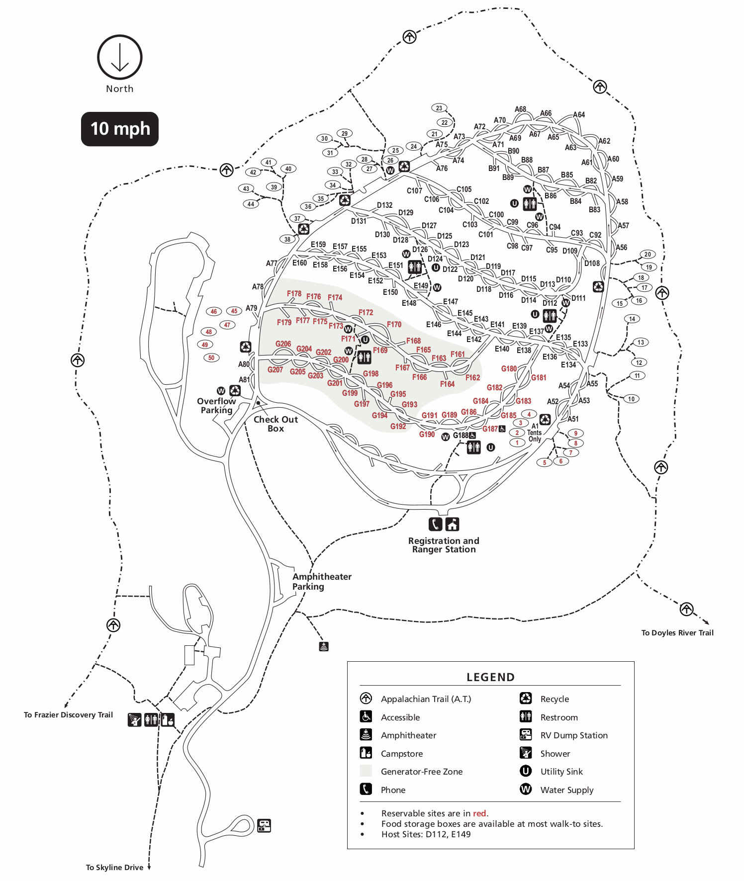
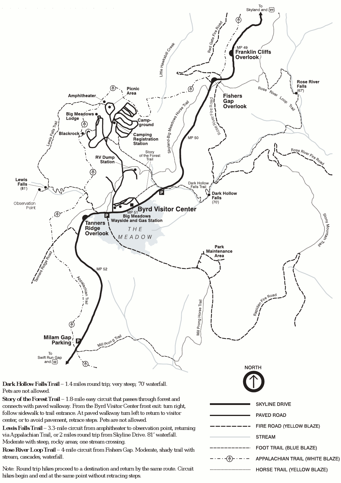
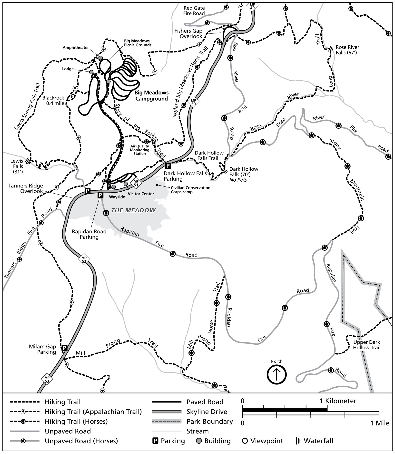 The Big Meadows trail map includes mile 49-53 of Skyline Drive, with Lewis Falls, Rose River, Dark Hollow, and the Story of the Forest hike. Click the image to view a full size map or download the NPS Big Meadows trail guide.
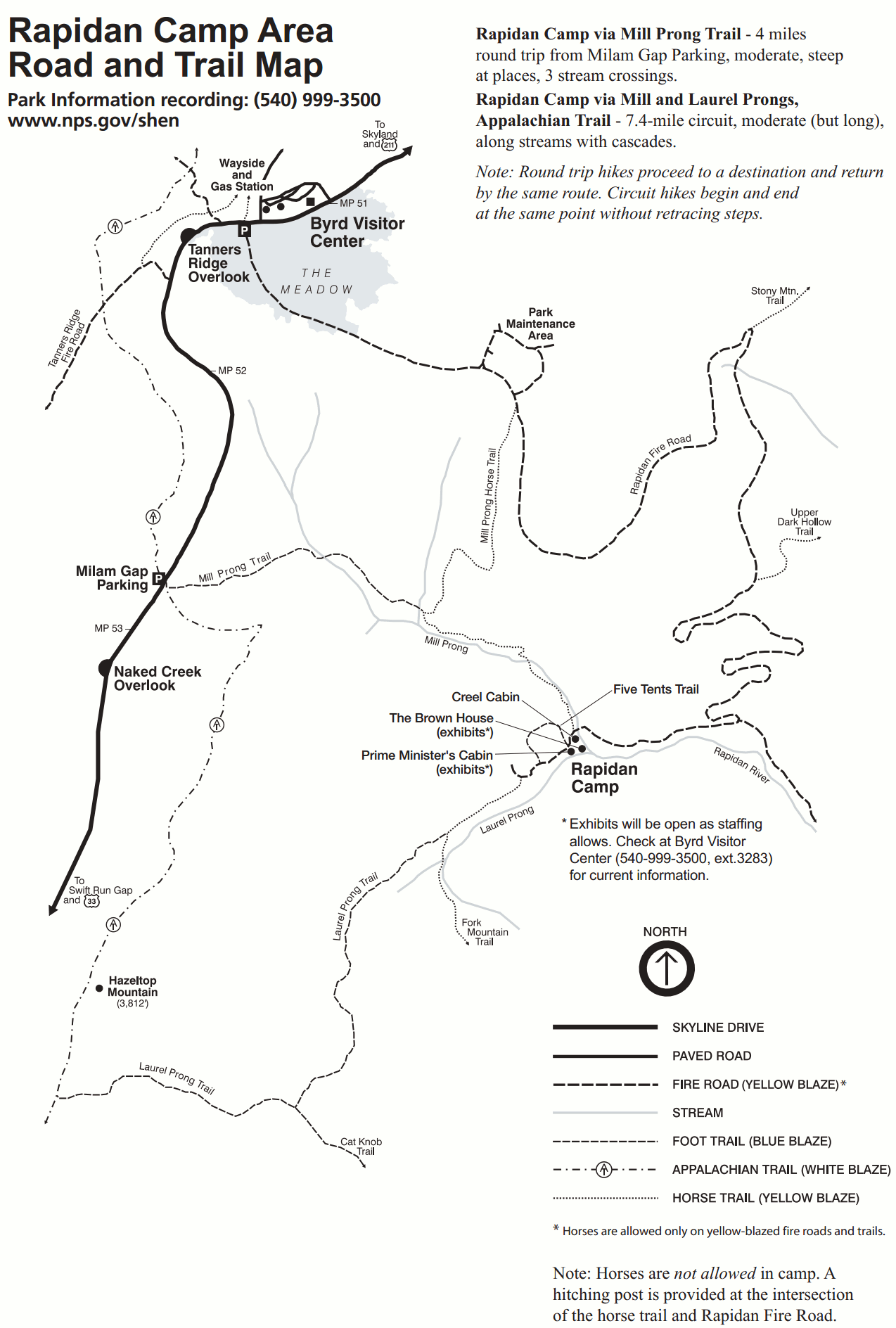
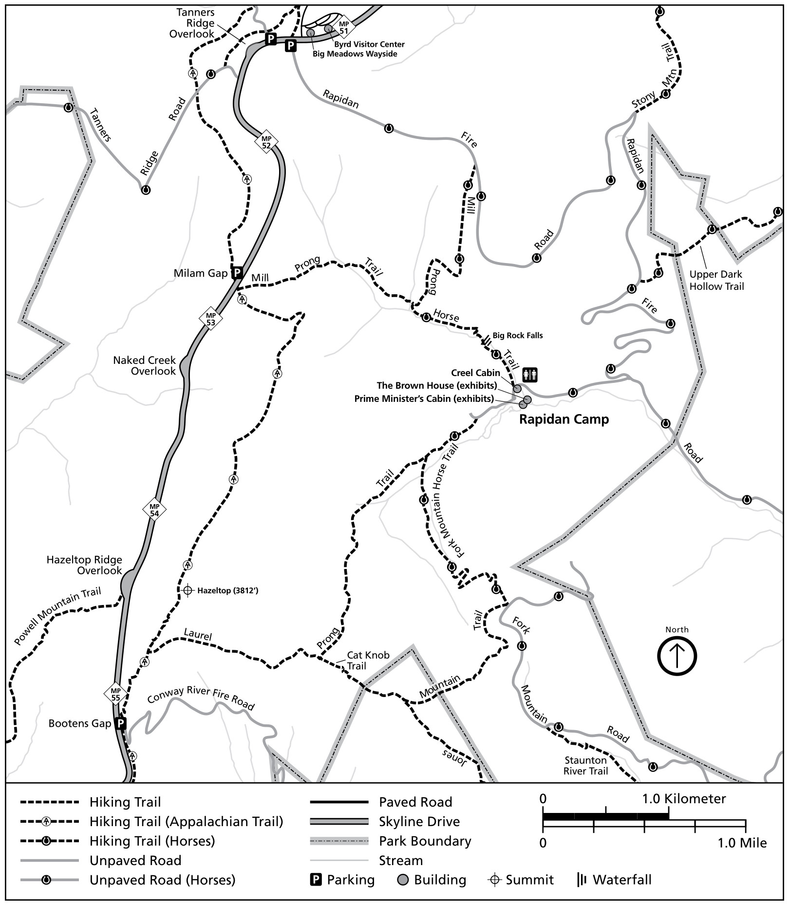 The Rapidan Camp trail map zooms in on miles 51-55 of Skyline Drive and includes Tanners Ridge and the Mill Prong/Laurel Prong loop hike. Click the image to view a full size map or download the NPS Rapidan trail guide.
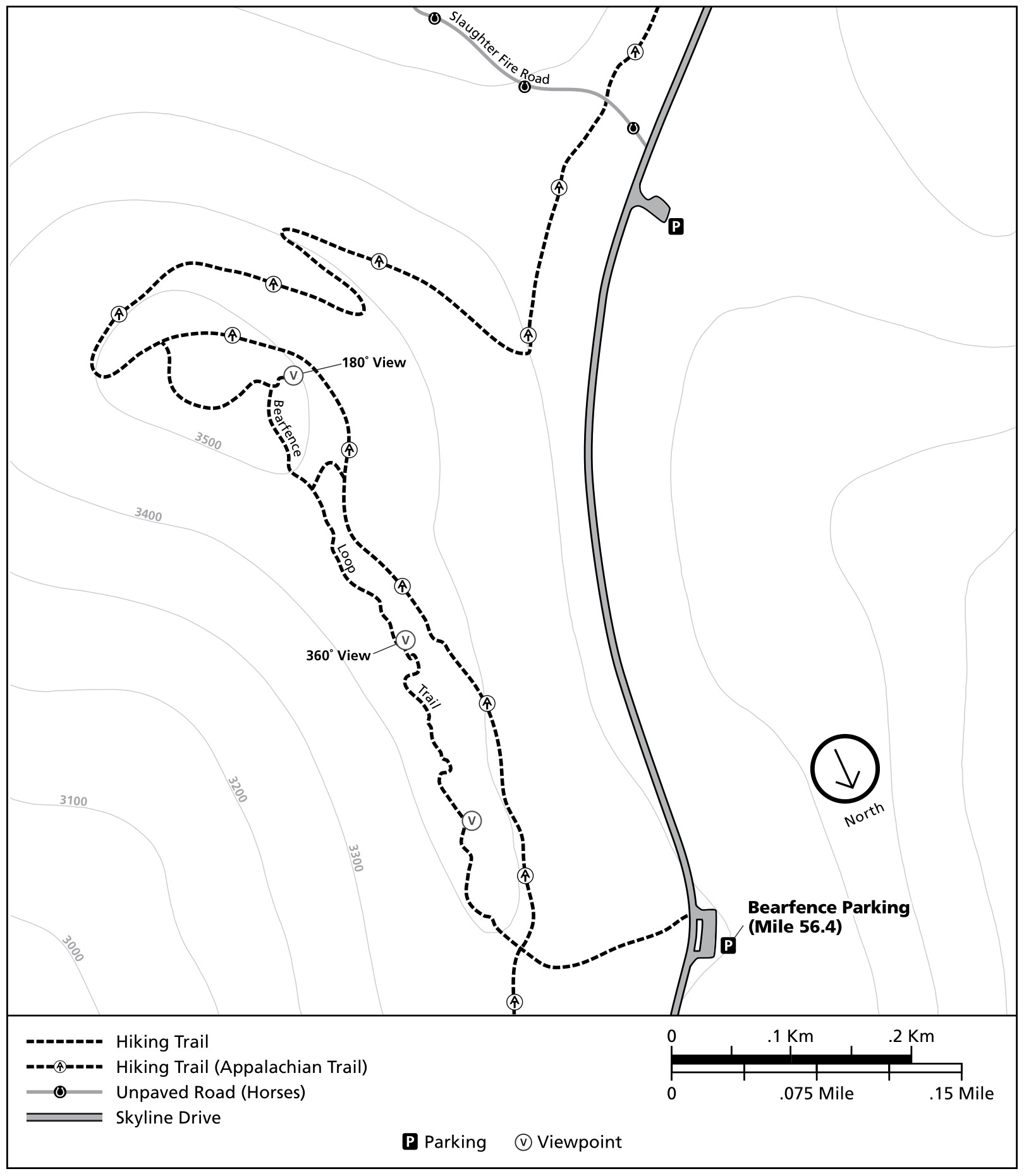 The Bearfence trail map zooms all the way into the Bearfence parking area at about mile 56 of Skyline Drive to show trails up Bearfence Rock. Click the image to view a full size map or download the NPS Bearfence trail guide.
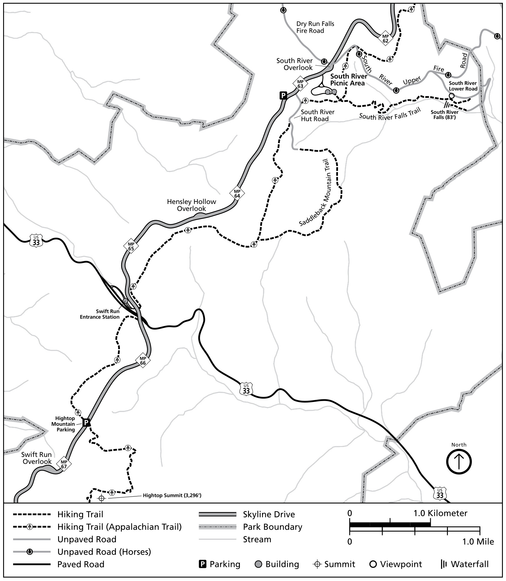 The South River trail map shows miles 62-67 of Skyline Drive and features South River Falls and Hightop Summit. Click the image to view a full size map or download the NPS South River trail guide.
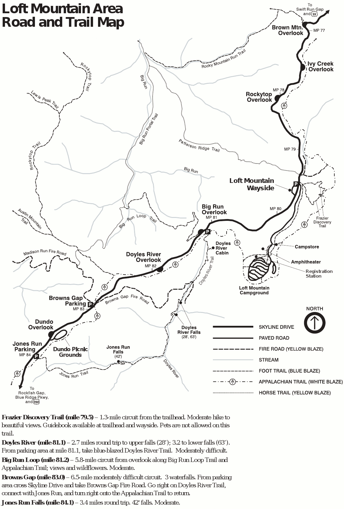
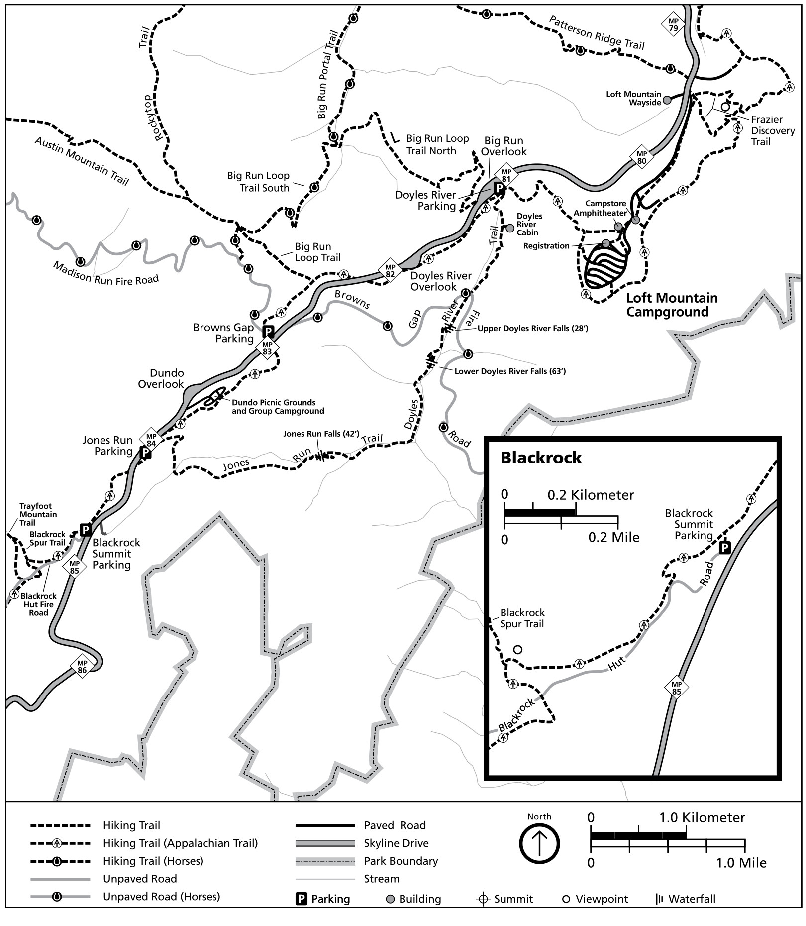 The Loft Mountain trail map includes miles 79-86 of Skyline Drive and features several waterfall hikes and an inset map of Blackrock. Click the image to view a full size map or download the NPS Loft Mountain trail guide.
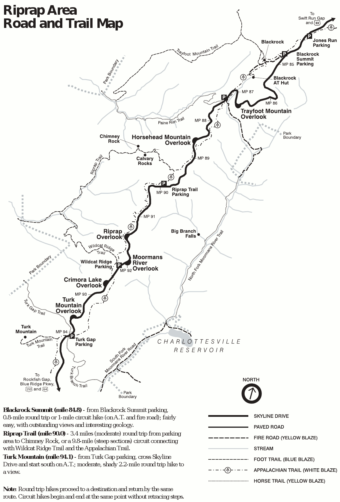
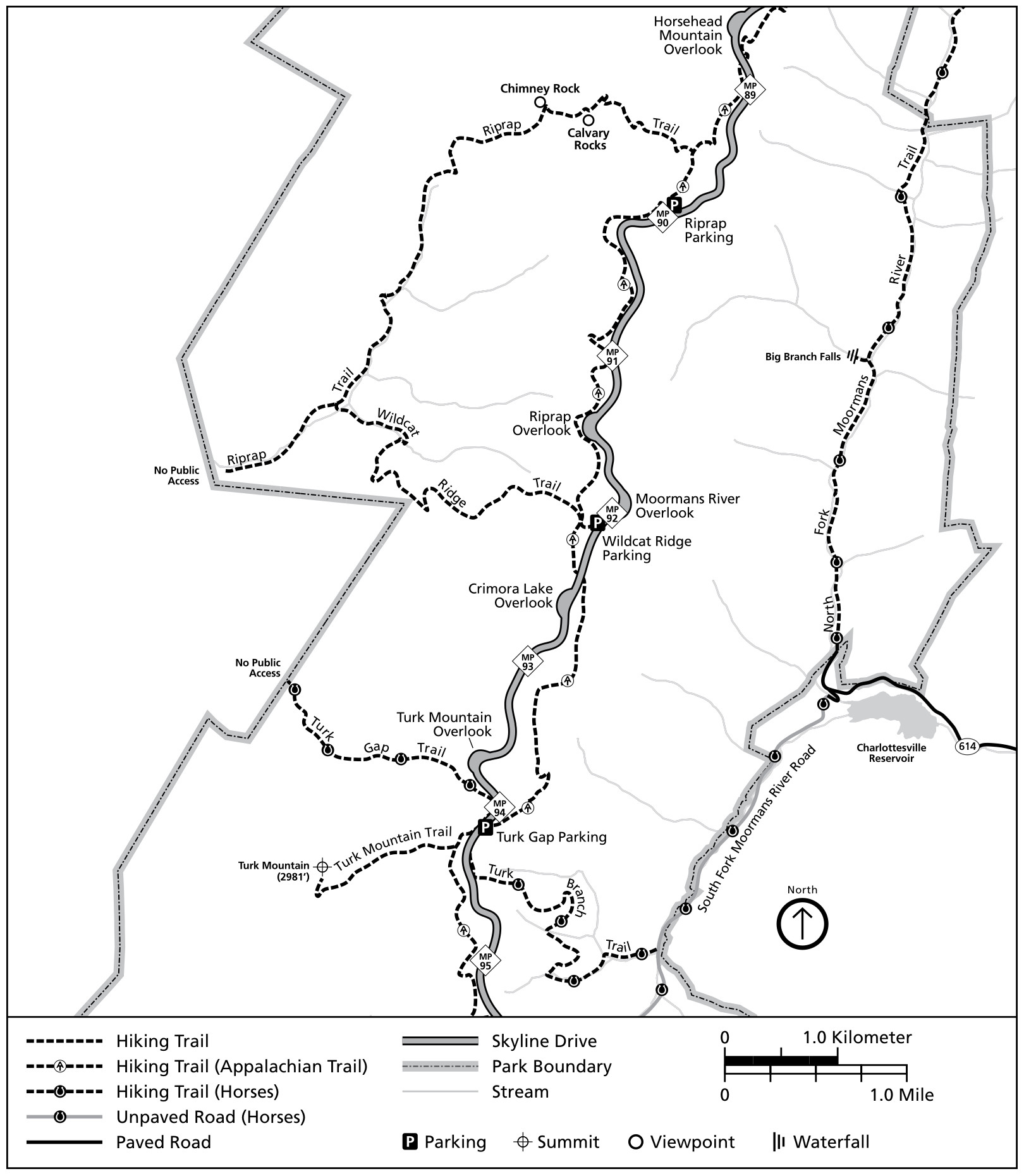 The Riprap trail map shows miles 89-95 of Skyline Drive, including Chimney Rock, Turk Mountain, and Wildcat Ridge. Click the image to view a full size map or download the NPS Riprap trail guide.
Shenandoah lodging map
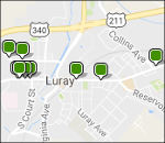 Shenandoah is a big park, so it may be hard to decide where to stay. To the right, I’ve linked to an Expedia interactive lodging map centered on Luray, which is located near park headquarters and the Skyland area. You can also browse Expedia’s top-rated Shenandoah lodging to compare all nearby towns. Otherwise, consider Waynesboro if arriving from the south and Front Royal if coming from the north.
Shenandoah campground maps
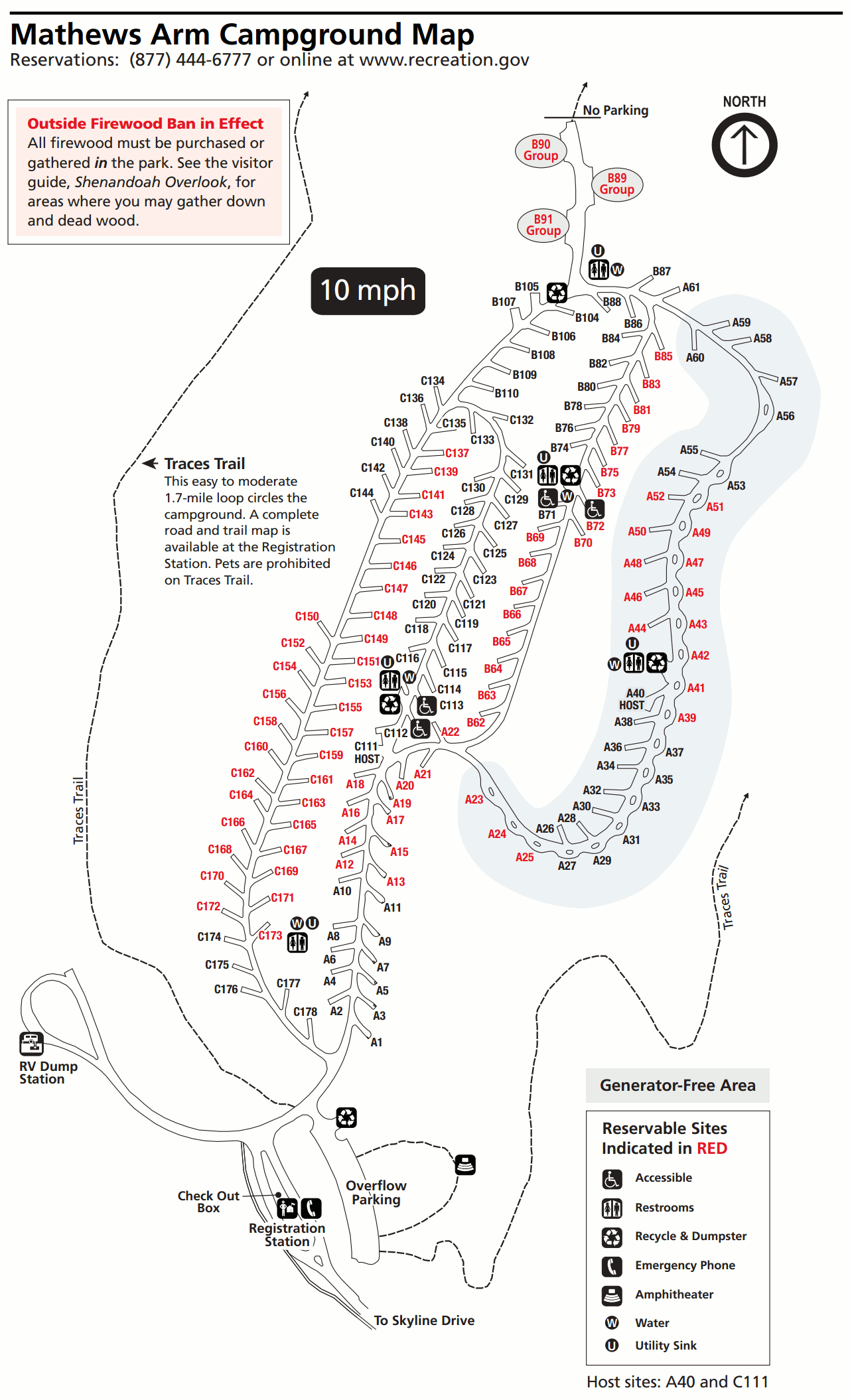
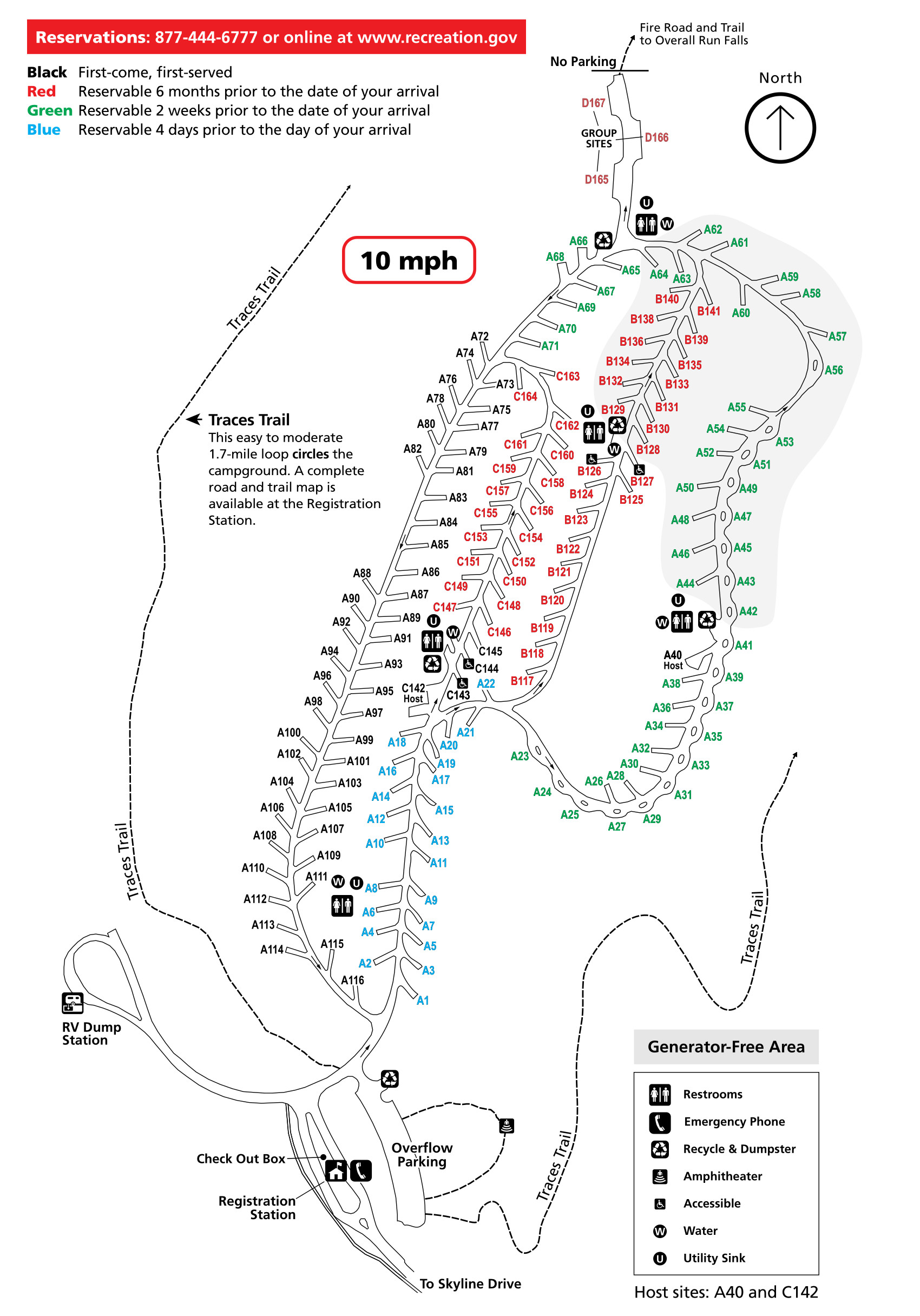 Here’s a Mathews Arm Campground map. Sites on this map are color-coded to show whether sites are reservable or first-come, first-served. Click the image to view a full size map or download the NPS Mathews Arm guide.
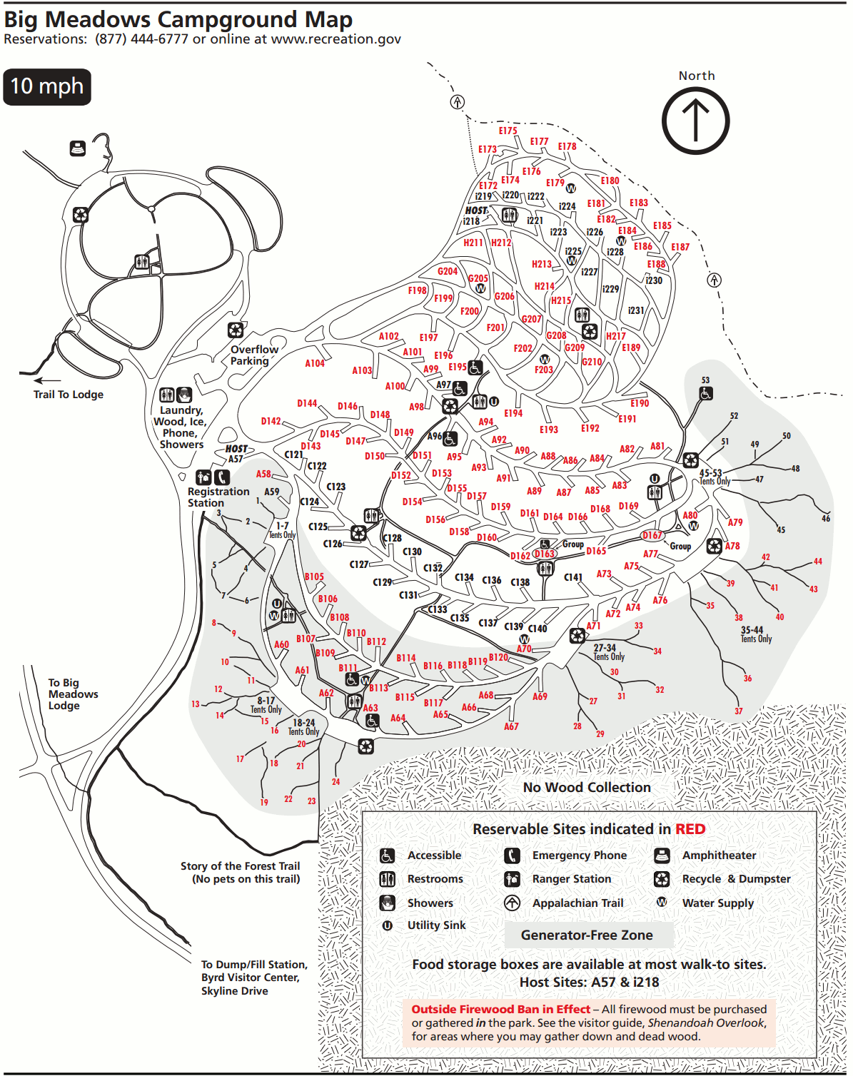
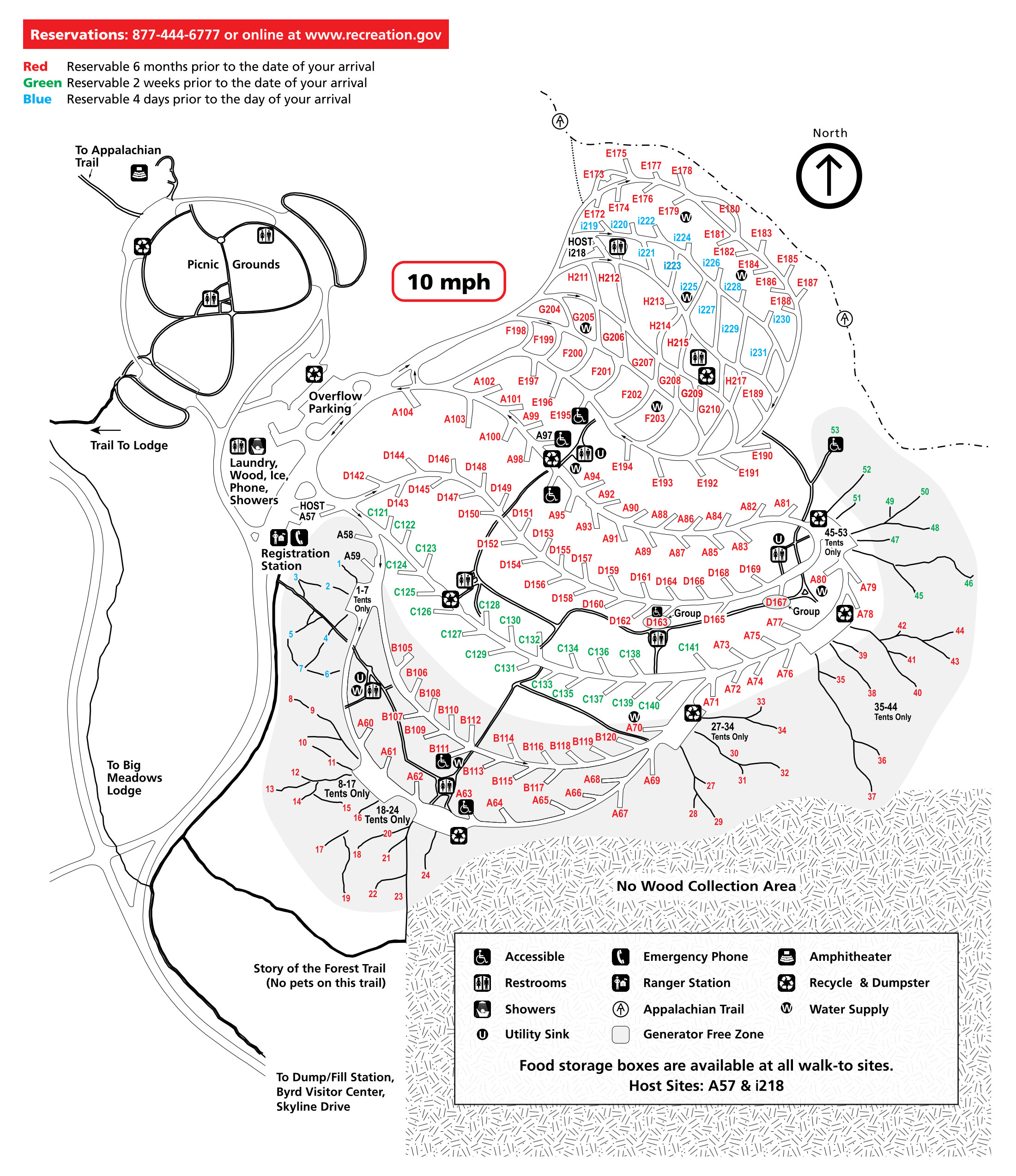 This is a Big Meadows Campground map. Campsites here are for reservation only, and colors show how far in advance you can reserve that site. Click the image to view a full size map or download the NPS Big Meadows guide.
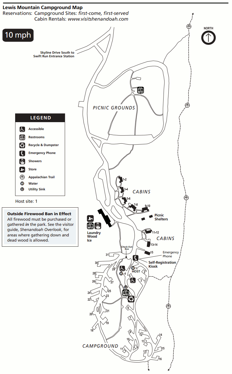 The Lewis Mountain Campground map isn’t color-coded because reservations are not accepted here; everything is first-come first-served. Click the image to view a full size map or download the NPS Lewis Mountain guide.
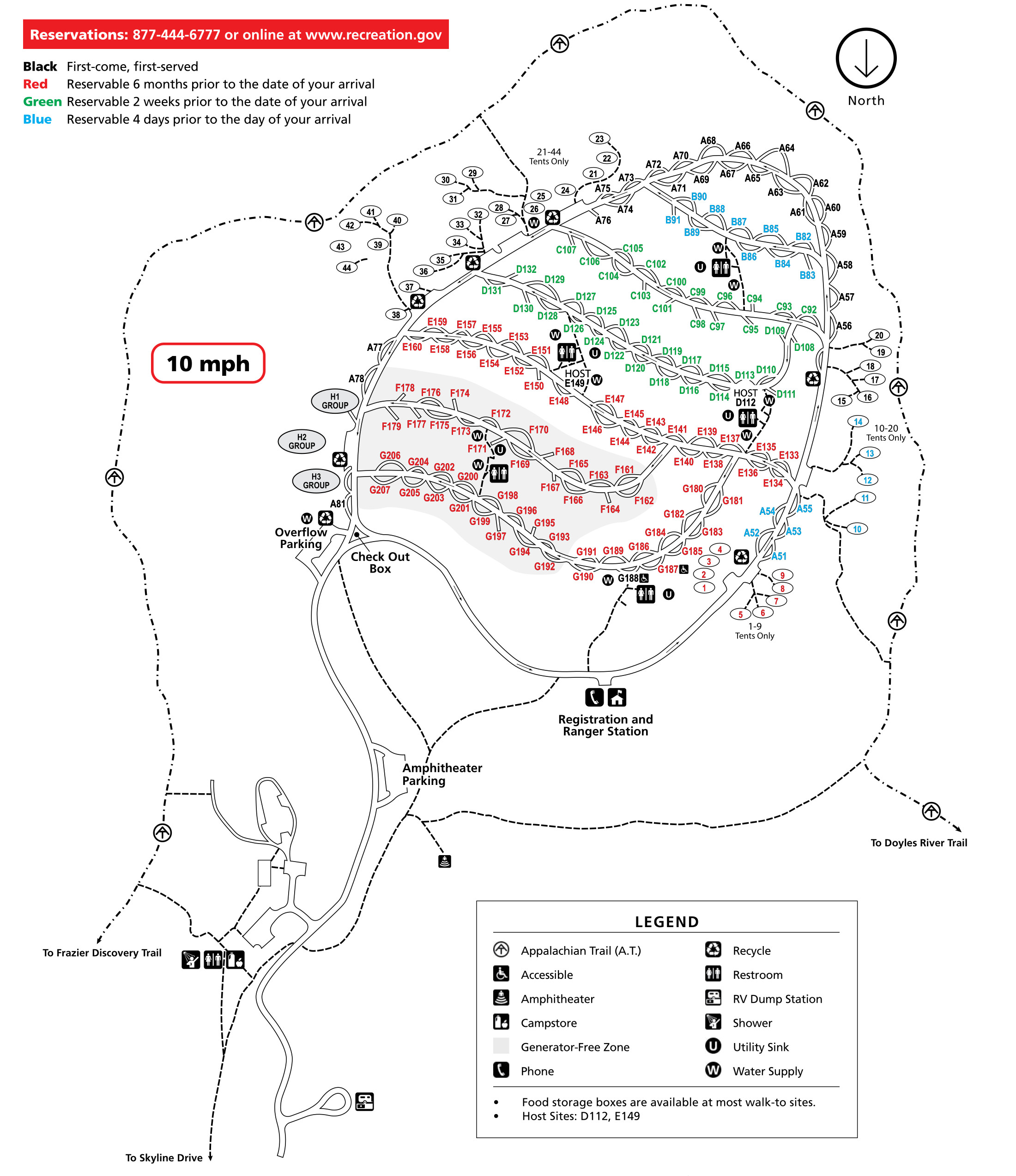 This Loft Mountain Campground map is color-coded, as this largest campground in Shenandoah has a mix of walk-up and reservable campsites. Click the image to view a full size map or download the NPS Loft Mountain guide.
Assorted Shenandoah maps
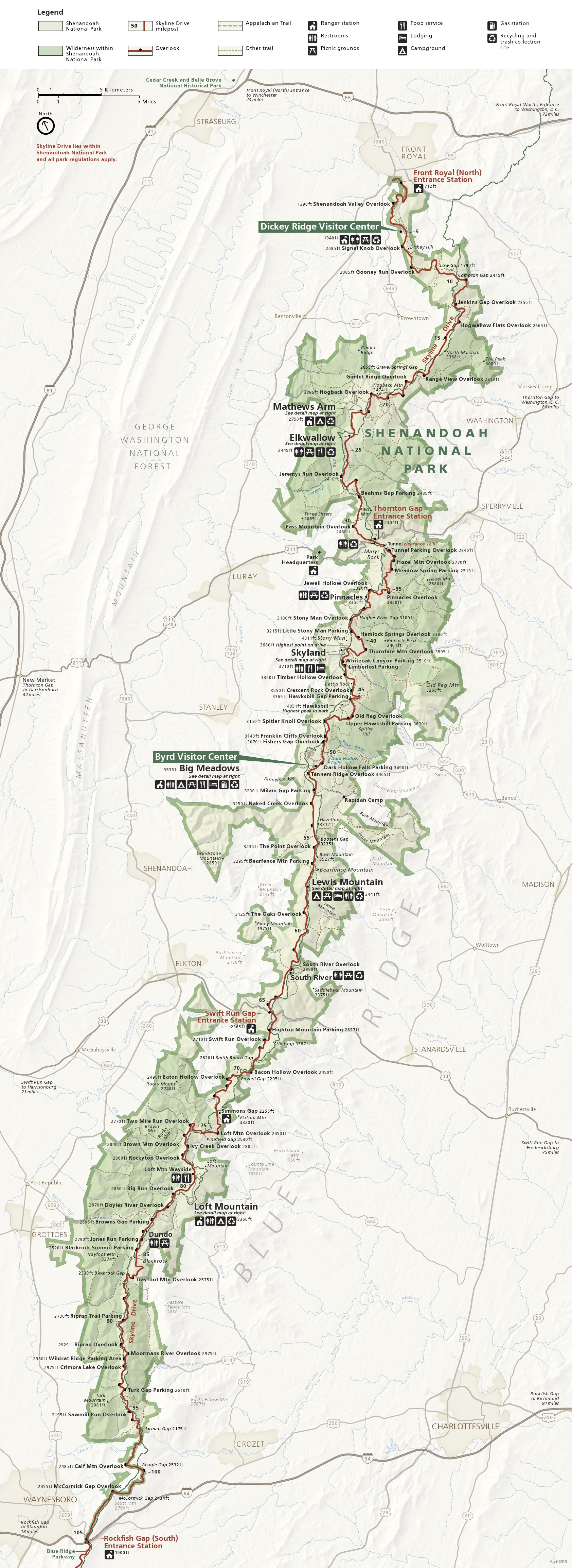
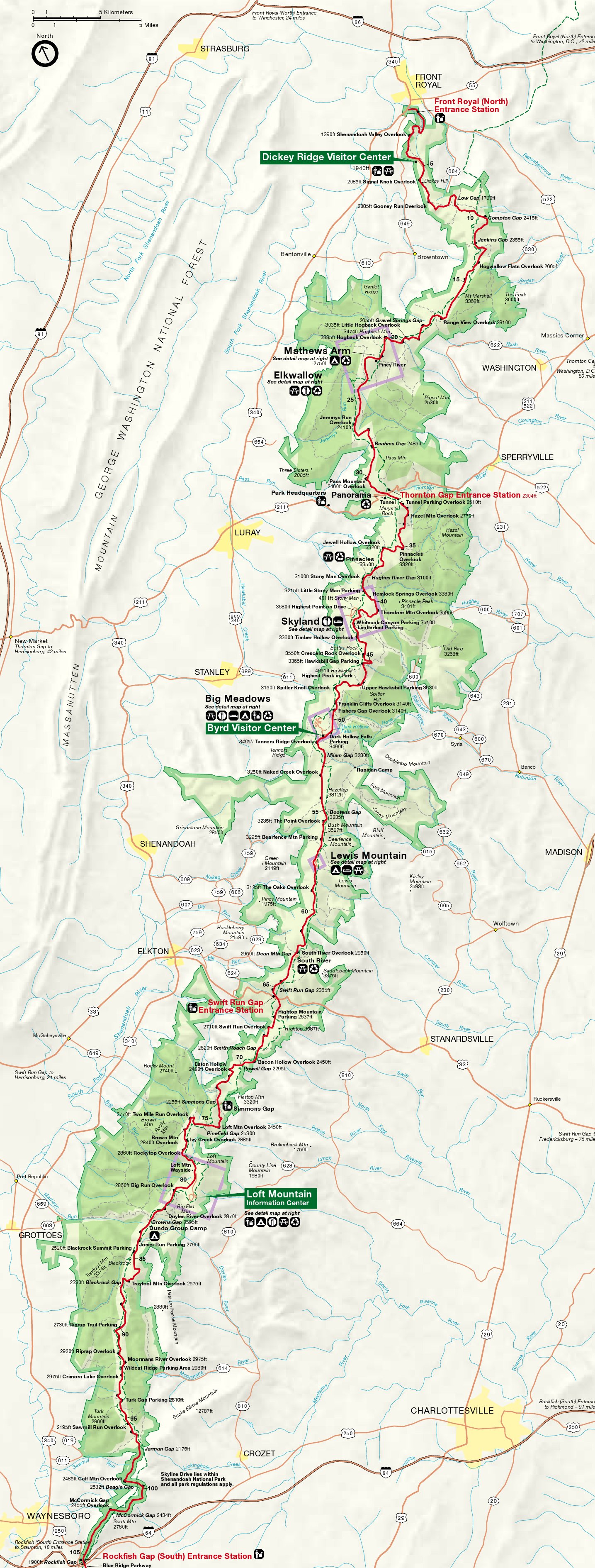
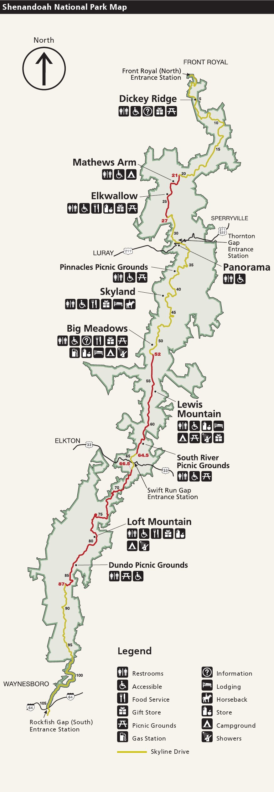 This is a simple map of Shenandoah National Park, showing just Skyline Drive and the major developed areas along its route. This is the simplest map for printing that shows the major park facilities.
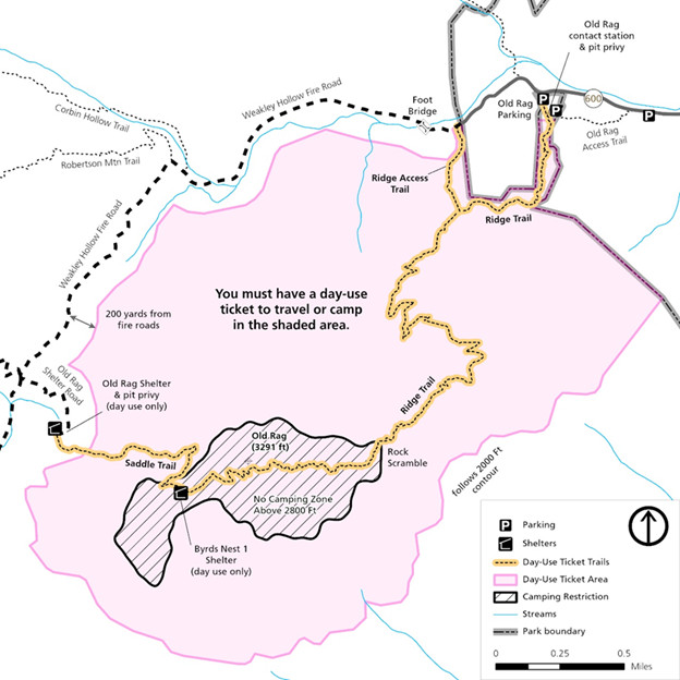 Here’s an Old Rag permit area map, which shows where Old Rag Day Use Tickets are required. Due to crowding issues, these tickets are required for all visitors hiking Old Rag Mountain from March 1 to November 30.
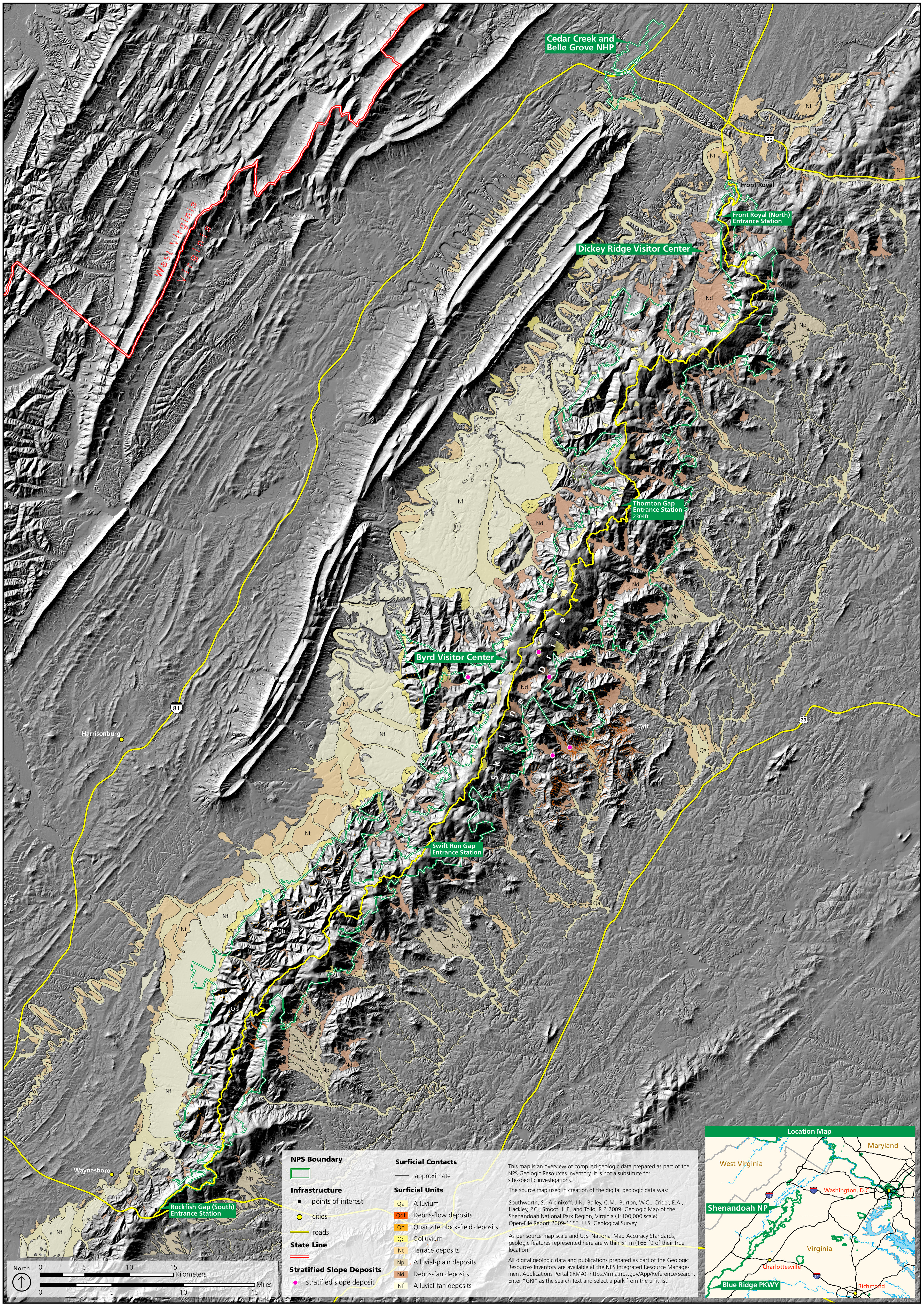
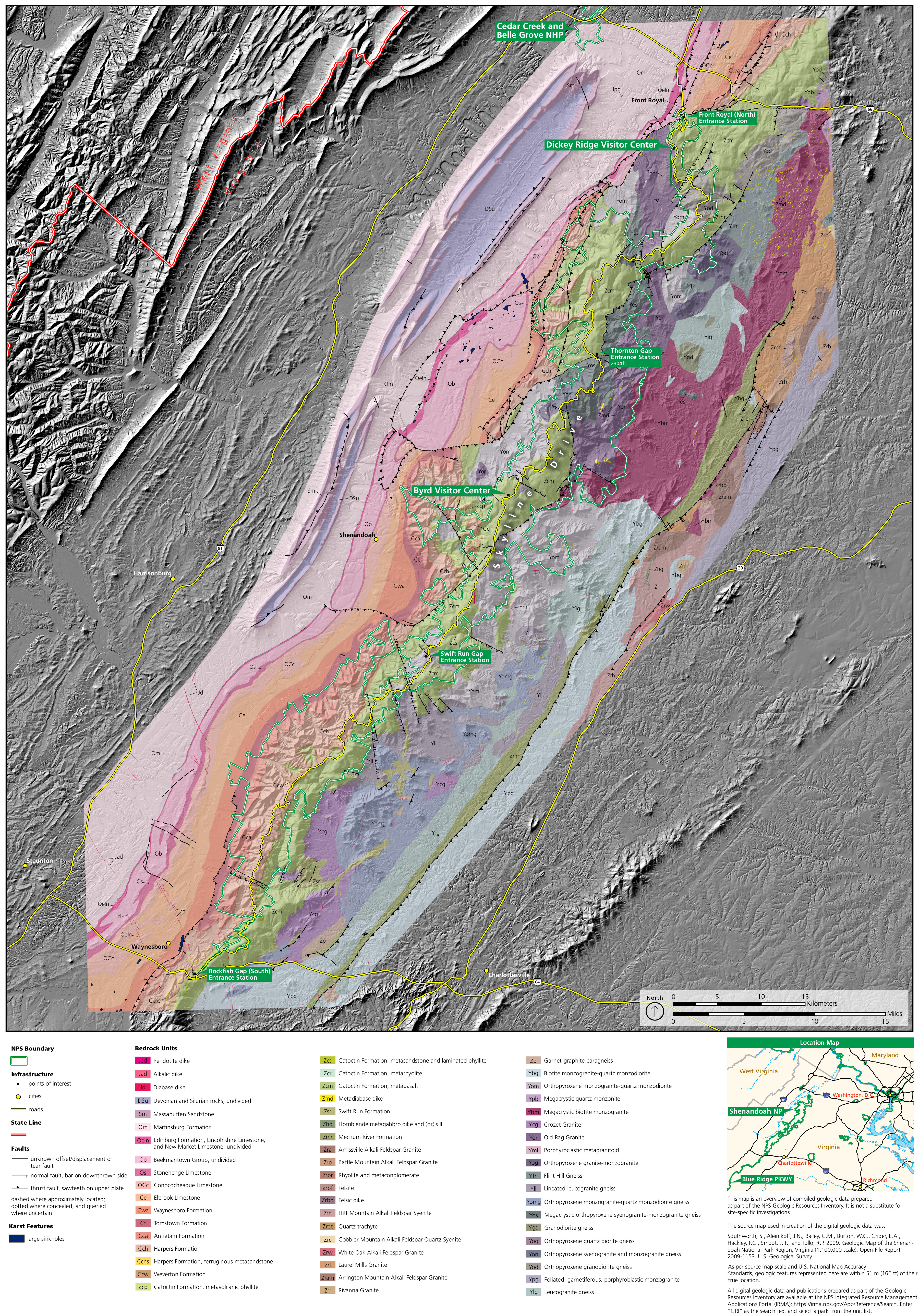 Here’s a Shenandoah geologic map, which helpfully includes Skyline Drive and visitor centers to orient you to the locations of the exposed rock layers labeled on this map.
 This Shenandoah surficial geology map better shows the topographical relief in the park and identifies young rock deposits. You really get a good picture of the park’s mountainous landscape.
Archived Shenandoah maps
The National Park Service is always putting out new and updated maps, and I do my best to upload them here whenever a new version is available. But rather than deleting older maps that have since been replaced, I preserve them here, as I believe it’s important for people to see how things in parks change over time. So the maps below aren’t the most recent version but are preserved for archival purposes.
 This is the old official Shenandoah map from the park brochure, from the mid-2010s. Inset maps of each Shenandoah National Park location are posted below. Click the image to view a full size map or download the PDF.
 This is the older official Shenandoah National Park map (pre-2013). I’ve provided it because I think it’s easier to read than the new version. Click the image to view a full size map or download the PDF.
 This is an old Mathews Arm Campground map from the mid-2010s. Mathews Arm is the northernmost campground on Skyline Drive in Shenandoah and has a mix of reservable and first-come, first-served campsites.
 This is an old Big Meadows Campground map from the mid-2010s. Big Meadows is near the Byrd Visitor Center and the popular Dark Hollow Falls hiking trail. You’ll find sites for RVs and also walk-in tent-only sites.
 This is an old Loft Mountain Campground map from the mid-2010s. Loft Mountain is the largest campground in Shenandoah National Park and has both reservable and first-come, first-served campsites.
The maps below have all been superseded by the new Shenandoah hiking maps further up this page. These below were all originally published in the mid-2010s.
 This is a Dickey Ridge trail map, showing trails originating from the Dickey Ridge Visitor Center area. Trails include Fox Hollow, Snead Farm Loop, and Dickey Ridge.
 This is a Mathews Arm and Elkwallow trail map, showing several trails both east and west of Skyline Drive, including the Appalachian Trail and a number of overlooks and waysides.
 This is a Panorama trail map. Most of these hiking trails are east of Skyline Drive, such as Buck Hollow and Pass Mountain. Also included are some text descriptions of the popular routes.
 This is a Skyland trail map, showing trails to Stony Man Summit, Little Stony Man, Millers Head Lookout, Limberlost, Corbin Mountain, and many others on fire roads and footpaths.
 This is an Old Rag trail map. It shows trails to Old Rag Mountain, Upper and Lower Whiteoak Falls, and others in the area. Trailheads from Skyline Drive and other nearby Virginia roads are included.
 This is a Hawksbill trail map, showing hiking trails to Hawksbill Mountain, Rose River Falls, and a few others accessed from Skyline Drive. You’ll also see the Rock Springs hut on the Appalachian Trail.
 This is a Big Meadows trail map, showing trails near the Byrd Visitor Center to waterfalls such as Dark Hollow Falls, Rose River Falls, and Lewis Falls. You’ll also find the Big Meadows Lodge and campground.
 This is a Rapidan Camp trail map, showing trails to access Rapidan Camp (Mill Prong and Laurel Prong), south of the Byrd Visitor Center and east of Skyline Drive.
 This is a Lewis Mountain trail map, showing trails to Bearfence Mountain (including the Appalachian Trail hut), Lewis Mountain, South River Falls, Upper Pocosin Mission, and others.
 This is a Loft Mountain trail map, featuring hiking trails to Jones Run Falls, Doyles River Falls, and mountains and ridges such as Rockytop, Austin Mountain, and Patterson Ridge.
 This is a Riprap trail map, the southernmost hiking trail map for Shenandoah. Blackrock, Chimney Rock, Trayfoot Mountain, Wildcat Ridge, Calvary Rocks, and other areas are all accessible from here.
…and more!
< Return to National Park Maps home
< Return to Park List
< Return to List by State