Harpers Ferry maps from the park brochure
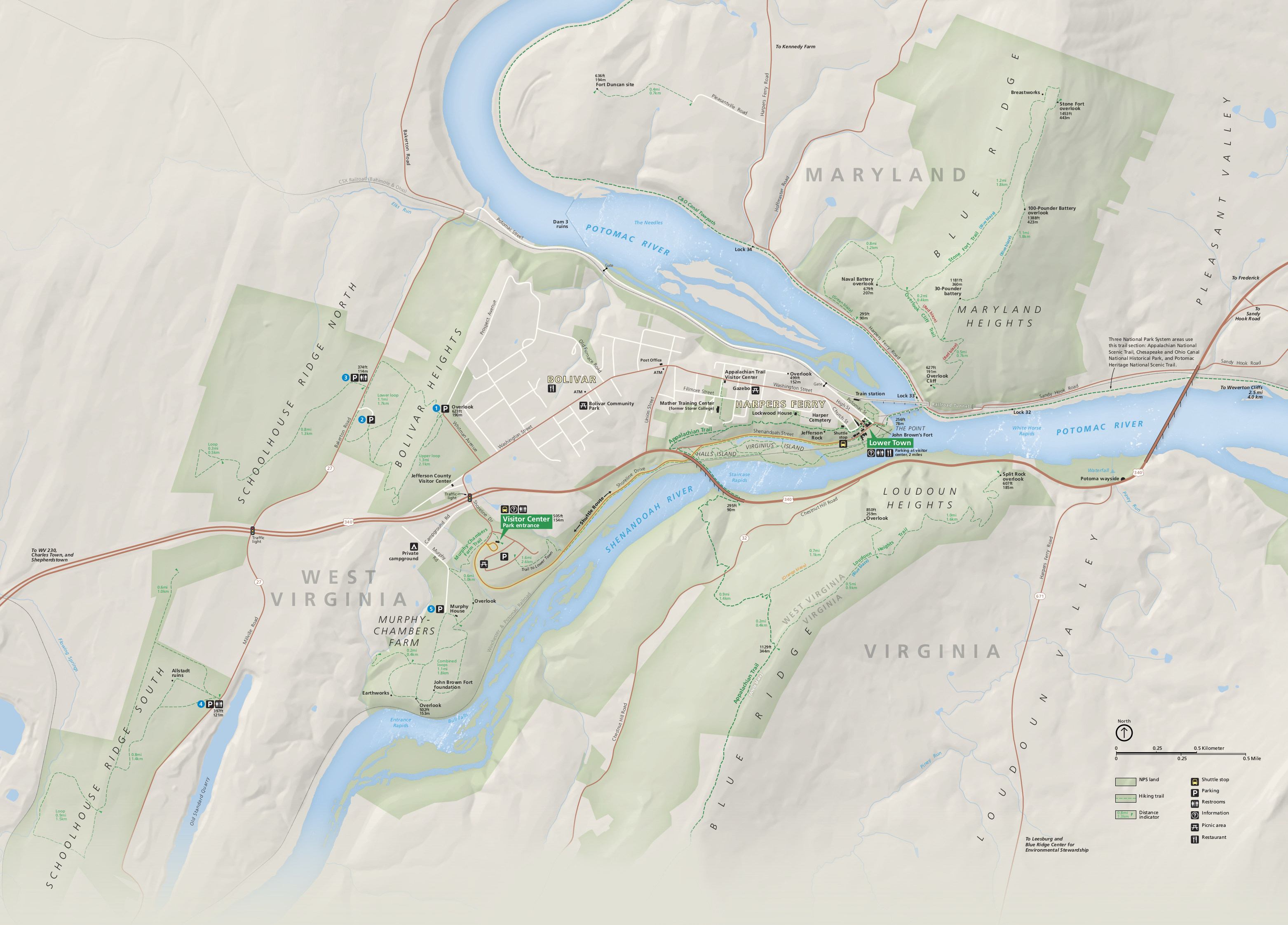
 This is the official Harpers Ferry National Historical Park map from the NPS brochure. It shows the parklands beyond the historic Lower Town, including the forested heights in West Virginia, Maryland, and Virginia.
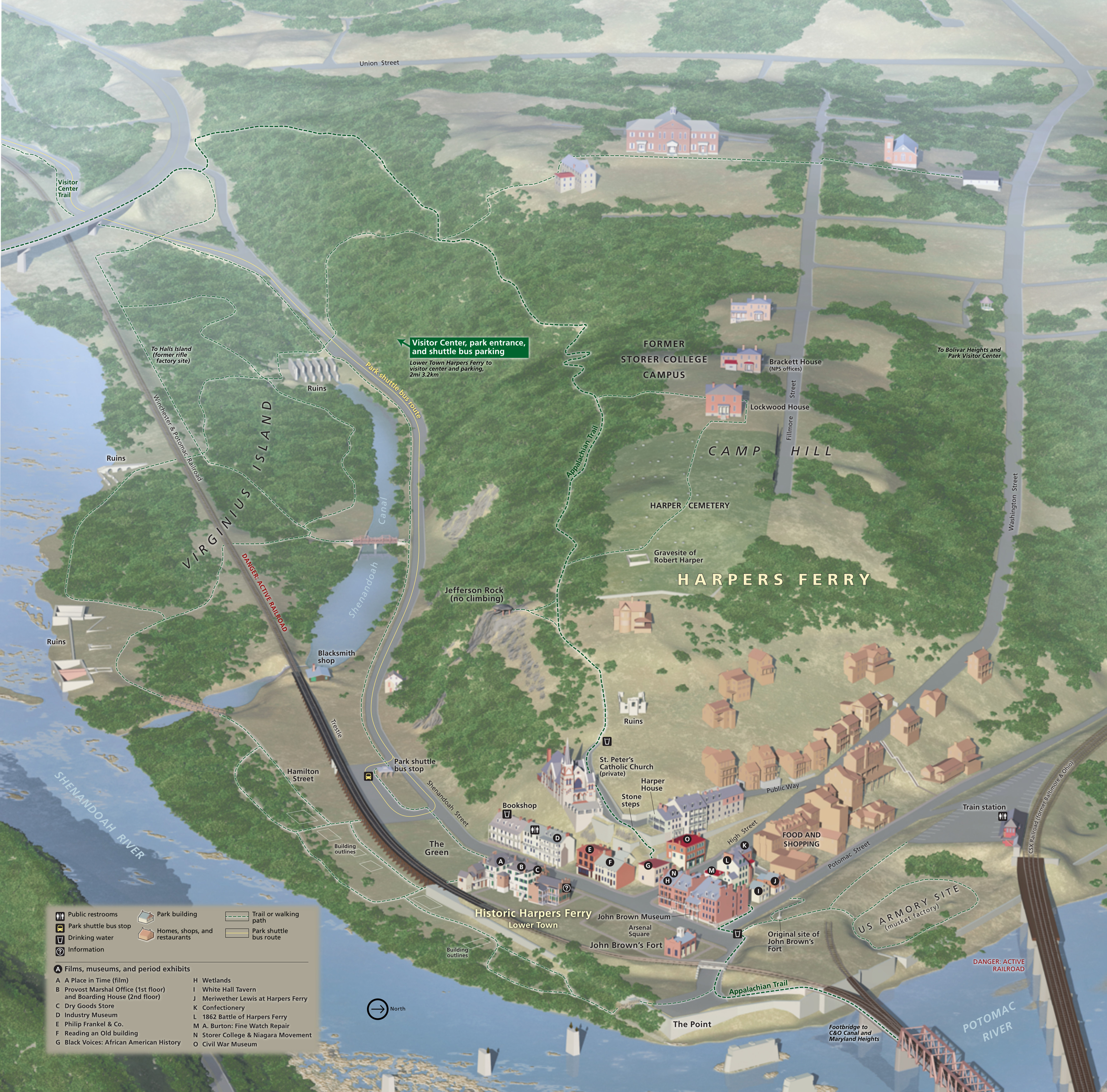 Here’s a Historic Harpers Ferry map, zooming in on the Lower Town located at the confluence of the Shenandoah and Potomac Rivers. Click the image to view a full size map or download the PDF.
Harpers Ferry lodging map
 The town of Harpers Ferry is a great place to stay if you like bed and breakfasts. If you’re not a big B&B fan, however, you may want to view the Expedia interactive lodging map on the right to find another option in a nearby town a few minutes down the road (like Charles Town). Better yet, start browsing the area’s best-rated lodging to compare prices, guest reviews, amenities, location, and traveler photos.
Harpers Ferry Lower Town maps
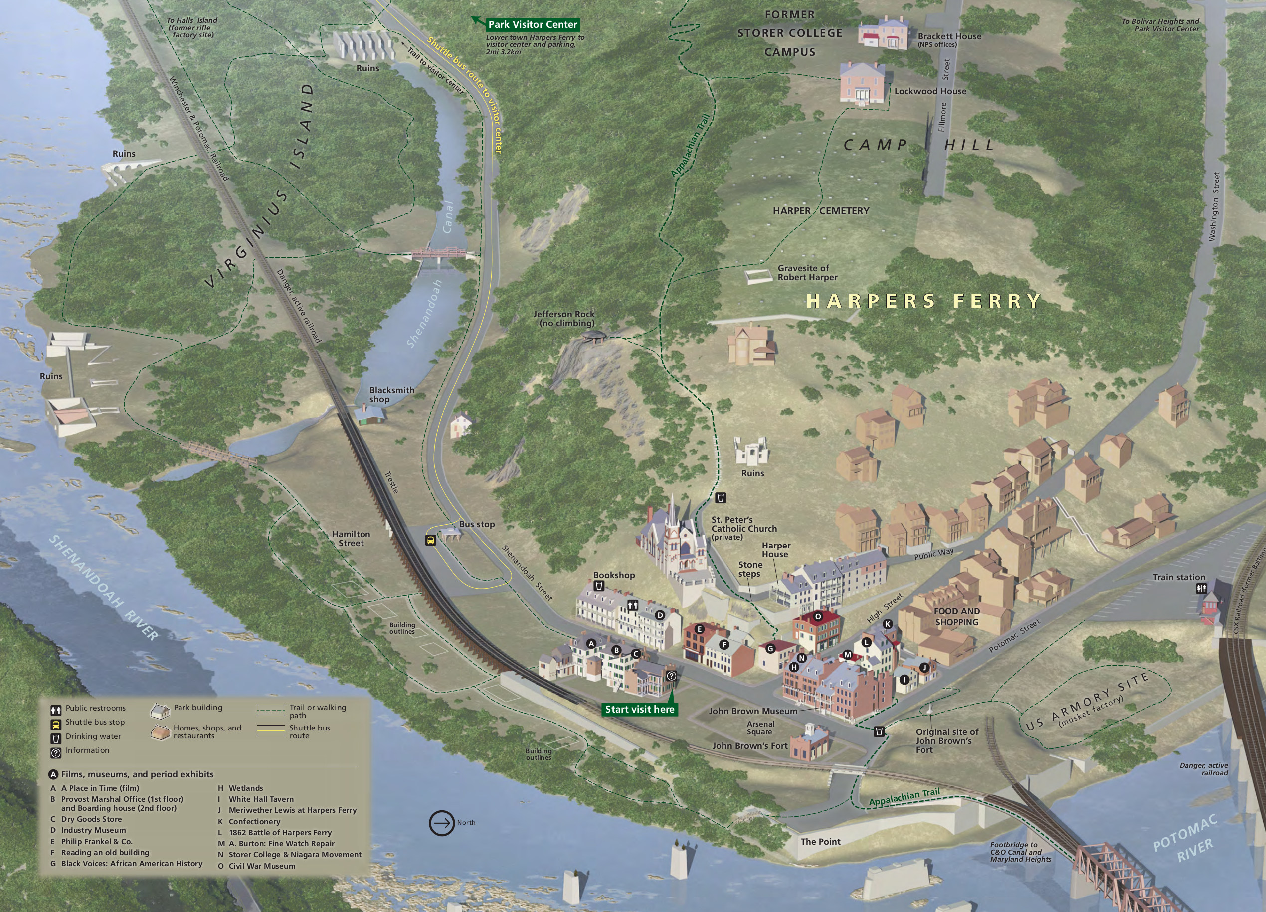
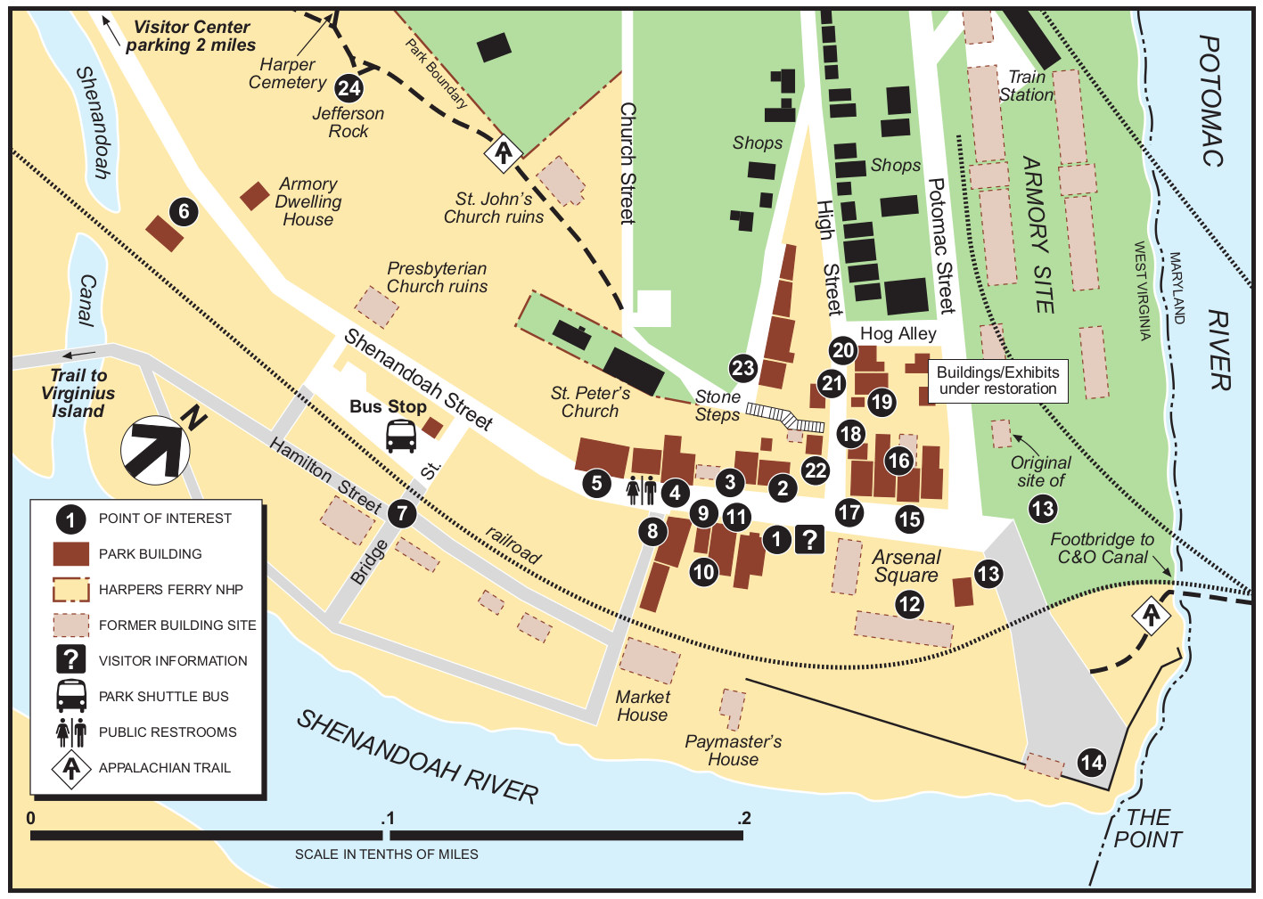 Here’s a Harpers Ferry Lower Town map and guide that includes a walking tour. Click the image to view a full size map or download the PDF to view short descriptions of each labeled location on the map.
 This is a Lower Town accessibility map, showing wheelchair accessible routes and additional information for those with mobility impairments, including which exhibits are accessible.
Harpers Ferry trail maps
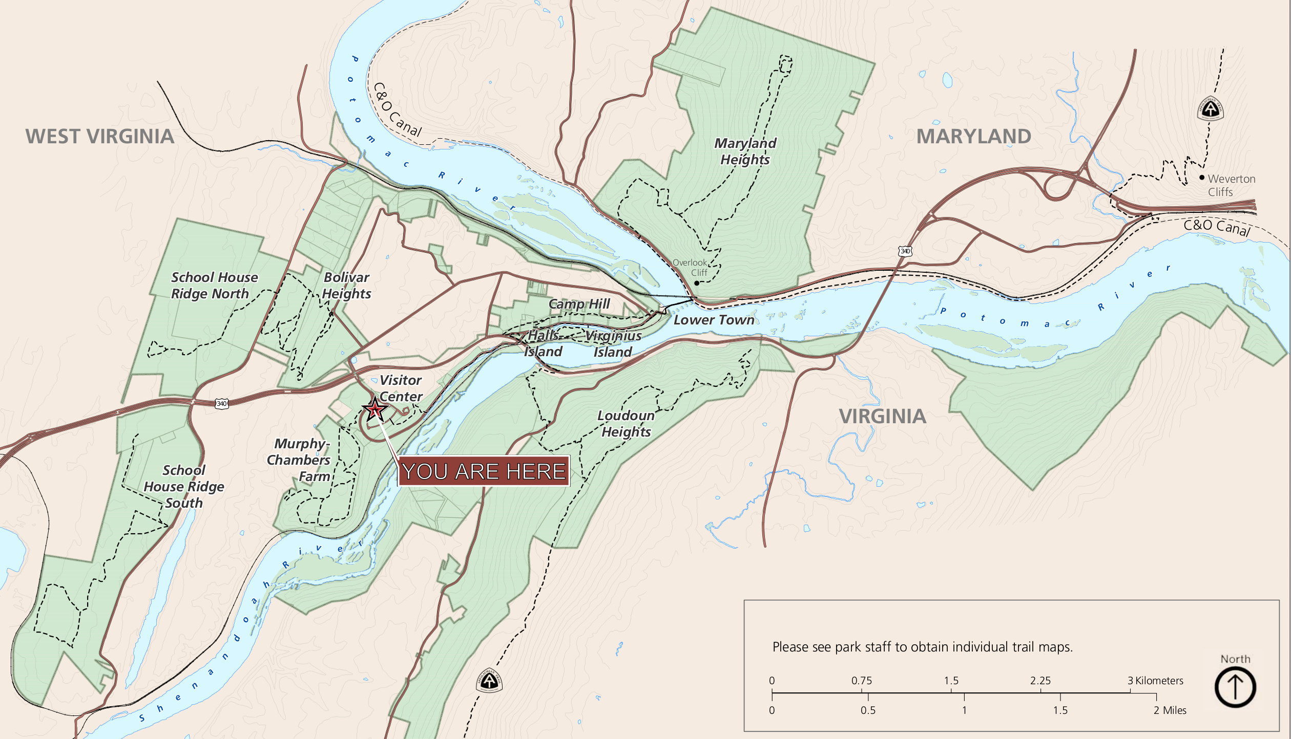 Here’s the Harpers Ferry trail map handed out at the park visitor center. This is an overview map that allows you to figure out the locations that each of the following maps in this section covers.
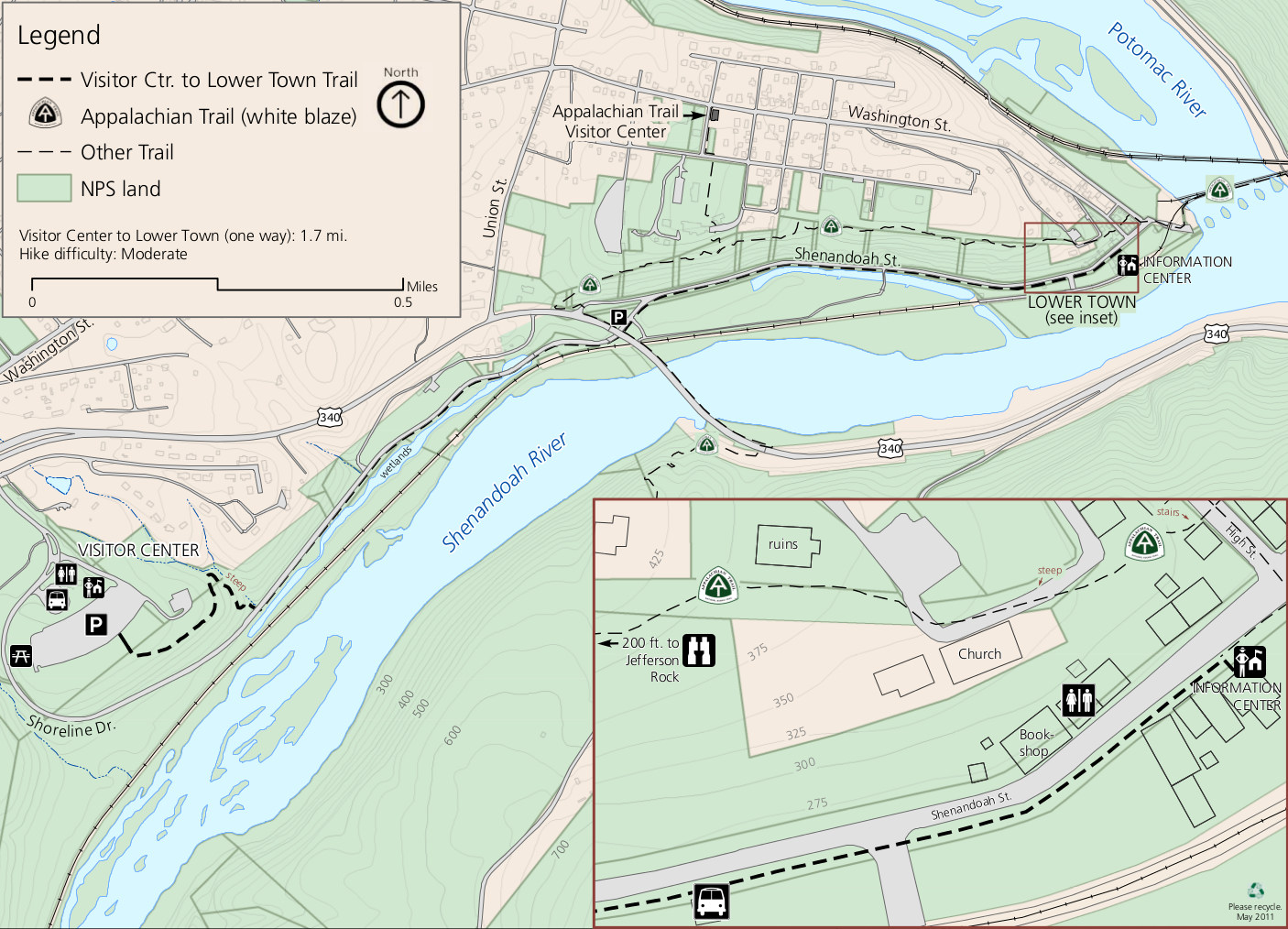 This visitor center to Lower Town trail map shows the walking route along the road to get to Lower Town if you don’t want to take the shuttle bus. Also included is the Appalachian Trail.
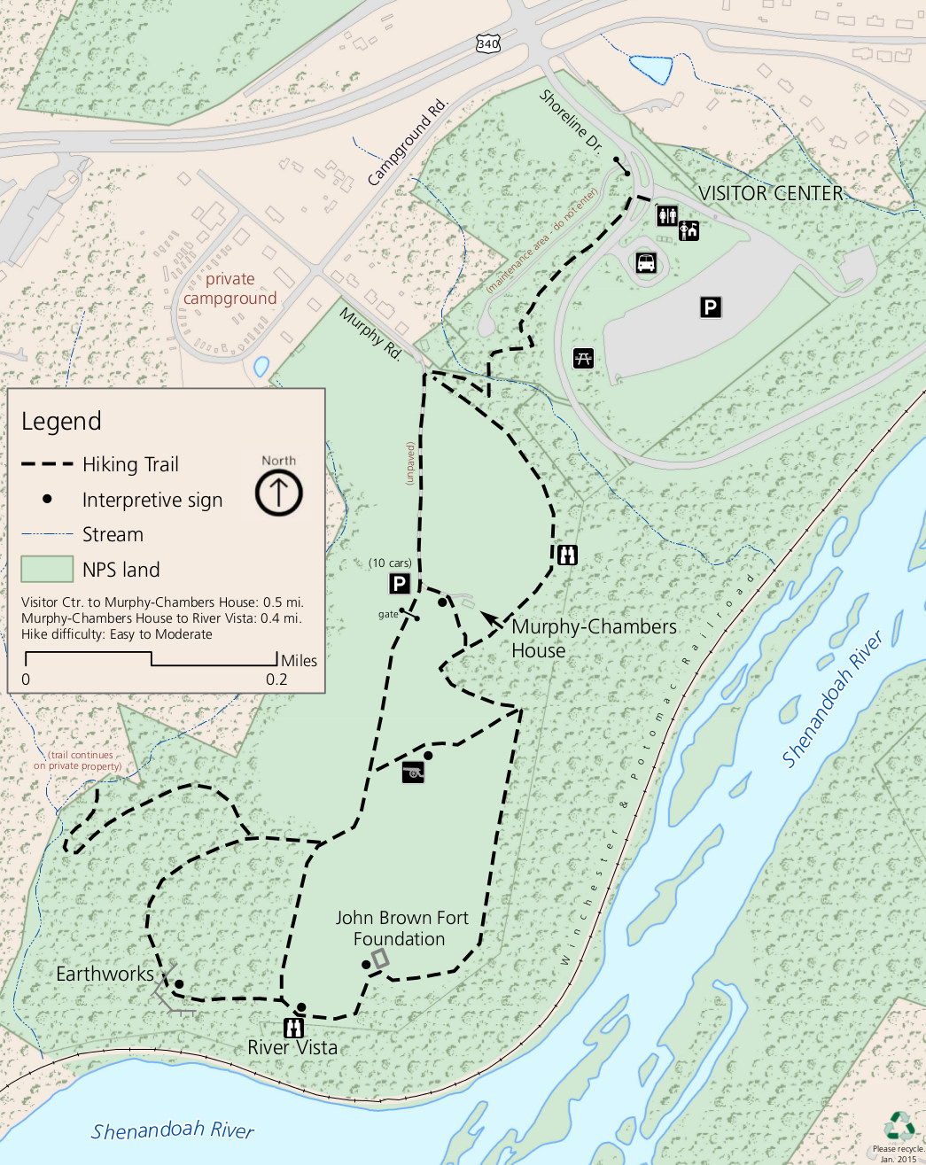 The Murphy-Chambers Farm trail map focuses on the trails starting from the park visitor center and includes views of the Shenandoah River and of old Civil War infrastructure.
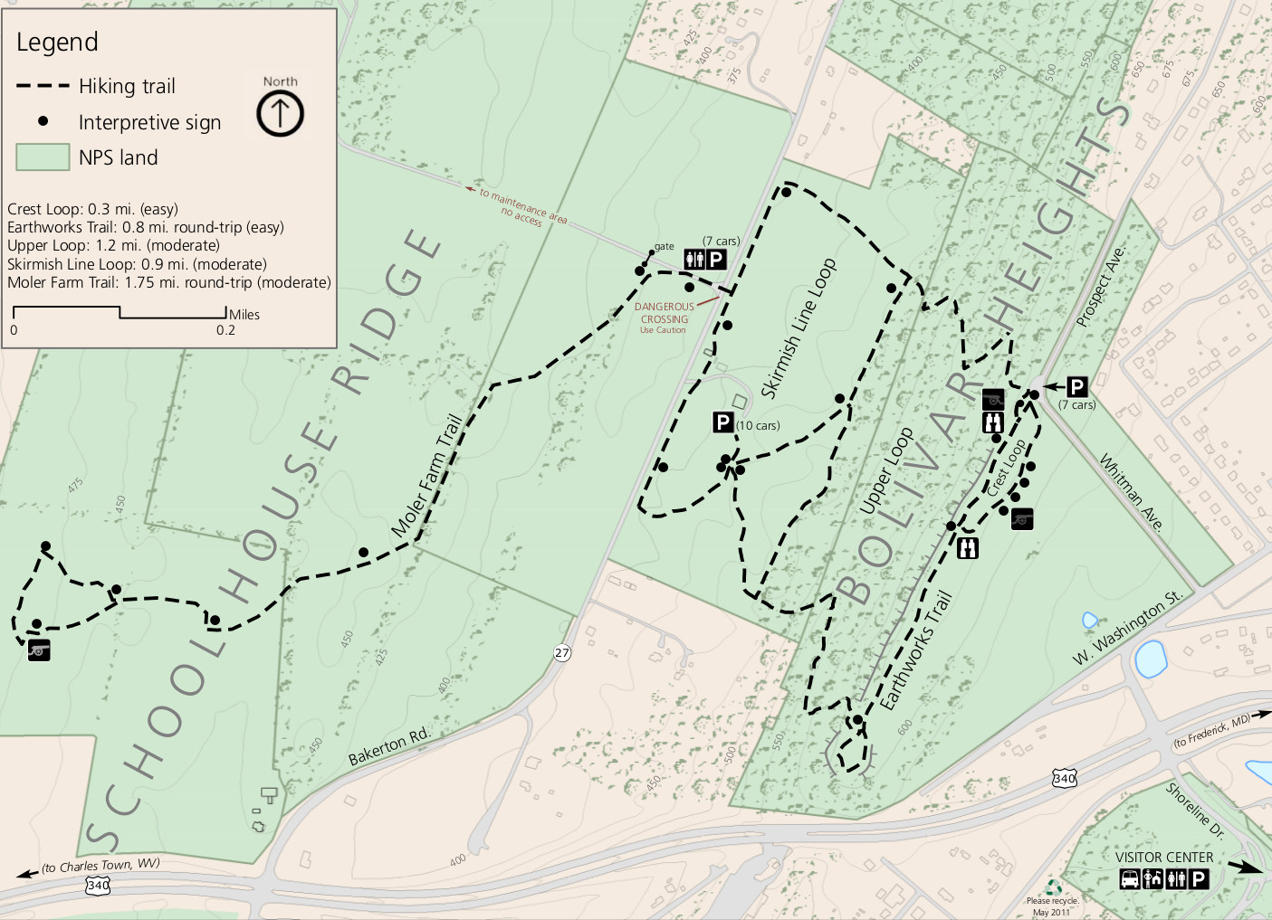 The Bolivar Heights/Schoolhouse Ridge trail map shows a few of the hiking options north of Route 340, useful for both views and Civil War history. A few loops of various distances are possible here.
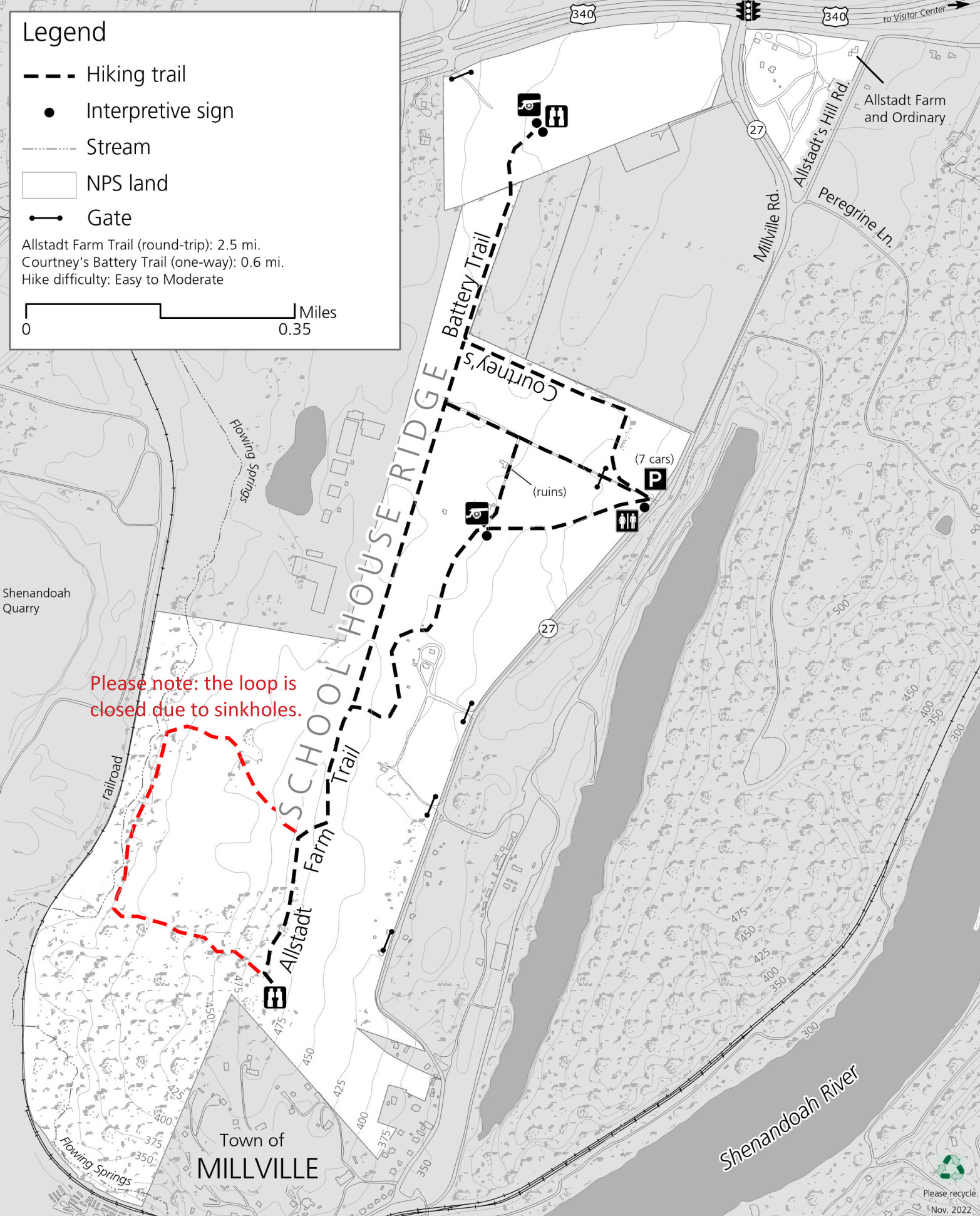 Here’s a south Schoolhouse Ridge map. This map was updated in 2022 to reflect the changes in the trail network due to closures from sinkholes in the southwest loop.
 The Camp Hill/North Shenandoah trail map includes a section of the Appalachian Trail (with great views at Jefferson Rock!) as well as islands along the Shenandoah River: Halls Island and Virginius Island.
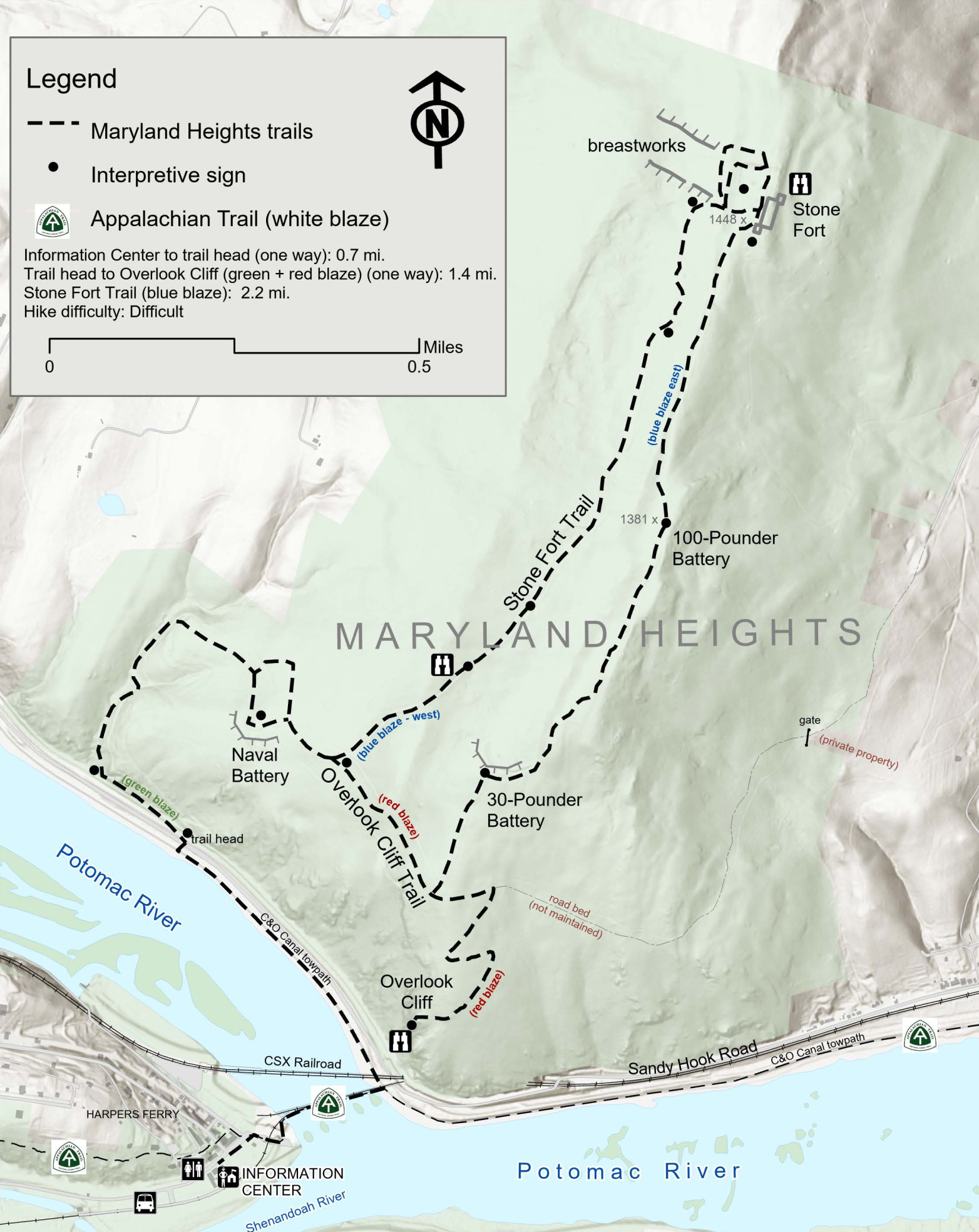 This Maryland Heights trail map shows the strenuous trails that lead to Civil War military ruins. Some incredible views of Harpers Ferry and the Potomac River can be found on the Overlook Cliff Trail.
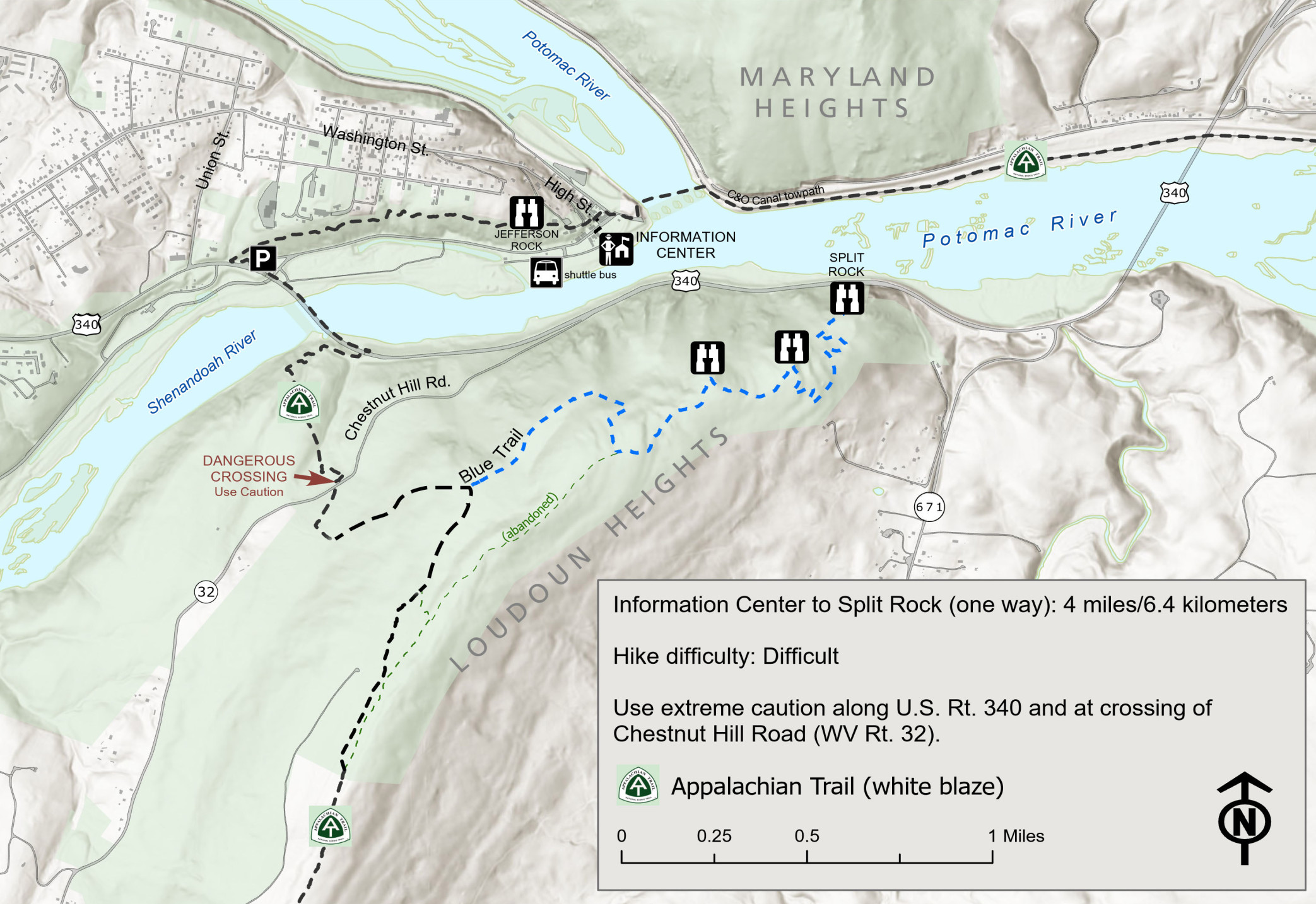 The Loudoun Heights trail map follows a strenuous uphill route along the Appalachian Trail to several viewpoints above the Potomac, culminating at Split Rock. The former Blue Trail/Orange Trail loop no longer exists.
Assorted Harpers Ferry maps
 Here’s a regional map of Harpers Ferry, showing the park’s location compared to nearby towns, roads, and highways, zooming all the way out to include Gettysburg, Baltimore, and Washington, D.C.
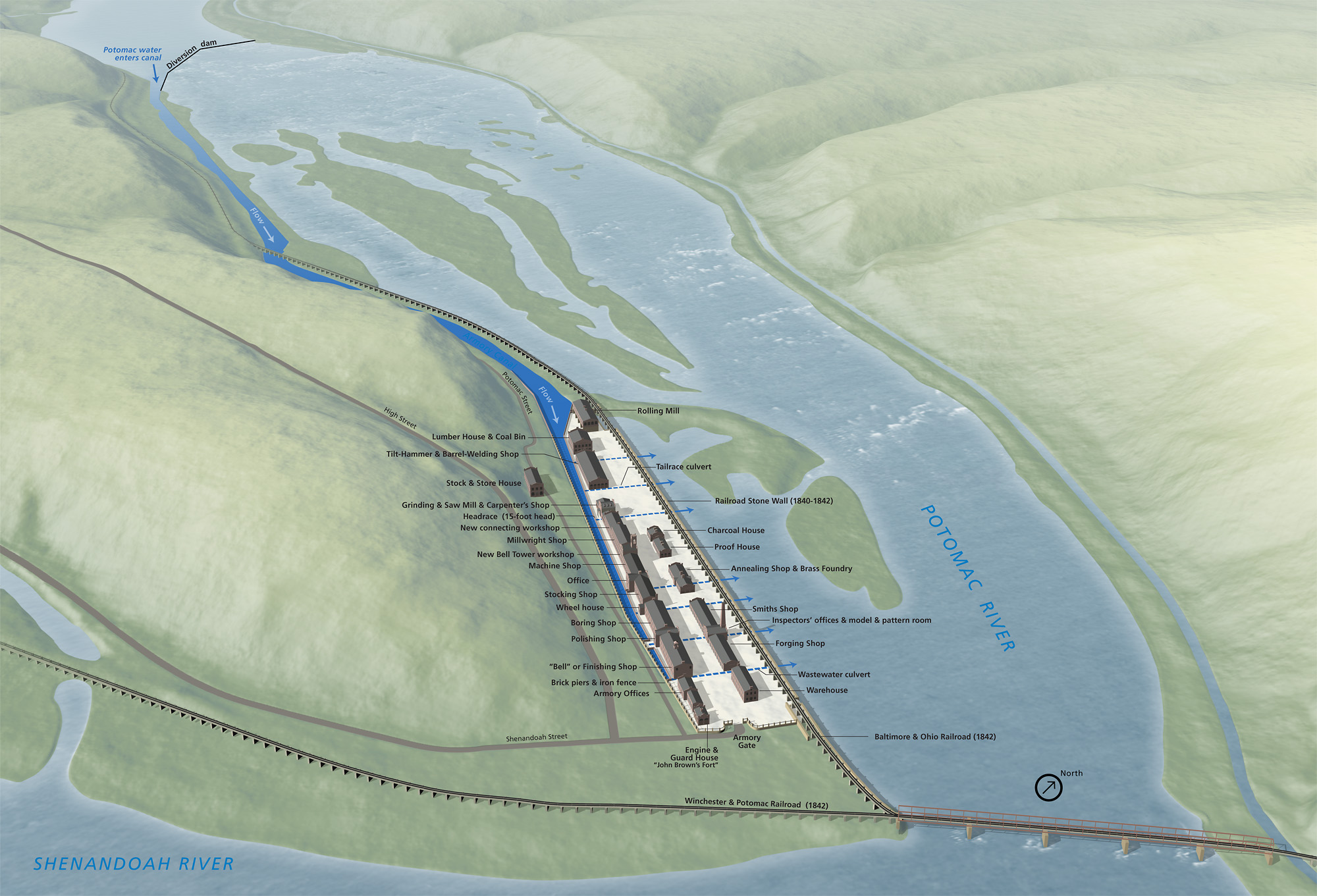 This Harpers Ferry Armory map was taken from a National Park Service exhibit sign in the Lower Town. Note the canal used to flow through waterwheels and turbines to power the early-1800s machinery.
 Here’s a zoomed out Harpers Ferry map that shows all the parklands in Virginia, West Virginia, and Maryland in a simplified manner. Click the image to view a full size map or download the PDF.
Harpers Ferry battle maps
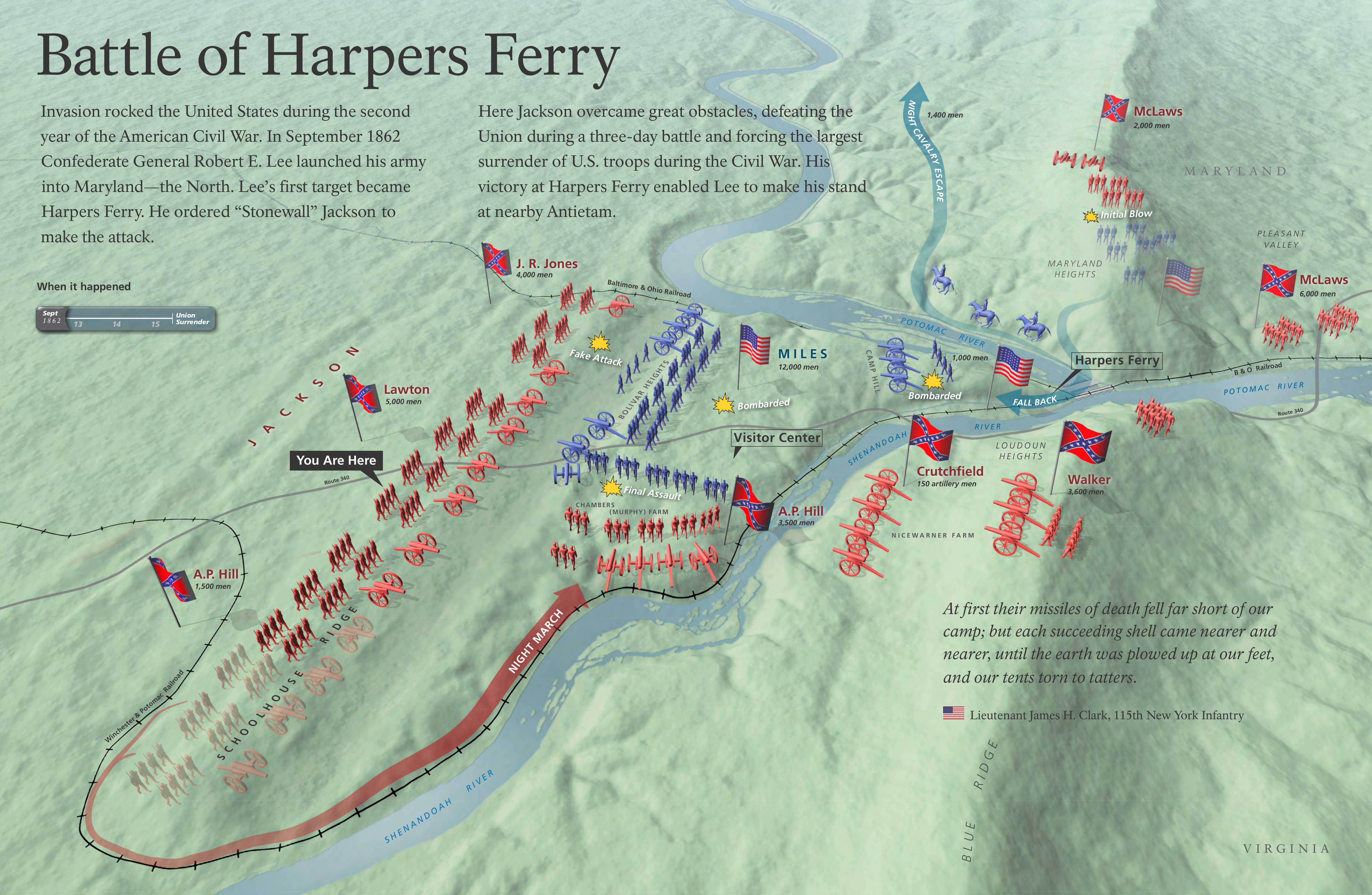 Here’s a Harpers Ferry battle map, showing an overview of the Battle of Harpers Ferry in September 1862. Stonewall Jackson led Confederate troops to victory, forcing the largest U.S. troop surrender during the war.
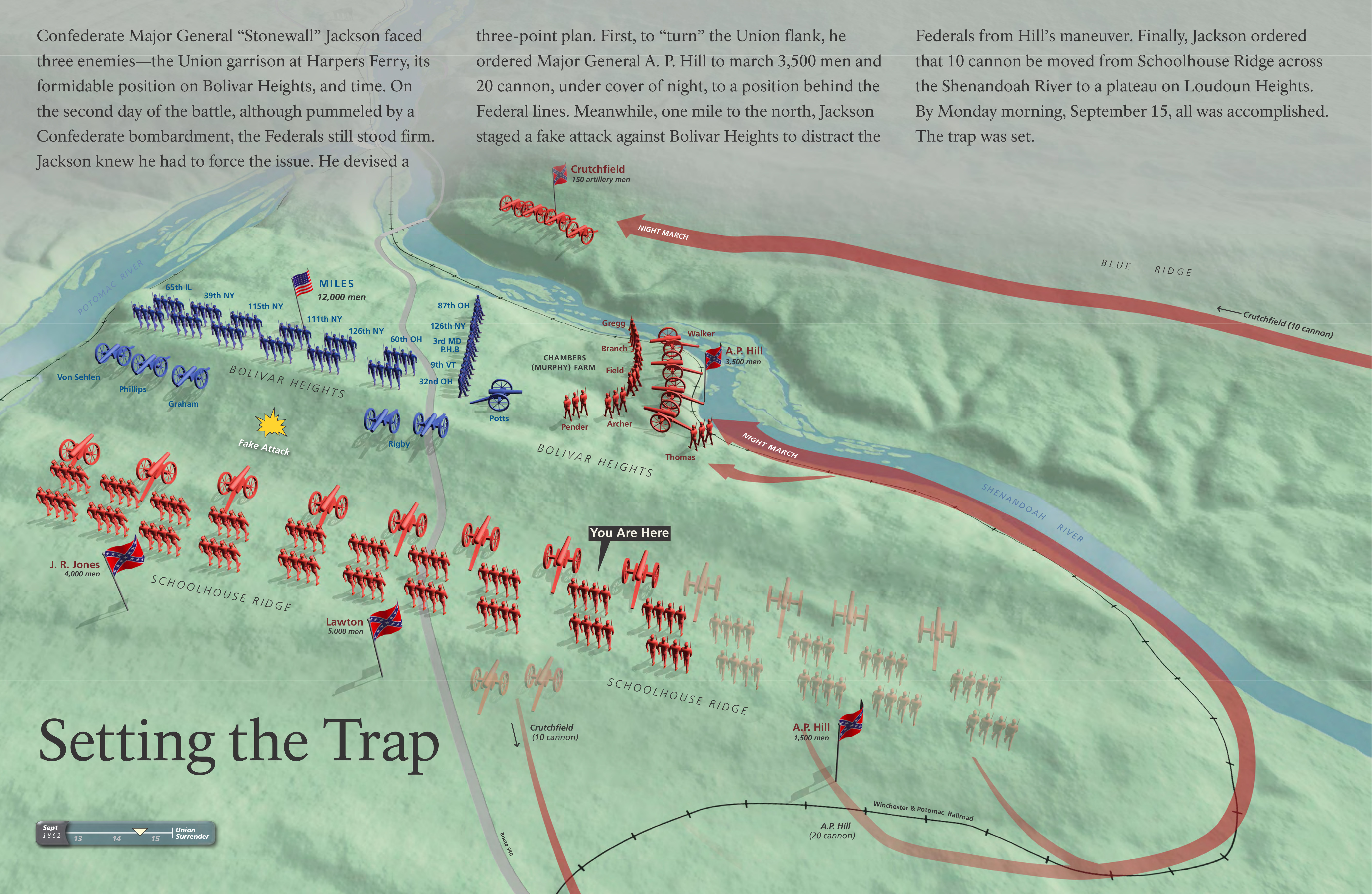 This is a Harpers Ferry night march map, showing the maneuvers of Jackson’s Confederate troops that led to their victory at Harpers Ferry by flanking the Union army.
Archived Harpers Ferry maps
The National Park Service often releases new and updated maps, and I do my best to keep the ones on this page up to date, replacing old Harpers Ferry maps with fresh ones. As maps get refreshed, I move the old ones down to this section rather than deleting them altogether. (I feel it’s important to preserve how parks change over time.) So any maps you find in this section have newer ones further up this page.
 This is the old Harpers Ferry map from the mid-2010s brochure that shows the historic downtown area as well as the surrounding trails and parklands. Click the image to view a full size map or download the PDF.
 Here’s an old Harpers Ferry Lower Town map from the mid-2010s that zooms in on the historic downtown area and labels the individual buildings. Click the image to view a full size map or download the PDF.
 This old printable Lower Town map identifies similar sites in Lower Town as the map above, but it doesn’t look nearly as cool. However, since it uses fewer colors, I find it prints off better on a home printer.
 This old Schoolhouse Ridge (south) trail map focuses on the part of Schoolhouse Ridge south of Route 340 and features Civil War ruins. You’ll find the Allstadt Farm Trail and Courtney’s Battery trail here.
 Here’s an old Maryland Heights trail map, focusing on the Maryland side of the Potomac River and the spectacular views looking back toward Harpers Ferry. Make sure you go to Overlook Cliff!
 The old Loudoun Heights trail map shows the trails on the Virginia side of the river with views toward the confluence of the Shenandoah and Potomac rivers from Split Rock at the end of the Blue Trail.
…and more!
< Return to National Park Maps home
< Return to Park List
< Return to List by State