Oregon Caves map from the park brochure
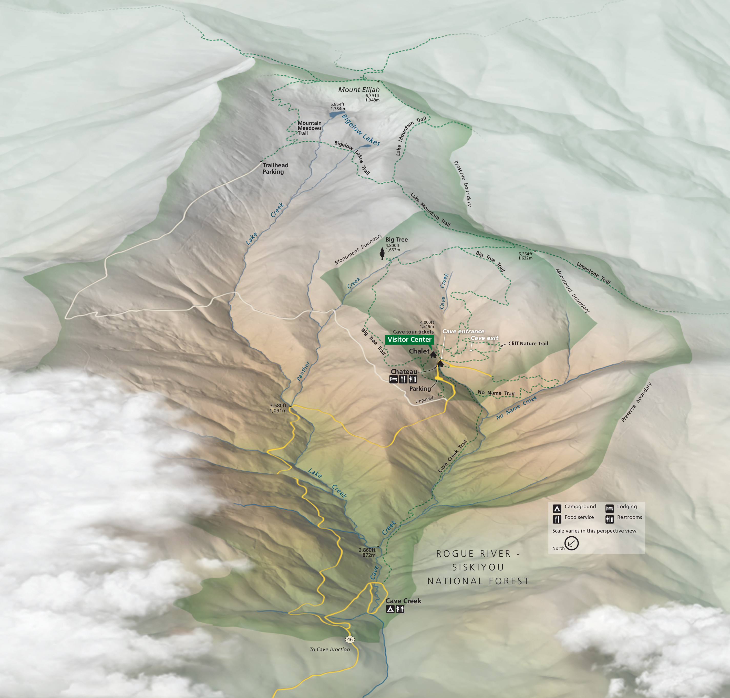 Here’s the official Oregon Caves map from the park brochure, showing the layout of the preserve from a three-dimensional perspective. Click the image to view a full size map or download the PDF.
Oregon Caves layout maps
 This Oregon Caves layout map shows an artistic view of the cave system’s general underground (obviously!) structure. Click the image to view a full size map or download the PDF.
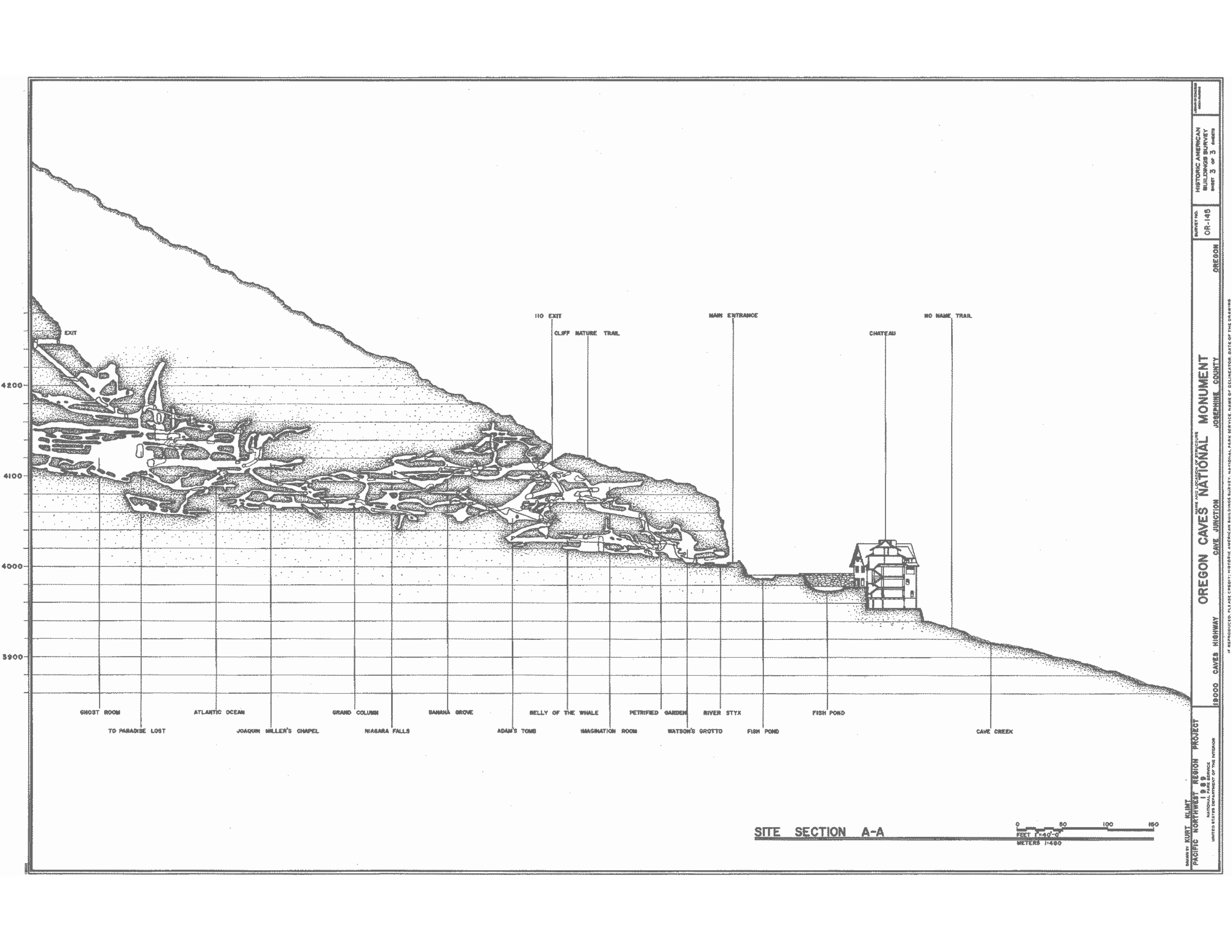 This profile map of Oregon Caves is similar to the above map but in much more detail and with more accuracy. It also shows the profile from a different angle than the map above.
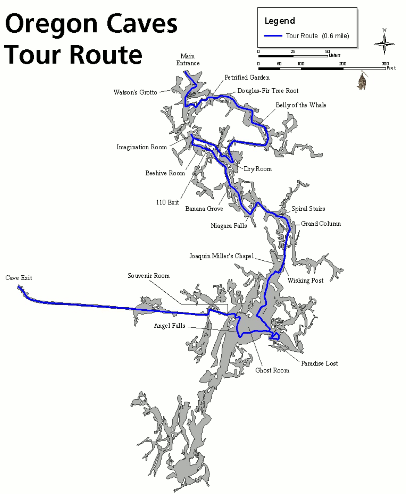 This Oregon Caves tour map shows the general route that the basic cave tours follow. This map has an overhead perspective (like above-ground maps) rather than a cross-section.
Oregon Caves trail maps
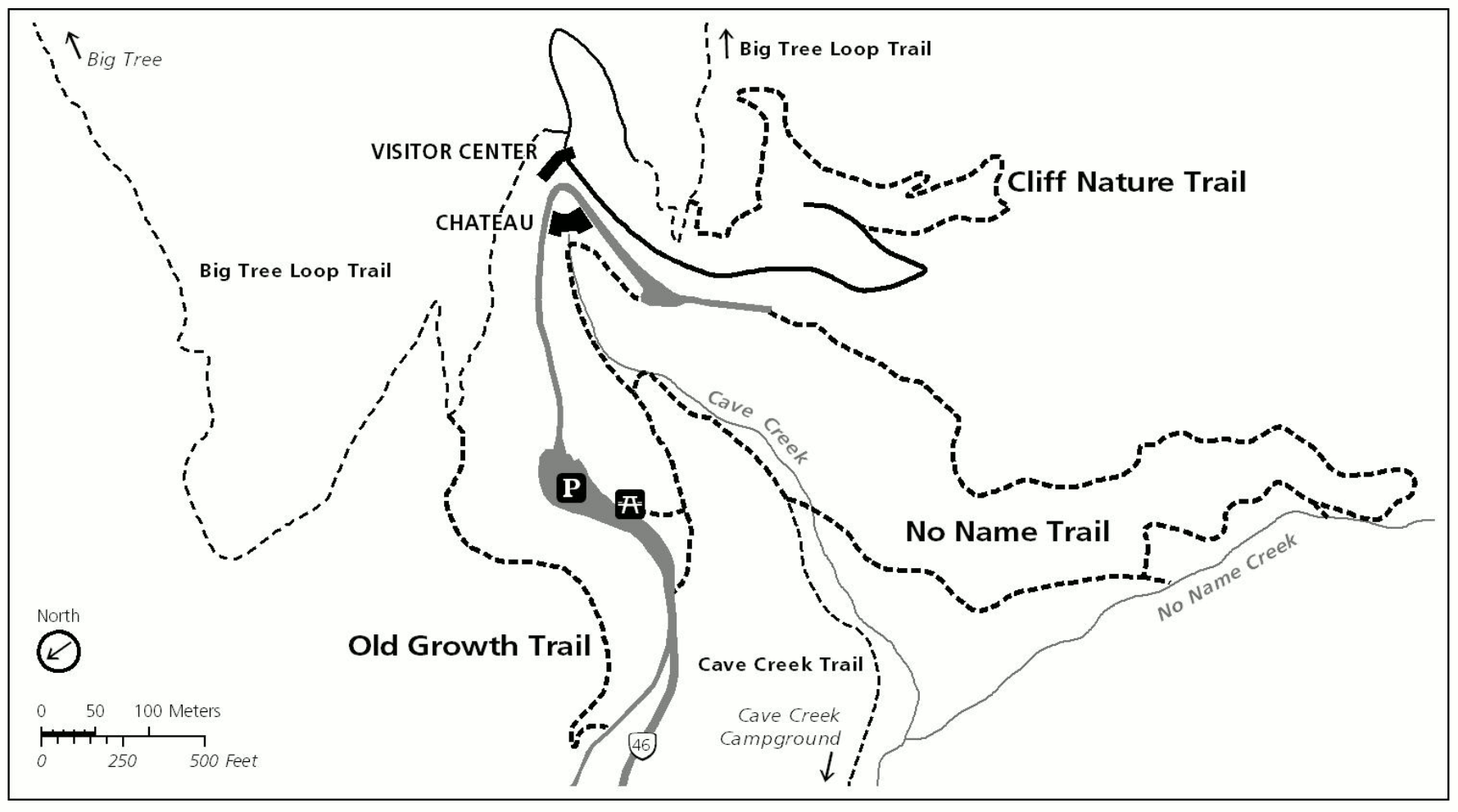 Here’s an Oregon Caves trail map that shows the visitor center, chateau, and routes of the three short trails departing from this area: Cliff Nature Trail, No Name Trail, and Old Growth Trail.
 This Oregon Caves longer trail map shows both the Big Tree Trail as well as the very strenuous, 9-mile Bigelow Lakes/Mount Elijah loop. These are also accessed from the visitor center area.
Various Oregon Caves maps
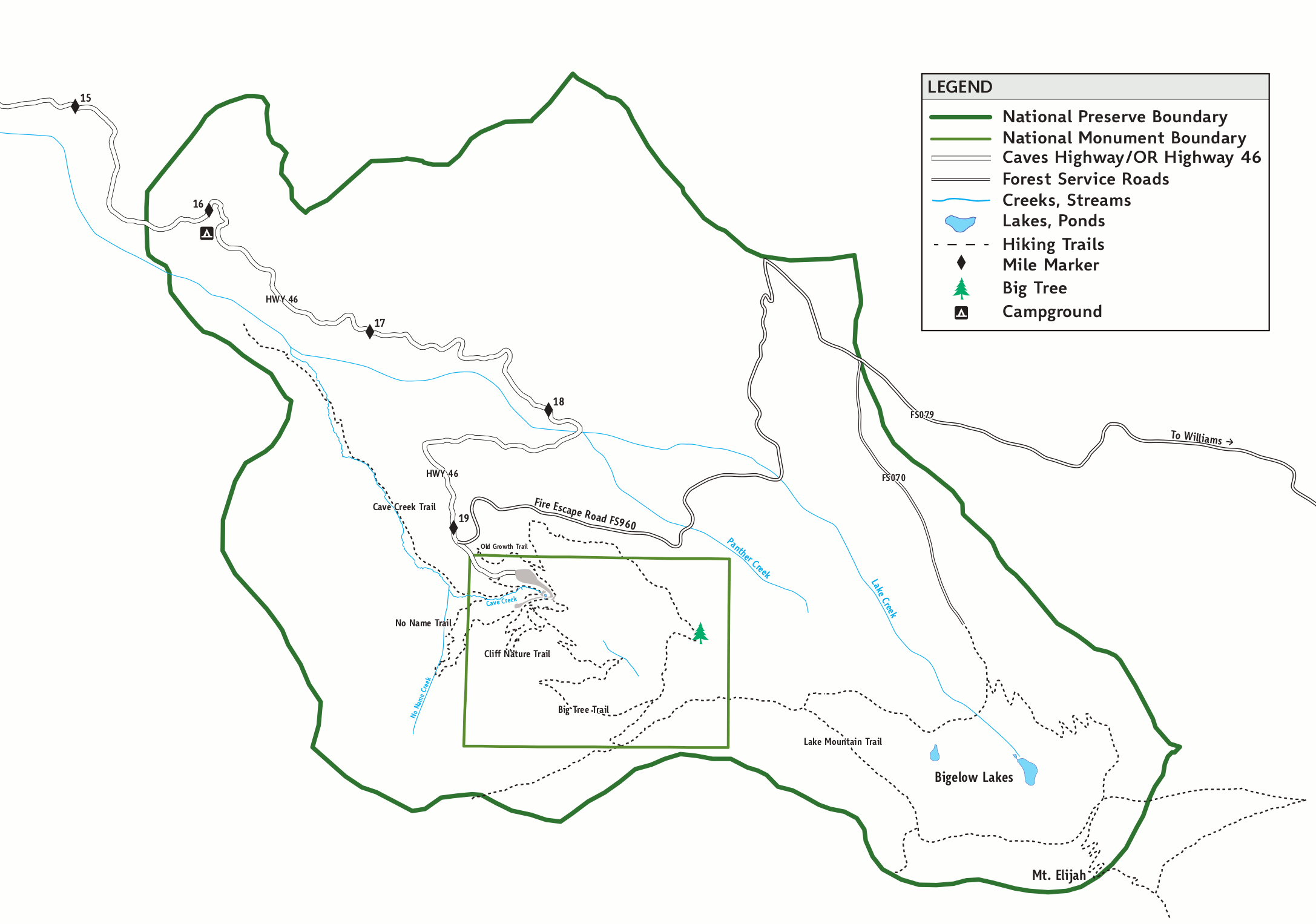 The overhead map of Oregon Caves shows the boundary of the Monument as well as the Preserve. Click the image to view a full size map or download the PDF.
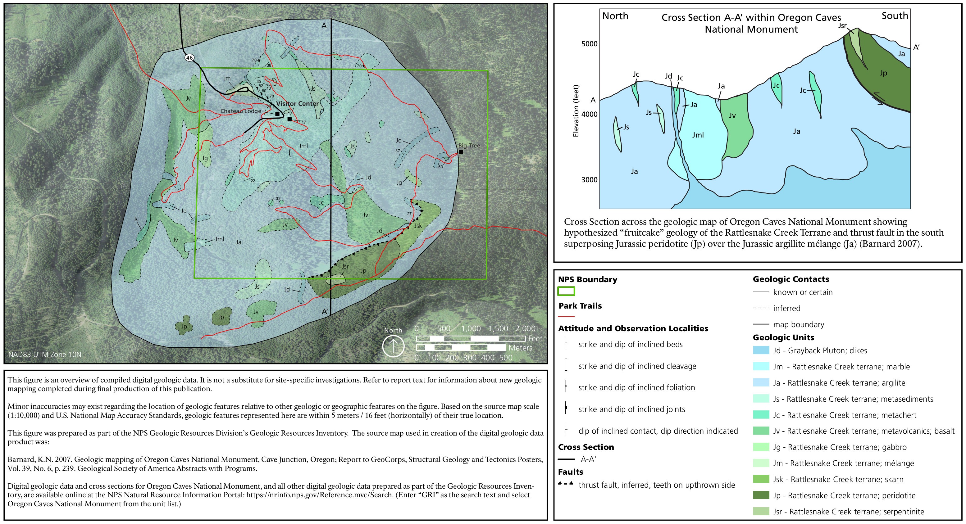 This Oregon Caves geologic map plots the rock units onto the Oregon Caves landscape and also includes a cross-section that shows the cave-forming marble surrounded by older rocks.
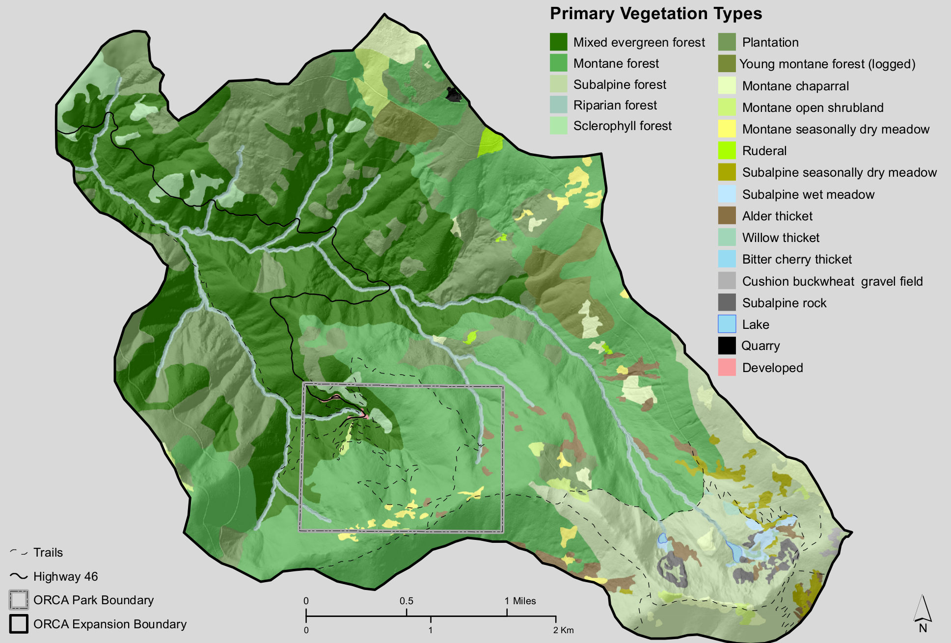 Here’s an Oregon Caves vegetation map, showing the different types of forests in the park and preserve – note how the forests change to shrubs and chapparal as the elevation increases.
…and more!
< Return to National Park Maps home
< Return to Park List
< Return to List by State